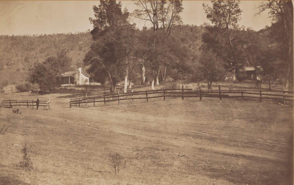
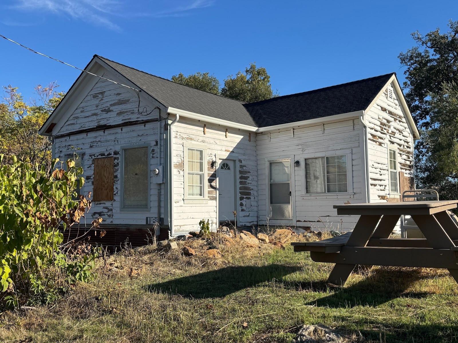
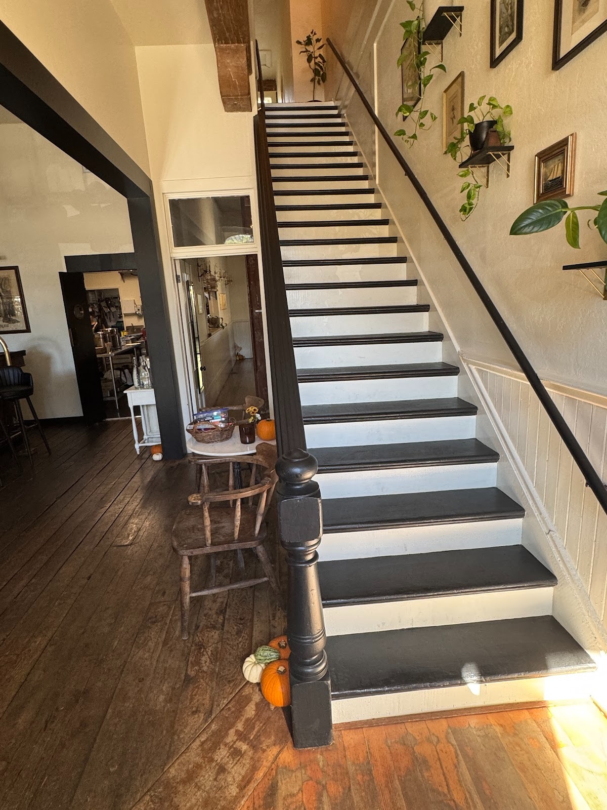
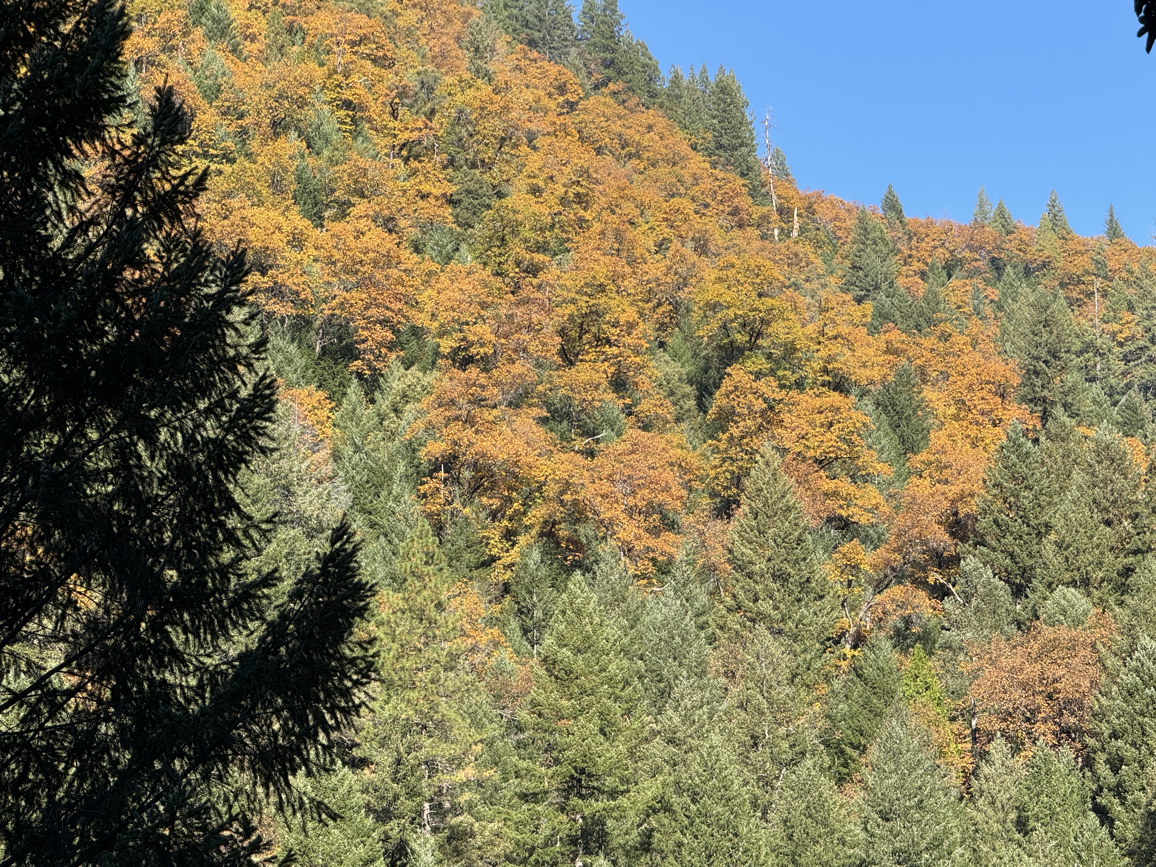
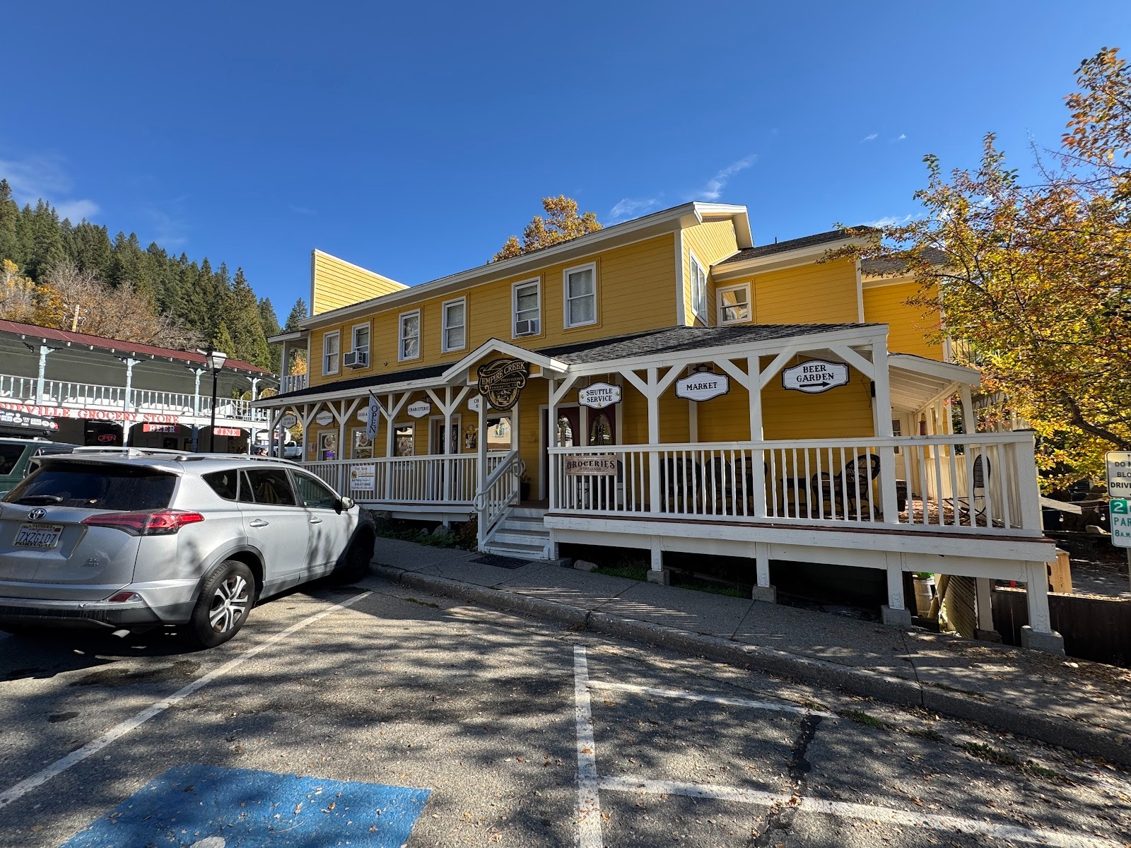
Rural California 7, State Route 49
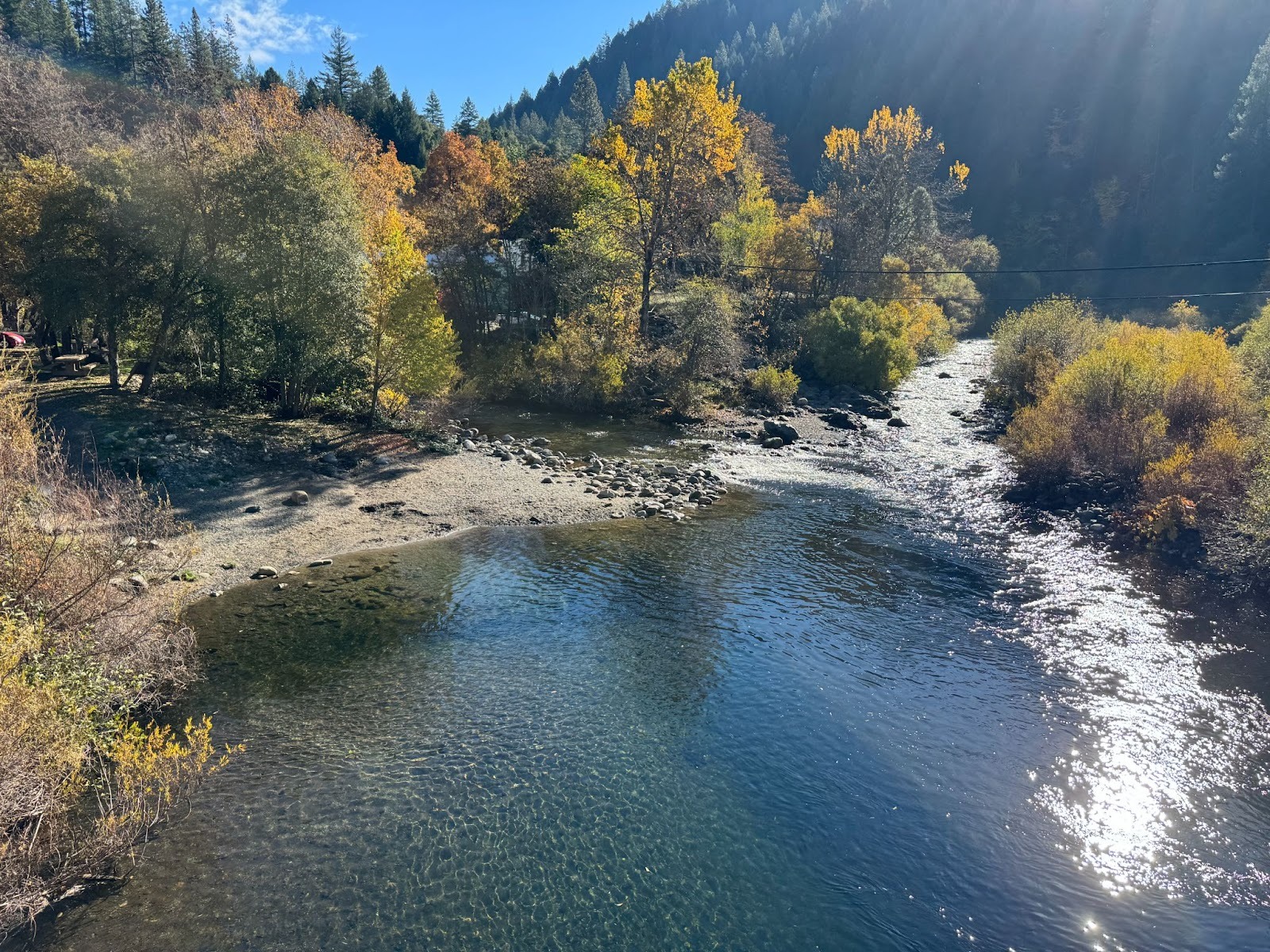
These photos, from October, 2025, record the entire length of California's State Route 49, from Oakhurst north to Vinton. That's a bit over 300 miles. There are also a few introductory and concluding photos showing the route I took from Fresno to Oakhurst and then from Vinton to Truckee and west on I-80.
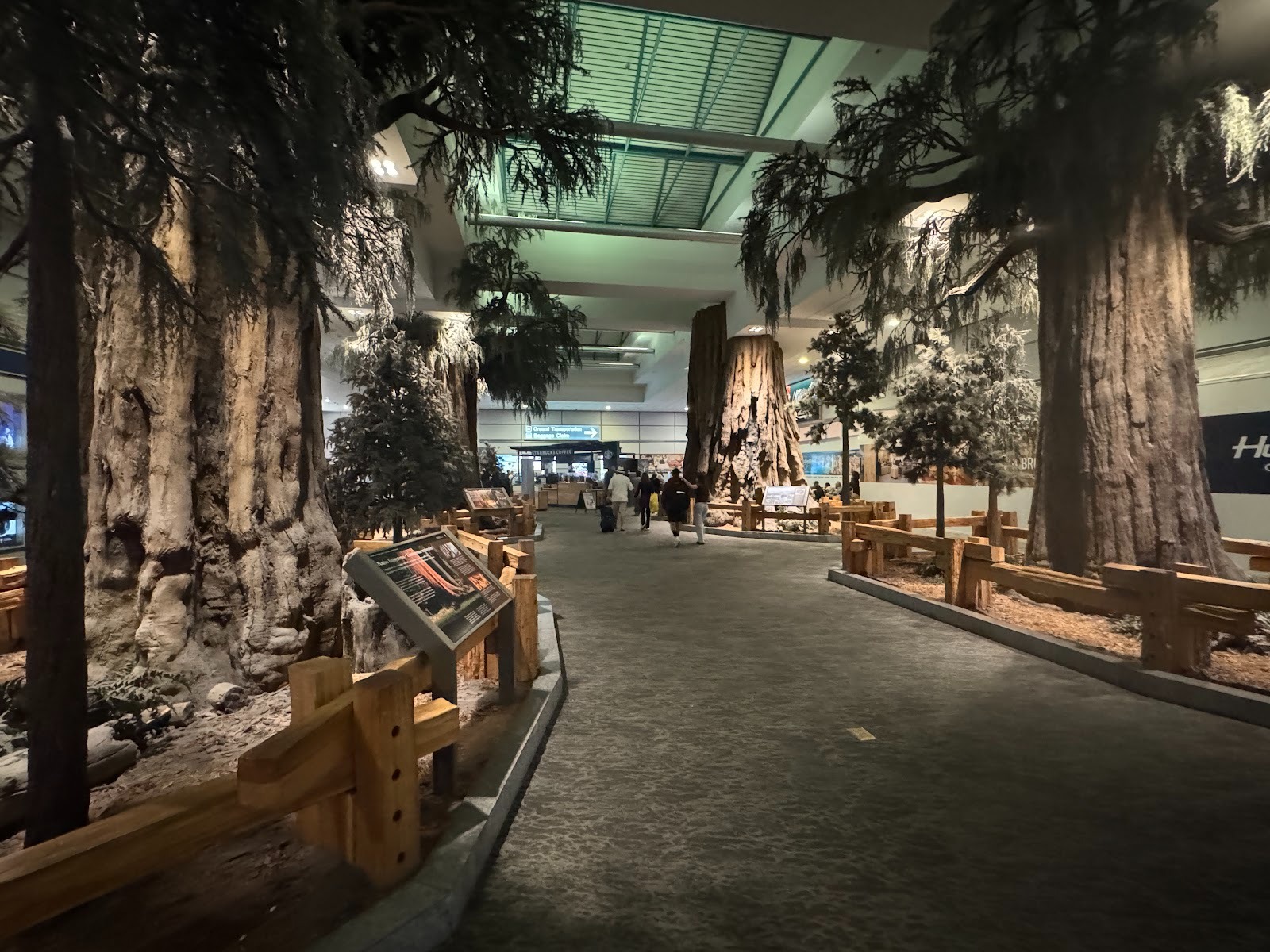
Fresno's Airport (laboring under the IATA code FAT, from Fresno Air Terminal) sits in the middle of a county whose leading farm products are grapes and almonds. Too bad: tourists come for the Sierra Nevada, and the airport aims to please. It's hard to duplicate Half Dome, so the airport settles for fake redwoods. They may be corny, but they're more interesting than what arriving passengers see in most airports, and they're a lot better than carting in tons of real trees.
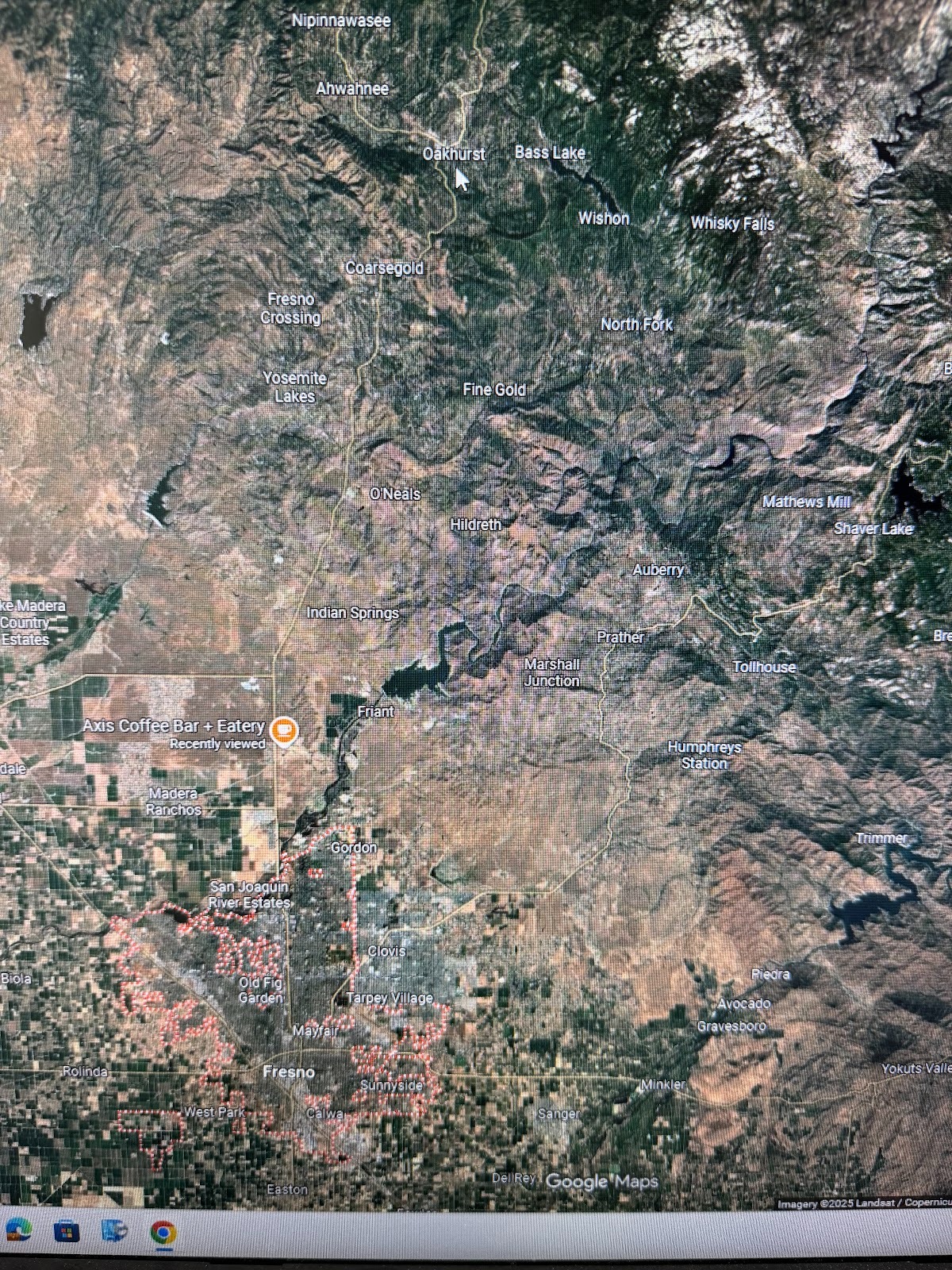
We're heading north on Highway 41 to Oakhurst (at the white arrow), which is the southern terminus of Highway 49. About halfway there (at the coffee-shop marker), there's something that caught my eye.
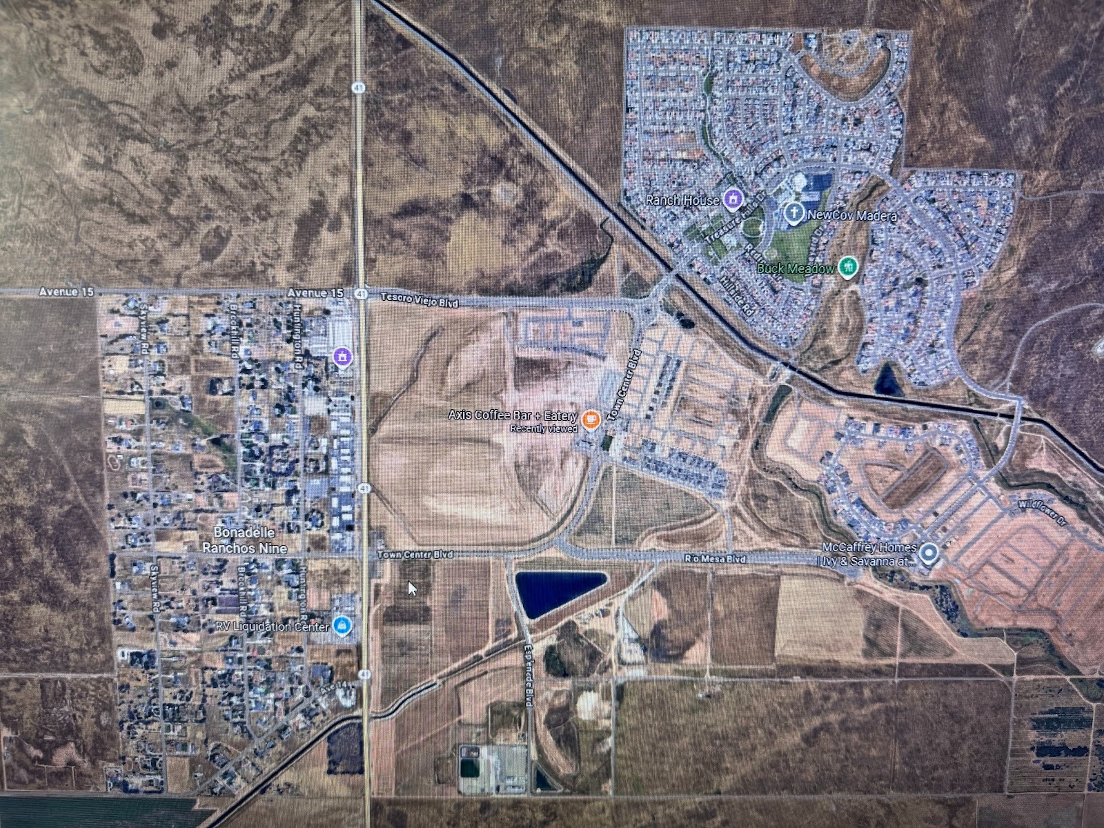
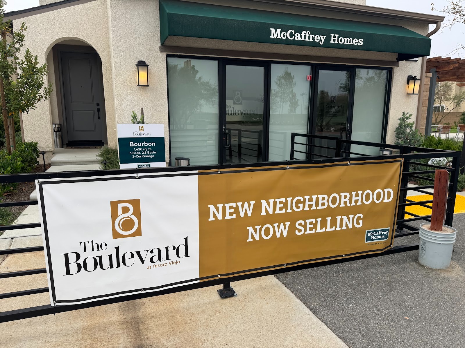
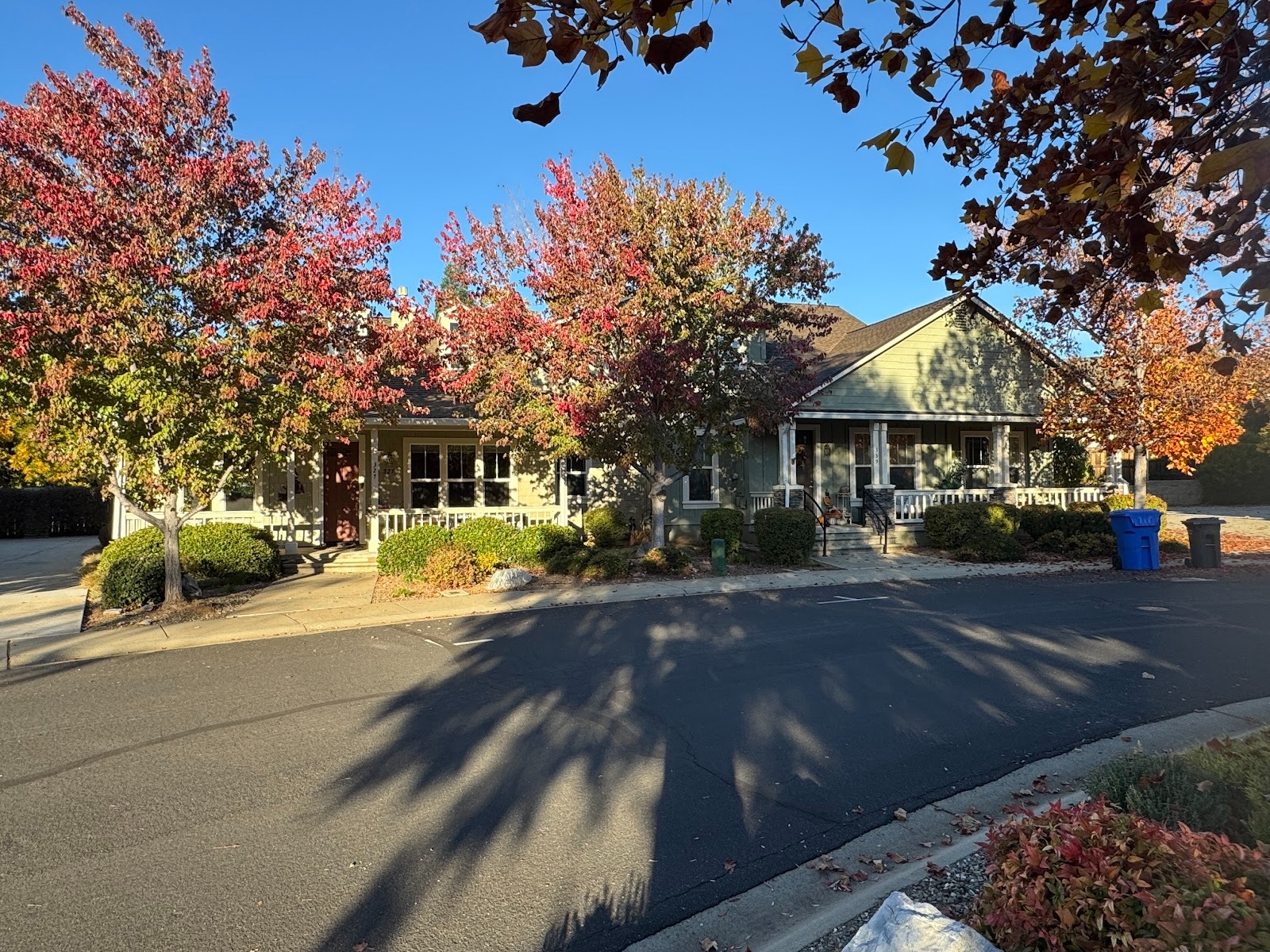
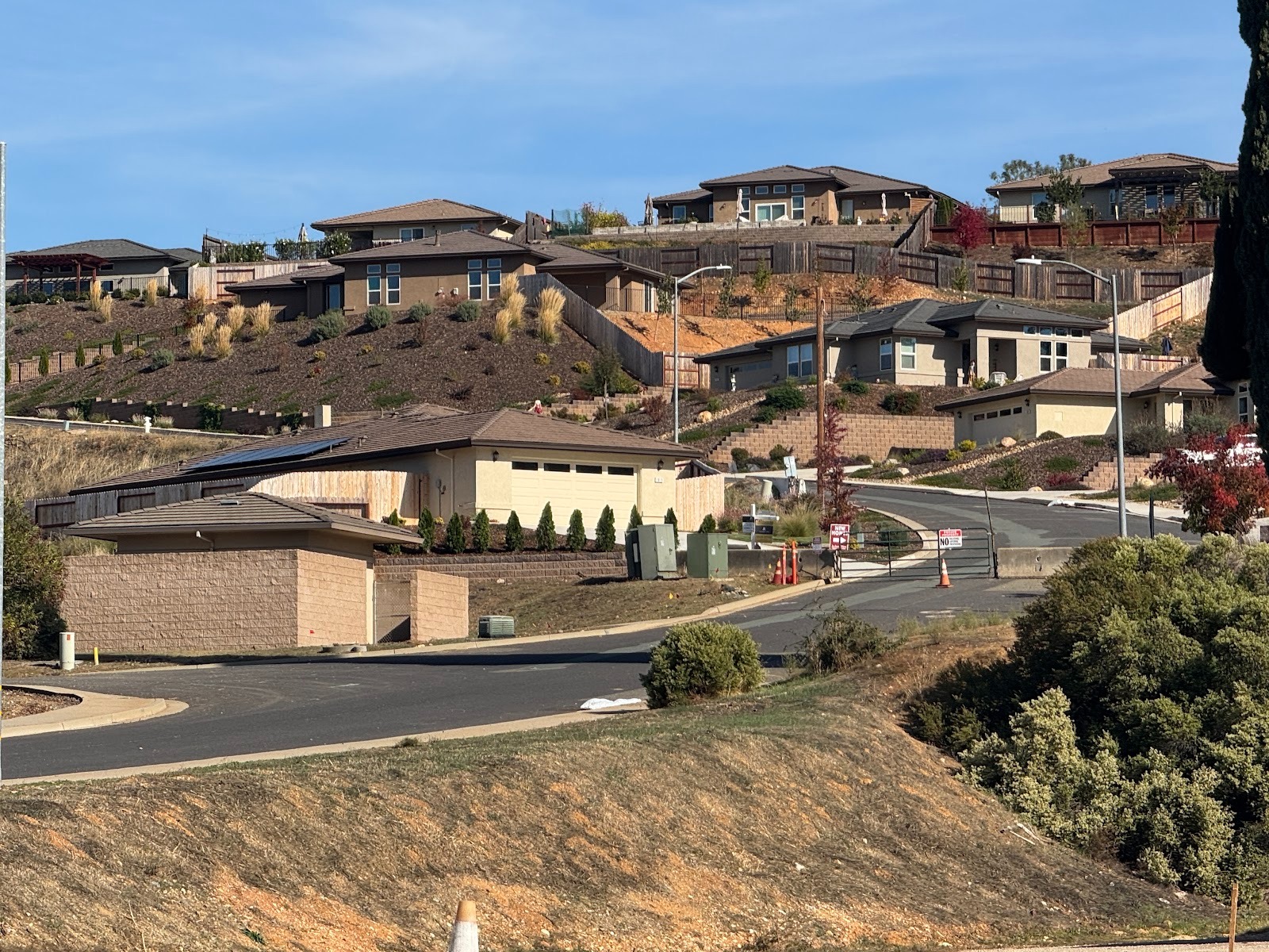
Welcome to Tesoro Viejo. Funny name for a brand-new development, but romance sells.
The plan calls for a bit over 5,000 homes on 1,600 acres. What was here before? I don't know. Grazing land?
No, we're not going in, no matter what you say.
The homebuilder offers several models at different price points. (What's the difference between a price point and a price? I have no idea, but price points are much better.)
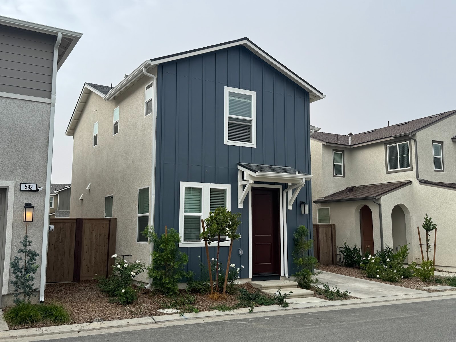
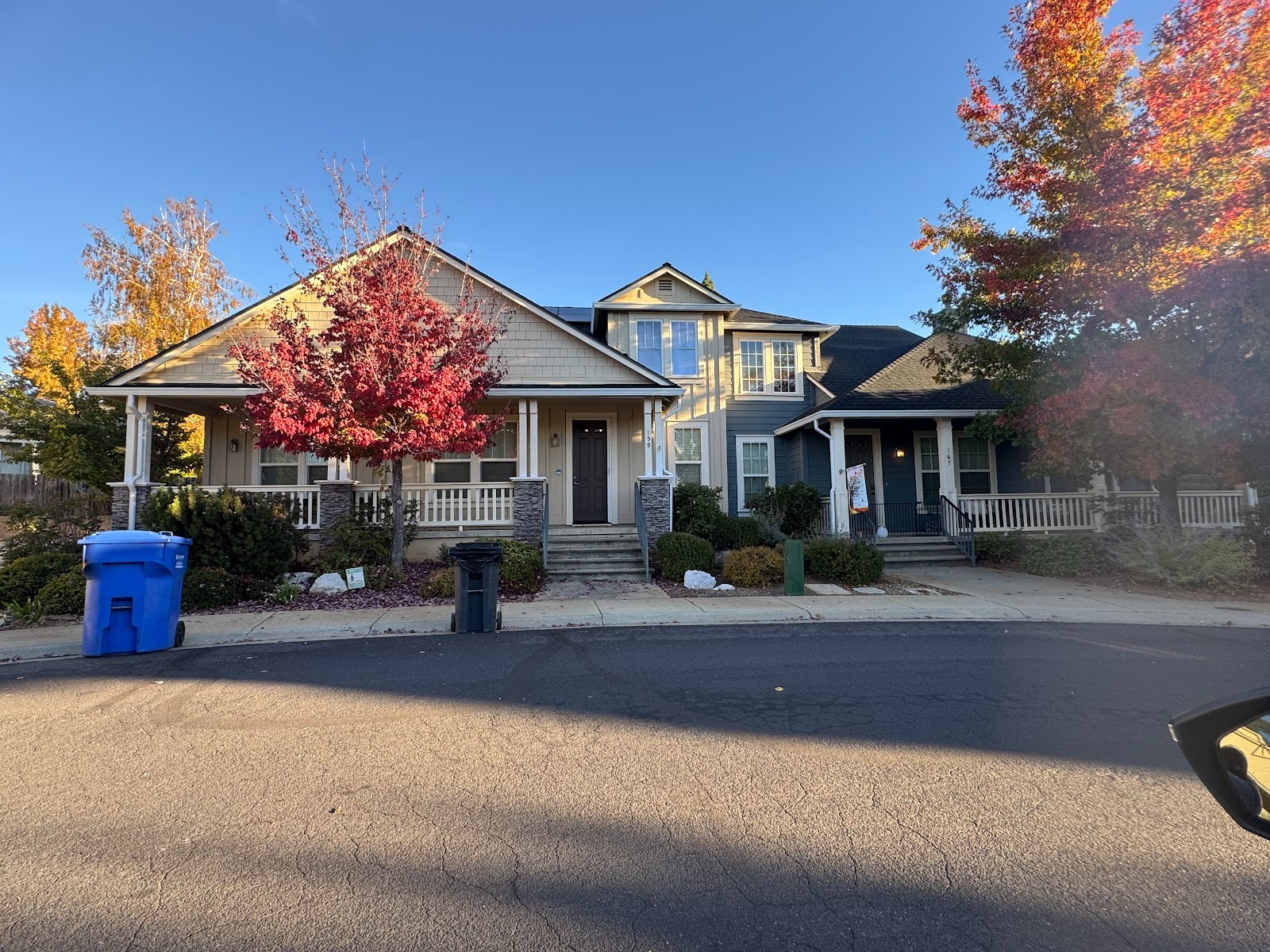
The Bellevue Model, with 1,227 square feet, starts in the high 300s. Customer: "Where's the beautiful view?" Realtor: "Get this guy outa here!"
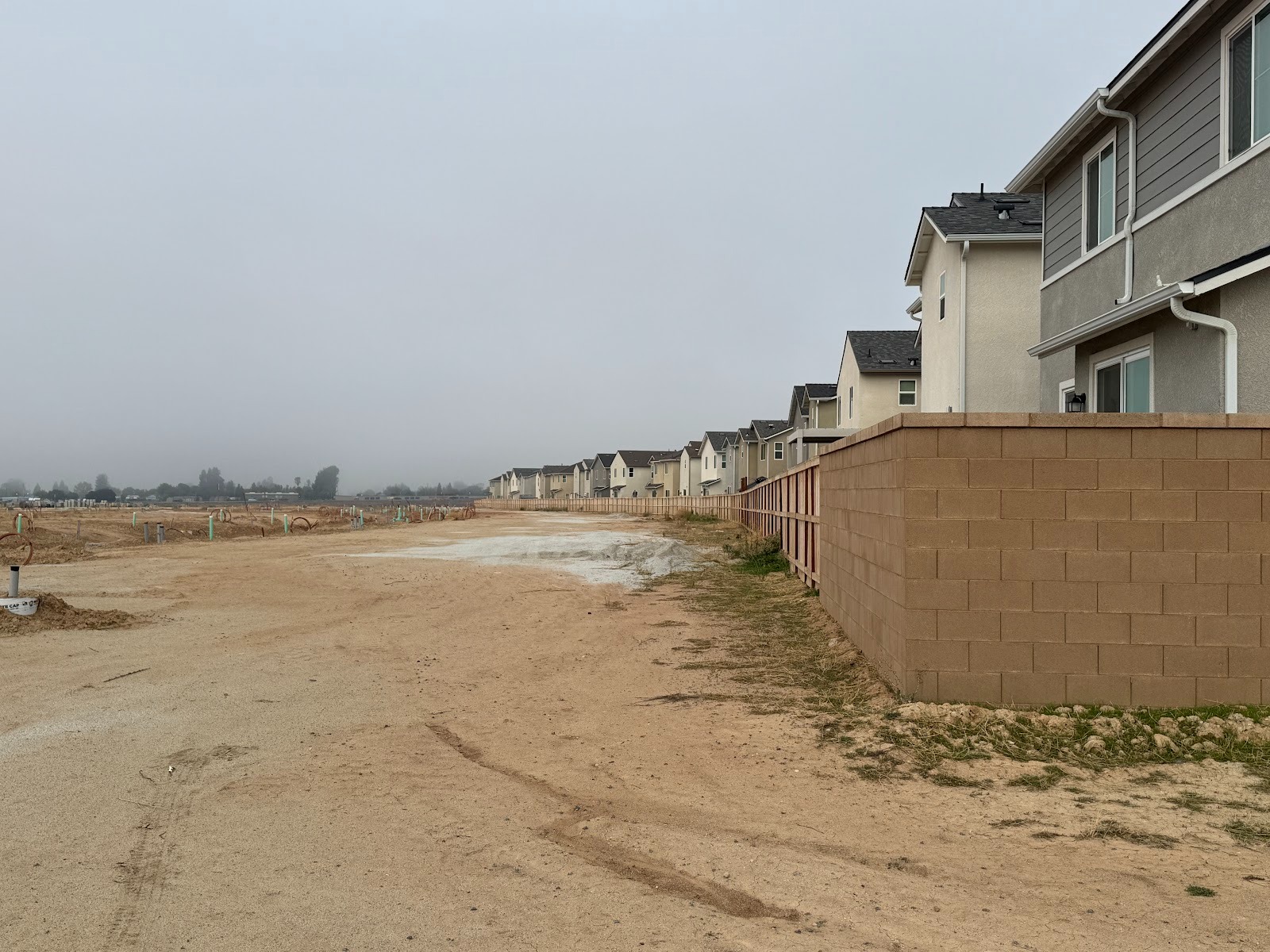
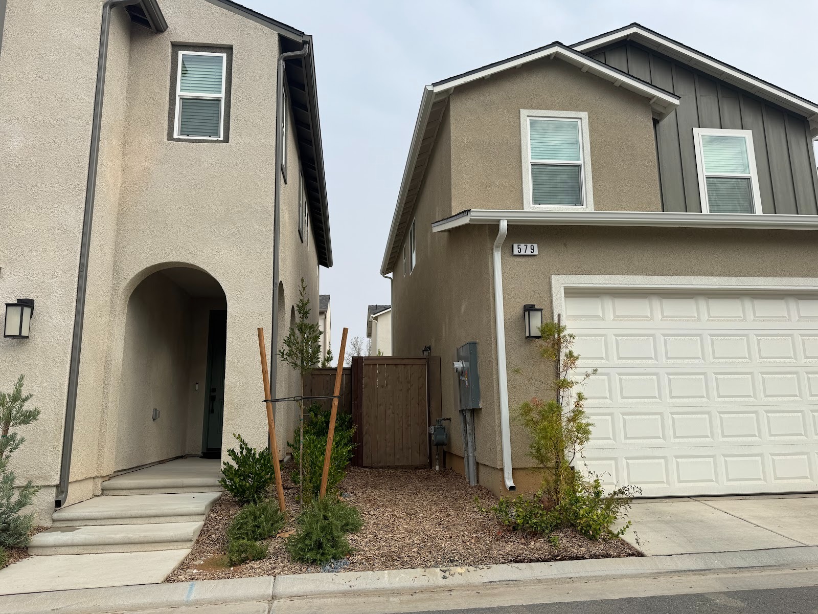
That's the Brookhill Model on the left, with 1,650 square feet. Maybe in 20 years mature trees will shade the street.
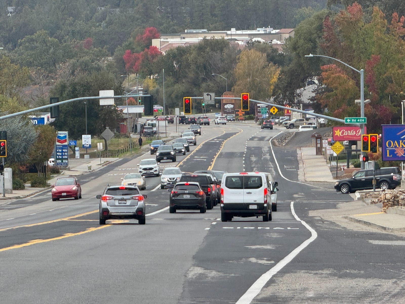
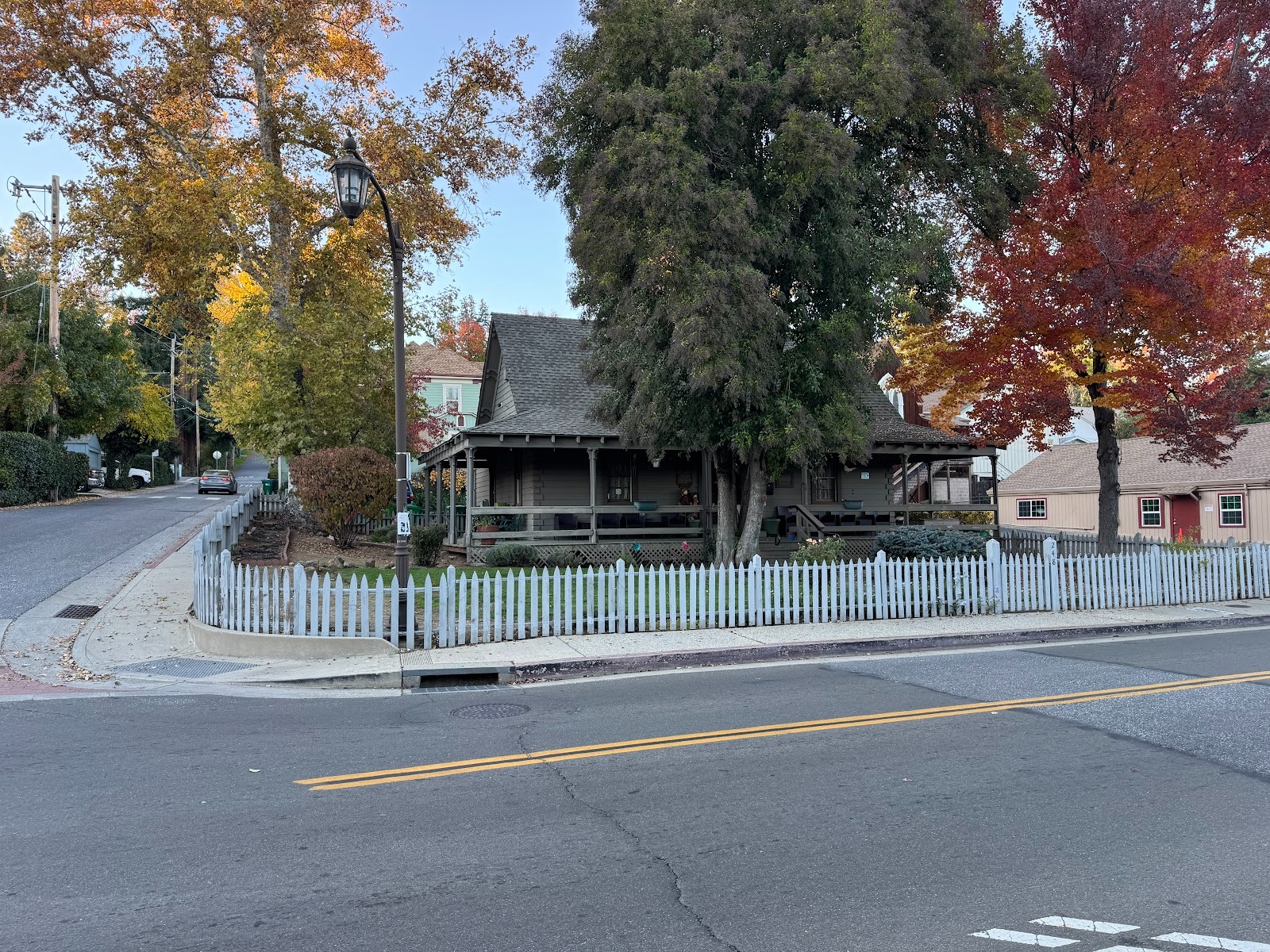
Made it to Oakhurst's main street, alias California Route 41. It brought us here from Fresno and in about 50 miles will land in Yosemite. And Oakhurst? The Census says that it has 5,000 people, but they're spread over 33 square miles. Implication: this "town" is better described as a "Census Designated Place," which is exactly what the U.S. Census does call it.
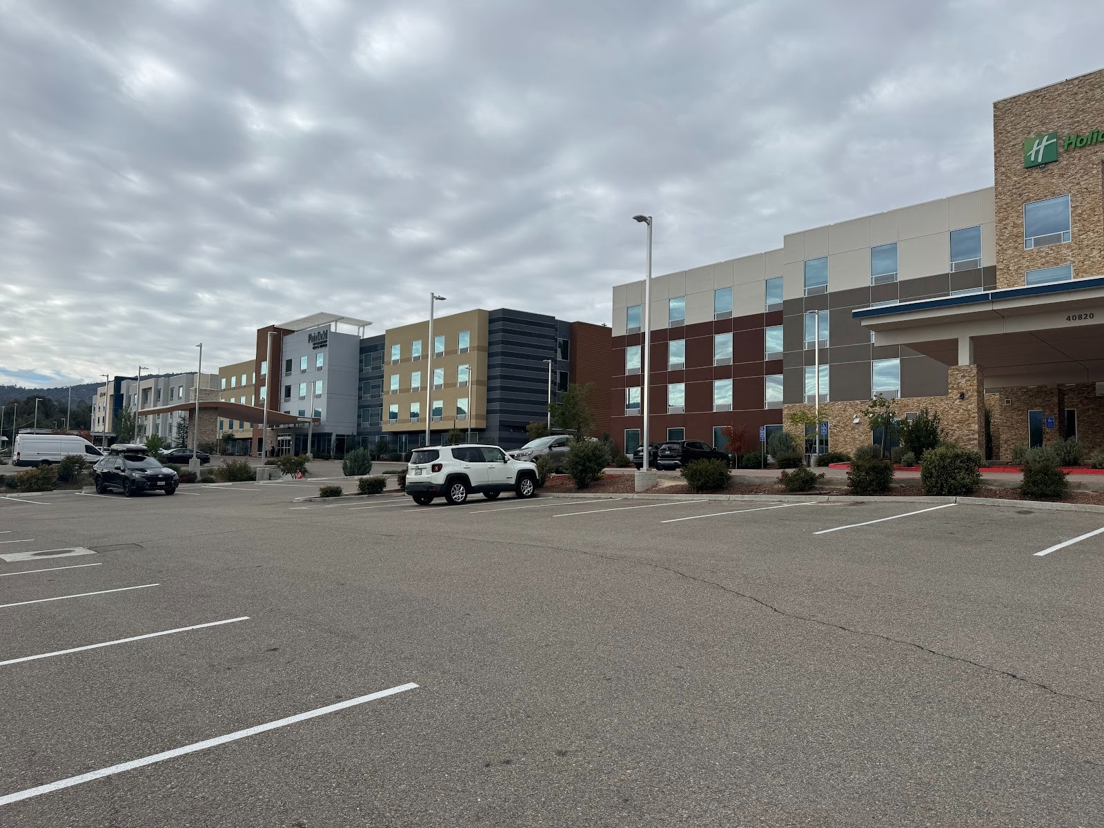
Tourists on the way to Yosemite come through and face the hellish choice of Hampton, Fairfield, or Holiday Inn Express.
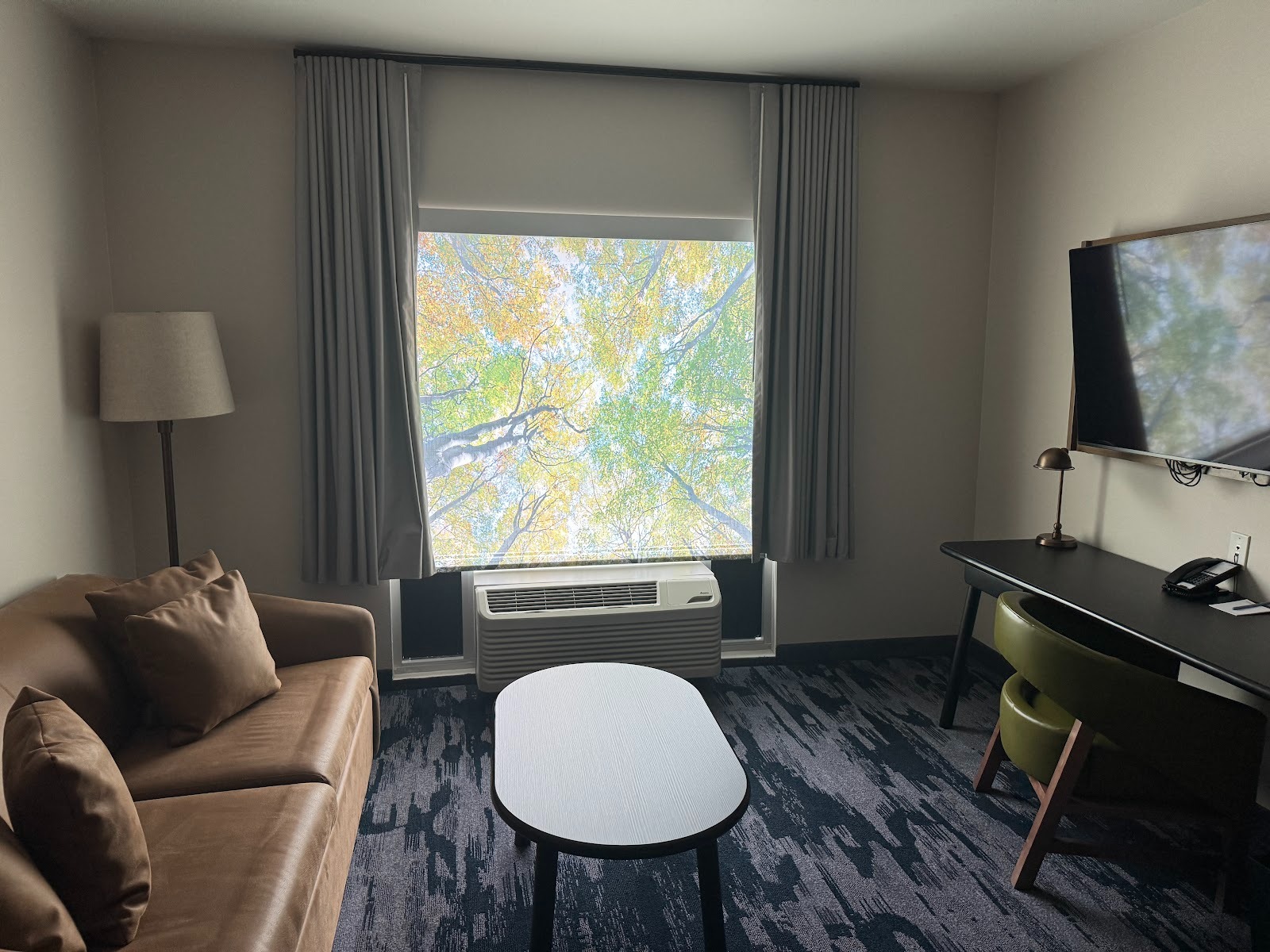
Beautiful window shade.
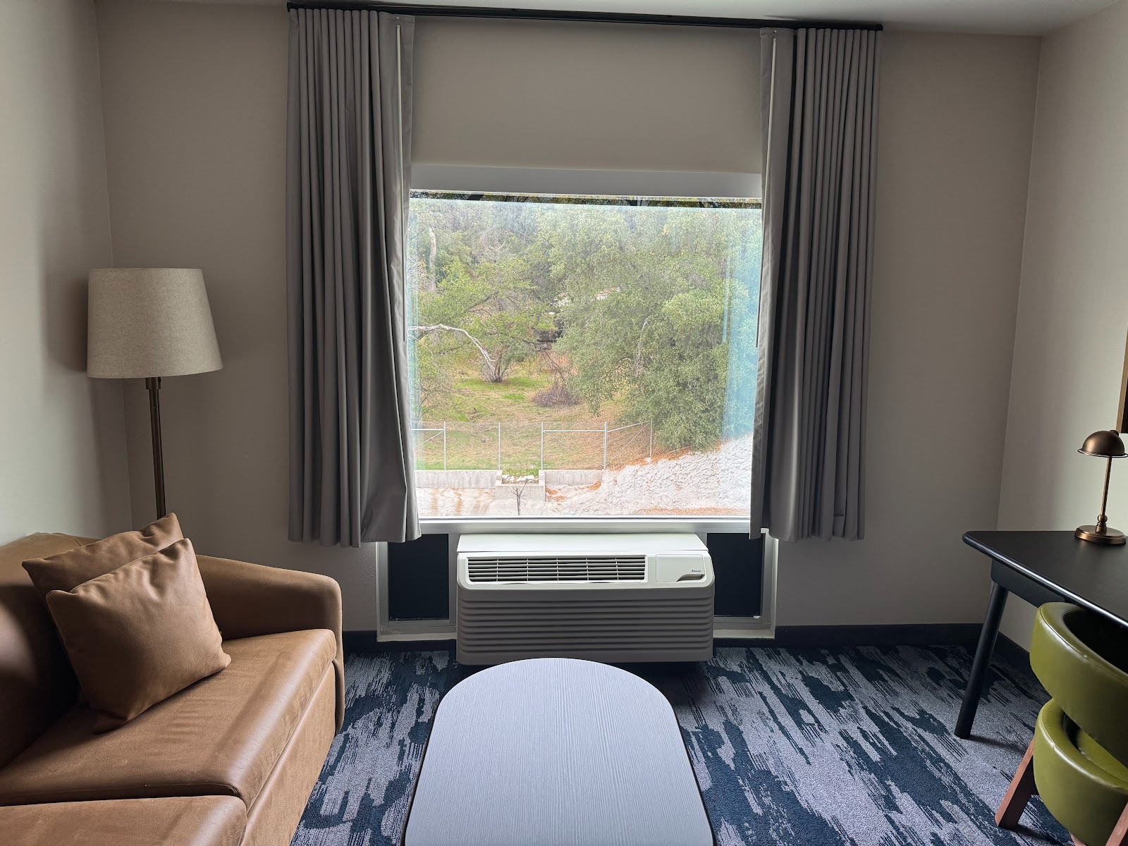
I rolled it up and left it up, never mind the fence and parking lot.
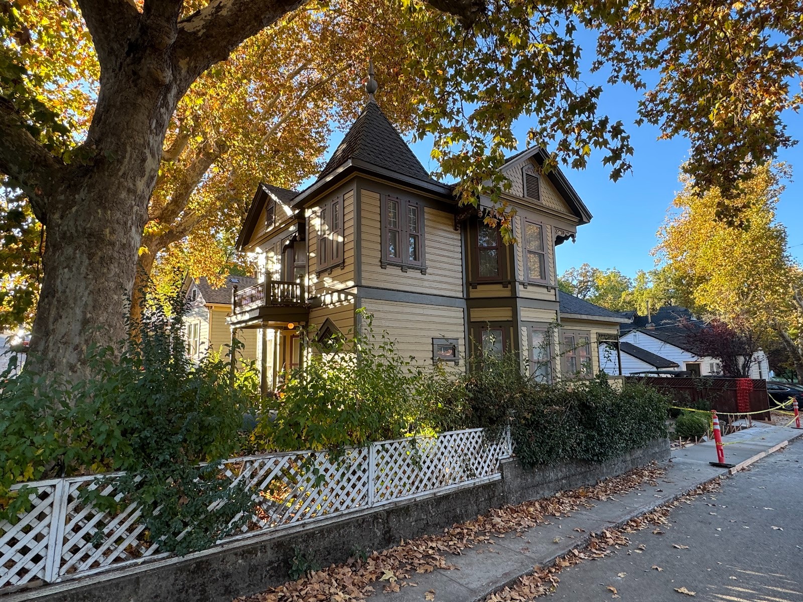
Oakhurst has no historic district (the Census didn't even recognize it as a "Census Designated Place" until 1980), but developers try to make it look traditional.
So do realtors. Think this is a house? Wanna bet?
You lose.
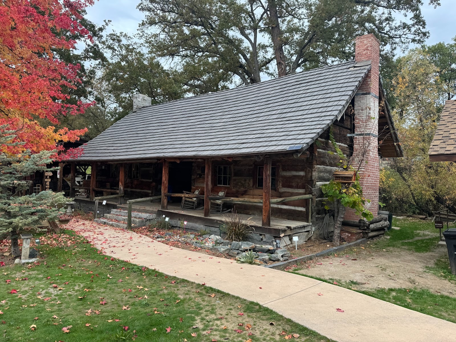
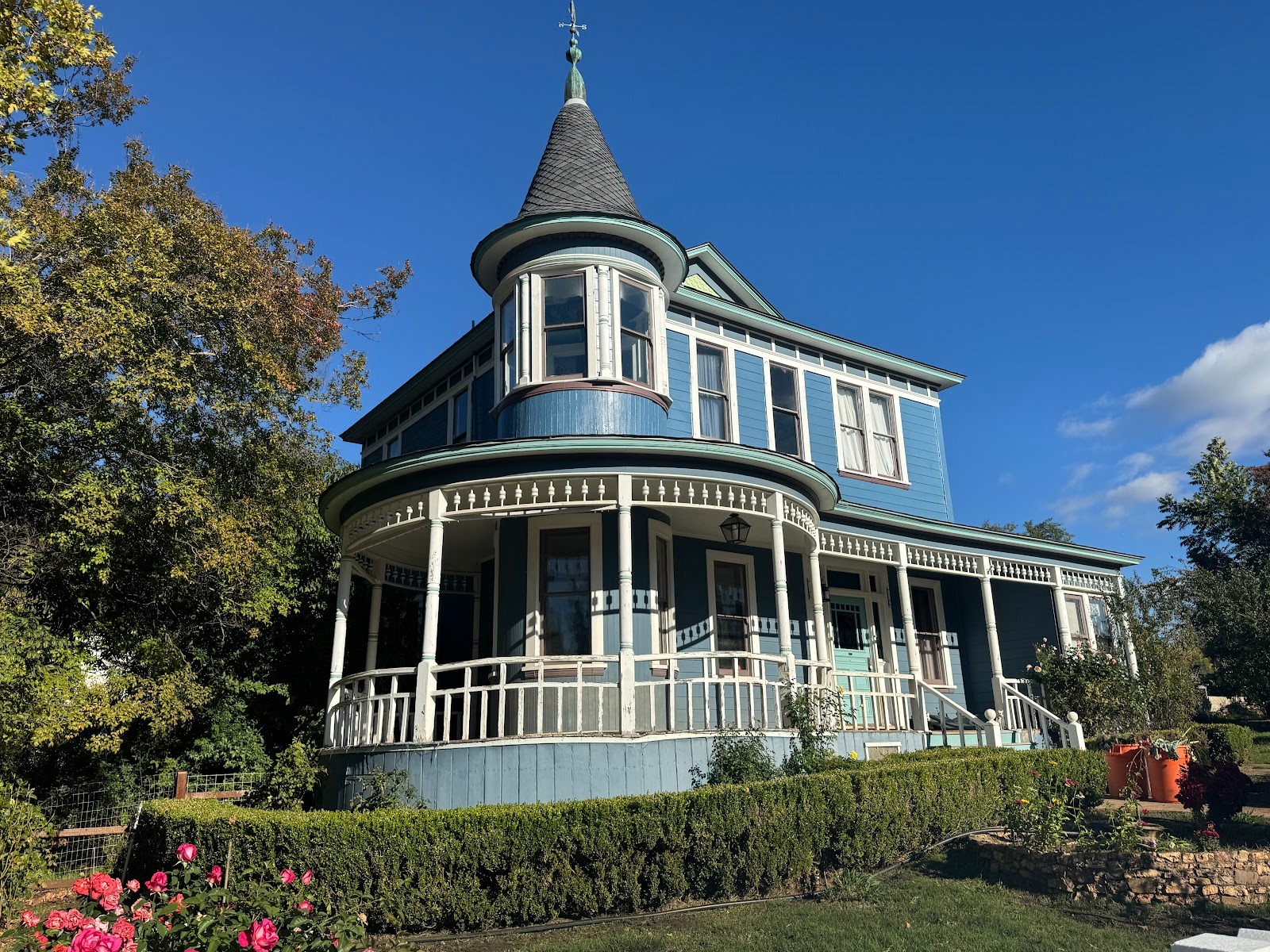
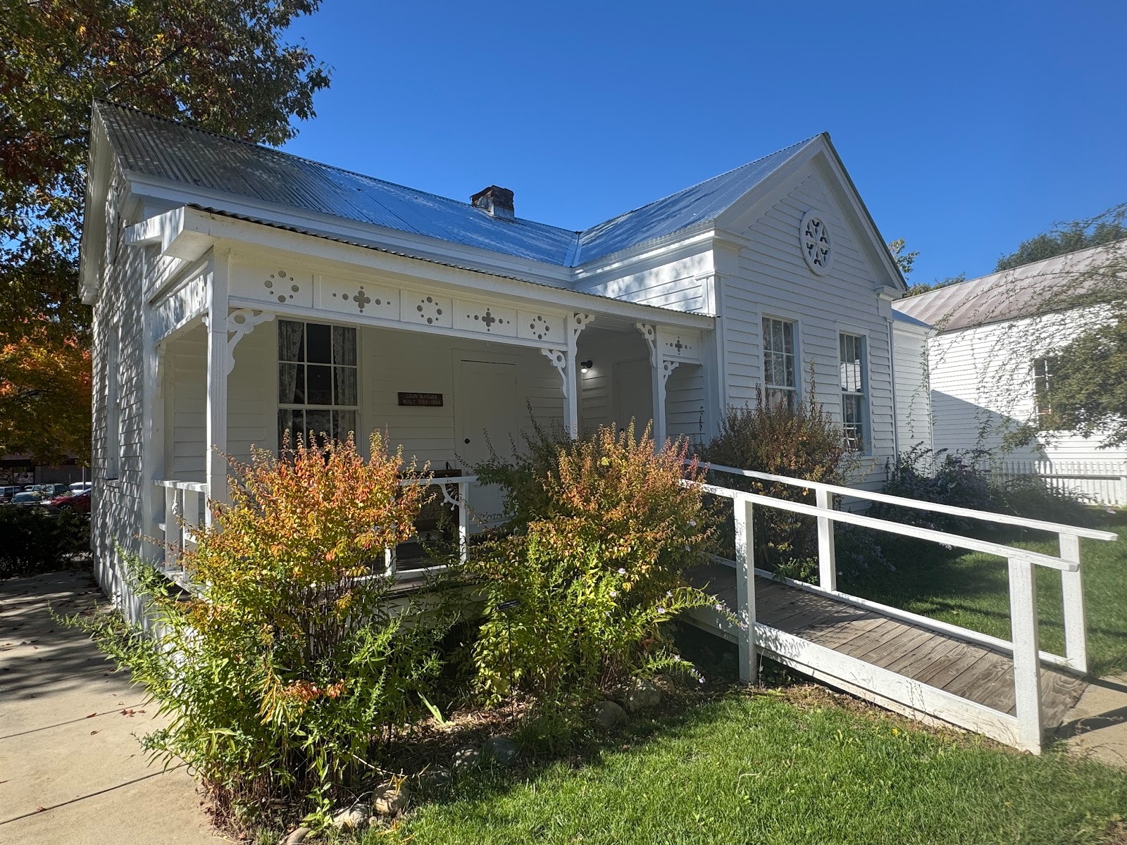
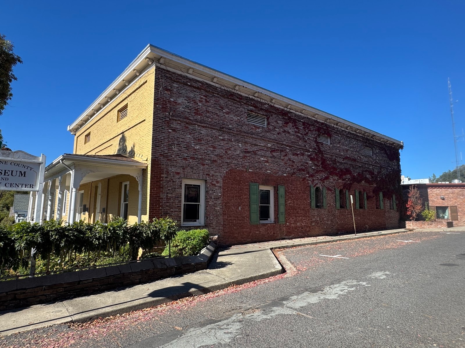
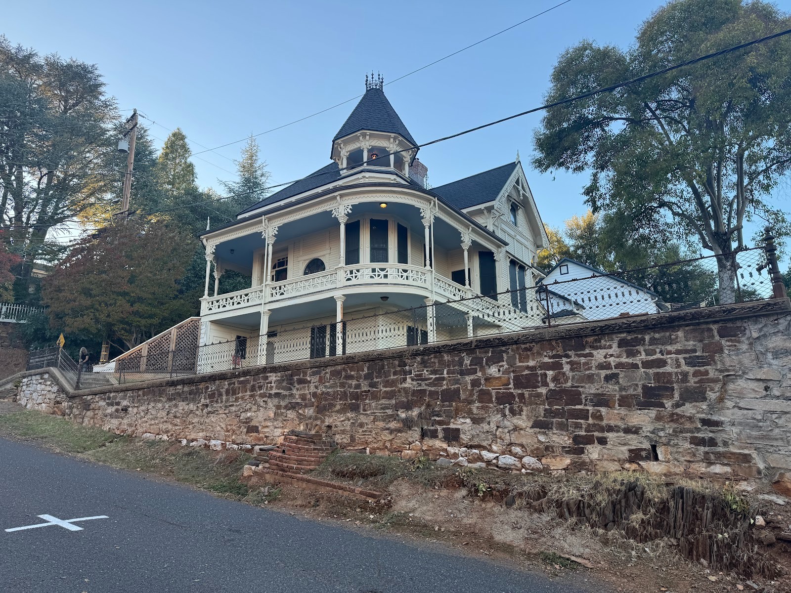
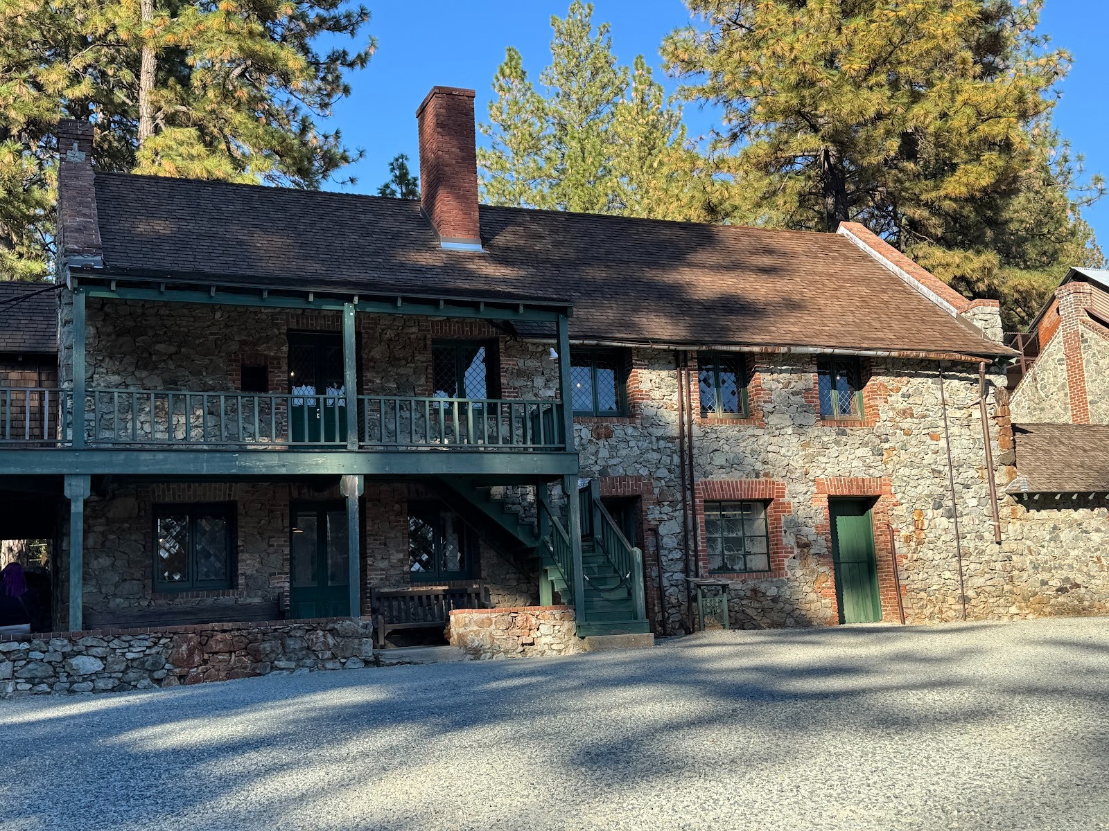
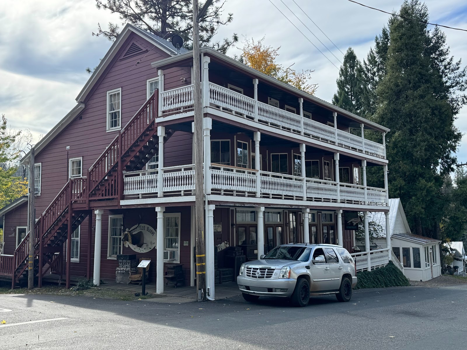
Still, somebody in Oakhurst (and somebody in every town ahead of us) cares deeply about history, expressed here in a two-pen dogtrot house built in 1869 and preserved in the Fresno Flats Historical Museum. (Oakhurst was called Fresno Flats until 1912.)
A sign explains that the structure was enclosed in a larger home built about 1900 and was only discovered when that larger home was demolished.
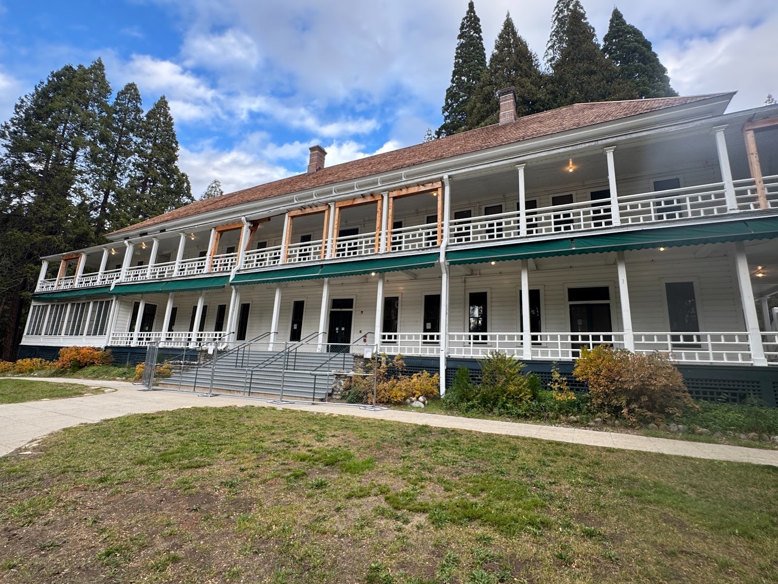
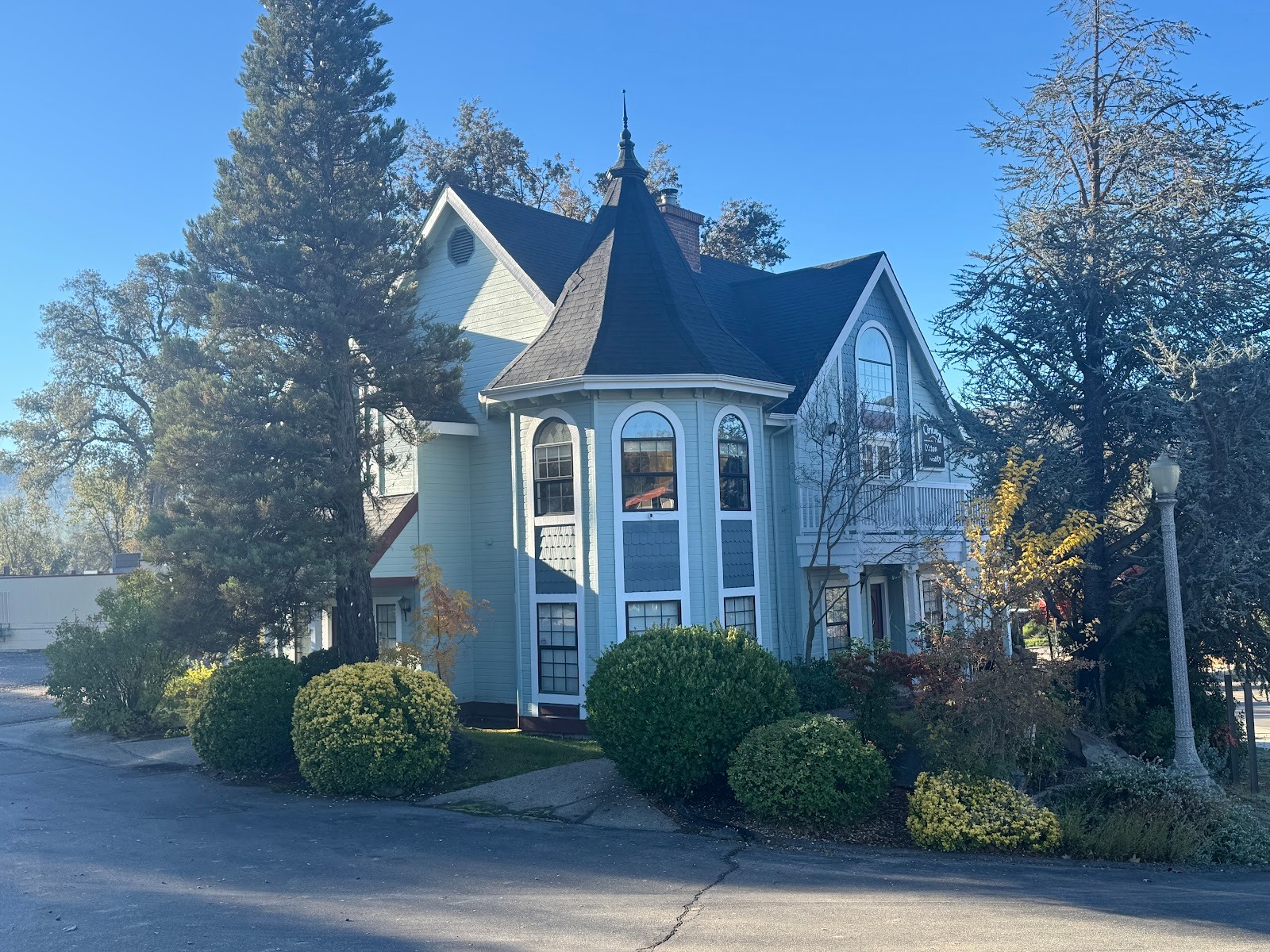
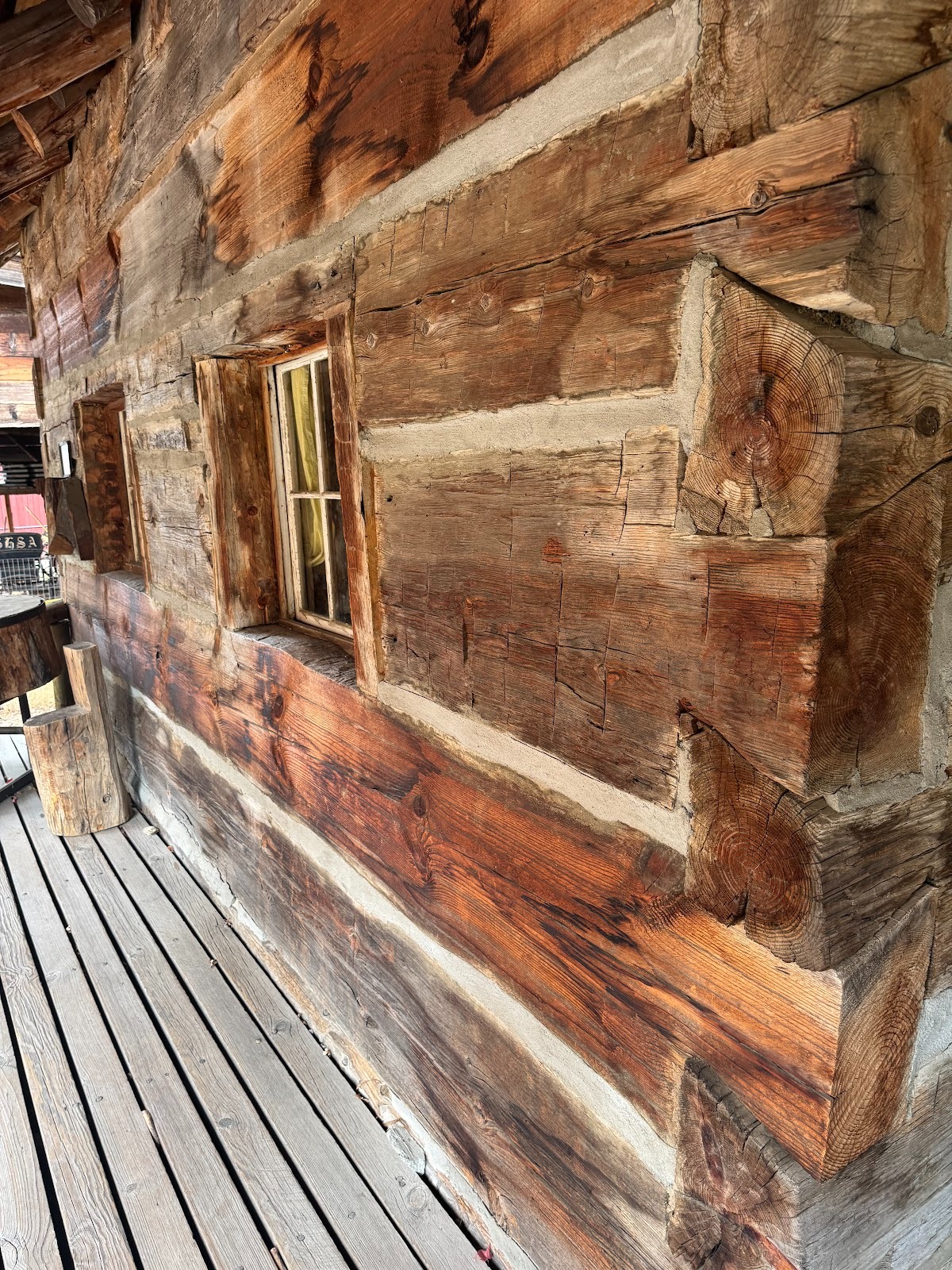
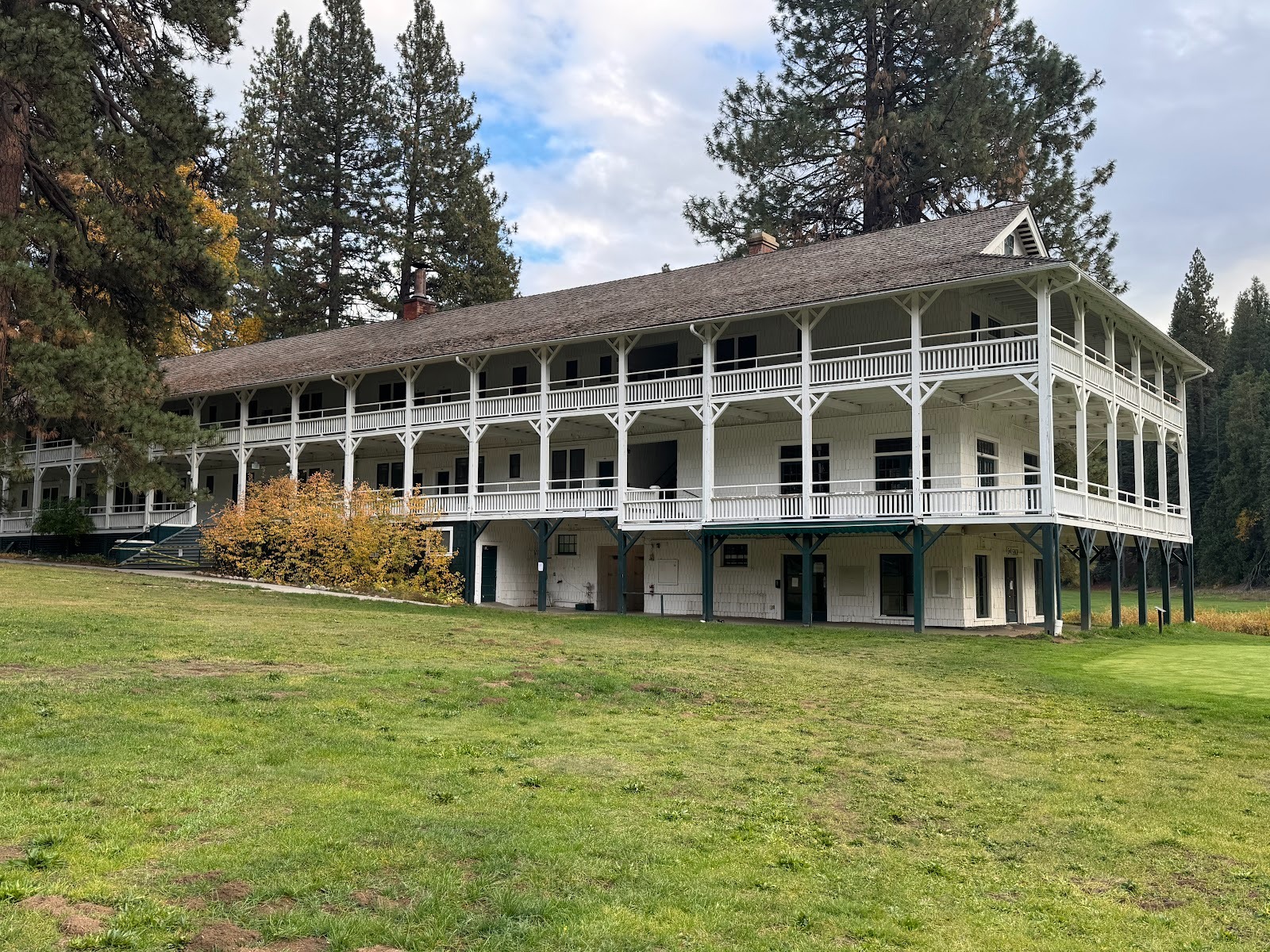
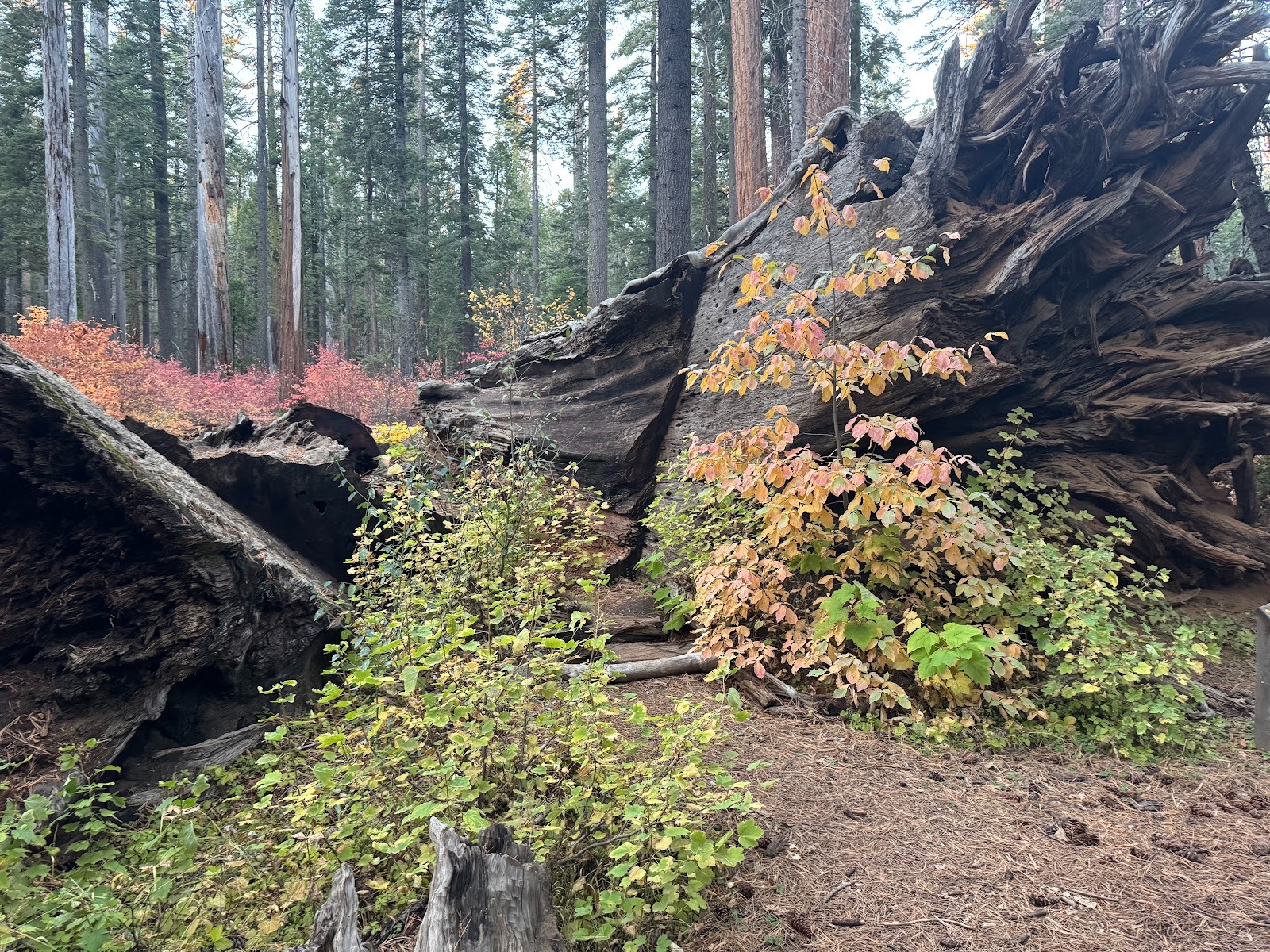
Most older buildings in this part of the world are made of fireproof materials, but wooden buildings persist. Case in point: the Wawona Hotel, just inside Yosemite National Park. Yes, the steps are fenced. The hotel was closed in 2025 for structural repairs.
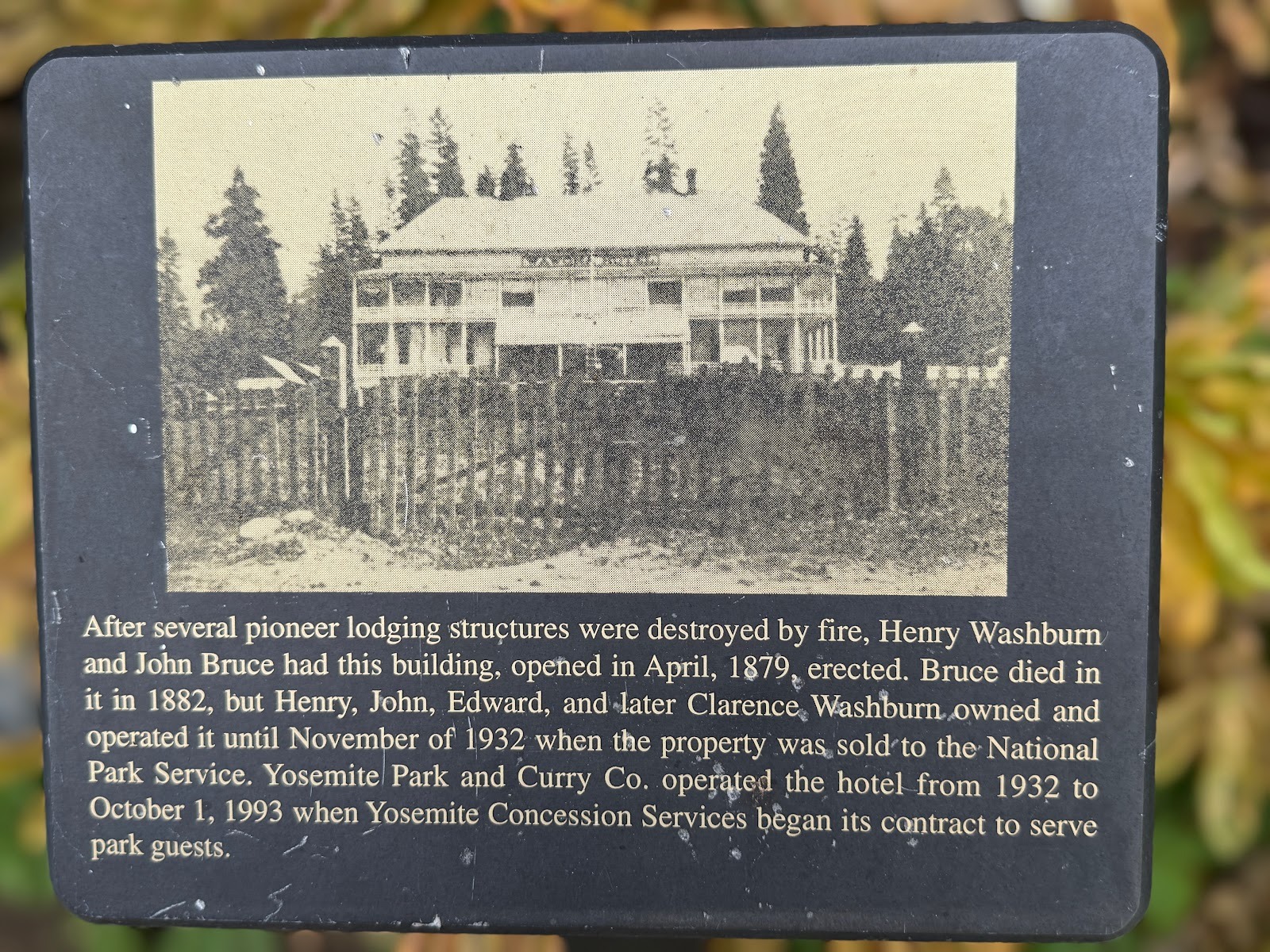
The original building, from 1879, was slightly different.
A newer wing. It, too, was closed in 2025.
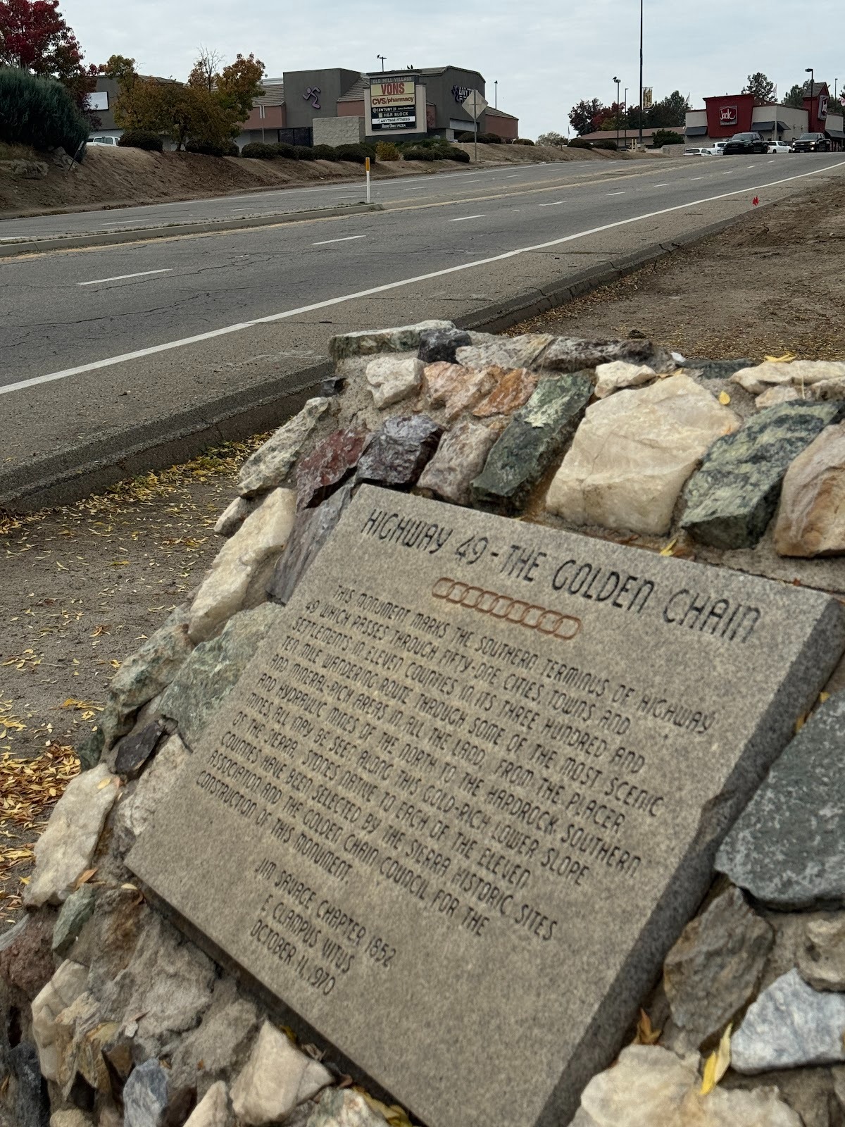
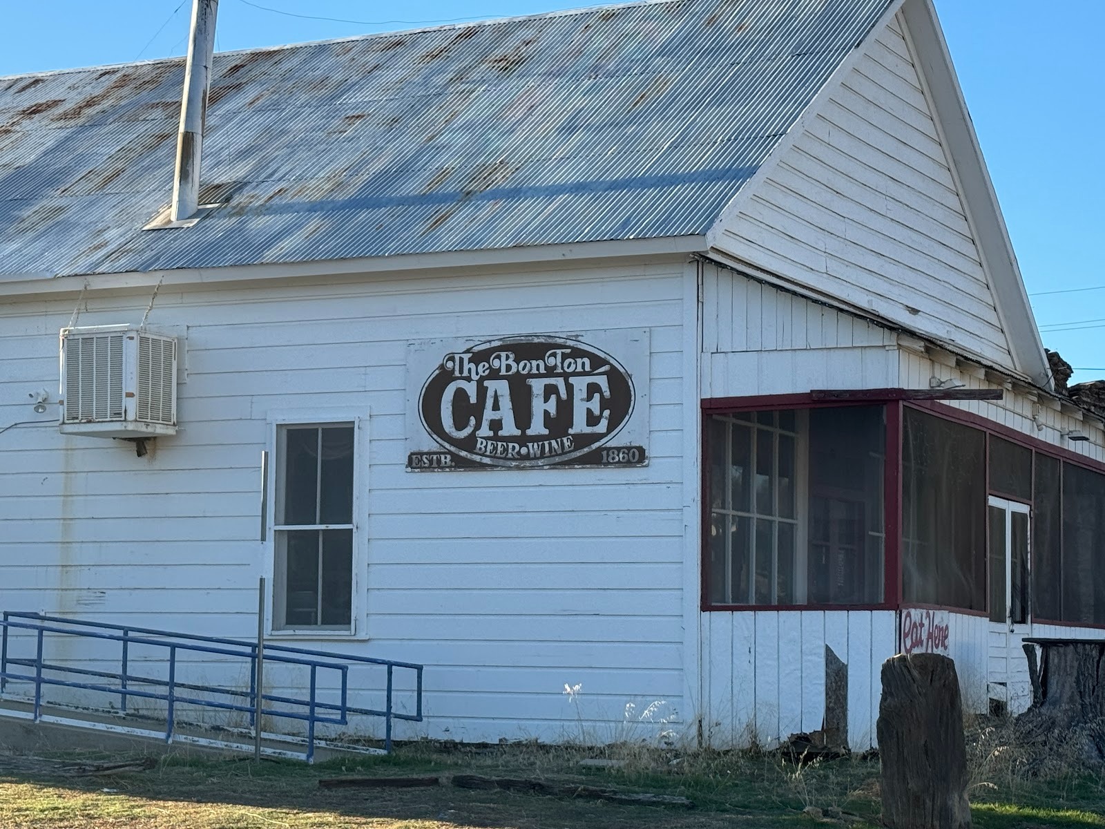
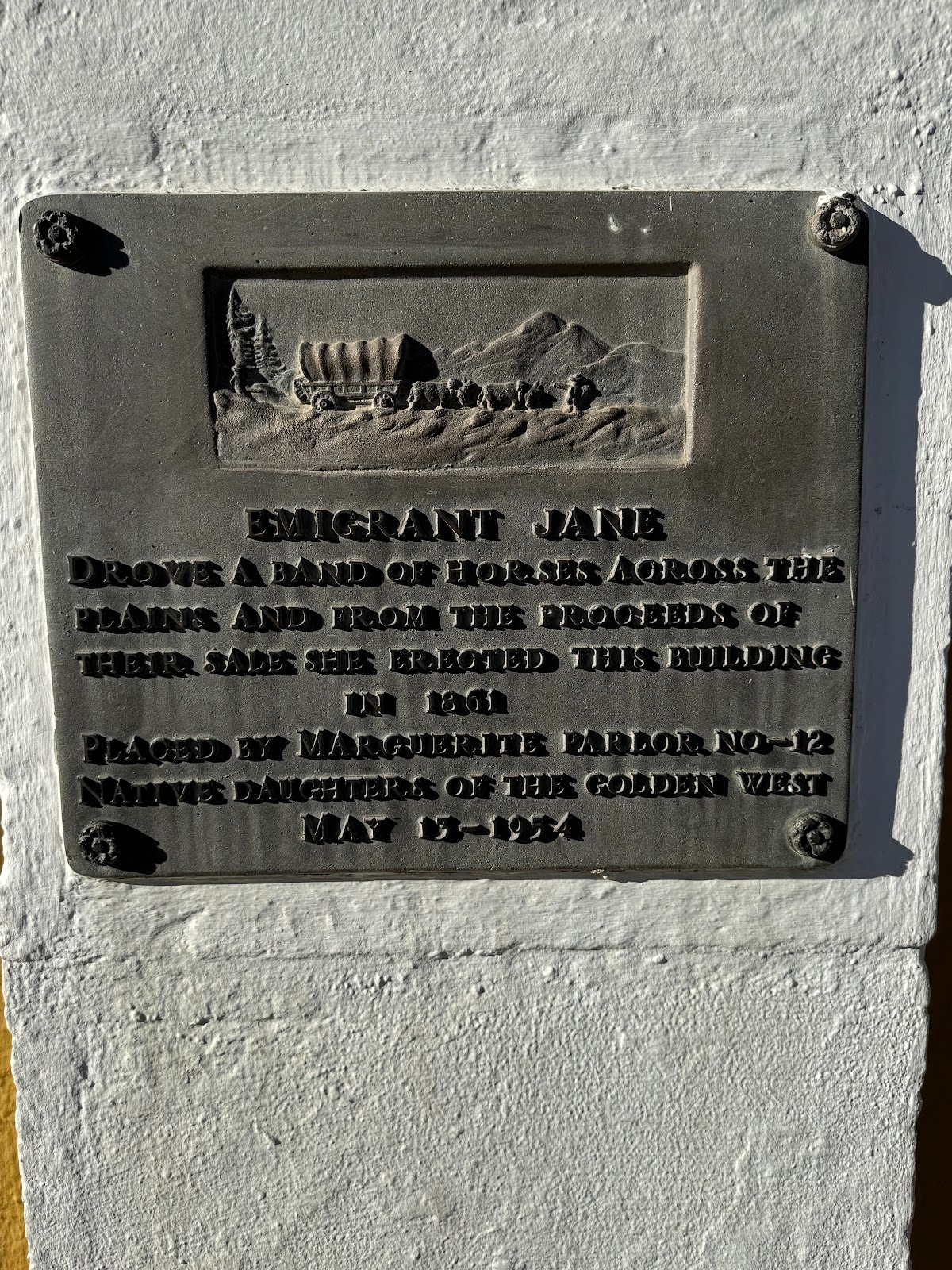
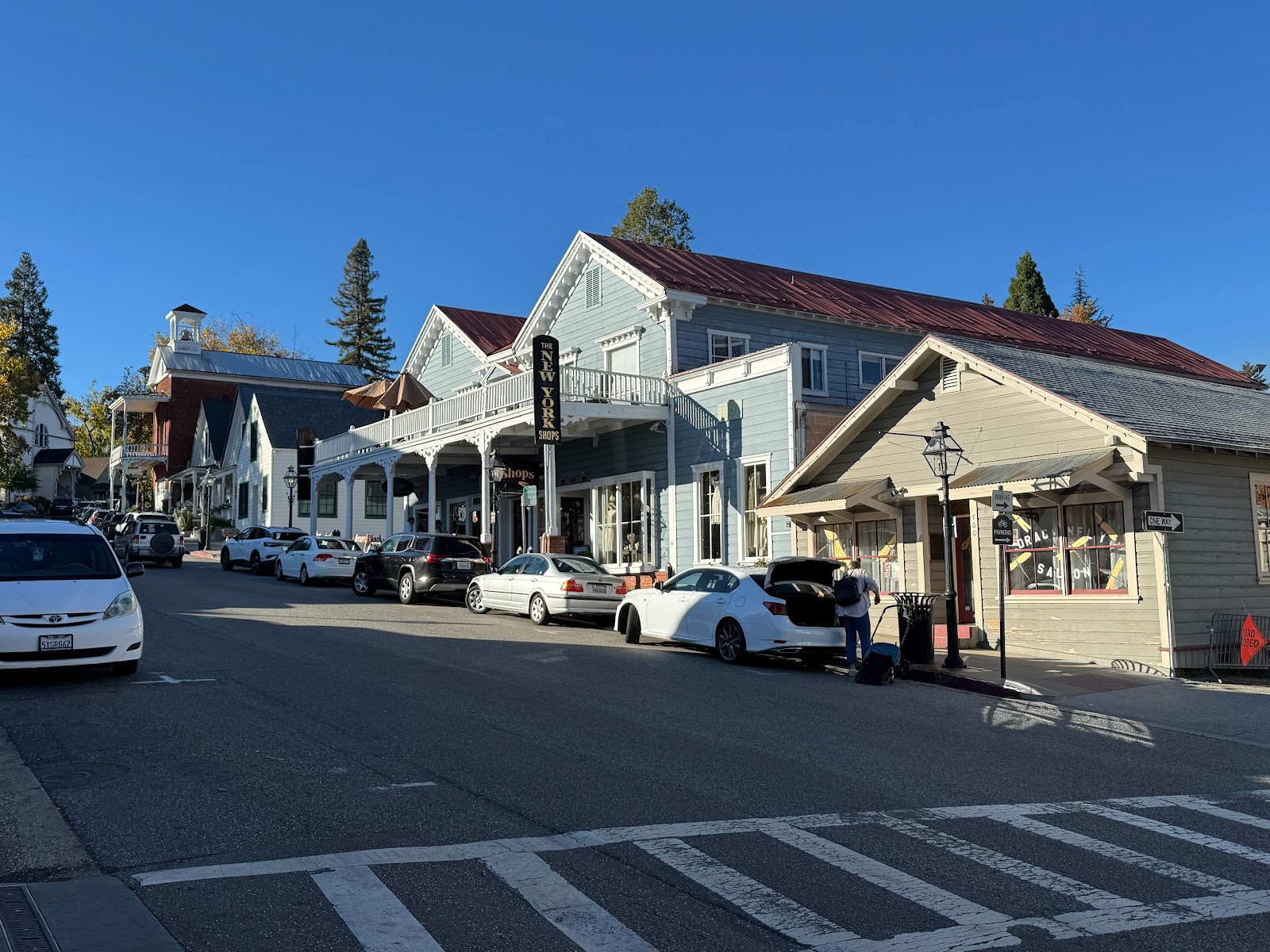
So here we are back at Oakhurst and at the starting point of Highway 49.
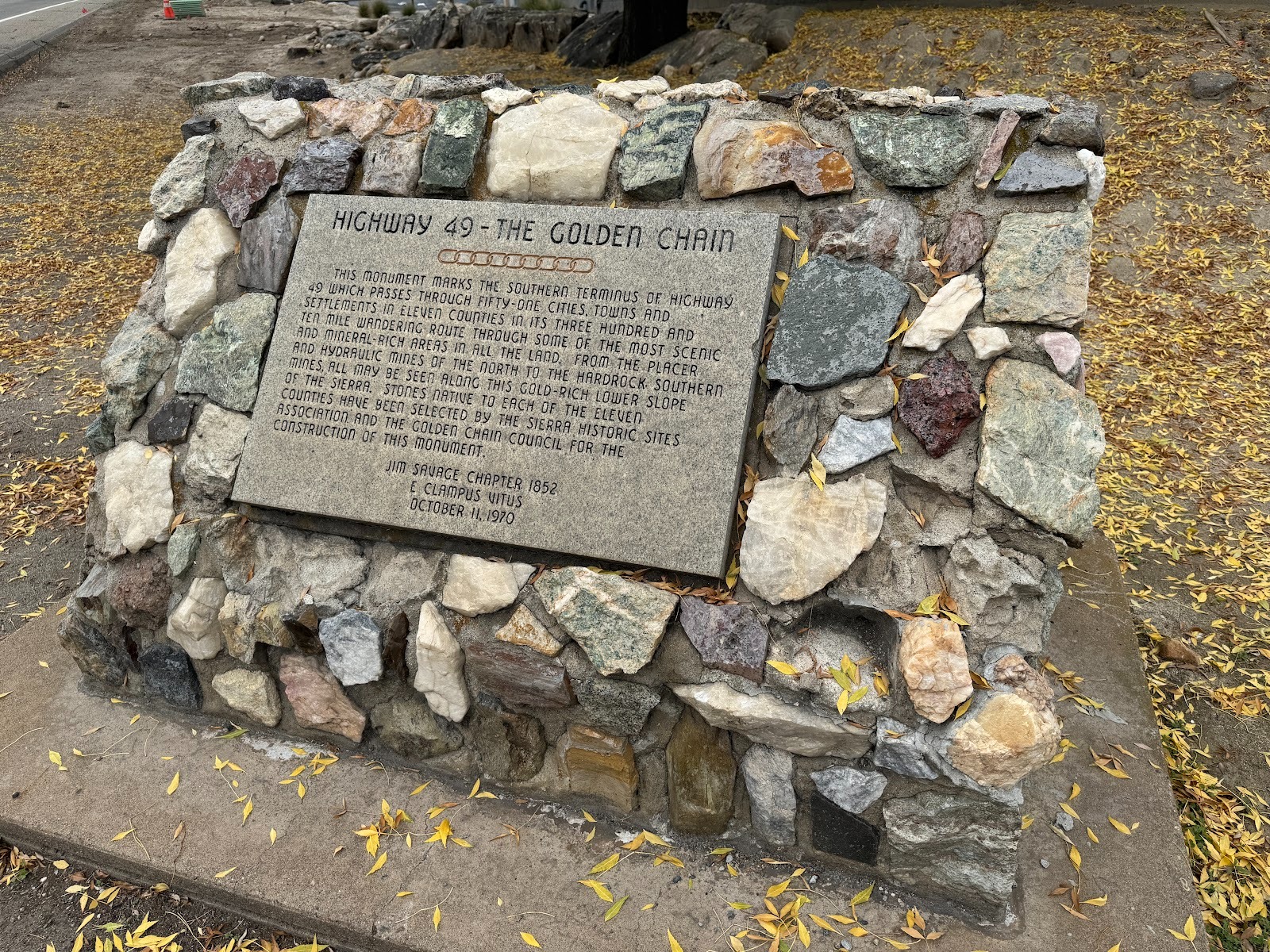
The plaque was put up by E Clampus Vitus, a fraternal organization established in California sometime around 1850 and priding itself on its sense of humor, beginning with its fake-Latin name.
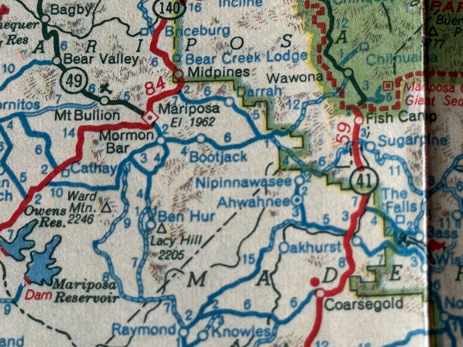
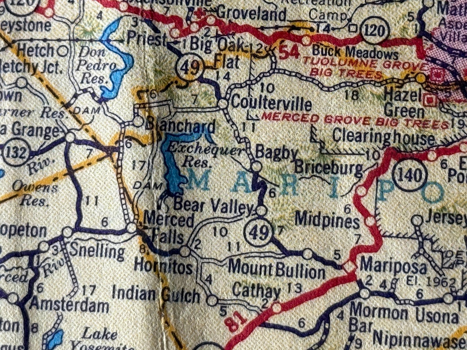
The plaque says very little about Highway 49, but this Flying A road map from the early 1950s shows 49 extending south only as far as Mariposa. (The map is undated but carries Census data from 1950 and does not mention the Interstate Highway system, begun in 1956.)
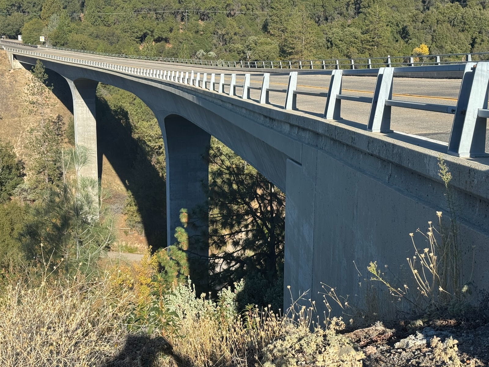
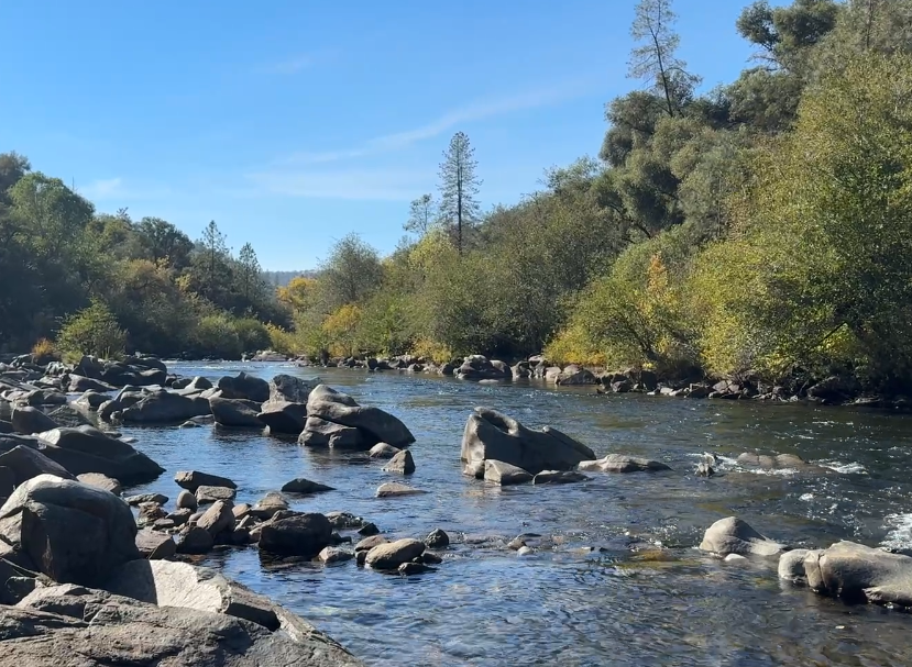
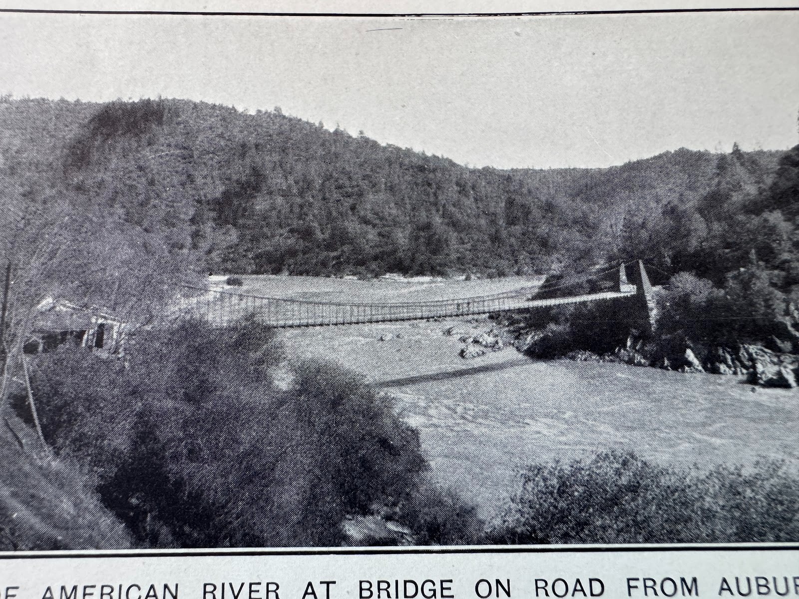
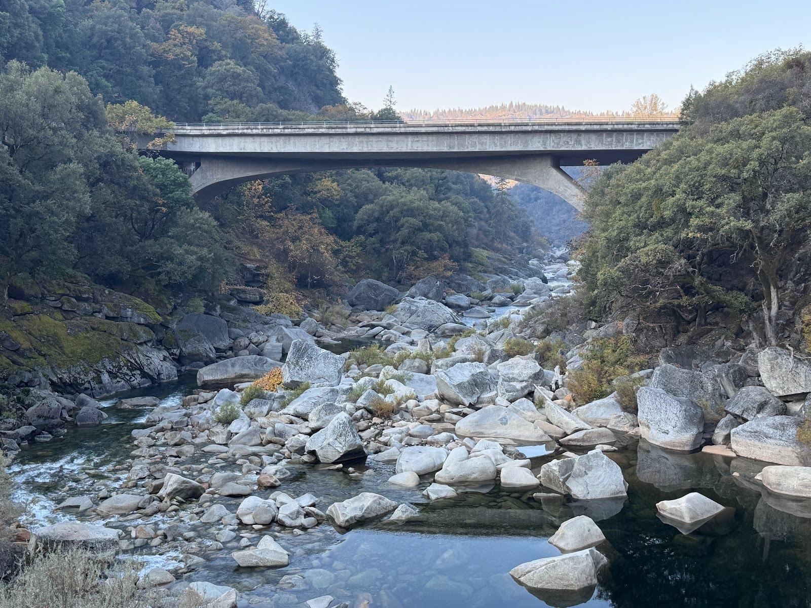
On the way north we're going to cross several rivers with intimidating canyons. Here, a few miles north of Oakhurst, is the modest canyon of the Chowchilla River. The bridge is one of a set of bridges built mostly in the 1990s to replace bridges from the 1930s.

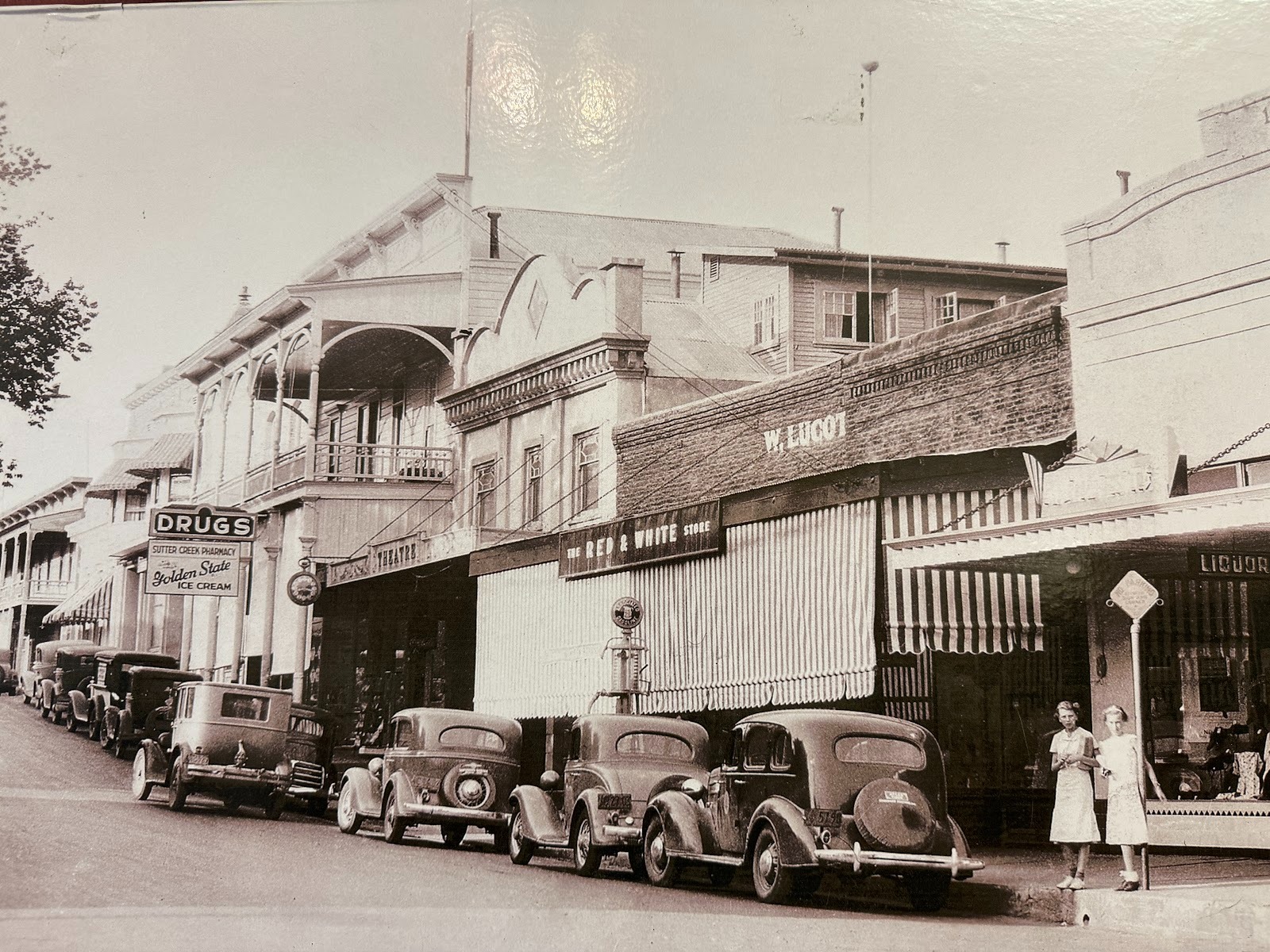
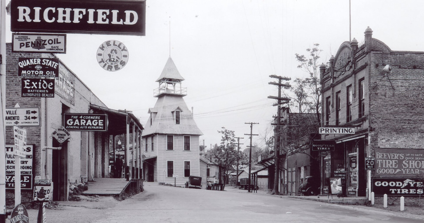
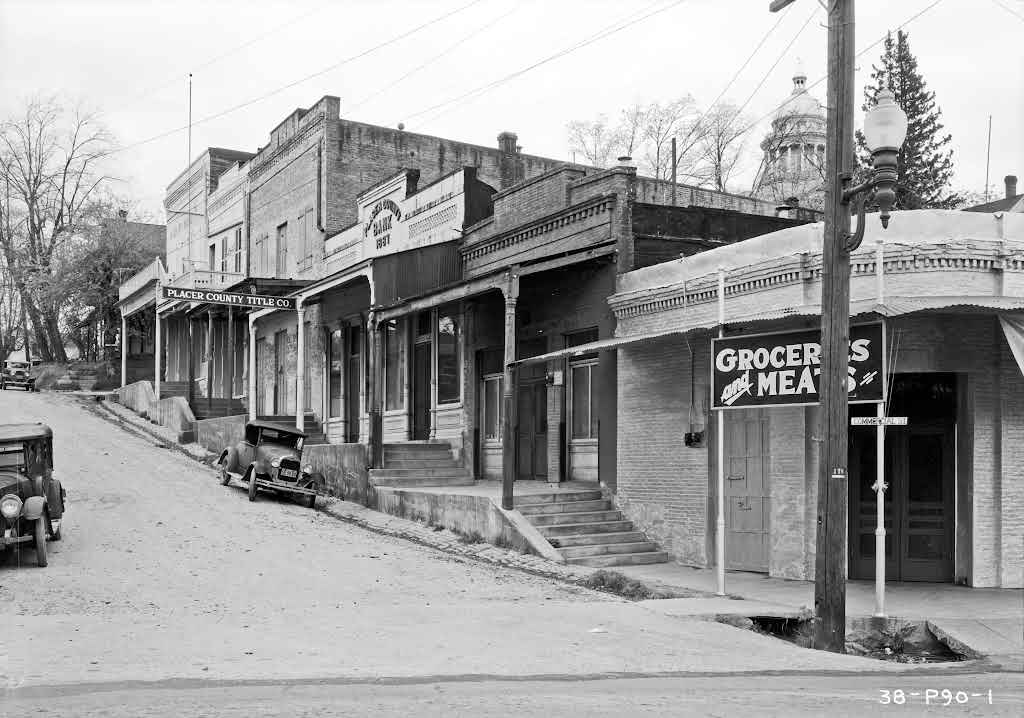
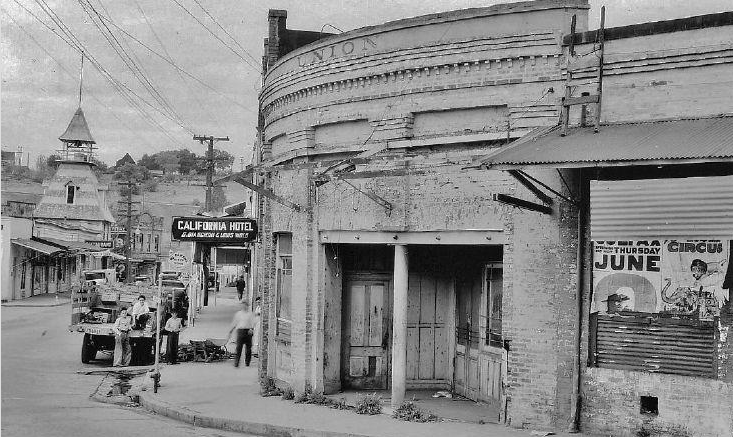
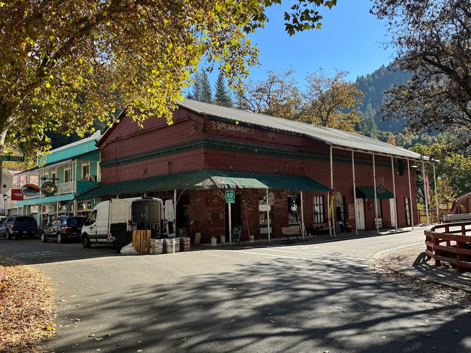
First stop: Mariposa, 20 miles up 49 from Oakhurst. The path through the most built-up section would become Highway 49 in the 1920s. The photograph, from 1860, is by Carleton E. Watkins, a pioneer photographer of Yosemite.
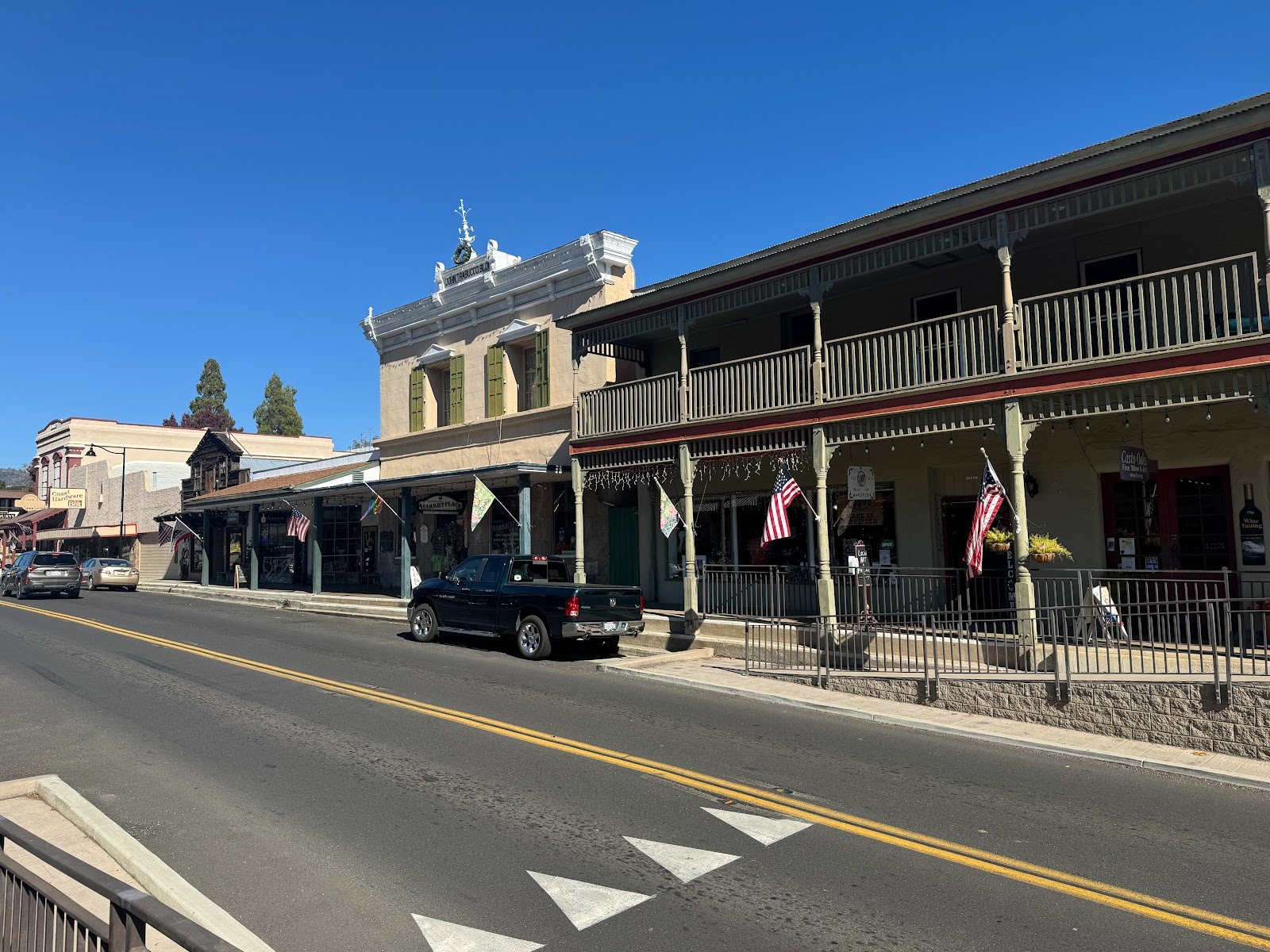
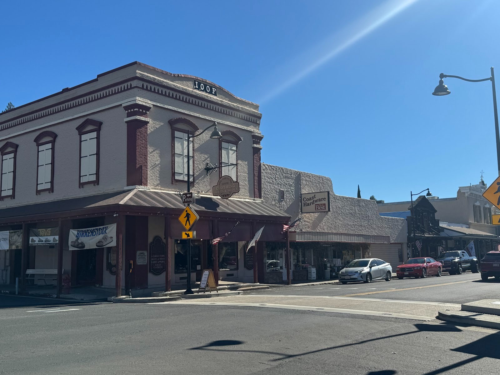
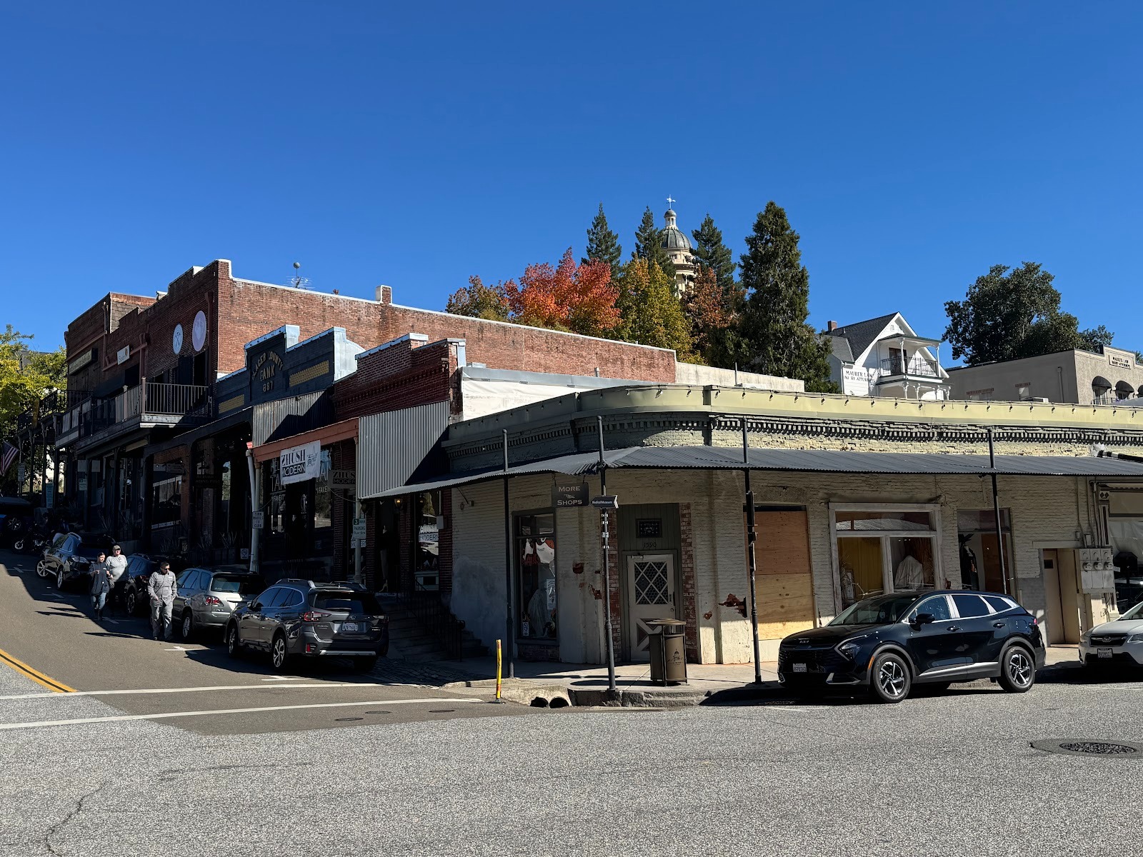
Here's that street today, showing the old part of town (Highway 49 between Fifth and Sixth streets). We're looking north from the Schlageter Hotel on the right to the IOOF building at the far left. (The Independent Order of Oddfellows has buildings in all or nearly all the towns ahead of us. Unlike E Clampus Vitus, the Oddfellows trace their history to 18th Century England.)
Here's that IOOF building again. A lurking question: what is the appeal of this place? The buildings in and of themselves are no more than functional or, when ornamented like the IOOF building, formulaic. Starr King, an influential figure in California in the 1860s, visited Mariposa and wrote that: "...the same showy, white-painted ten-footers, with square fronts extending above the ridge-pole, which we had noticed in other villages, lined the street here." Should we be any more impressed that he was? If not, what is the allure? The answer I like best is that in a state (or country or world) that wants to look like Tesoro Viejo, even the most modest history is important. It's like a guy who barely knew his grandparents but respects them because they're as far back as he can go.
(Thomas Starr King, A Vacation Among the Sierra, ed. by John A. Hussey, 1962, p. 20.)
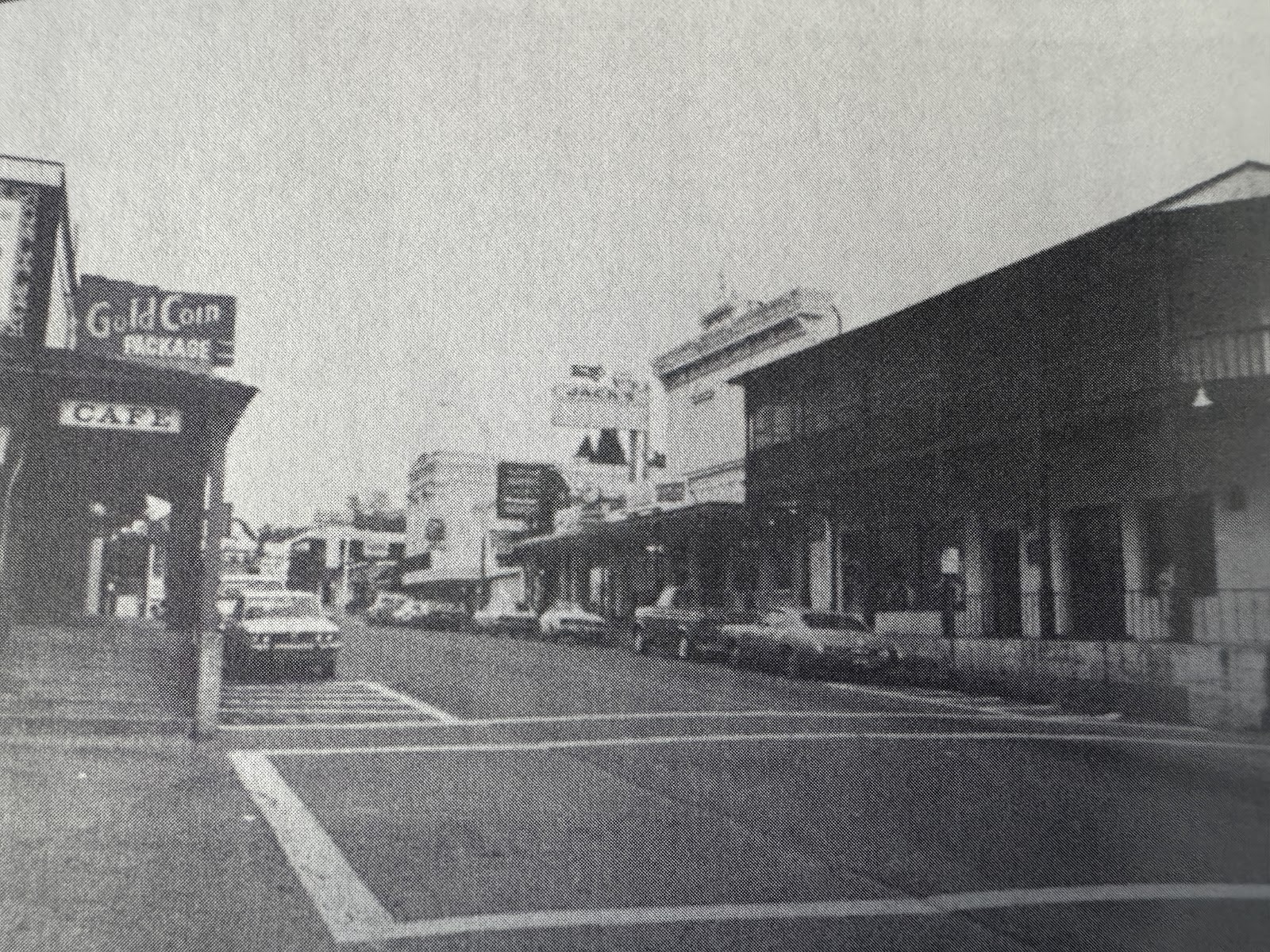
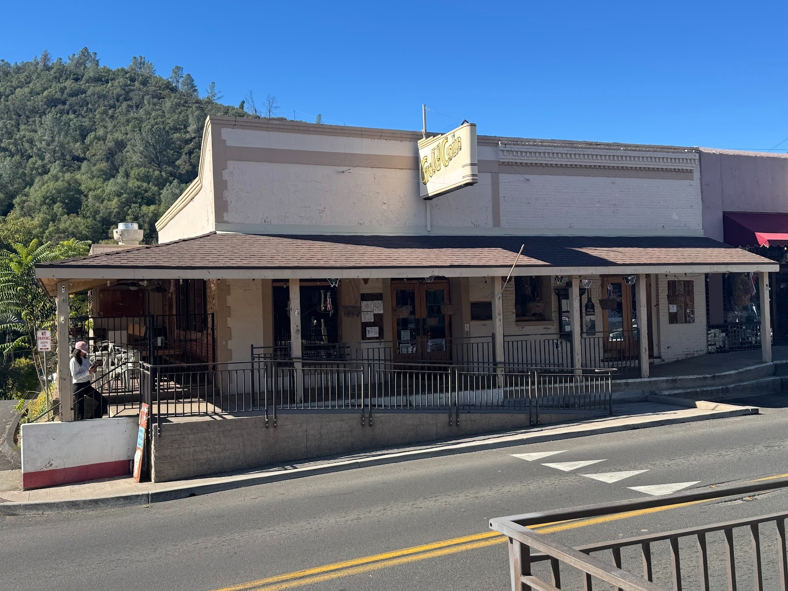
A view from the 1950s. Notice the Gold Coin.
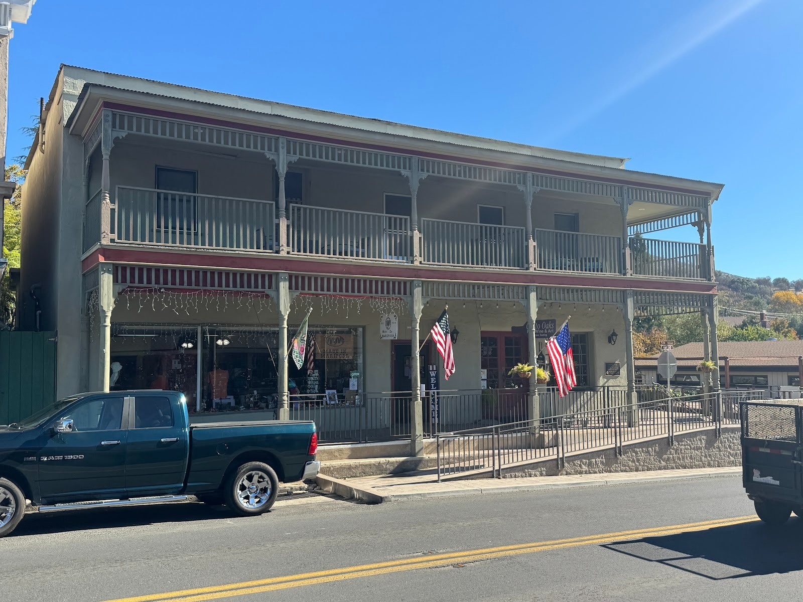
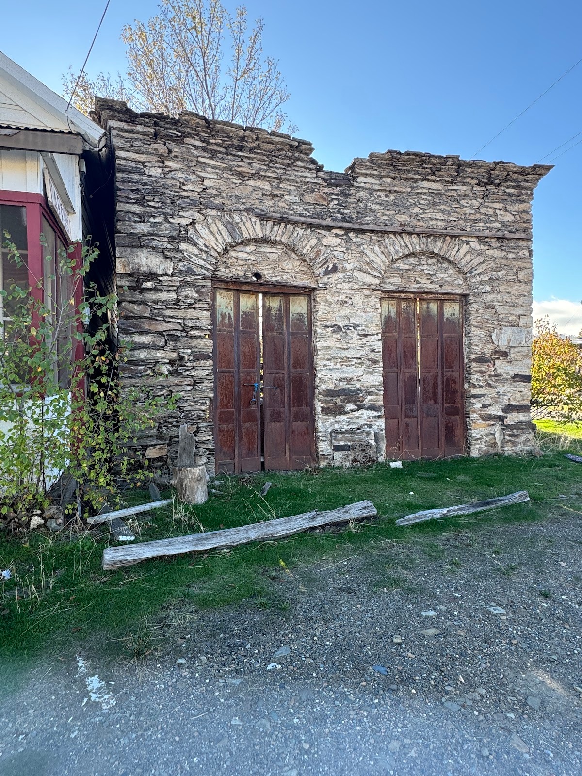
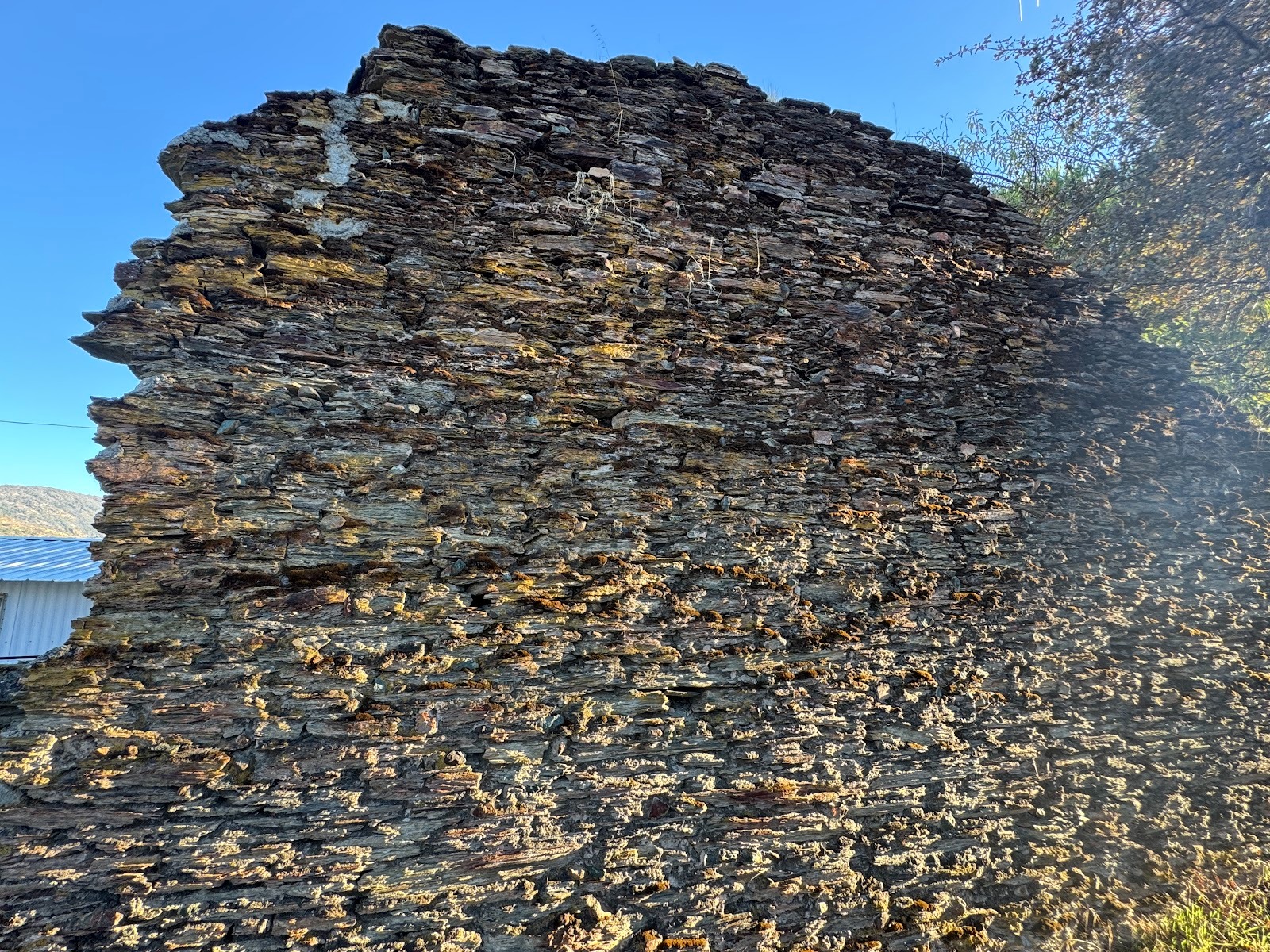
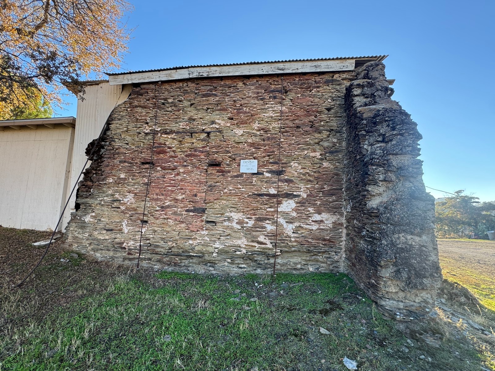
Here it is today, much altered since it was built in 1850 to house offices for General (and, later, Senator) John C. Fremont's nearby mines.
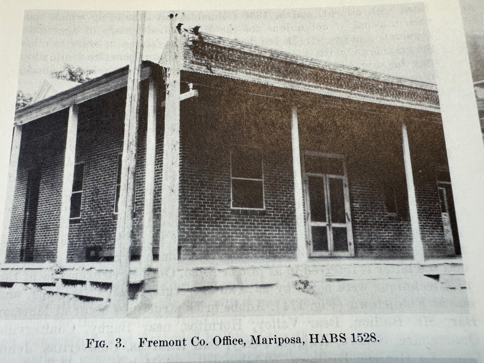
Here it is in the 1940s (Robert F. Heizer and Franklin Fenenga, "Survey of Building Structures of the Sierran Gold Belt, 1848-70," in California, Division of Mines Bulletin 141, The Mother Lode Country, 1948.)
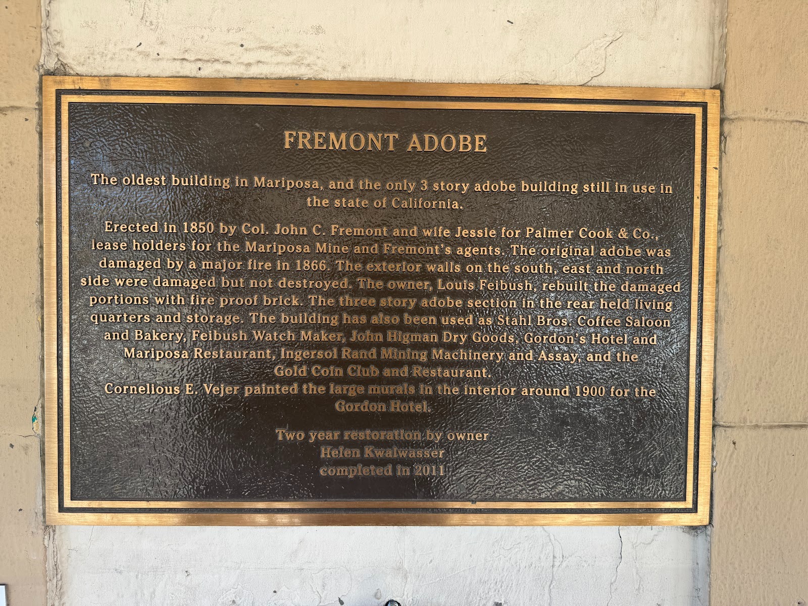
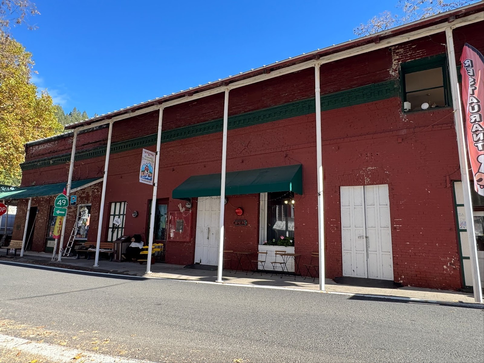
A helpful plaque on the exterior of the building.
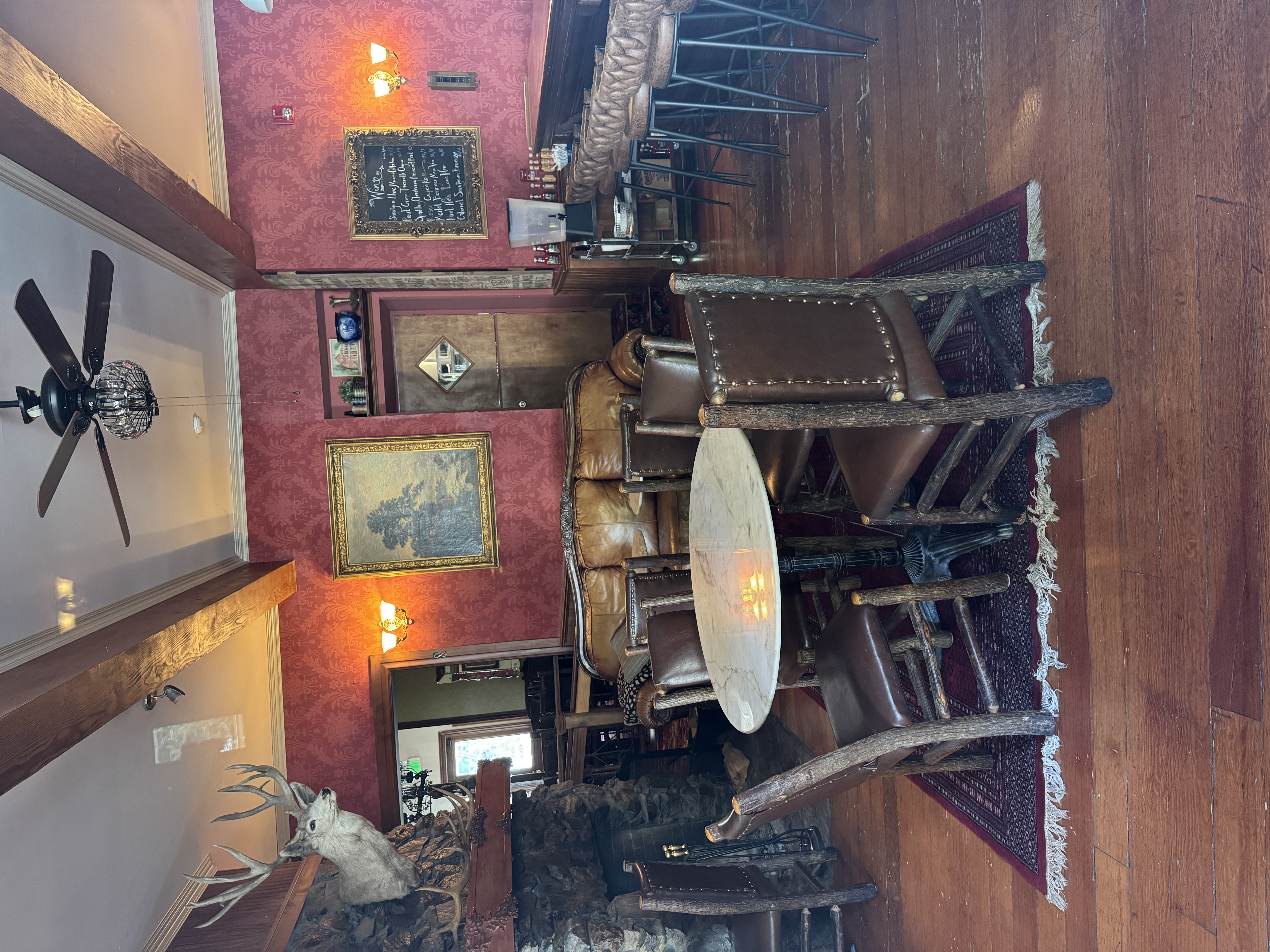
In 1867, Herman Schlageter rebuilt the Pine Tree Hotel, which had been built in 1859 only to burn down seven years later. Presidents Grant and Garfield are said to have stayed in the rebuilt hotel. Today, the upstairs appears vacant; the downstairs is shared by a wine-tasting bar and an arts-and-crafts shop. And that balcony? We'll see a lot more like it. It's iconic. (I promise not to use that word again.)
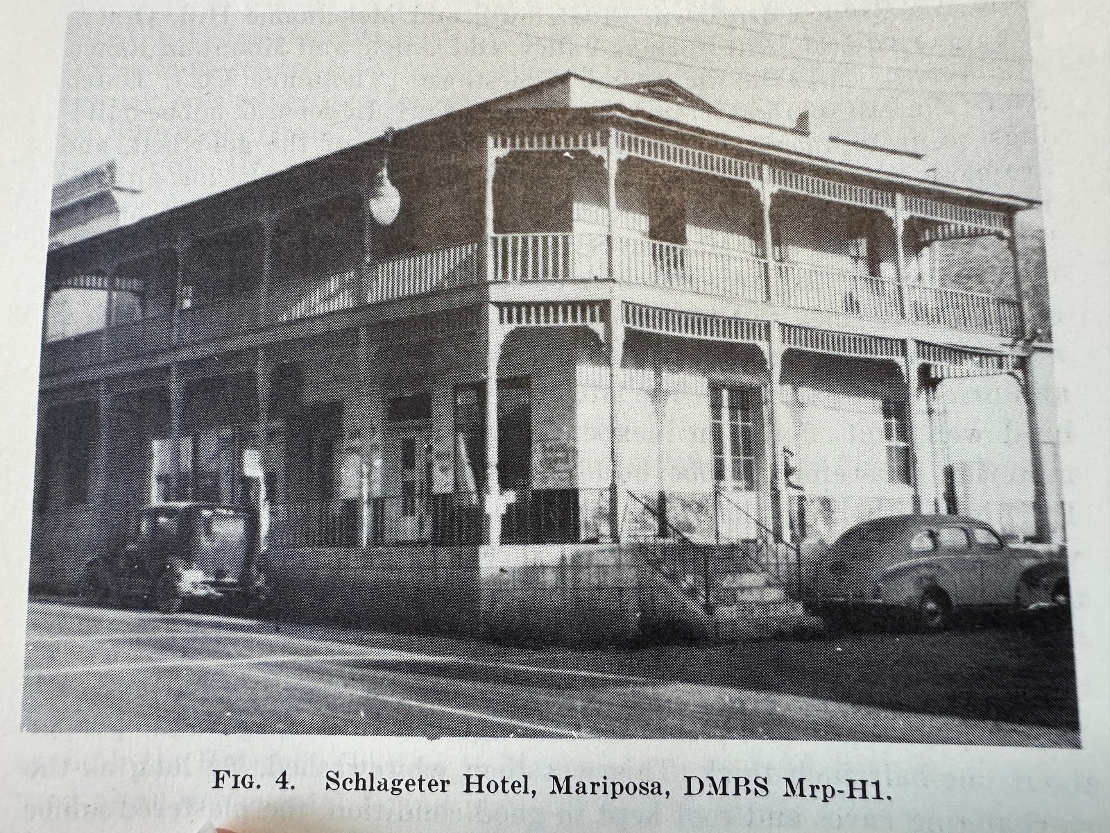
The Schlageter may have operated as a hotel into the 1940s. (Heizer, 1948).
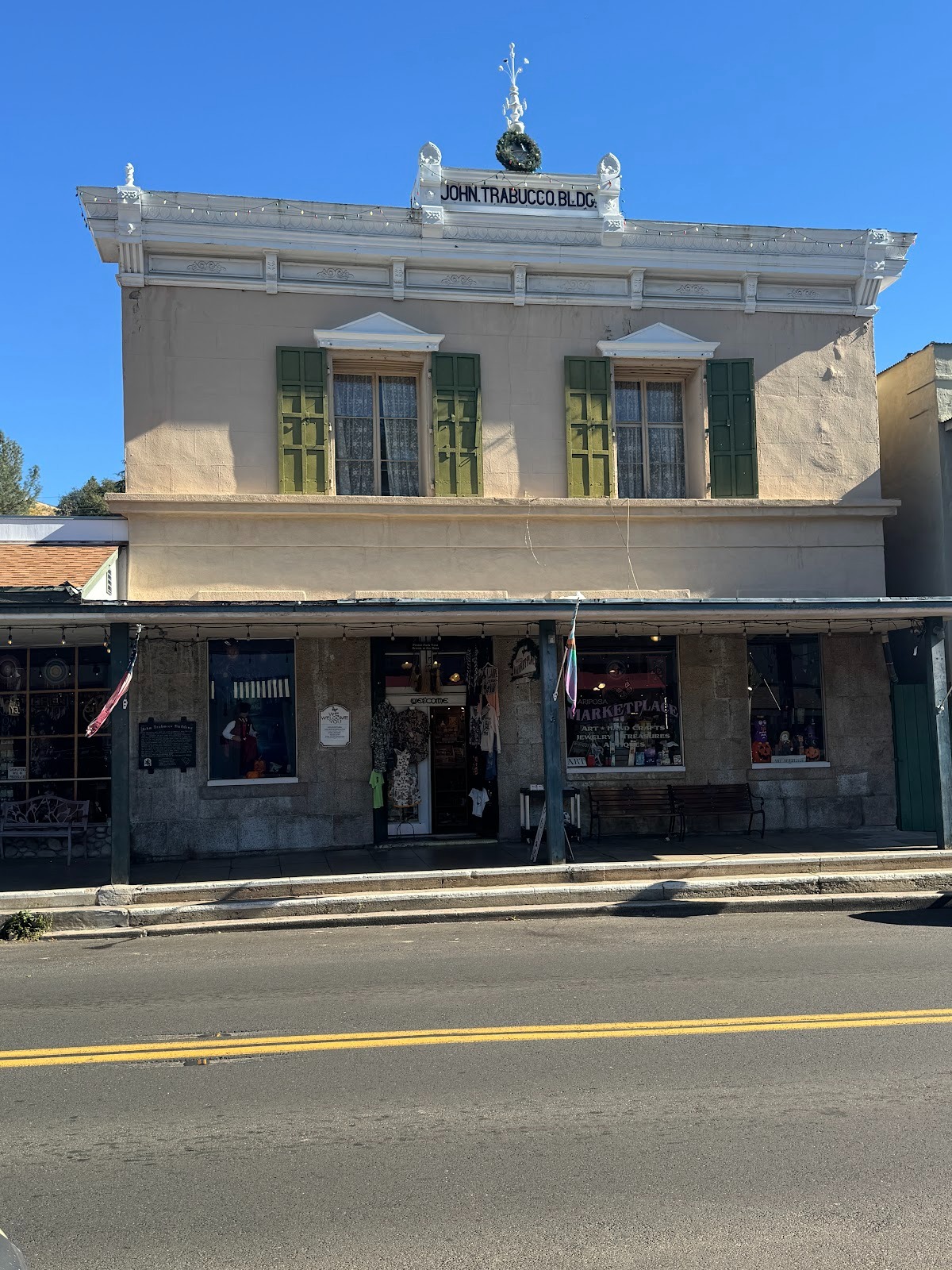
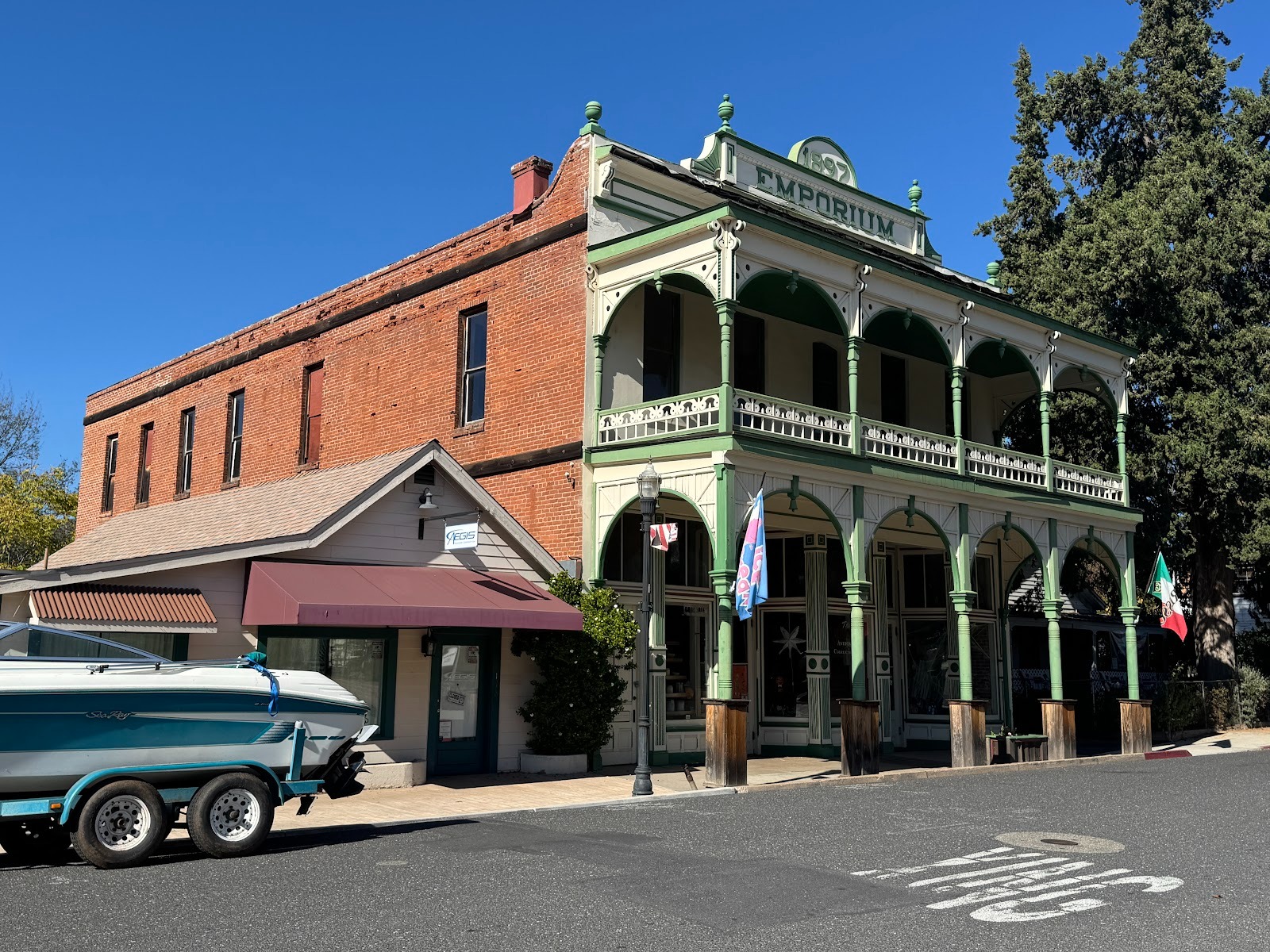
Next door there's another arts-and-crafts shop. The building opened as John Trabucco's "cheap cash" store. It stayed in business from 1896 until 1972.
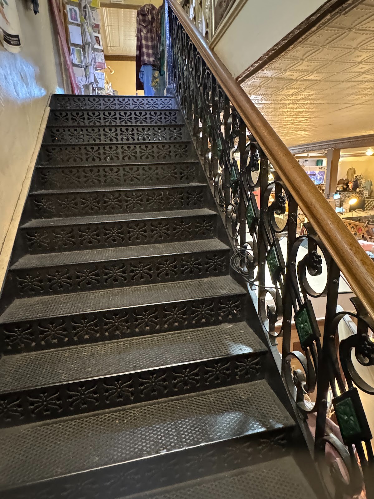
Cheap it may have been, but these heavy iron stairs weren't. They are said to have been shipped from the East Coast via Cape Horn.
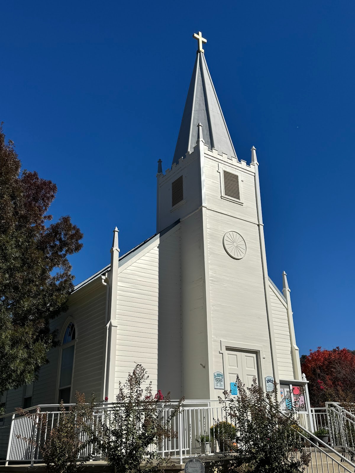
Members of the Trabucco family are buried behind Mariposa's Catholic church.
The church (locked tight when I came by) is upstaged by the rectory, built in 1927. Beautiful garden.
Who says a priest can't have a sense of humor?
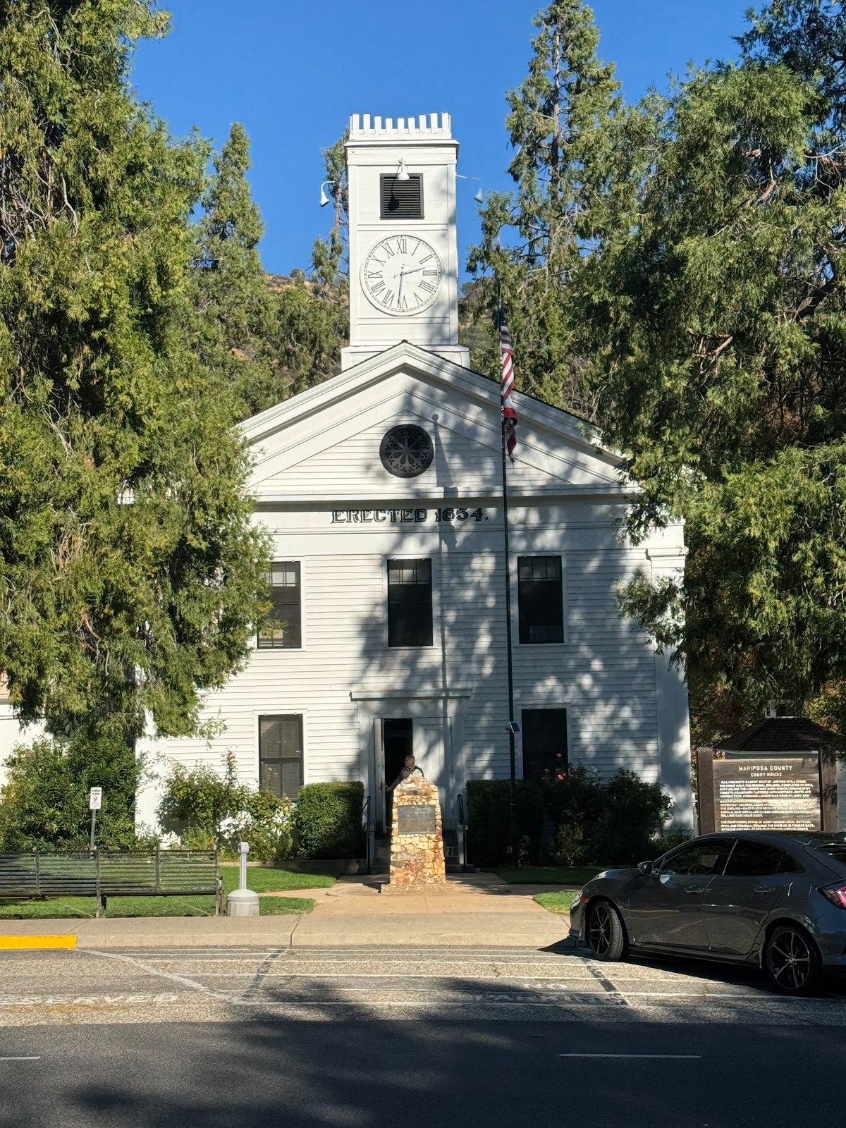
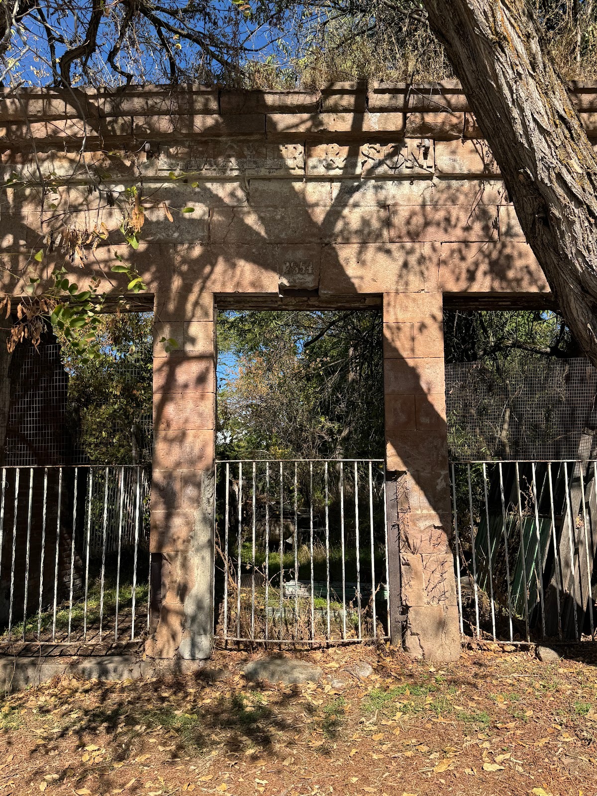
The town's most celebrated building is the county courthouse, built in 1854 and still in use.
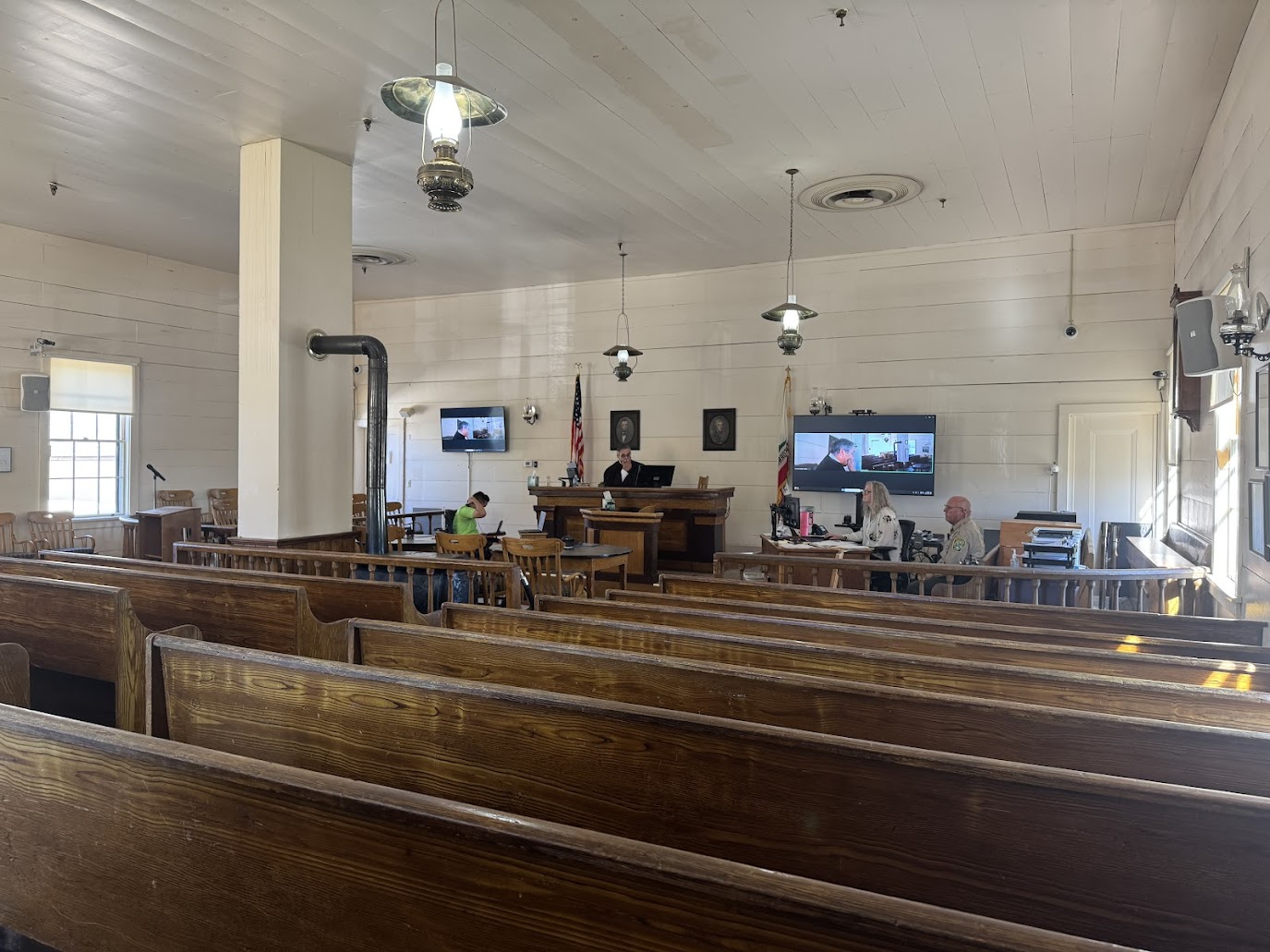
Courtroom with old stove and oil lamps (yes, electrified, but not replaced).
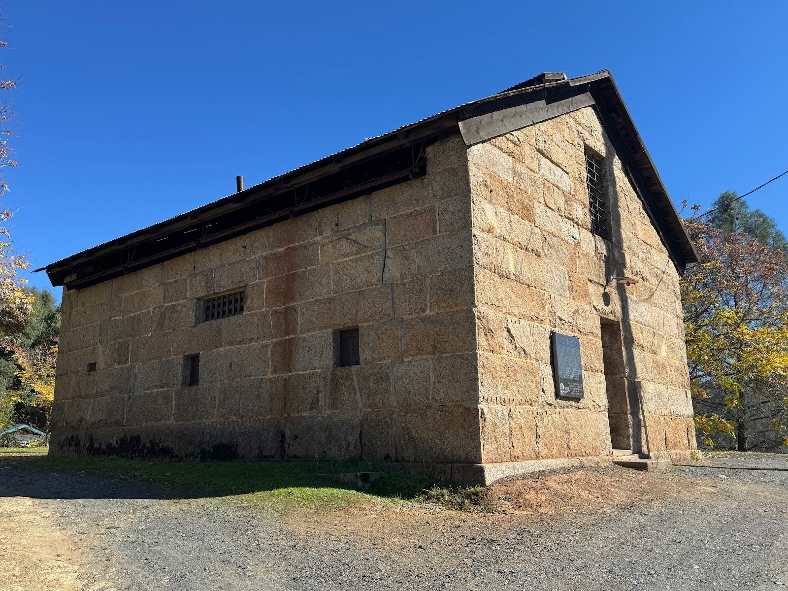
The formidable county jail was built in 1858. Originally with two stories, it was reduced to one after a fire in 1892. Condemned in 1963, it's not going anywhere.
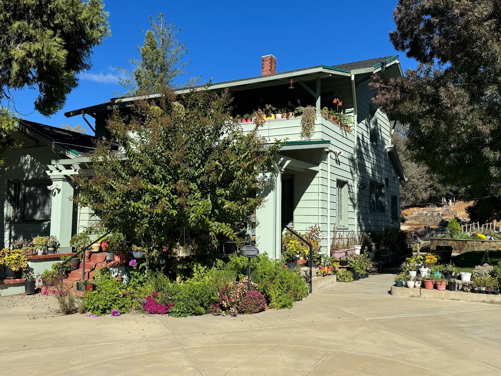
Speaking of courthouses and jails, this house, at Jones and Eighth, was built in 1901 by long-serving Judge J. J. Trabucco, who was (I'm guessing) a brother of storekeeper John.
This house, originally at 5064 Jones St,, was built by and for Augustus Shiver, who also built the county court house. Wish I knew more about him. The building is called the Count House because it became the home of George and then Samuel Counts, both of whom served as county treasurers. (The house now stands on the grounds of the town's historical museum.)
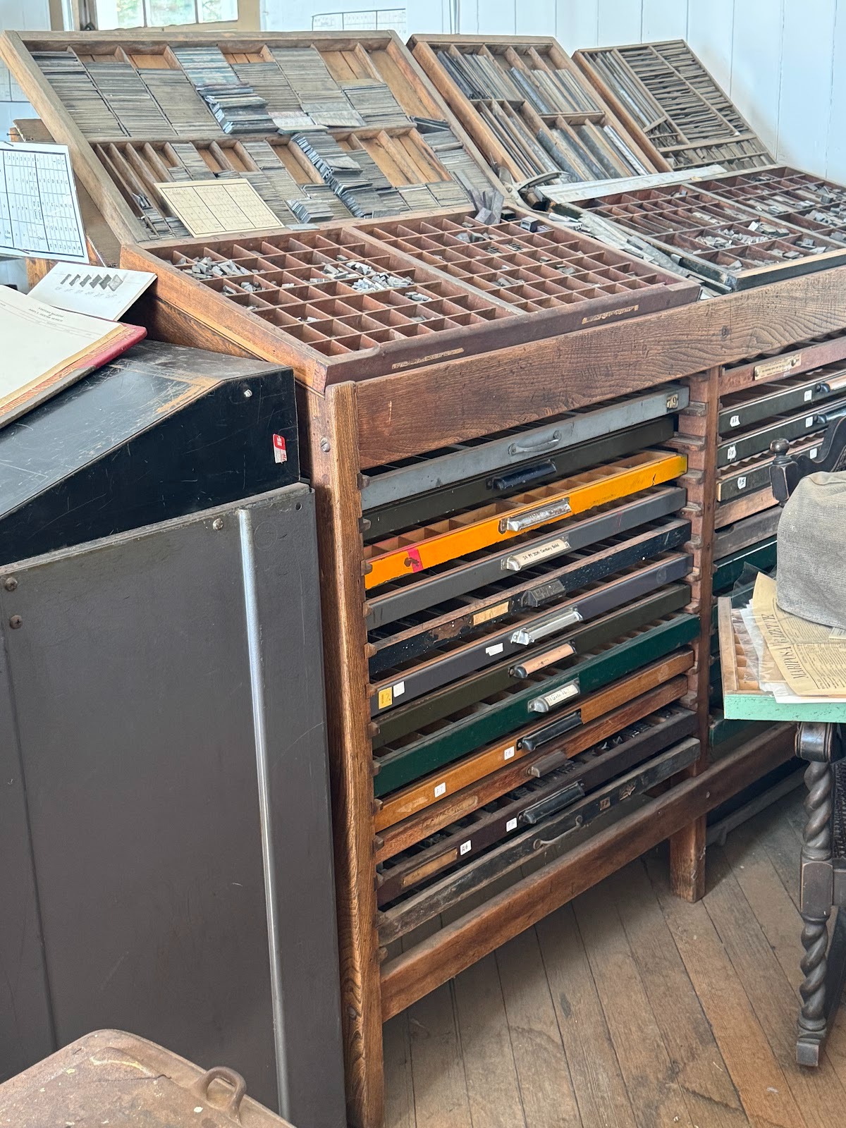
That museum also contains job cases from The Mariposa Gazette, established in 1854.
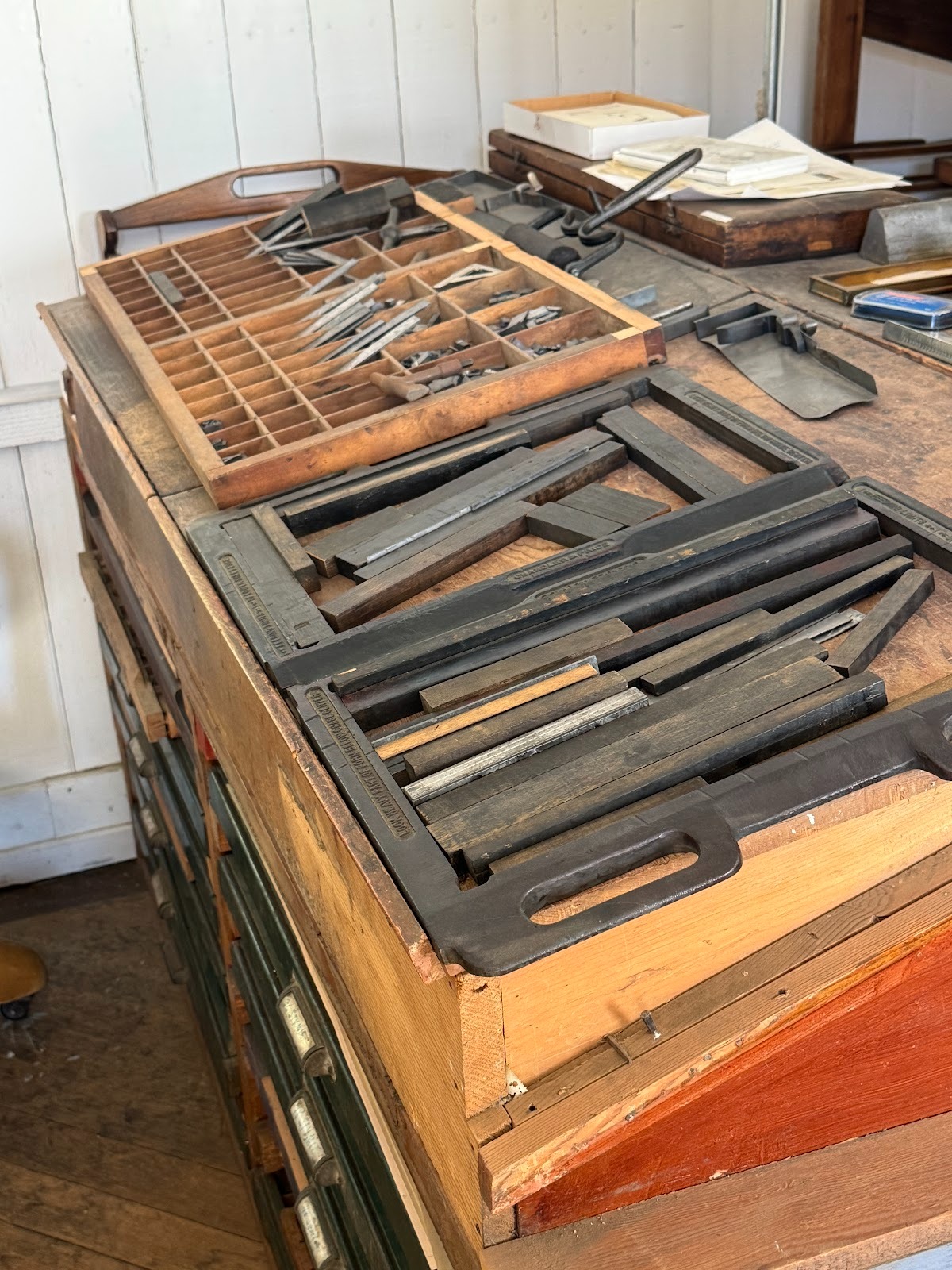
Chases, too. And a stick. I don't see any quoins. (Ah, once a printer's devil, always a printer's devil.)
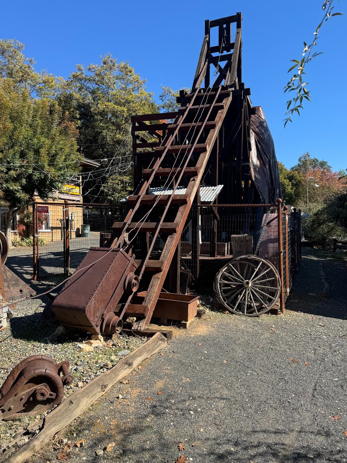
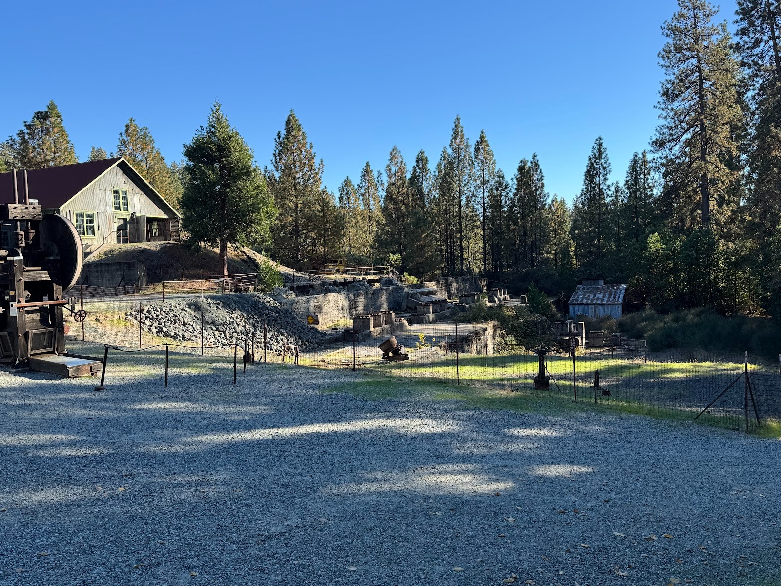
The museum has a small stamp mill, here with the carts that hoisted rock into the mill.
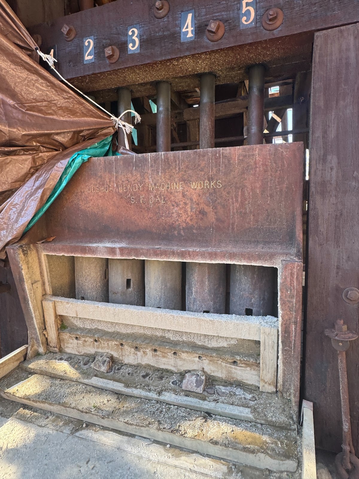
Here, according to the posted description, are the 1,000-lb hammers that a camshaft raised and dropped eight inches 100 times a minute. Noisy? You bet. The mill operated until 1953 at the Golden Key Mine, about five miles north of town.
Somewhere up here in the northeast corner of town is Fremont's old Mariposa Mine. Extract from an official report of 1915: "The vein averages 5 feet in width.... The development consists of a 1550-foot shaft, 5757 feet of drifts on the 8 levels, 800 feet of crosscuts, 1000 feet of raises and about 100 feet of winzes.... All underground equipment has been removed to the surface as the mine is caving.... The mine is idle and formerly used to be one of the large producers of the county" (Calif. State Mining Bureau, Mines and Mineral Resources of the counties of... Mariposa..., 1915, p. 161).
Mariposa sat within the 44,000-acre Mariposa land grant, confirmed to John C. Fremont by the U.S. Supreme Court. Fremont never lived in Mariposa, however. He chose to live in Bear Valley, about ten miles up 49. Here's a bit of that road, along with a restaurant (closed in 2025) and the ponderous stonework of what may have been a general store.
In 1890, the restaurant was a saloon operated by John Trabucco, who later built the general store in Mariposa. When was it modernized? Don't know. It very recently served Cajun food. Who says we're not a melting pot?
Here's the store next door. Know your rocks? Try schist.
I don't know when brick became common here, but until then schist was the material of choice, unless you didn't mind if fire took your property.
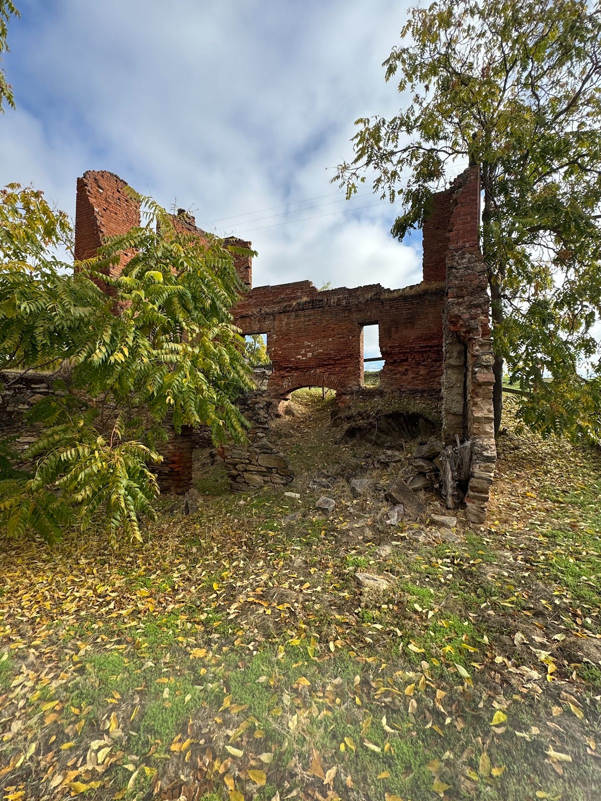
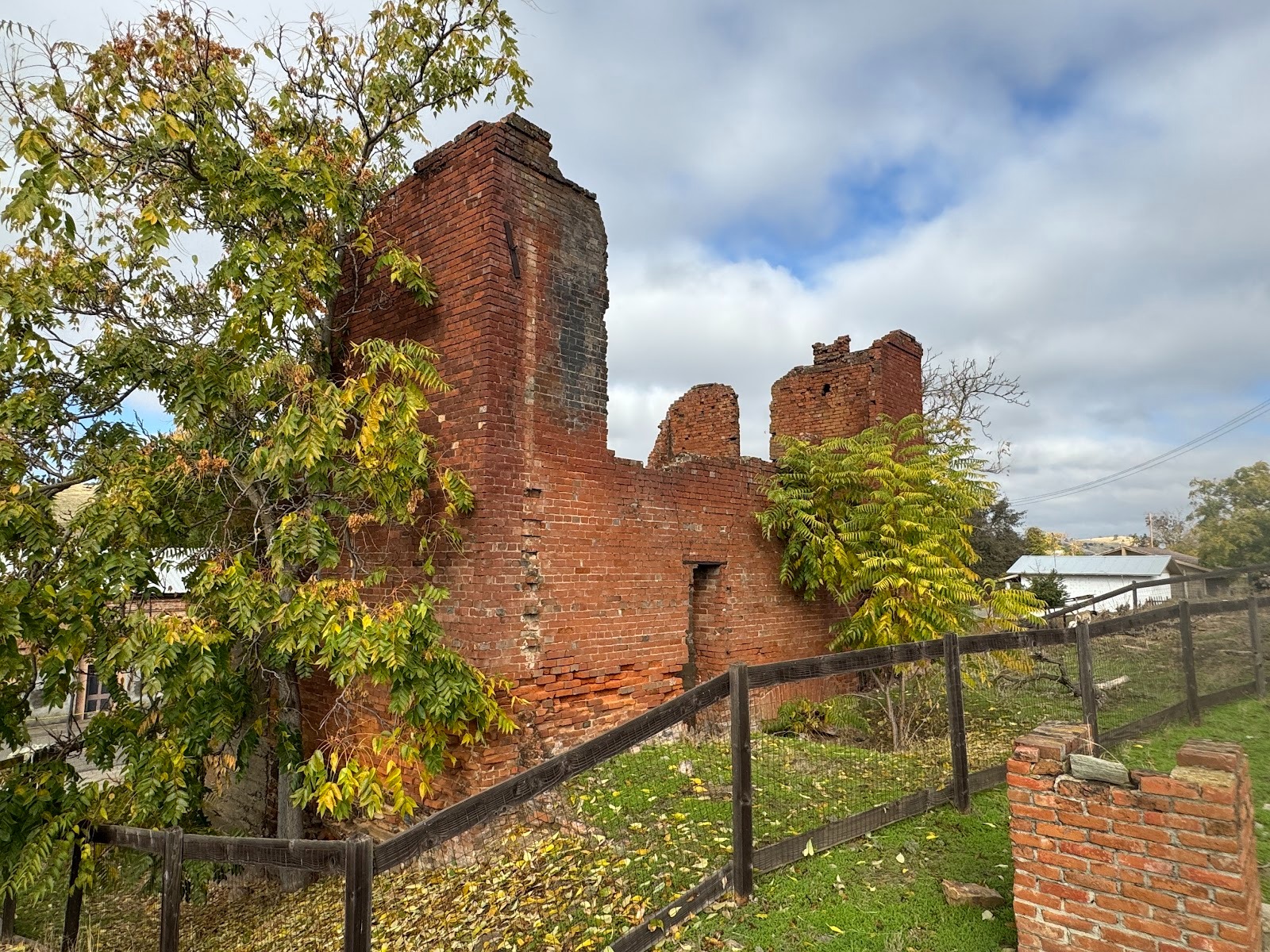
This building is identified as the Fremont Company Store. I don't know when it fell into ruins, but the WPA's Guide to California, published in 1939, refers to "a jagged stone ruin, a tree growing within its walls" (p. 499).
Fremont and his wife lived at the eastern edge of Bear Valley and only between 1858 and 1861. They had some important visitors, though, including Horace Greeley. The house burned down shortly after they left. The photograph is another by Carleton E. Watkins, that pioneering Yosemite photographer.
The site of the Fremont house is off limits. The red and white sign reads something like "Anyone entering this property uninvited ... will be considered a target." I take this as humor with an edge.
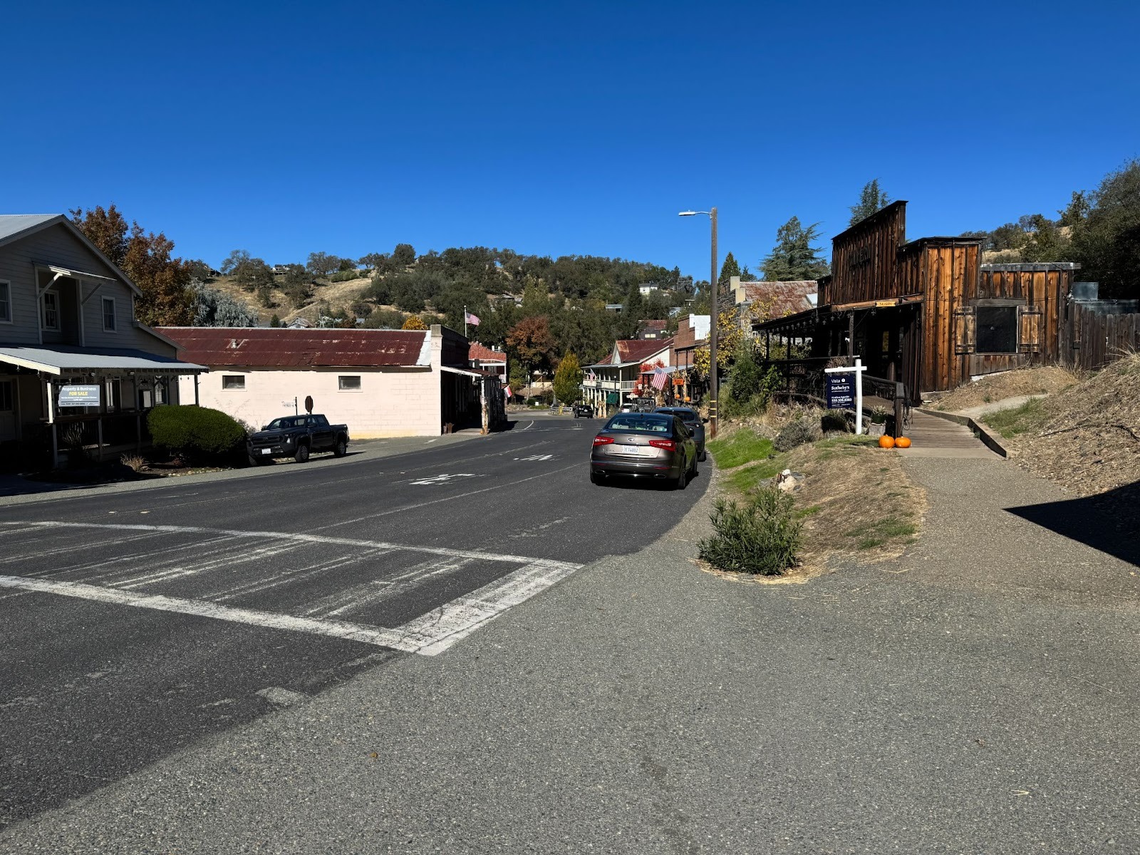
We're taking a detour off 49 and heading a dozen miles downhill along the Hornitos Road.
Hornitos in the 1850s had 15,000 residents, mostly Mexican placer miners. The Census now reports 38.
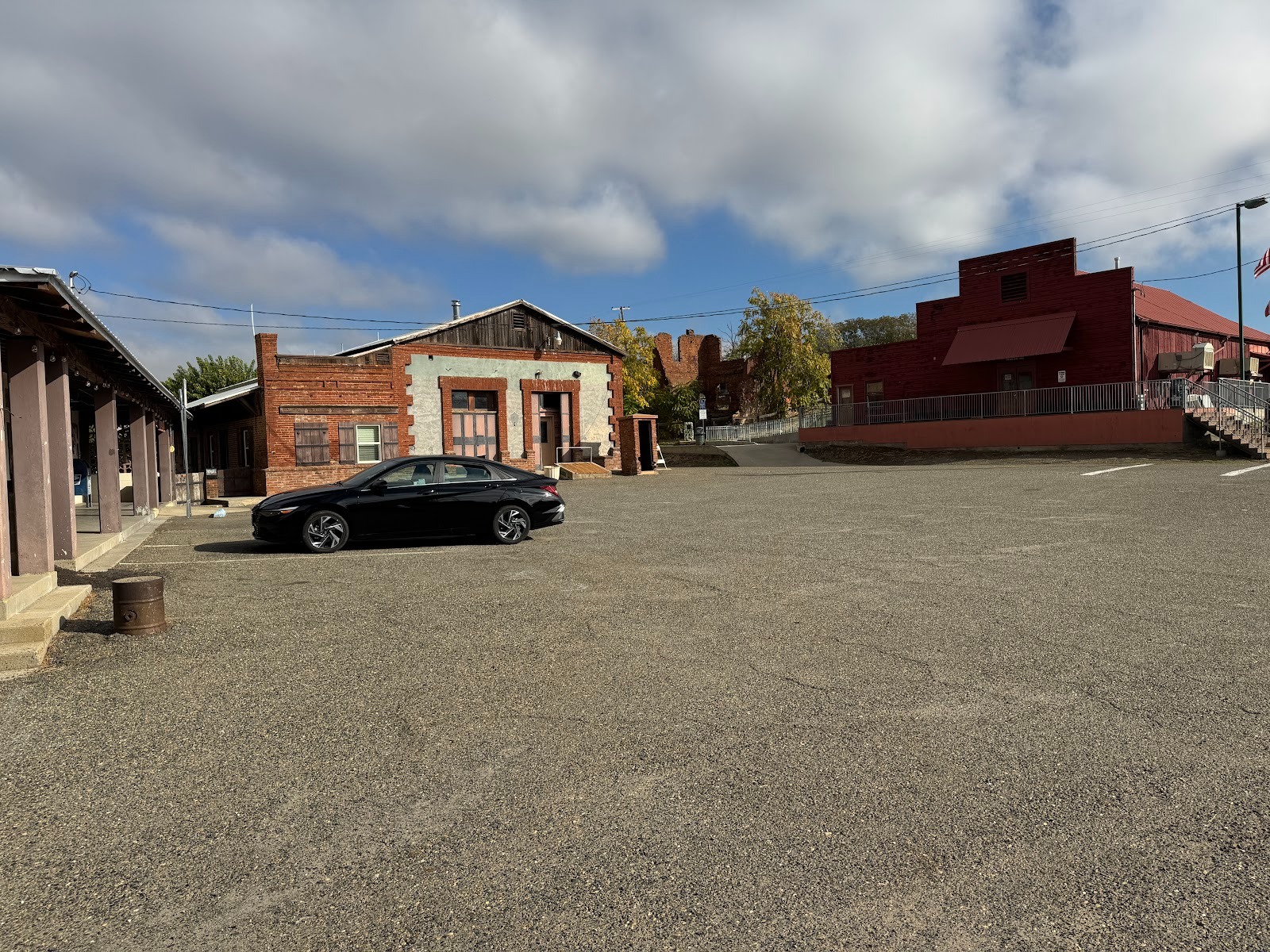
The town plaza.
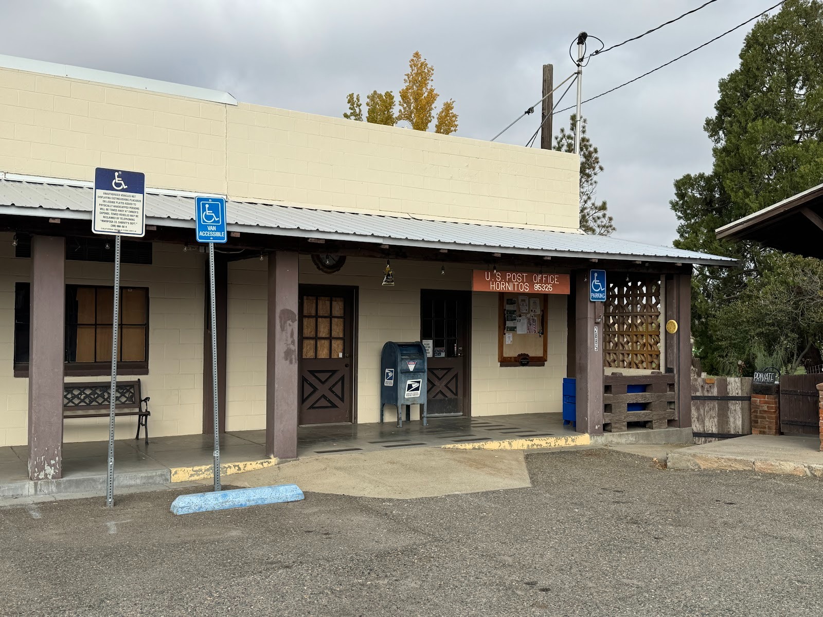
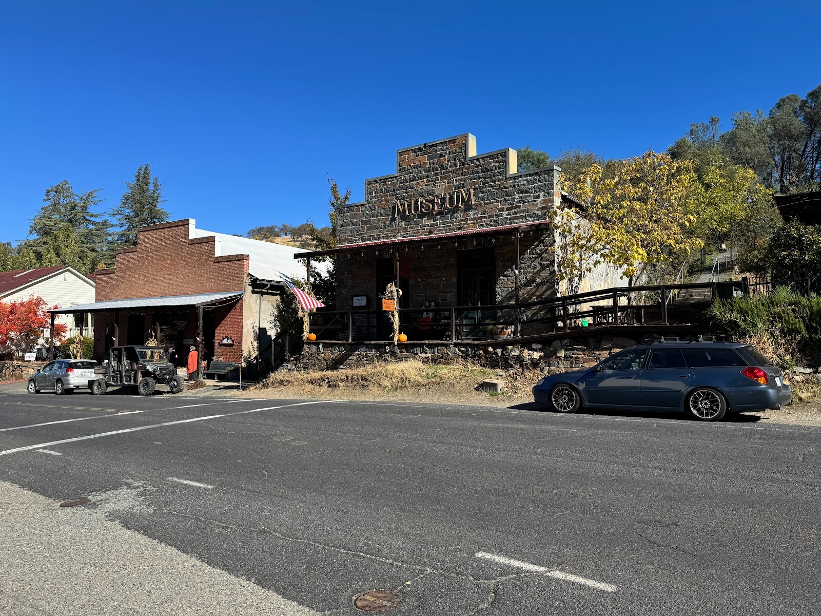
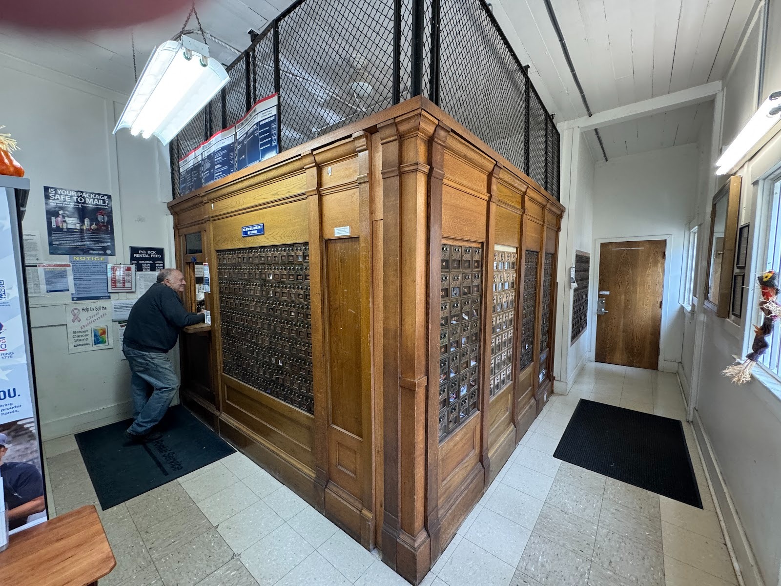
The only place open is the U.S. post office.
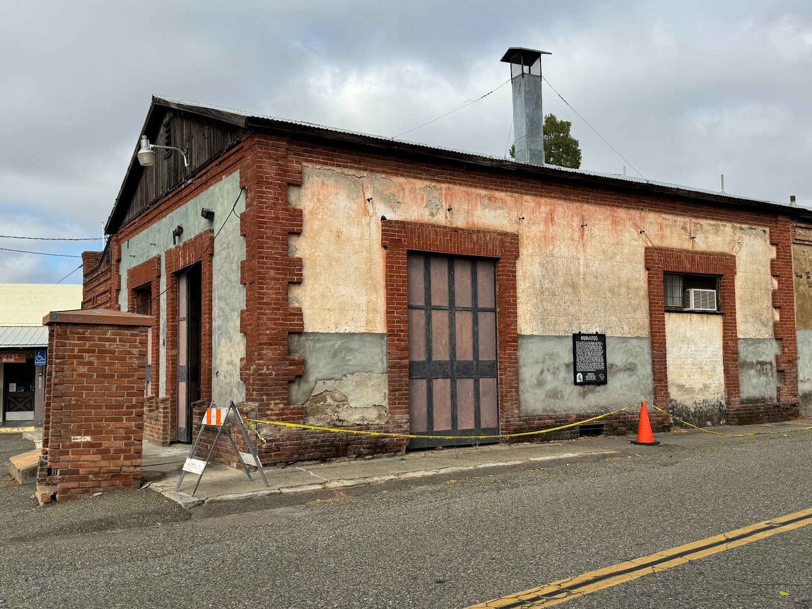
A general store from 1857.
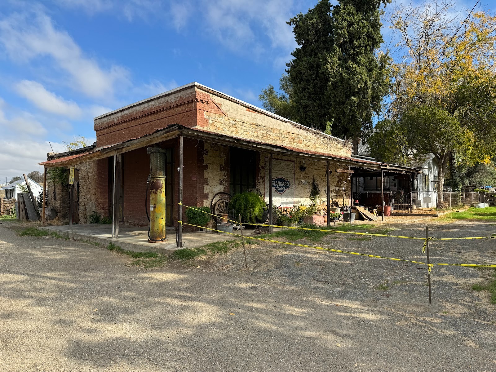
A later store, complete with gas pump.
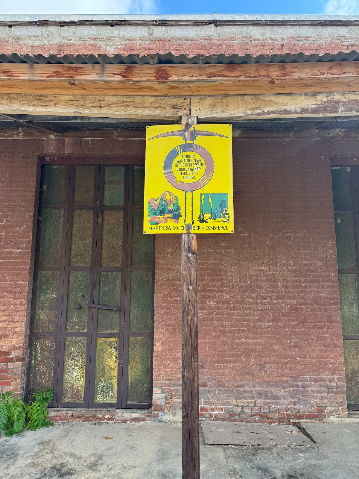
In case you can't read it, the sign says that the store was built by Carlo Cavagnaro.
Another Italian, who later became a famous chocolatier, began making chocolate here.
He moved to San Francisco in 1852, but I don't know when this place closed. The owner's name? It survives on packages today, though the company is now Swiss-Owned. Bingo: Domenico Ghirardelli.
A bit of the view along the Bear Valley Road as it returns uphill to 49 .
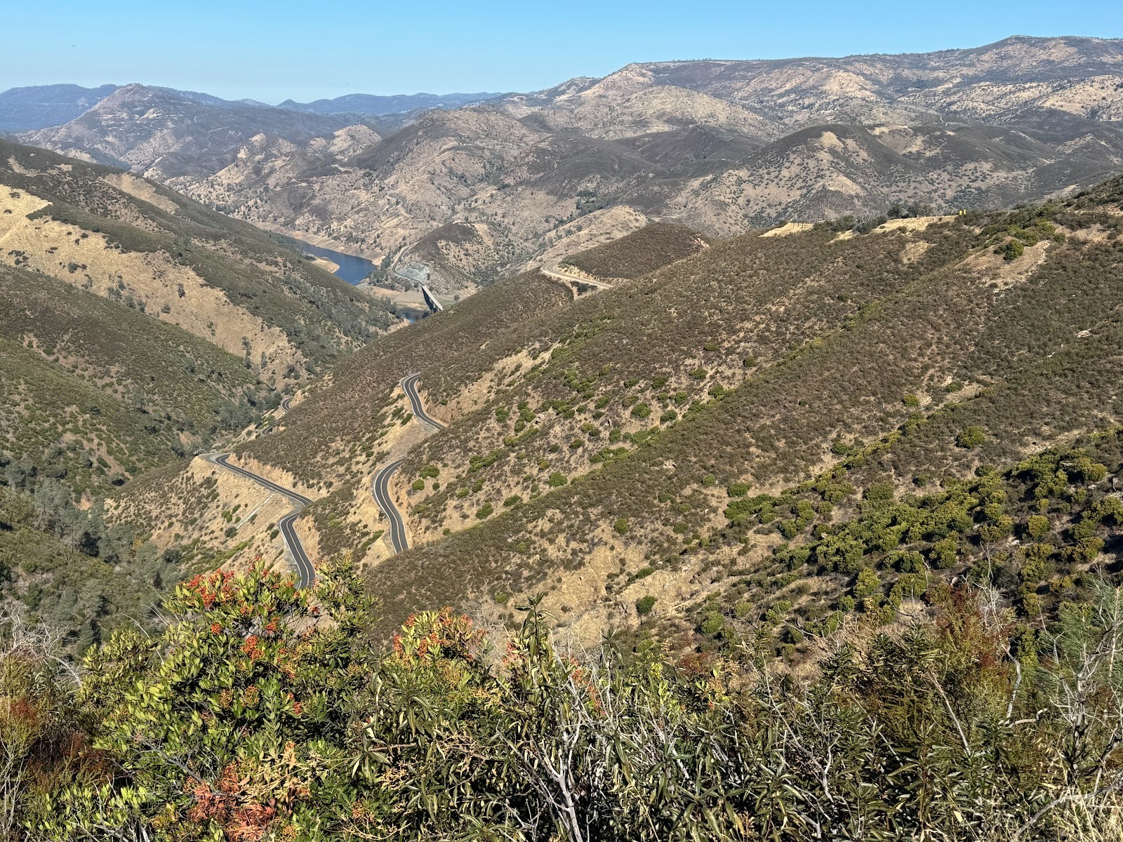
We're back on 49 a few miles north of Bear Valley and overlooking Hell Hollow, with a view down to Lake McClure, a reservoir on the Merced River.
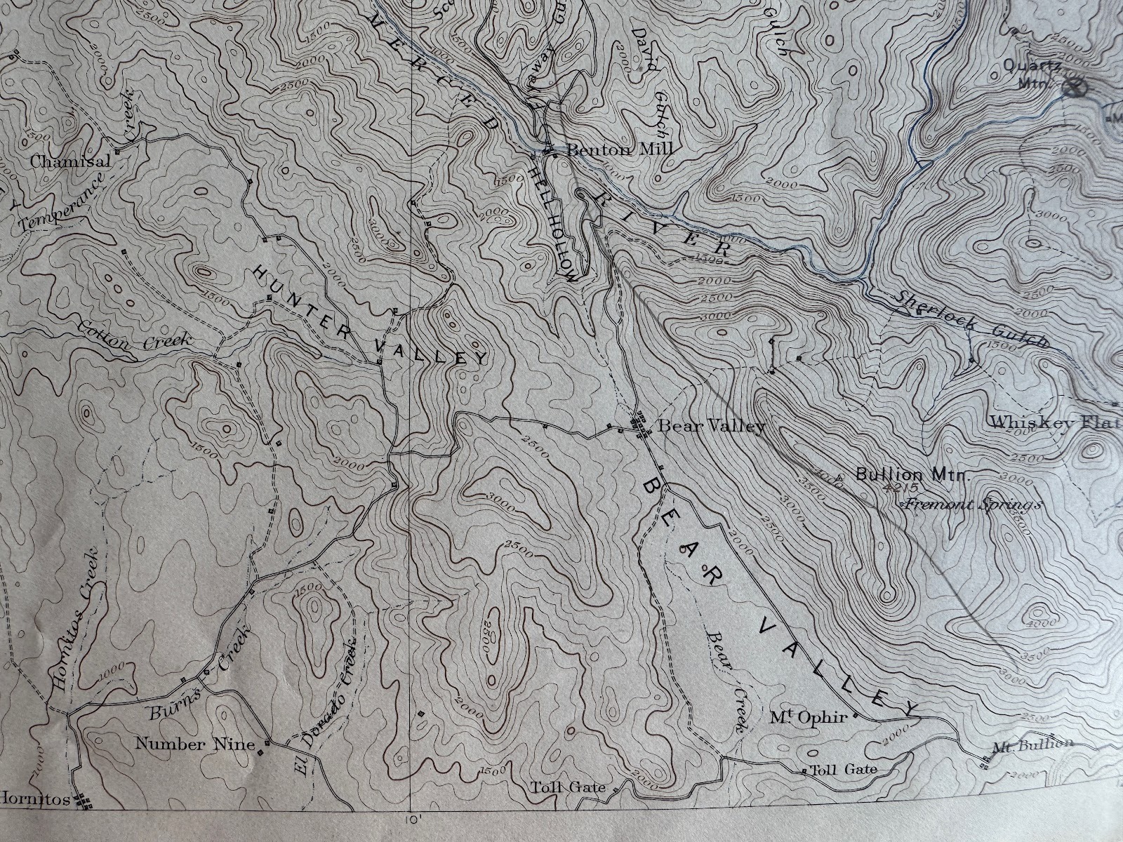
The road and the name Hell Hollow appear on this 1897 USGS Sonora quad. Apple Maps retains the name Hell Hollow; Google Maps does not. Score one point for Apple. The name Benton Mill refers to Senator Thomas Hart Benton, Fremont's father-in-law. The mill processed ore taken from mines on Mt. Bullion and carried down to the water-driven mill by rail. How exactly, I don't know, but Horace Greeley wrote that Fremont "has just contracted for the transportation of thirty thousand tons of vein-stone from his great mine to his mill on the Merced (barely a mile and half down hill) for sixty thousand dollars. One half of this sum would construct a railroad from the heart of the mine down to the floor of the mill..." (Horace Greeley, An Overland Journey, From New York to San Francisco, in The Summer of 1859, 1860, p. 319). No railroad appears on this map, however, suggesting either that the rails were never laid or were laid and later removed.
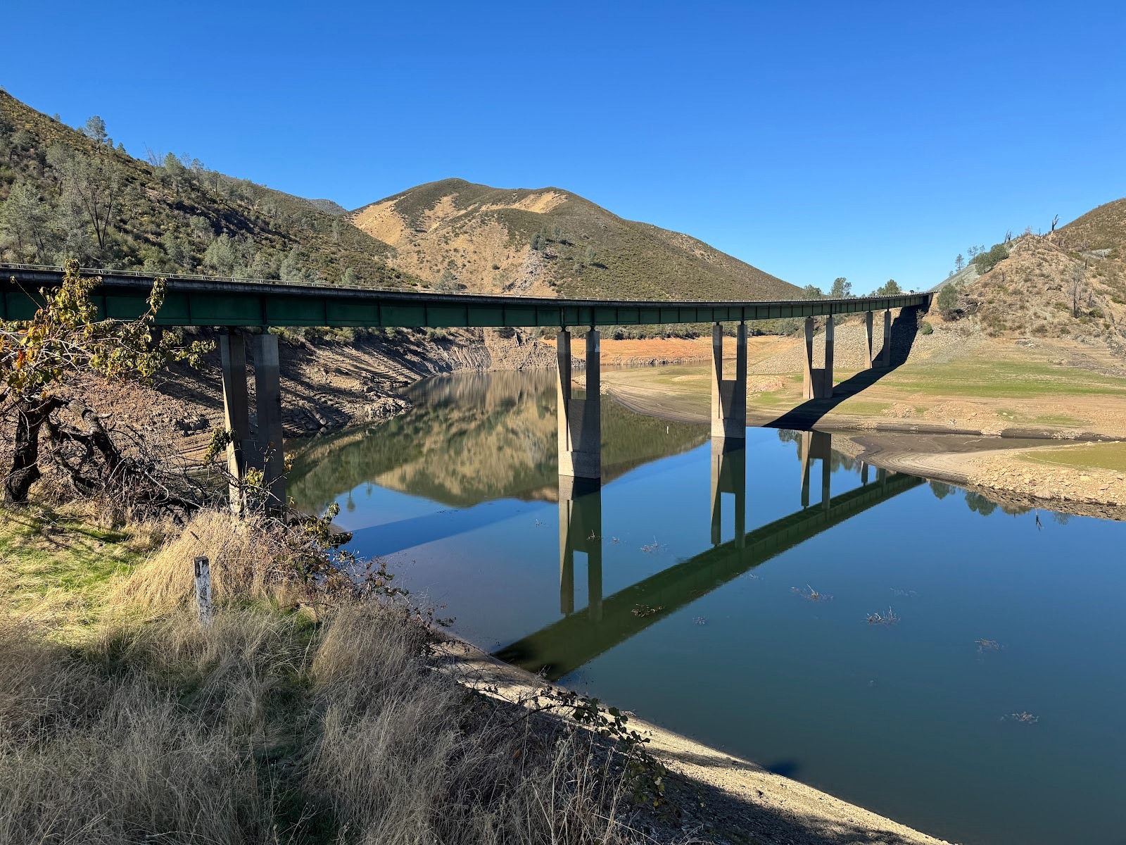
Low water. Compare this bathtub with what Starr King wrote after a visit this way in 1860: "We found the noble Merced River immediately beneath us. ... roaring in right leonine majesty. This was the first clean river I had seen in California... It is as pure at the point where we saw it, as when it bursts through granite ramparts of the Yo-Semite,..." (King, 1962, p. 13.)
A Shell road map from the 1940s shows that the highway north from this point (Benton Mills has become Bagby) is unpaved to Coulterville.
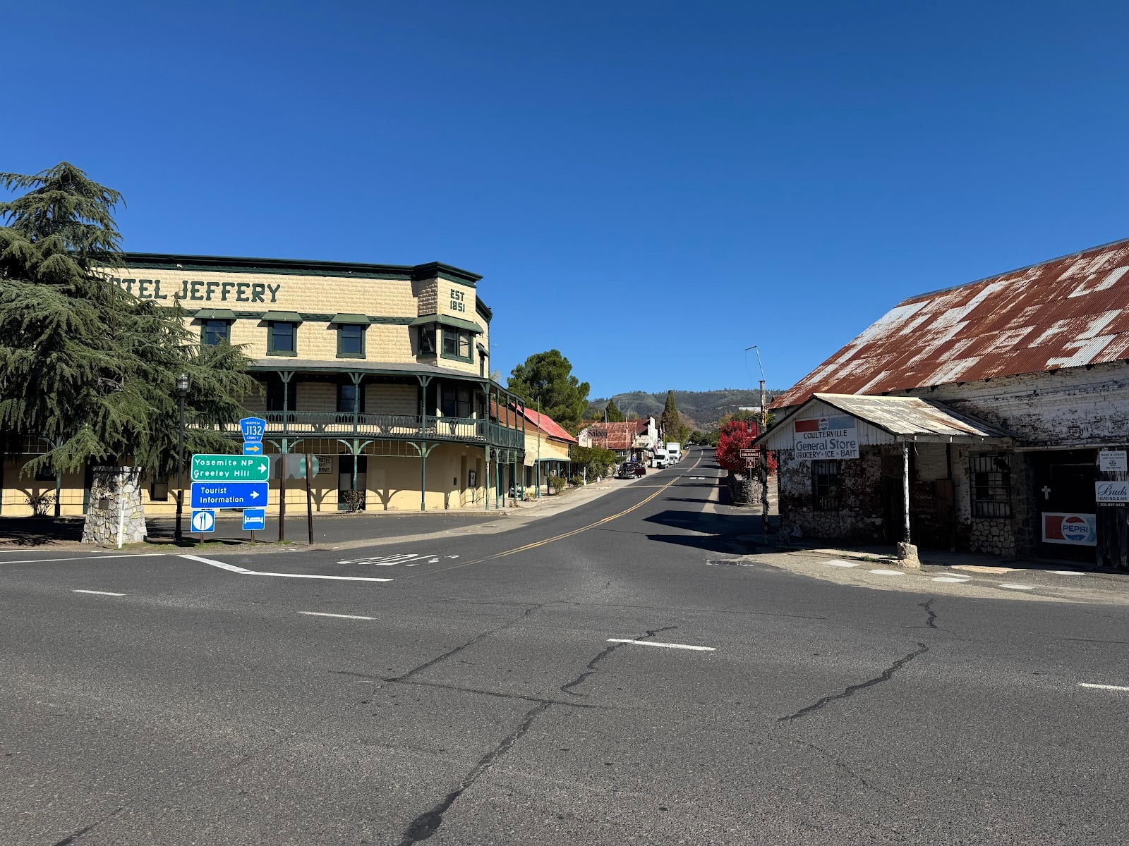
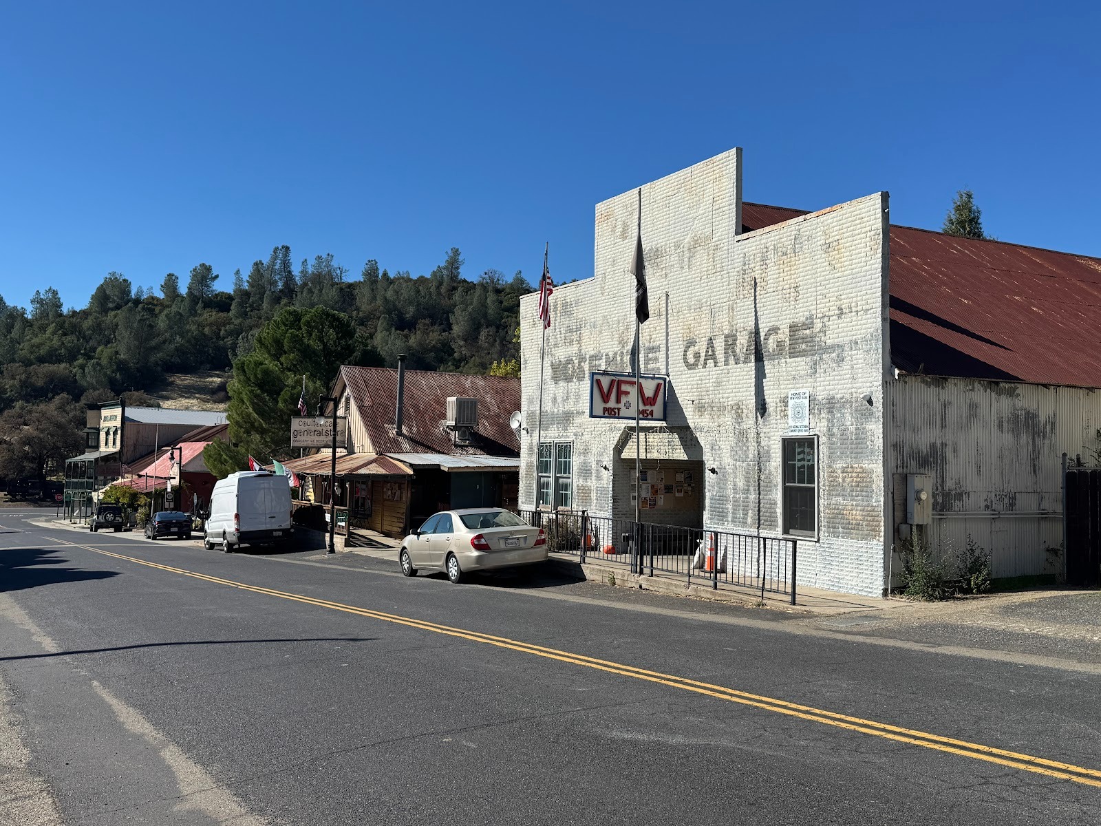
Highway 49 meets Greeley Hill Road, Coulterville's main street. (It would be odd if the name didn't come from Horace.) The hotel lacks the iconic balcony, perhaps because it housed miners, not visitors.
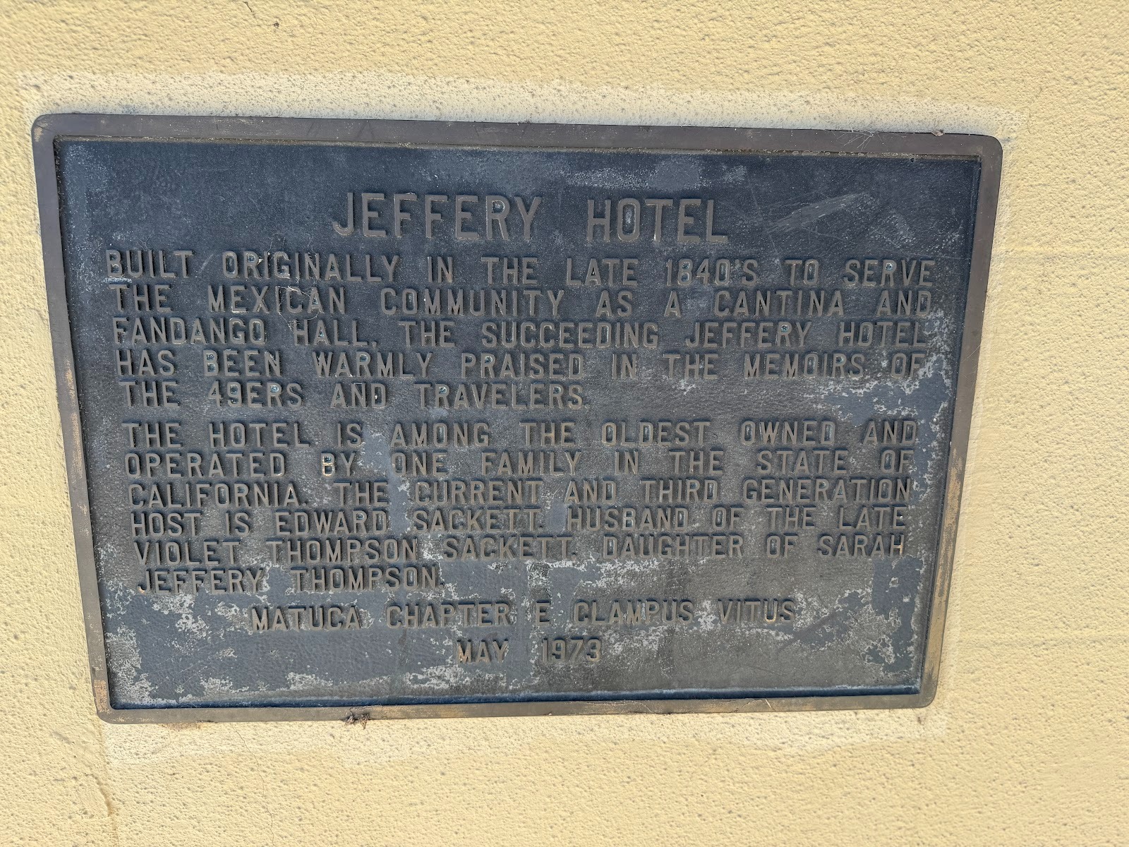
Plaque on wall.
Old gas station at the junction.
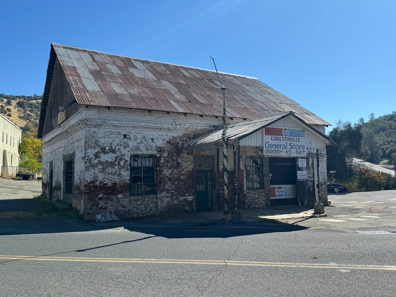
Looking back down Greeley Hill Road. The Jeffery Hotel is in the distance; the peaked building is the Coulter Cafe.
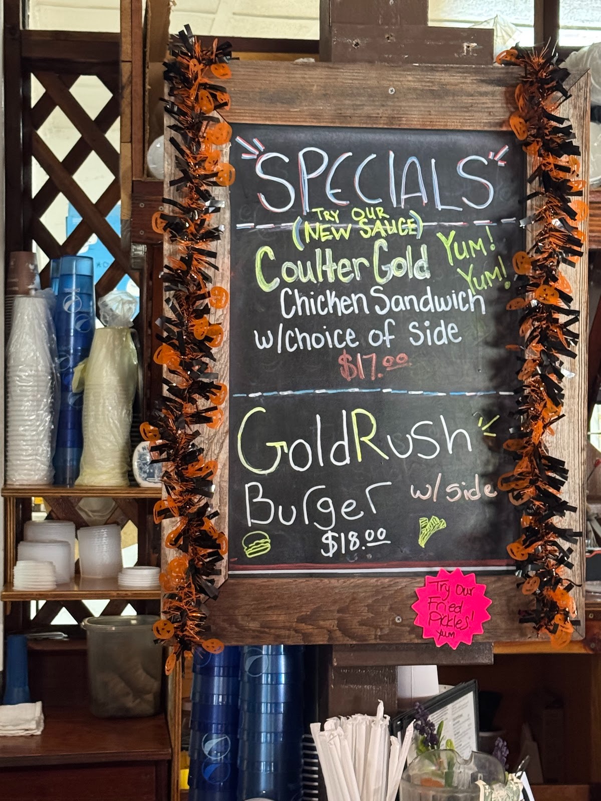
Today's specials. Gulp!
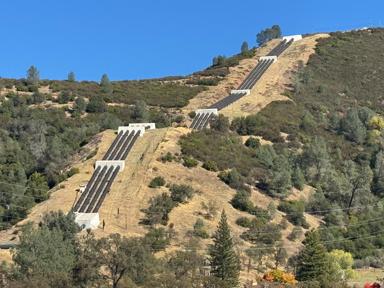
Ten miles farther up the highway, these are the penstocks for the Moccasin powerhouse, part of the Hetch Hetchy system, which brings water from the Tuolumne River to San Francisco.
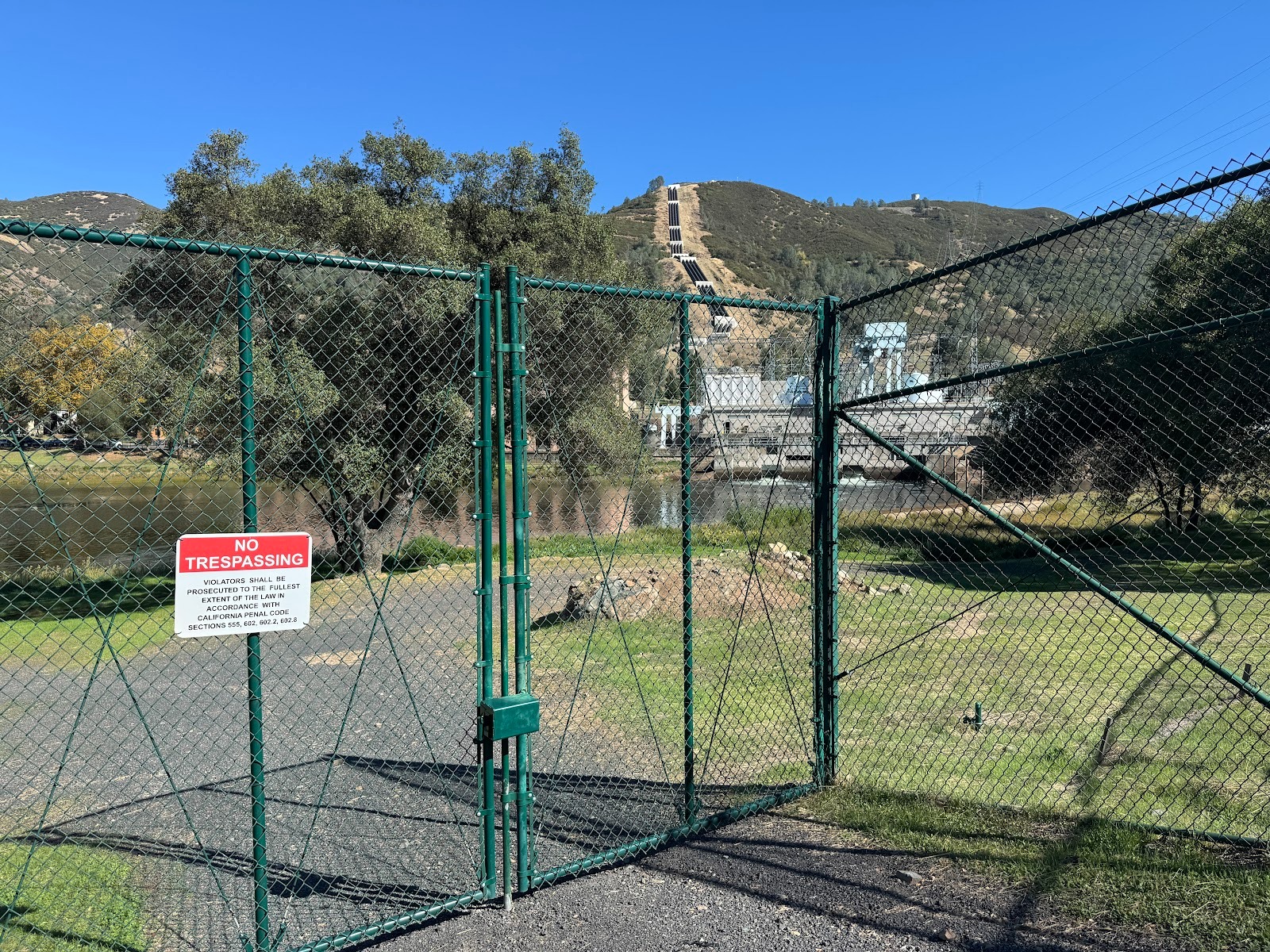
Not so friendly warning.
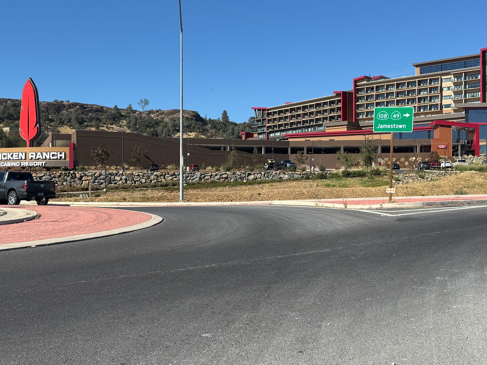
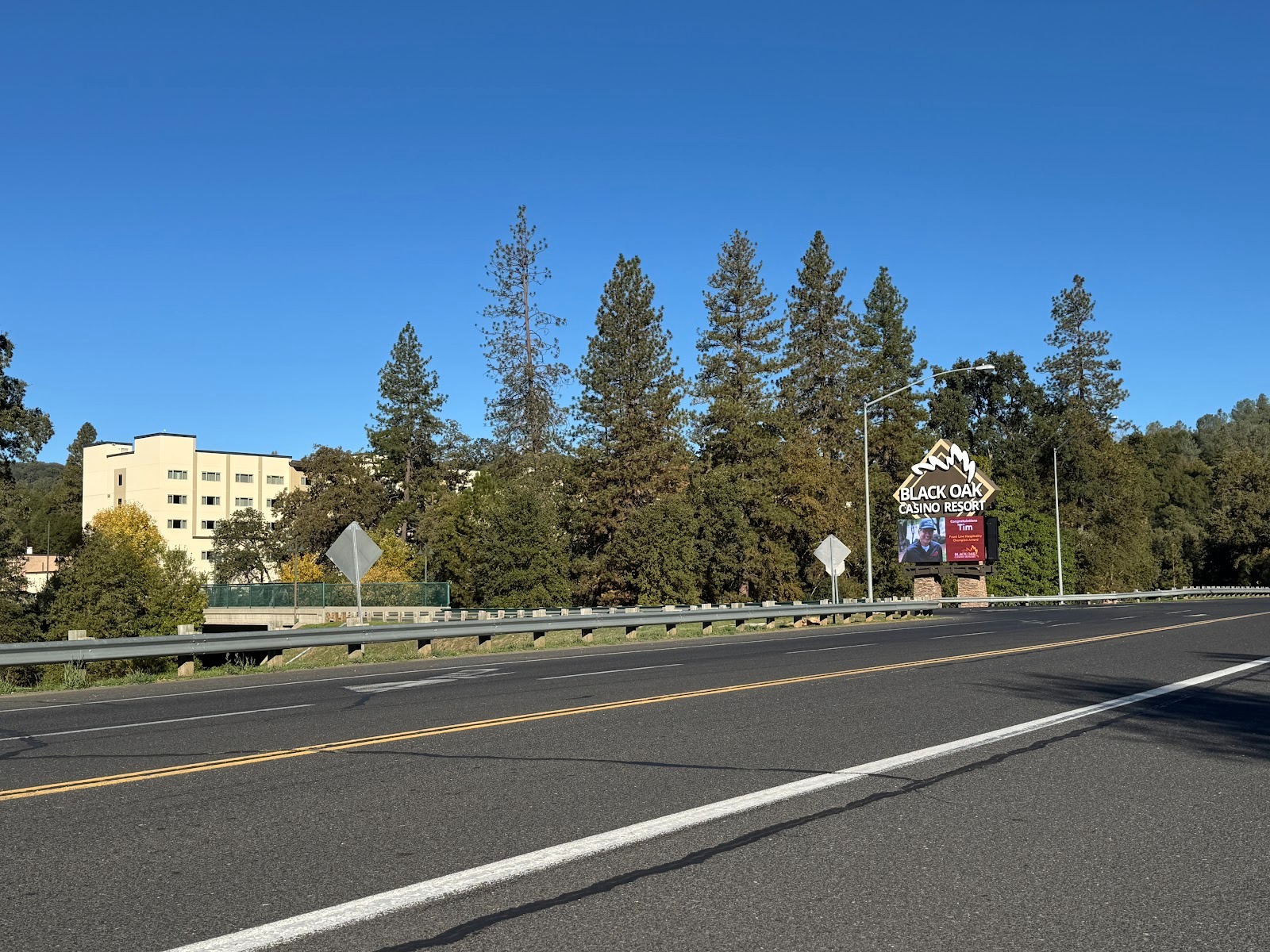
Another dozen miles and we're forced to break the bank at the Chicken Ranch Casino, here with its new (2024) hotel.
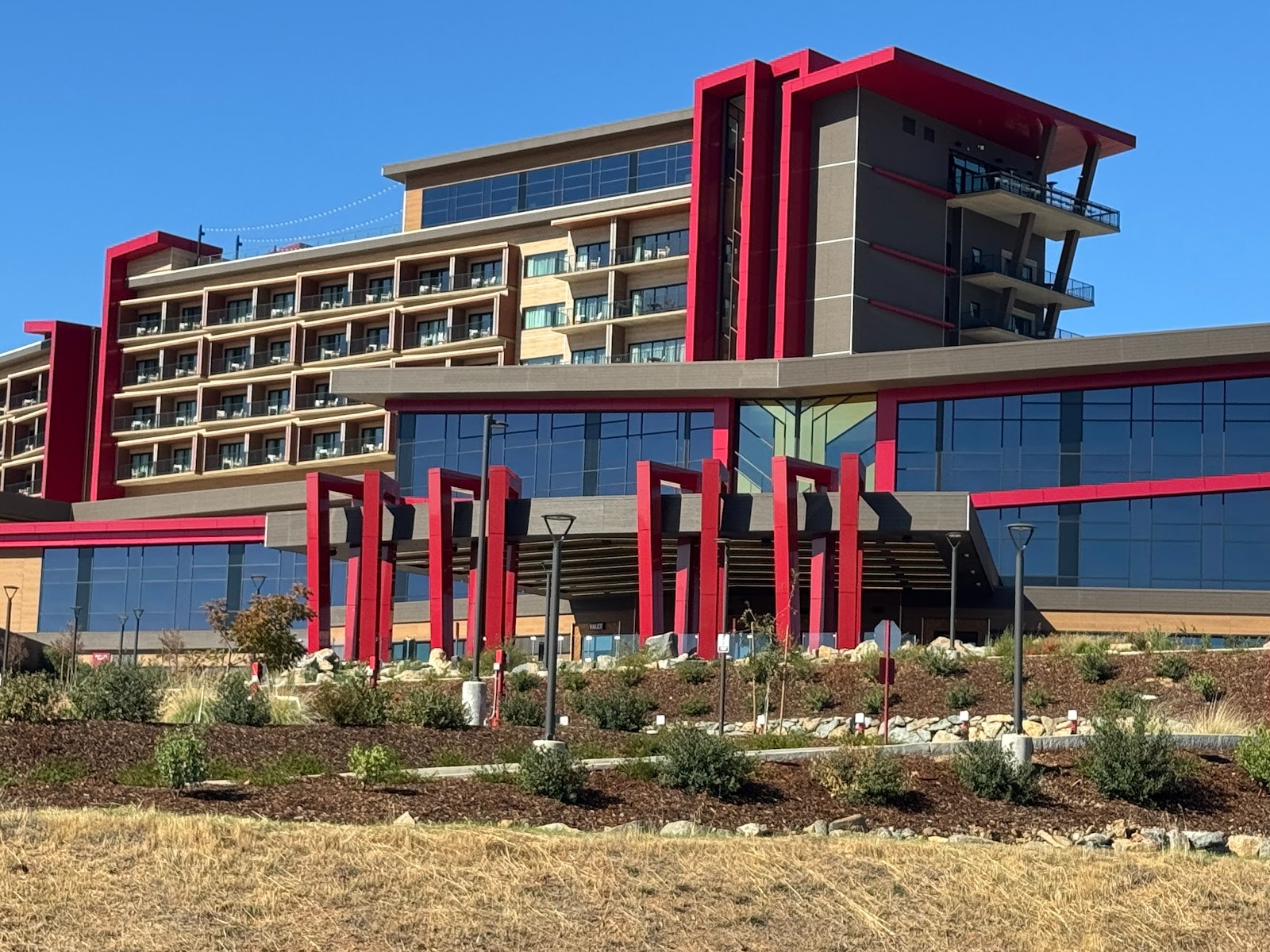
The name comes from the Chicken Ranch Band of Miwok Indians.
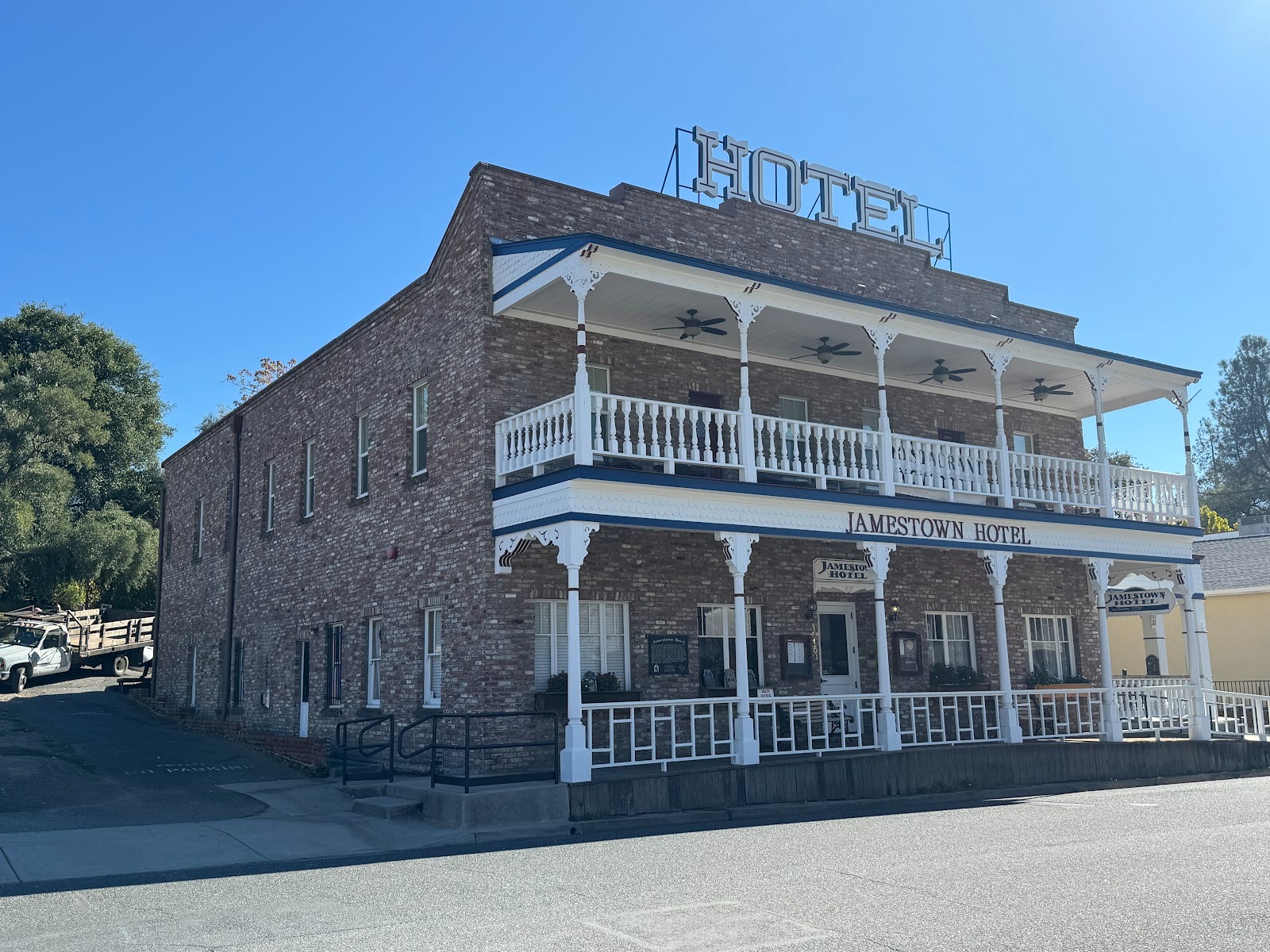
In 2019 the same band bought this hotel in Jamestown, which is a few miles farther along and which was rebuilt in 1919. I'm still puzzled at the power of balconies to make a brick block seem attractive. Maybe the balcony proves that the owner understands that sensible guests like fresh air.
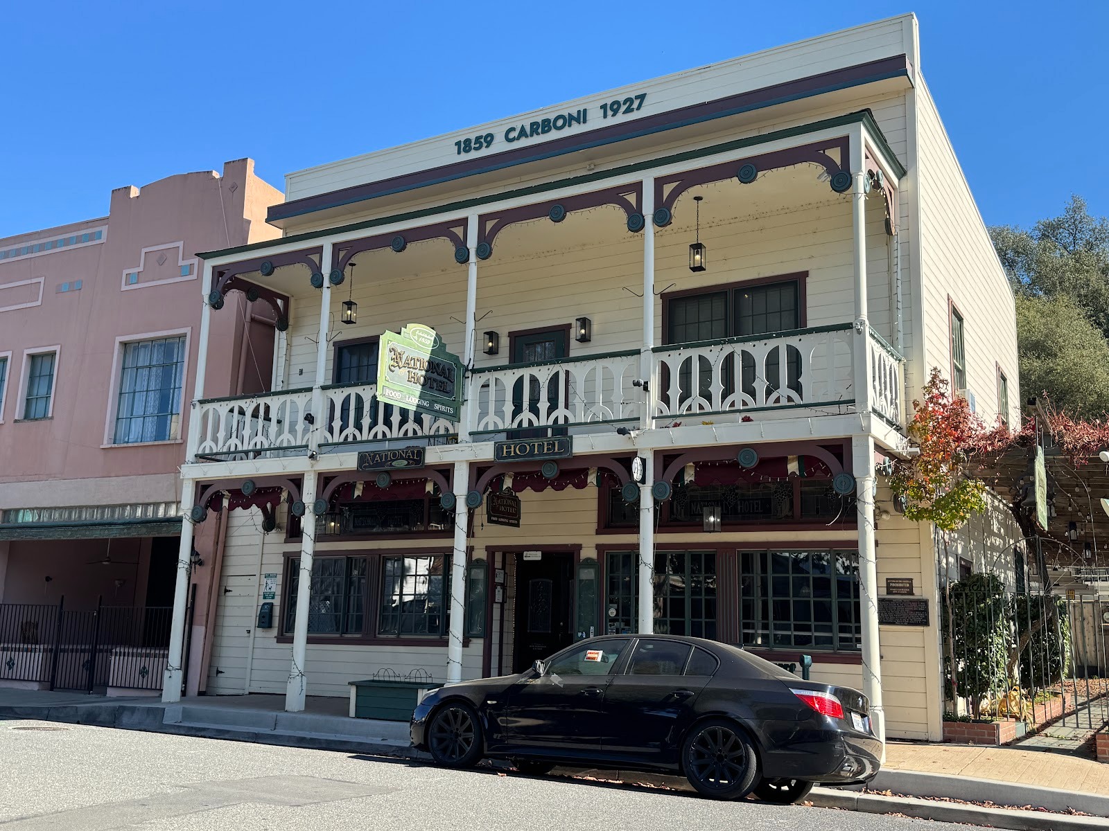
Some competition: the National Hotel, built in 1849 as the Hotel Europe.
Seen one, seen 'em all. We're 3 or 4 miles from Sonora.
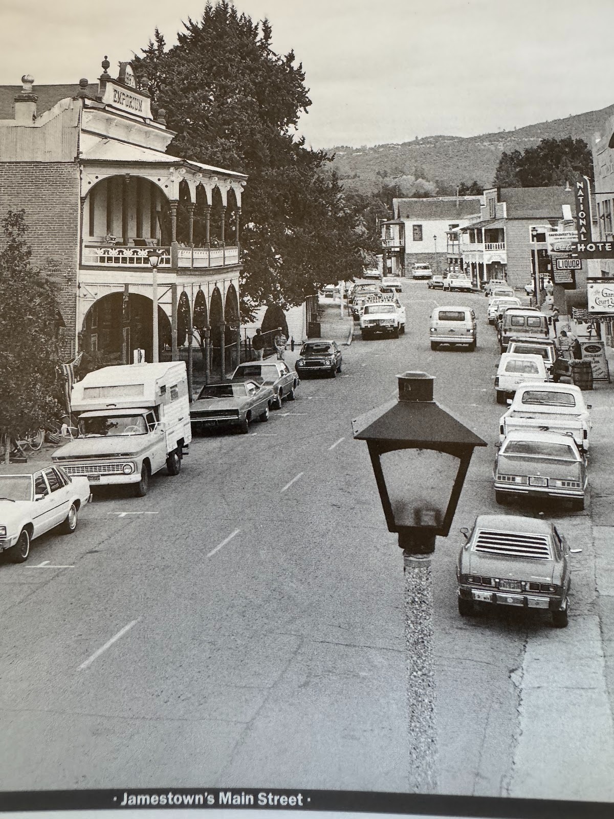
Circa 1960, when the National Hotel (on the right) still had its movie-theater marquee.
Before I get too critical of pioneer architecture, I should remind myself what newer stuff looks like, here seen as 49 enters Sonora.
Hey, no need to go all the way to Europe.
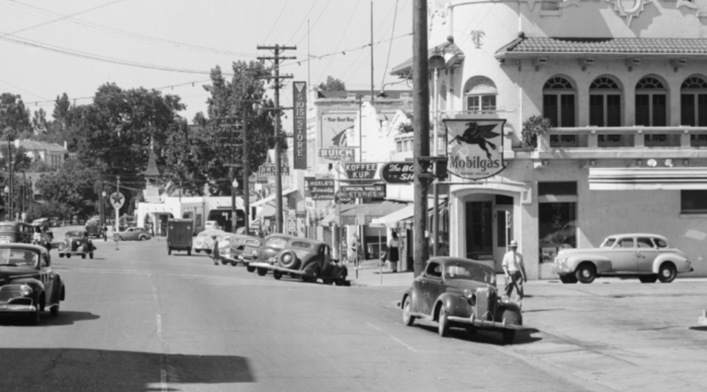
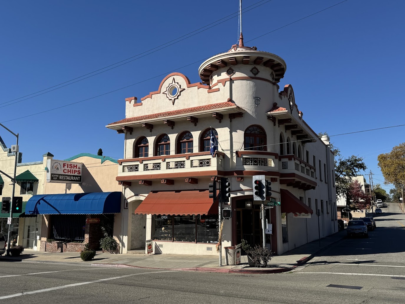
That's the Hotel Sonora, originally the Hotel Victoria, from 1896. In 1931 it got a Spanish makeover from an owner who knew that the town was settled by miners from... uh... let me think. What's the name of that Mexican State just across the border from Arizona?
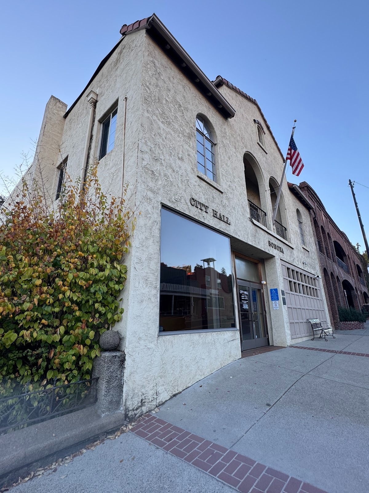
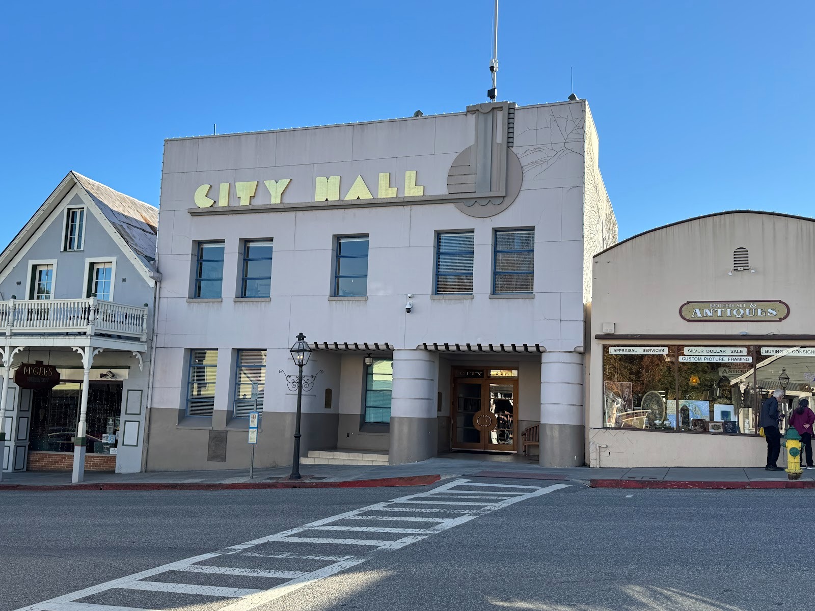
The city hall picked up the Spanish mood, even though less than a tenth of the city's residents are Hispanic.
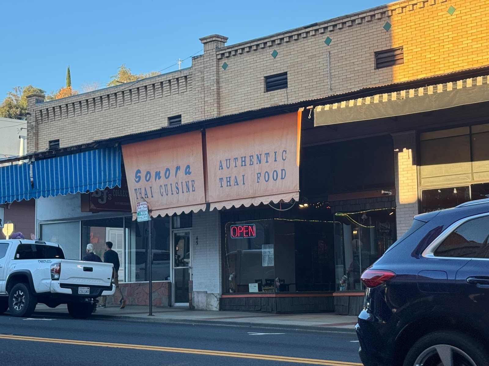
We're still on 49, here called Washington Street. Boring buildings, but talk about a cultural mishmash. That's us.
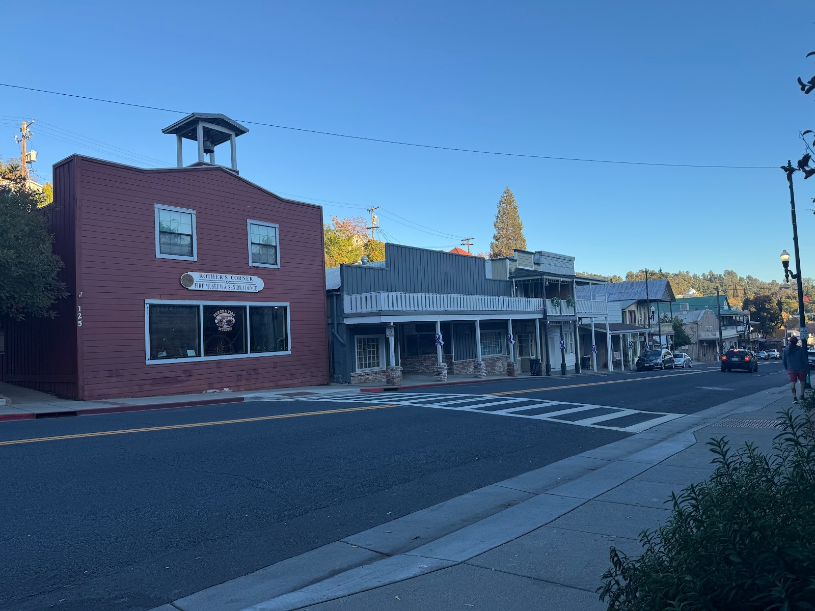
Here's the town's old fire station, next to some law offices. Do you fancy an architectural stroll? I thought not.
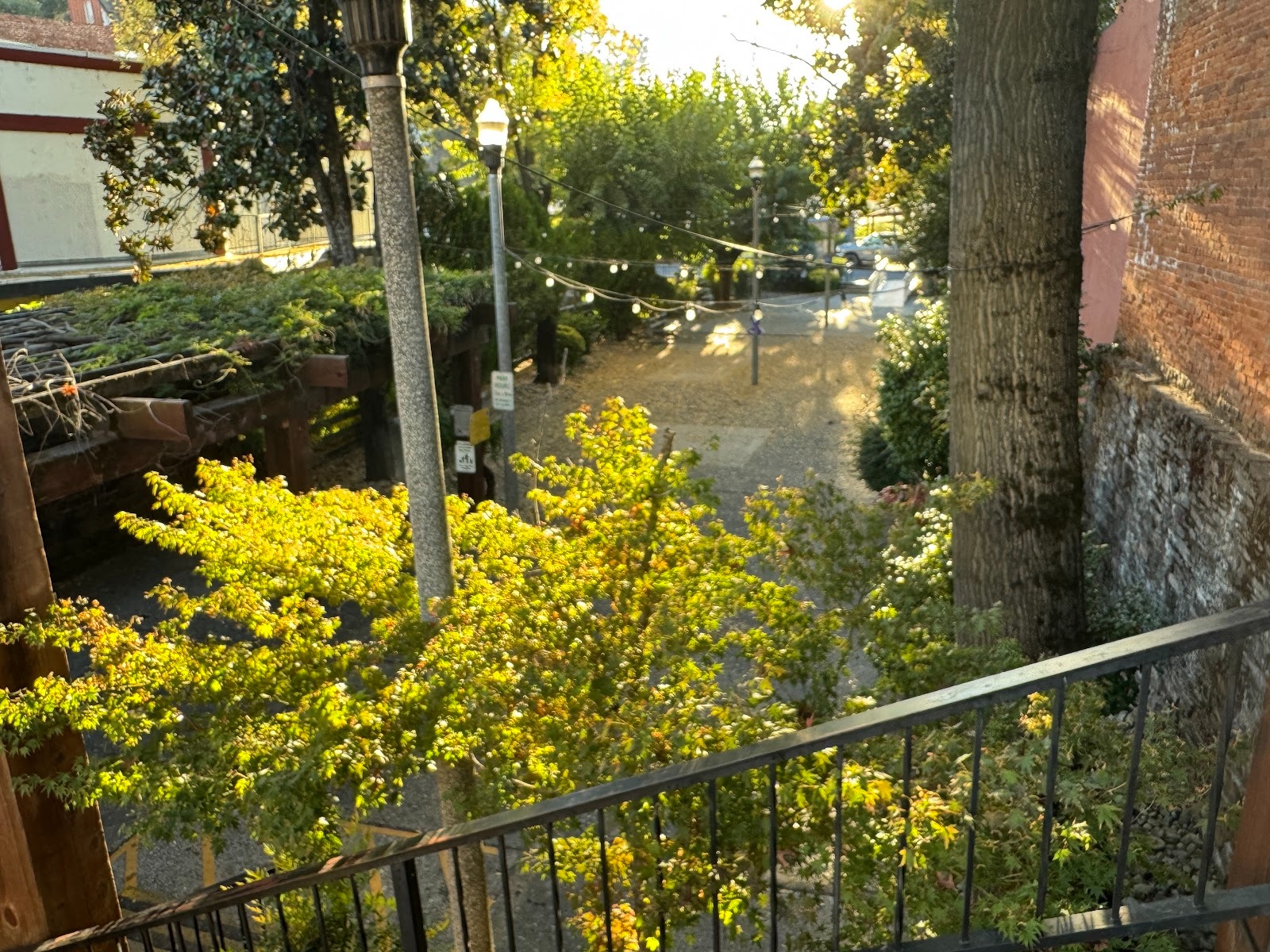
But here's a nice bit: Sonora Creek passes under Washington Street and has been made into a park.
Also, there's a jail from 1866. An earlier one burned down. This one served until 1960.
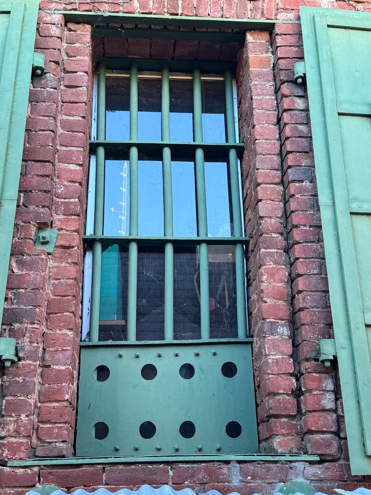
Not quite sure why you want shutters in addition to bars. Maybe to protect prisoners from high (or low) temperatures? Or maybe they're just a convention.
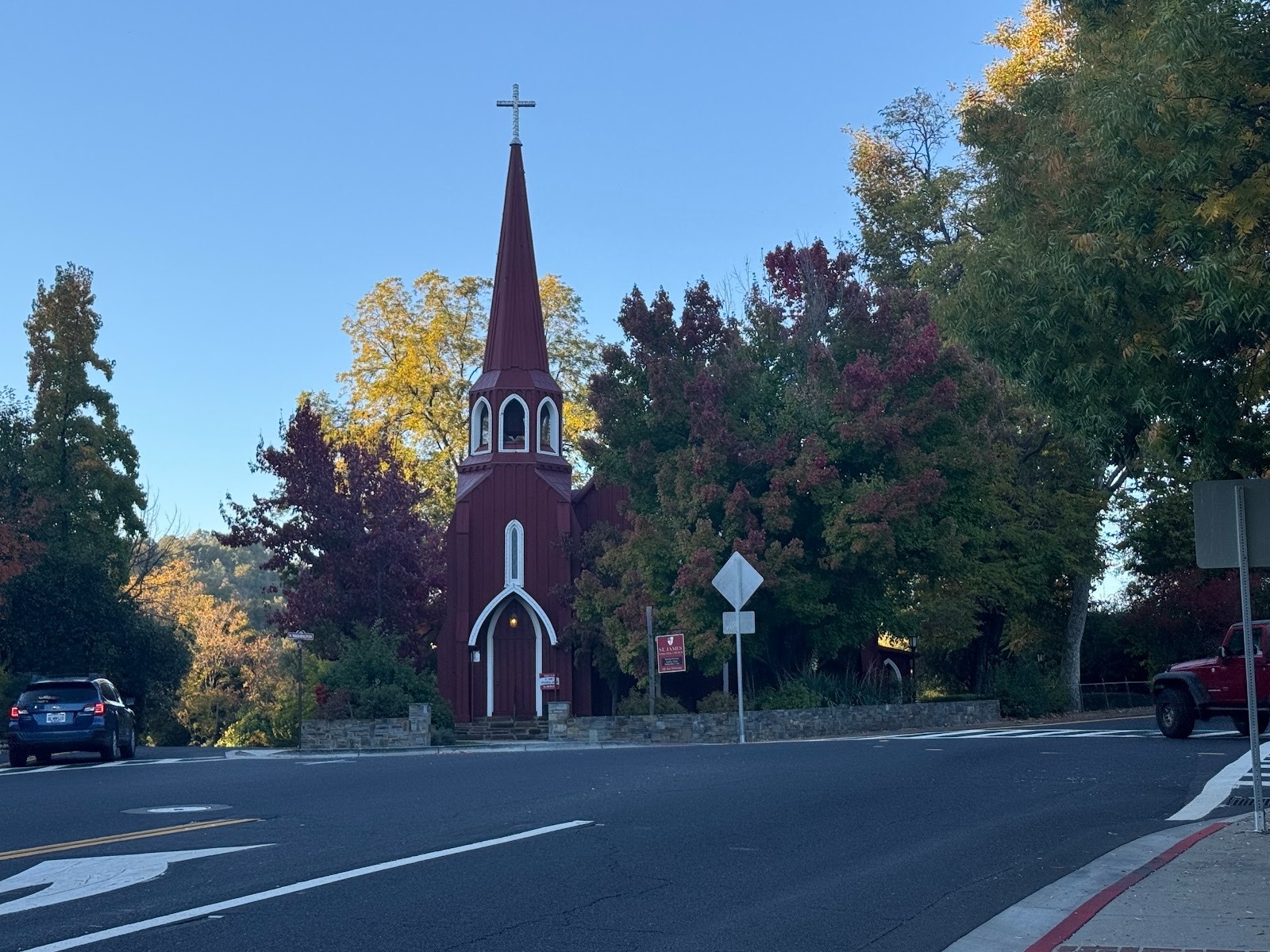
There's an Episcopal church where Washington Street splits. Alas, churches are mostly locked tight these days. This one was. Do you remember when people didn't lock their houses or their cars?
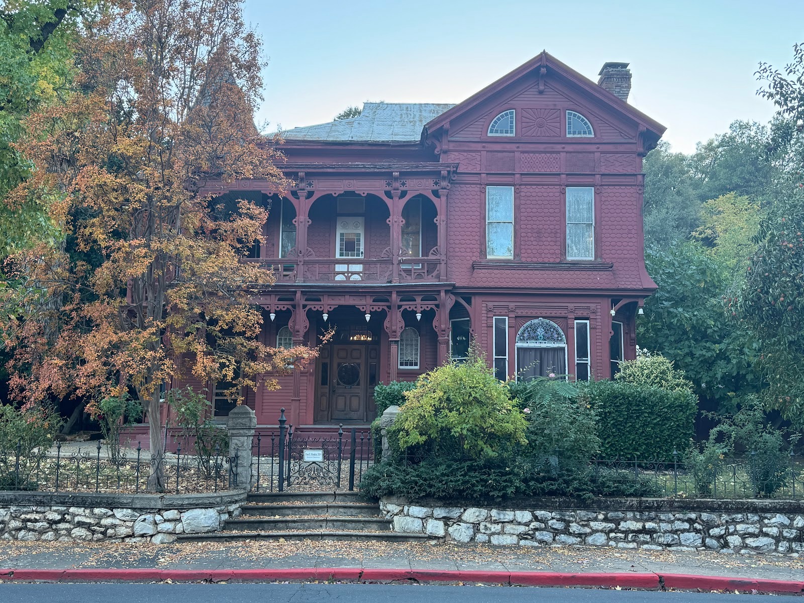
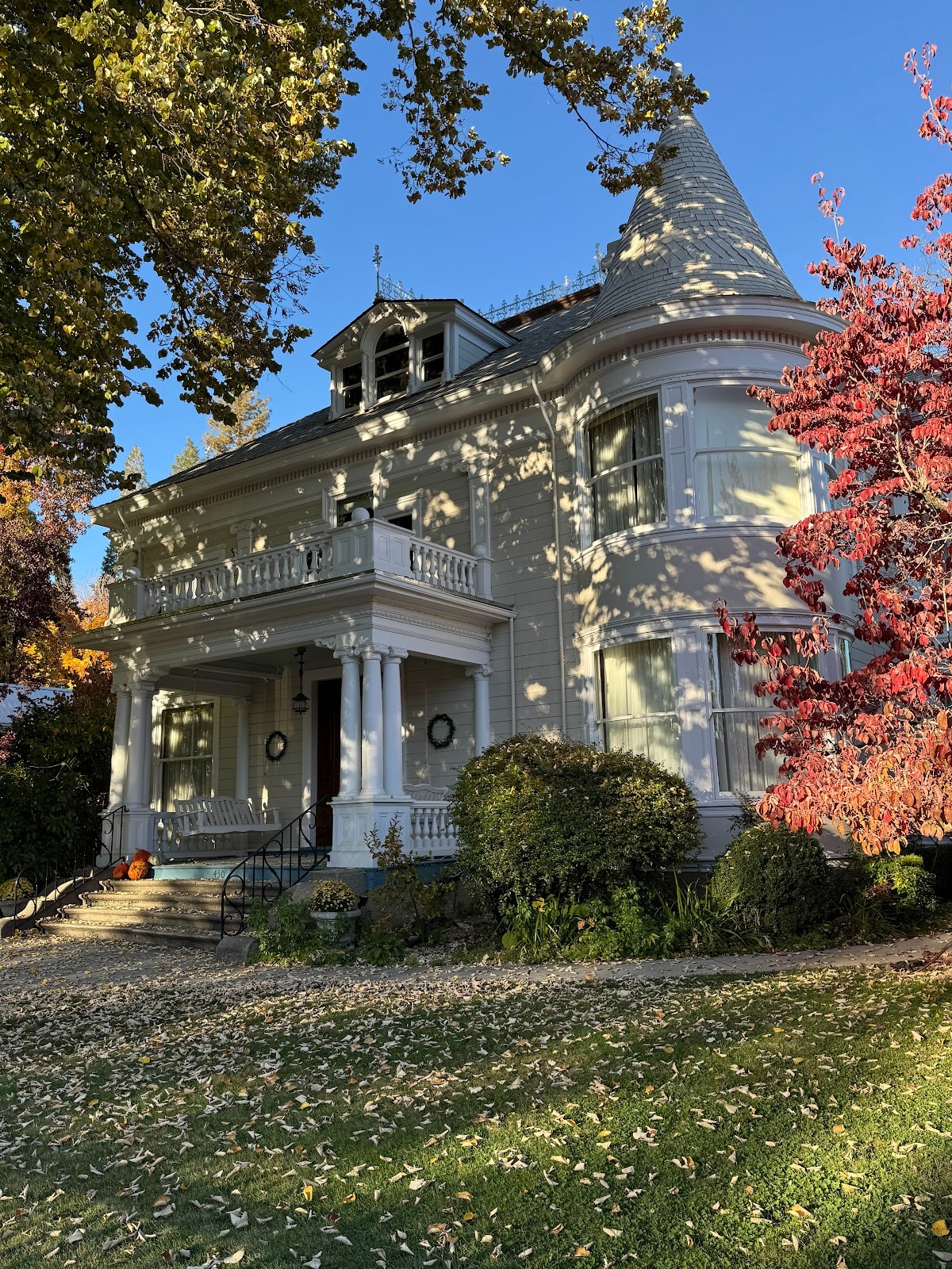
Now we're talking. Sonora had houses that needed servants.

Same house; a sign says this place is now a dentist's office. Wonder if the dentist uses period equipment.
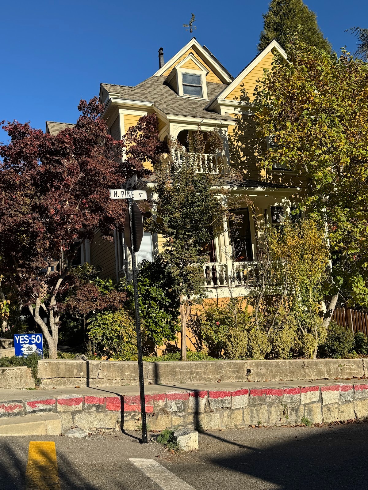
Another fine old house.
A notch down.
A bit more colorful.
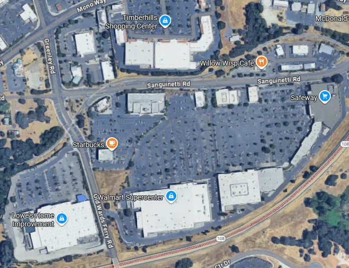
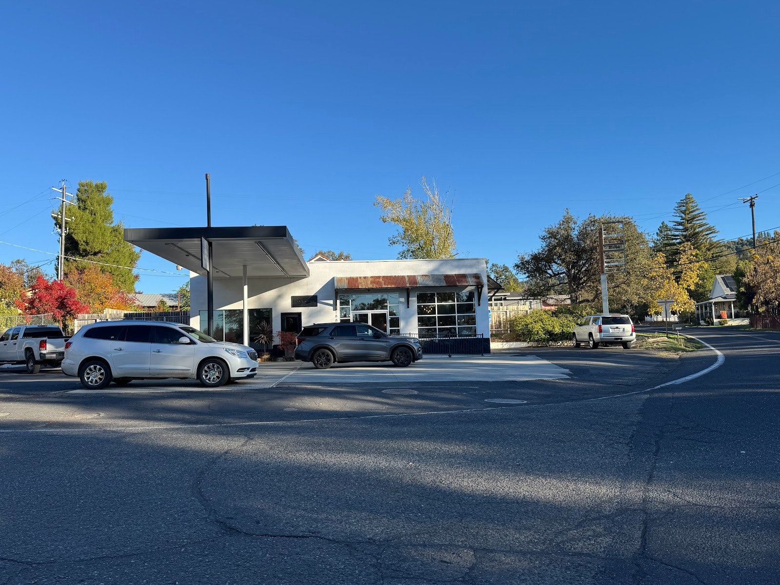
Where do these people shop? Bingo: not Washington Street but East Sonora, a five-minute drive or less. This is by far the biggest shopping center we've passed so far, although it has stiff competition ahead in Placerville, Auburn, and Grass Valley.
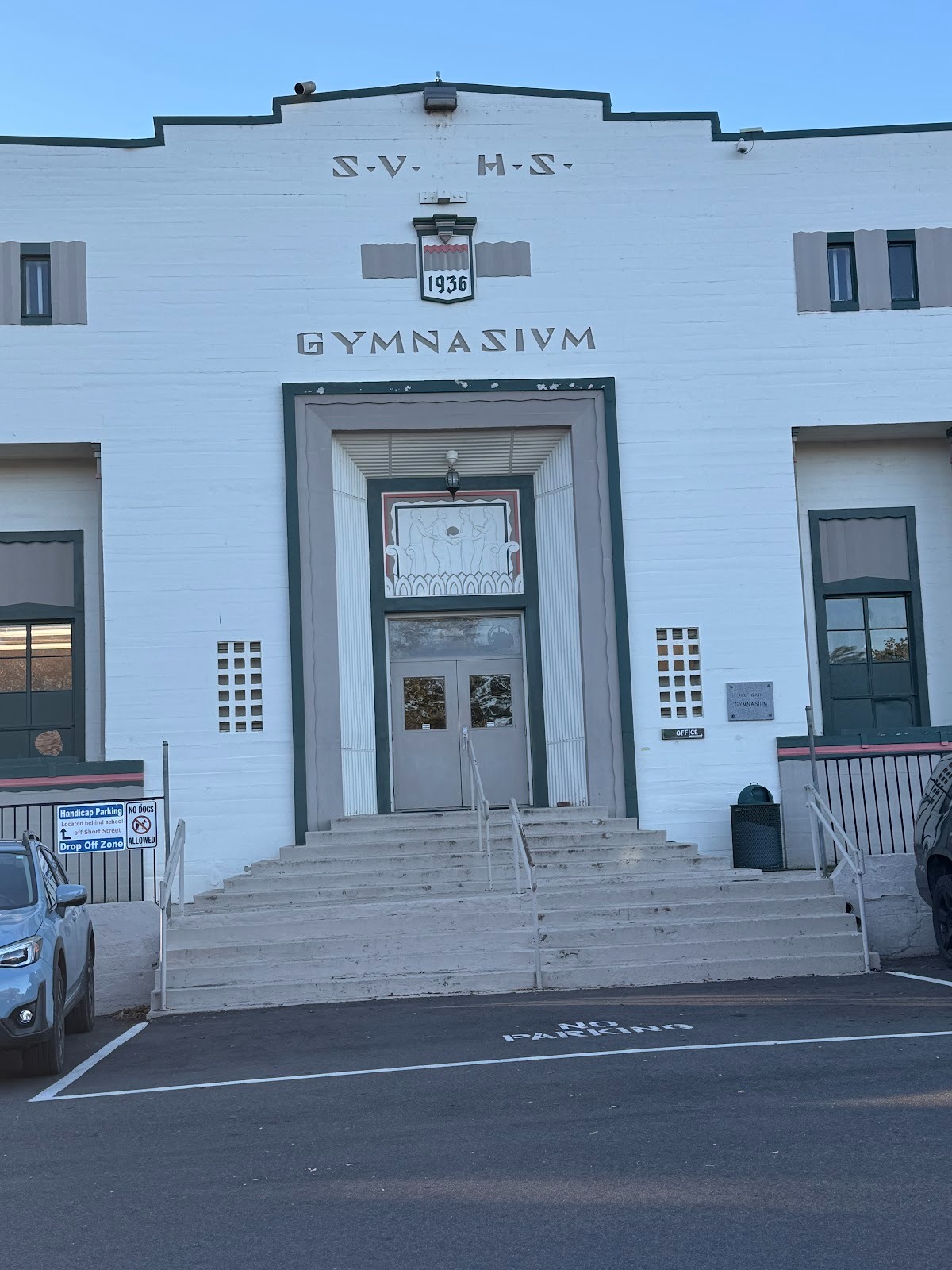
There are three places near Sonora I want to look at. The first is the town of Tuolumne, about 10 miles east of Sonora. We're looking here at the high-school gymnasium built for the Summersville High School (hence the initials). It dates from the 1930s, which is puzzling, because 20 years earlier Summersville had merged with a neighbor and become Tuolumne.
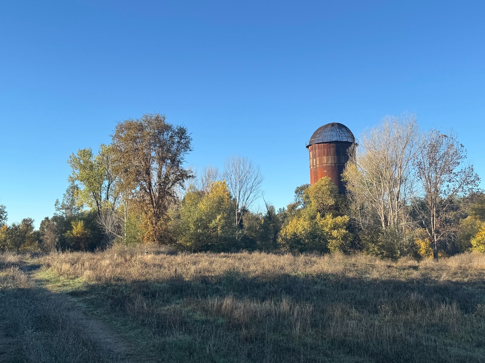
This was a logging town, sustained by the West Side Lumber Company, which closed in the 1960s after its mill burned. There's nothing left except the incinerator.
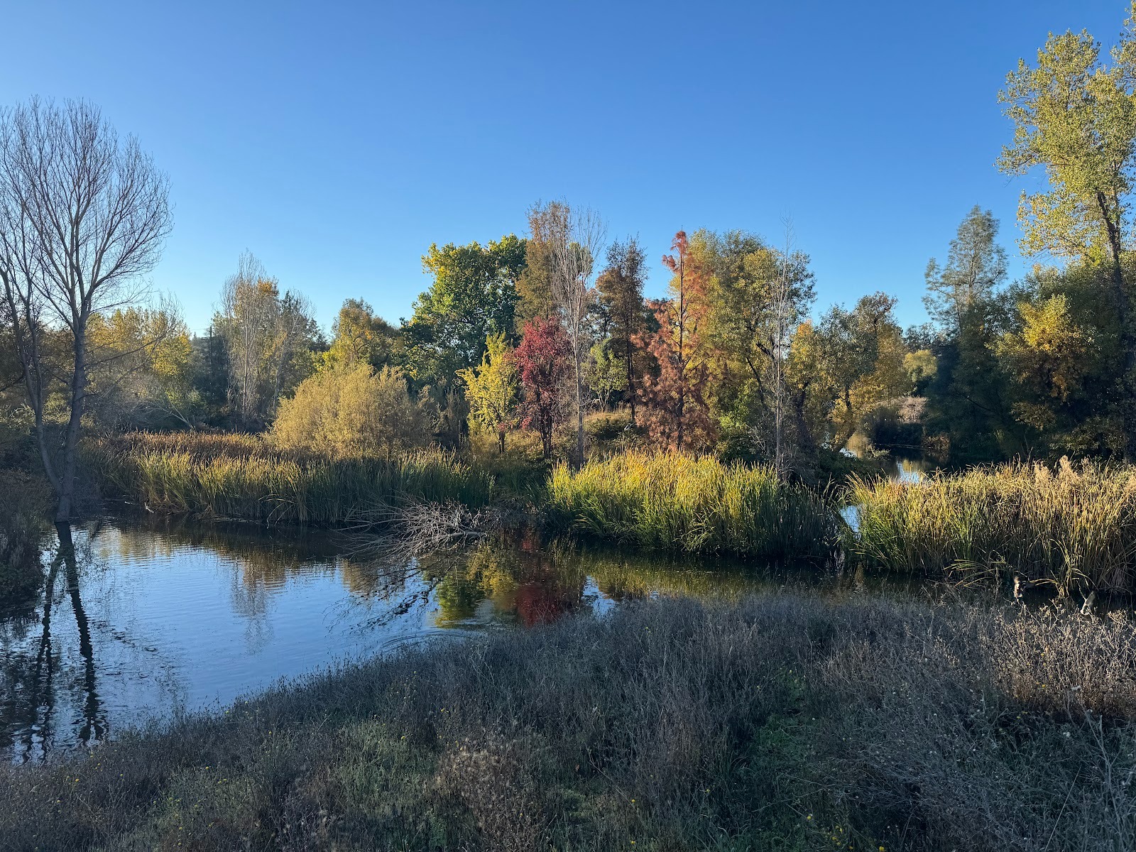
And the mill pond, gradually silting up.
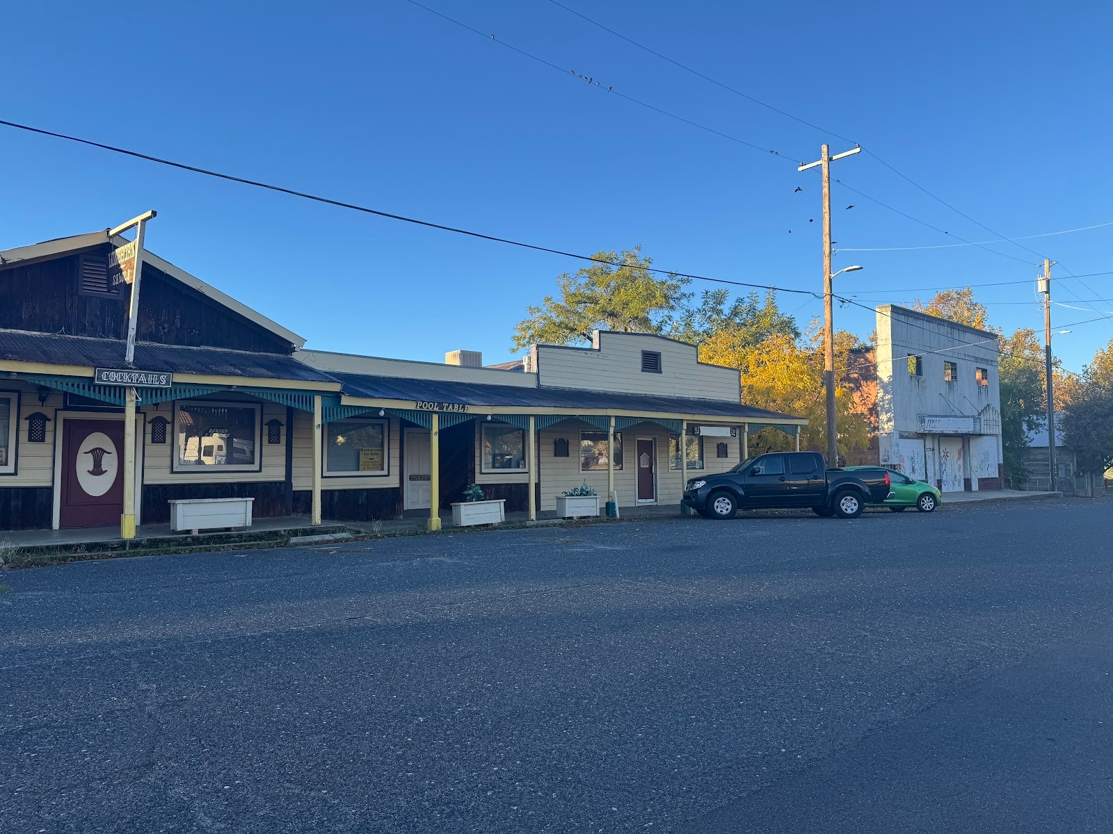
The main street is kaput.
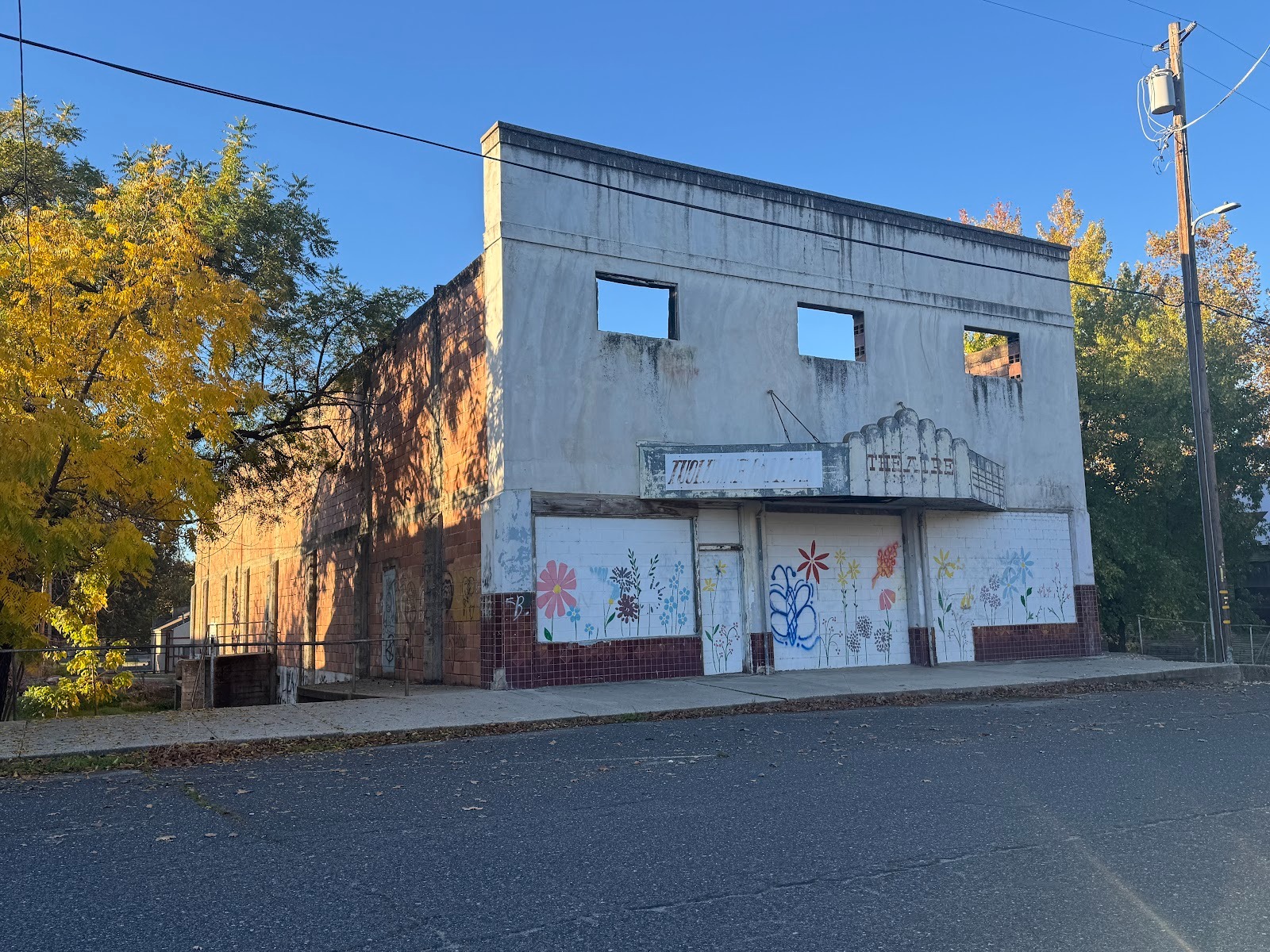
I guess it wouldn't be fair to blame Netflix.
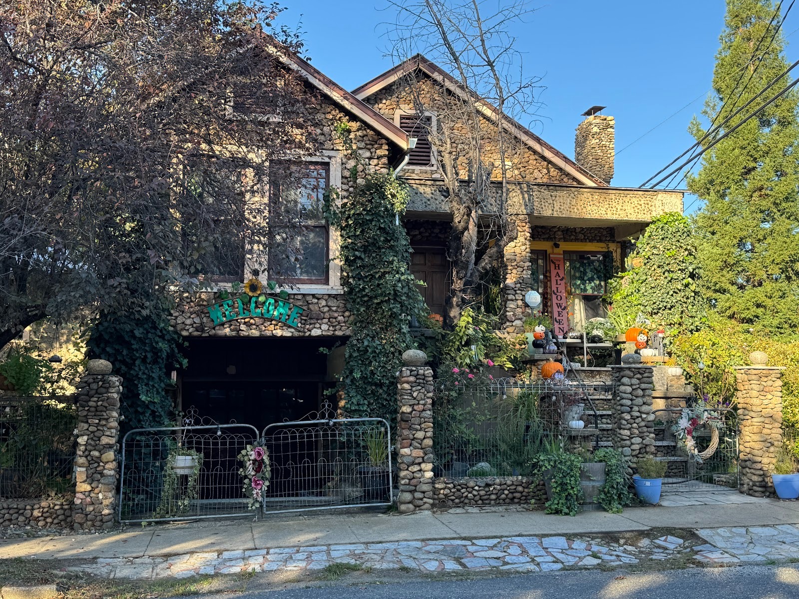
There are some nice old houses.
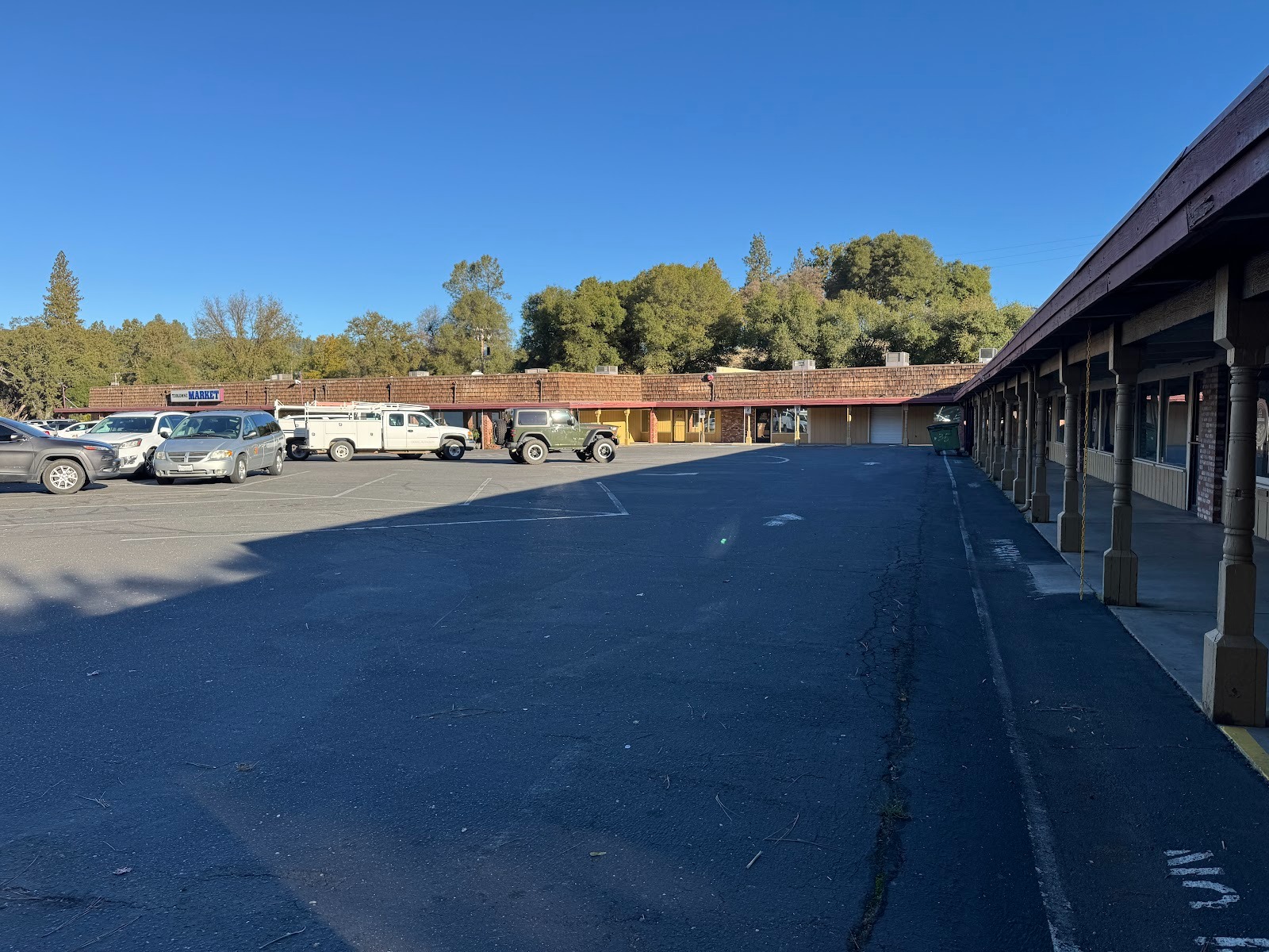
A new shopping center was built, but all the shops have closed.
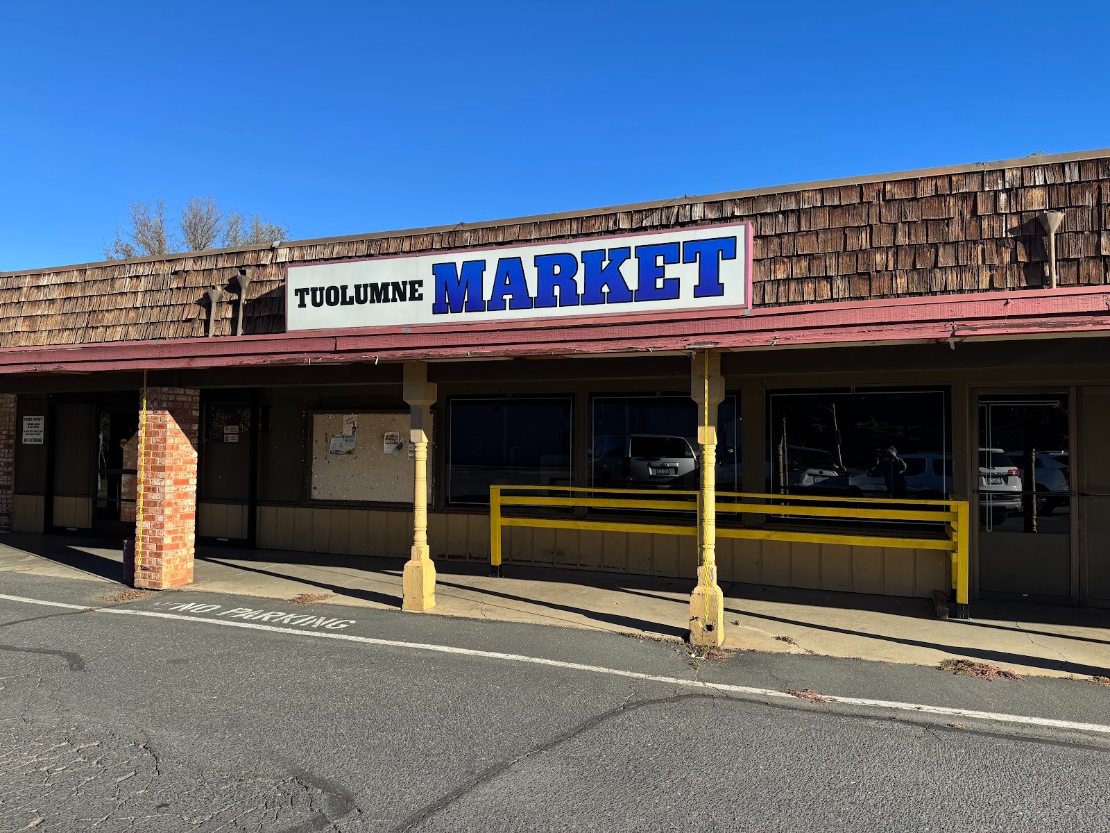
Even the supermarket is gone, except for the sign.
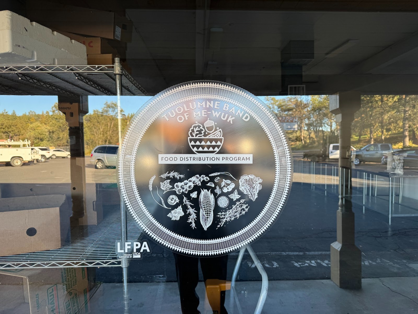
The only occupied space serves the Tuolumne Band of the variously spelled Miwok (or Me-wuk).
An old gas station has been repurposed.
If you want gas, you have to come up the road a quarter mile to the casino the Mi-wok own.
I was too drunk to hold my phone, but you get the idea.
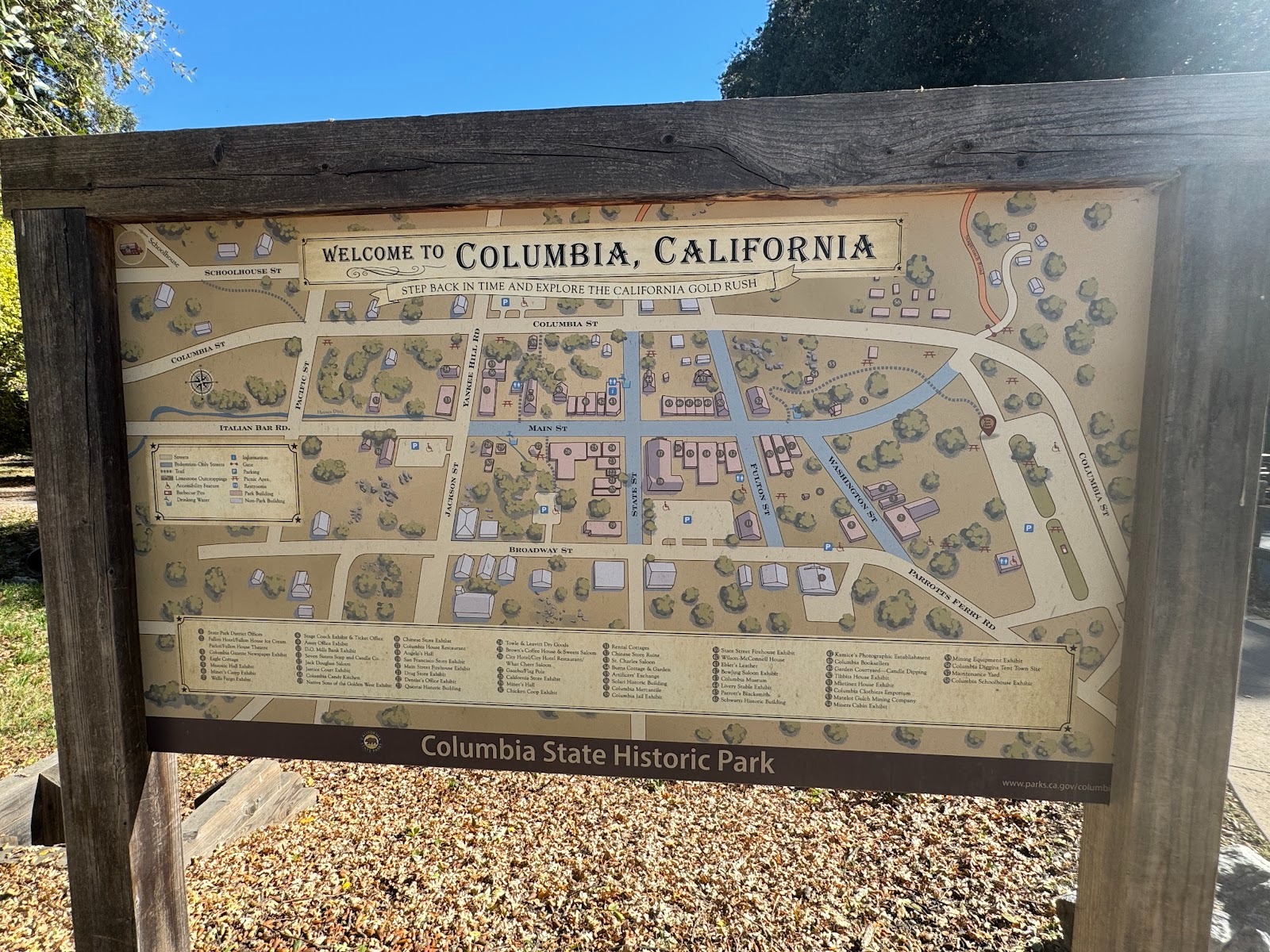
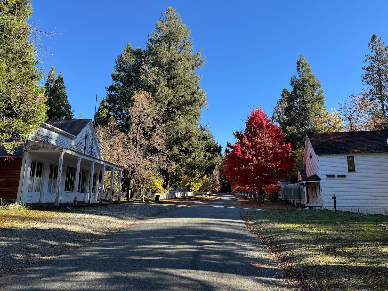
The second place I want to look at is Sonora's prime tourist attraction, the old mining town of Columbia, since 1945 a state historical park.
As it was.
As the miners left it, or left the parts that they scoured clean.
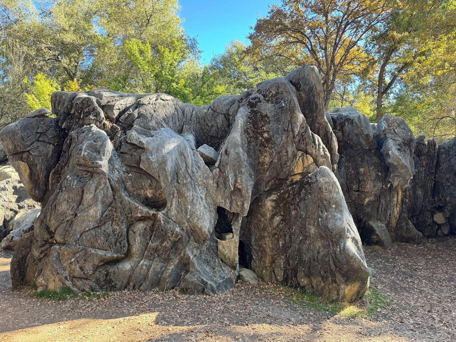
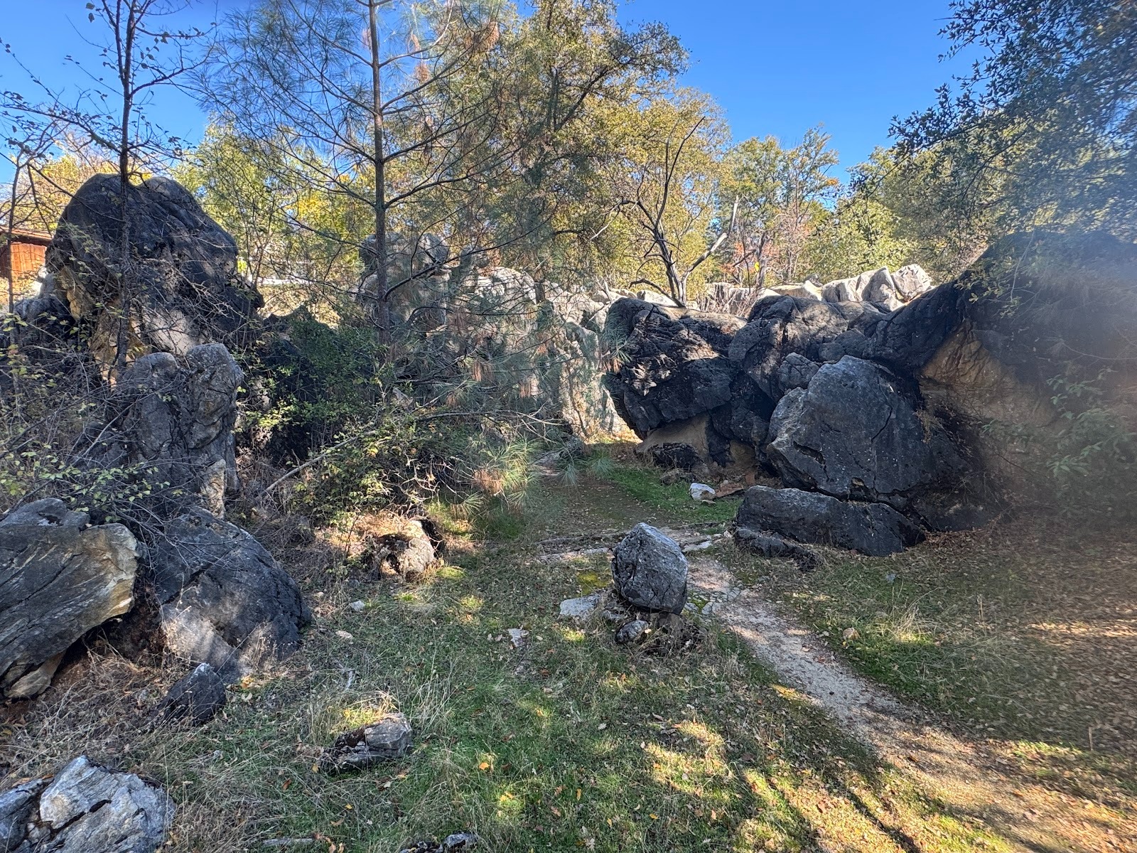
Think you're in Guilin? It's limestone, and I suppose you could call it karst. Reminds me of pictures in the Babar books by Jean de Brunhoff.
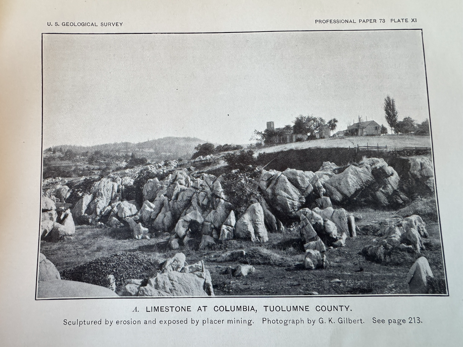
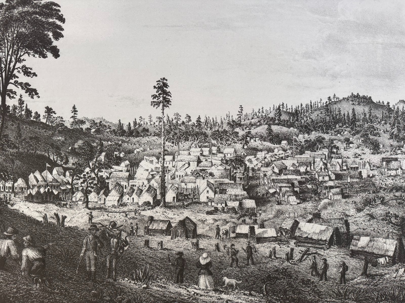
A fine old photograph showing what the surface looked like before the miners had their fun.
Waldemar Lindgren, The Tertiary Gravels of the Sierra Nevada of California, USGS Professional Paper 73, 1911, facing p. 72.
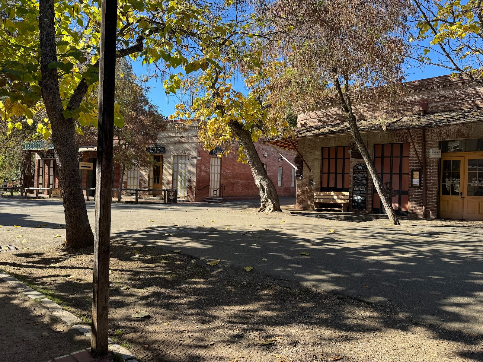
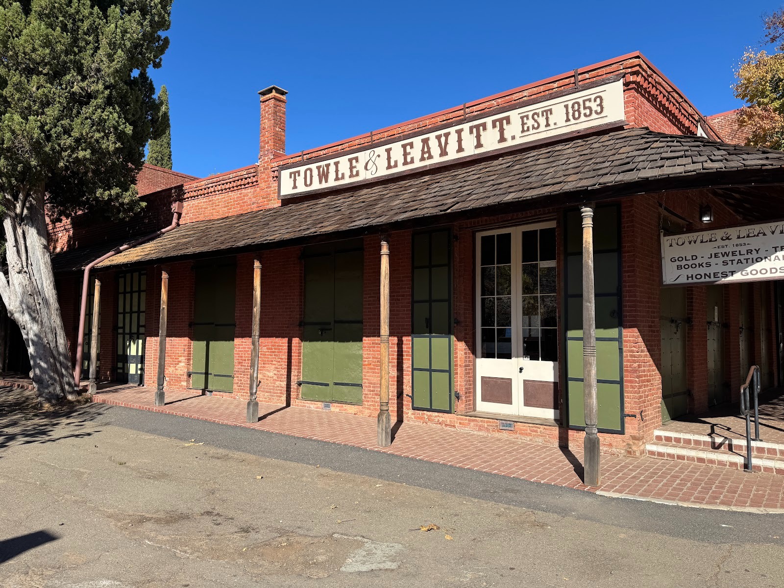
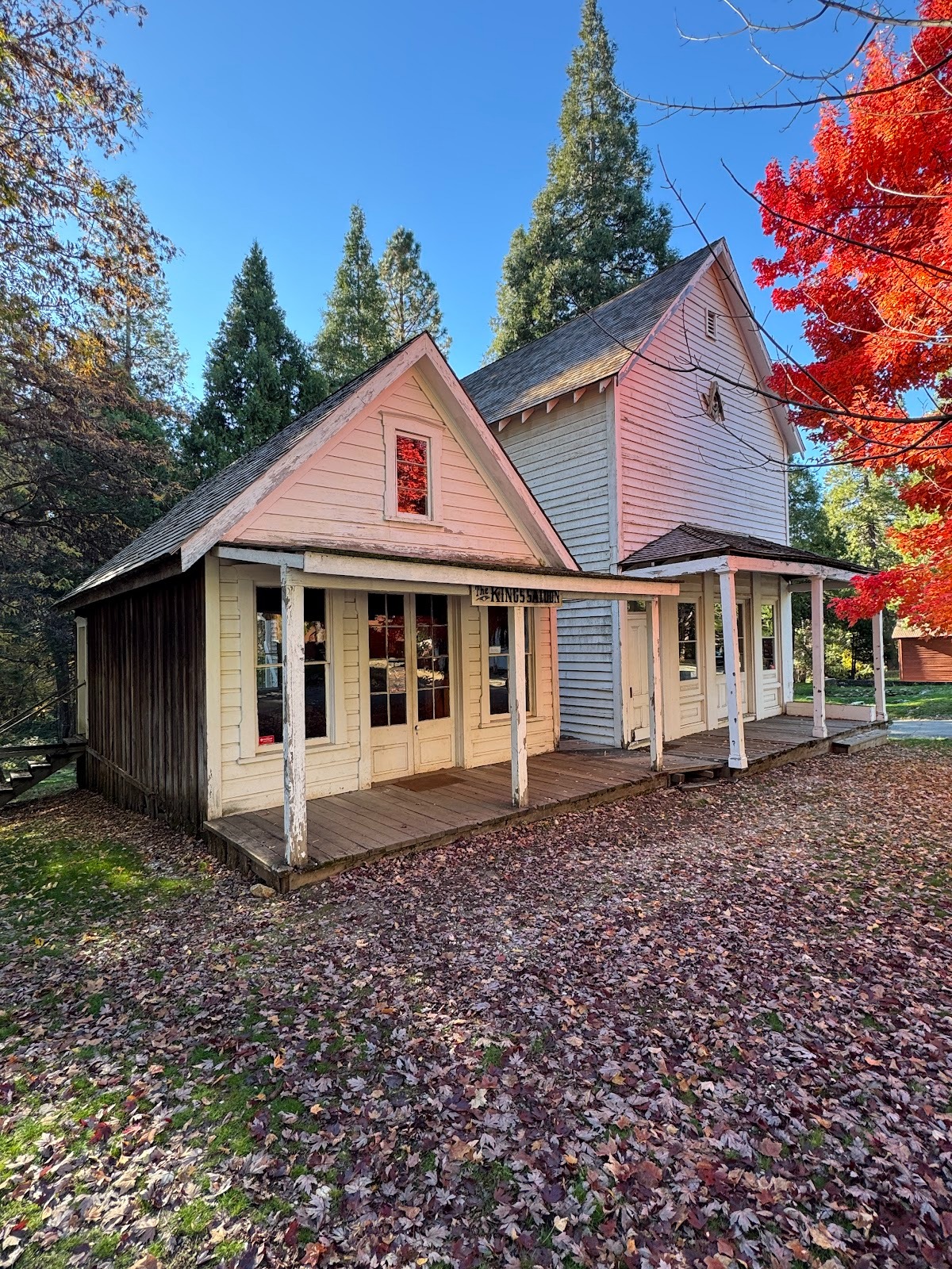
There's a living town adjoining Columbia, but here's a bit of the old part's main street.
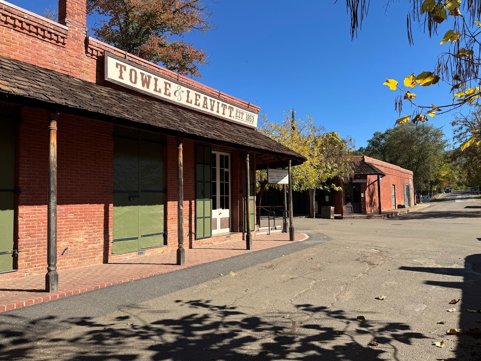
It must be crowded in summer.
It's a little sterile. Brings us back to that question about why we like places as basic as this. Partly it's because we've grown up with Westerns, but it's also because we're reminded that people didn't always drive 70 miles an hour while messing with their phones.
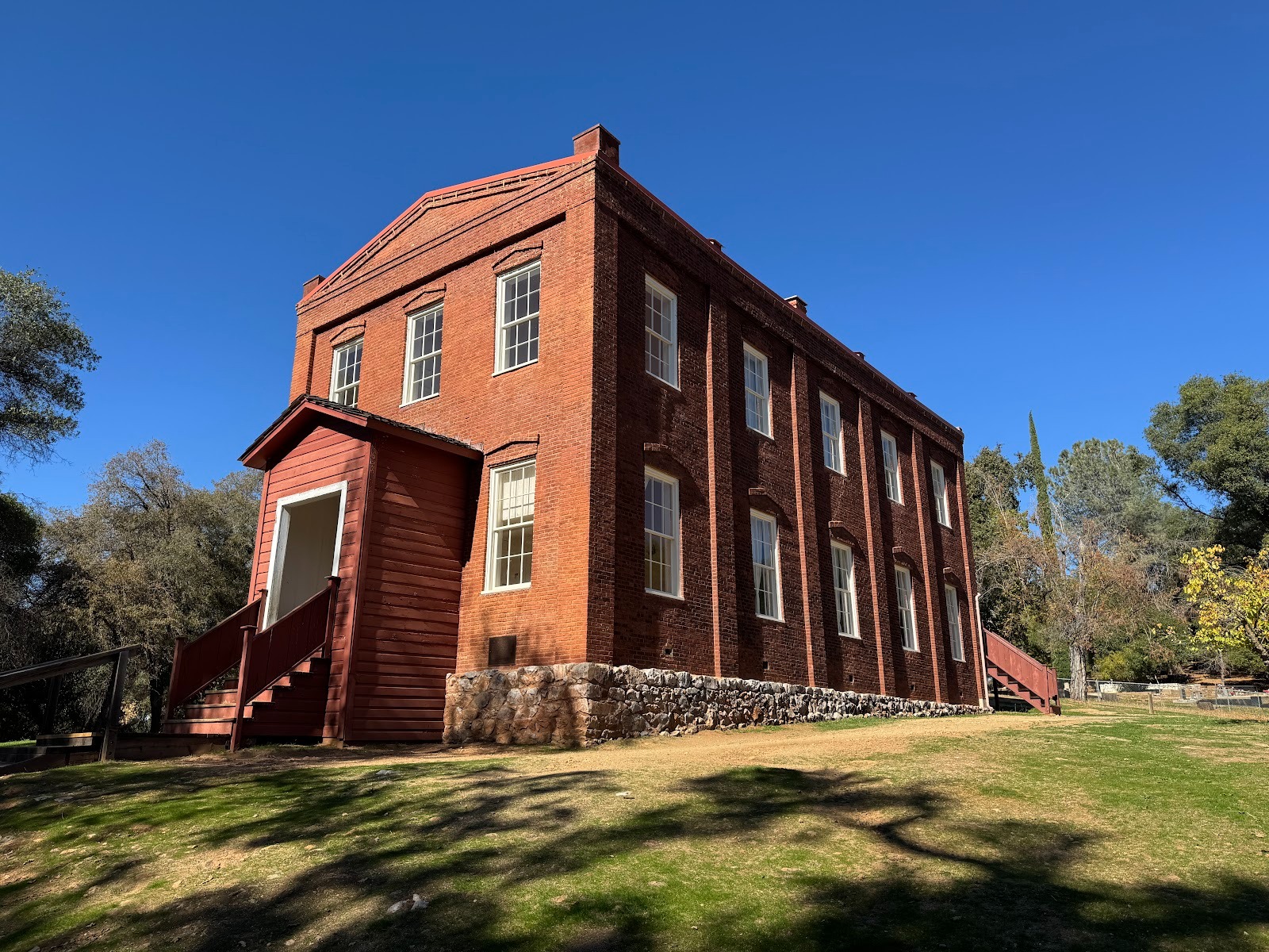
A 10-minute walk leads to the town's school. It opened in 1860, was renovated in 1872 and again in 1881. It closed in 1937 not for lack of students but because of new earthquake regulations.
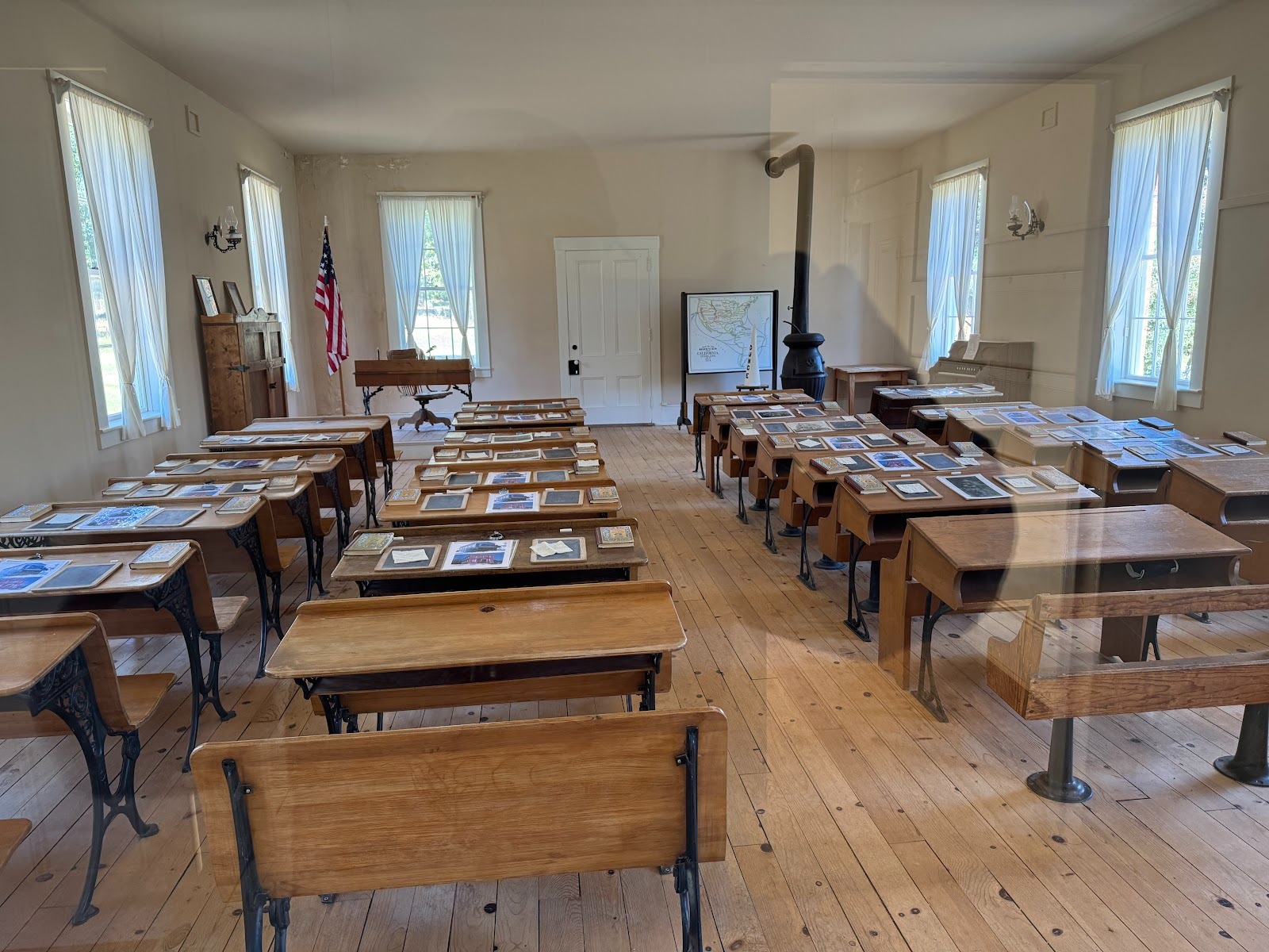
Back in fourth grade I would have loved to share one of these seats with a girl. Think the teacher would have allowed that?
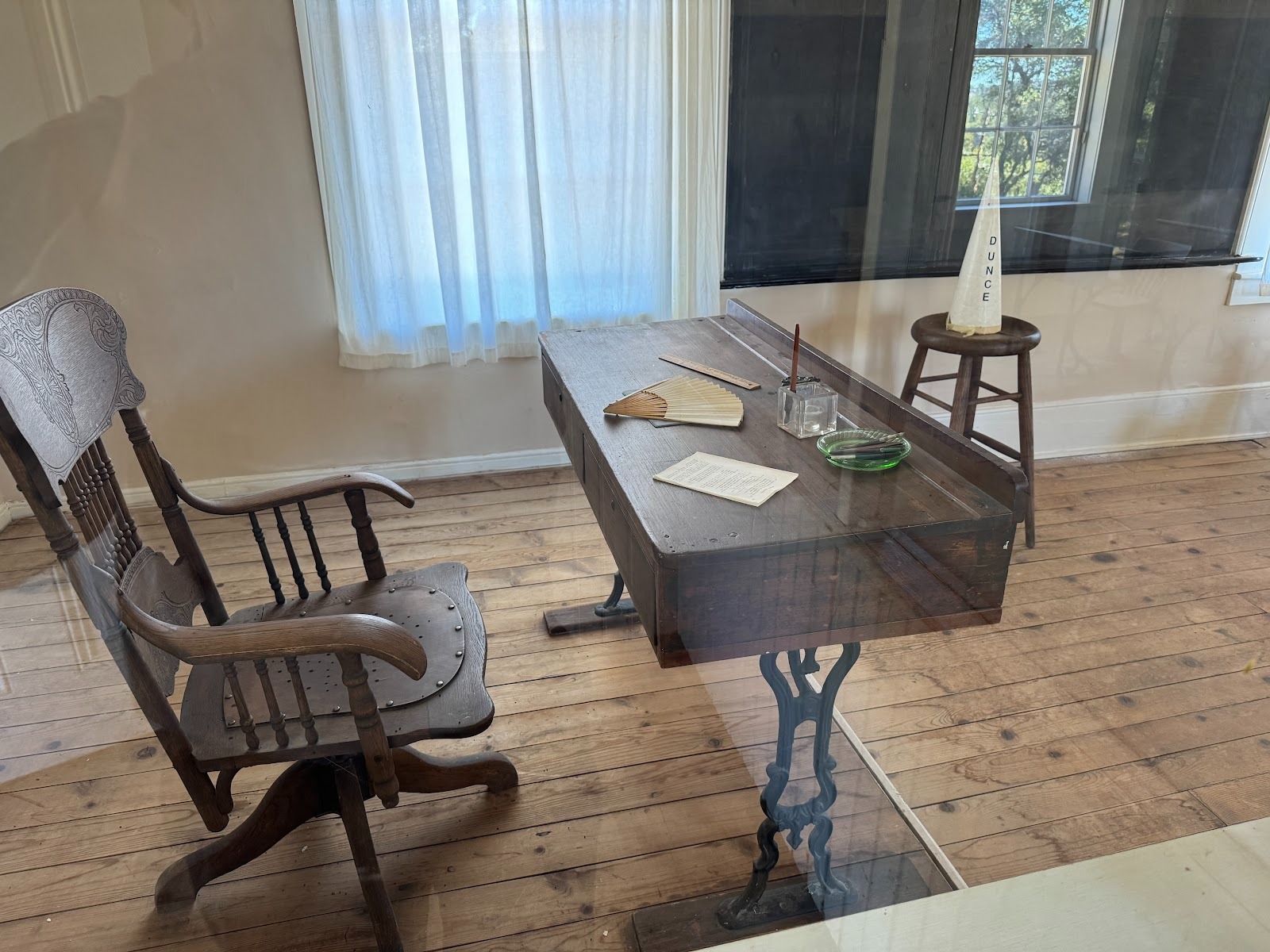
She was so strict. I spent a lot of time on that stool.
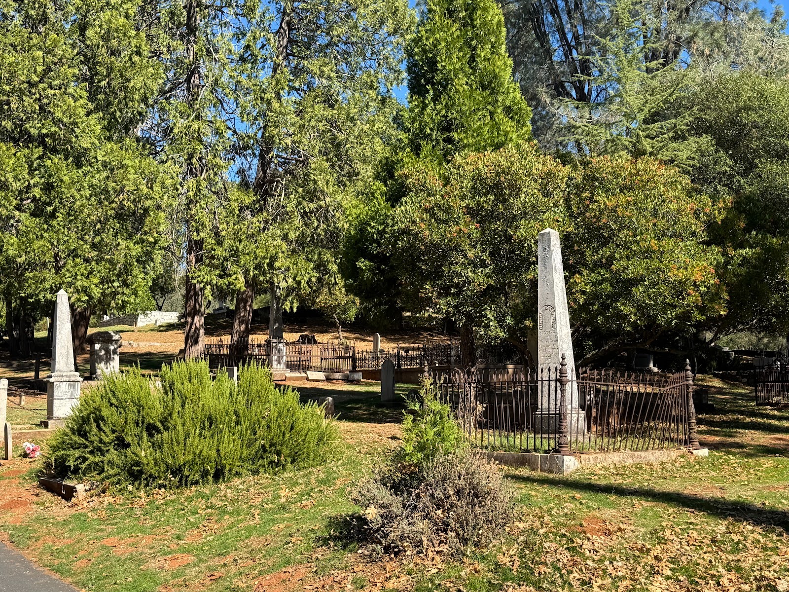
Next to the school is the Columbia Cemetery.
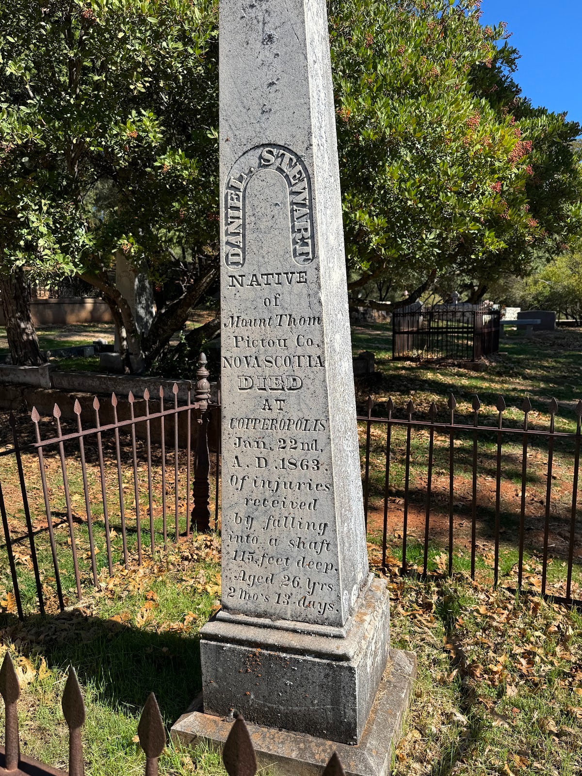
Most of the stones offer nothing beyond name, dates, and place of birth, but here's an exception: a native of Nova Scotia who died of "injuries received by falling into a shaft 115 feet deep." Age 26.
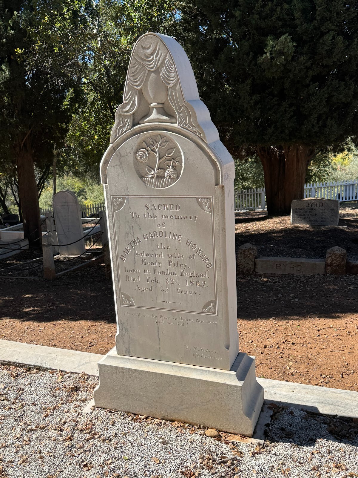
A Britisher, dead at 35.
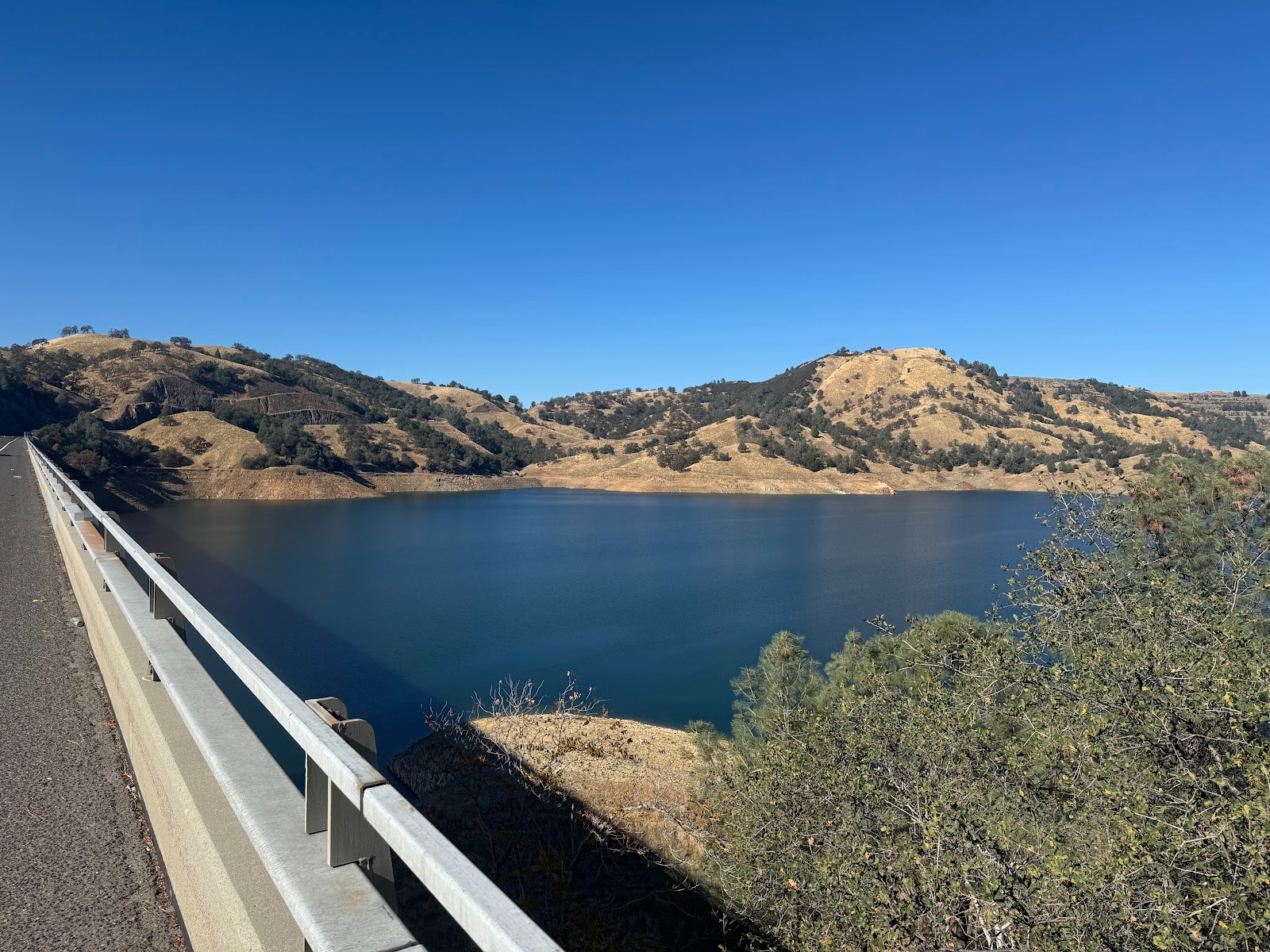
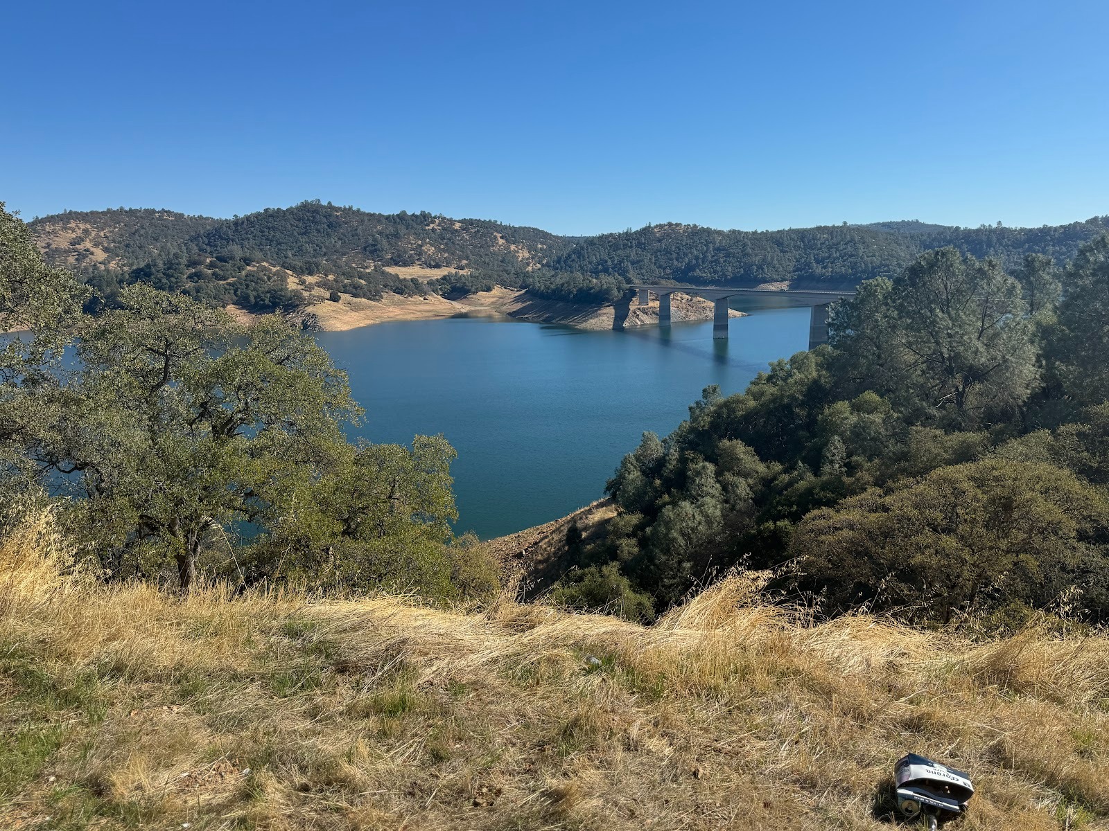
What's this? We're at the third place. It's Jackass Hill, a bit north of Sonora and overlooking New Melones Lake on the Stanislaus River. How enthusiastic people are about dams and reservoirs is a good indicator of whether they're grown up. I admit that the global economy depends on our remaining children.
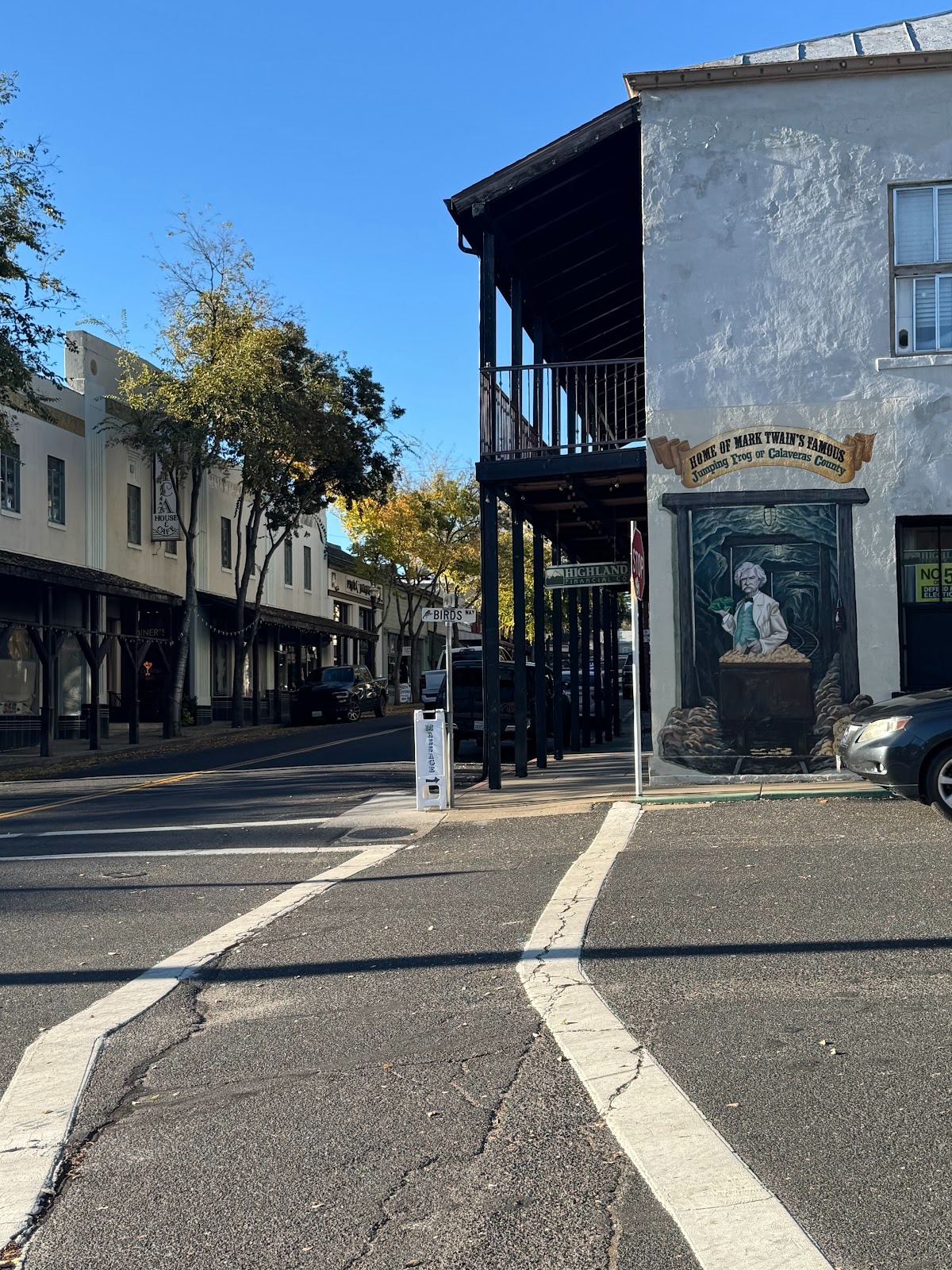
But this is what people come up here for. It's the so-called Mark Twain Cabin (it's actually a replica). Here's what Sam himself says about it: "By and by, an old friend of mine, a miner, came down from one of the decayed mining camps of Tuolumne, California, and I went back with him. We lived in a small cabin on a verdant hillside, and there were not five other cabins in view of the wide expanse of hill and forest. Yet a flourishing city of two or three thousand population had occupied this grassy dead solitude during the flush time of twelve or fifteen years before, and where our cabin stood had once been the heart of the teeming hive, the centre of the city" (Mark Twain, Roughing It, 1872, Chapter LX).
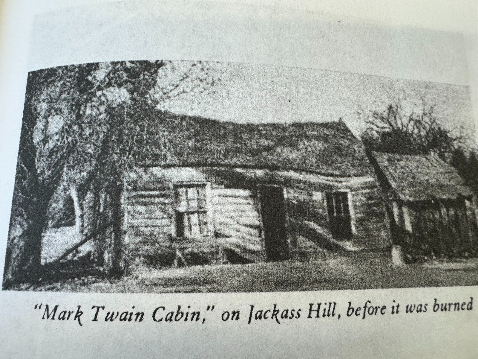
Here's the original cabin. A replica was built in 1922 and a second in 2005. I suppose today's iron fence is a necessity, but the best reason to come up here (and it's not a very good one) is so you can say you've been at the coordinates where Mark Twain wrote the story called (variously, but usually) "The Celebrated Jumping Frog of Calaveras County." The story is tedious (I say that as my opinion, not as an statement of fact), but it jumpstarted his career as a writer.
(Louis Stellman, Mother Lode: The Story of California's Gold Rush, 1934, facing p. 64.)
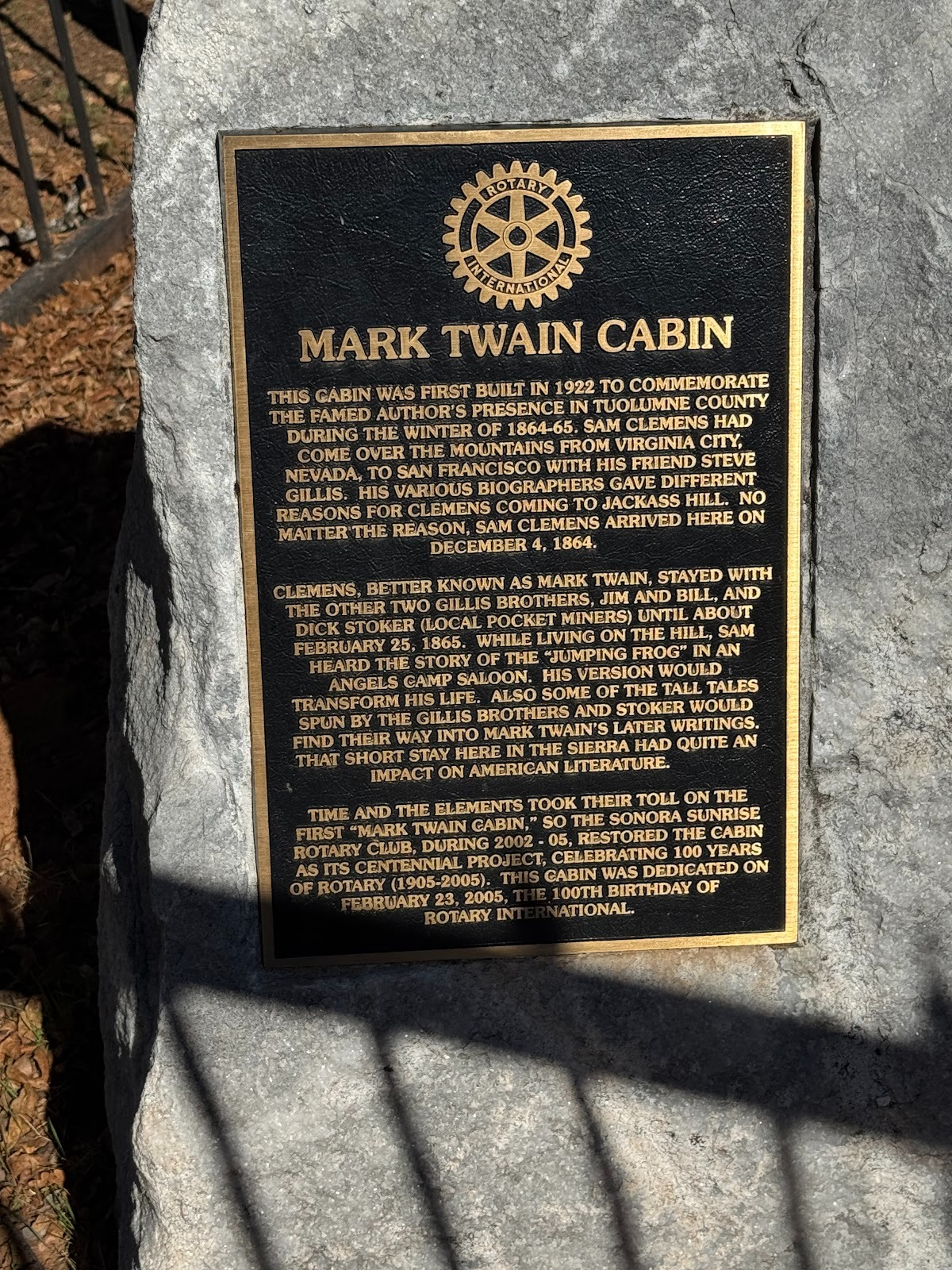
A plaque on the site.
We're crossing the Stanislaus and jumping from Tuolumne to Calaveras County. Twain, in his cabin, took a ferry across the river when he wanted to visit the nearest town, Angels Camp. That's where he heard the story about the frog. He doesn't mention that the word Calaveras translates as "skulls" and came into use because Mexican miners saw lots of Indian skeletons in this canyon.
View from the north side. It's a struggle to visualize what this part of the world looked like in 1850, when 100,000 people were chasing gold. Here's a contemporary account: "They were ten in number, and their only implements were shovels, a rude cradle for the top layer of earth, and flat wooden bowls for washing out the sands. Baptiste took one of the bowls which was full of sand, and in five minutes showed us a dozen grains of bright gold... When I first saw the men carrying heavy stones in the sun, standing nearly waist-deep in water, and grubbing with their hands in the gravel and clay, there seemed to me little virtue in resisting the temptation to gold-digging, but when the shining particles were poured out lavishly from a tin basin, I confess there was a sudden itching in my fingers to seize the heaviest crowbar and the biggest shovel.... Every knifeful brought out a quantity of grains and scales, some of which were as large as the fingernail. At last a two-ounce lump fell plump into the pan, and the diggers, now in the best possible humor, went on with their work with great alacrity" (Bayard Taylor, Eldorado: Adventures in the Path of Empire, 1850, pp. 69-71).
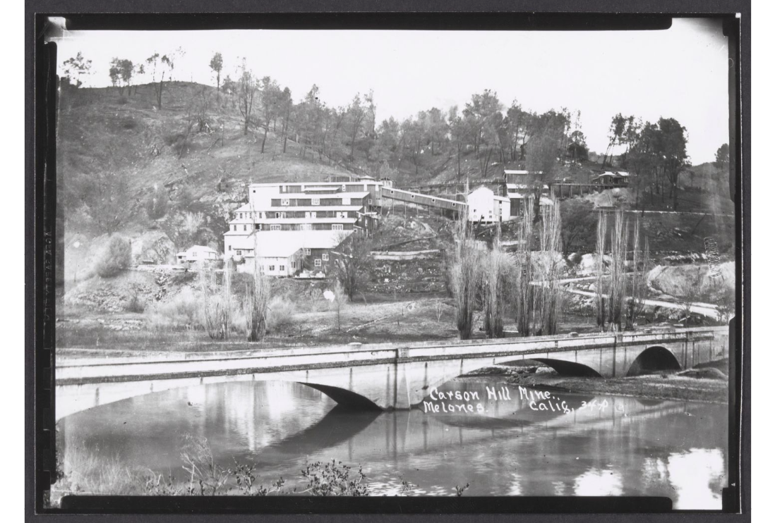
We've retreated back to the south side of the river and are looking (over the old Highway 49 bridge) at the Carson Hill Mine as it was about 1930. The site's been cleaned up, but hold on.
https://californiarevealed.org/do/ac09f21a-ec17-4842-867f-e915913bdaf4#page/1
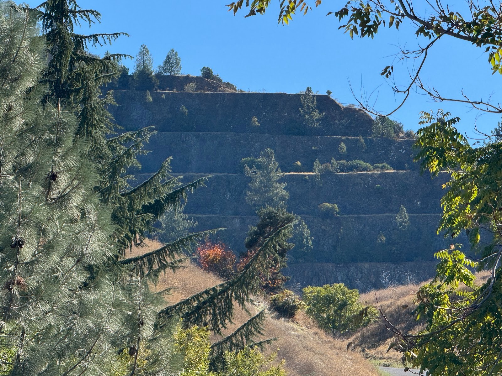
Over the north side of the hill, the Carson Hill Gold Mining Corporation ran an open-pit mine in the 1980s.
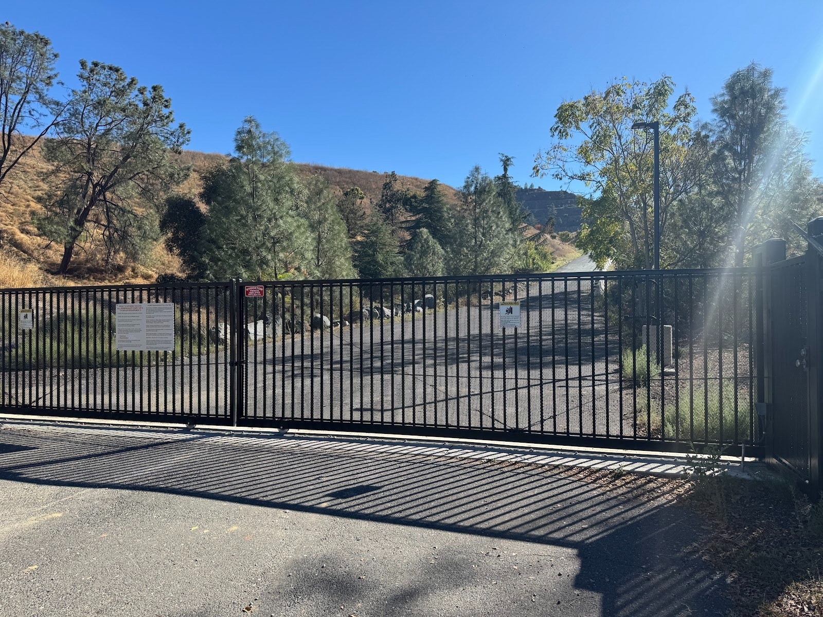
Wanna look? Not so easy, if you're just a drifter.
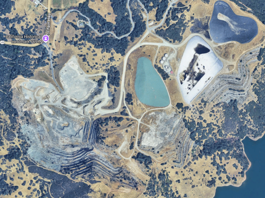
Google Maps earns its keep. The gate in the previous photo is at the purple pin.
The mine is closed, but remediation work continues.

The property now belongs to BHP, one of the biggest mining companies in the world.
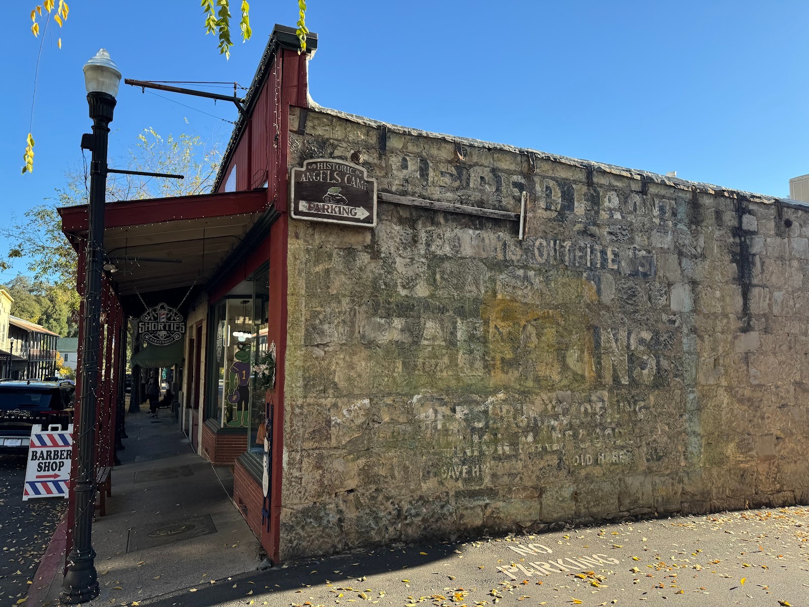
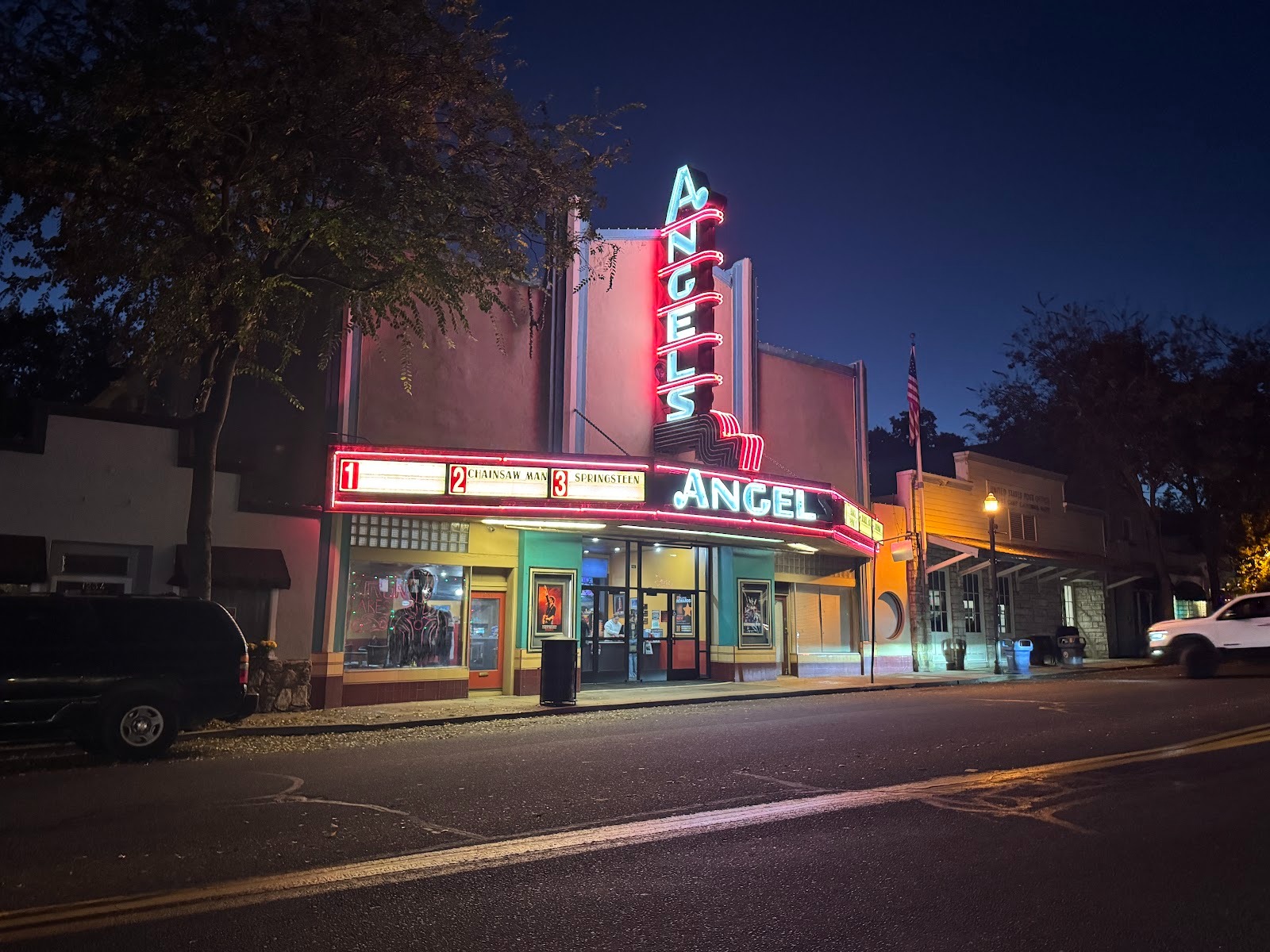
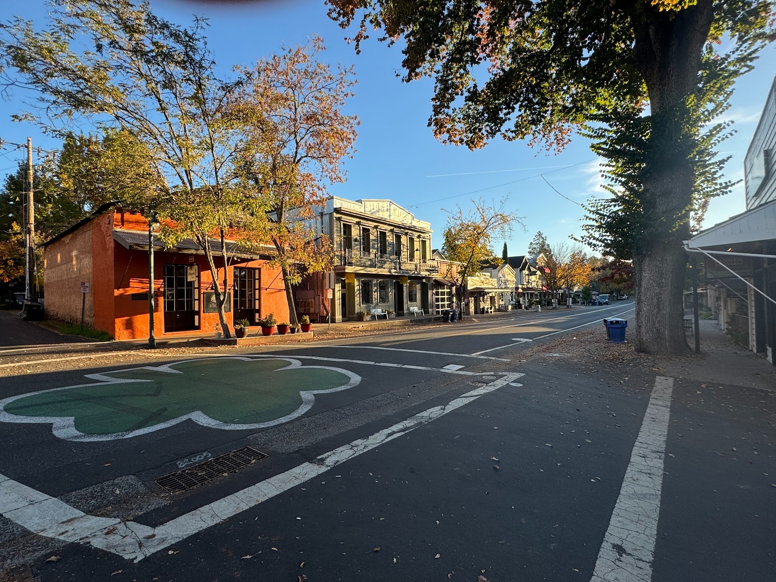
A different world three miles later, where 49 crosses into Angels Camp, named for George Angel, not winged beings.
Sign on the bridge.
The balcony belongs to the Angels Hotel, where Sam Clemens apparently heard the story that changed his life.
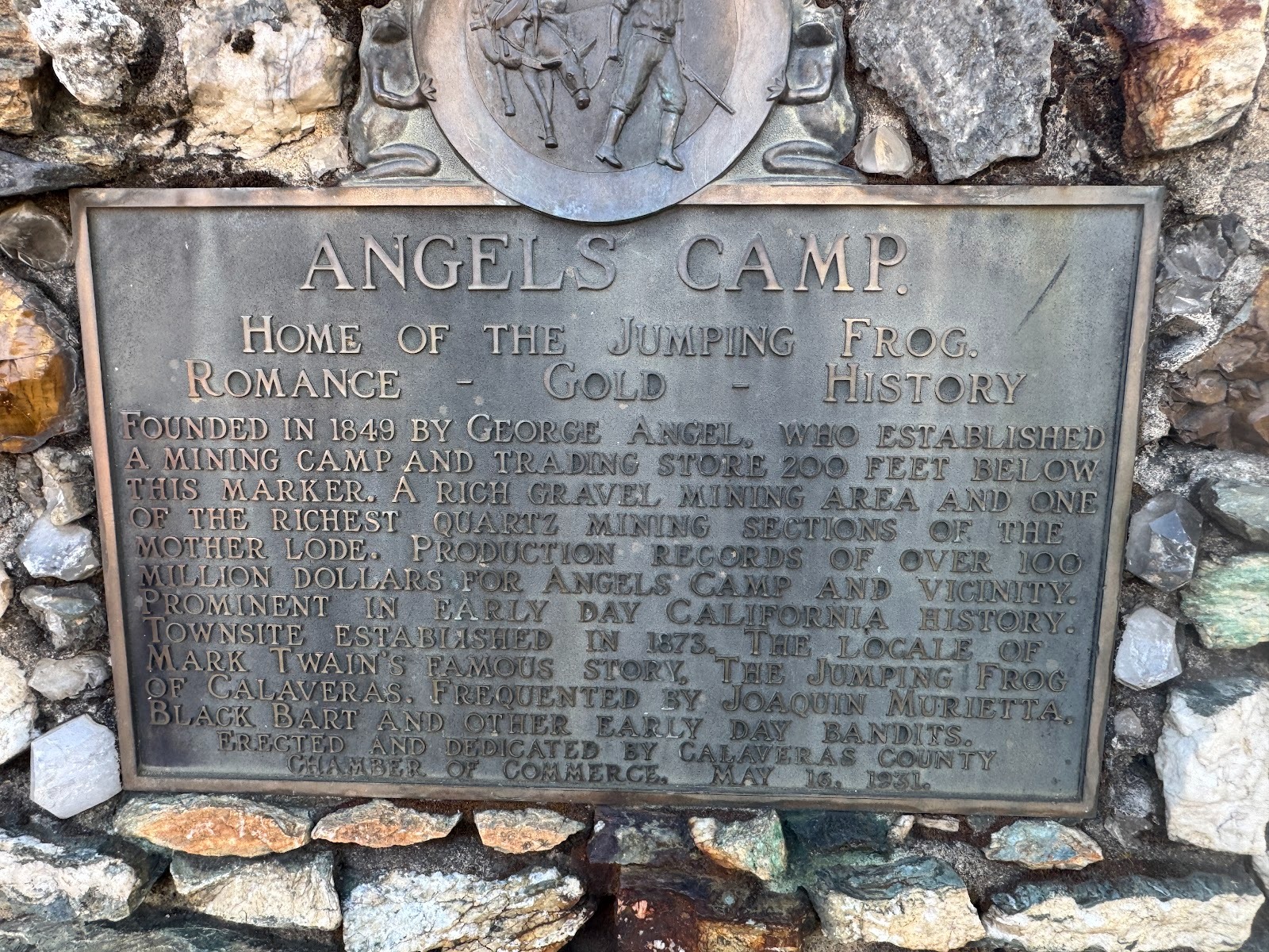
The town makes hay from that frog that didn't jump.
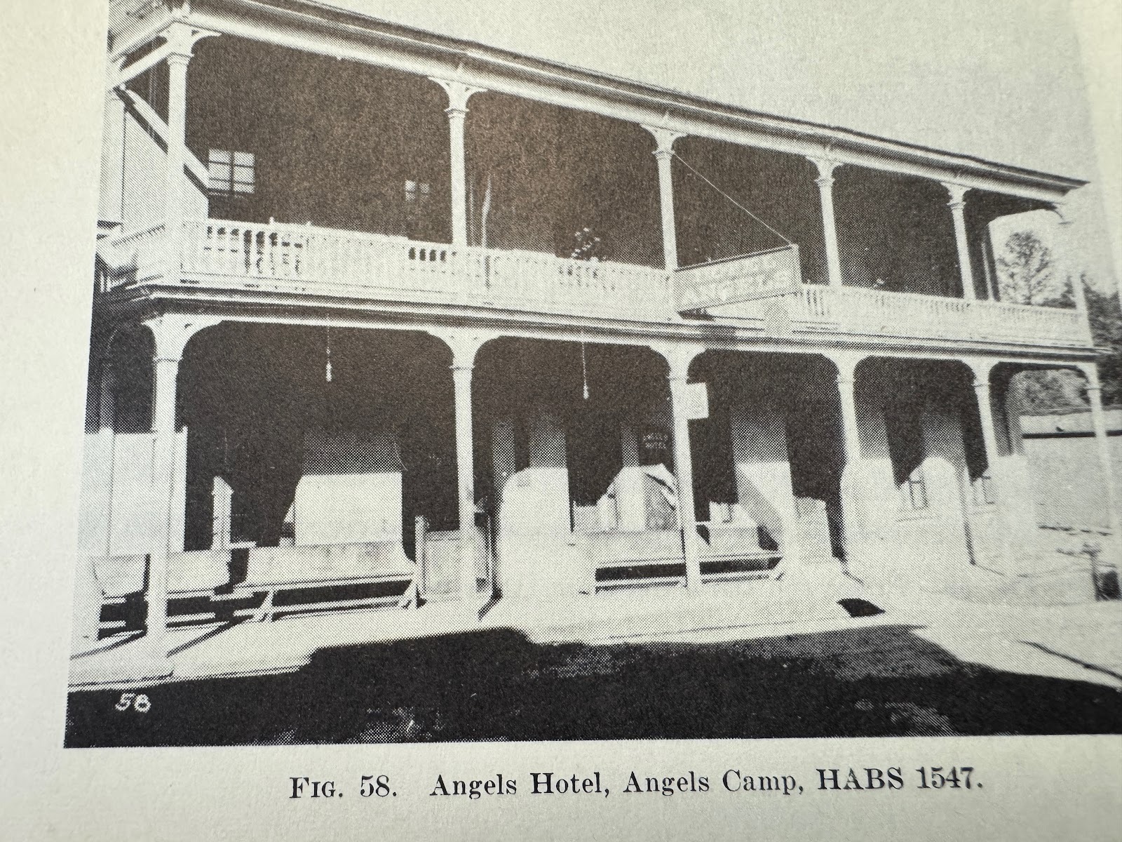
The hotel as it was in the 1940s. (Heizer)
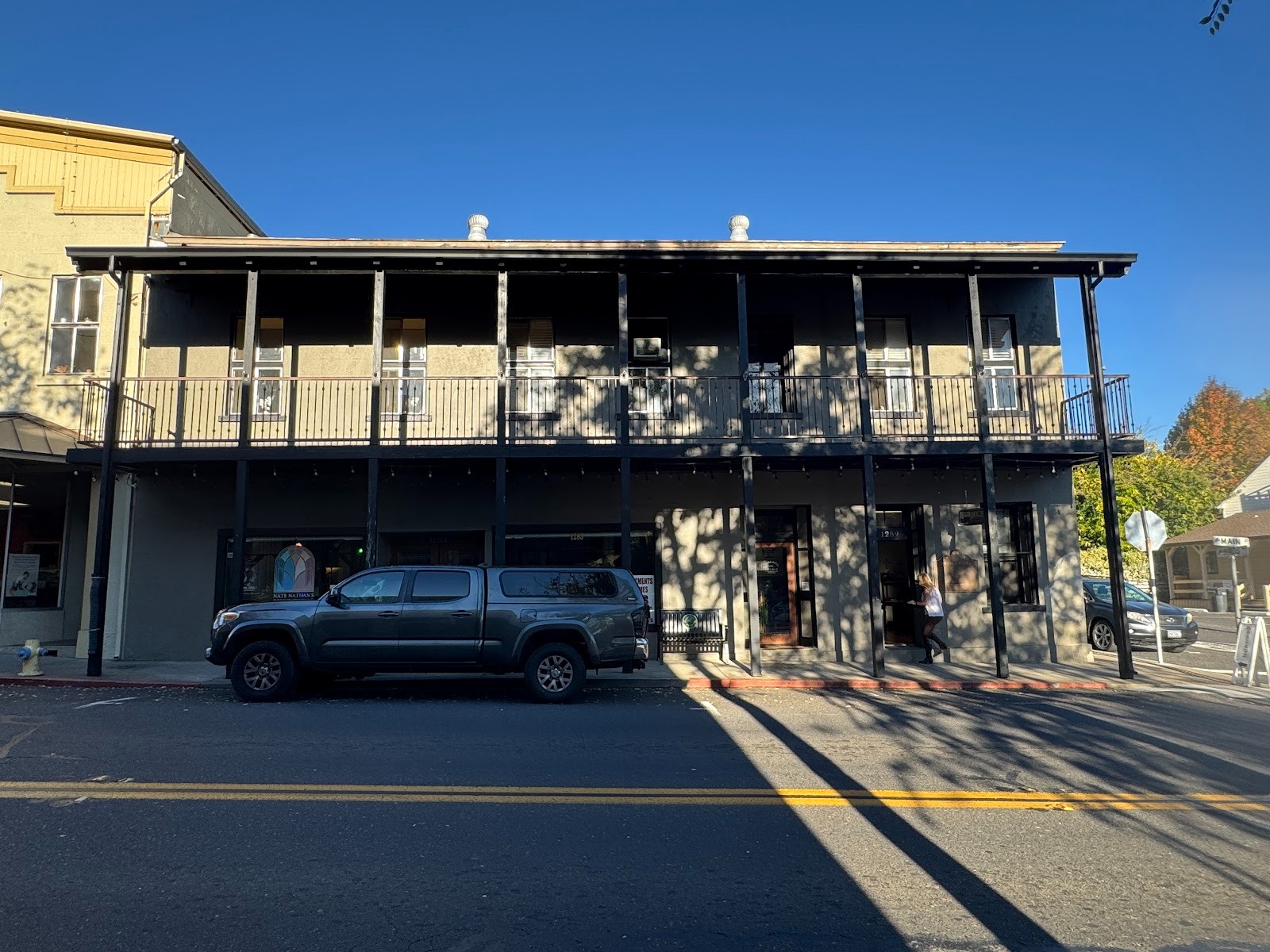
As I saw it, with apartments upstairs and commercial space below.
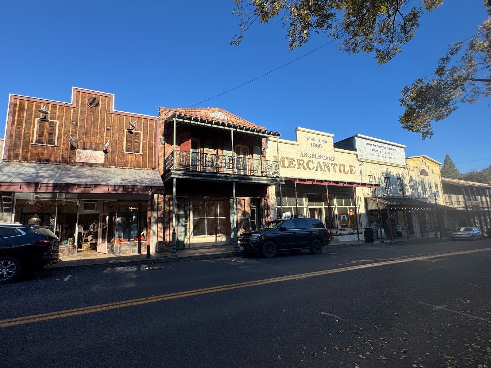
The hotel is at the far right. Want to rent space? Try the Mercantile Building.
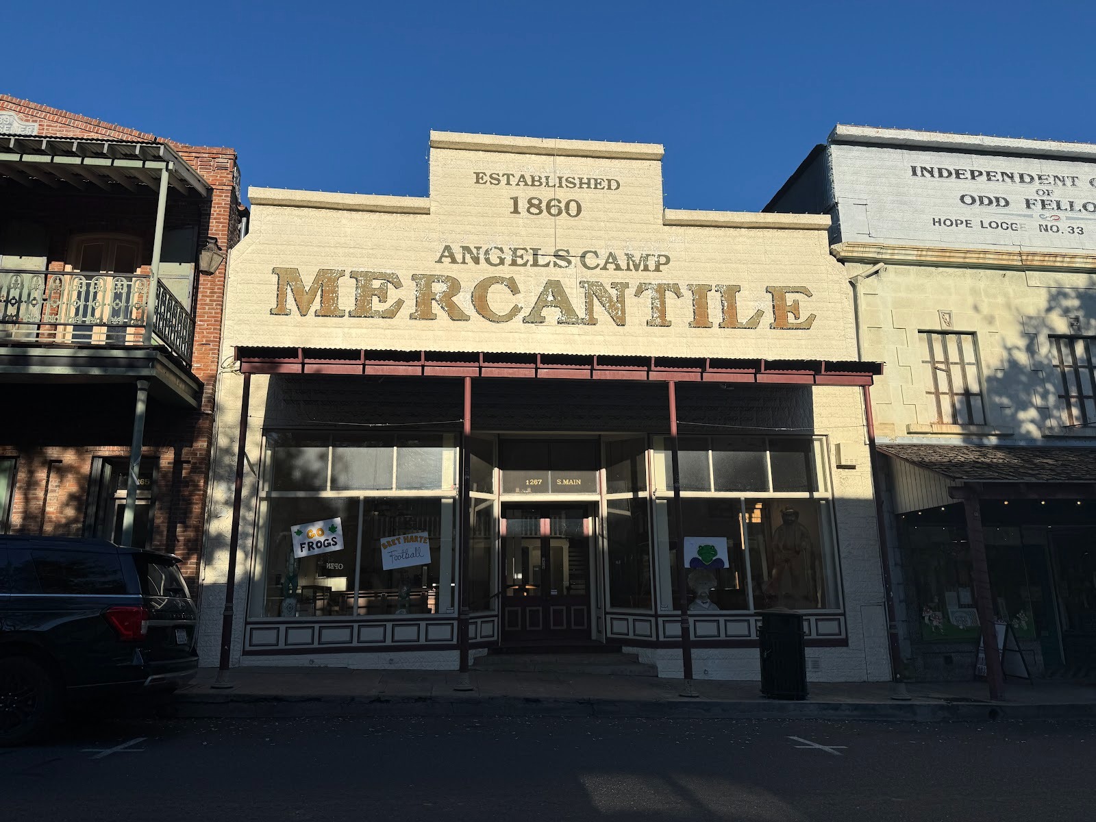
Looks good.
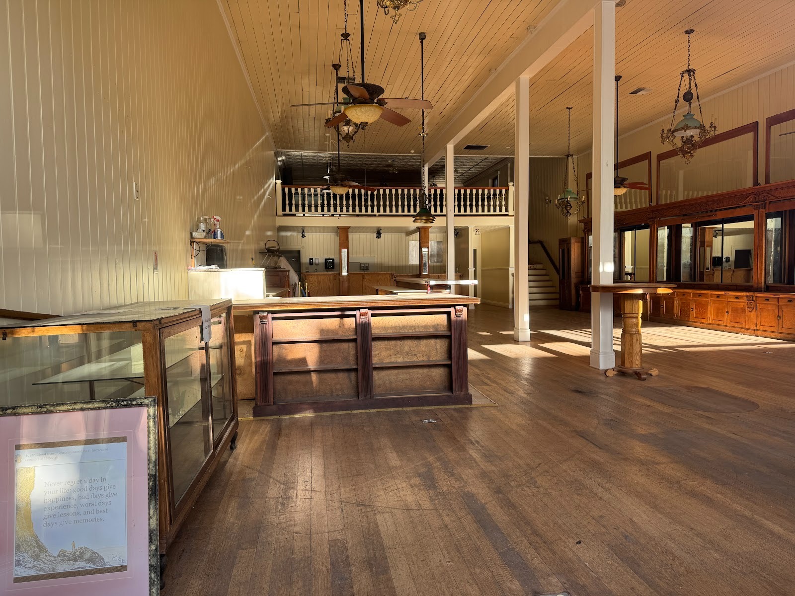
Inside: it's too big or it's too small. And parking's a problem.
On the other side of the street, the massive Angels Creek Restaurant suggests the difficulty of modifying these buildings.
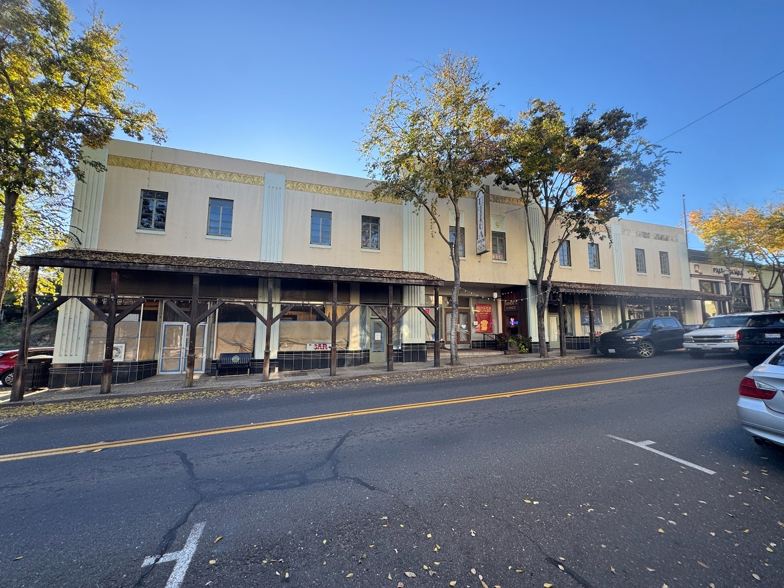
They can be replaced, as here across from Angels Hotel, but that changes the character of the street.
So does this, though it's pretty in the gloaming. (Who says I'm not a poet?)
Result: commercial activities have moved a mile north to Altaville, with space for big-box buildings and still bigger parking lots. This is the shopping center for Calaveras County, which has almost 50,000 people.
The most spectacular home in town is the Utica Mansion, close to the town's historic center. It was built by the owners of the adjoining Utica Mine, which closed in 1915.
There's a lot of simpler stuff climbing up the sides of the hills on both sides of the historic district.
Another example.
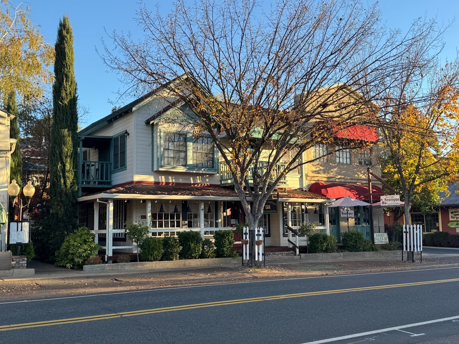
You want something new? We should head up to Murphys (no apostrophe).
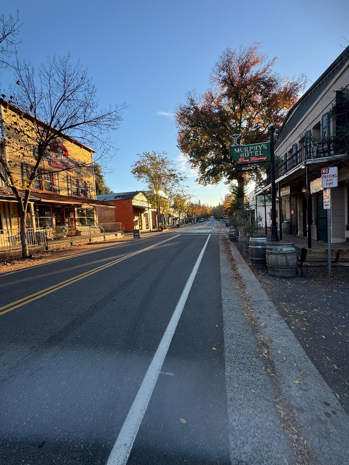
It's quiet because we're early. See the Murphys Hotel sign?
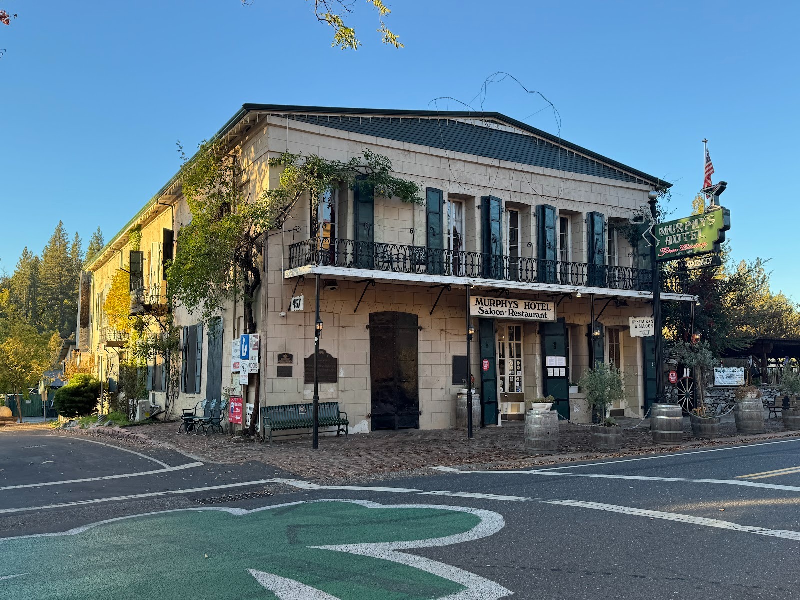
The hotel opened in 1856, became the Mitchler Hotel in 1882, and since 1945 has operated as the Murphys Hotel.
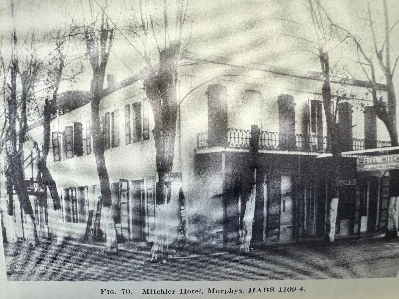
From the early 1940s (Heizer).
You want something newer than the Murphys Hotel? How about this? It's the Victoria Inn.
It opened in 2000 after a remodel of an older place called the Red Bud Inn.
The bright paint belongs to Allegorie, a wine bar.
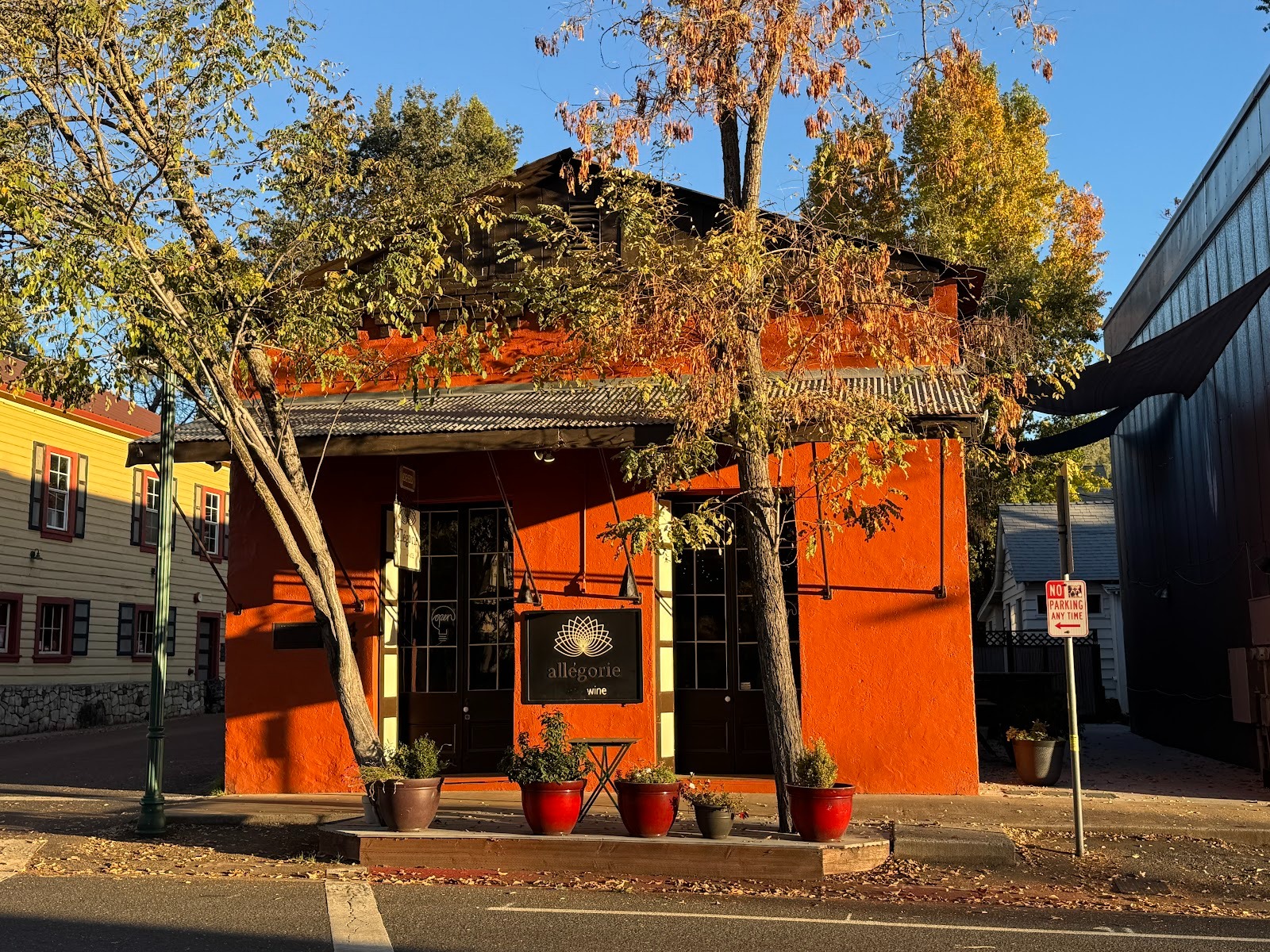
Allegorie started out as the Jones Apothecary, rebuilt with 30-inch-thick brick walls after a fire in 1859.
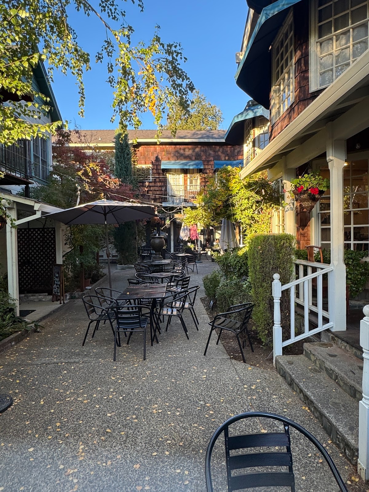
There's competition.
Do you feel the beat, low-key but pervasive?
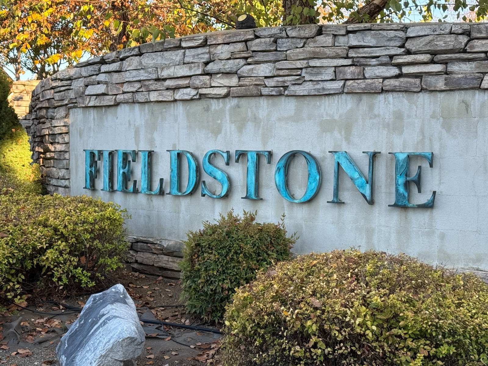
But I forgot: we were looking for a new or newish place to buy when we need to relax. Try this, on the outskirts of Murphys.
It's a masterplanned community. (Don't ask me to explain the difference between "planned" and "master-planned." It's "price" and "price point" all over again.) I happen to have a leaflet for the place on the left, so I can add that it has a "cozy gas fireplace" as well as "solar and Tesla battery storage."
They're all duplexes, about 1,500 square feet, and just shy of 500K.
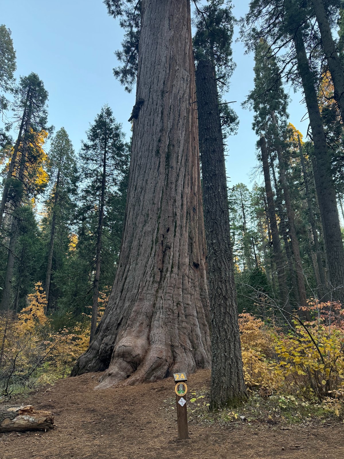
Since we're up here and I'm not a fan of wine bars, let's go another 15 miles up into the mountains to the Calaveras Big Trees State Park. Yes, the name Big Trees is infantile, but it's been around since the 1850s. Here's an anonymous piece from Harper's Weekly, June 5, 1858, p. 357: "Among the many remarkable natural curiosities of the land of gold, not the least is that solitary group of gigantic pines known as the 'Big Trees of Calaveras County.'"
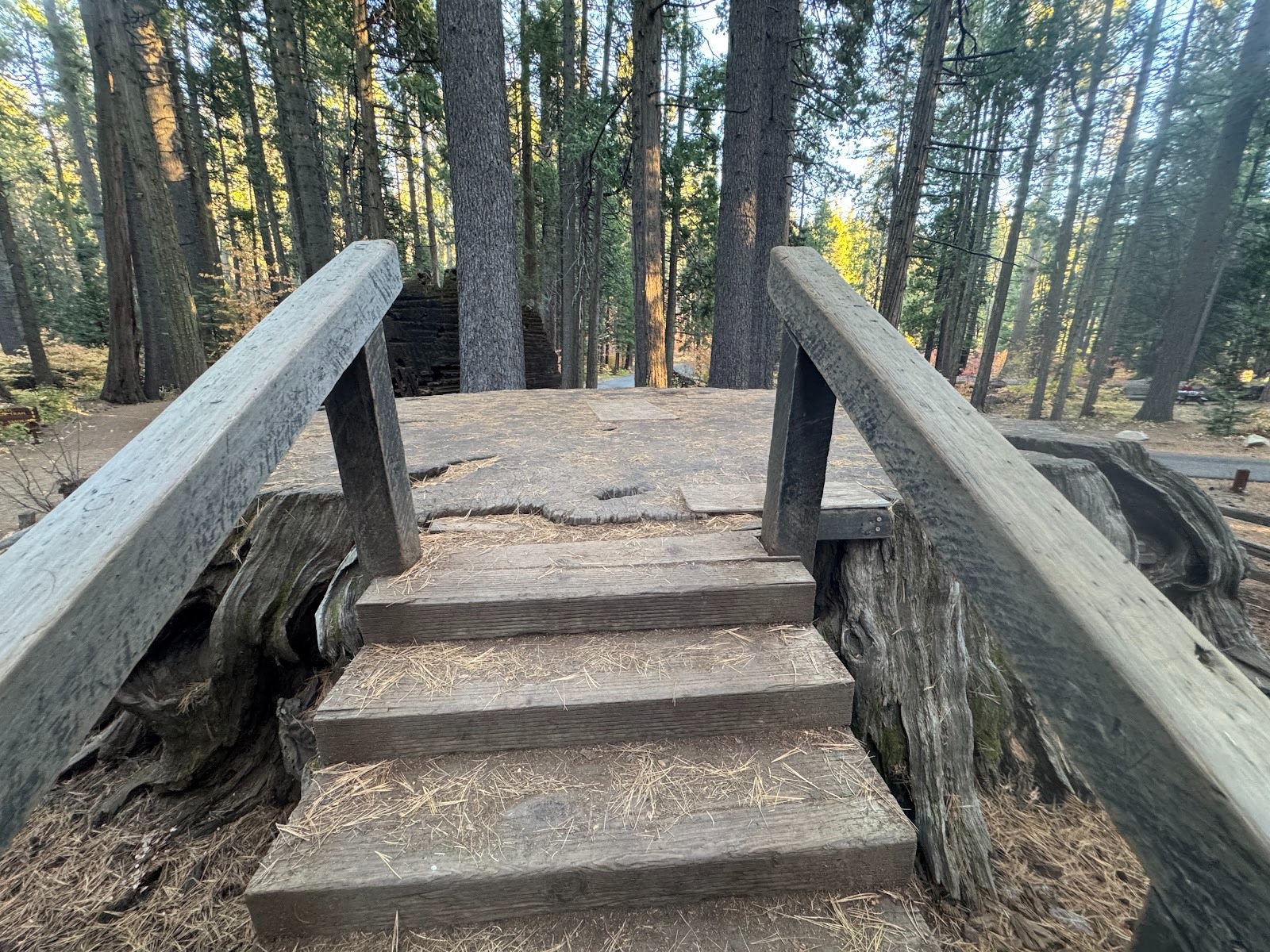
Even then, the grove was privately owned. Not only that: the owner had built a hotel. Next to it, he cut down a Big Tree to make a dancing floor big enough for 32 persons. How great is that?
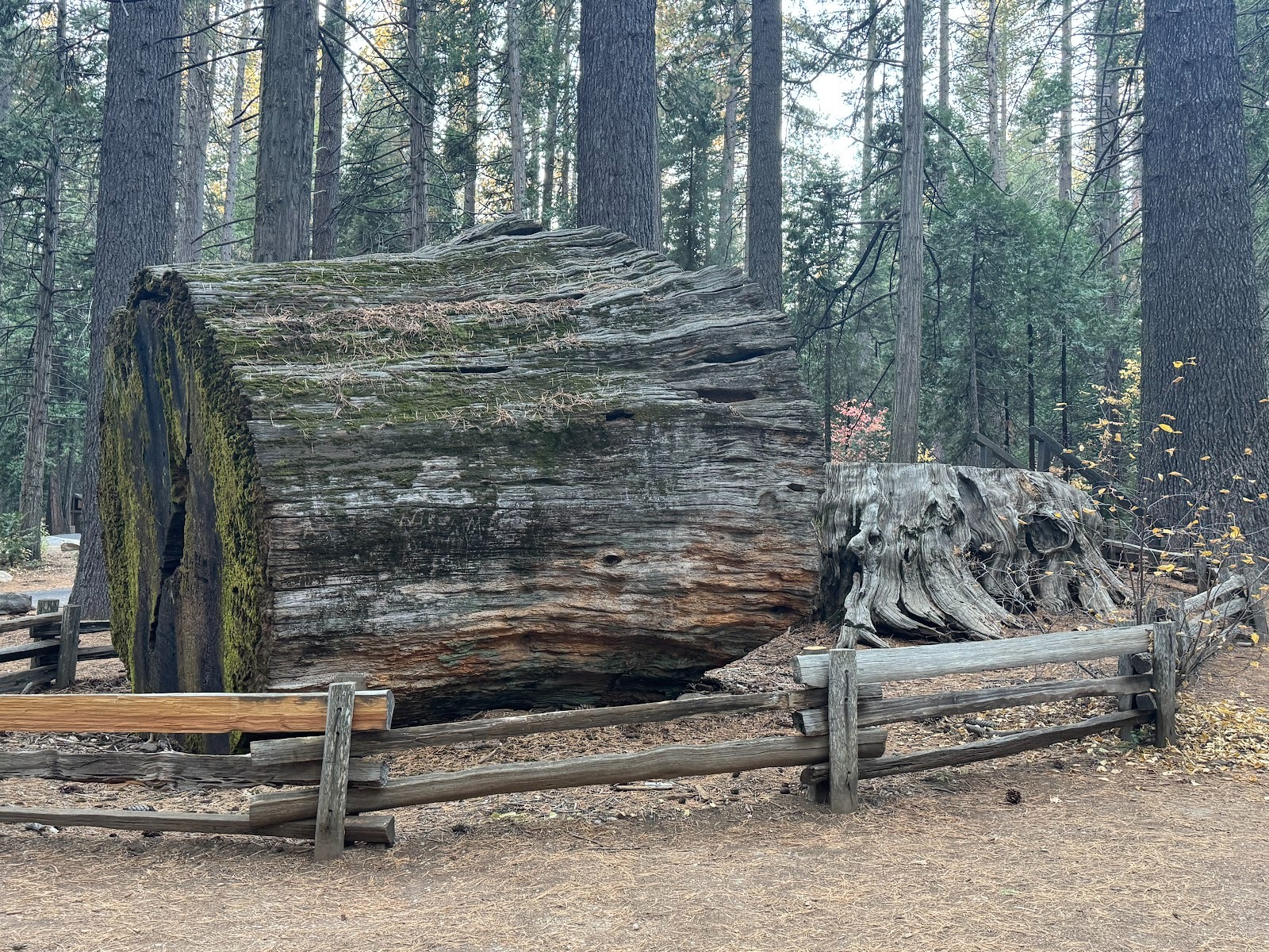
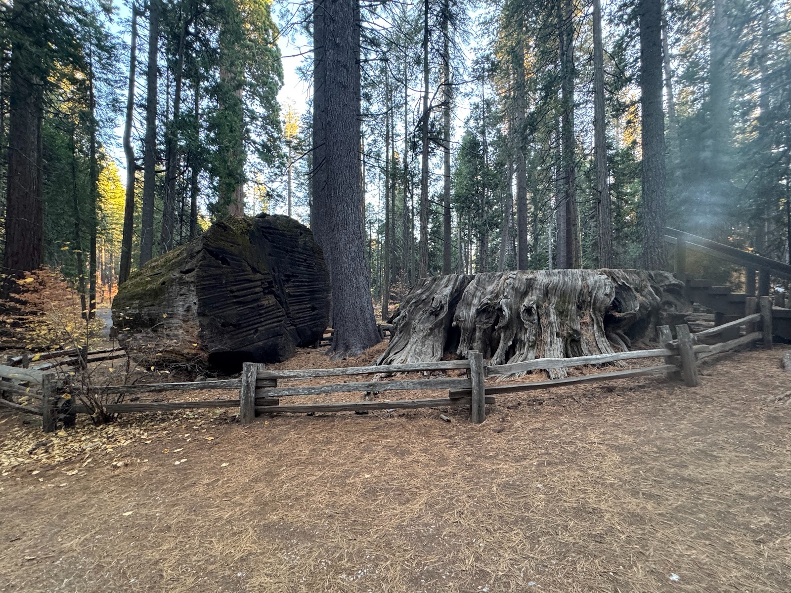
Another view with the stump and a bit of leftover trunk.
The Harper's author was eloquent: "This monster was cut down by boring with long and powerful augers, and sawing the spaces between—an achievement of Vandalism as ingenious as the Chinese refinement in cruelty of pulling out the nails of criminals with pincers." I like that.
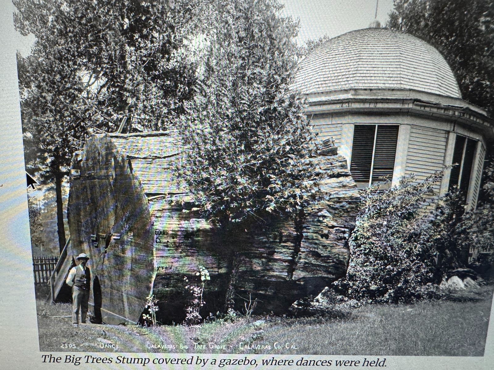
For a while a kiosk or gazebo sheltered the dancers.
(Frances E. Bishop and Judith Cunningham (Marvin), "Big Trees, Early Years," 1988, published online by CalaverasHistory.org)
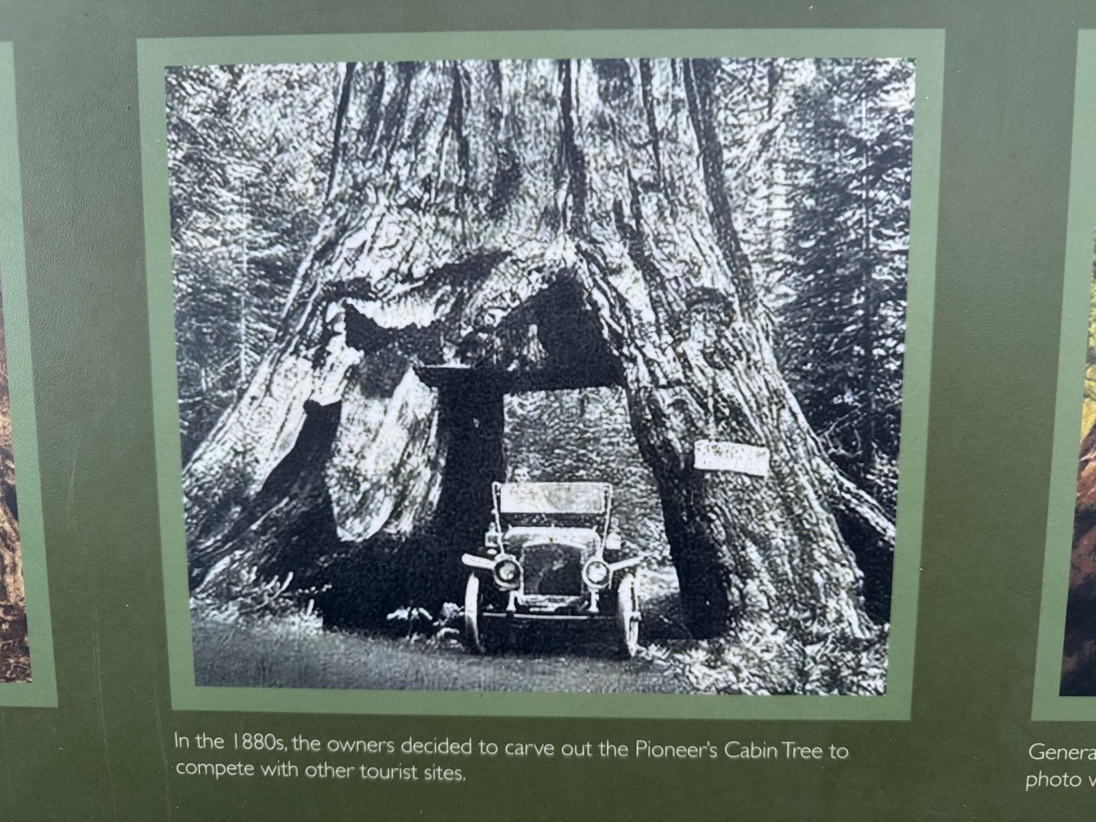
The grove's owners had other creative ideas, too, including making their own copy of the tunnel tree at Wawona. You understand, they couldn't risk falling behind the competition.
The Calaveras tunnel tree fell down in 2017.
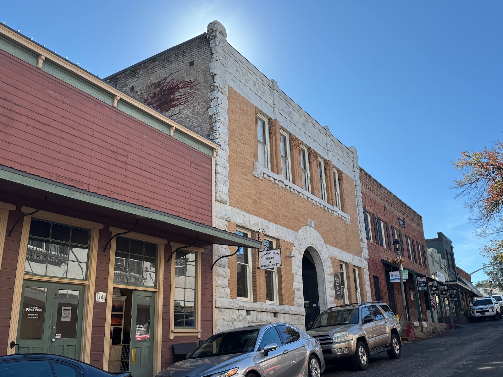
We've gone back to Angels Camp and are on the way to Jackson, about 30 miles up the road. On the way there, we're stopping at San Andreas and Mokelumne Hill, populations 3,000 and 1,000. Here, in San Andreas, the old Calaveras County courthouse, built in 1867, has become an exceptionally good museum.
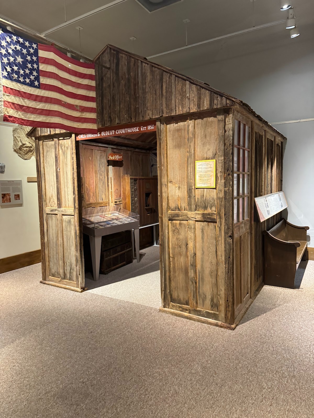
The county's first post office has been moved inside.
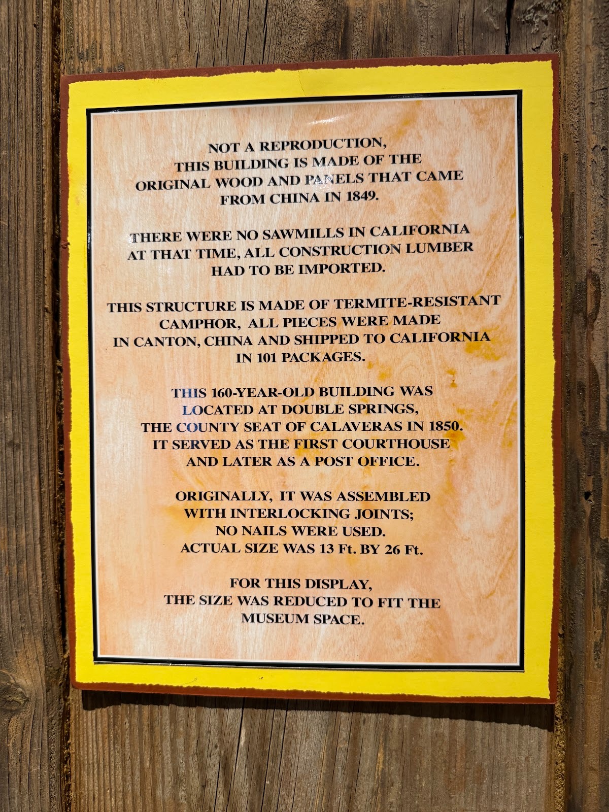
Plaque.
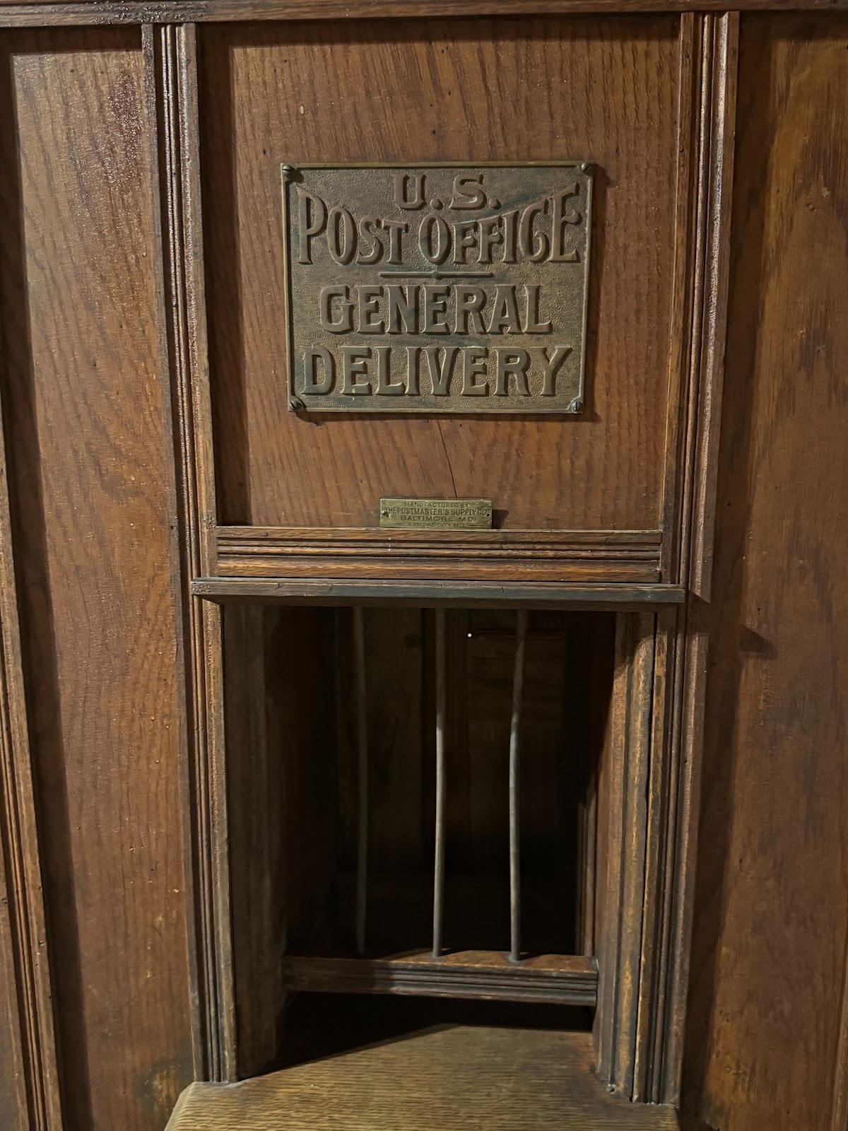
I think I used general delivery only once, in 1963 in Buffalo, N.Y. I thought Buffalo was on the direct path from California to New York City.
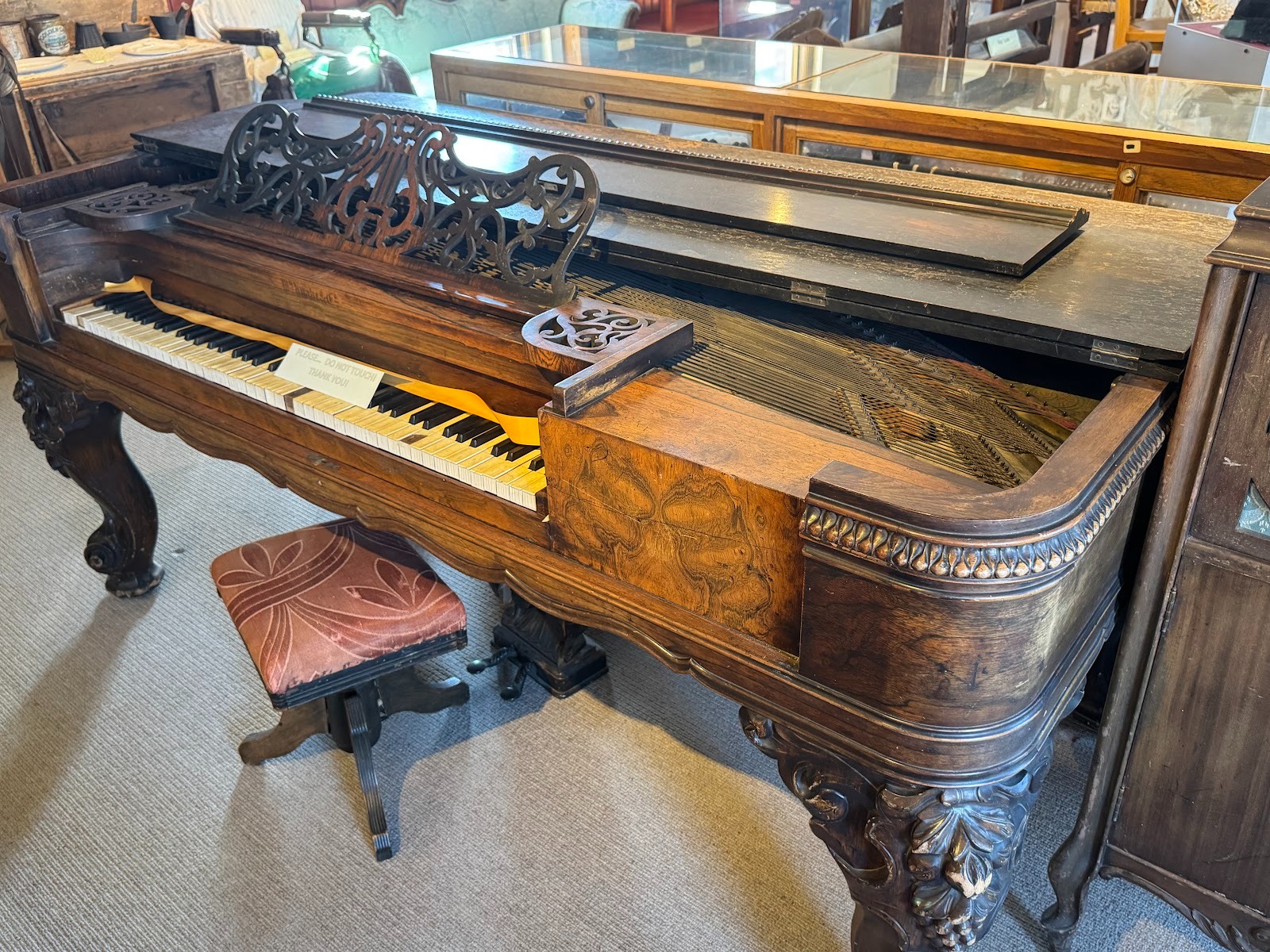
I do hate pianos with missing ivories. It's the stuff of bad dreams, especially when it escalates to broken keys.
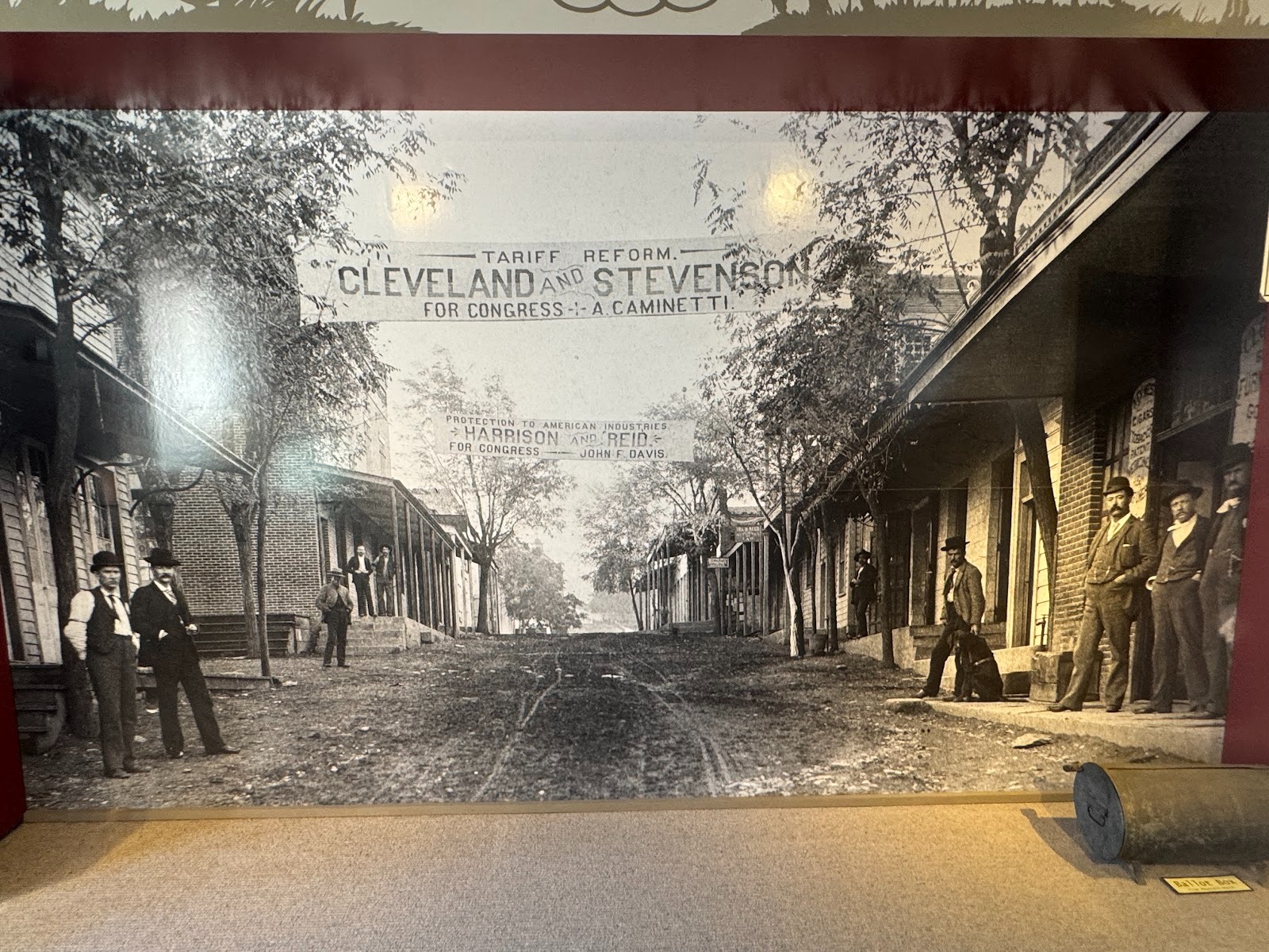
A photo, in the museum, of the San Andreas main street during the presidential campaign of 1892.
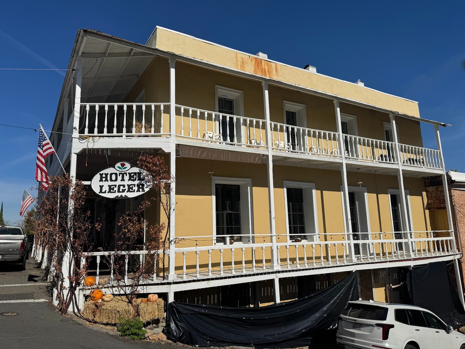
Another eight miles up the highway we come to Mokelumne Hill and its locally famous Leger Hotel.
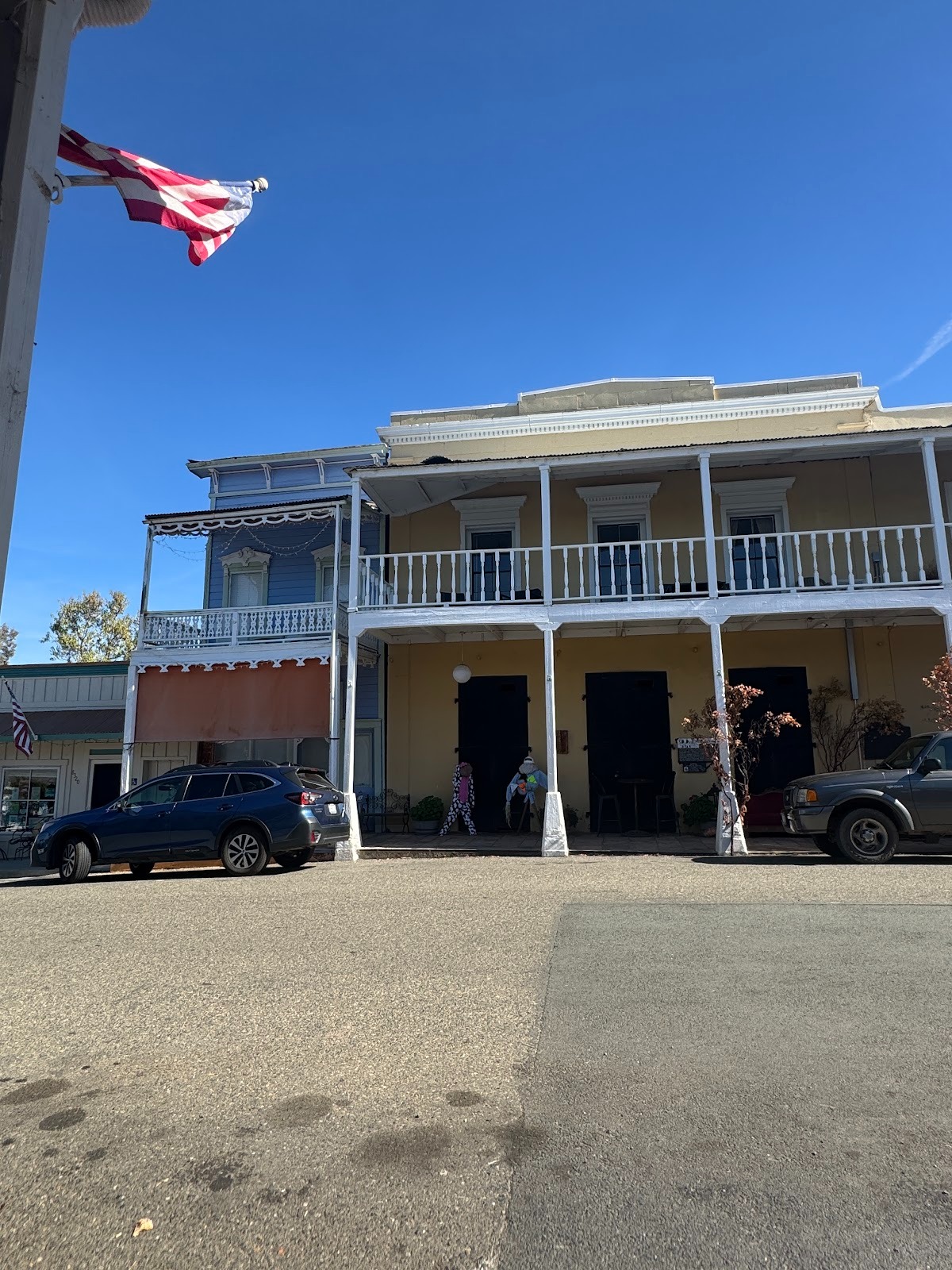
Uninspired front view.
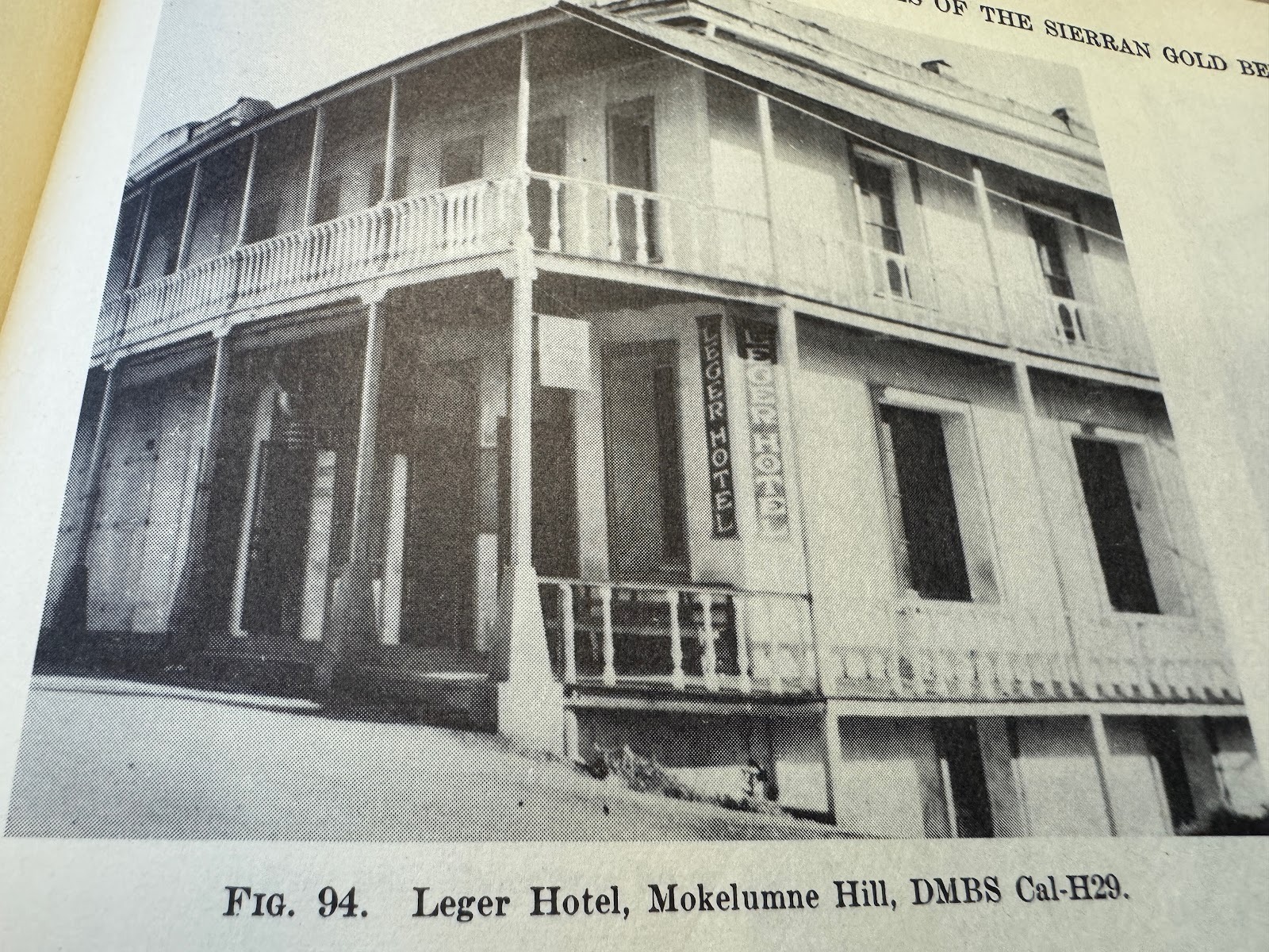
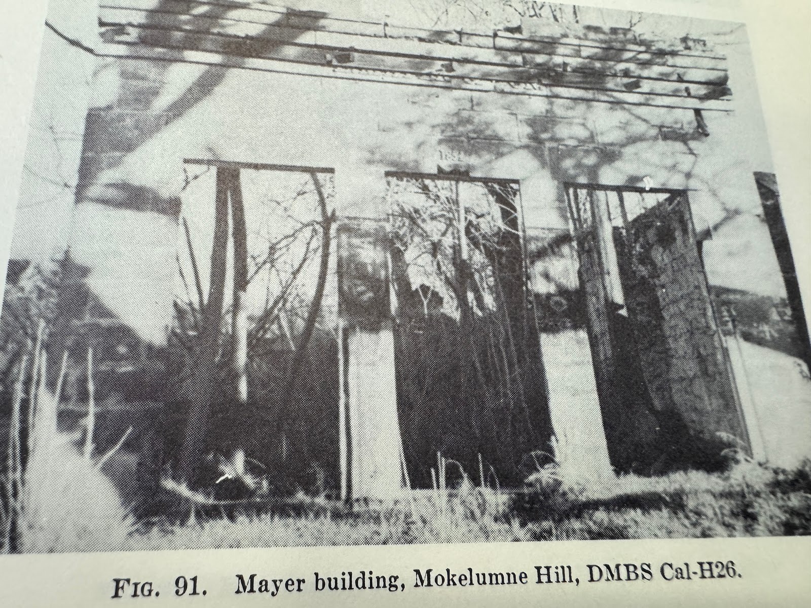
A photo from the 1940s (Heizer).
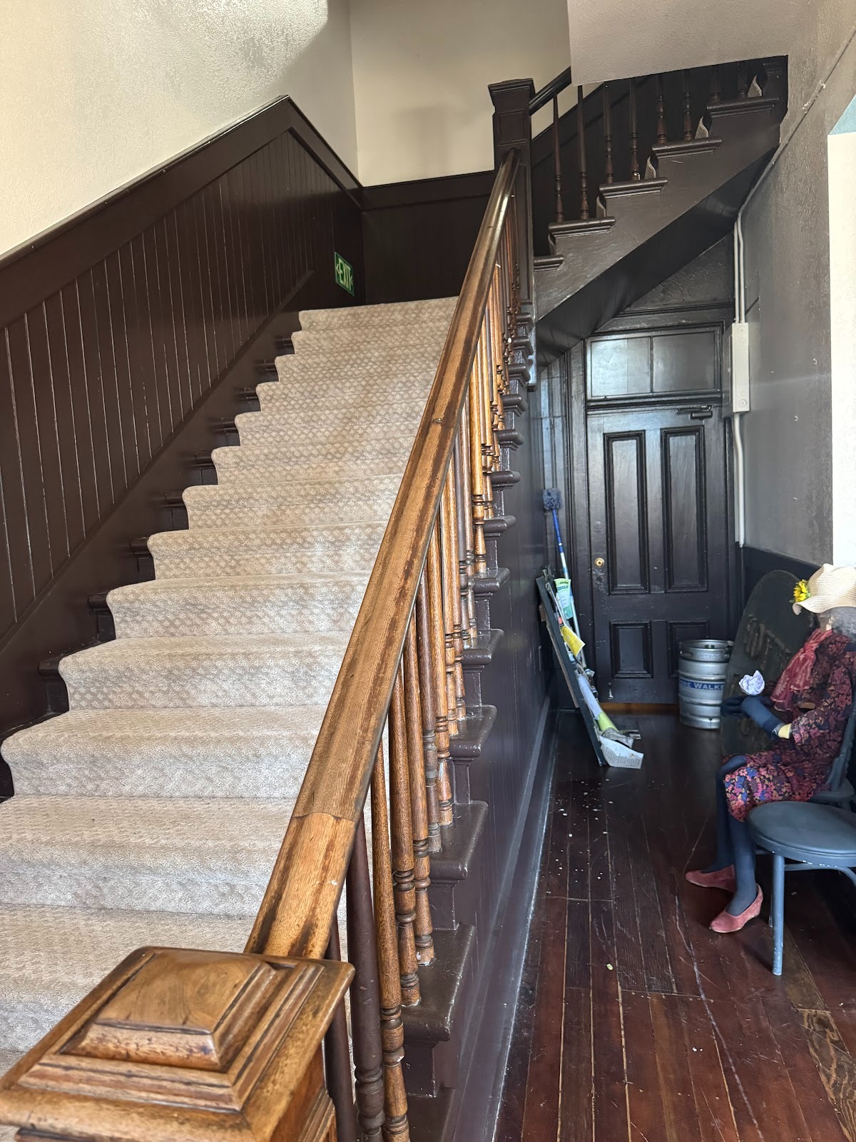
How do you like them stairs? No bellboys. Have at it.
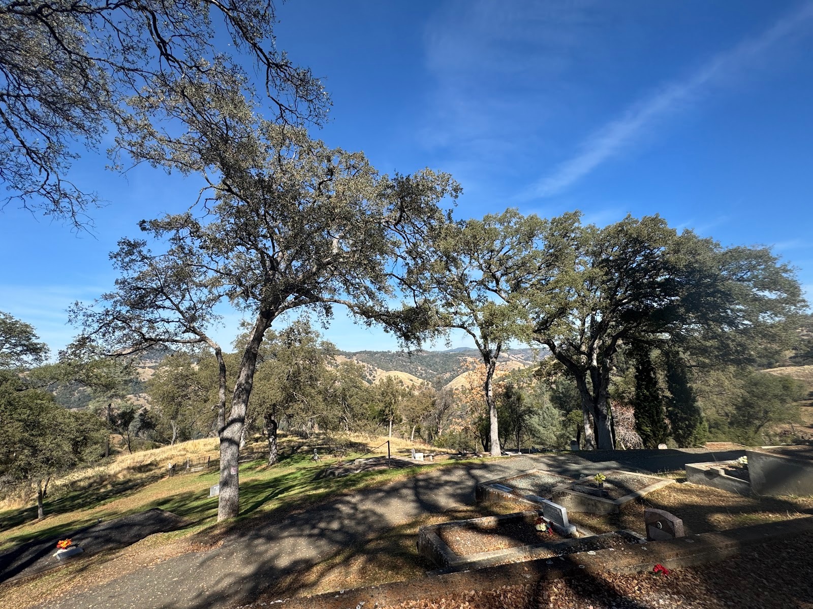
We've come up to the town's cemetery for a reason.
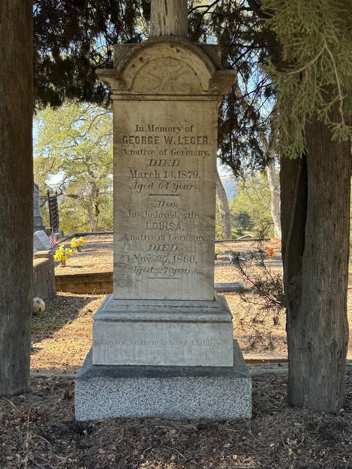
Here it is: the Leger Hotel's owner, dead at 64 in 1879.
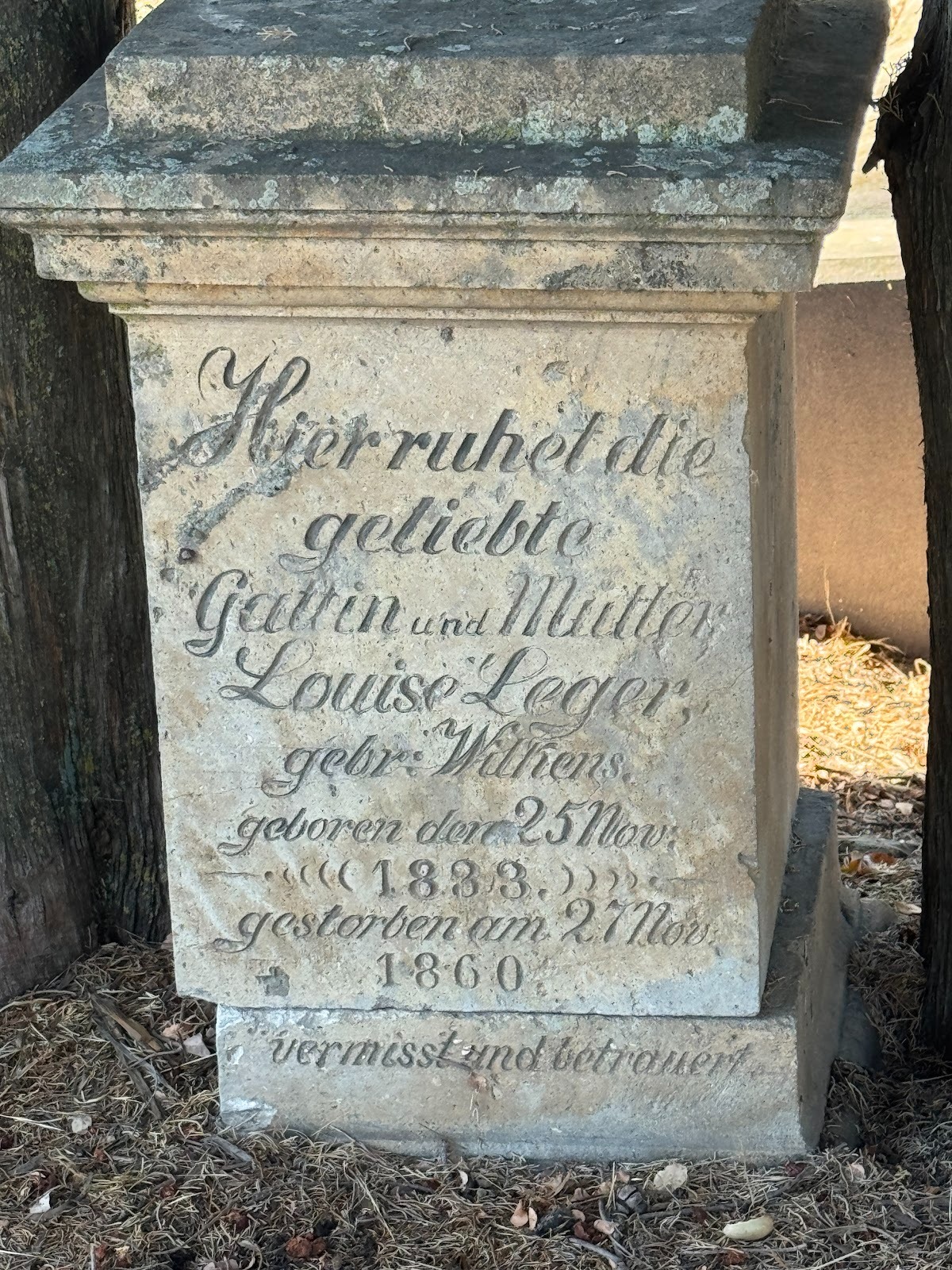
An even better reason is his wife, who died much earlier and who her husband memorialized in their mother tongue.
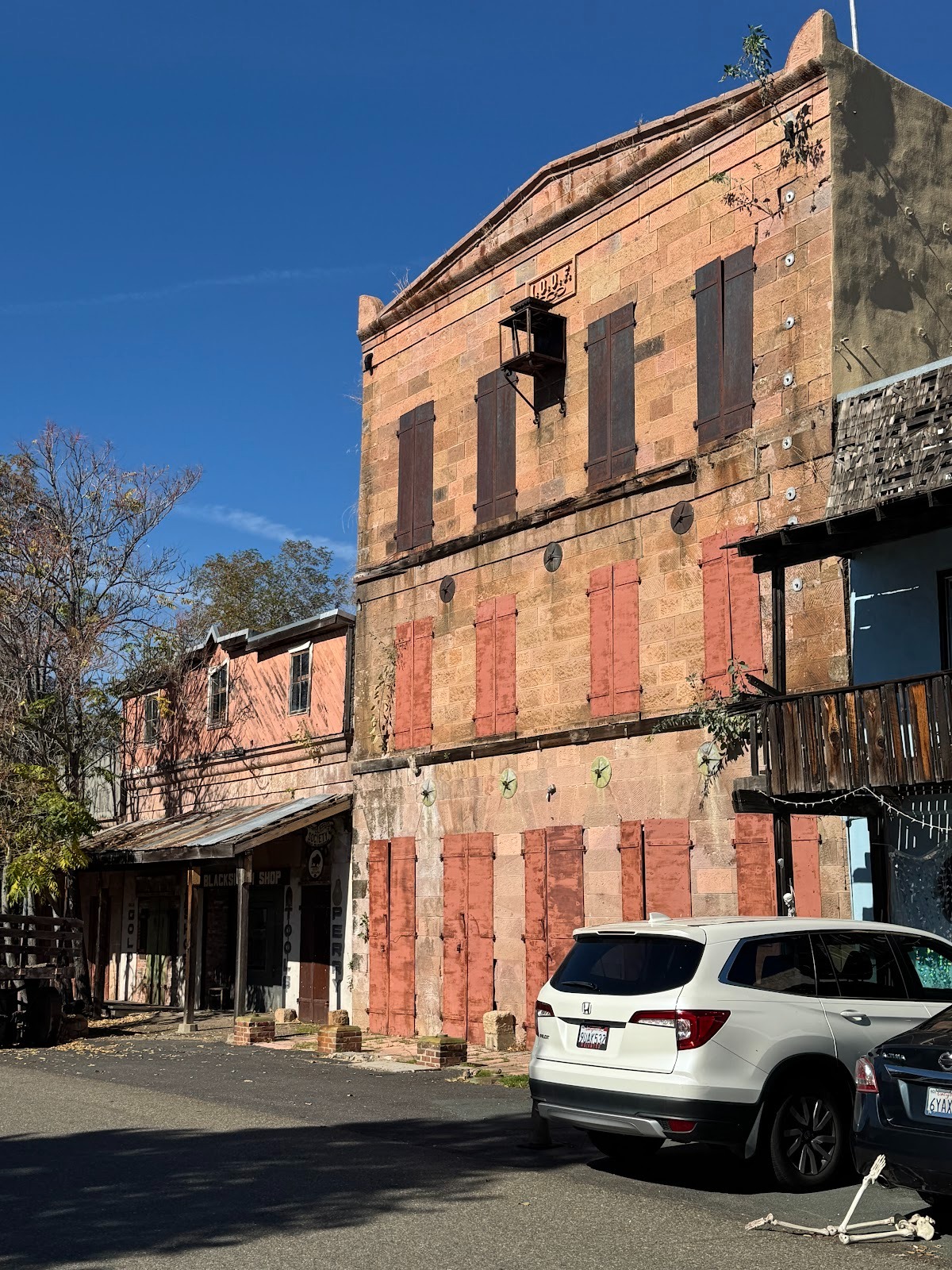
This IOOF building was built in 1854 with two stories and then raised with a third in 1861 after the IOOF bought it so the organization would have a place to hold meetings. They were held up top.
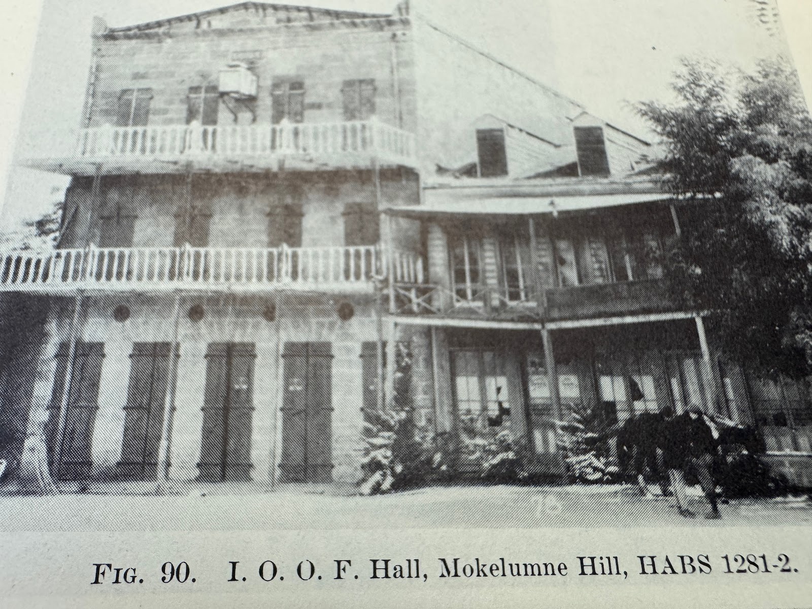
Their used to be balconies. (Heizer)
A noble ruin, which you might expect to find somewhere around the Mediterranean. The stone is rhyolite tuff, locally quarried.
Lower your expectations: it served for 30 years as a "barber shop and store" (Heizer).
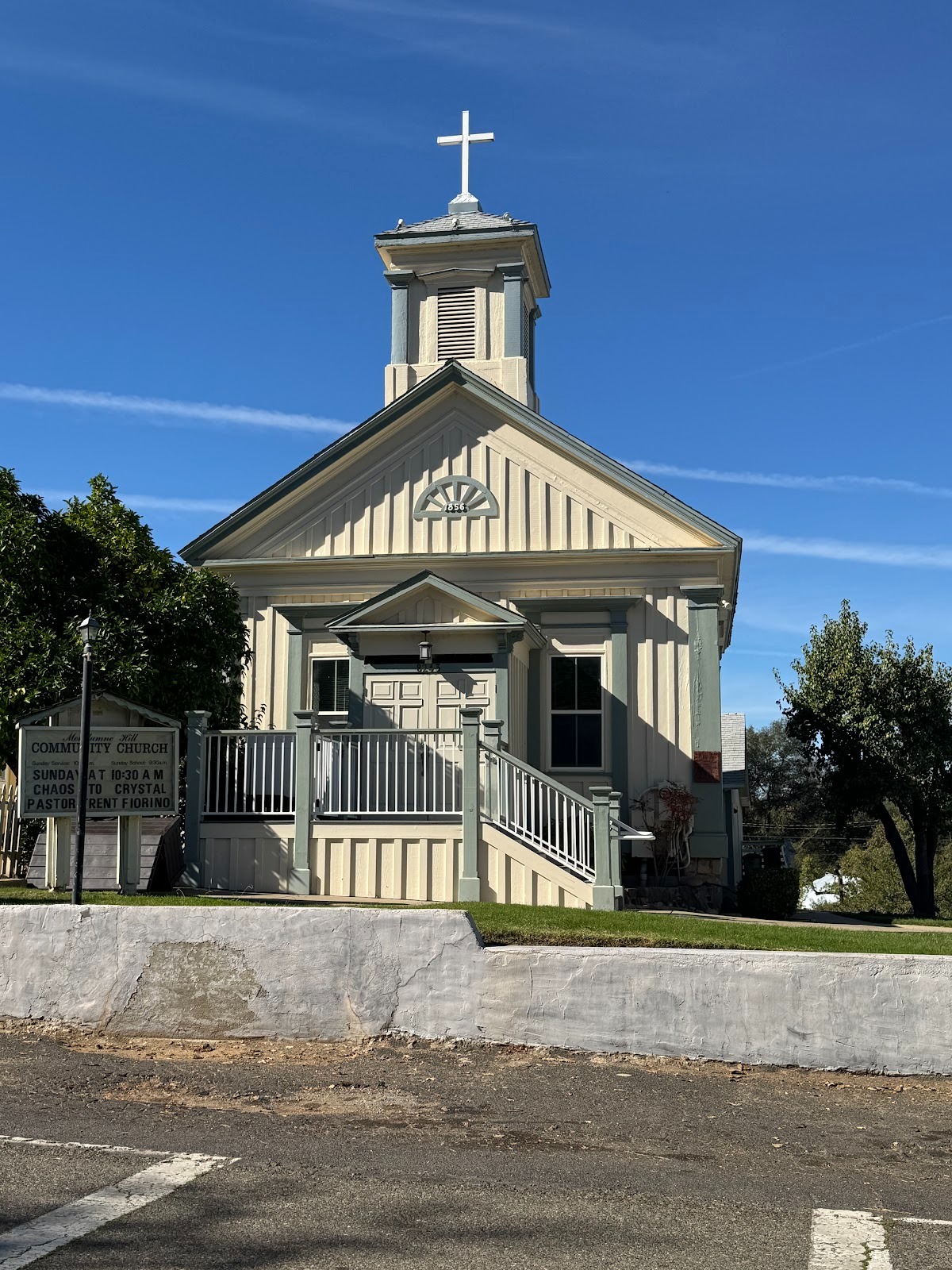
Mokelumne Hill also has the state's oldest Congregational Church, from 1856.
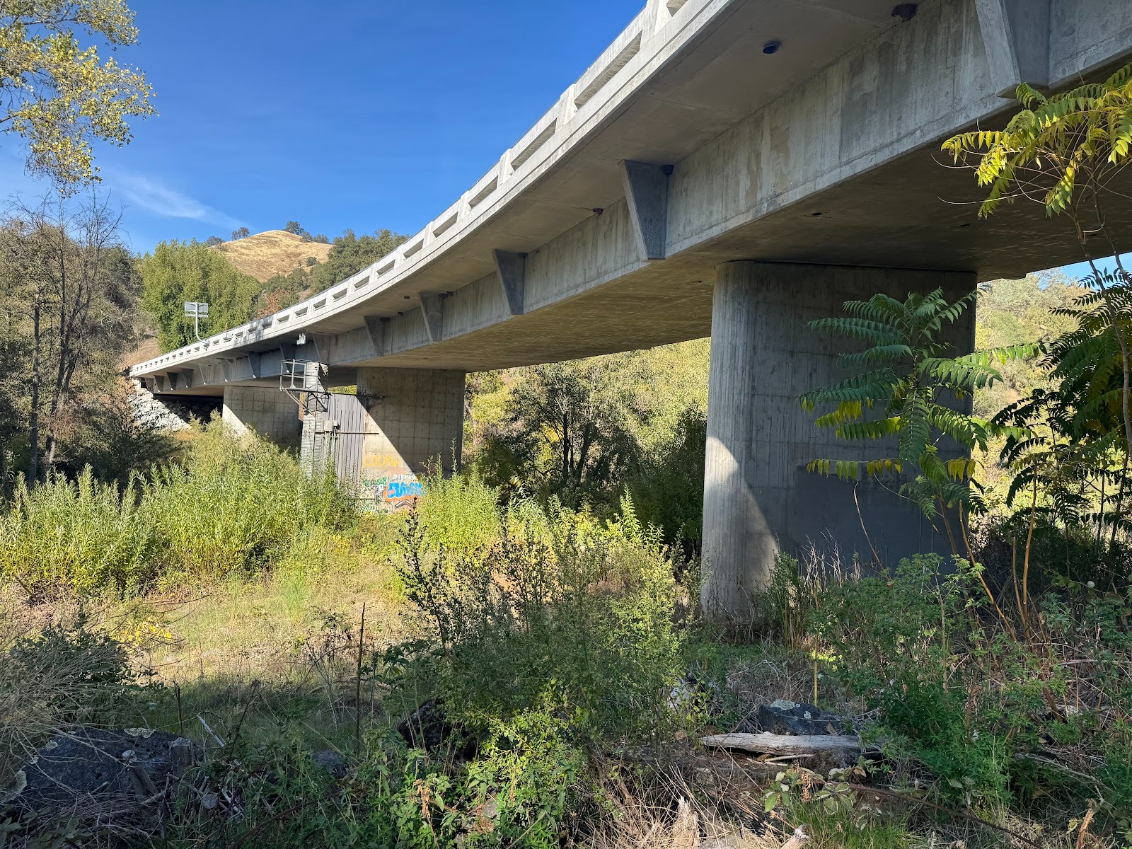
Time to change partners, I mean counties. We're at the North Fork of the Mokelumne River, which means we're moving on from Calaveras to Amador County, where we will look at Jackson, Sutter Creek, Amador City and (detouring to the east) Volcano. It's only a few miles to Jackson, then four miles from Jackson to Sutter Creek and only two more to Amador City. Why so many towns so close together? Answer: these places were set up by placer miners travelling on foot or mule.
The North Fork of the Mokelumne, note, is the first free-flowing river we've crossed. Yes, there's a dam downstream (Pardee Dam and Reservoir, for Oakland's drinking water), but it doesn't back up this far. Remember the Wild and Scenic Rivers Act of 1968? Seems long ago and far away. Time to toast the memory of Senator Frank Church.
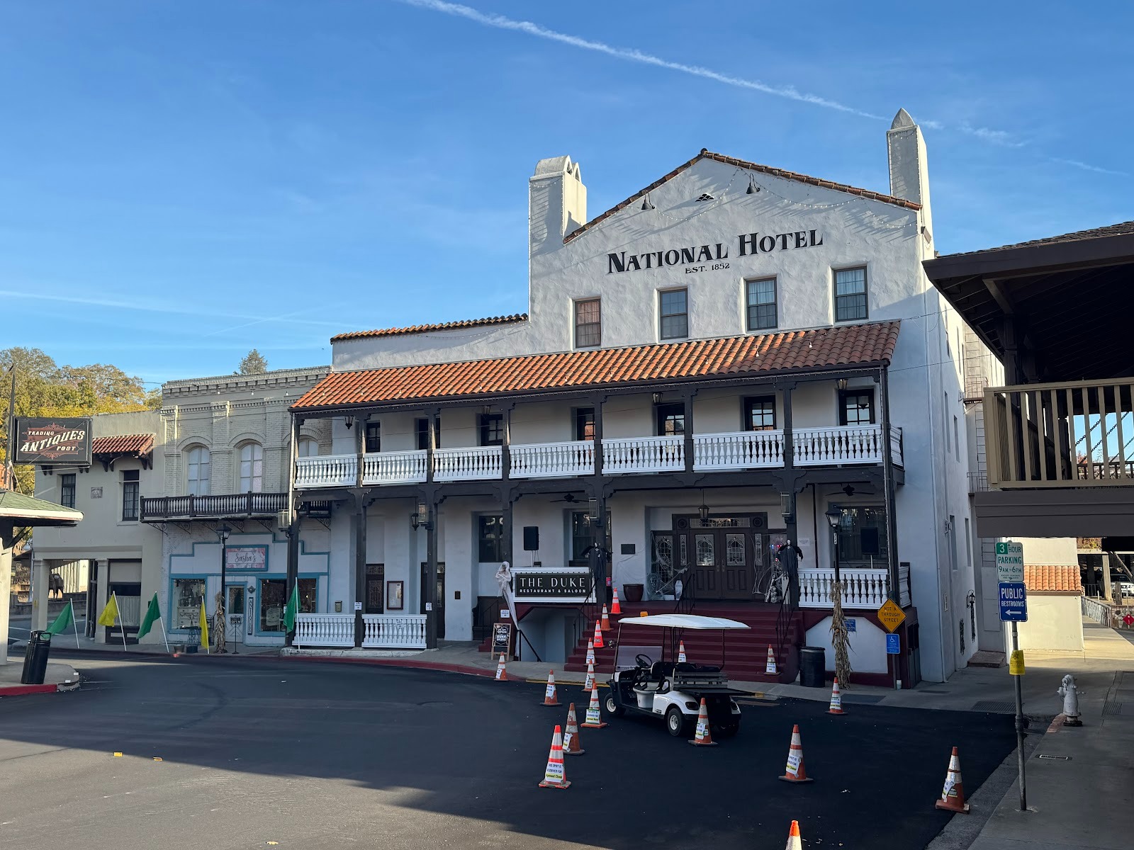
Made it to Jackson and the National Hotel, from 1852. The third floor was added in 1927 and the Spanish atmosphere arrived about 1940. With further renovations, the hotel opened under the Hilton flag in 2012. The hotel backs up against Jackson Creek, while this, the front side, looks up the town's main street.
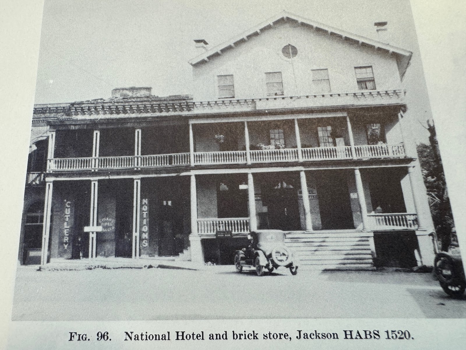
An earlier incarnation (Heizer).
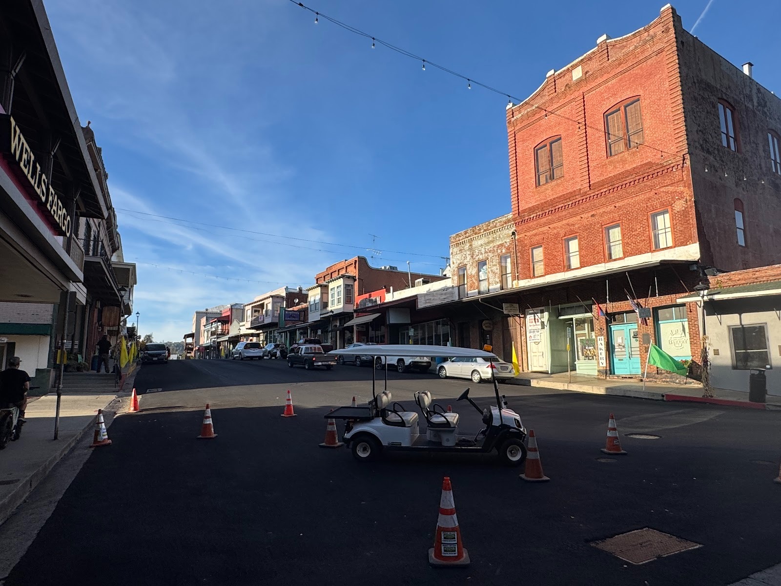
Looking up Main Street from the hotel. It's late in the day. That's another IOOF building on the right, again with a third floor added after the fact, in this case in 1904.
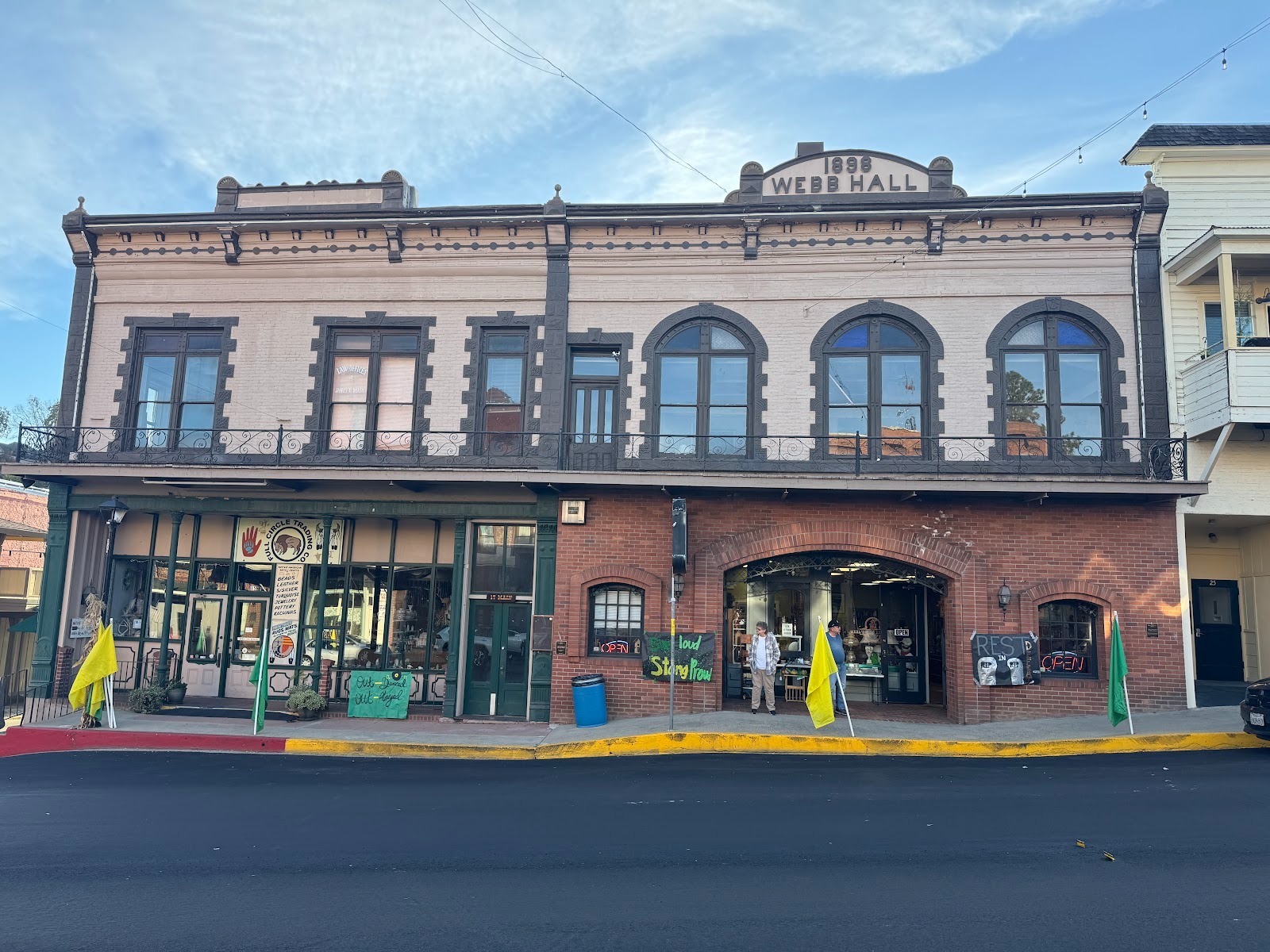
The National is just to our left. Webb Hall is on the site of what, until 1908, was a livery stable. It became the office of The Amador Ledger, edited by an English immigrant, Richard Webb. The ground floor was remodelled in 1977 and is now a pawn shop. Apparently there's a dentist upstairs.
The town burned in 1862 and was rebuilt in brick. In the distance you see a three-story building.
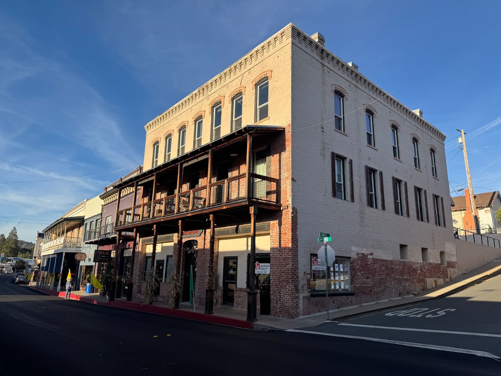
It was the Globe Hotel. It's no longer a hotel, and it has lost its third story balcony.
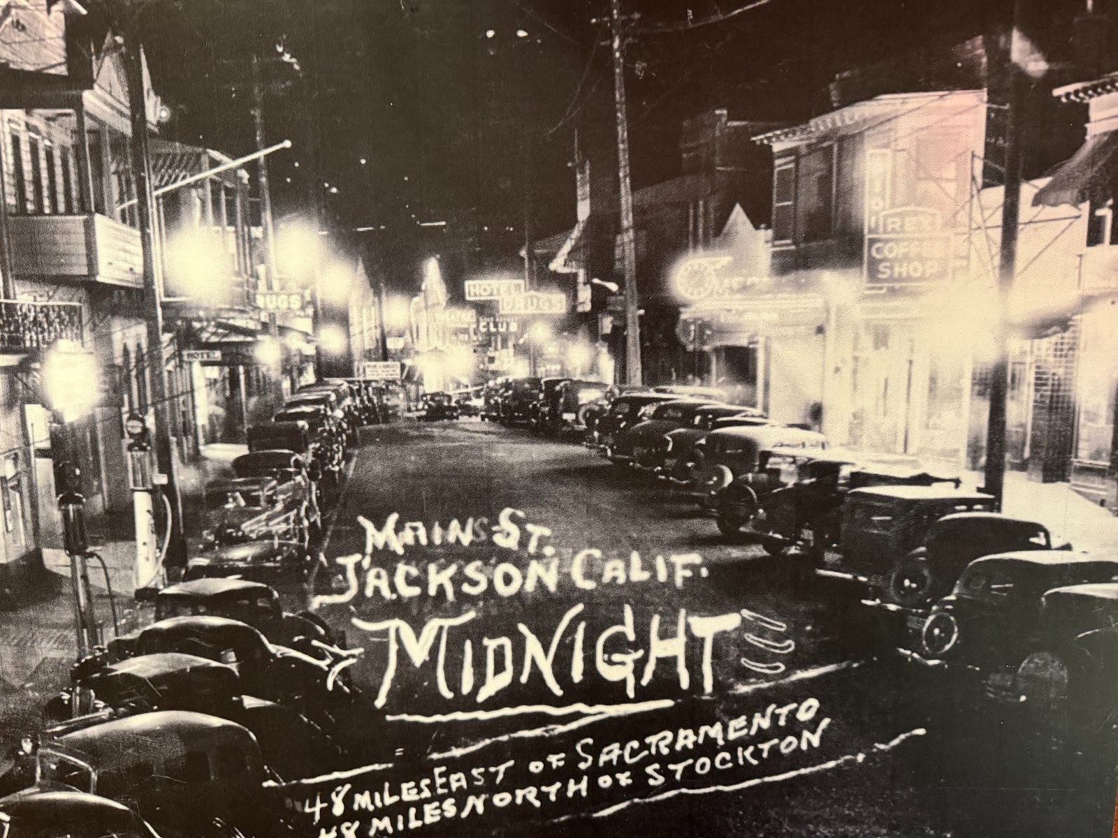
The town looks more exciting in this night view. The National Register of Historic Places, in its report on Jackson's downtown historic district, reports that "prohibition shut down the most popular type of business in the district. About half the twenty saloons there did not reopen when selling alcohol became legal again in 1933. Main Street still provided diversions, now including movies as well as gambling and prostitution."
Like Murphys, Jackson has new residential areas. Here's Jackson View Estates, with three floor plans averaging 2,000 square feet for 500K. The developer is Roseville's Advantage Group. Here's a Zillow posting: "BUILDER NEEDS TO SELL STANDING INVENTORY!!!! TAKE ADVANTAGE OF SEVERE PRICE ADJUSTMENT!!!!! Lovely brand new 3 bedroom, 2 bath home in gated active adult community of Jackson View Estates in charming foothill town of Jackson."
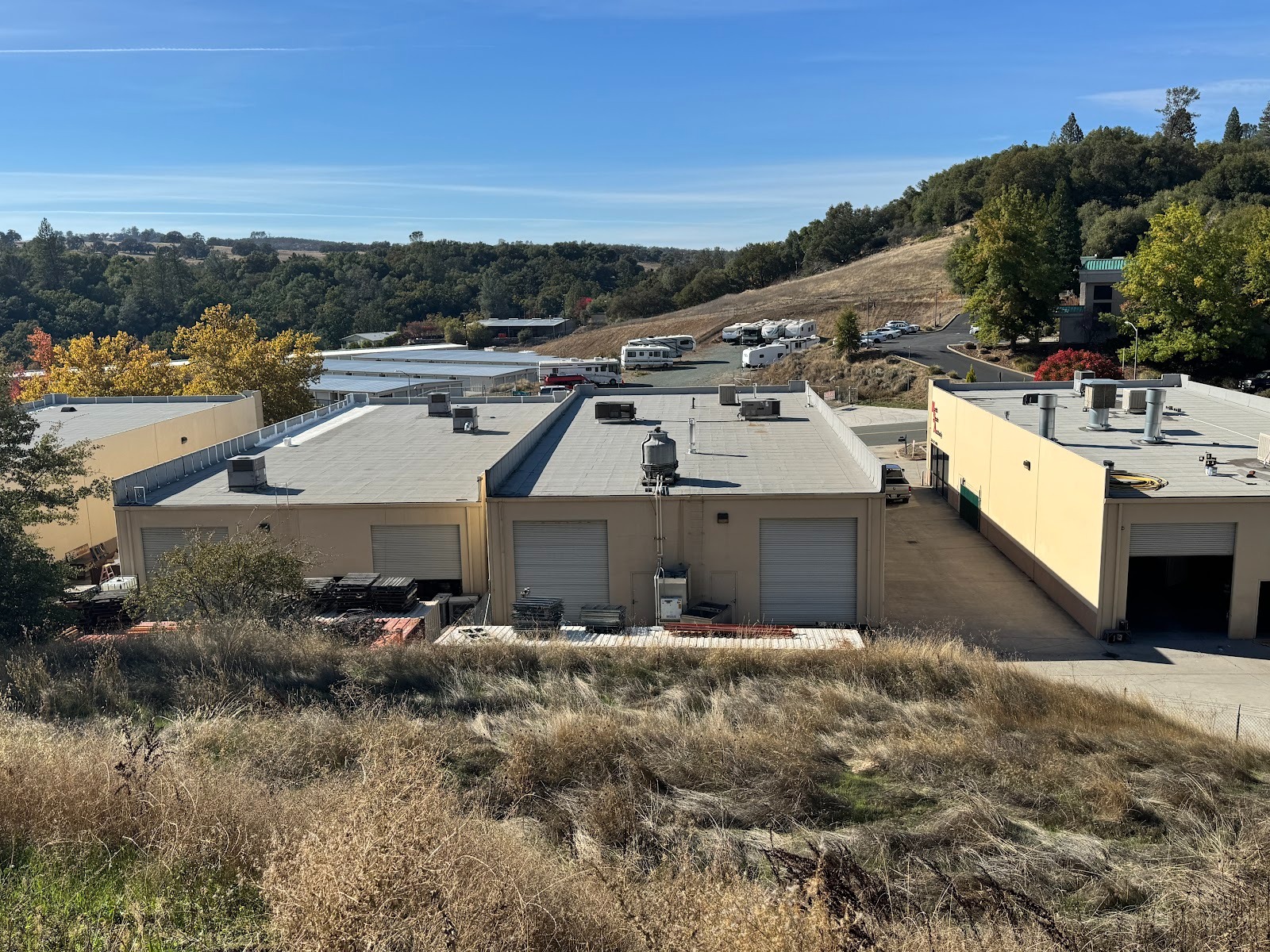
Some of the homes enjoy views of the Jackson Business Park, with its auto-repair shops, body shops, and self-storage units.
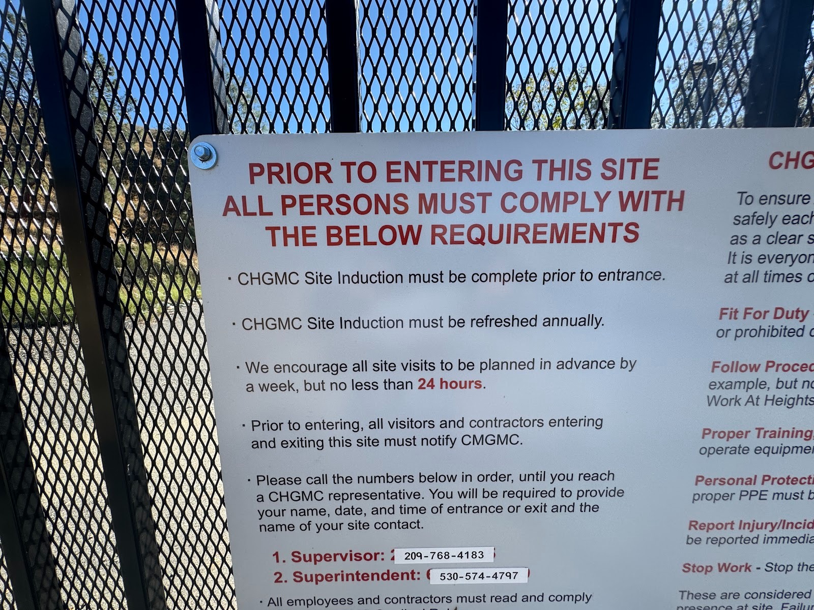
New homes bring us back to modern shopping, here about a mile north of Jackson in Martell. Between Jackson and Martell and just off the highway (here it's 88 as well as 49) see the Kennedy Mine, which, until it was forced to close during World War II, was the deepest mine in the United States.
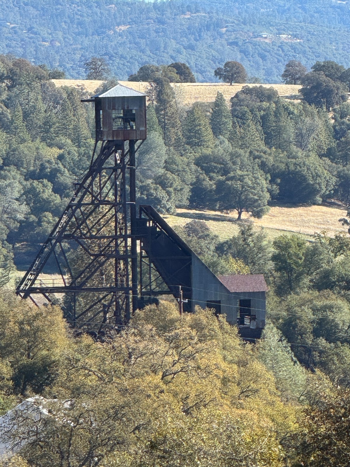
You can see surviving bits from the highway.
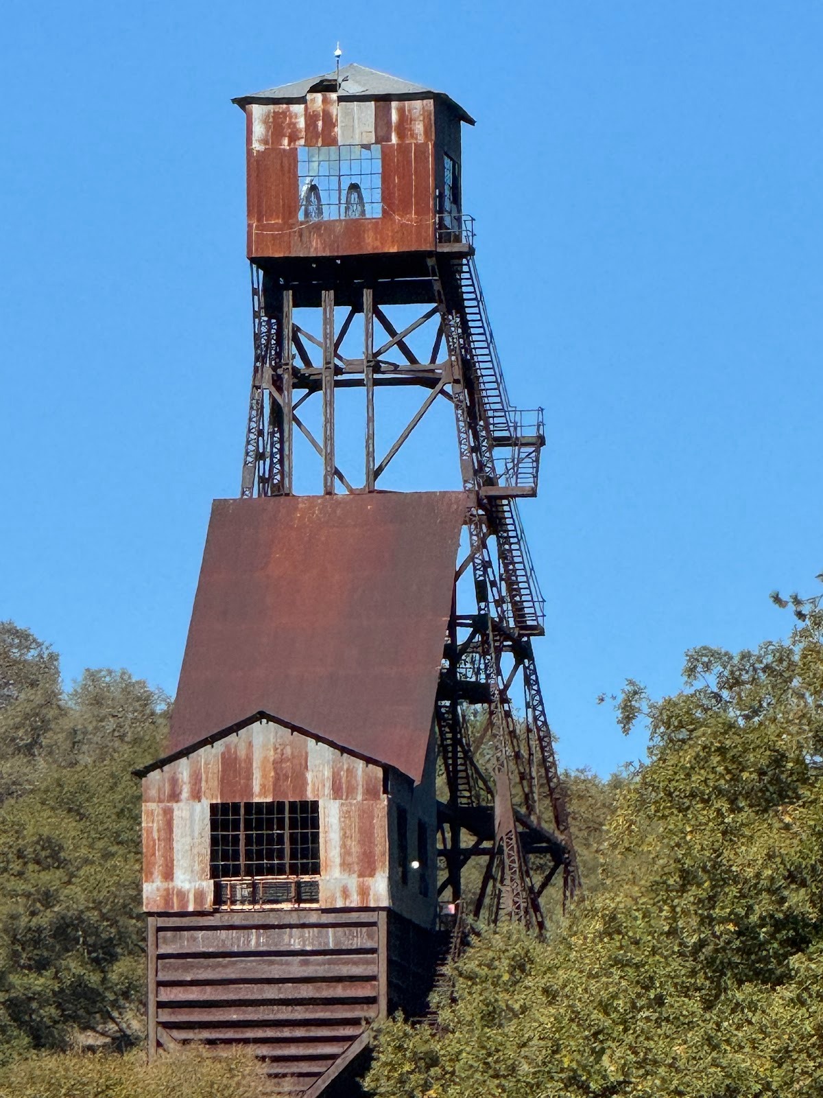
Seen from the other side.
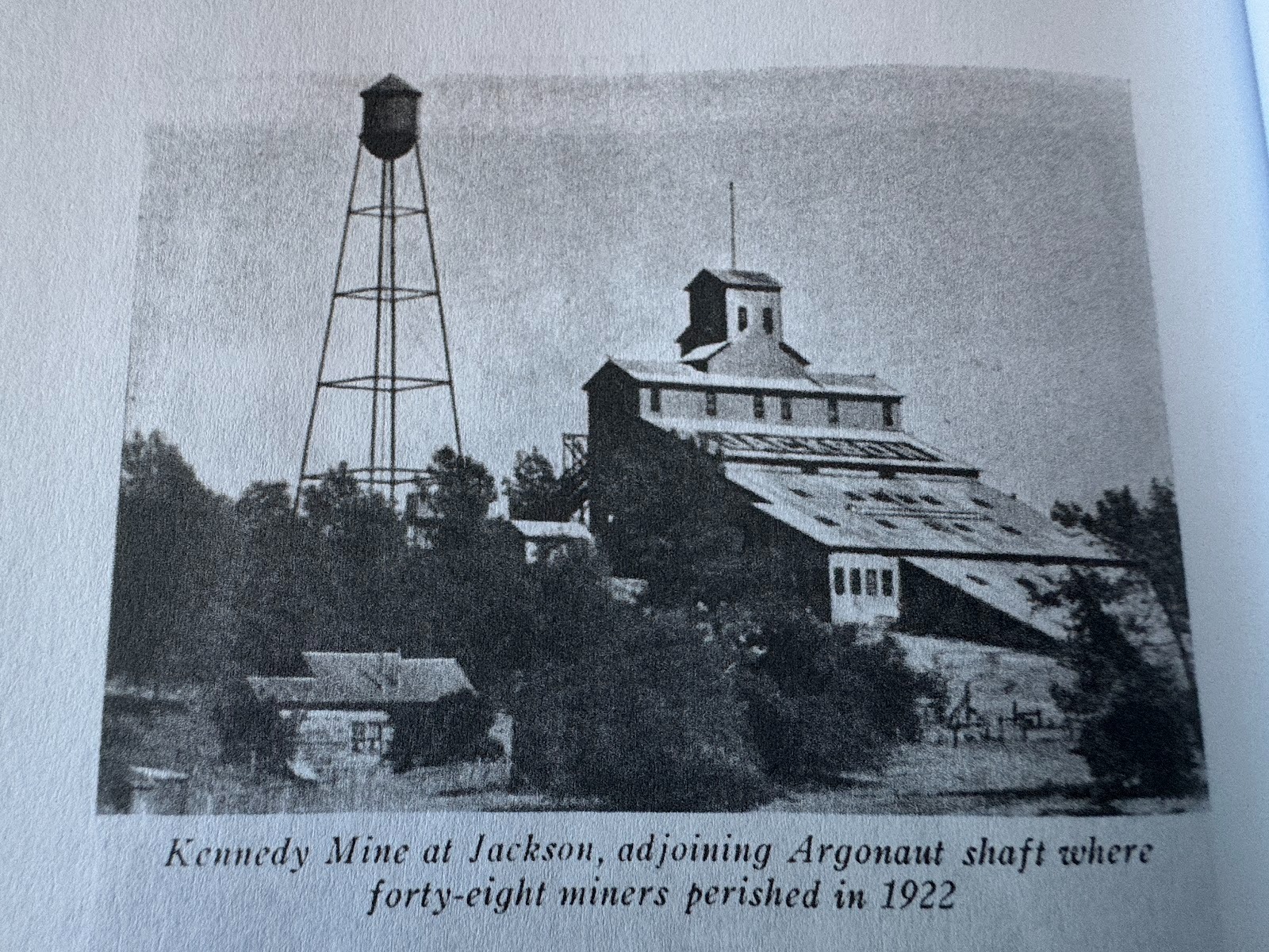
The mine flourished about 1890, which (no coincidence) is when both the National and Globe hotels added third stories (Stellman, facing p. 289).
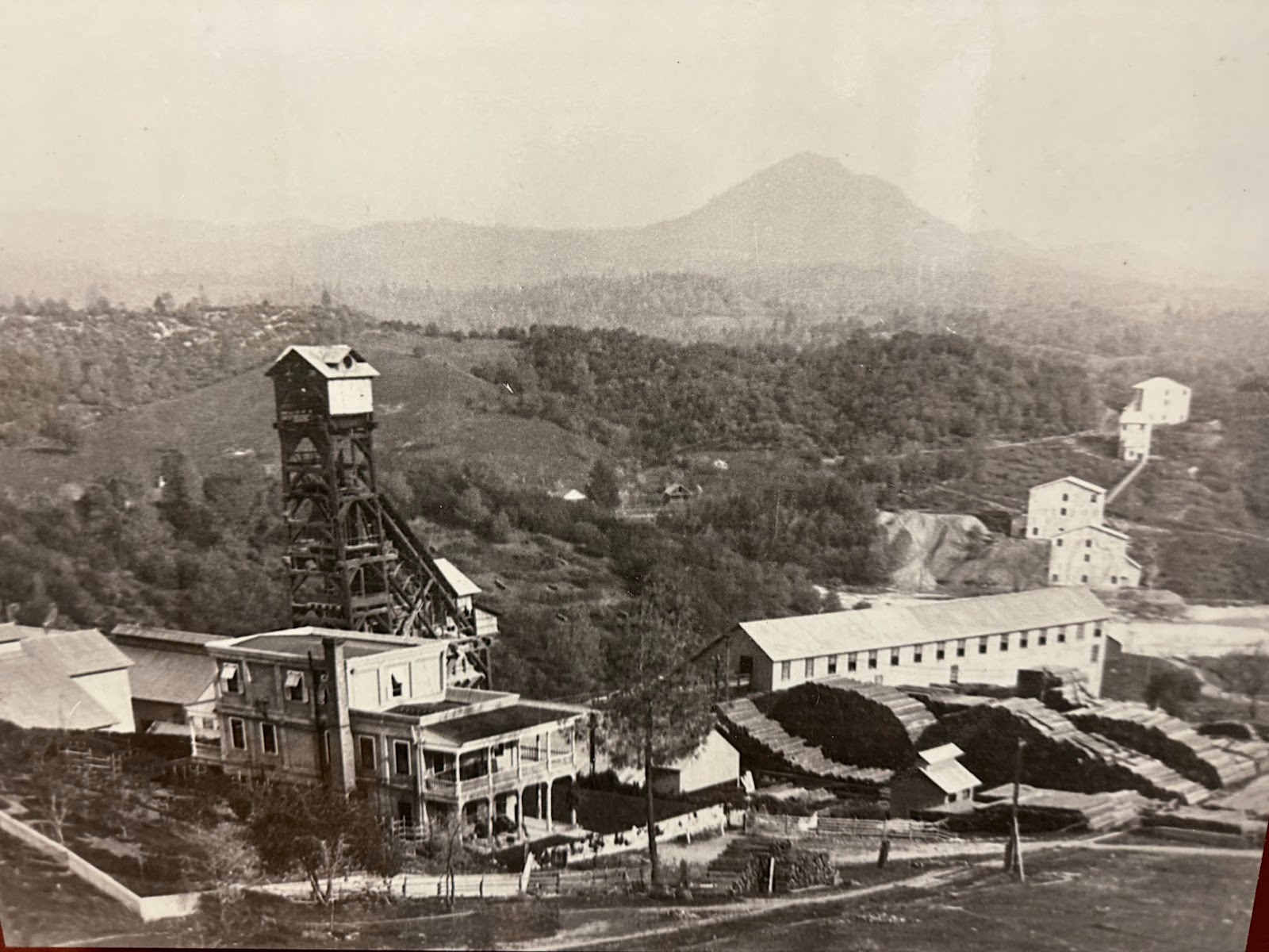
Note the buildings on the far right, which seem to be connected.
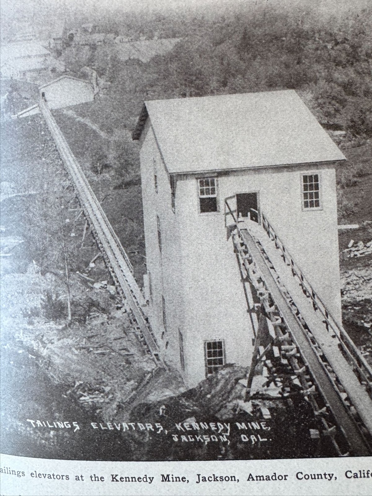
Close up of the series of elevators that carried a slurry of mill waste to a distant pond. What was inside those elevator buildings?
(W.B. Tucker, Mines and Mineral Resources of Amador County..., Calif. State Mining Bureau, 1915, p. 33.)
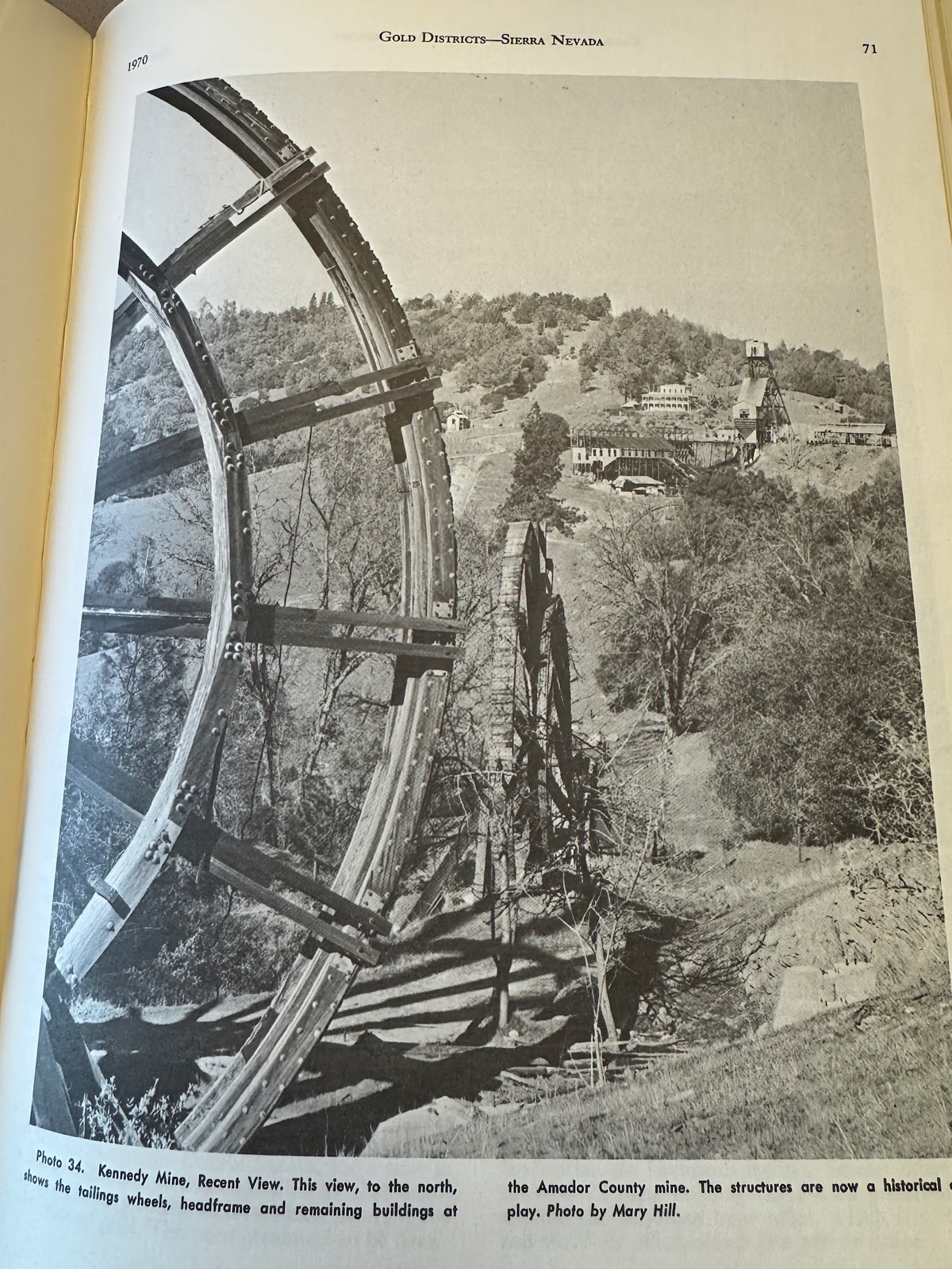
Answer: waterwheels, driven by electric motors.
(William B Clark, Gold Districts of California, (California Div. of Mines, Bulletin 193), 1970, p. 71.)
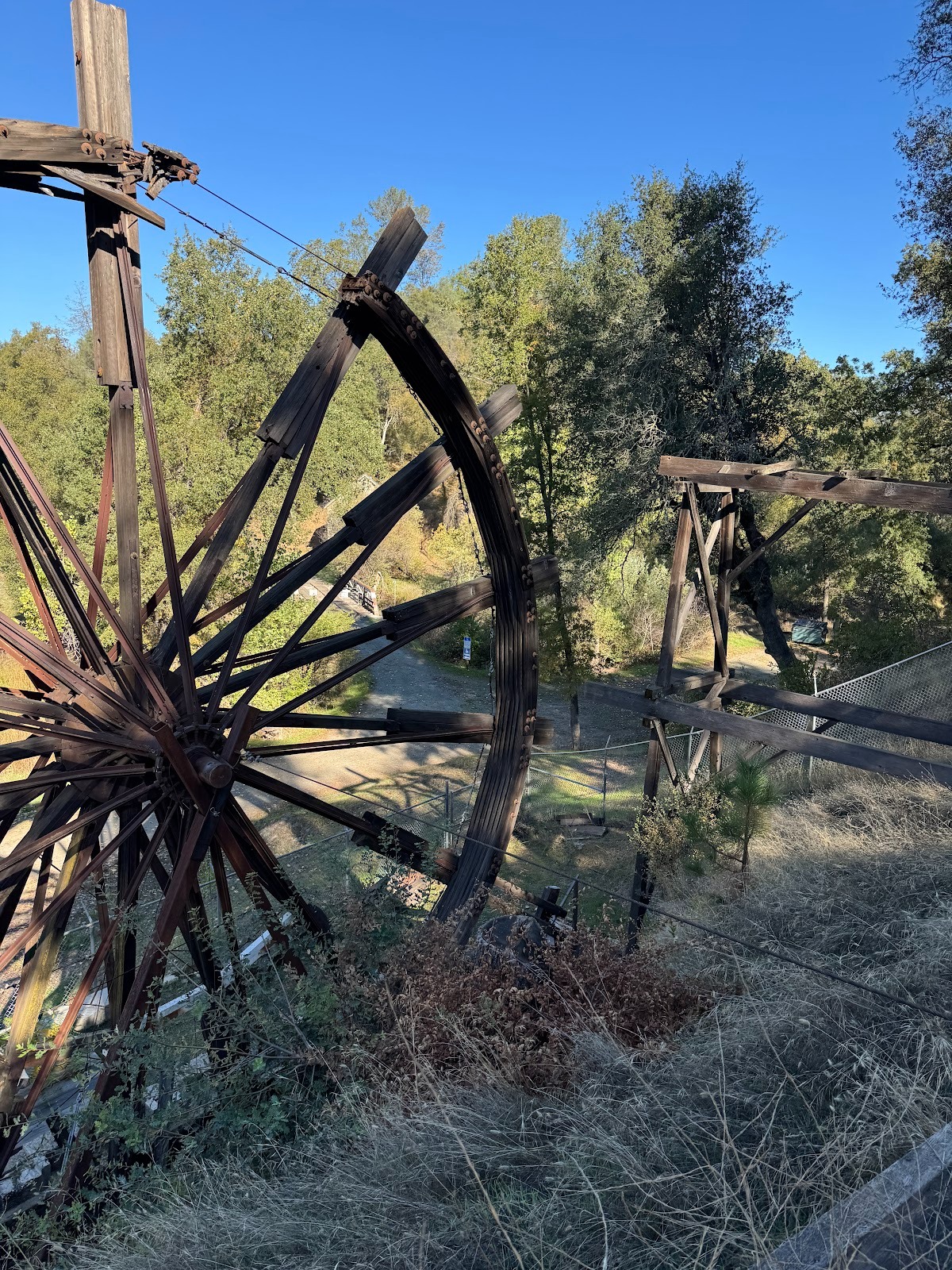
The wheels have now mostly collapsed.
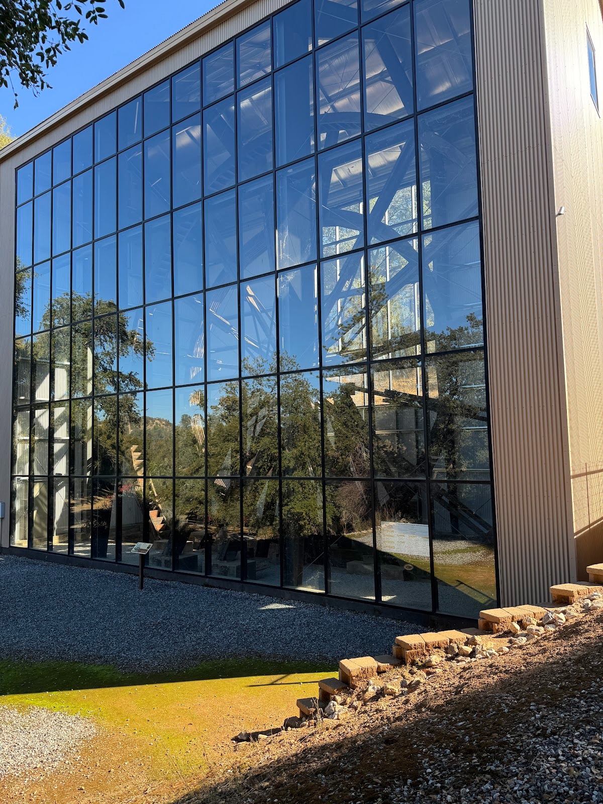
One is saved in a sealed building whose reflective glass makes photography difficult.
Before we continue north from Jackson to Sutter Creek and Amador City, I want to make a 10-mile detour east to the town of Volcano, which has cratered from 10,000 people to about 100. (I wrote "cratered" before I saw the double entendre, but let it stand.) Note the building on the right.
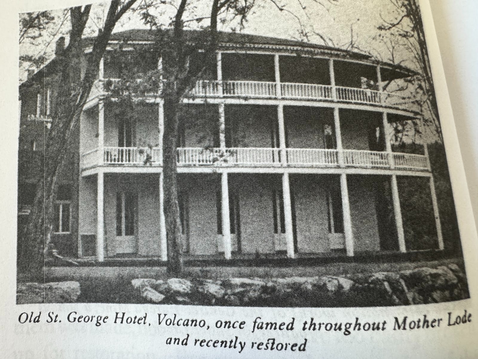
Here it is (Stellman, facing p. 144).
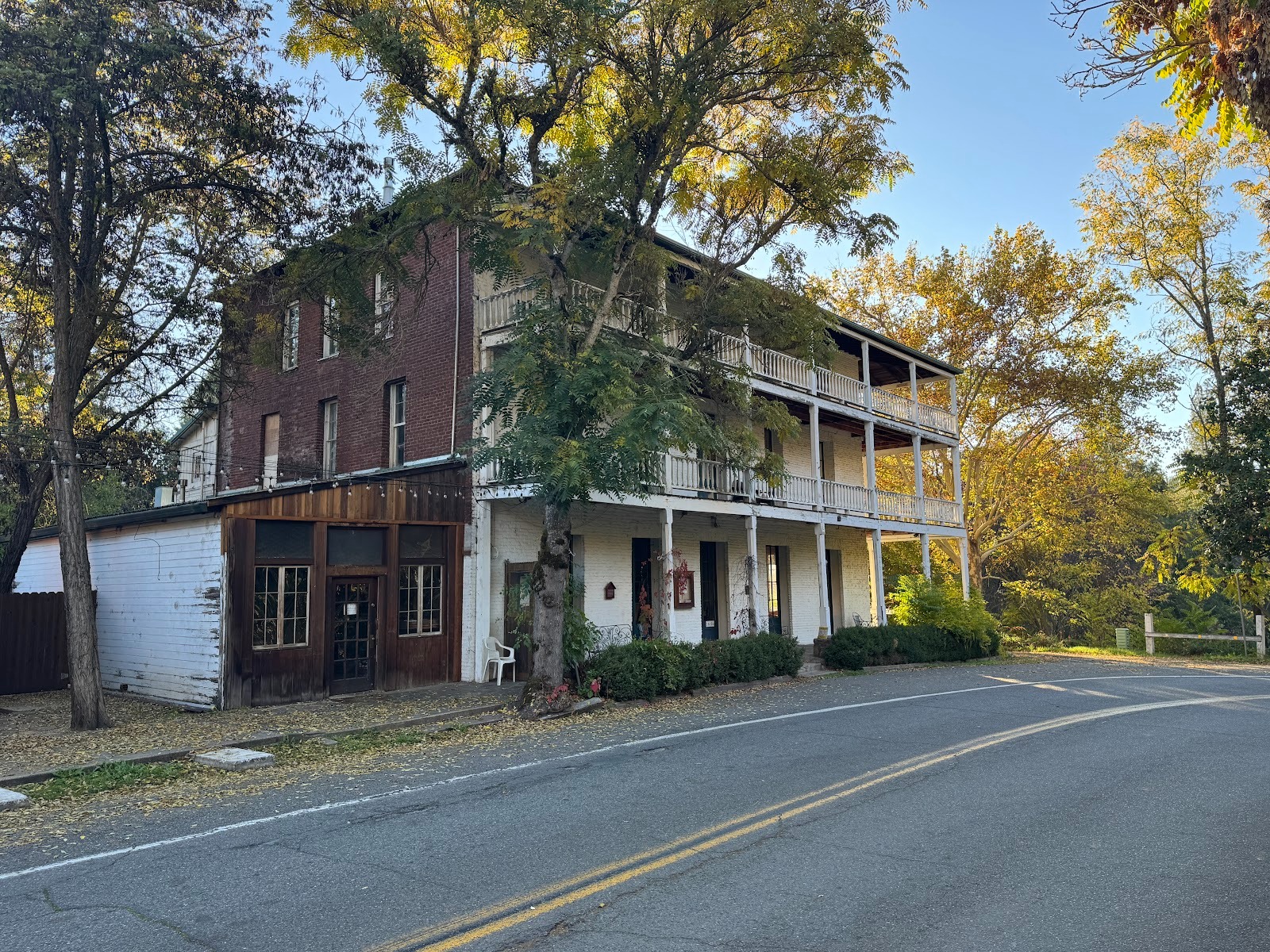
And here as I saw it.
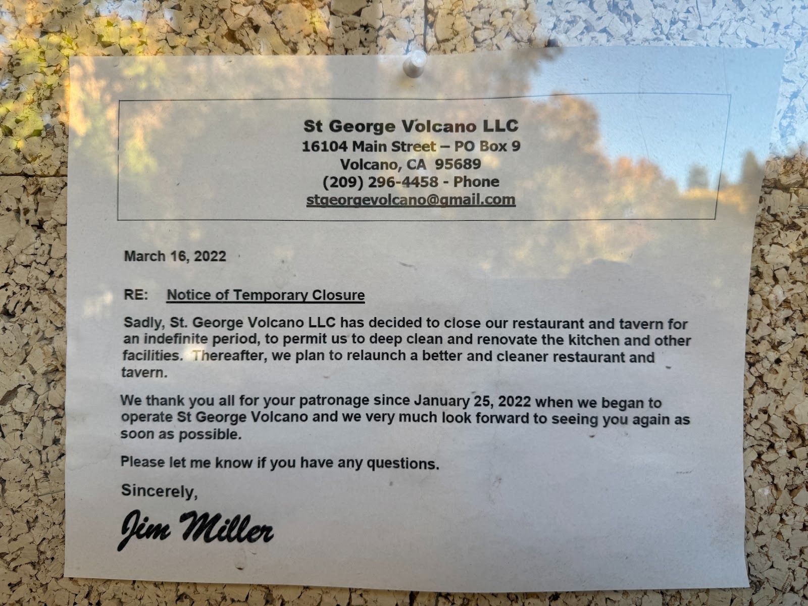
Still defunct as of 2025.
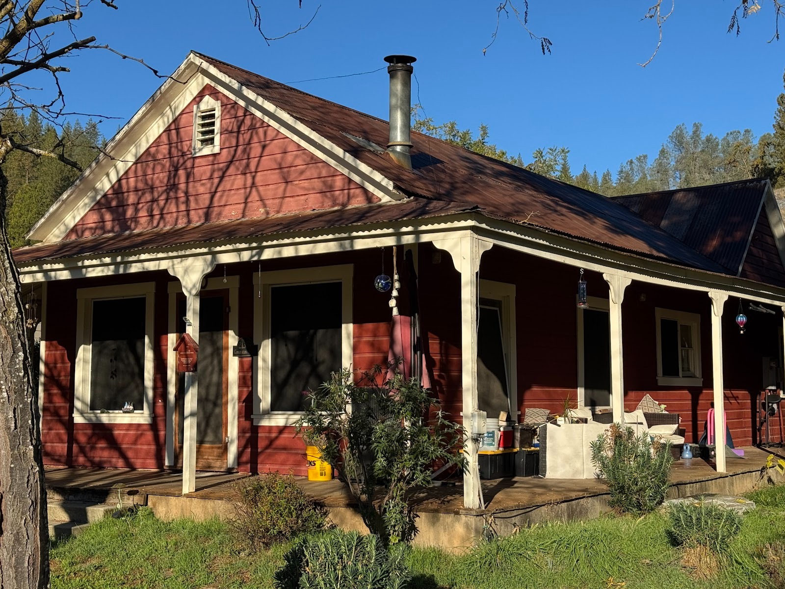
Not so for the home built in the 1850s for Judge Peter Jonas, who owned (or at least had some connection to) the hotel.
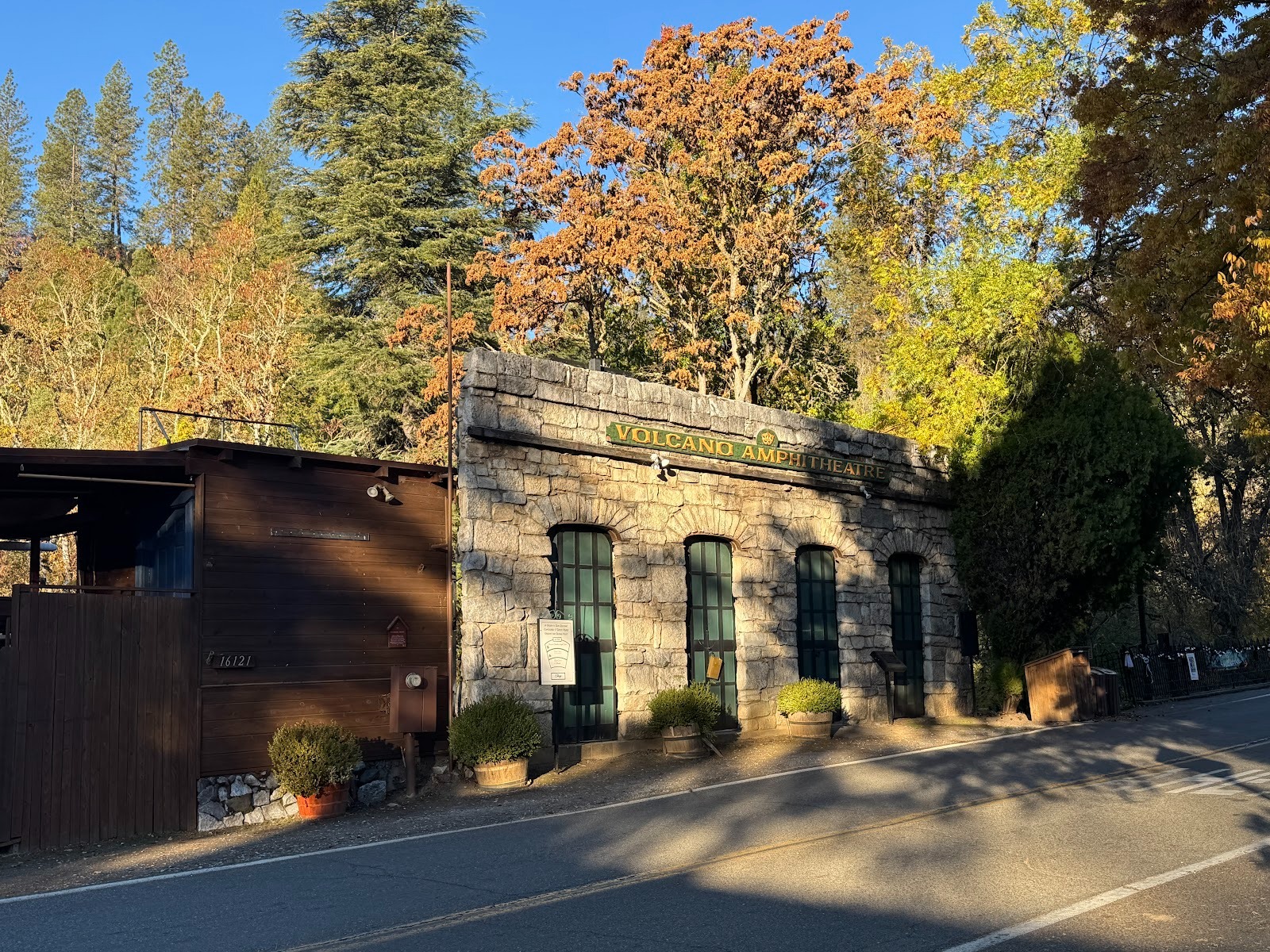
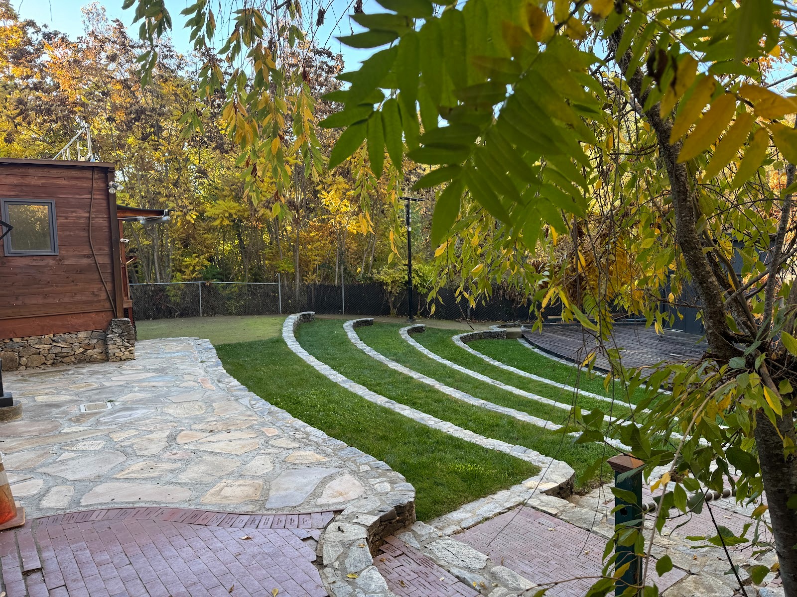
Volcano had a "thespian society" in 1854 and still leans heavily on live theater, as with the amphitheater behind this facade, built in 1855 to house a saloon on one side and a door and sash mill on the other.
In 1980 the facade was acquired by the Volcano Theater Company.
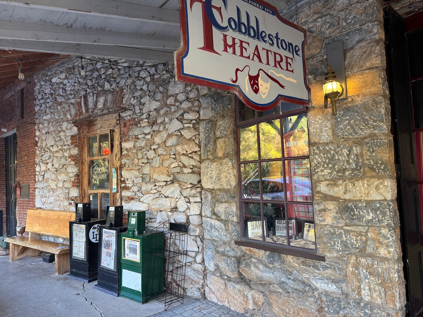
Across the street there's an indoor theater.
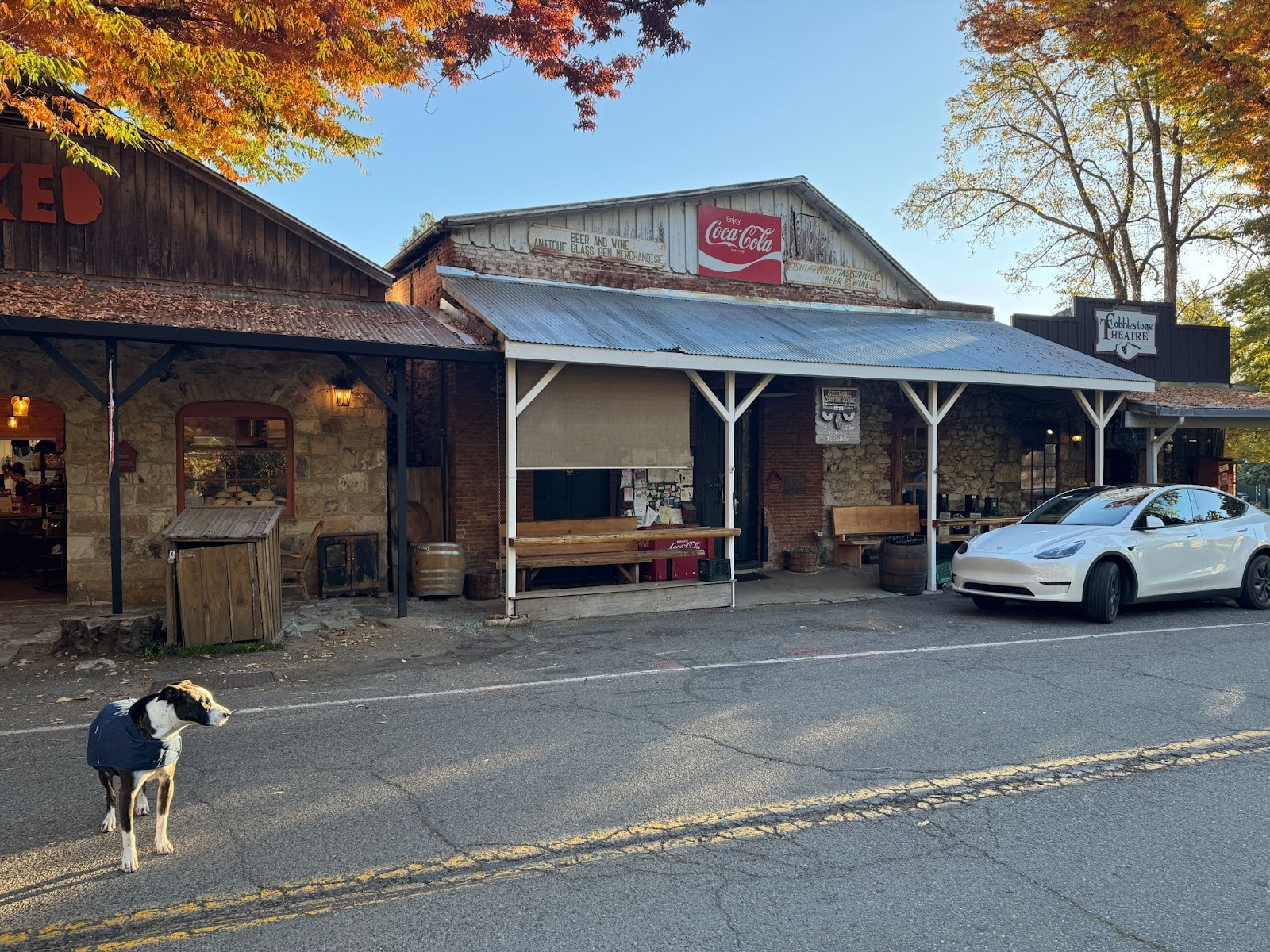
Adjacent store.
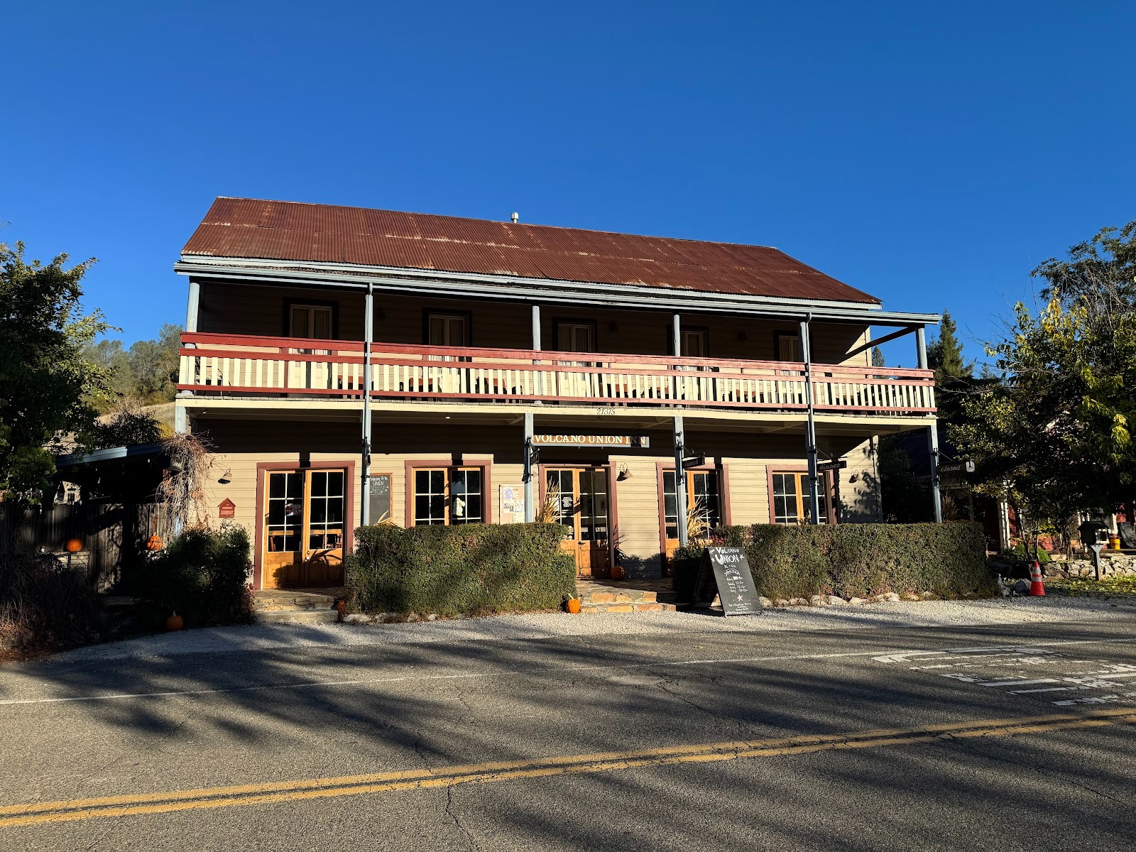
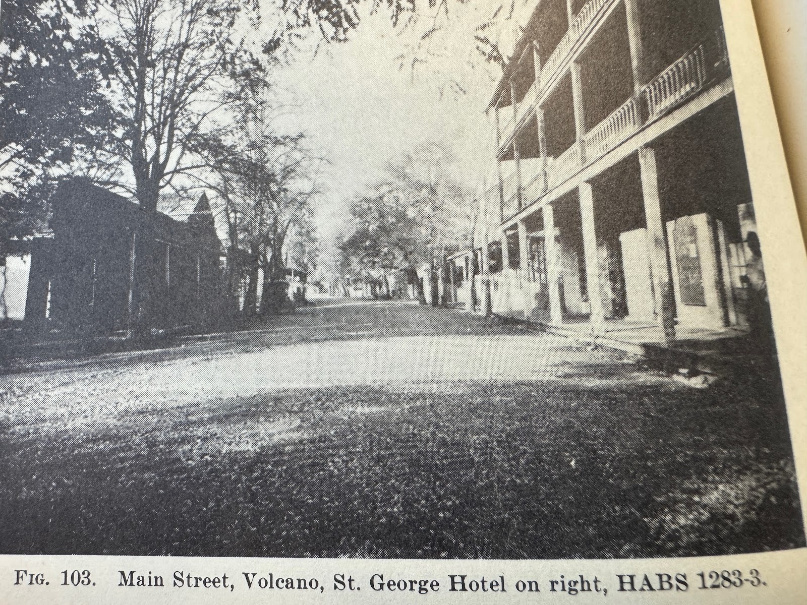
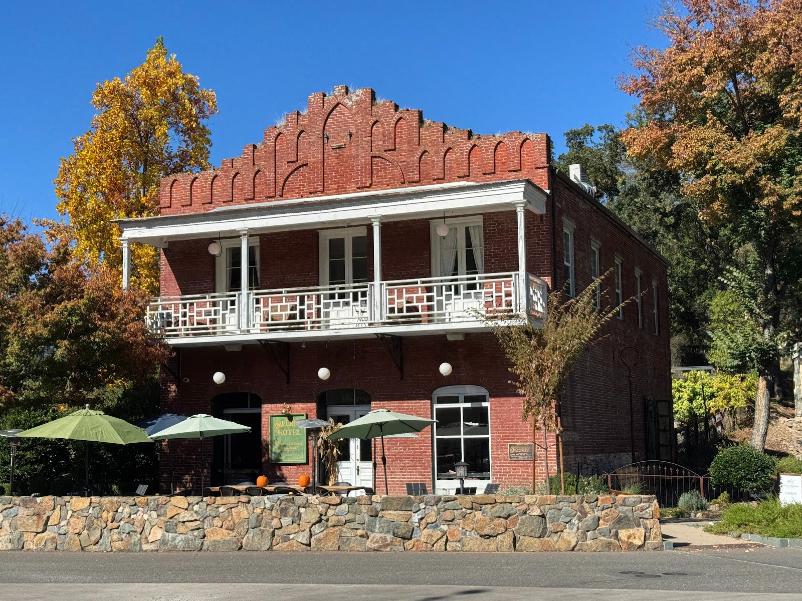
Volcano does have a functioning hotel, the Volcano Union Inn, built in 1880. The address is 21375 Consolation Street, a name testifying to somebody's distant troubles.

Looks good, but I'm a retired teacher. I don't have a private jet, either.
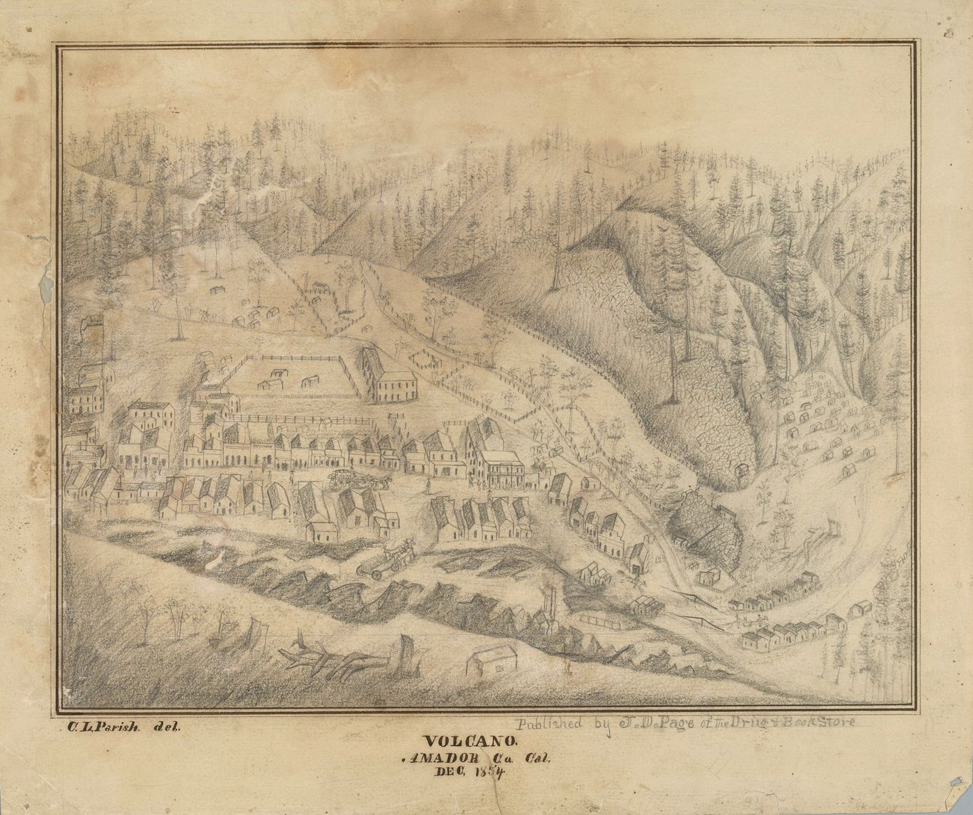
An image of Volcano in 1854. The large building at the elbow on main street is probably the Hotel Eureka, predecessor of the St. George. (Wikipedia)
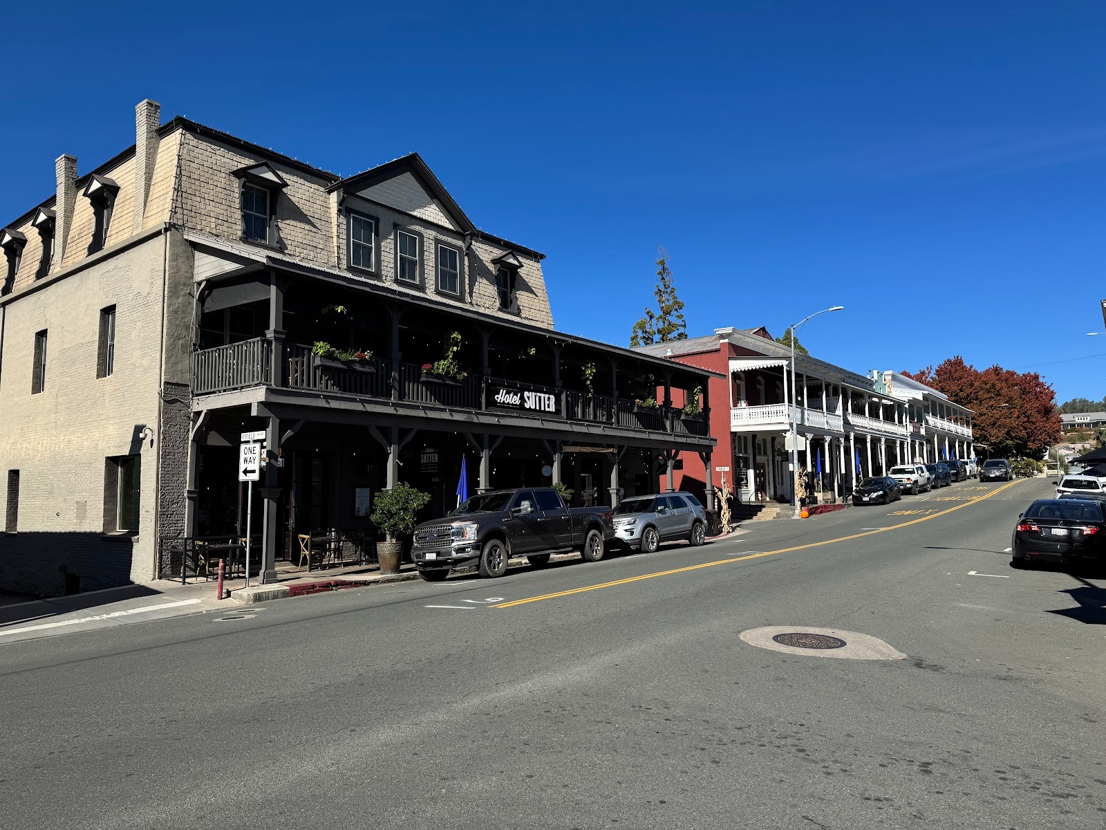
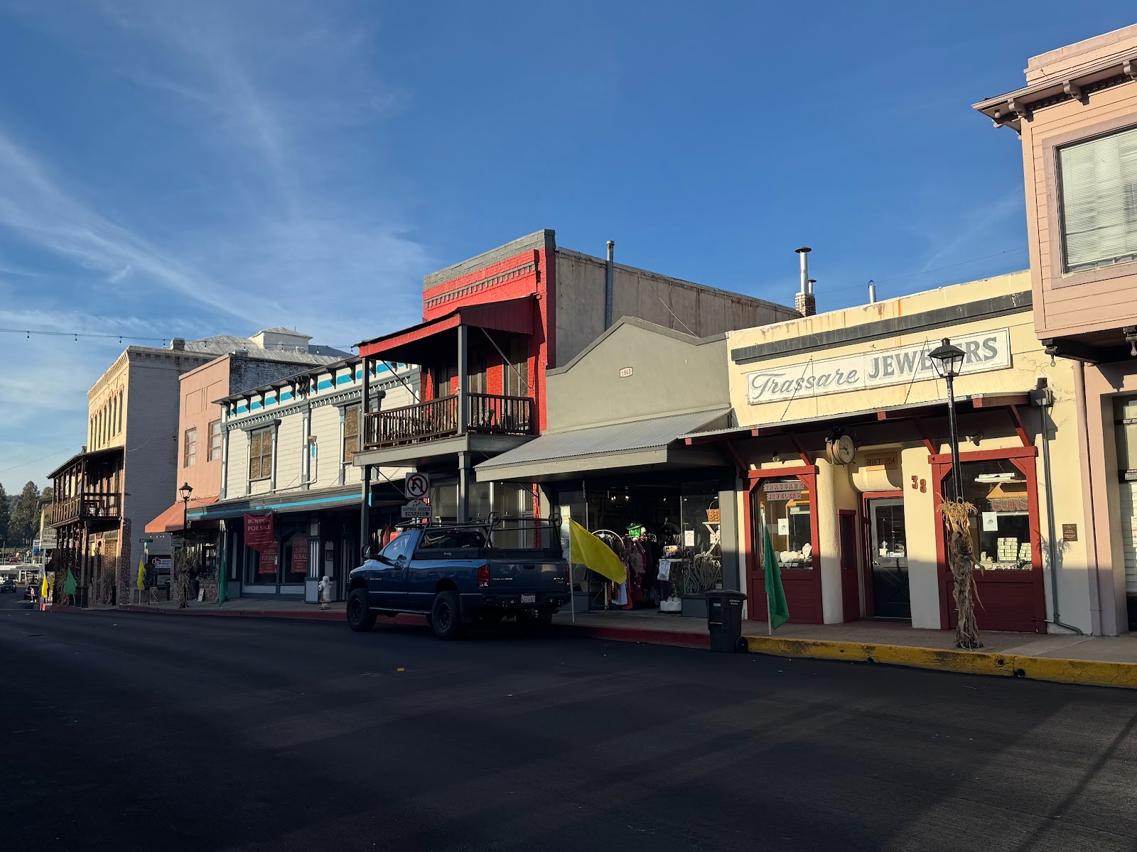
We're returned to Jackson and driven four miles to Sutter Creek, the spiffiest of all the towns along 49. Not the biggest or the best (whatever that might be), just the one that speaks loudest to those hungering for wine bars, galleries, and antiques. The building in the foreground is the Sutter Hotel.
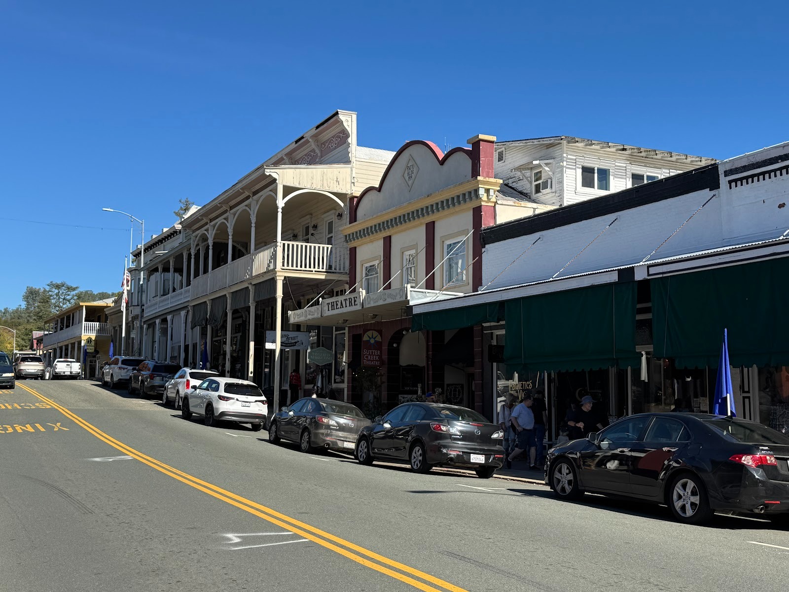
Across the street, the building with the balcony sells women's clothing and (in 2025) was partly for rent. One building closer is the town's live theater. Closer still, a gallery.
What a difference from the 1930s, when the balcony building was a pharmacy downstairs and when the gallery was a chain-grocery store.
Amador City is much, much quieter.
An excellent museum.
This hotel was built in 1879 as a store but was converted to a hotel and boarding house in 1927. The brick wall, according to a plaque, is 12 bricks thick at the base, tapering to four. The building was renovated in 1968 and is once again a hotel.
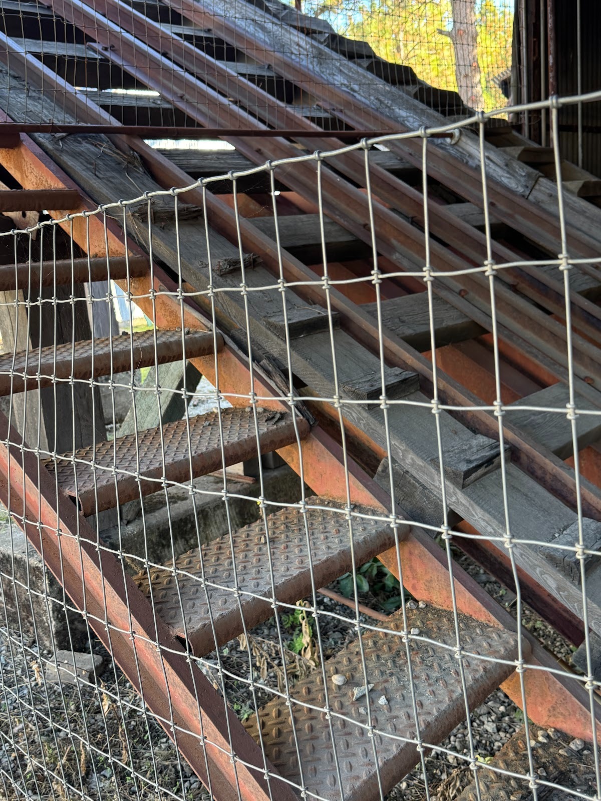
It has another of those staircases from hell. Maybe we could stage an action movie here. You know: one where the bad guy shoves somebody downstairs to make it look accidental. Then again, I fear that the stairs aren't steep enough.
The town's bakery closed during the pandemic and never reopened. Gossip: it closed because the staff quit en masse when the owner told them to ignore masking rules.
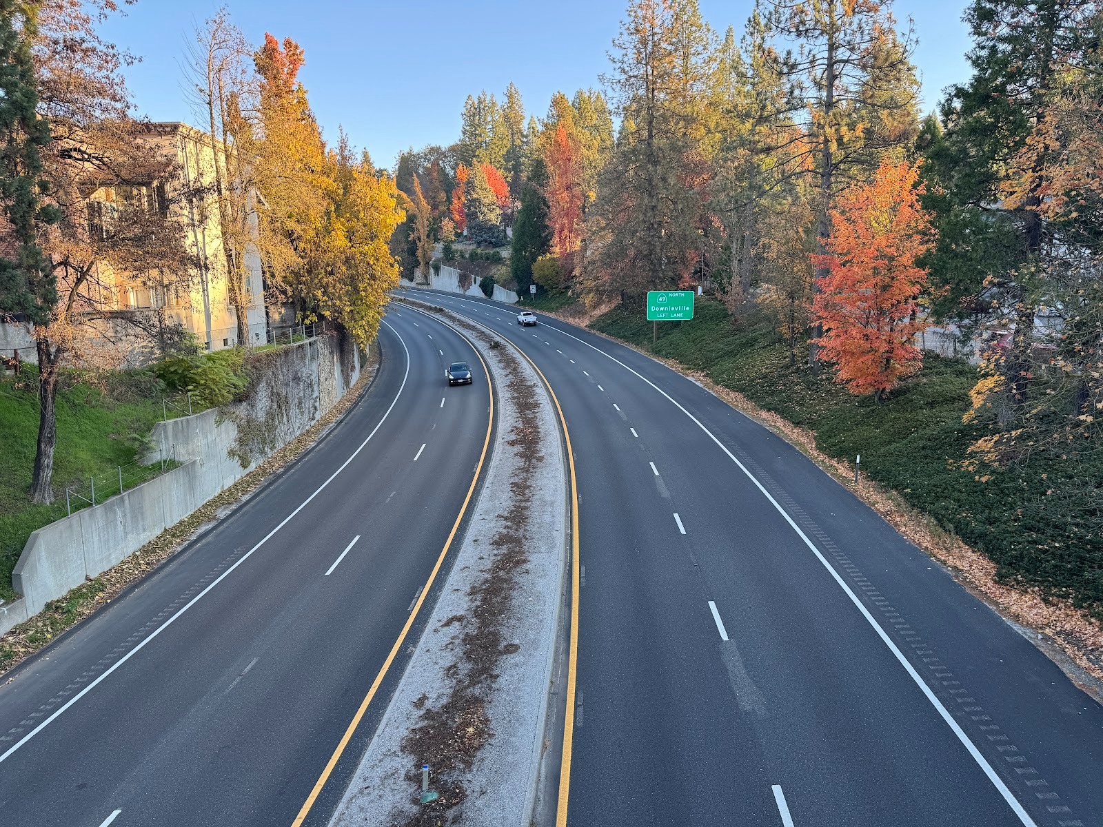
Exciting, huh! This is U.S. 50 as it cuts Placerville in half. That dissection explains this pedestrian overpass.
Get yourself a big highway, and pretty soon you need a big garage.
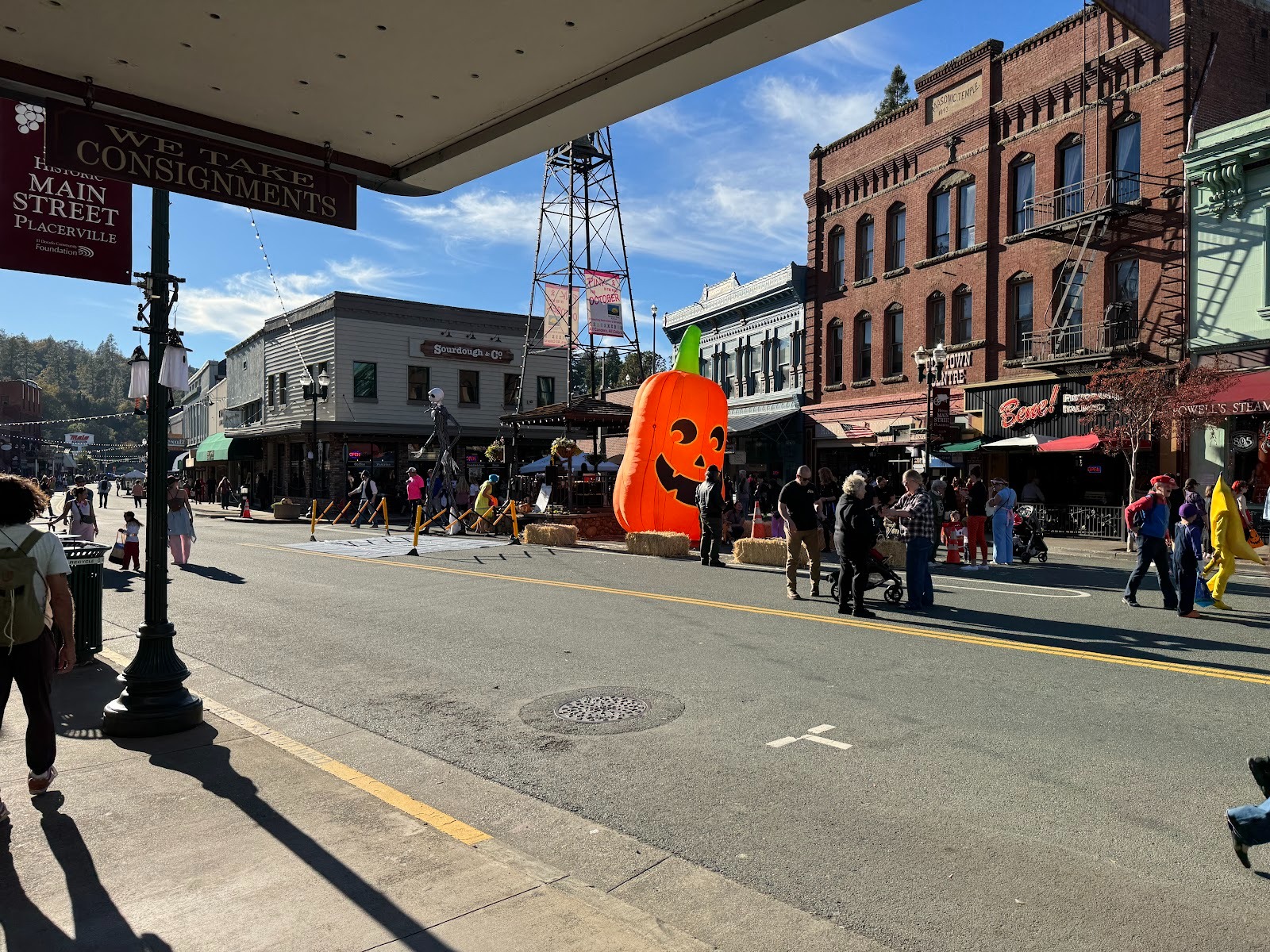
It's Halloween, 2025, so there are no vehicles on Placerville's main street. That would be the town's fire-bell tower. Although there are car-oriented shopping centers on either side of central Placerville, the town's big enough, with 10,000 residents, to have an old center that isn't beholden to tourists.
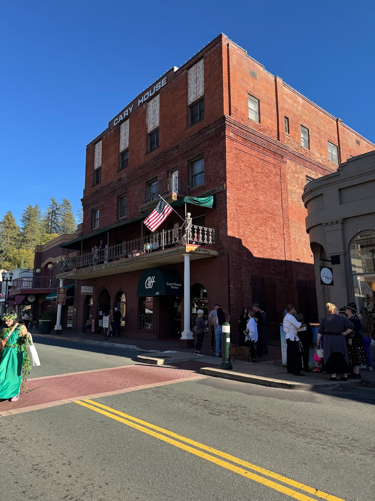
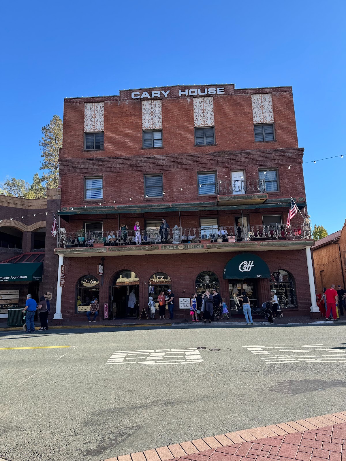
In the Cary House, Placerville does have another old brick of a hotel.
Getting ready for candy handouts.
The old city hall is on the left, with a bit of free therapy. The building on the right has a plaque, for which scroll.
Placerville's other claim to fame is its standing as the western terminus of the Pony Express, which started April 4, 1860, and ended June 30, 1861. Blame that dratted telegraph.
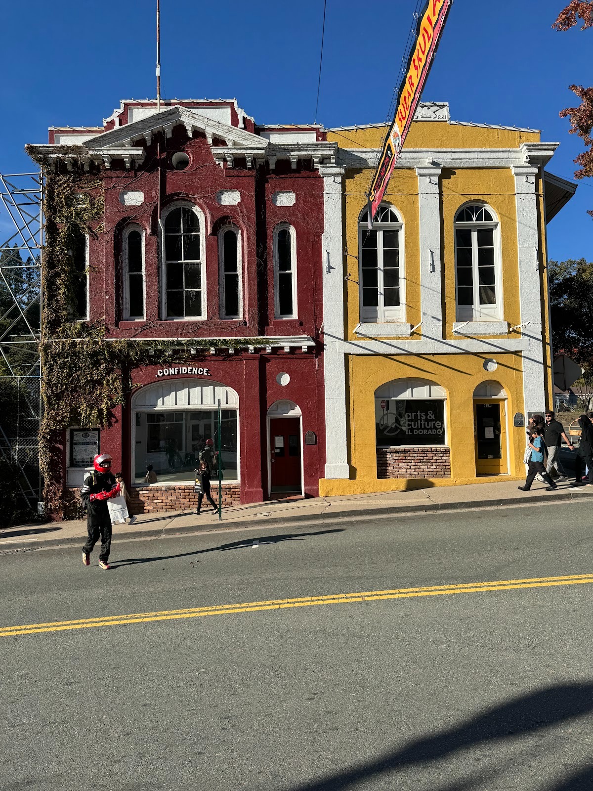
There are a few buildings of stone, or at least with stone facades.
But Placerville has always had enough economic activity that most of its 19th century buildings are gone.
The big exception is in housing stock, here seen on the north side of U.S. 50.
Another example.
Another. Yes, this is 49 on its way to Coloma and Auburn.
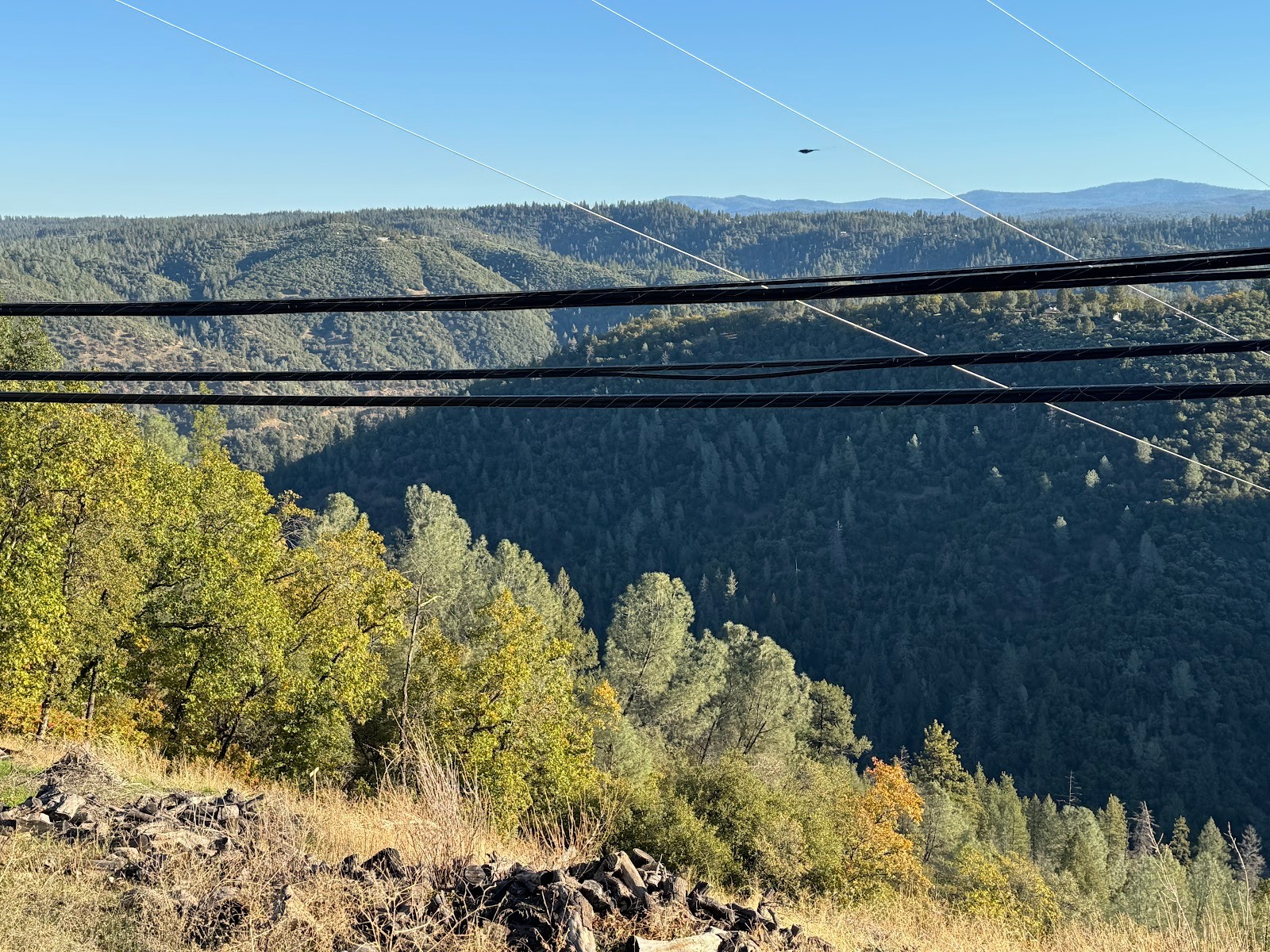
Quick stop to admire the power lines that cross the Sierra's canyons, and also to emphasize the plateau-like surface of much of the Sierra's western slope. We'll see more of that up ahead.
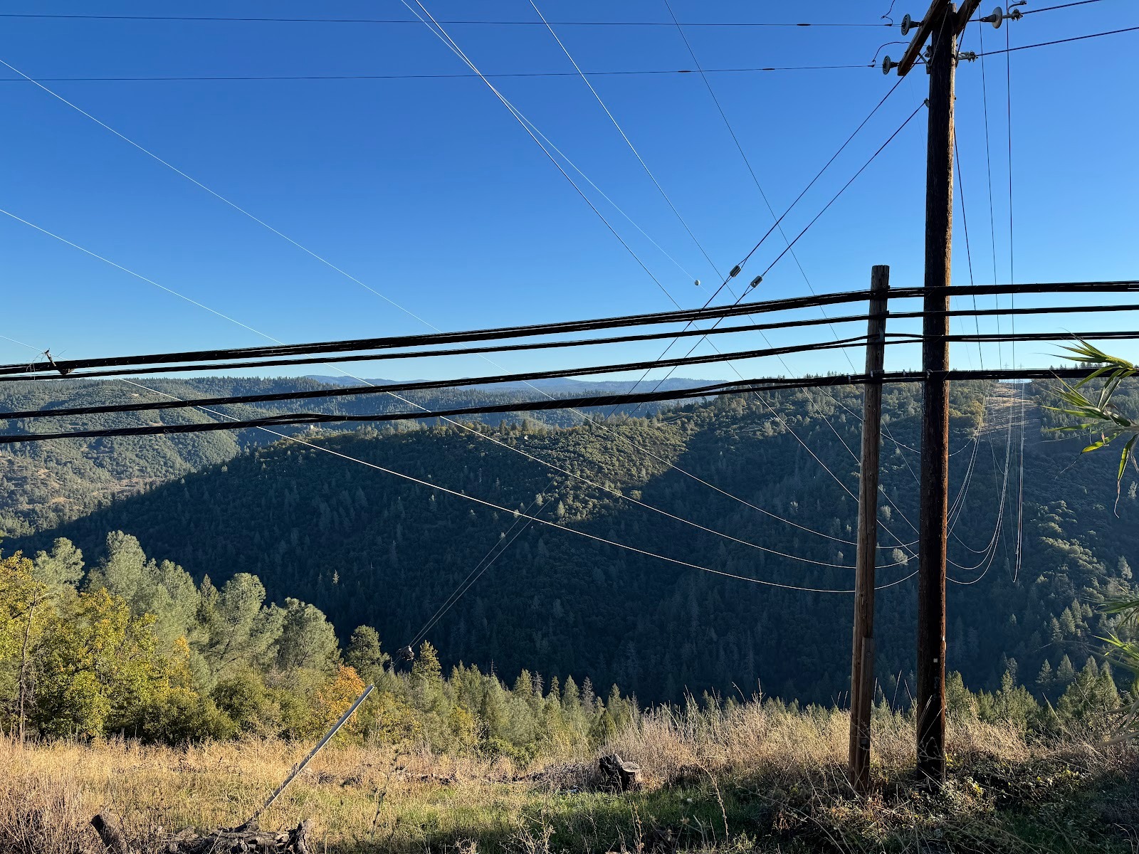
I want to see the Wichita Lineman try this.
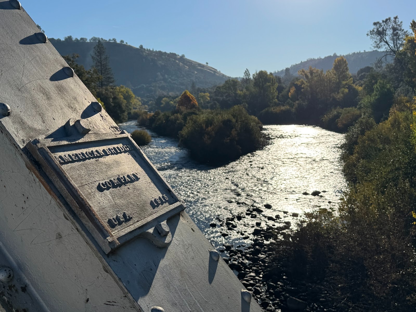
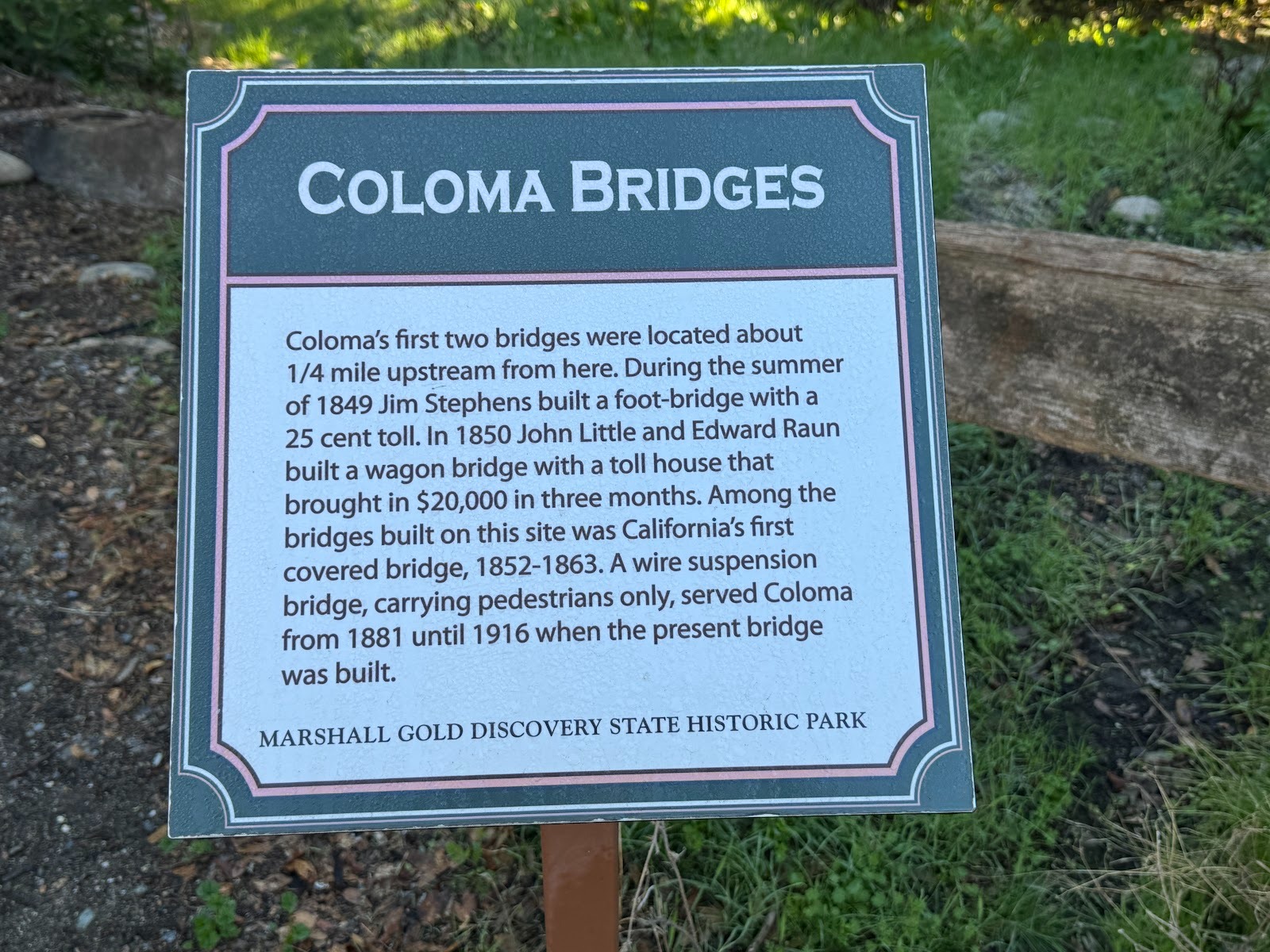
Here we are at the fateful location on the South Fork of the American where James W. Marshall found gold flakes in the tailrace of the sawmill he had just built.
Info, courtesy of the State Park that has taken over the site.
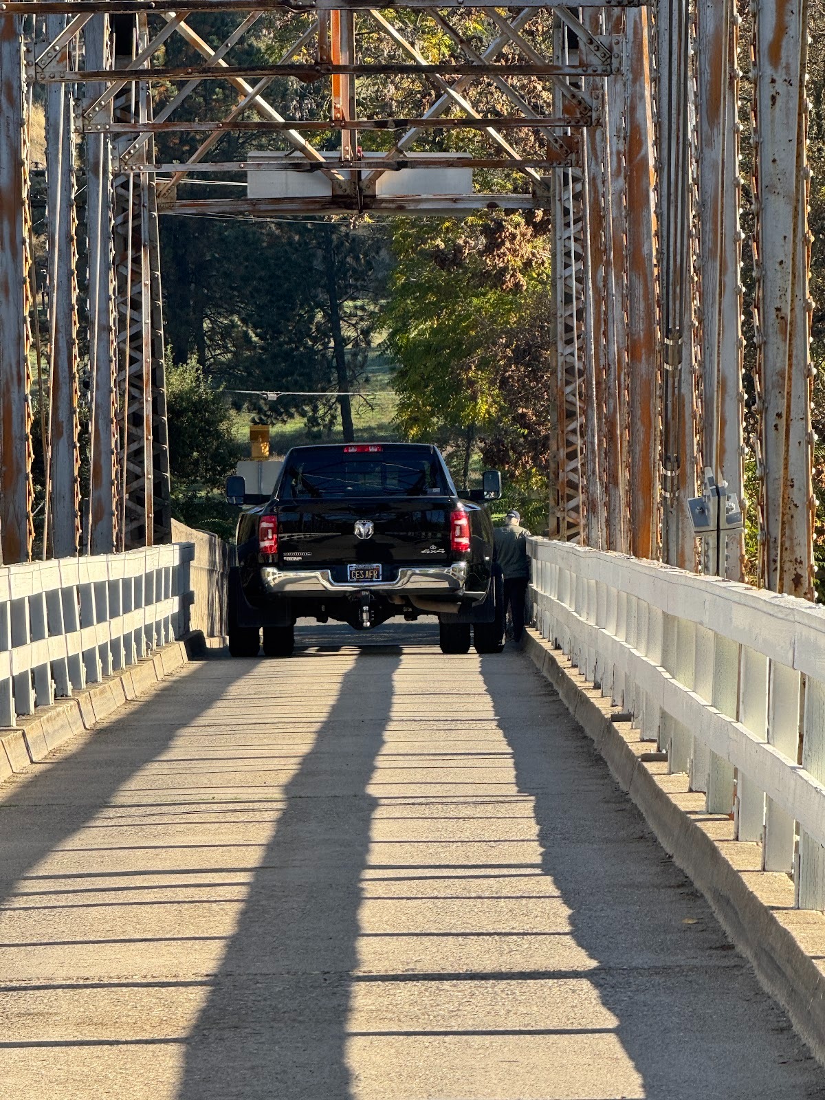
Those baby dualies are a problem, especially when there are pedestrians on the bridge.
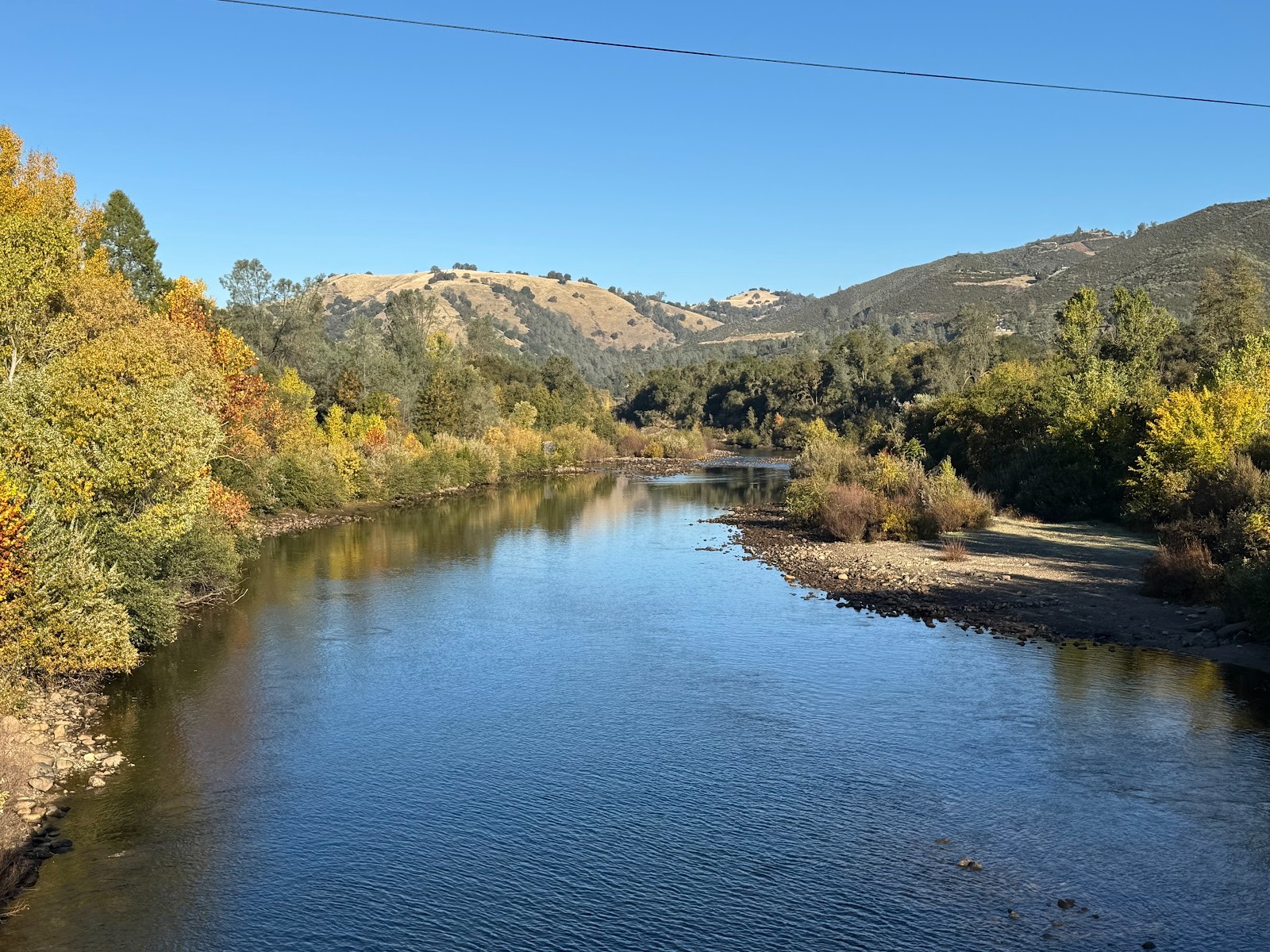
Calm as can be.
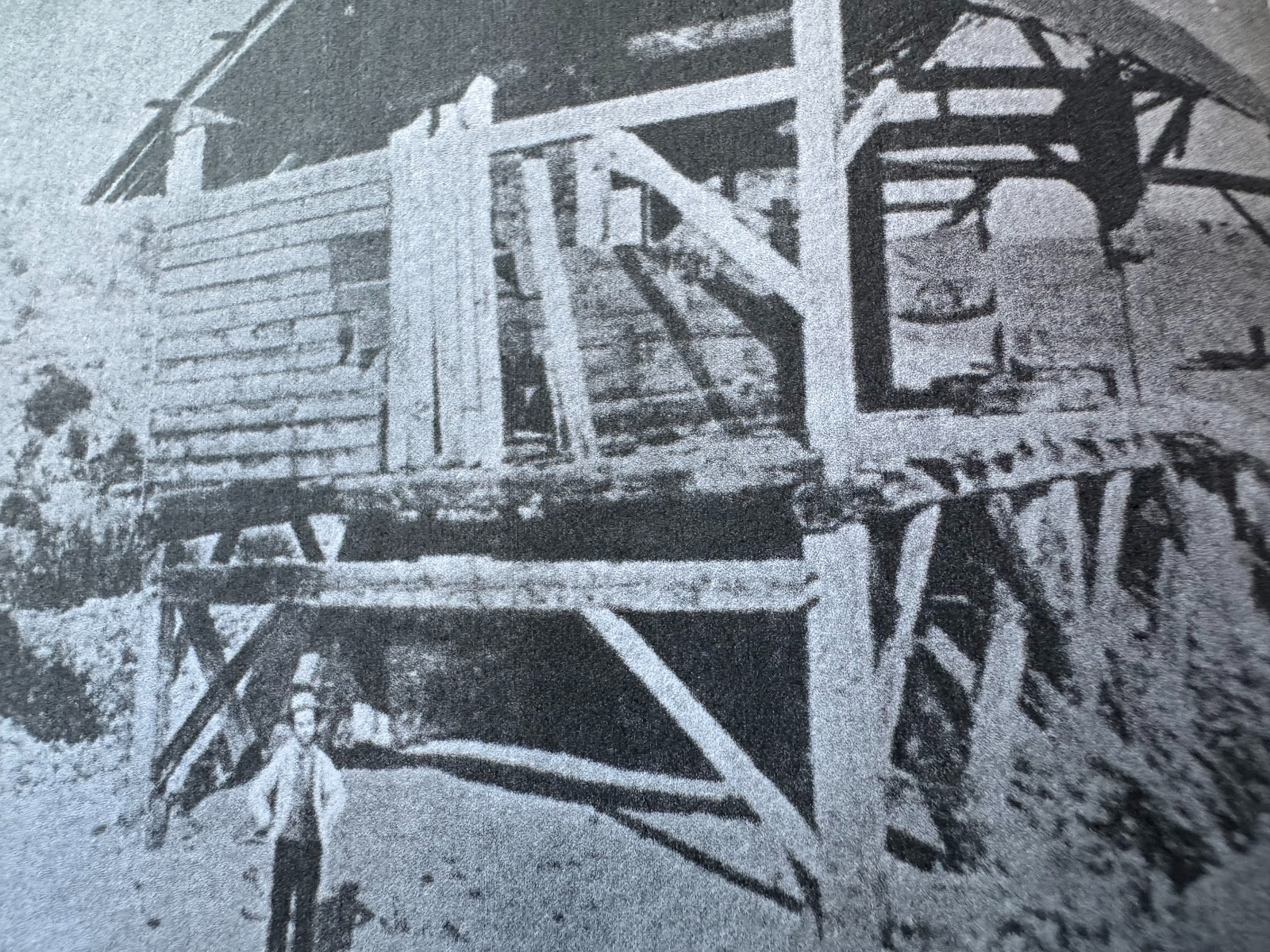
Here is Mr. Marshall's sawmill and, one reads, Mr. Marshall himself (Stellman, facing p. 1).
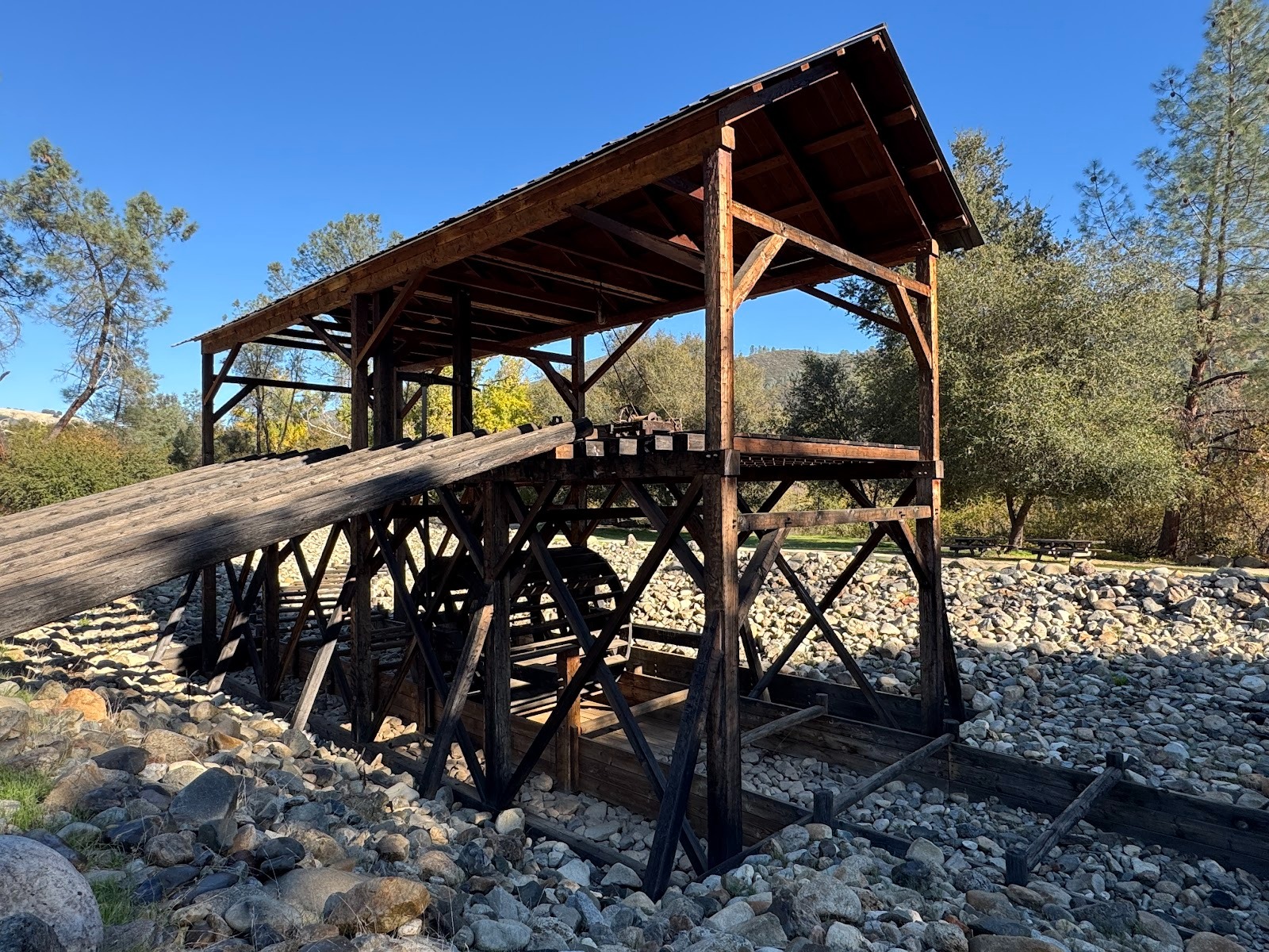
There's a replica on the site today. You can make out the ramp for logs, and the waterwheel below.
**
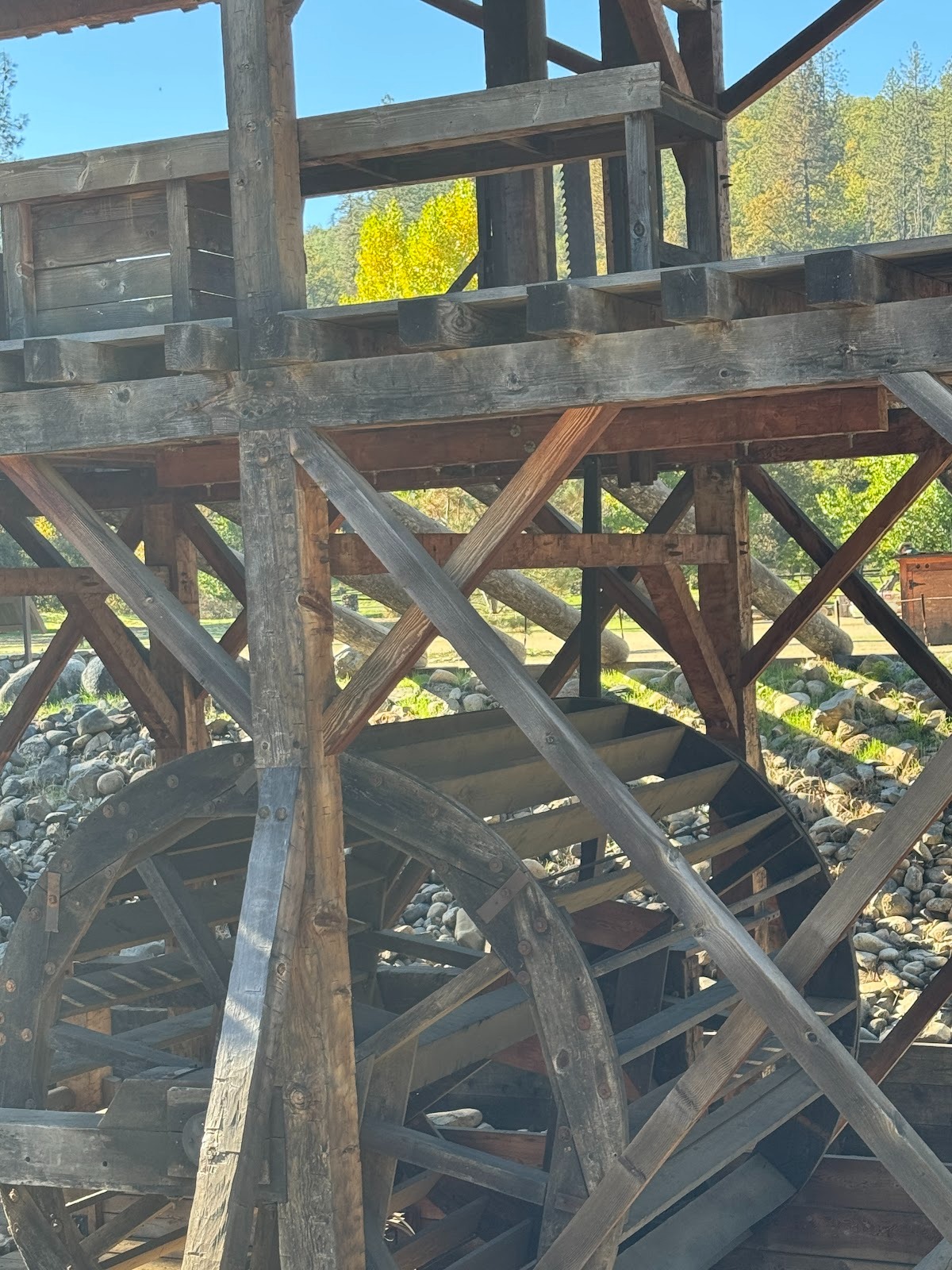
Look carefully and you can make out the saw blade driven by a crank on the far side of the wheel.
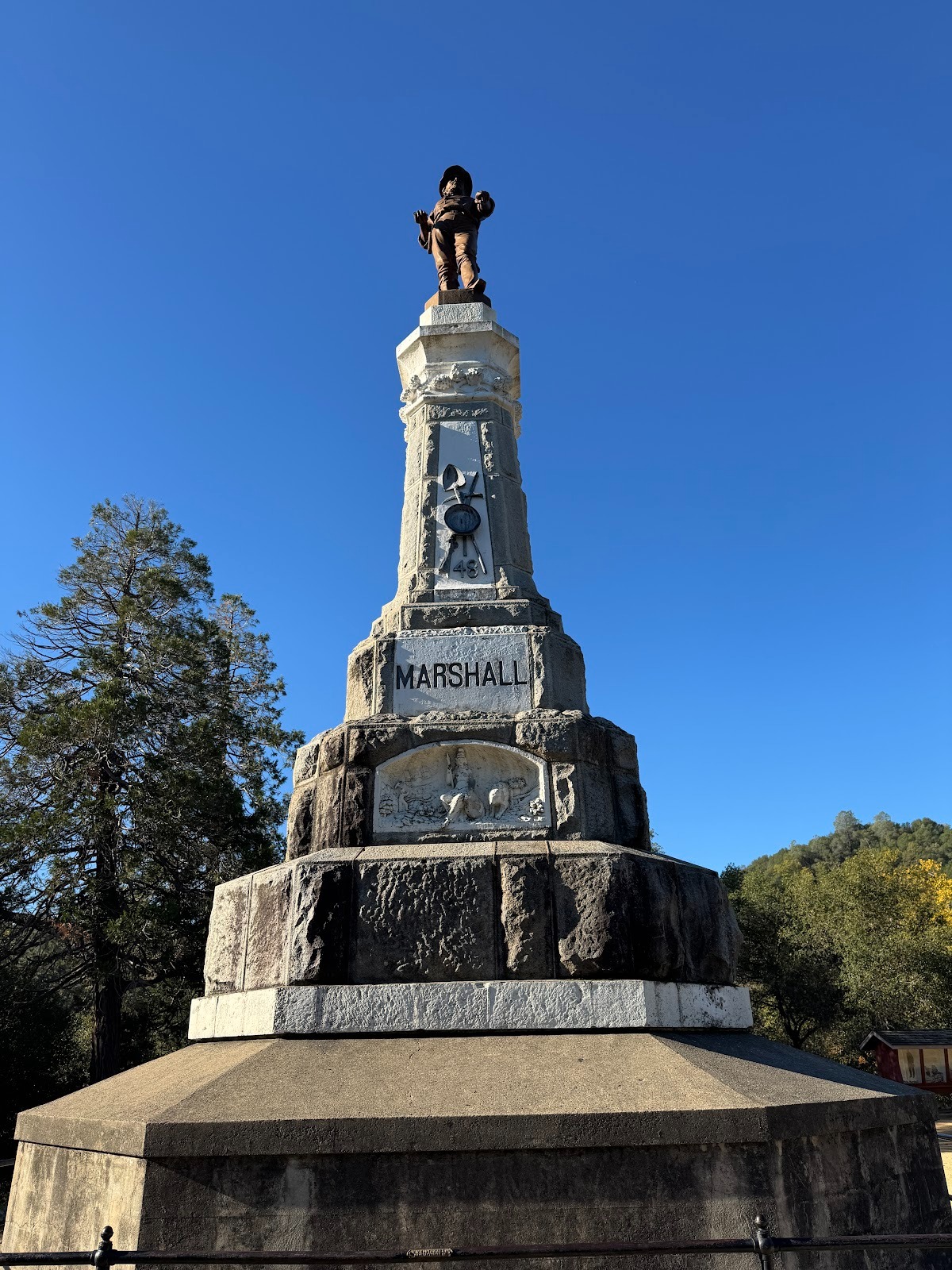
Marshall never made a fortune from gold or from anything else. He died broke but a few years later got this fine monument about a mile from the sawmill.
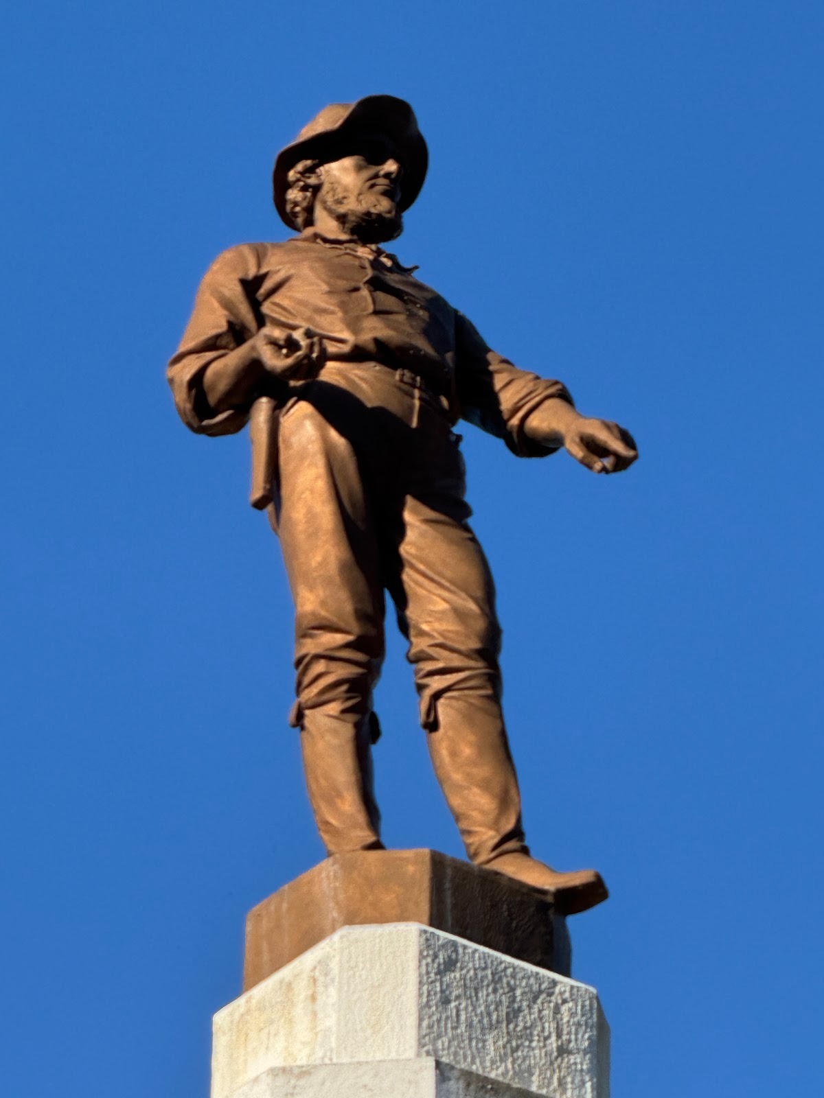
In fact he's buried under it.
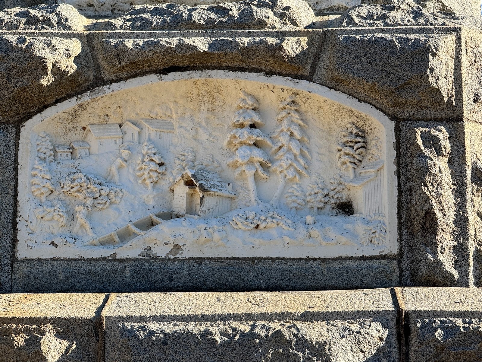
At the base, a relief shows the mill and the tailrace.
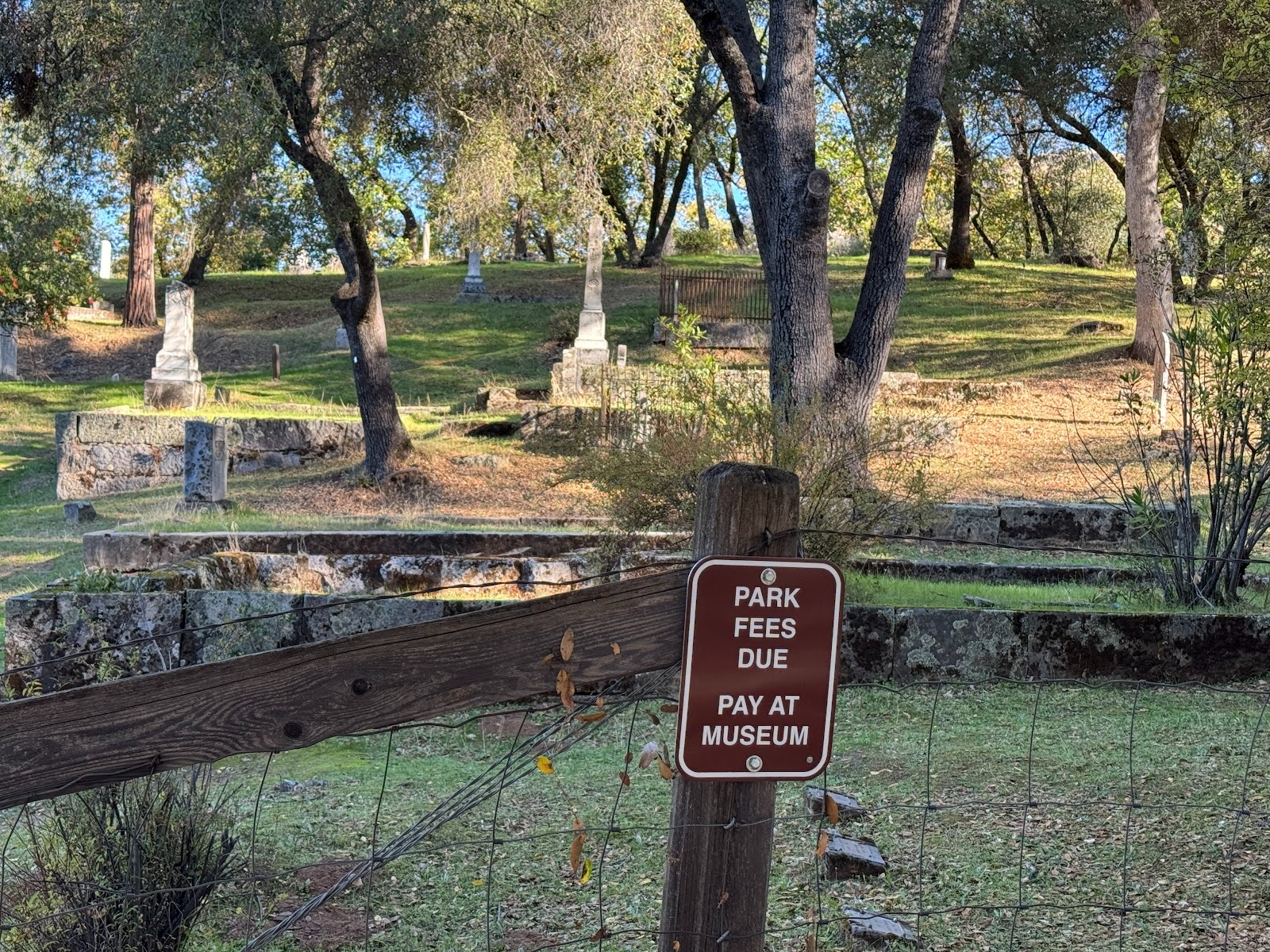
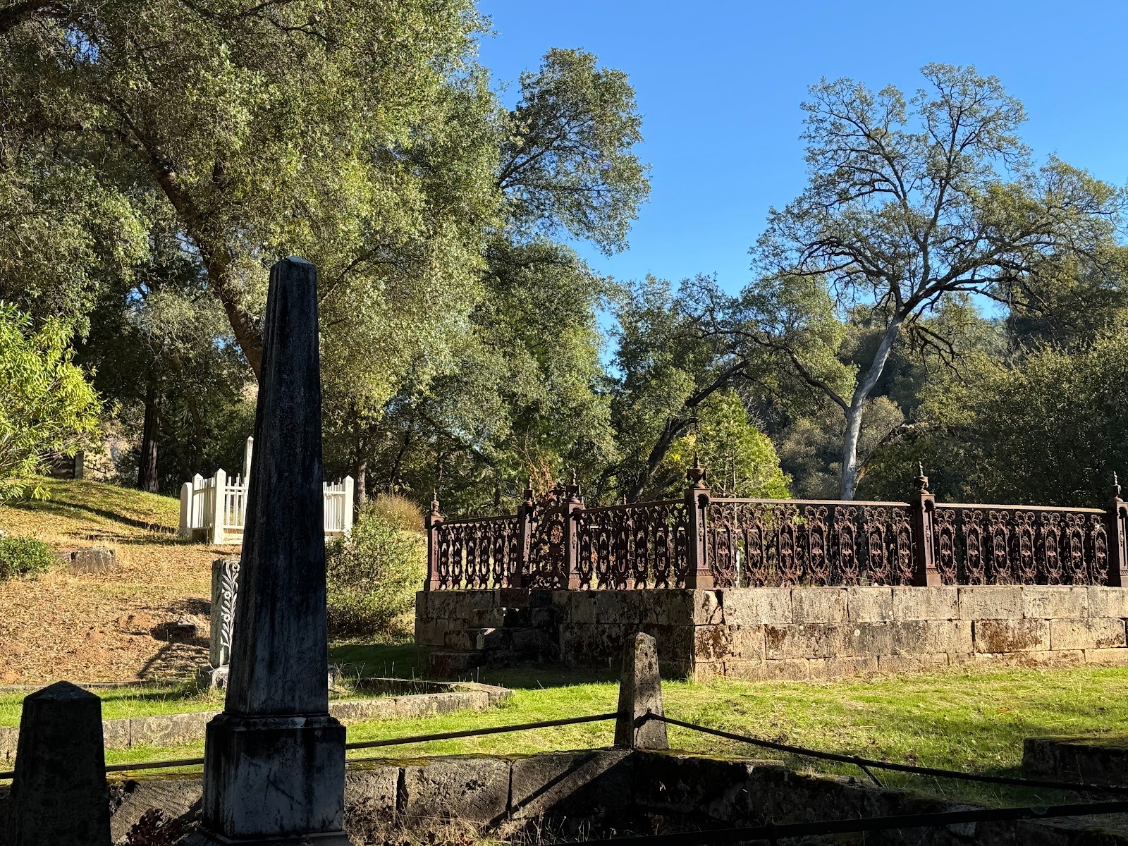
There's also a nearby cemetery. Now tell me: is it reasonable to charge admission?
Let's gate crash.
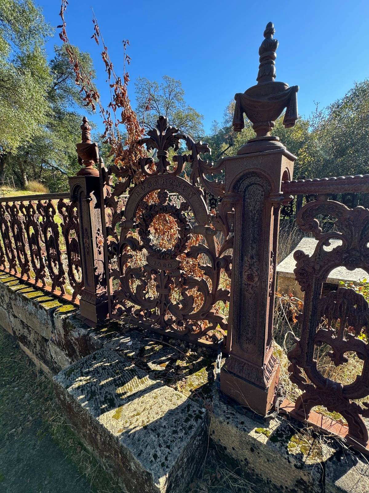
Nice ironwork for Mr. Robertson.
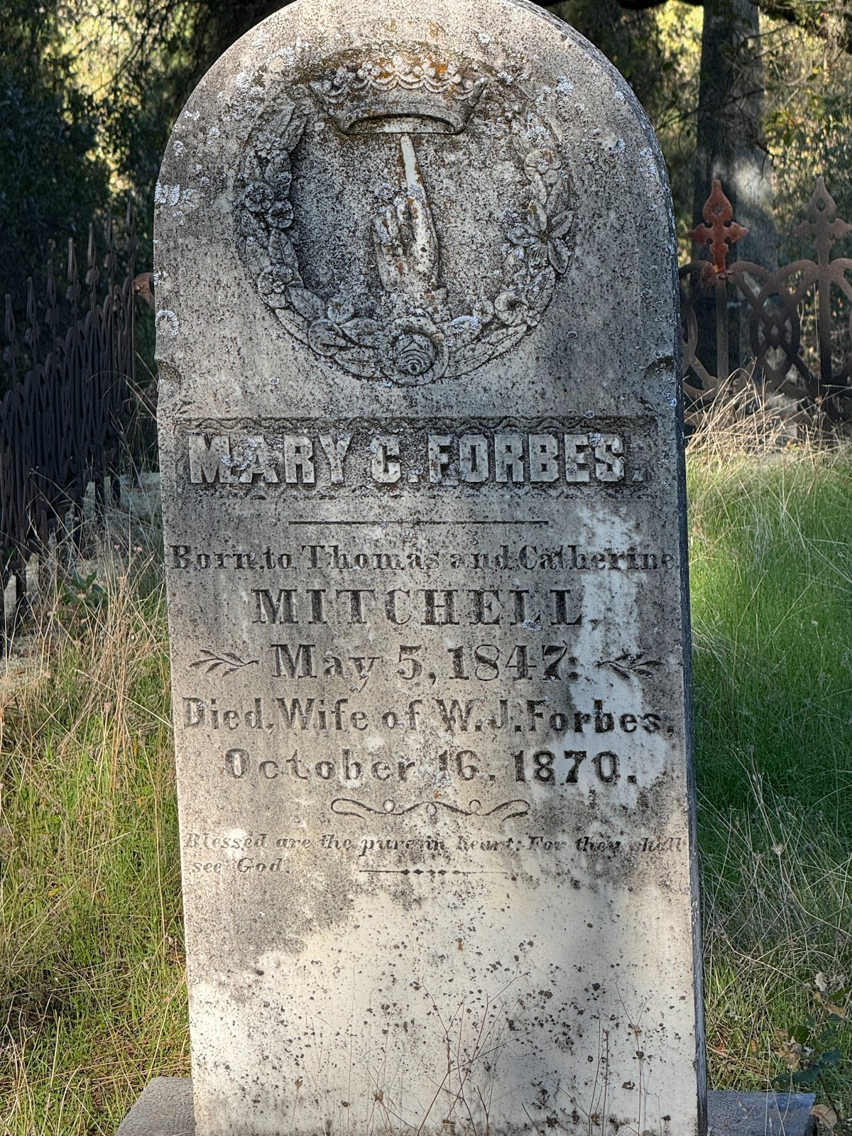
How's your mental arithmetic these days?
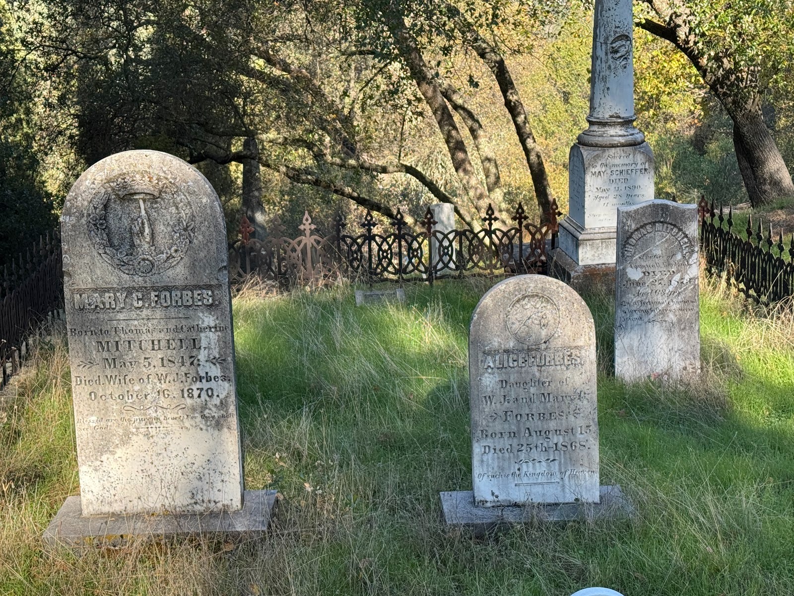
Mrs. Forbes survived by two years the death of her infant daughter.
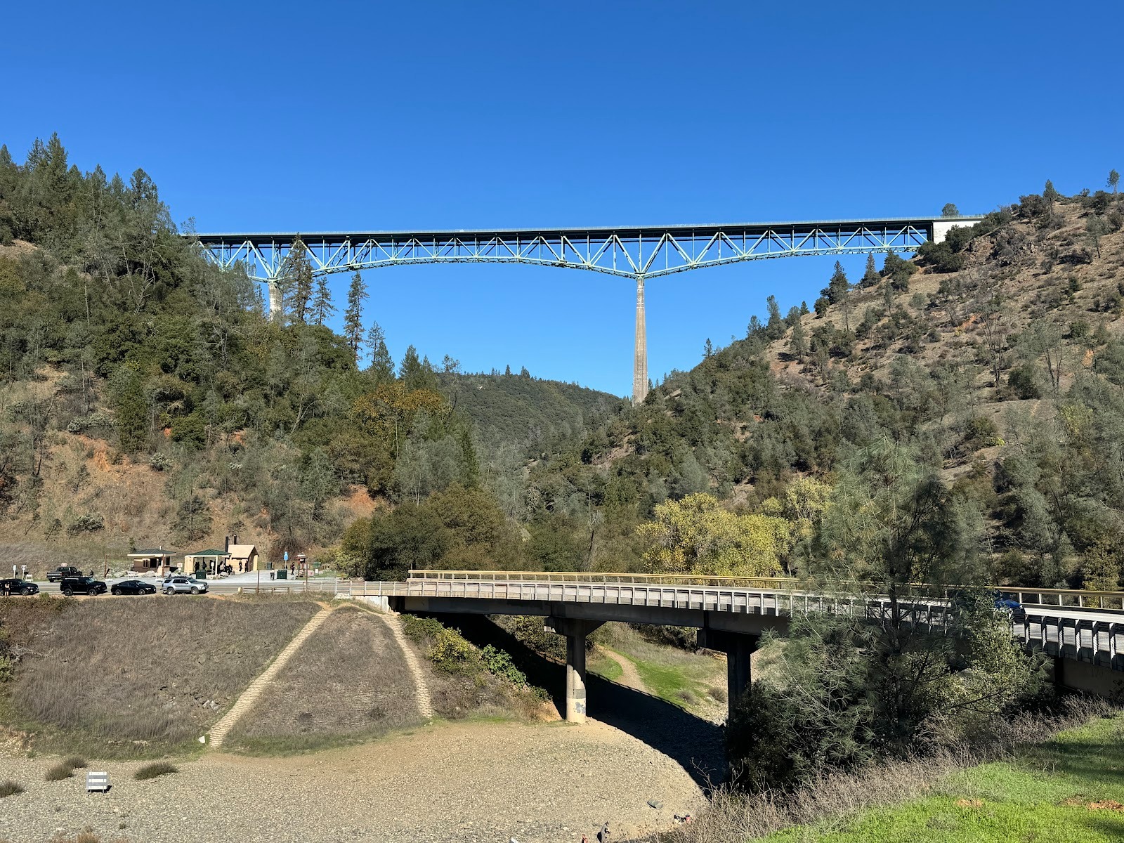
Another ten miles and we're at the confluence of the north and middle forks of the American River. That bridge yonder is the tallest in the state and serves Foresthill, a town of 2,000 people which, until the bridge came along, was reached circuitously via that low bridge. Why the extravagant new bridge? Because the low one was going to be flooded by an immense reservoir. Engineers around the country were heartbroken when the mighty Auburn Dam, about two miles off to the left, was cancelled after some preliminary work had been done, including the construction of this bridge. If work had gone as planned, the canyon would have been full of water just about up to the metalwork of the high bridge. Enthusiasts had to retool and go to work for SpaceX or Blue Origin.
An early bridge at approximately the same site. Notice the gravel-choked canyon. More of that anon, but think "hydraulic-mining debris."
(Lindgren, facing p. 79.)
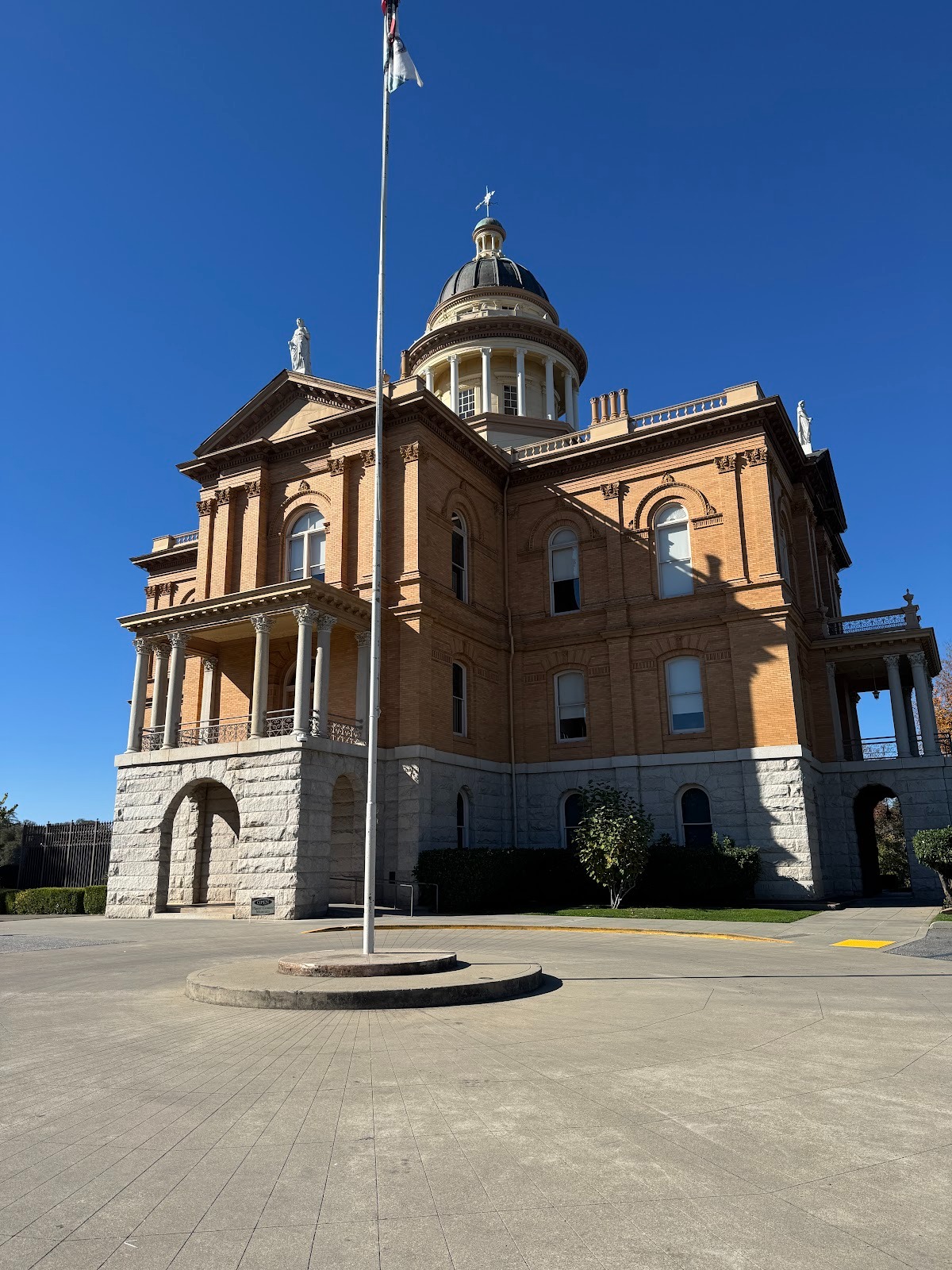
Here we are back in the 19th century at the Placer County Courthouse, completed in 1894 at Auburn, a town of 15,000 people at the top of the canyon we just climbed out of.
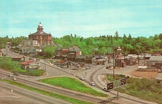
A postcard shows the same courthouse and Auburn's Old Town along with then-new U.S. 40. Interstate 80 pretty much follows the same alignment. (Notice the pyramidal building? Keep in my mind.)
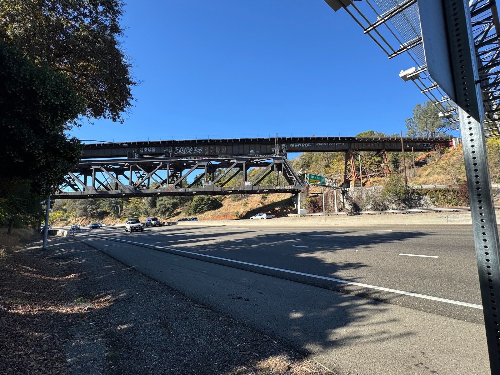
Here's the interstate, along with a reminder that Auburn lies on the route of the first transcontinental railroad. The tracks now belong to the Union Pacific, though earlier they belonged to the Southern Pacific and, earlier still, to the Central Pacific.
Here's that pyramidal building again. It's an old fire station. You're looking at the road over the Sierras before U.S. 40 had four lanes. The fire station survives, but most of the other buildings were cleared for the new highway.
https://pitsenberger.com/historic-photos/highway-40-through-auburn-1940s
See the courthouse? We've barely moved. Once again, the old core has had a hard time adapting to modern shoppers. The building at the corner was empty in 2025.
Here it is back when the world was young.
Up the street one block, there's the California bar and Carpe Vino.
Same corner before the wine bar.
https://goldcountrymedia.com/news/148124/one-photo-two-old-town-auburn-bar-stories/
Same corner again, showing traffic headed east before four-laned U.S. 40 opened.
**
**
If you had gone another mile, you would have come up here, to a newer part of Auburn.
https://pitsenberger.com/historic-photos/otfemj8zo30h9vkl4p9azoa124caur
**
**
Same corner in 2025.**
** Seems like we've toned down the sign noise.
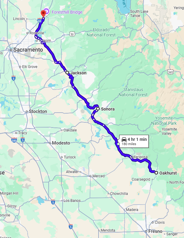
Feeling lost? All we've done is run up the blue line. Plus take a few detours.
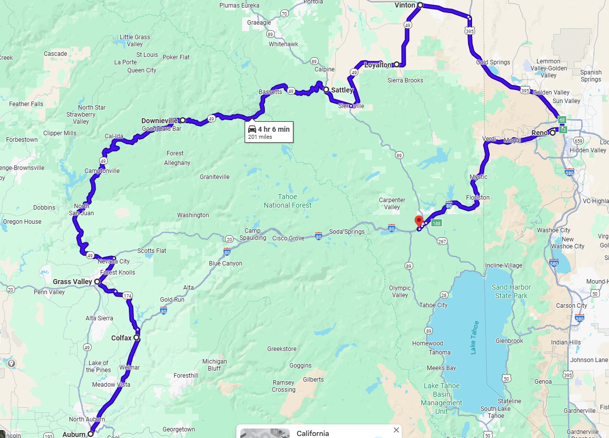
We're presently in Auburn (at the bottom of the line), and we're about to go to Grass Valley in a slightly deviant way, via Colfax. Then we'll continue to Vinton (at the top of the map), which is the north end of 49. I have to get to Sacramento (don't ask why, and I won't tell). That's why from Vinton we'll go to Reno and Truckee and a bit beyond.
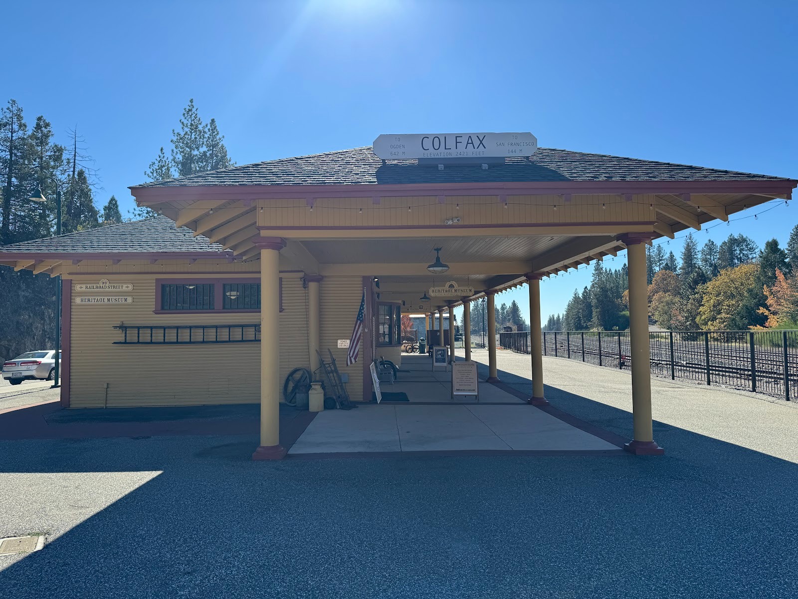
Nobody remembers poor Schuyler Colfax, even though he was Vice President of the United States. He came this way the same year that the transcontinental railroad opened. Auburn already had a name; this place didn't. It got his.
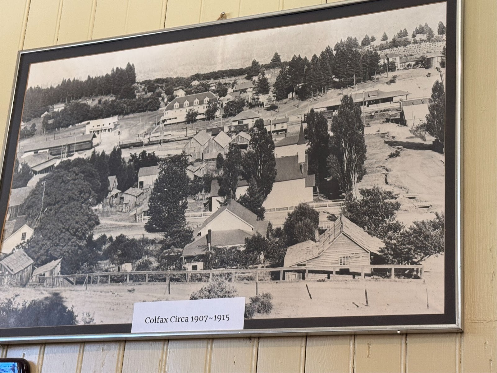
Amtrak trains come through here once a day, each way, but the station is now a museum, which has this photo on a wall. You can see the station at the upper right and a big hotel in the center distance.
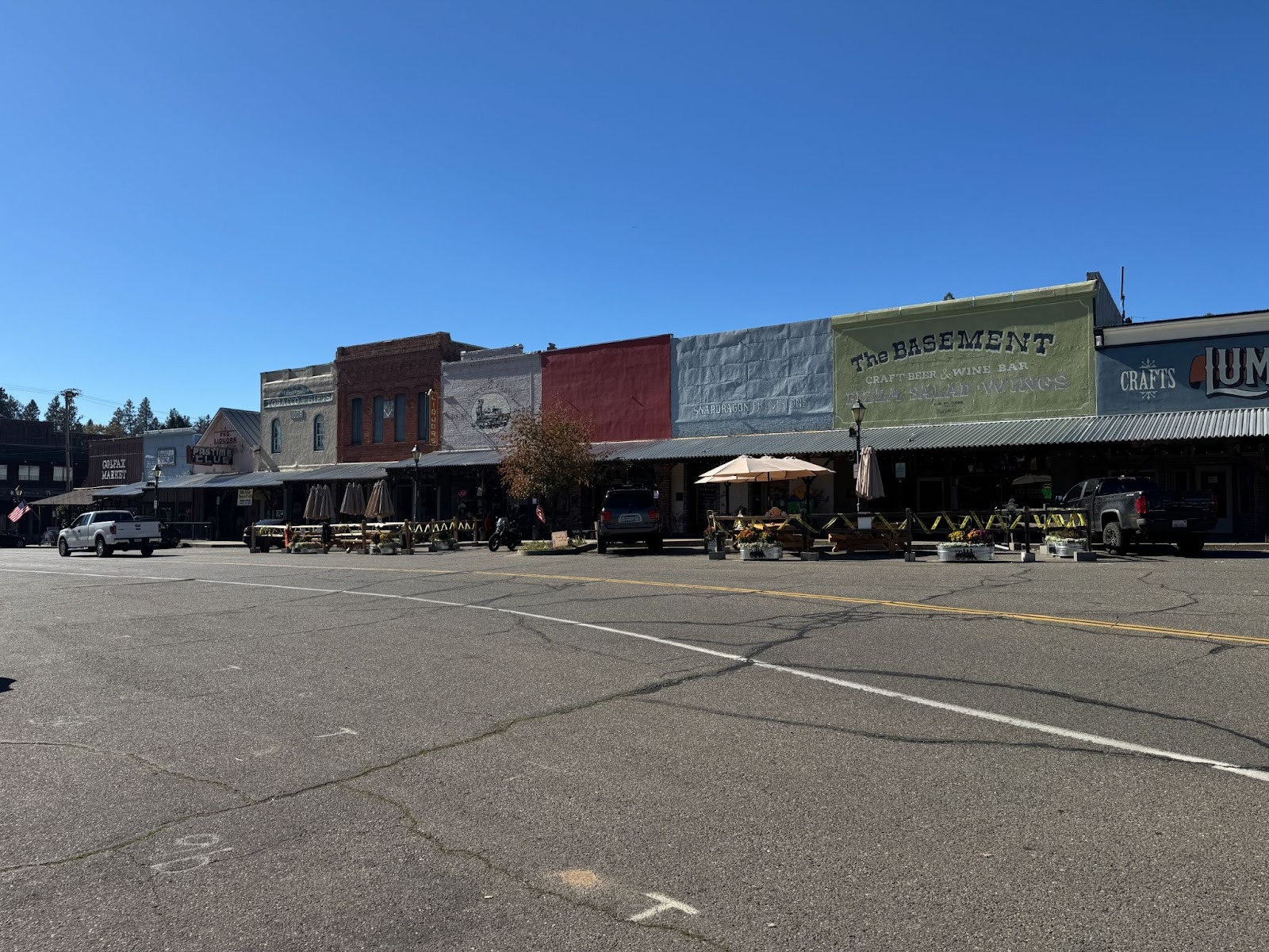
Even in 1915, part of Colfax was built solidly. The more I look at its main street, which is called Main Street, the more I think I'm looking at a preview of America in the 1950s. I wish that "Little Boxes," by Malvina Reynolds, had included a stanza or two about commercial buildings.
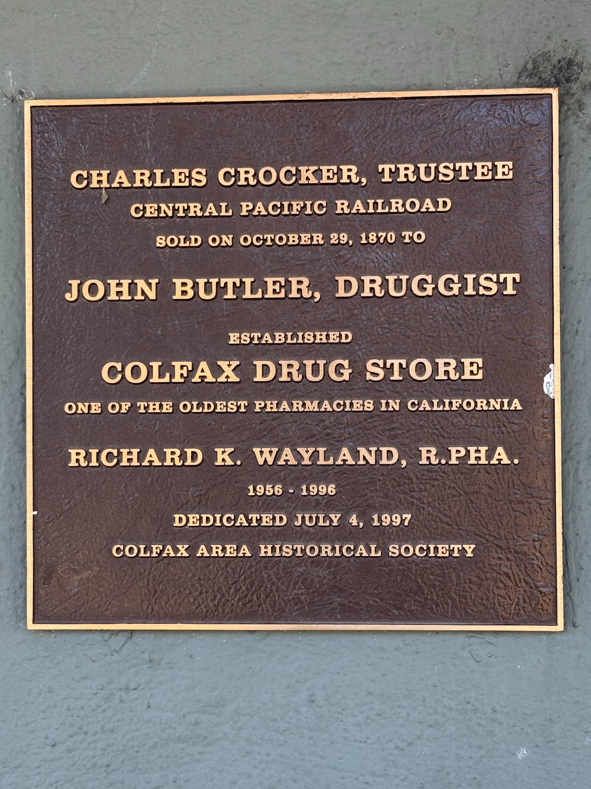
One of the buildings has this plaque. You remember Charley, don't you?
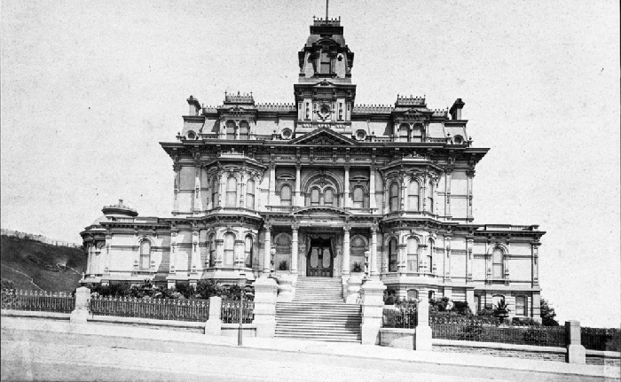
This was his place in Frisco. (It's the site of Grace Cathedral today.)
https://www.opensfhistory.org/osfhcrucible/2021/07/04/the-big-4-on-nob-hill-a-closer-look/
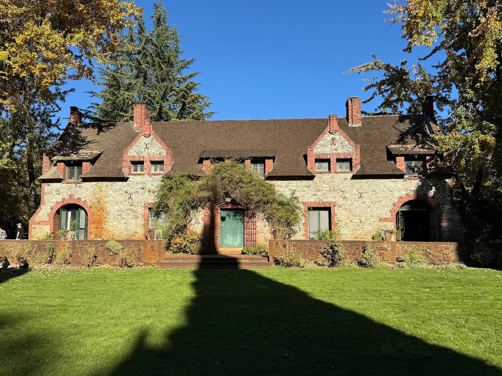
Those were the days when mansions were mansions and when a place like this was called a "cottage." This one was built between Colfax and Grass Valley by William Bowers Bourn II, a mine owner and a founder of PG&E. He had a mansion in San Francisco and another down in Woodside, on the Peninsula. They're still there.
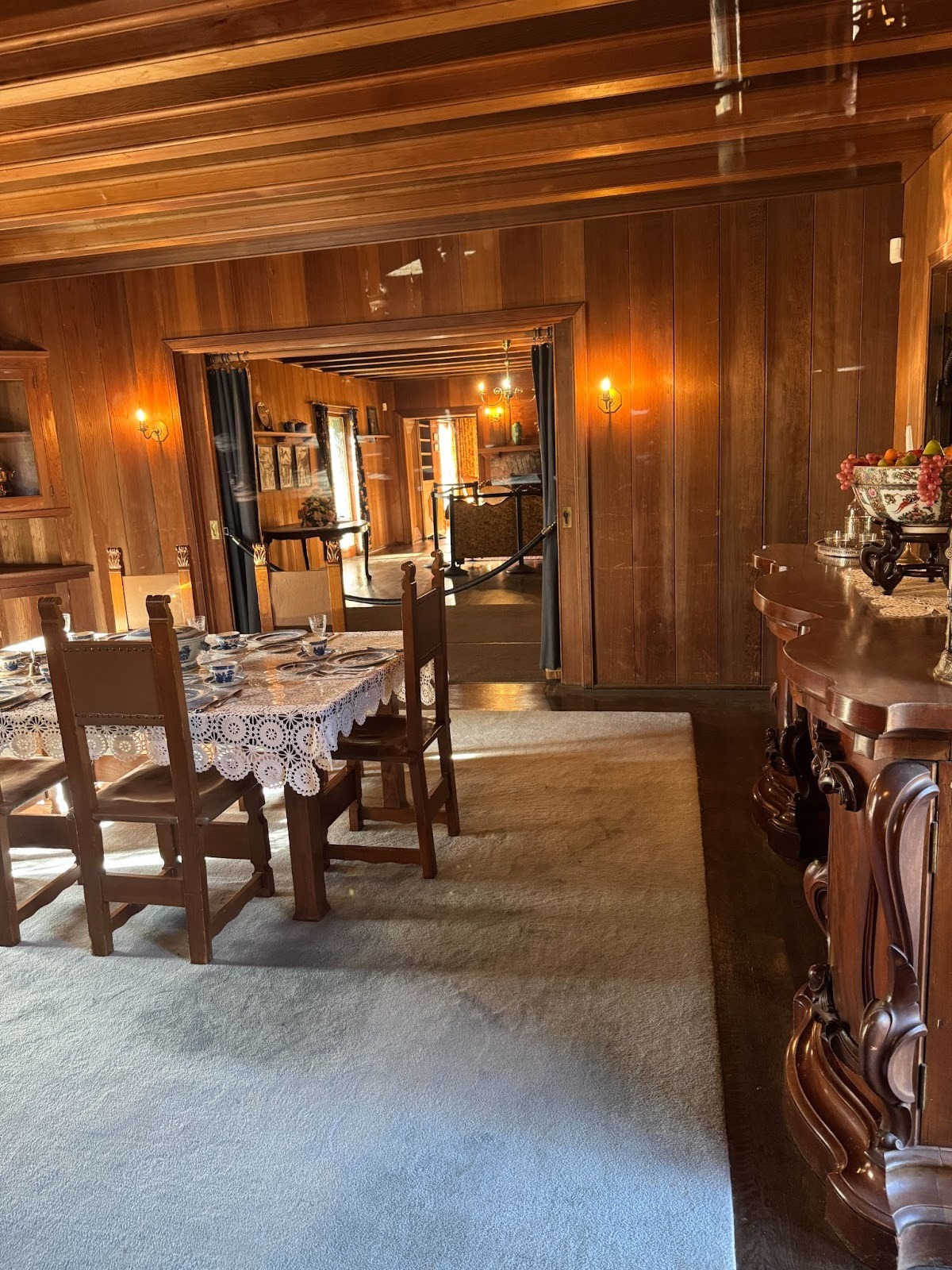
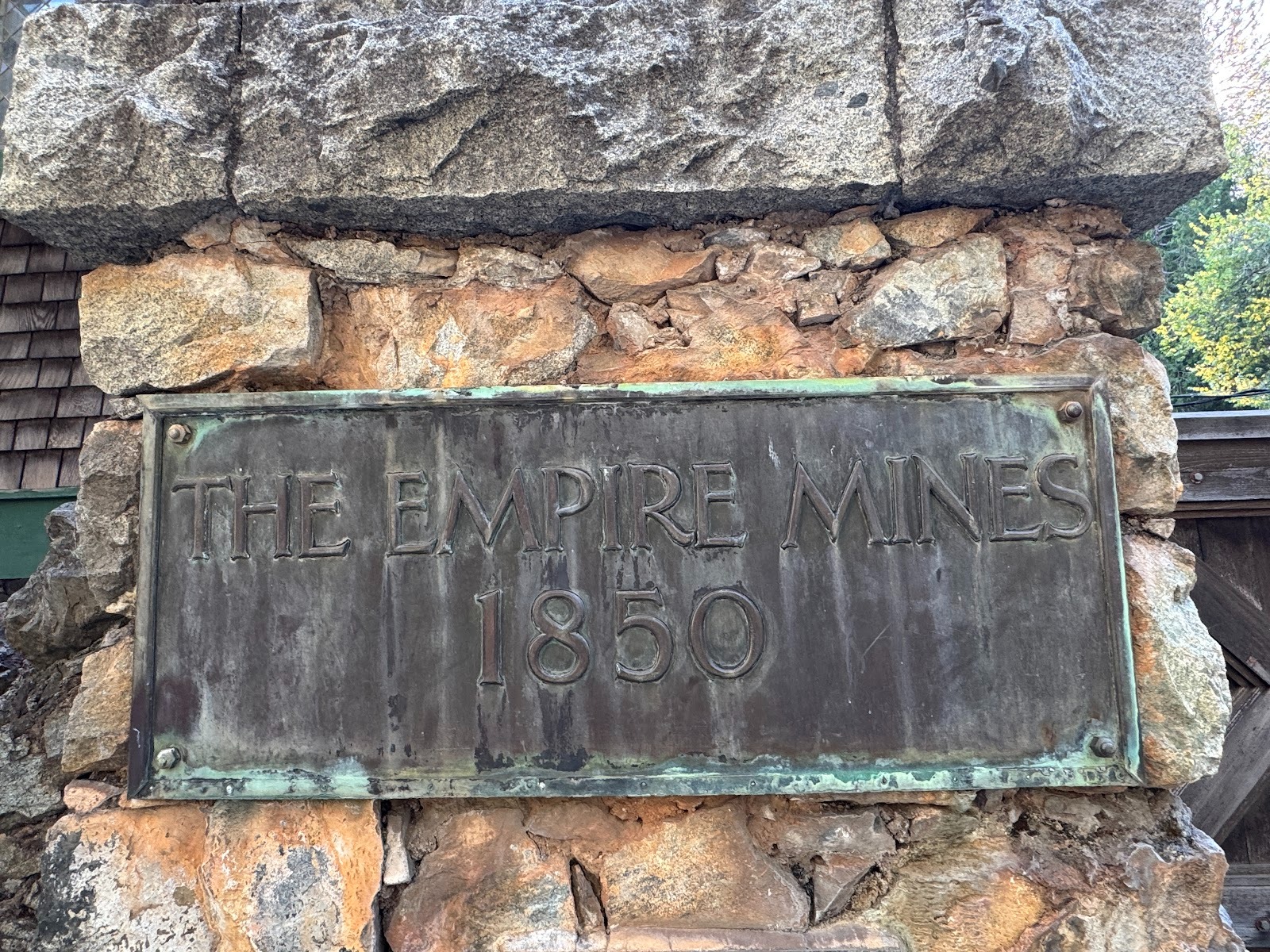
The interior's not too bad, but sleeping here would have been difficult, because we're next to Bourn's Empire Mine and its adjacent stamp mill.
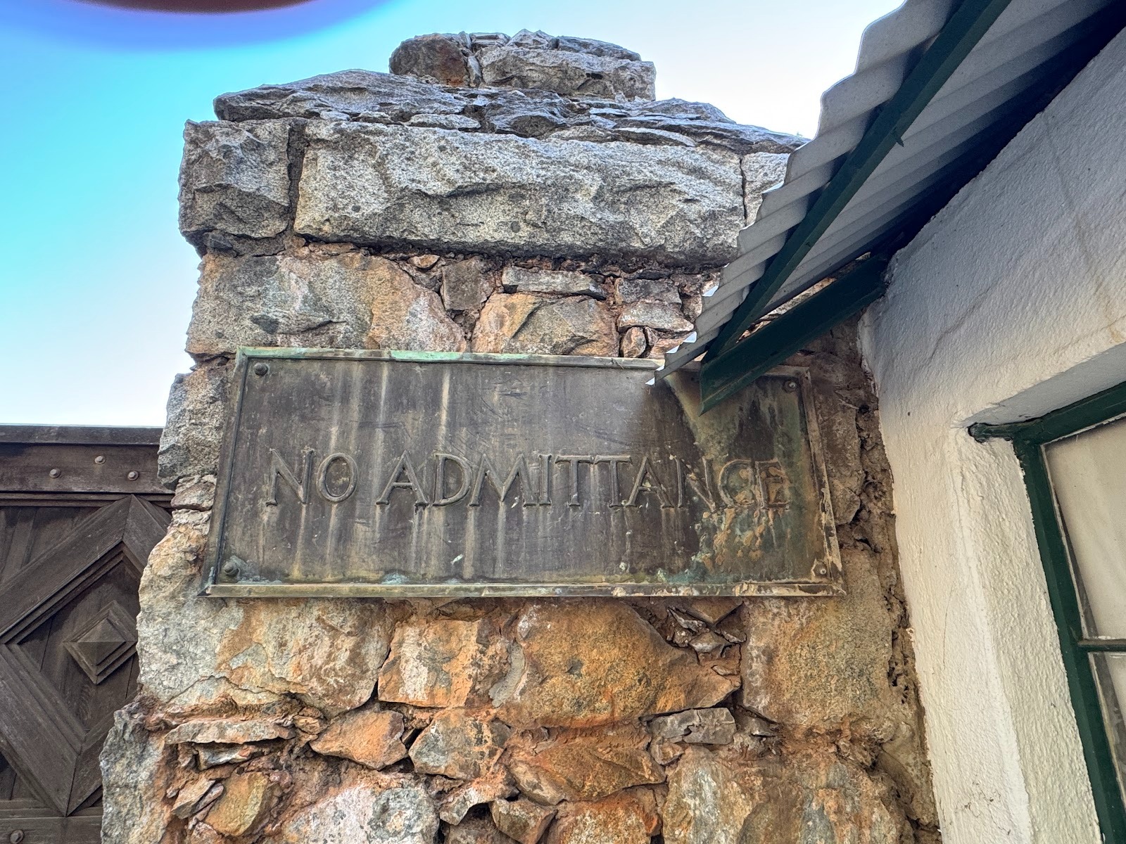
Don't worry about the sign.
We'll buy a damned ticket.
Here's the admin building, designed by the same architect, Willis Polk, who designed the cottage.
The Empire Mine was accessed through an inclined shaft that dived underground at an angle of about 30 degrees for 11000 feet to a bottom depth of about 4000 feet below the surface. You bet that the engineers had maps of all its branches.
Look at the top of the image. That's horizontal, and the track is descending. At depth, it's been flooded since the pumps were turned off when the mine closed after a strike in 1956.
You can see the angle of the incline more clearly here.
Foundation of the stamp mill.
So the cottage looked peaceful but wasn't. Bourn, who died in 1936, had sold the mine in 1929 to Newmont, which remains the world's biggest producer of gold, with interests in Nevada, Australia, and Ghana.
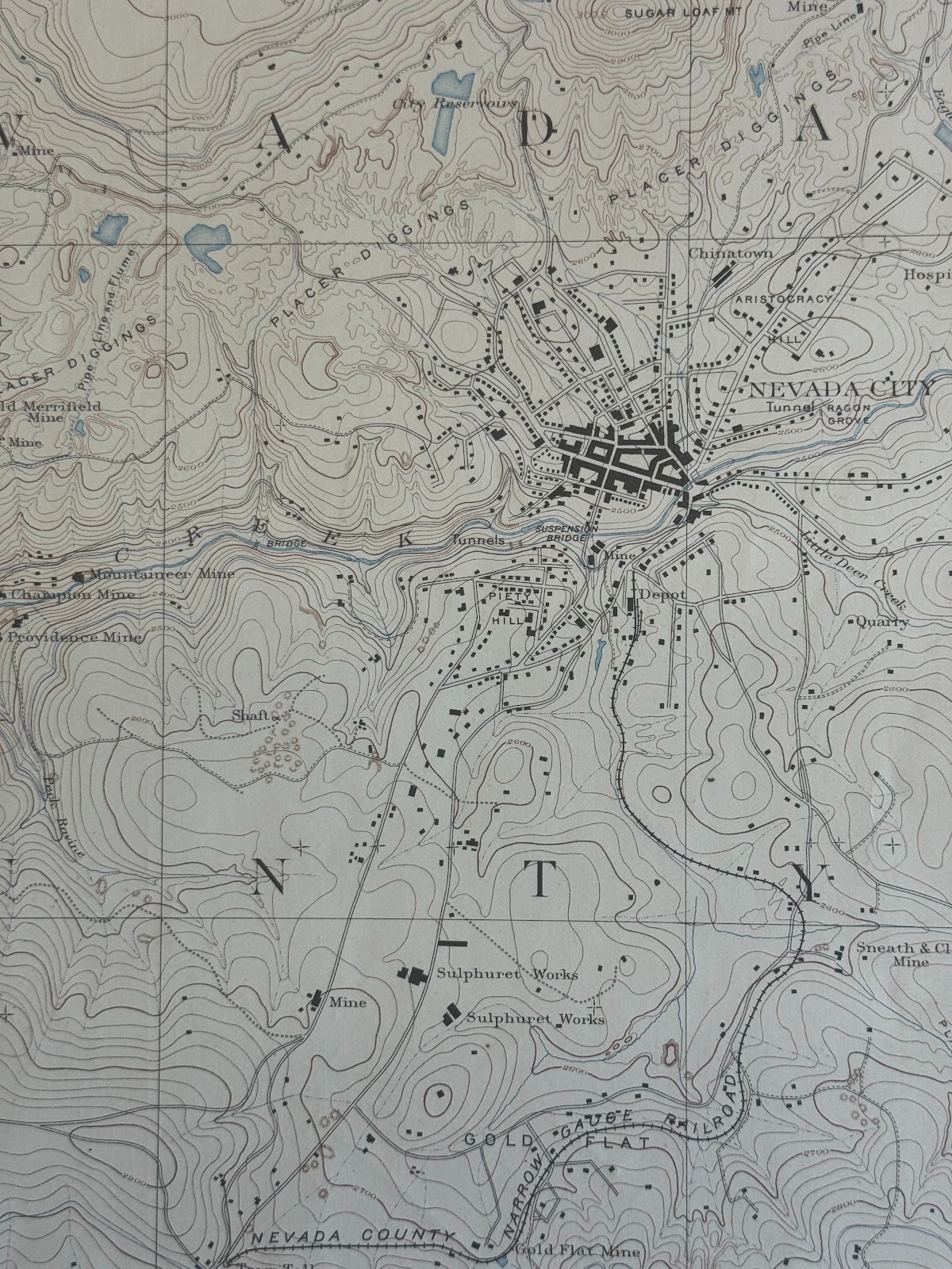
The Empire Mine is shown at the lower right, along with placer diggings blanketing the countryside. The railroad at the top right was a short line connecting Grass Valley and Nevada City with Colfax.
(USGS Nevada City Special Map, 1:14,400, 1891.)
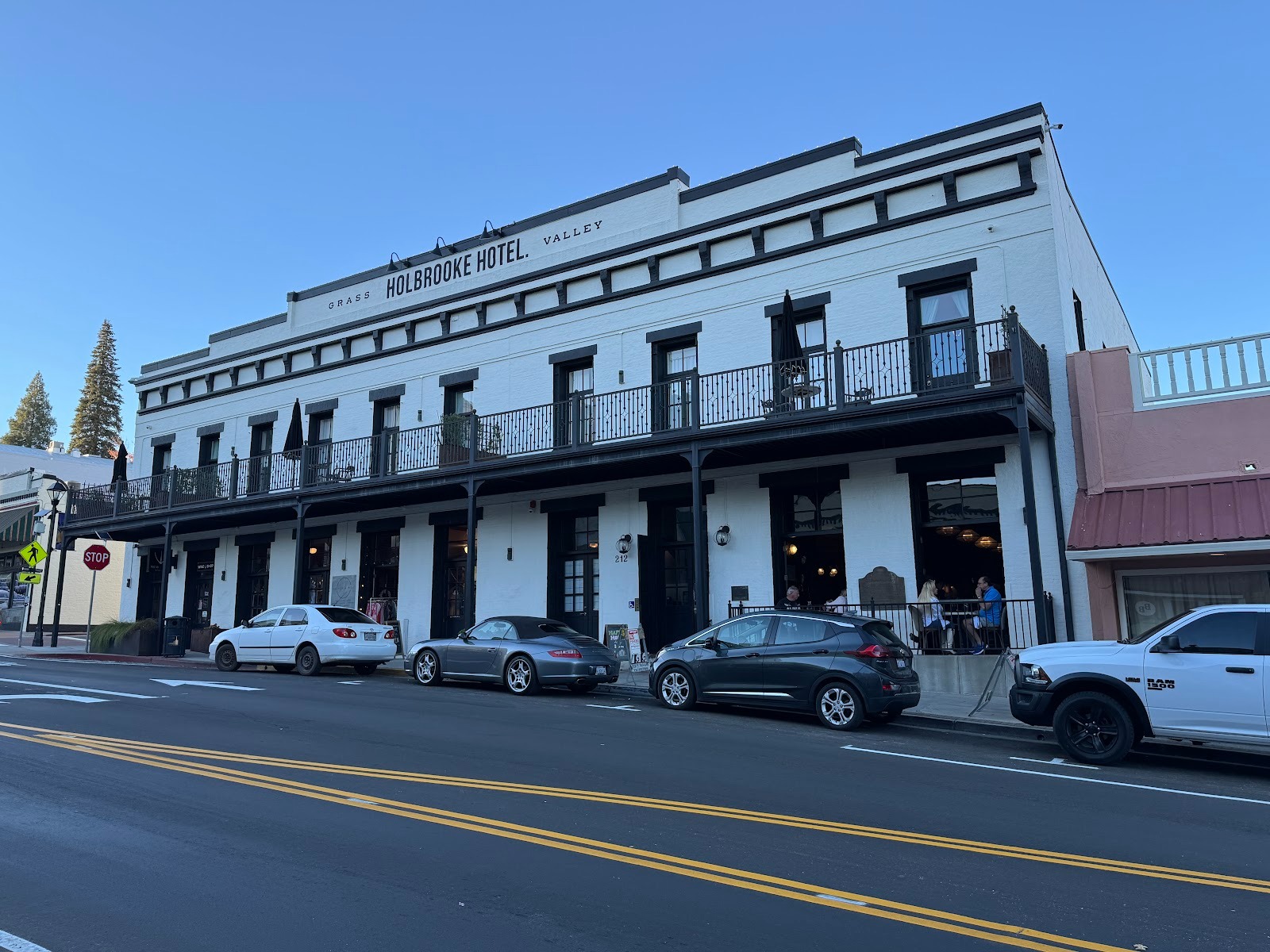
We're in Grass Valley and looking at the Holbrooke Hotel from 1862. Guests included Presidents Grant, Harrison, and Cleveland. Mark Twain stayed, too.
(Rural California 6 traces much of the same ground as the remainder of this file but the photos in that file were taken 20 years earlier.)
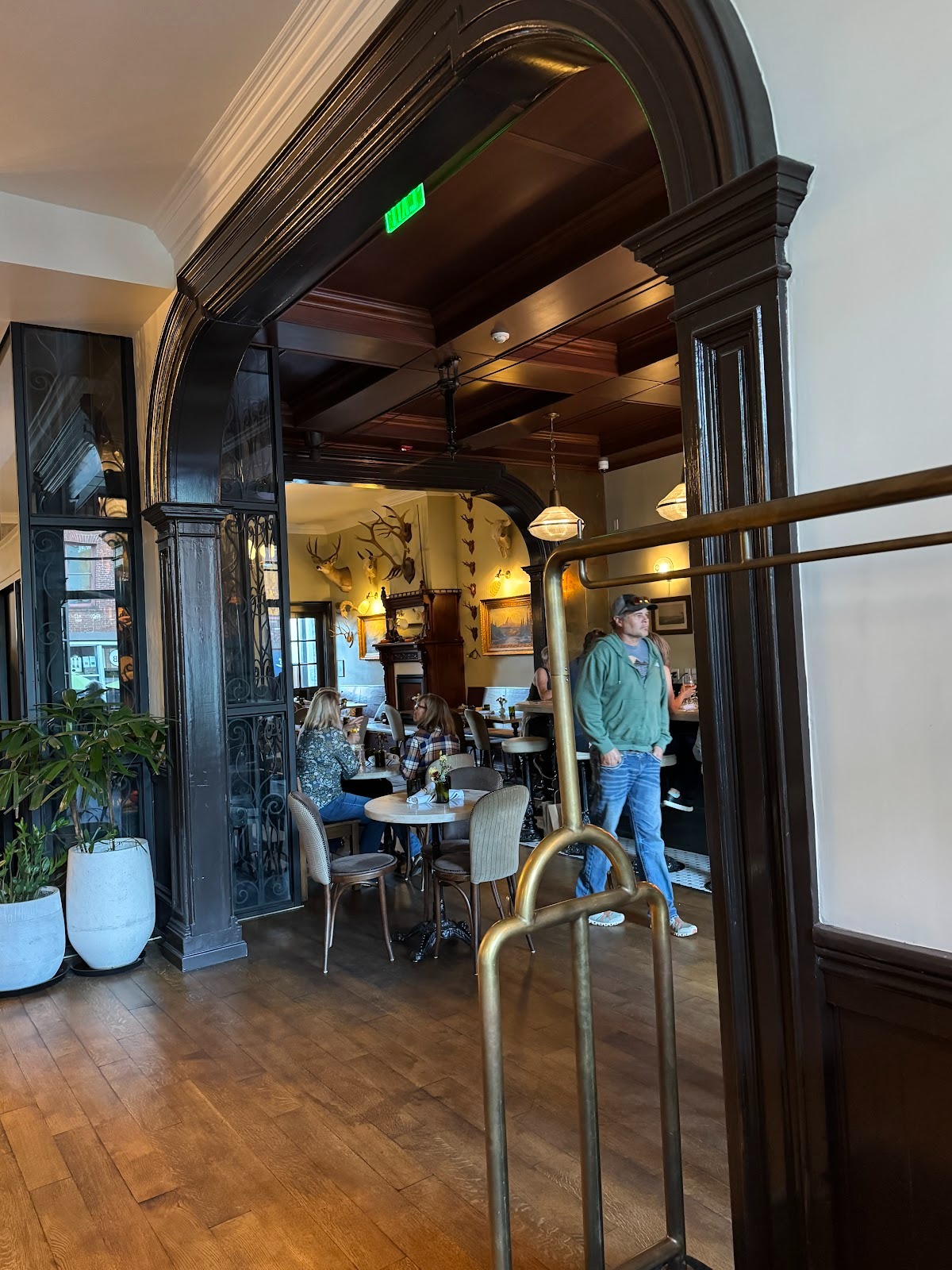
We're not staying, but nice woodwork.
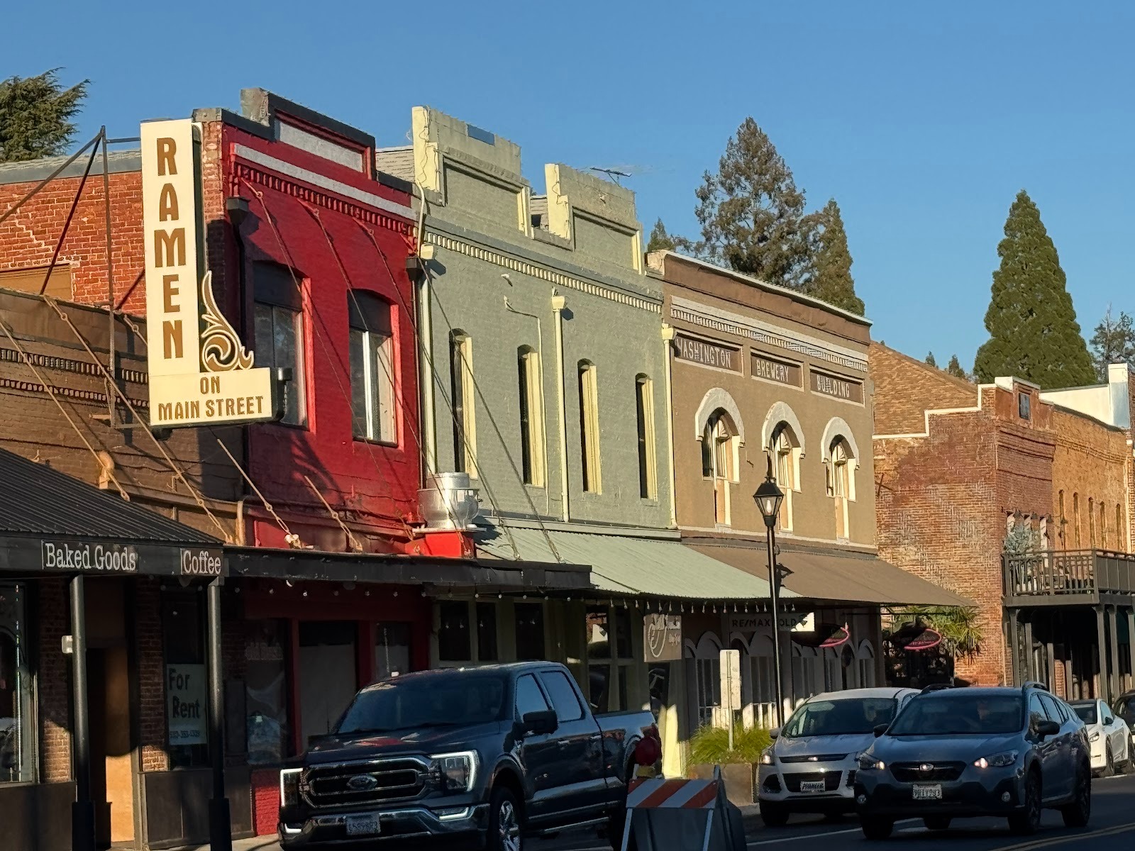
Down the street there's the usual cultural pluralism. (Don't get angry with my fancy words; I have to keep in trim.) The words atop the building with the arched windows say Washington Brewery Building.
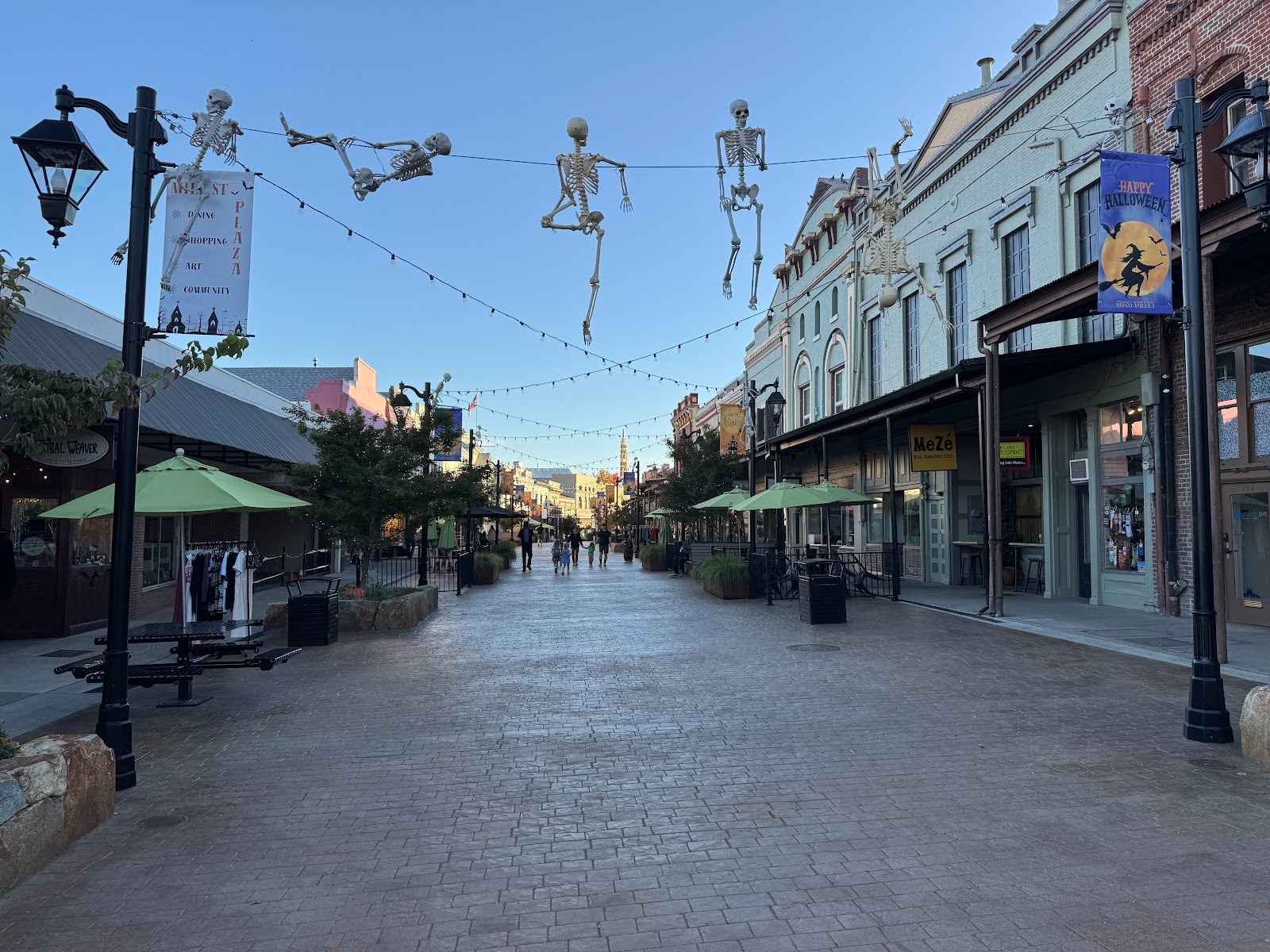
Anyway, during the pandemic this busy street was closed to traffic. In 2021, the town decided to make the closure permanent. Now we have the Mill Street Plaza, about two blocks long.
Pleasant enough.
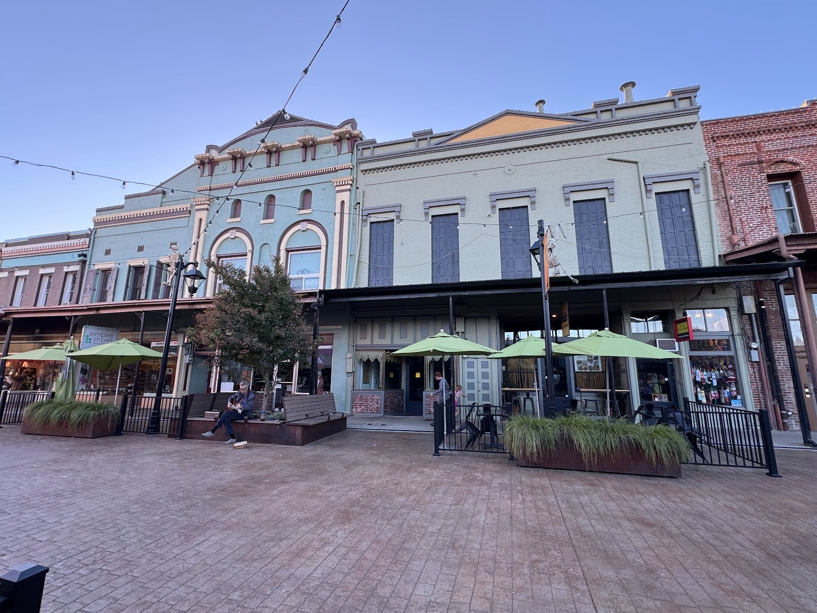
A few blocks more, and Mill St reopens to traffic and passes this curiosity. It's a replica of the home purchased by and lived in by none other than the notorious Lola Montez. She wasn't here long, just from 1853 to 1855, but she still provides some titillation. A plaque refers to her as the Countess of Landsfeld and says that "She brought culture and refinement to this rude mining camp."
This is the only stretch of Highway 49 that's four-laned. It runs for about five miles between Grass Valley and Nevada City.
You can see the railroad coming in from Grass Valley and stopping a bit short of Nevada City, which lies on the other side of a creek and has its main street going up a few blocks on the other side.
(USGS, Nevada City Special Map, 1: 14,400, 1893)
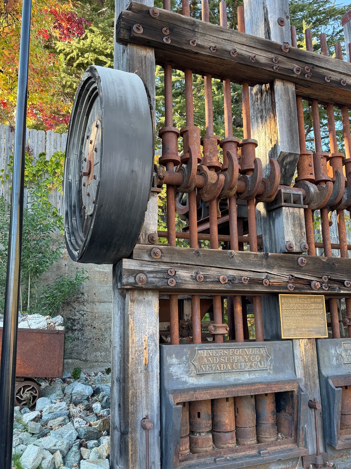
The town celebrates its mining history, in part by plopping down a stamp mill that was made here and which operated at the nearby Alpha Mine from 1905 to 1931.
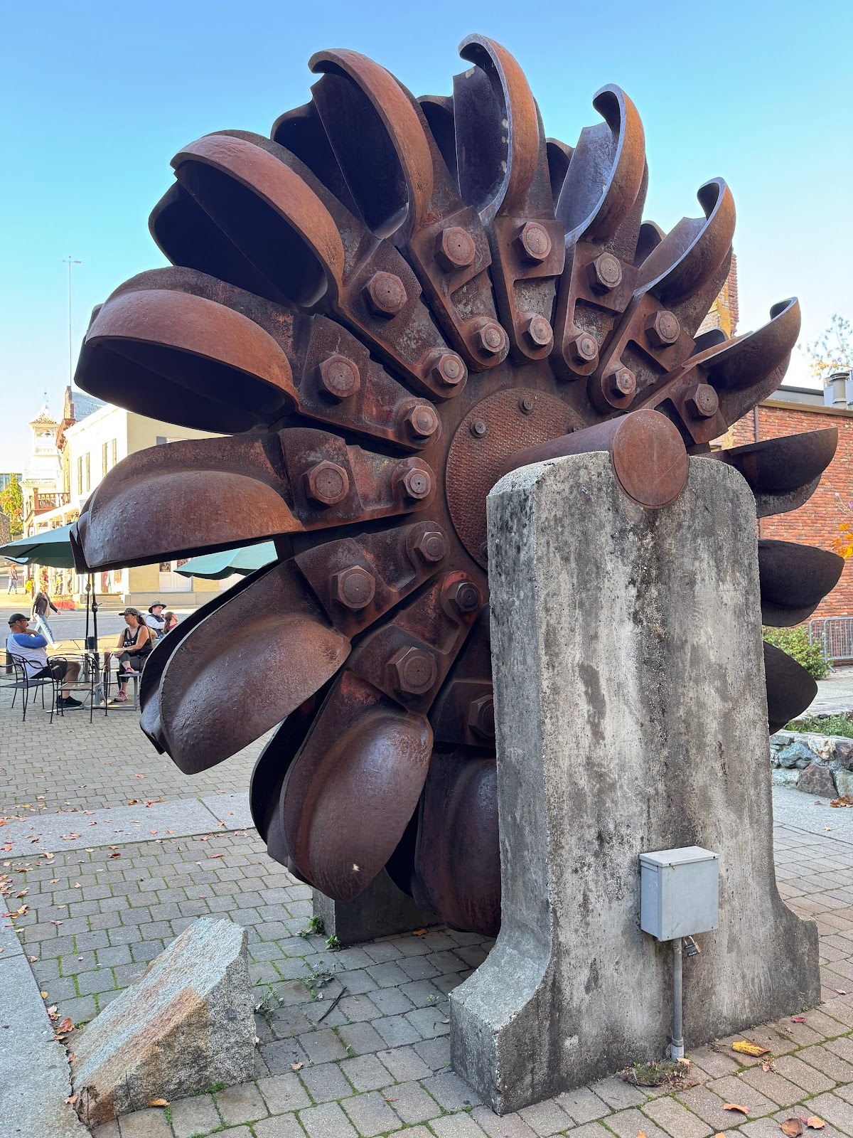
Most hydroelectric plants today run on Francis turbines, but the Pelton Wheel was invented locally by Lester Pelton and is well suited to plants with a lot of drop but not much water. This wheel operated at PG&E's Drum Power House between 1928 and 1987. At 257 rpms, it generated 18,000 horsepower.
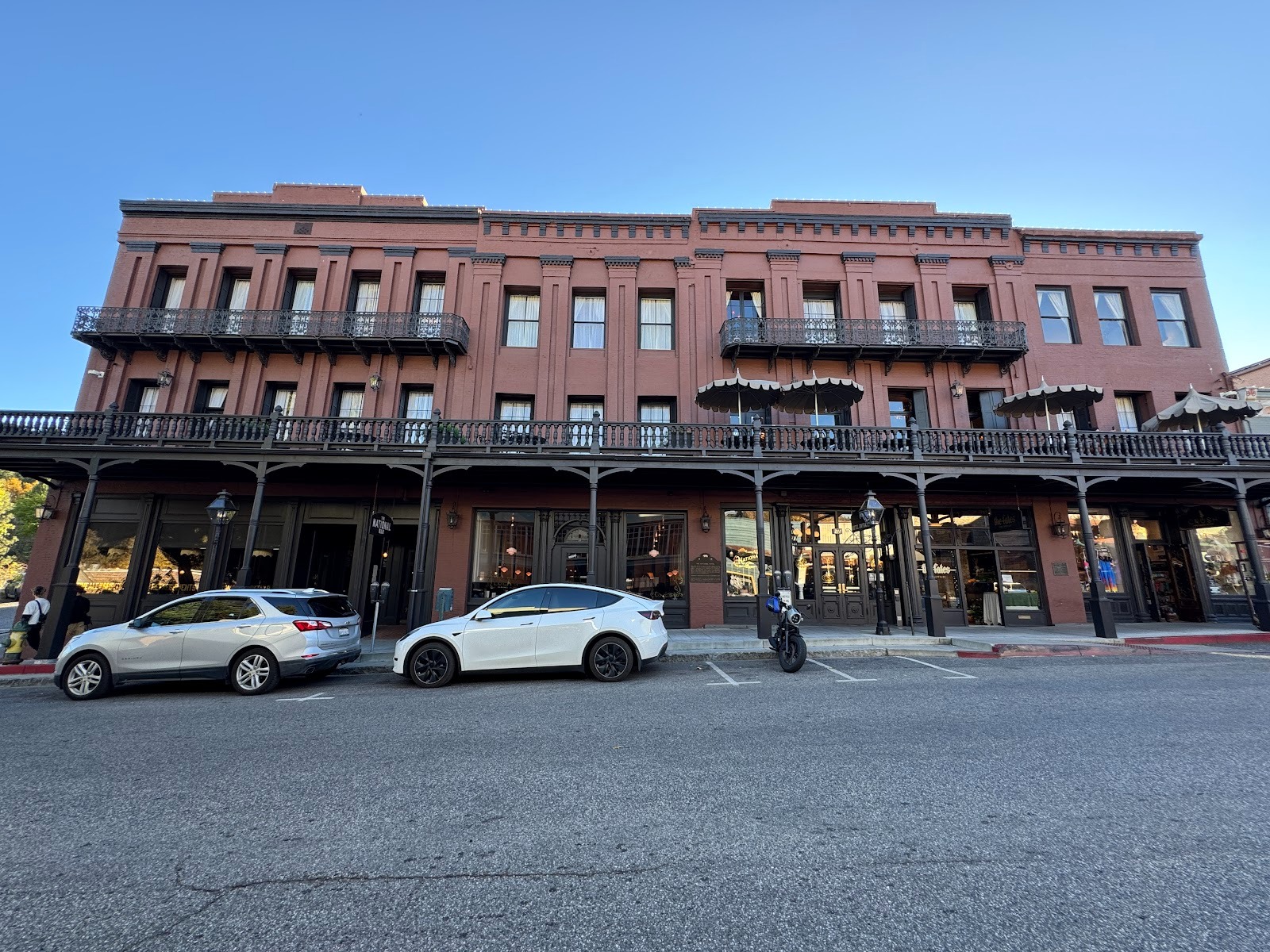
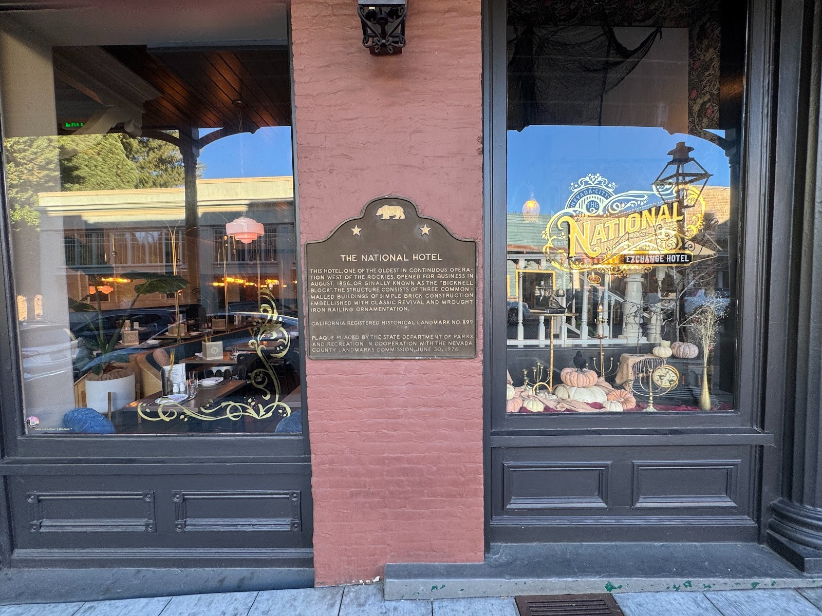
Nevada City has a fancy hotel, of course, in its case the National Exchange Hotel from 1854.
Are we civilized enough to partake?
Sorry. I'll get some crackers.
Across the street.
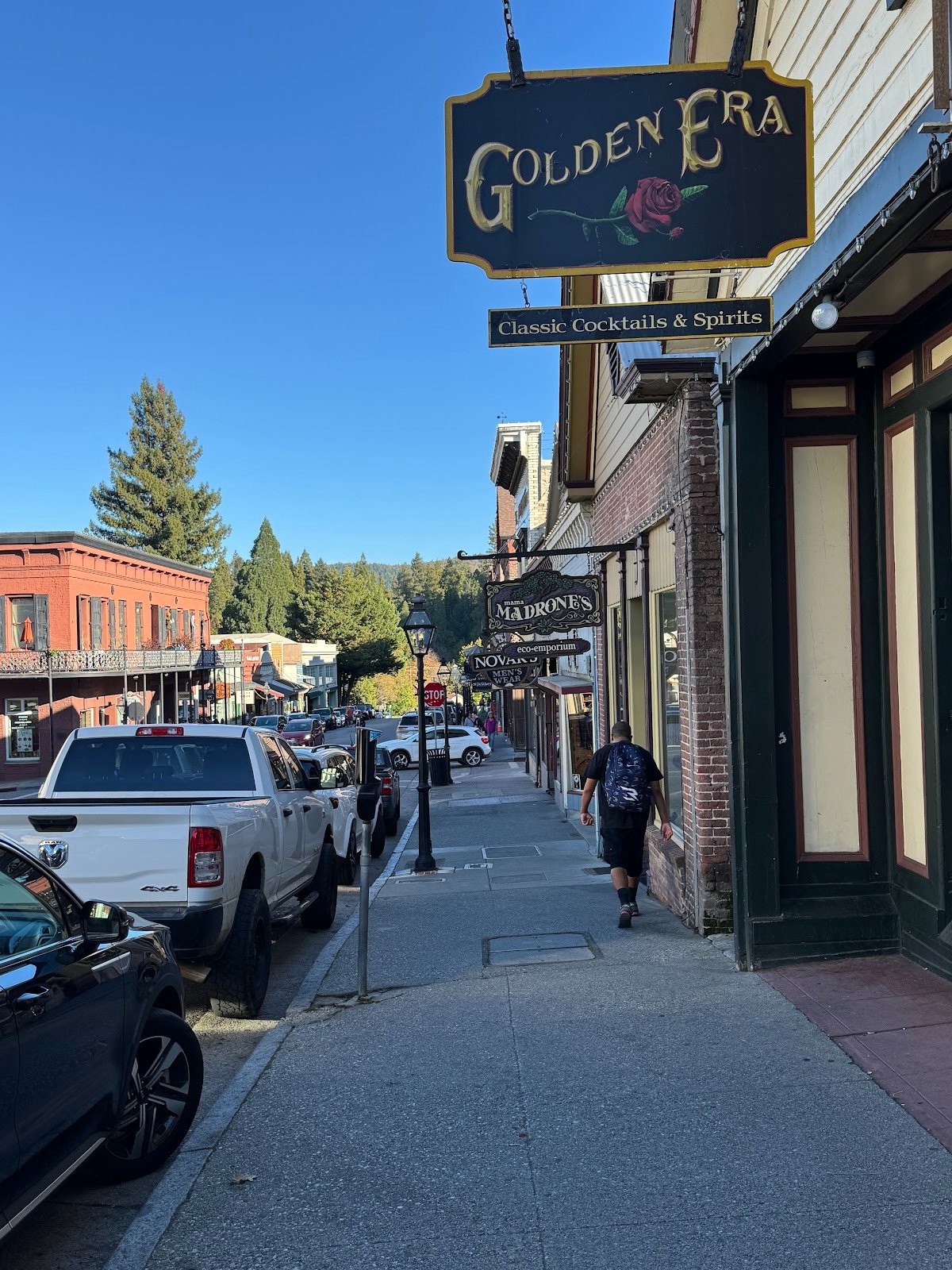
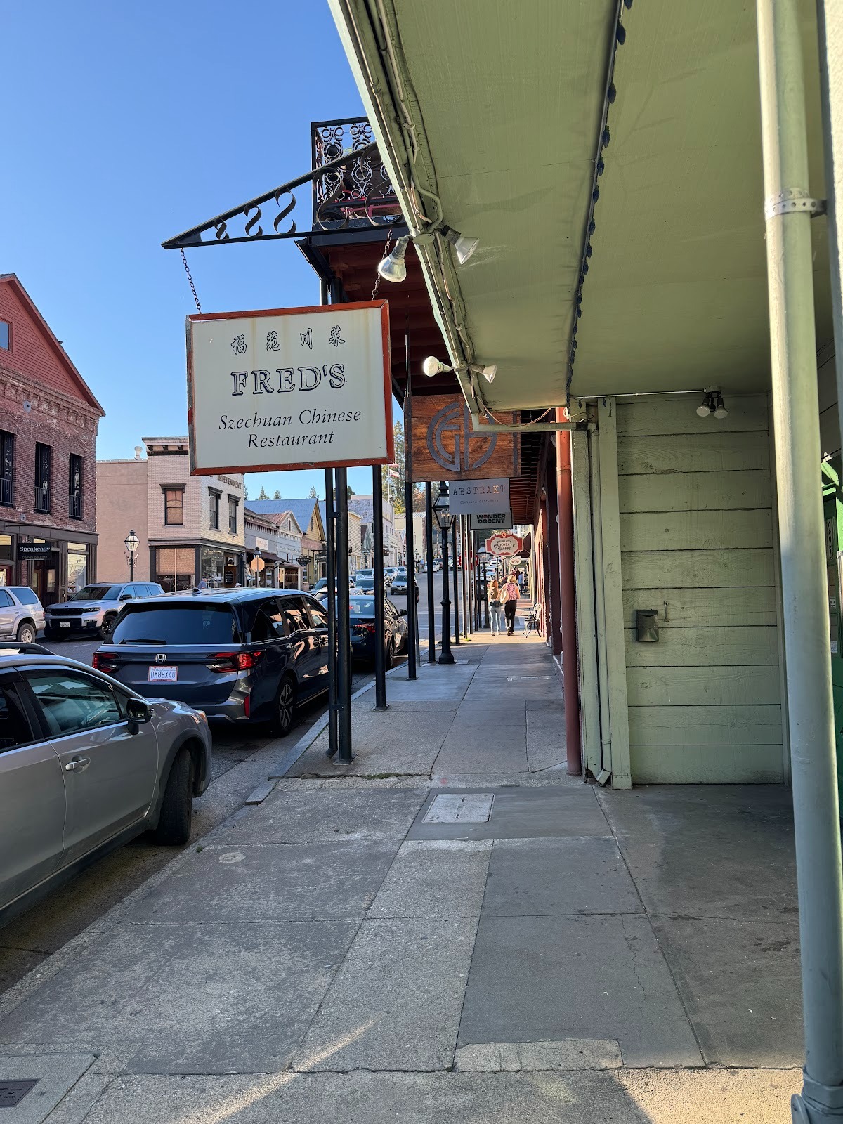
Classic Cocktails and Spirits, next door to Mama Madrones Eco-emporium. How often do I have to tell you: this is not the California you grew up in.
Firehouse Museum.
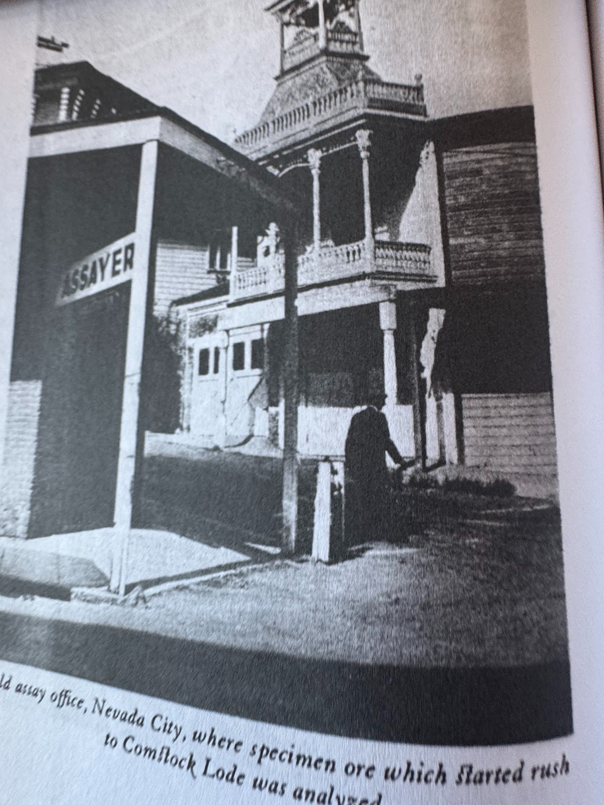
Do you need more proof: the old Assay Office now houses Inner Path: Resources for Yoga, Meditation, and a Spiritual Life.
(Stellman, facing p. 193).
We're going to go househunting.
Nice?
The yard sign speaks to the redistricting proposition that passed in the state but failed in every county we've passed through except Placer, with its Sacramento suburbs.
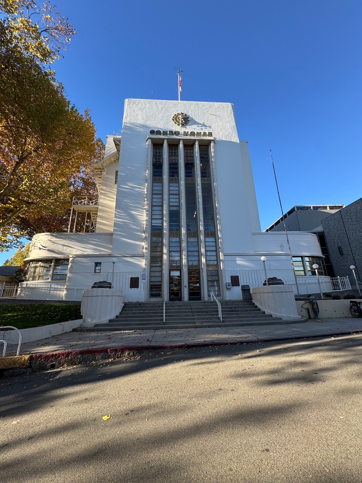
The Nevada County courthouse looks like it was built in the 1930s but dates to 1864, with enlargement in 1900 and then again in 1936-7.
George Sellon, architect of the courthouse, also did the city hall. He was the state architect for a while and designed parts of San Quentin.
Across from the court house, this was the Searls Law Office and was used by three generations of attorneys in the Searls family, beginning with Niles, who became chief justice of the California supreme court, continuing with his son Fred, who drafted the papers incorporating the state's hydroelectric power industry, and ending with grandson Carroll, who became general counsel of Newmont Mining. The office operated for a century, from 1870 to 1972.
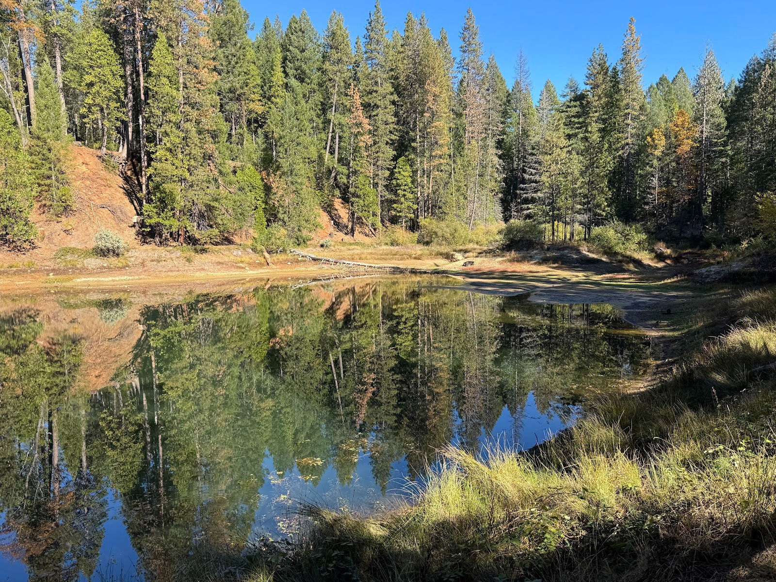
We're half a dozen miles up 49 at the South Fork of the Yuba. We're looking downstream.
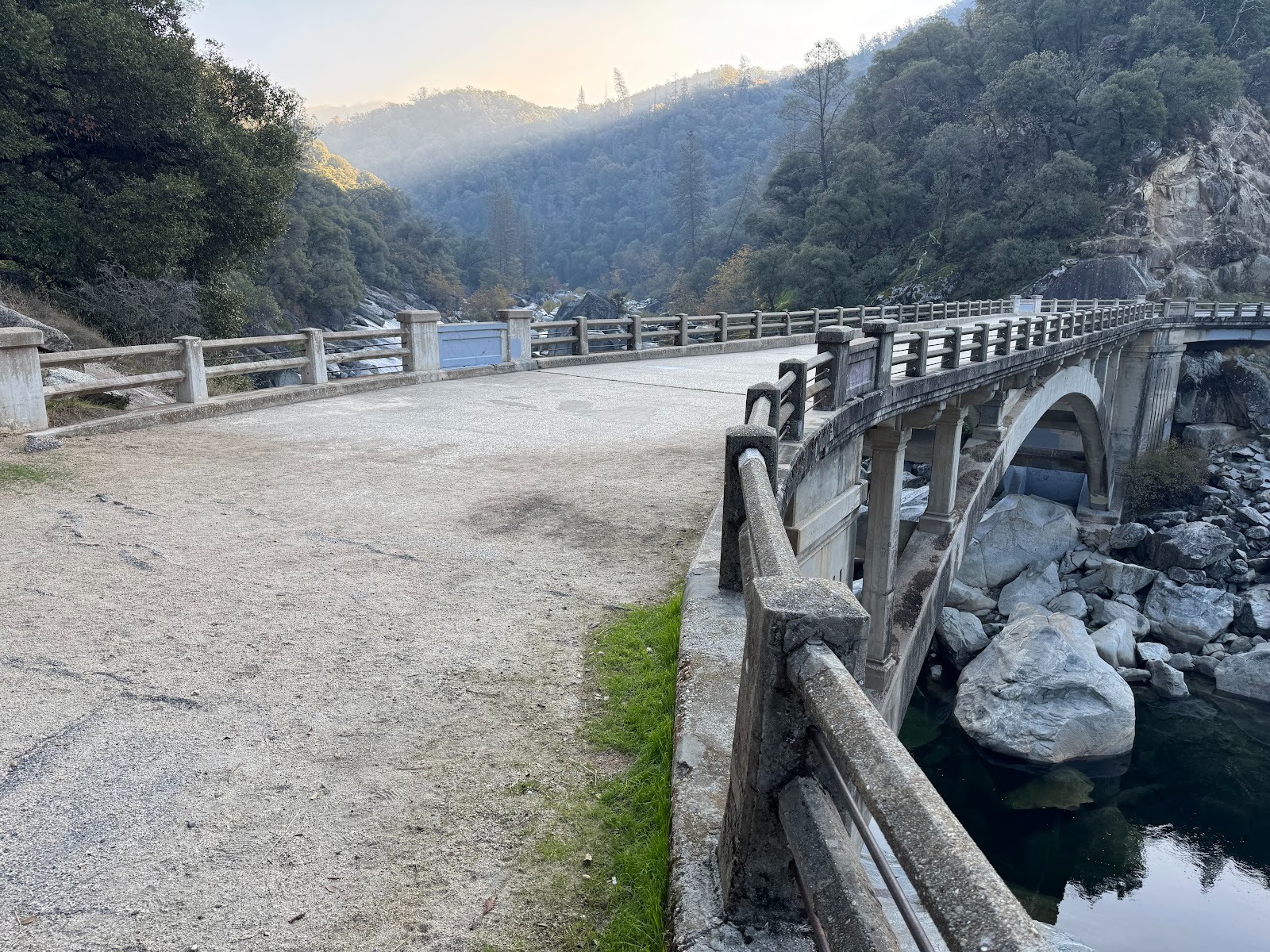
That last photo was taken from this old bridge, just upstream.
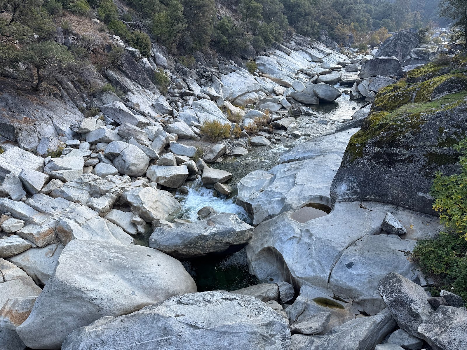
Here's the view upstream from that old bridge. Mysterious, almost like a broken pottery tube.
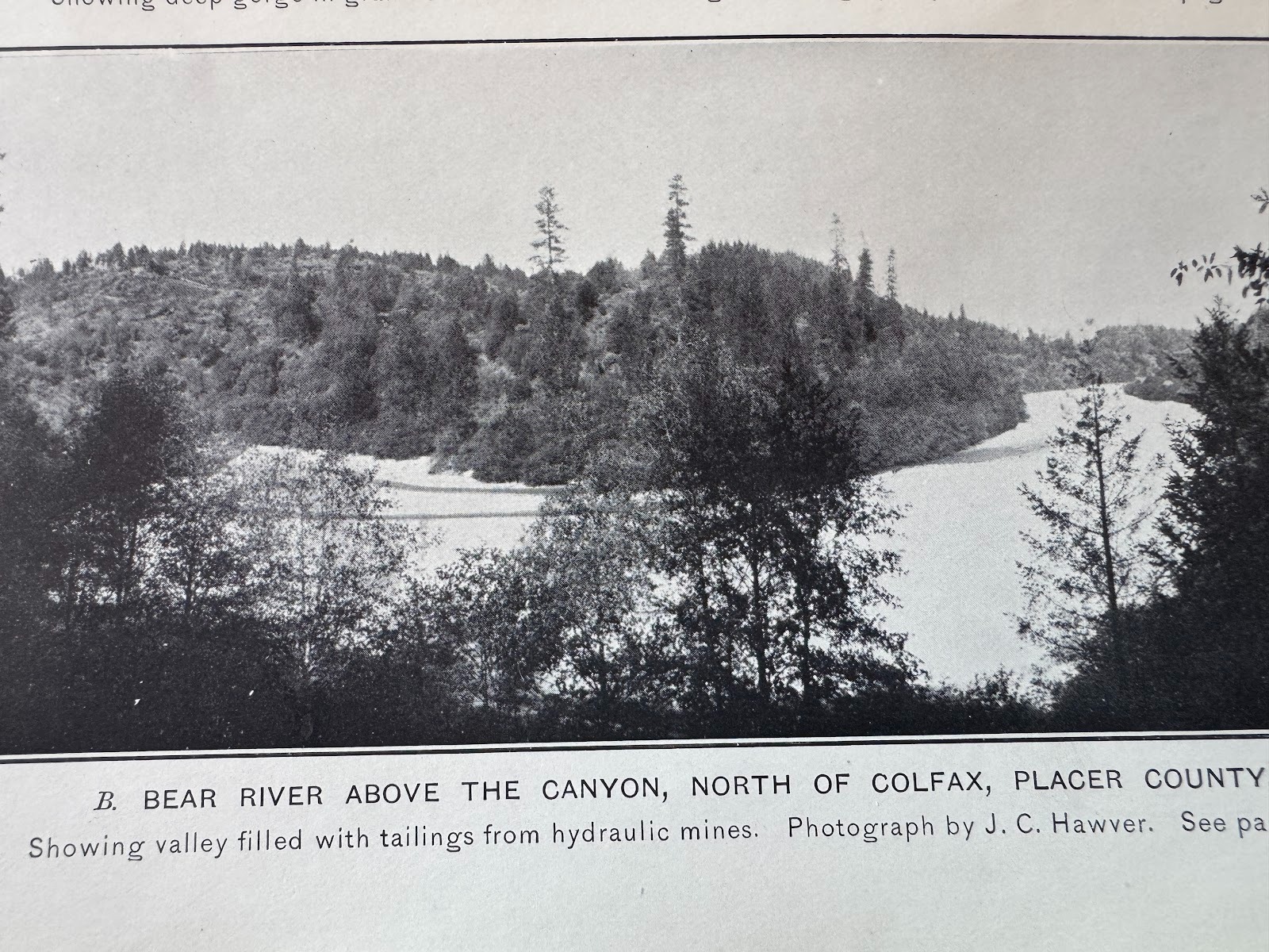
Compare it with this photo of the nearby Bear River shortly after 1900. Quite a difference. We're gonna figger this out.
(Lindgren, facing p. 79).

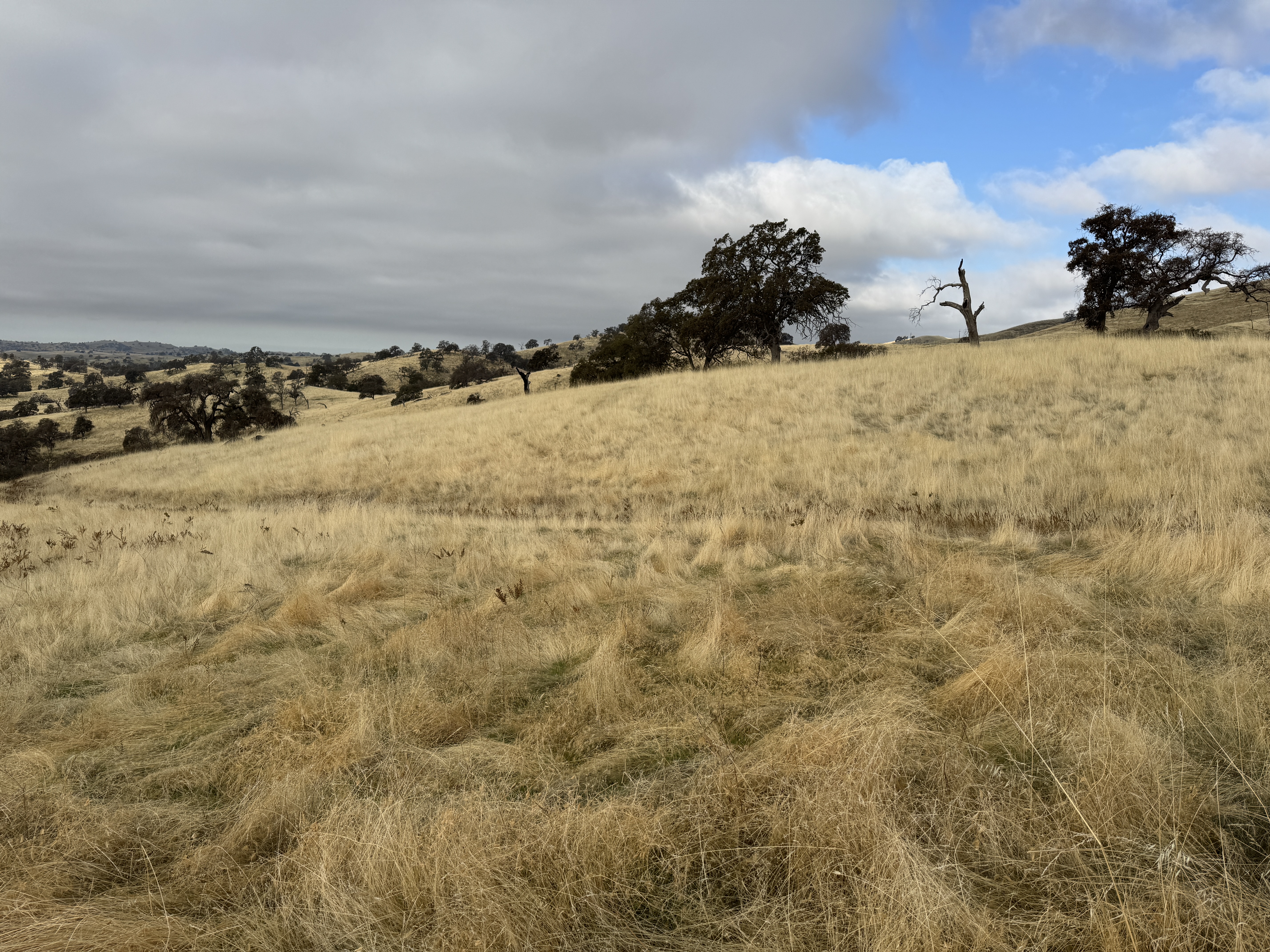
Notice how level the surface is, except where the rivers have cut deep.
There's a ghost town up here, North Bloomfield. (California has no South Bloomfield, but there was a Bloomfield.)
It looks in good shape because it's another state historic park, like the one back in Columbia.
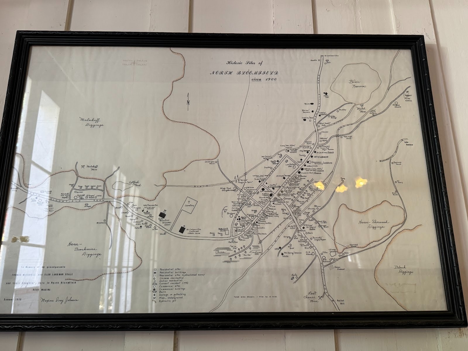
A map of the town as it was.
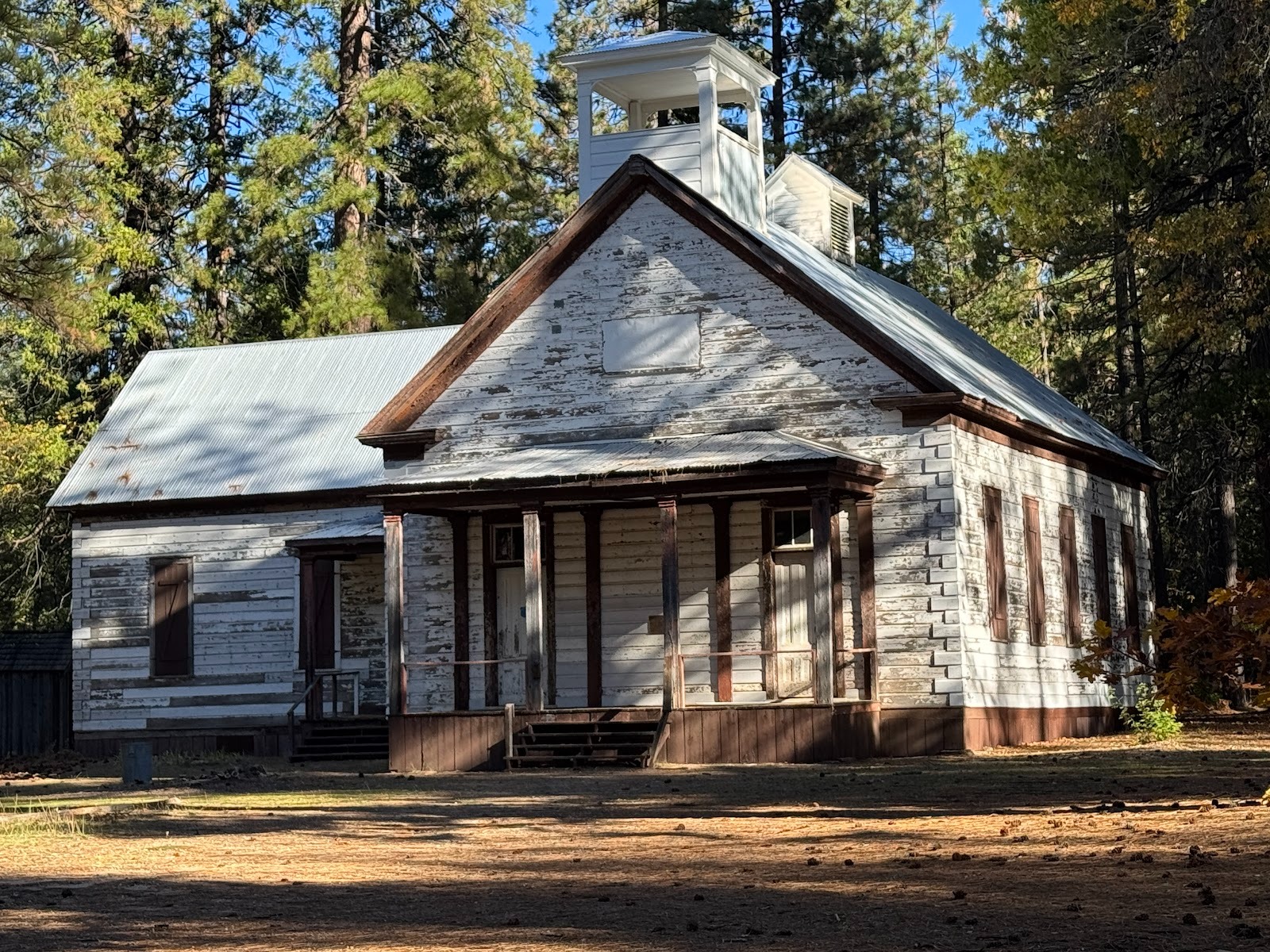
The school opened in 1873 and closed in 1941.
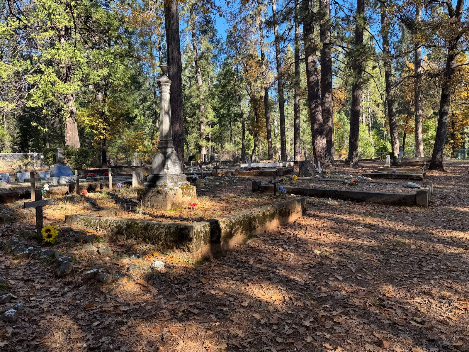
Adjoining cemetery.
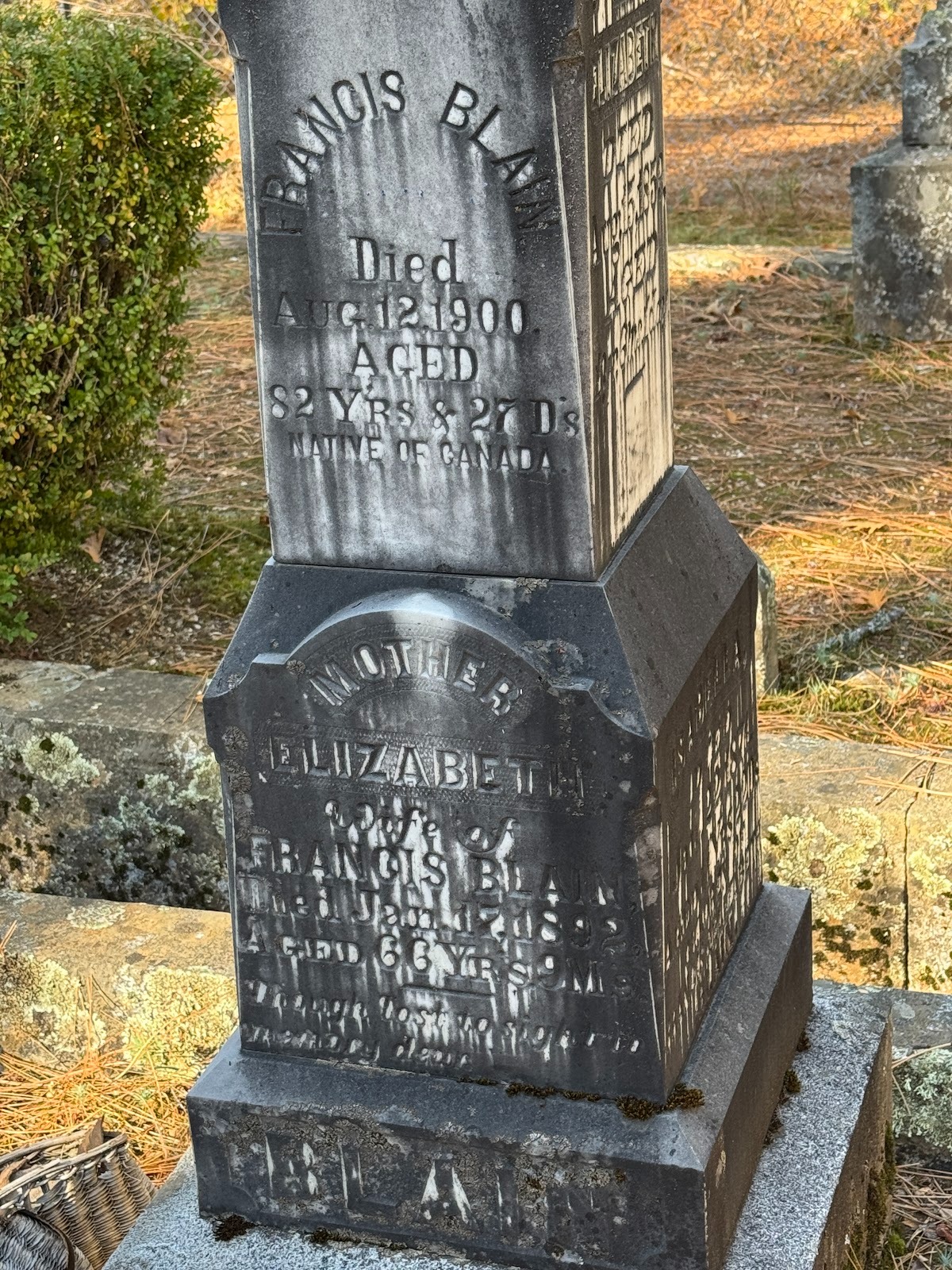
Francis Blain, a Canadian who died here at 82. But wait! Go back 18 years before he died.
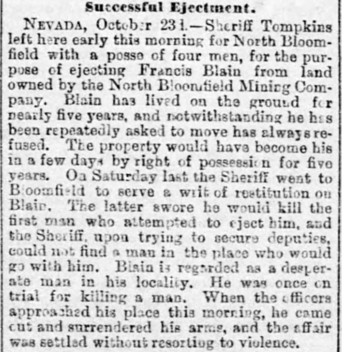
It does raise the question of where the sheriff got his posse.
(From The Sacramento Union, Oct 24, 1882)
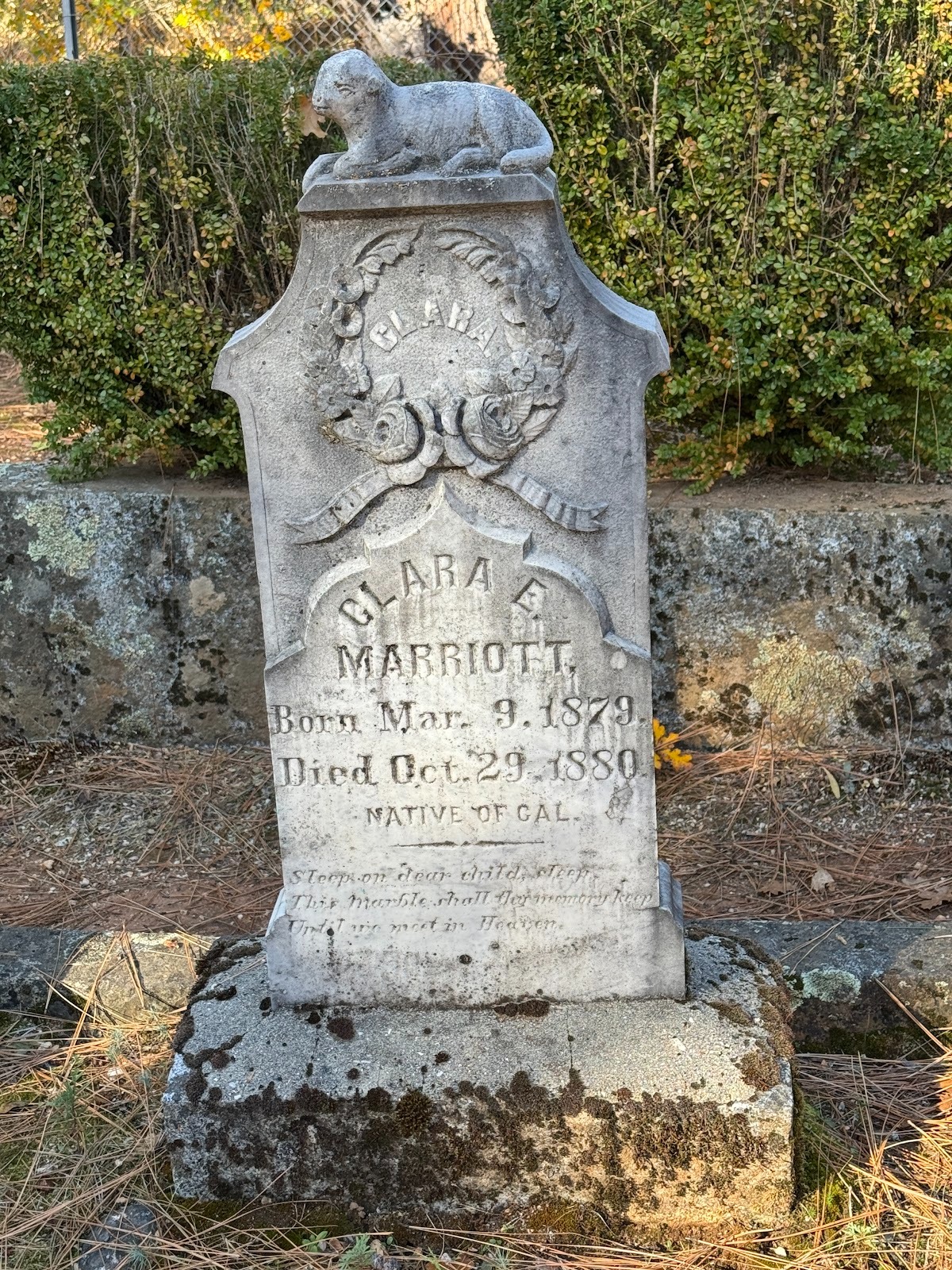
An unusual detail. A child who dies before age 2 is described as a "Native of California."
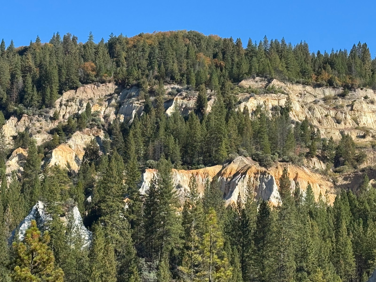
But here's why we came. It looks like Bryce Canyon, but it's manmade (or anthropogenic, if you insist).
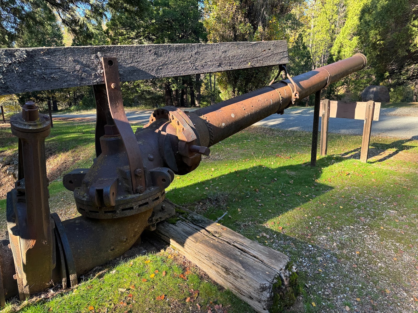
Here's a monitor on display: it's the nozzle that blasted away in an industrial form of placer mining.
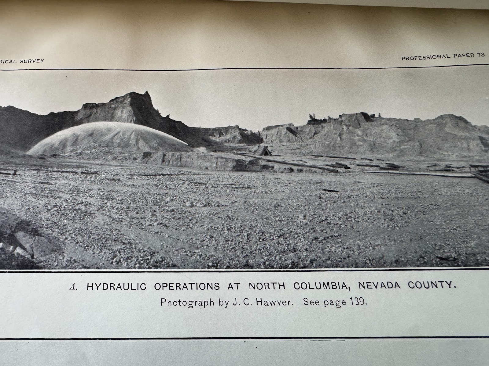
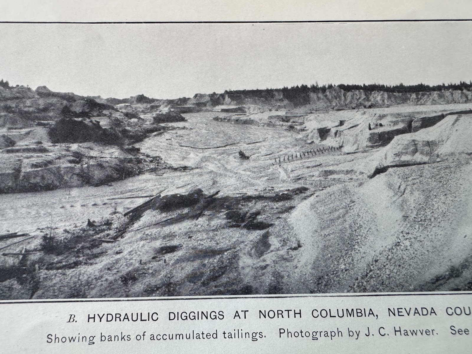
Here's a picture of a monitor in action. The photographer, John Carpenter Hawyer, was a dentist in Auburn but had been born near hear.
(Lindgren, facing p. 20.)
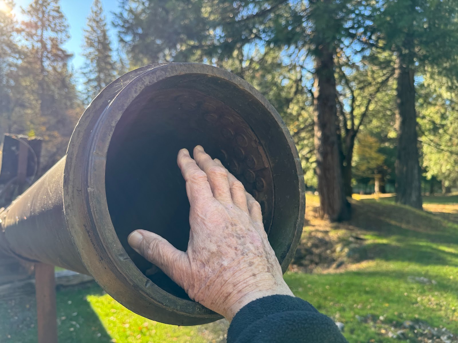
Bigger than a fire hose.
Water was brought by long flumes and ponded here briefly before passing through the monitor.
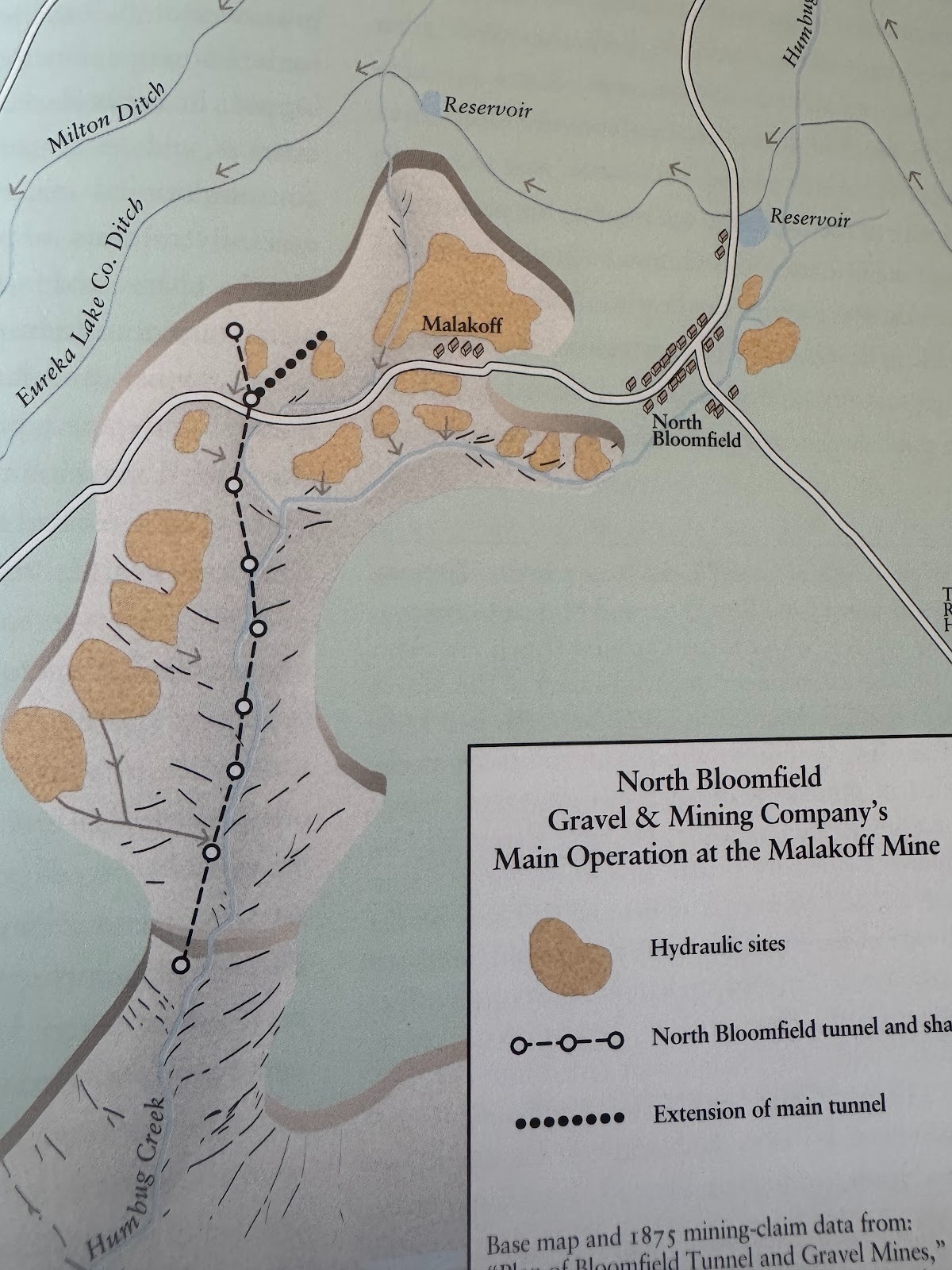
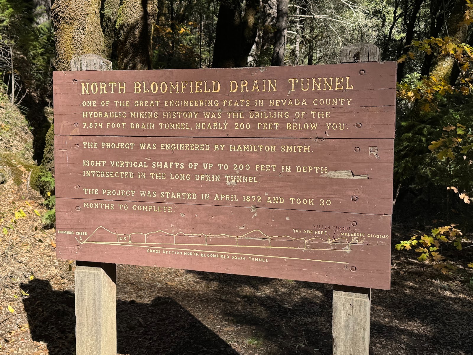
See the town. See the ditches that brought water to other hydraulic mines. See the areas worked by the Malakoff's owners. See the tunnel through which the gravel was sent for screening.
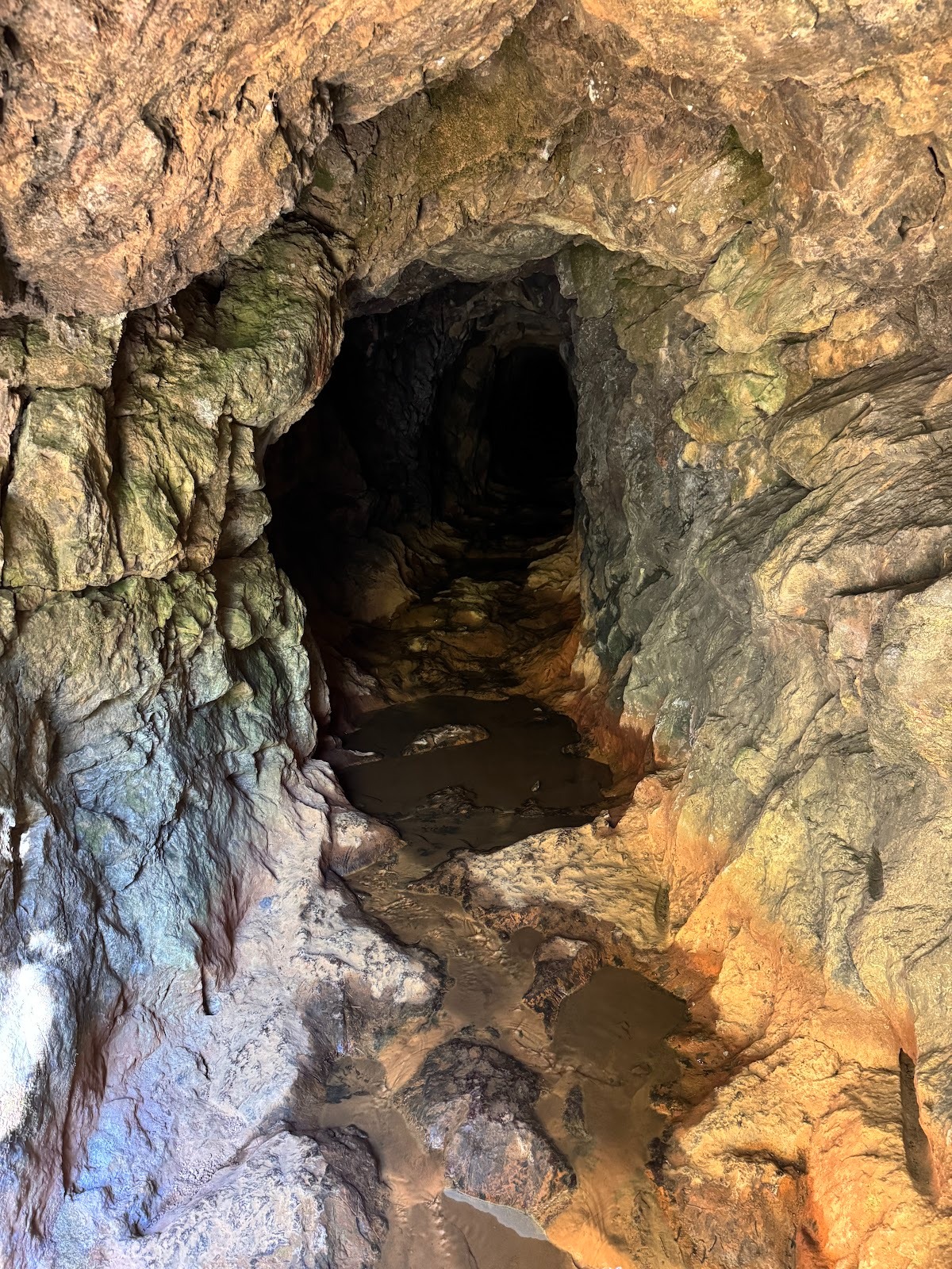
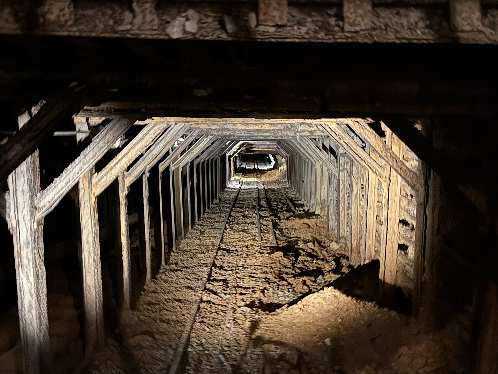
Here it is: 7,874 feet long with eight vertical shafts.
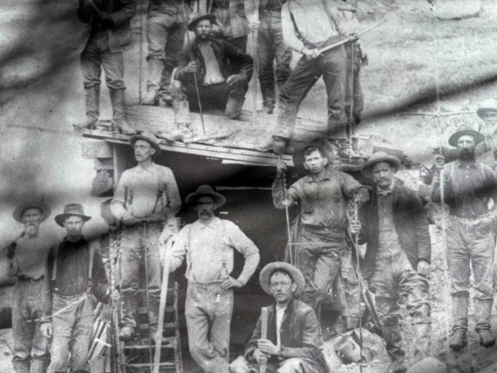
Under construction about 1872.
On the site.
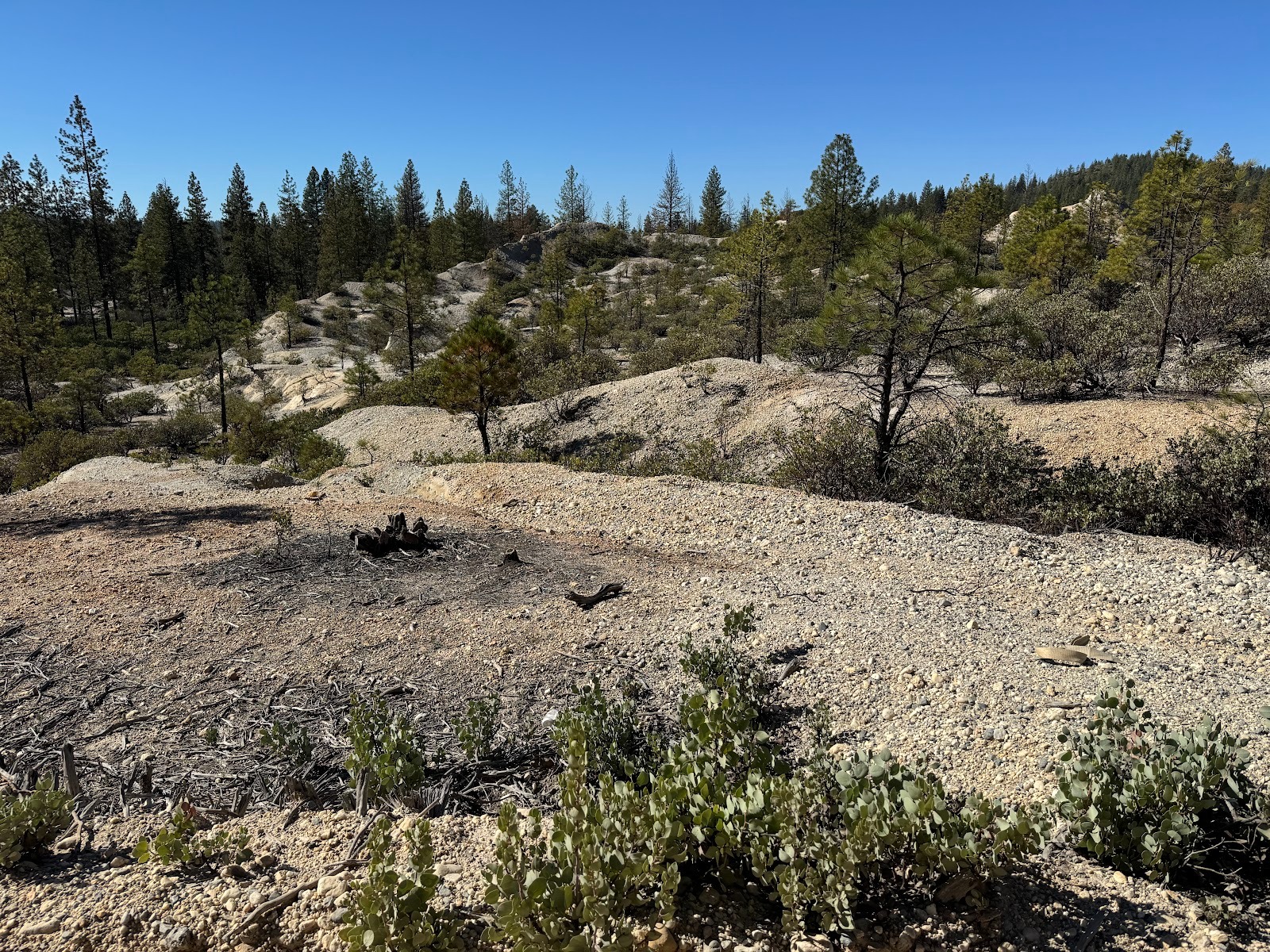
Come a few miles, and we can find some more land that was "hydraulicked." We're on Jackass Flats Road, very close to the site where the picture of a working monitor was taken.
Hydraulicking washed so much debris downstream that landowners sued to stop the practice. Federal judge Lorenzo Sawyer held in their favor, and in 1884 hydraulic mining was shut down, for all practical purposes. The case was Woodruff v. North Bloomfield Gravel Mining Company (18 F. 783).
(Lindgren, facing p. 20.)
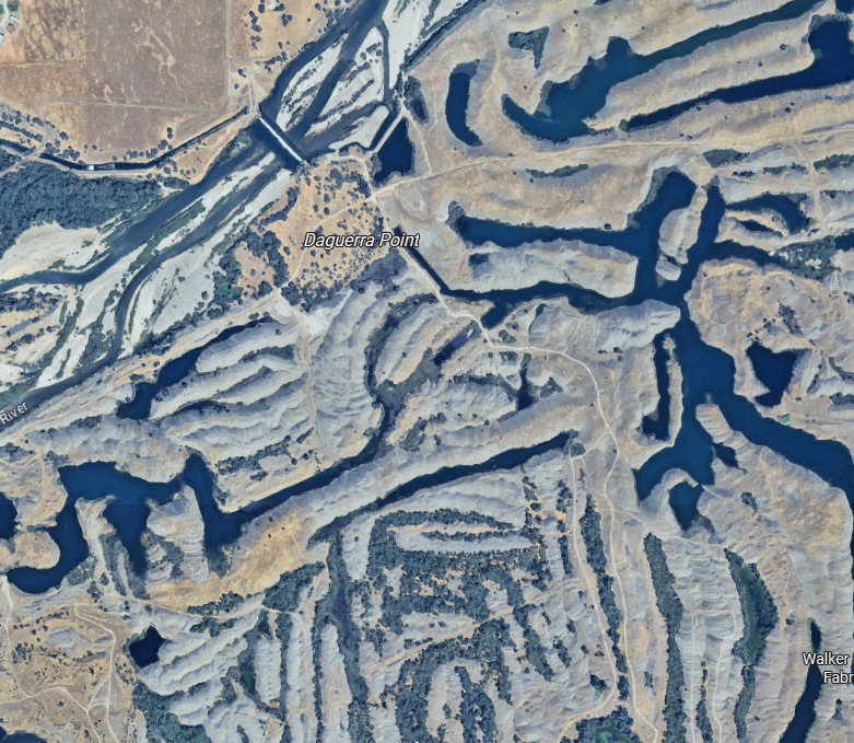
Come downstream about 20 miles from the bridge where we saw the river that has cleansed itself and you find some of the mining debris that has settled. Since about 1900 there have been efforts to slow it down. See, for example, the dam just above Daquerra Point. For the vermiform appearance you can thank dredges, which have worked the gravel to extract residual gold.
Foot on the gas: we're jumping 40 miles from Nevada City to Downieville, which with 300 people ranks as the least populous county seat in Californie. (OK, OK, you're right: it's second after Markleeville, which has under 200.) But notice again that incised but generally level surface.
This is the pleasantest part of 49 to drive. Very little traffic and only the occasional puzzle, like this invasive plant.
It really takes over.
And here, as we stand on a bridge at Downieville, is the North Fork of the Yuba. That's Downie Creek coming in on the left.
The Craycroft building, built in 1850 is the town's photo op. It has always been a multi-purpose building, with everything from saloons to jails.
It's not elegant, but I like it for its informality. It still houses a restaurant and a bar whose window on the street has a card saying, "Beware pickpockets and loose women."
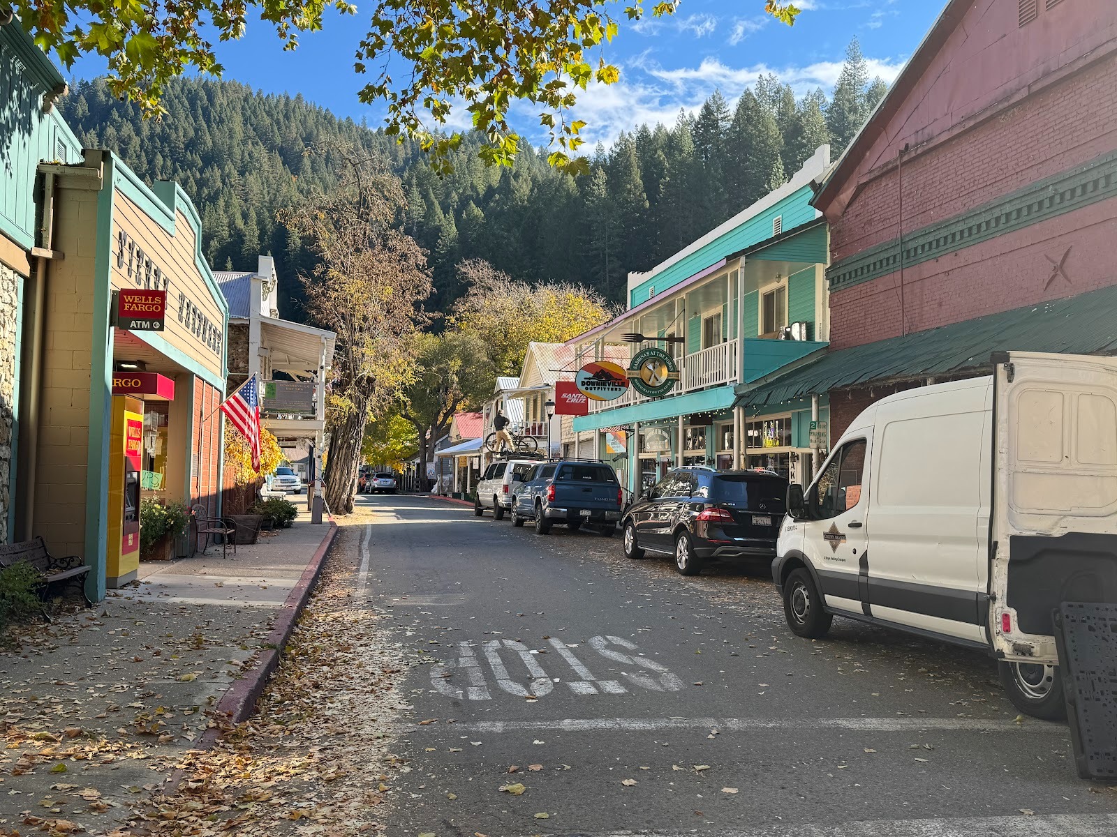
Here's a view down the town's main street, with the Craycroft at the right. Notice the hardware store on the left (the yellow building).
We're looking the other way on the same street; the yellow building is on the right side at the far end.
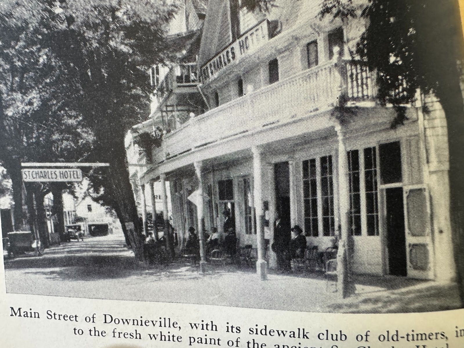
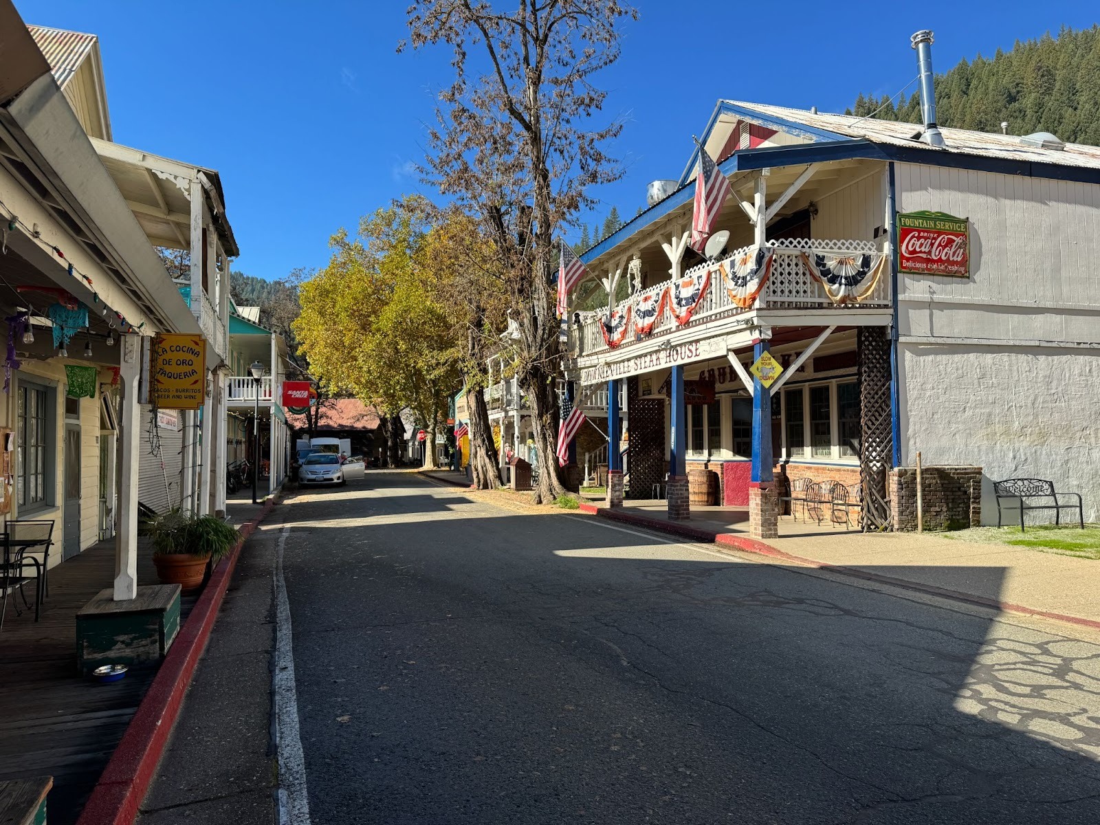
I mention the yellow building because it stands on the site of the St. Charles Hotel, which burned down repeatedly until 1947, when it burned for the last time.
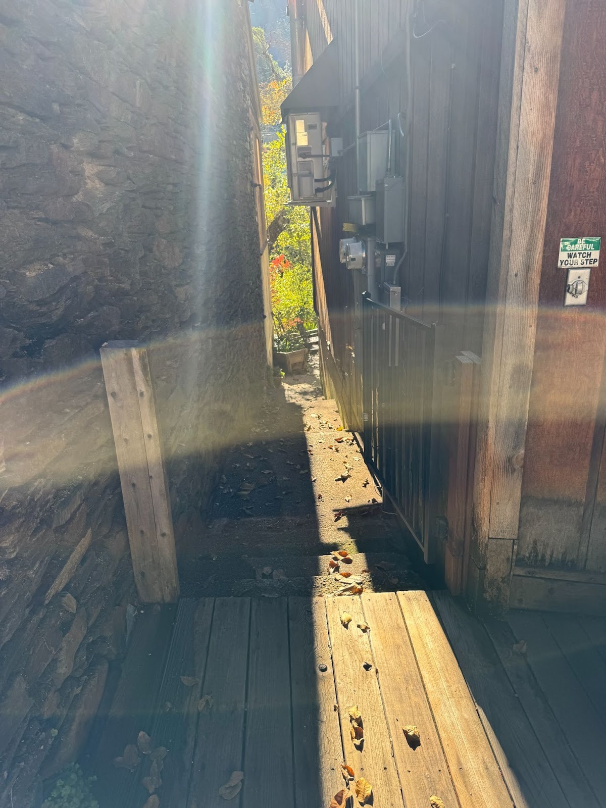
There's not a lot of room between buildings, which probably explains why, when fires started, they levelled the place, but here's a path we can squeeze through.
Look: a deck overlooking Downie Creek.
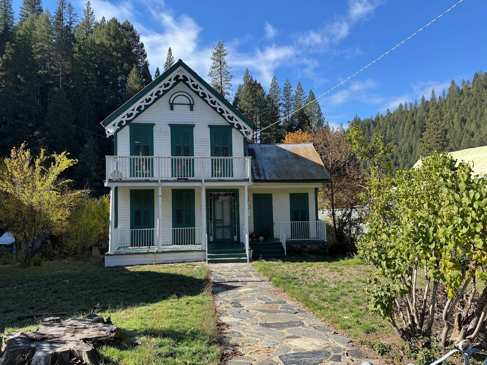
A nearby house. Not too bad.
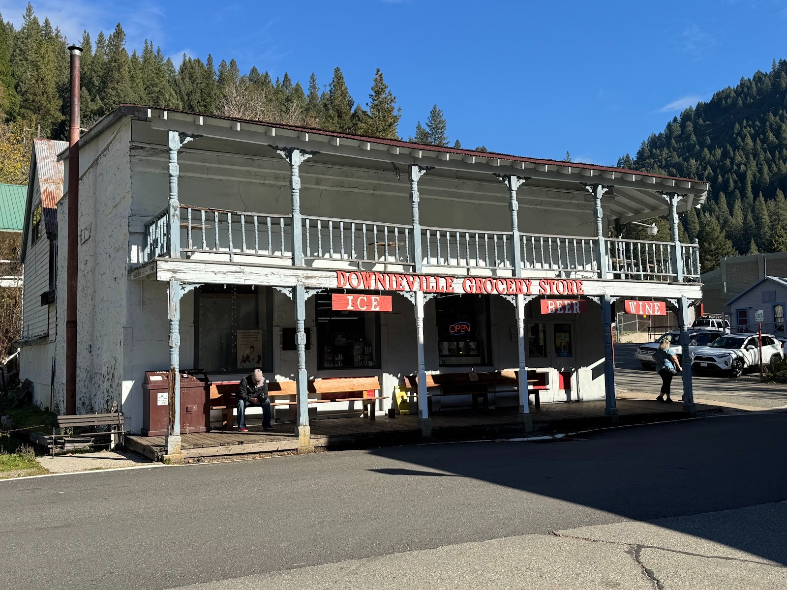
The town's grocery store, which I show as the setup to a contrast.
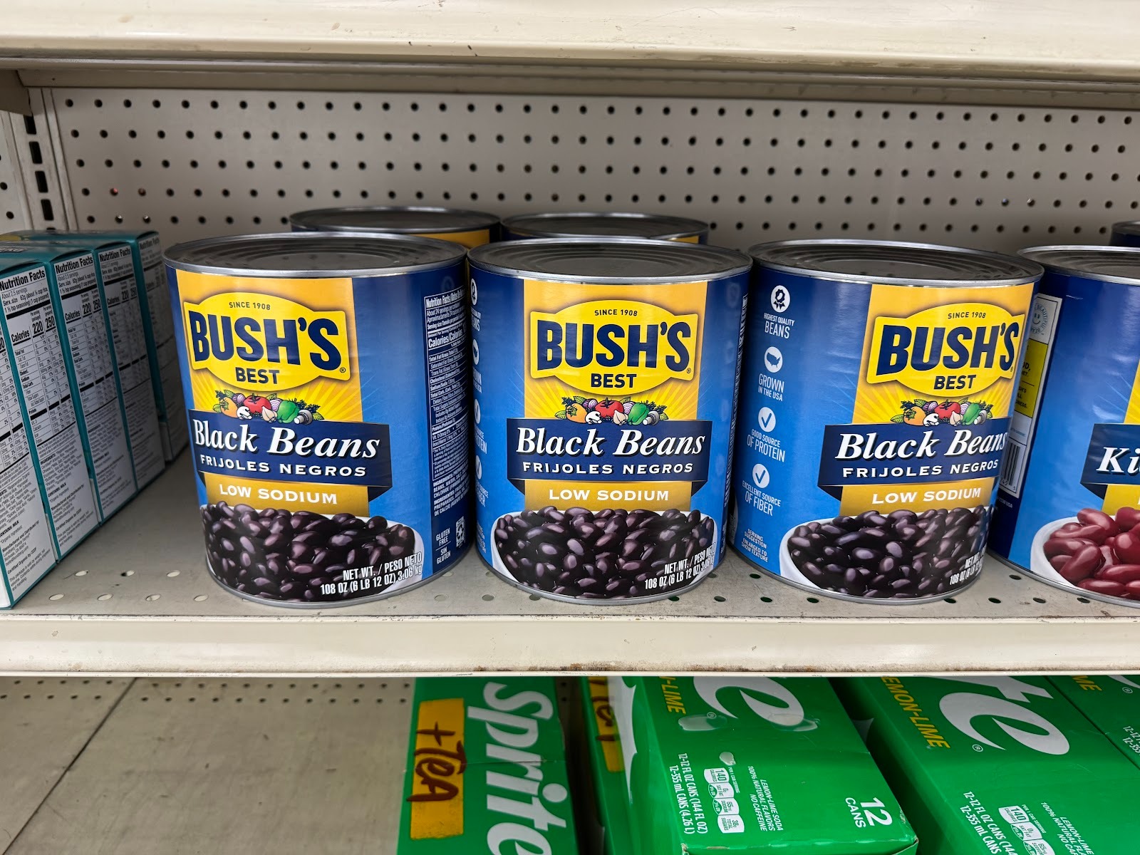
Look closely, and you'll see that those cans weigh over six pounds each. That's pretty perfect for an old mining town.
But come across the street and what do we have: another damned charcuterie, with parking spaces reserved for McLarens and Ferraris. (Yeah, I'm kidding.)
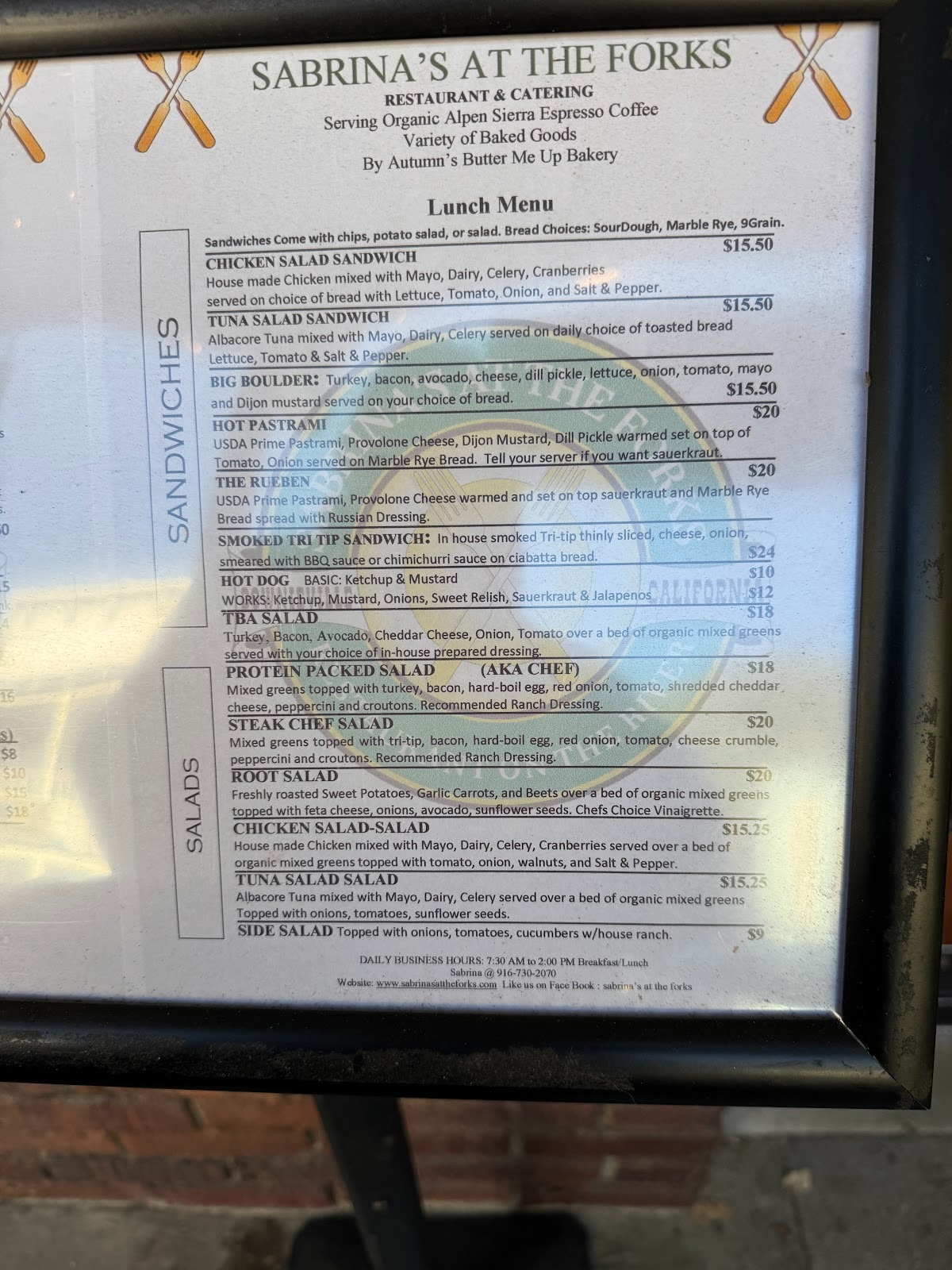
At another place, back on Main Street, we can get a Chicken Salad Sandwich for $15.50, admittedly cheaper than what we found back in Coulterville.
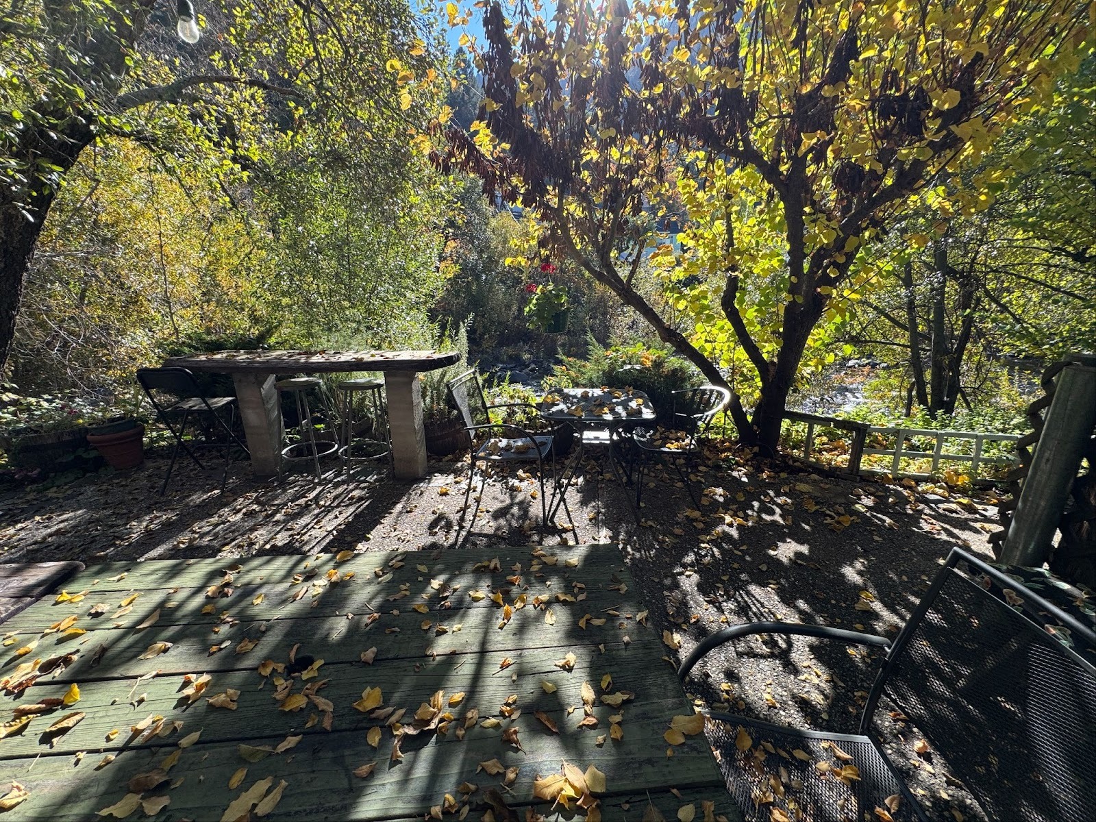
Little bit of paradise? We're heading up the North Yuba another dozen miles to Sierra City.
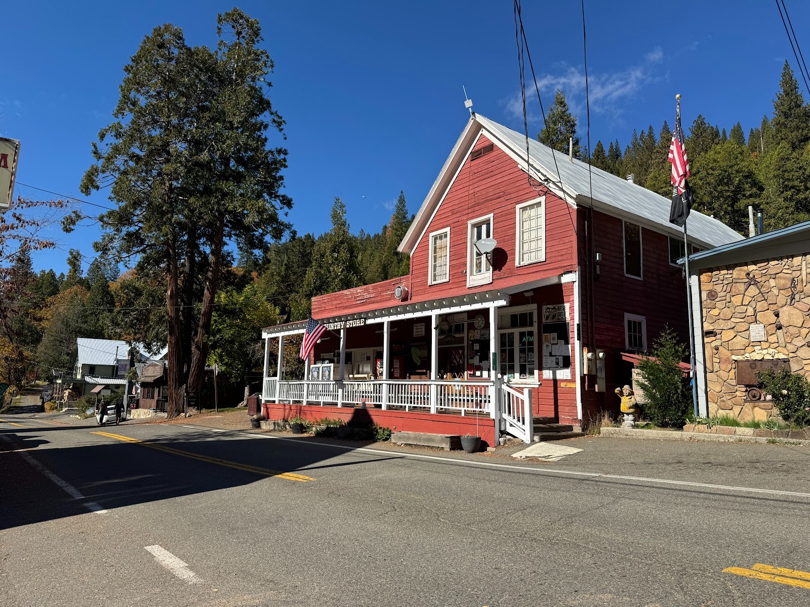
The Sierra Country Store.
What would John Wayne say?
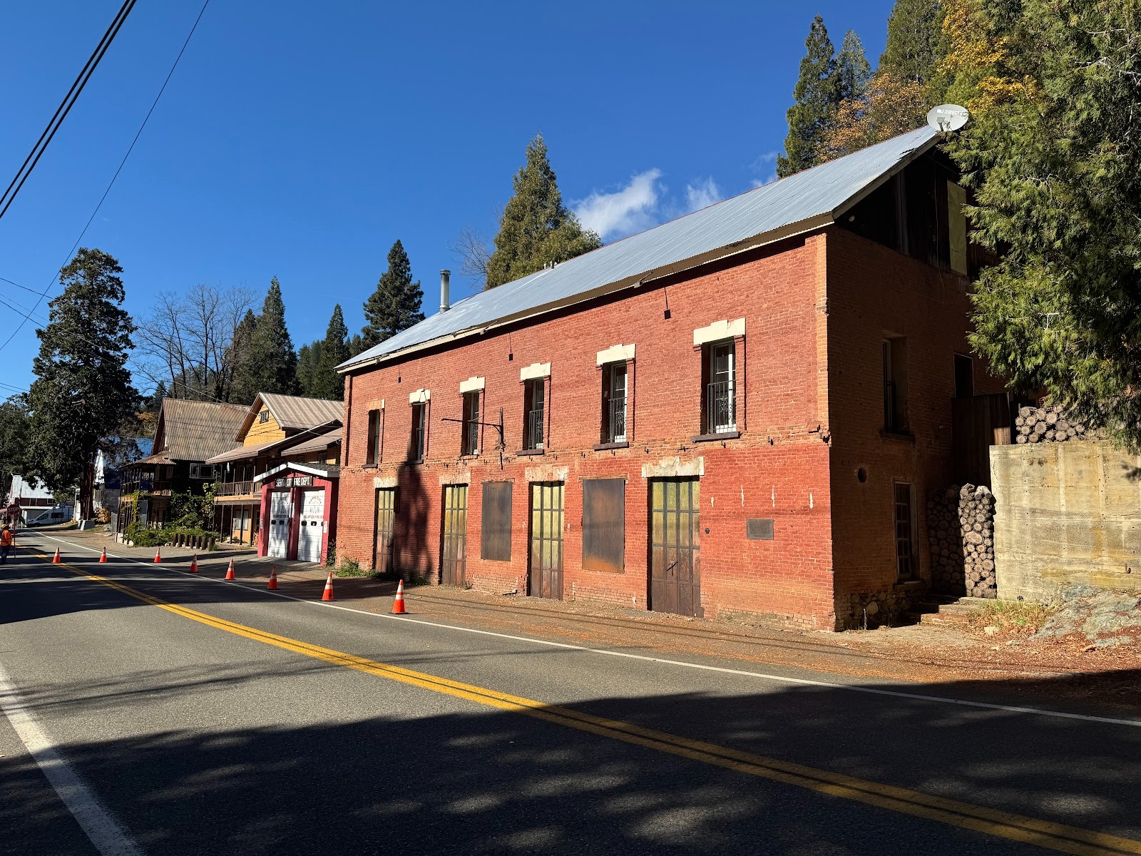
The Busch and Heringlake Building, 1871, once housed Wells Fargo, Western Union, and E Clampus Vitus, which had a third-story meeting room destroyed by fire in 1948. The building later became an inn and may yet become one again.
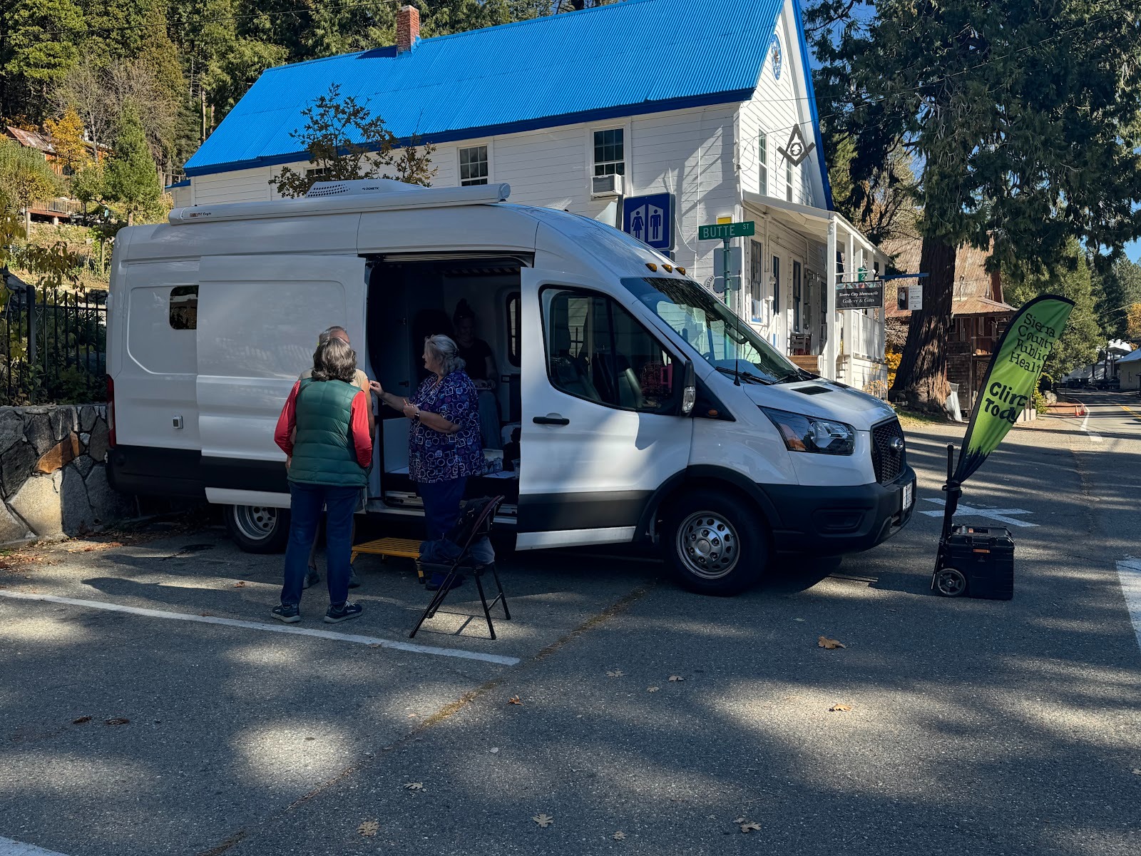
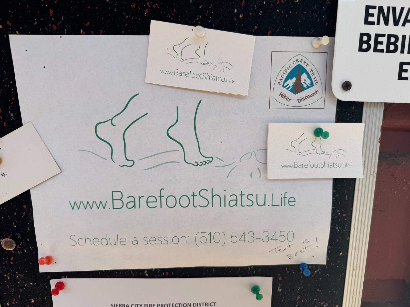
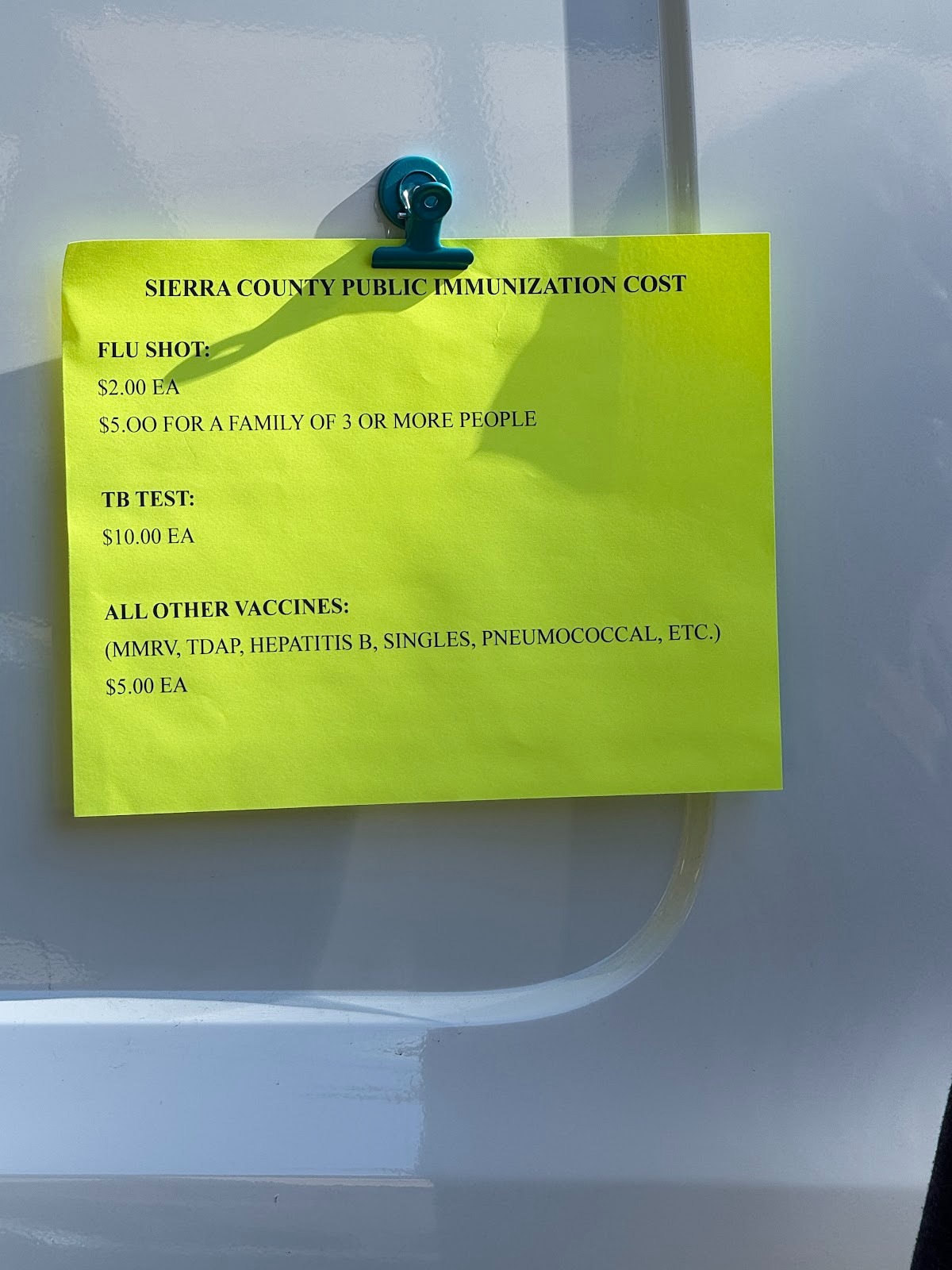
What do you know: a mobile health clinic offers flu shots for $2. COVID-19? Not available. The van came from Sierra County's biggest town, Loyalton, population almost 800. It's still ahead.
Choices, choices.
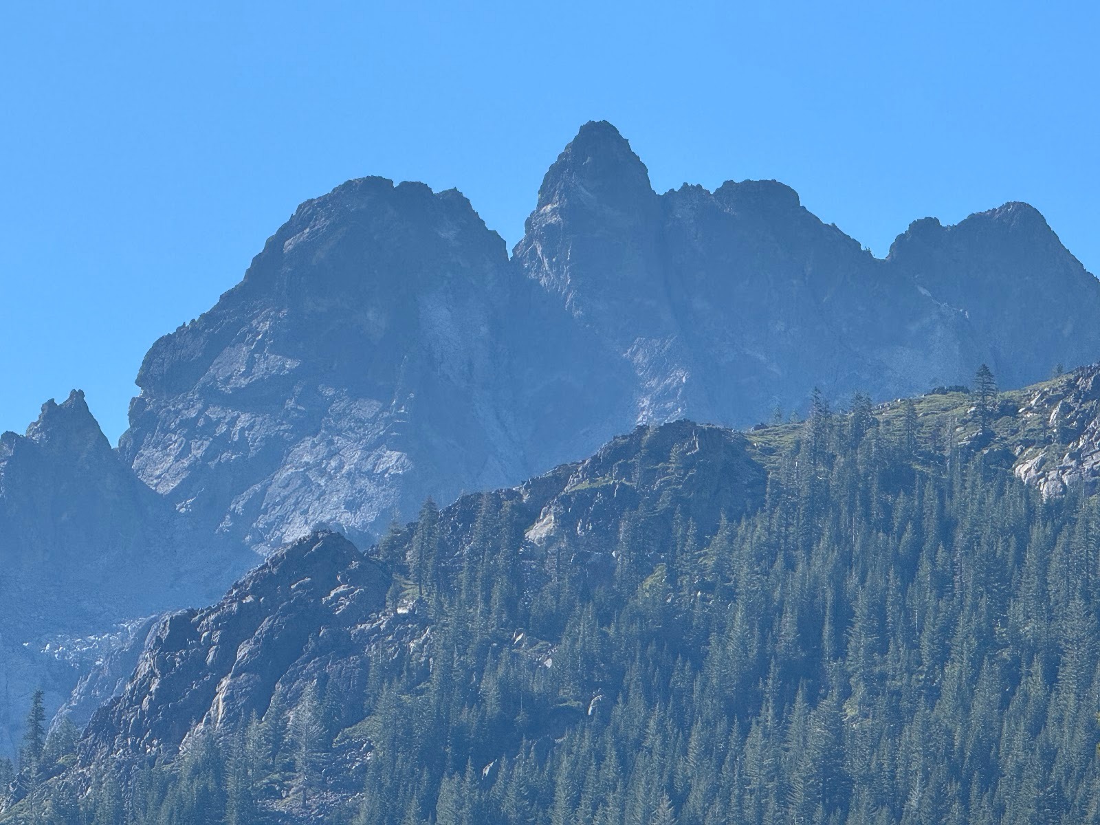
Although you can't see the Sierra Buttes from Sierra City, they're only two miles north of town and rise about 4,000 feet above it. This image was zoomed from a point several miles farther along 49.
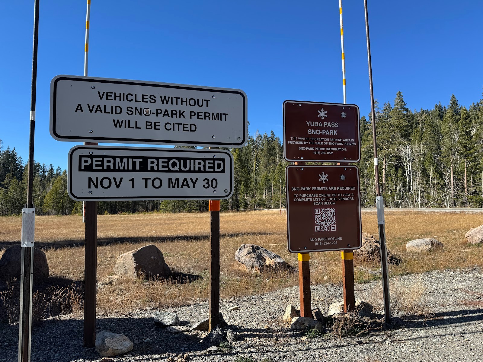
Yuba Pass, 12 miles past Sierra City, is a letdown after the Buttes. Worse than that: look at those signs, demanding a permit to park.
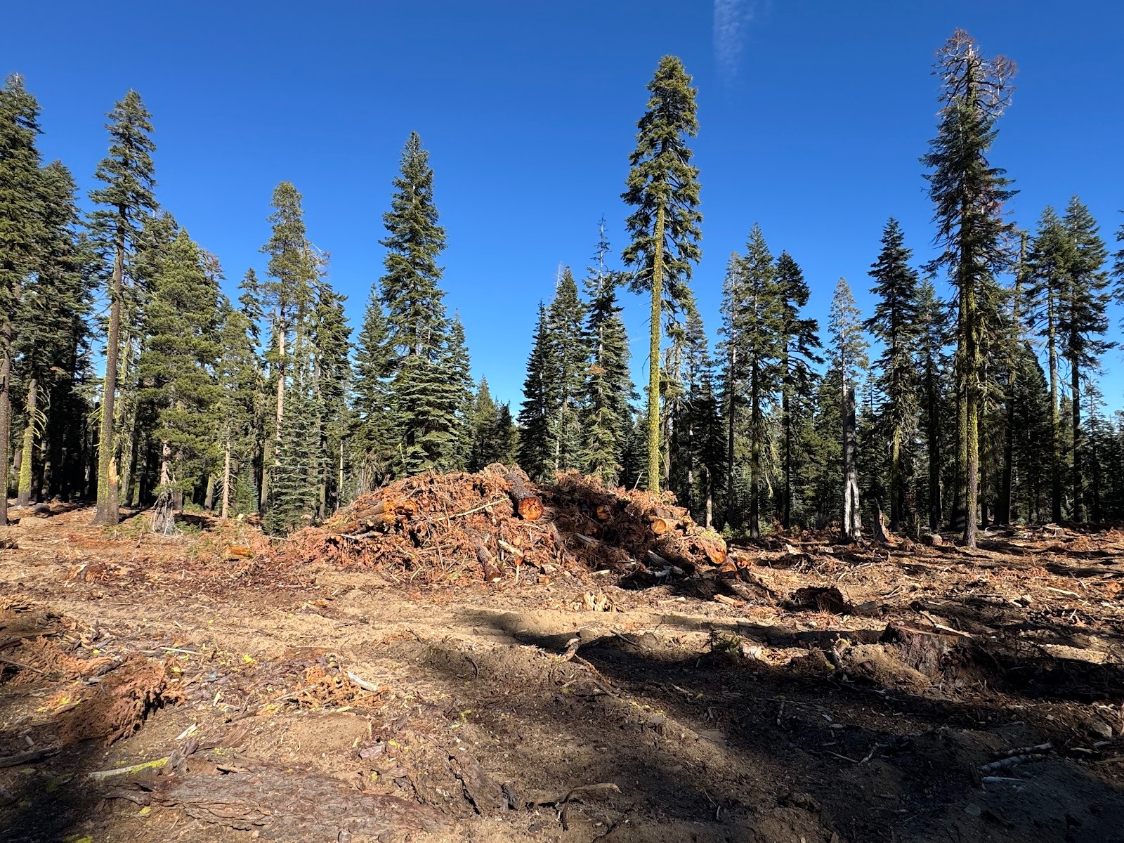
If you harbor any dreams of the local scenery, as I did, it's best not to look around. I don't want to criticize the Tahoe National Forest (I spent some time there with foresters decades ago), but I couldn't believe that the were clearcutting up here.
Don't trip.
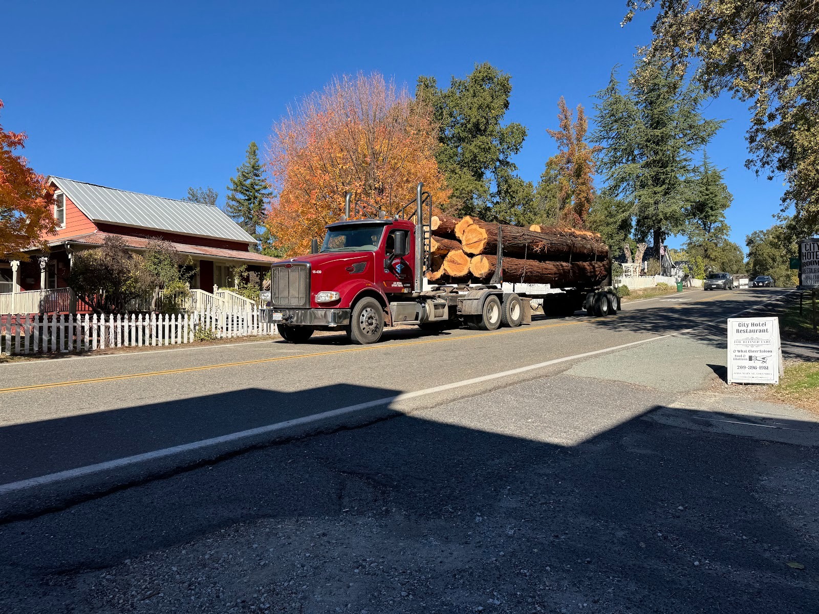
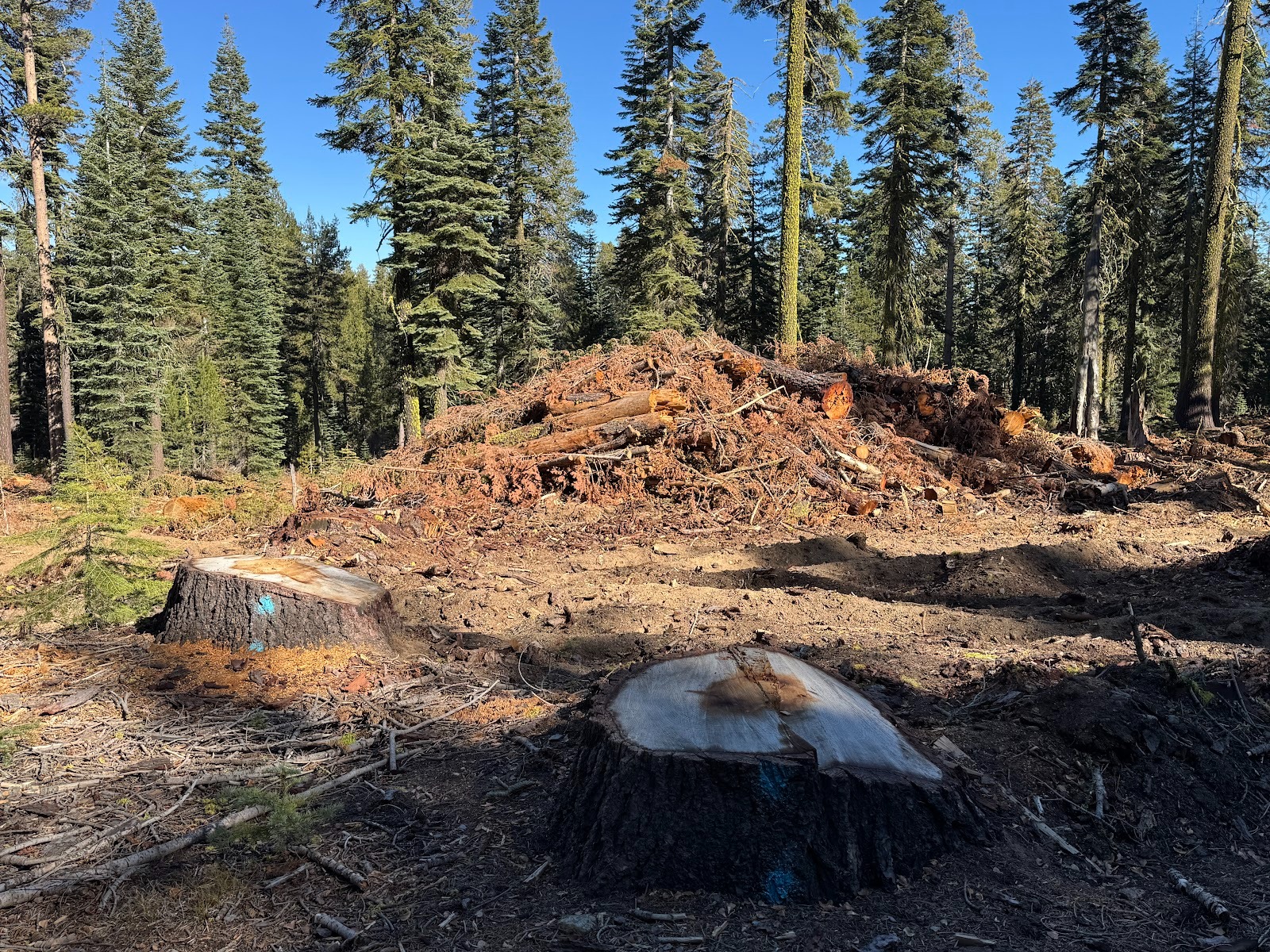
Well, it's perfectly true that I buy the occasional board. My house is wood-framed, too, so you can call me a hypocrite, but I just hate seeing these log trucks. We've outgrown shooting elephants for their ivory, more or less, but we're still hung up on chopping trees.
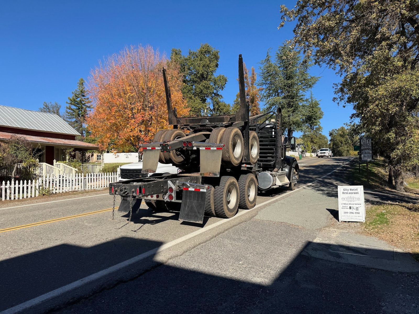
Back for more. (This pair of photos was taken near Columbia, which goes to show that the timber industry is still cooking not just around Yuba Pass but more generally in the Sierra.)
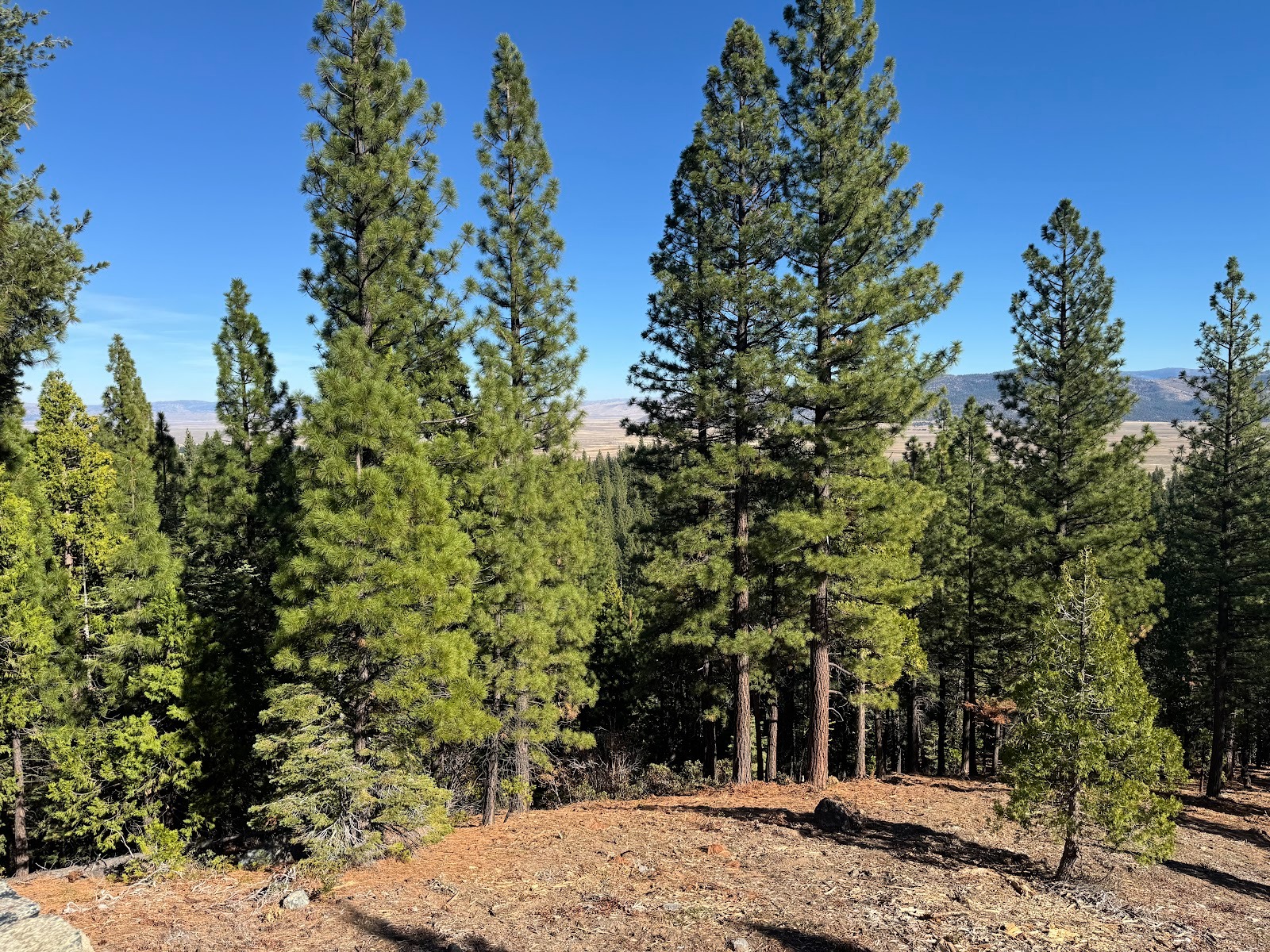
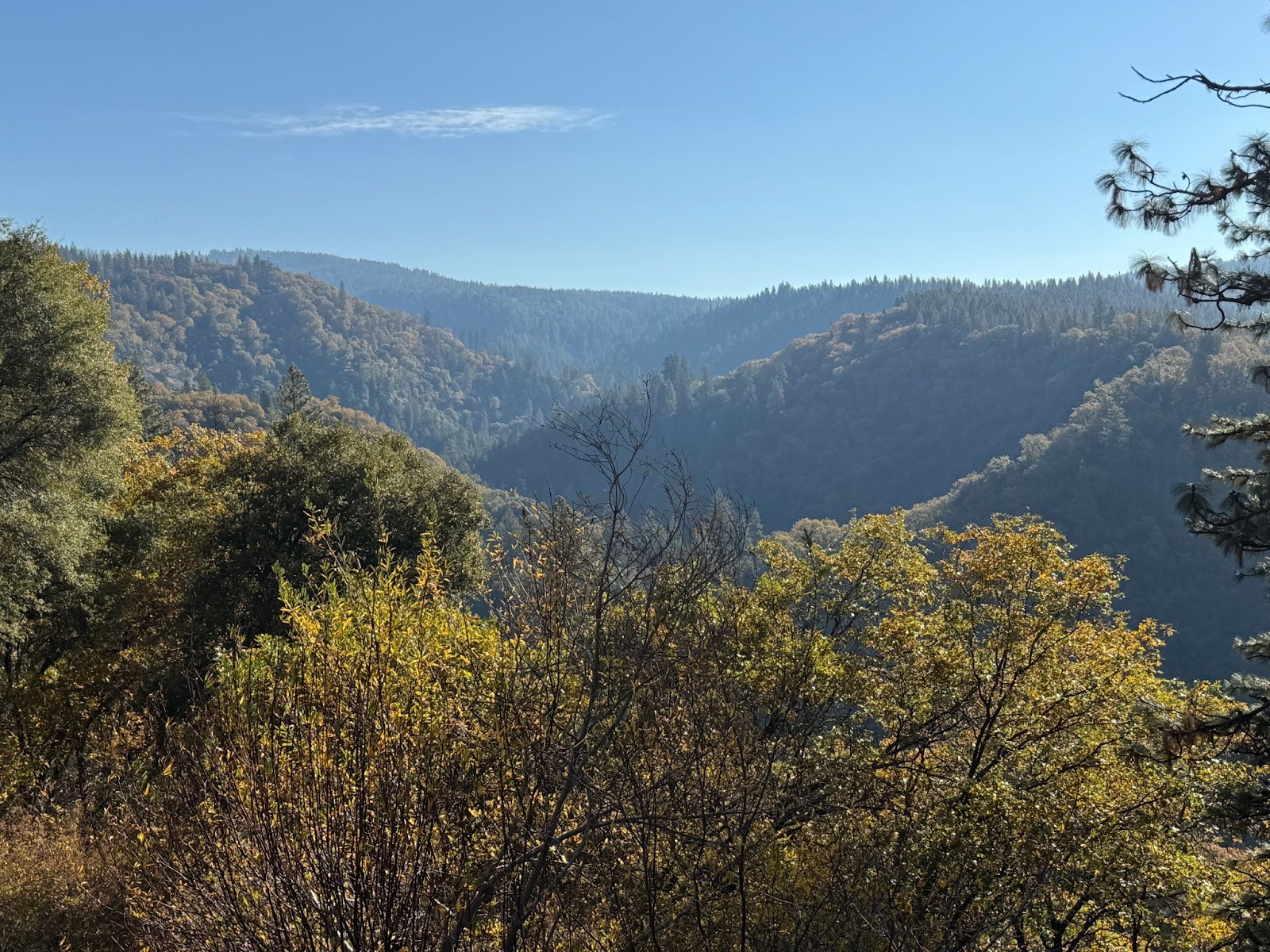
Maybe you can discern through the trees Sierra Valley in the distance.
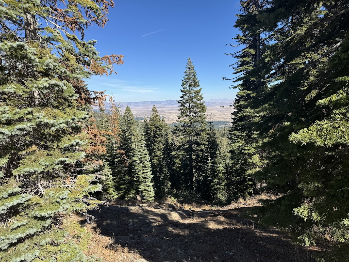
Better view.
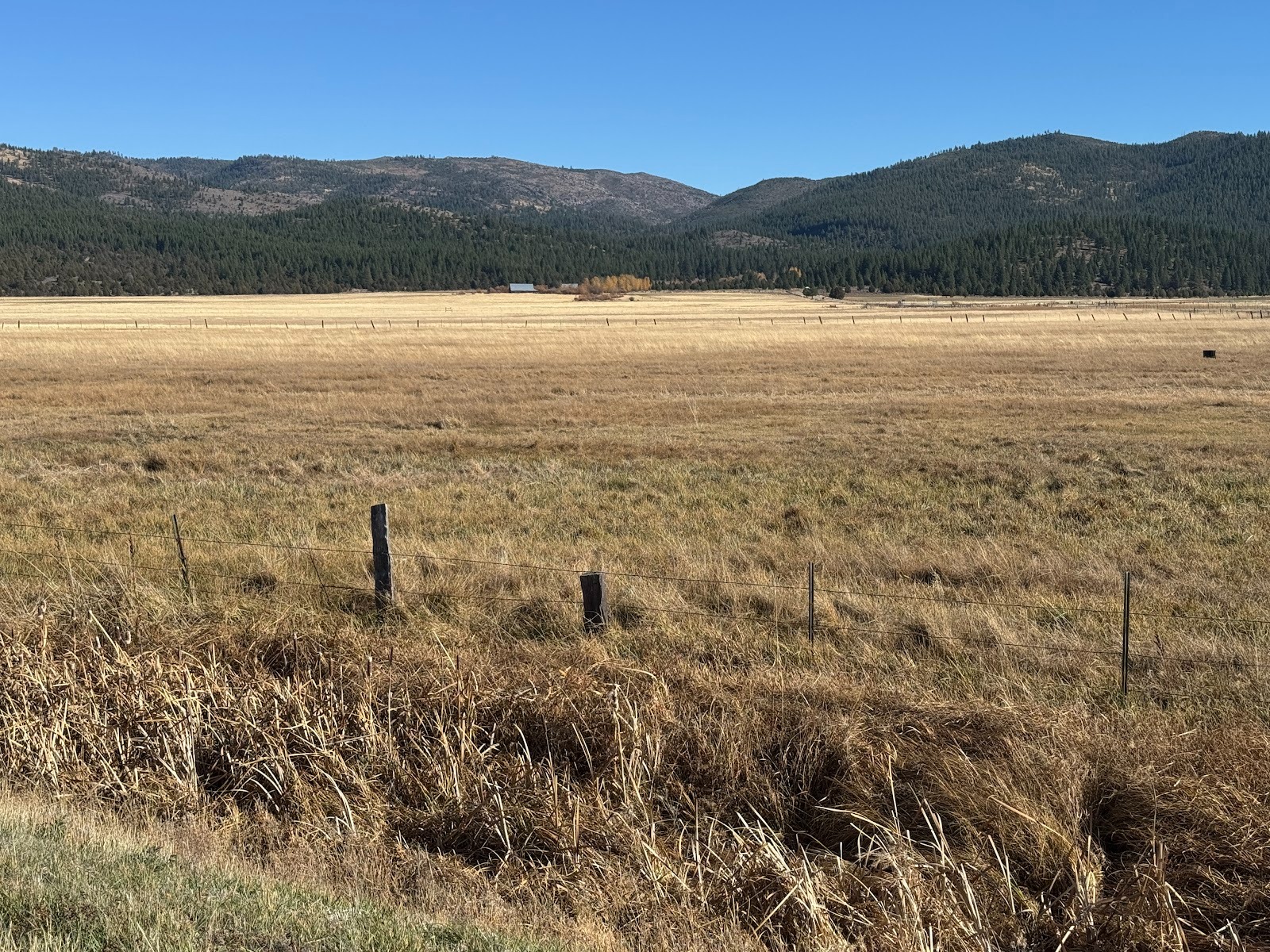
We're down on the floor of an old lake bed. It's about 50 miles north of Lake Tahoe and, like that lake, is framed by mountains on both sides. It's also about three times the size of Tahoe. Mostly it's cattle country.
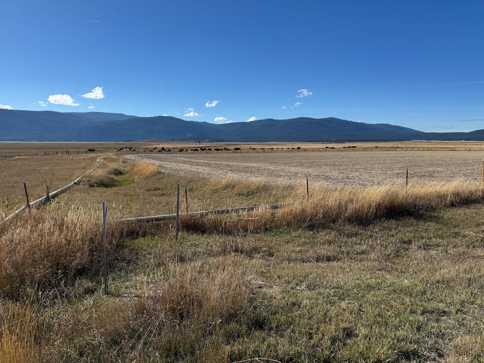
Squint, and maybe you can see some black Angus.
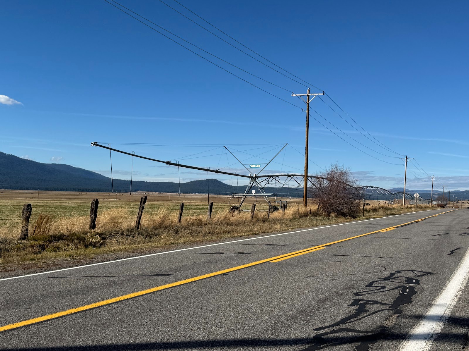
There's about 20 inches of annual precipitation, so pastures are helped by irrigation, in this case a center-pivot sprinkler.
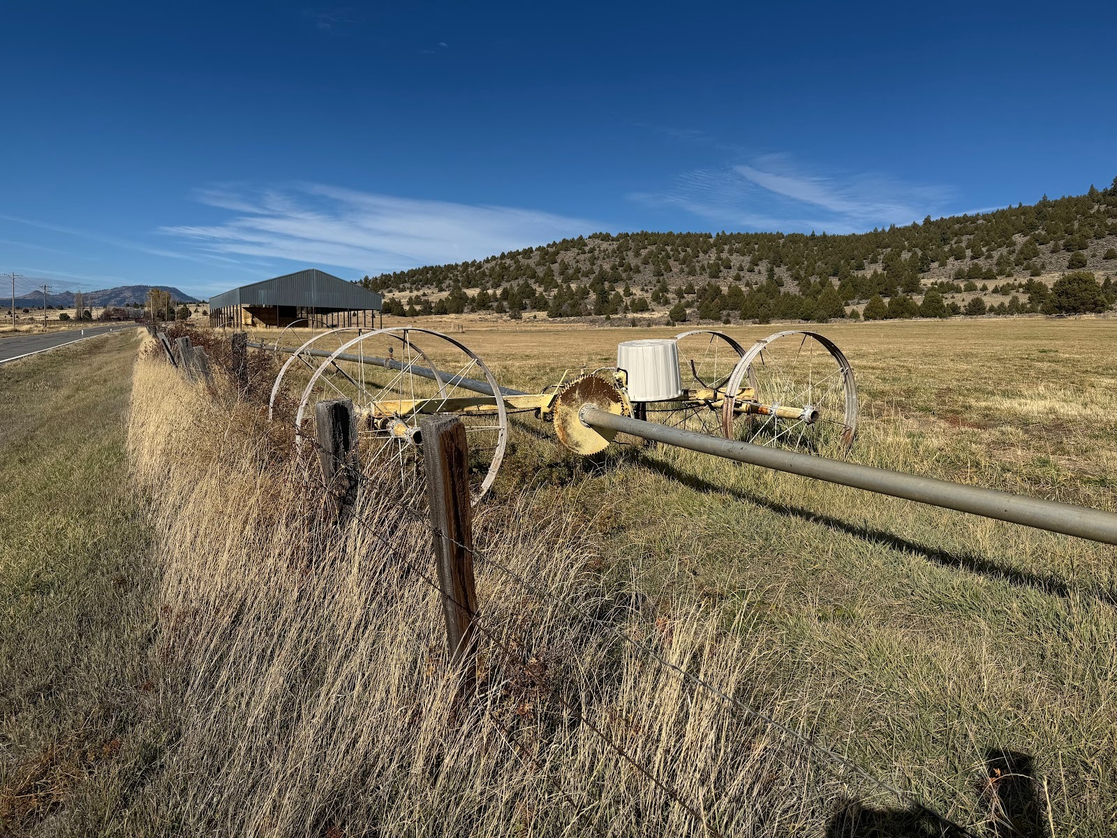
A side-roll sprinkler.
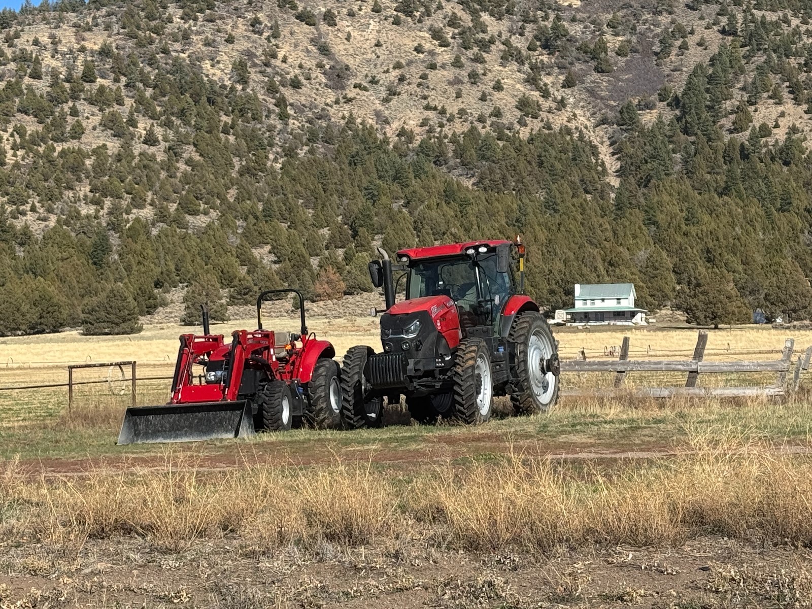
Settlement here was late in the 19th century, but ranchers keep up.
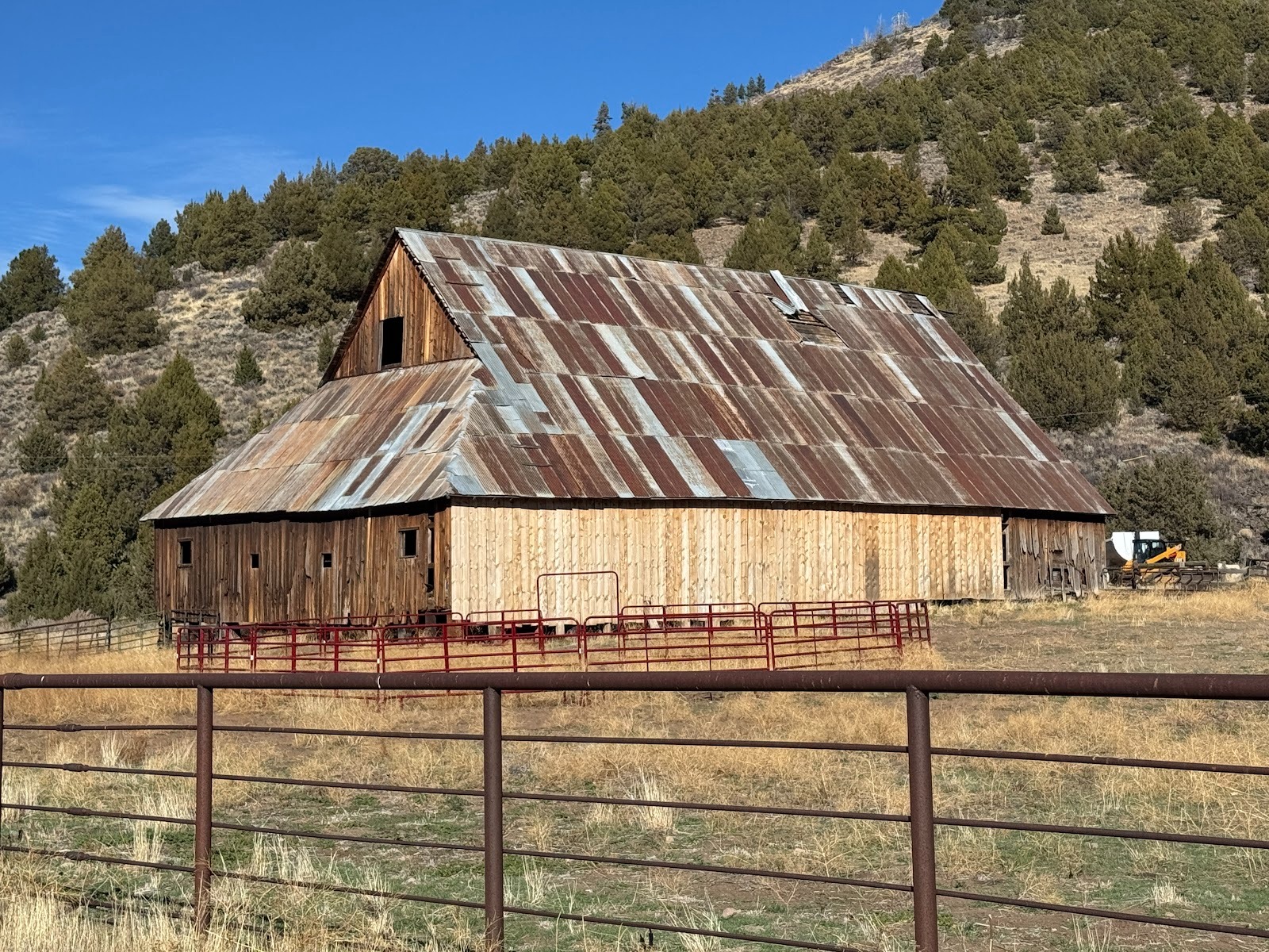
Old barn.
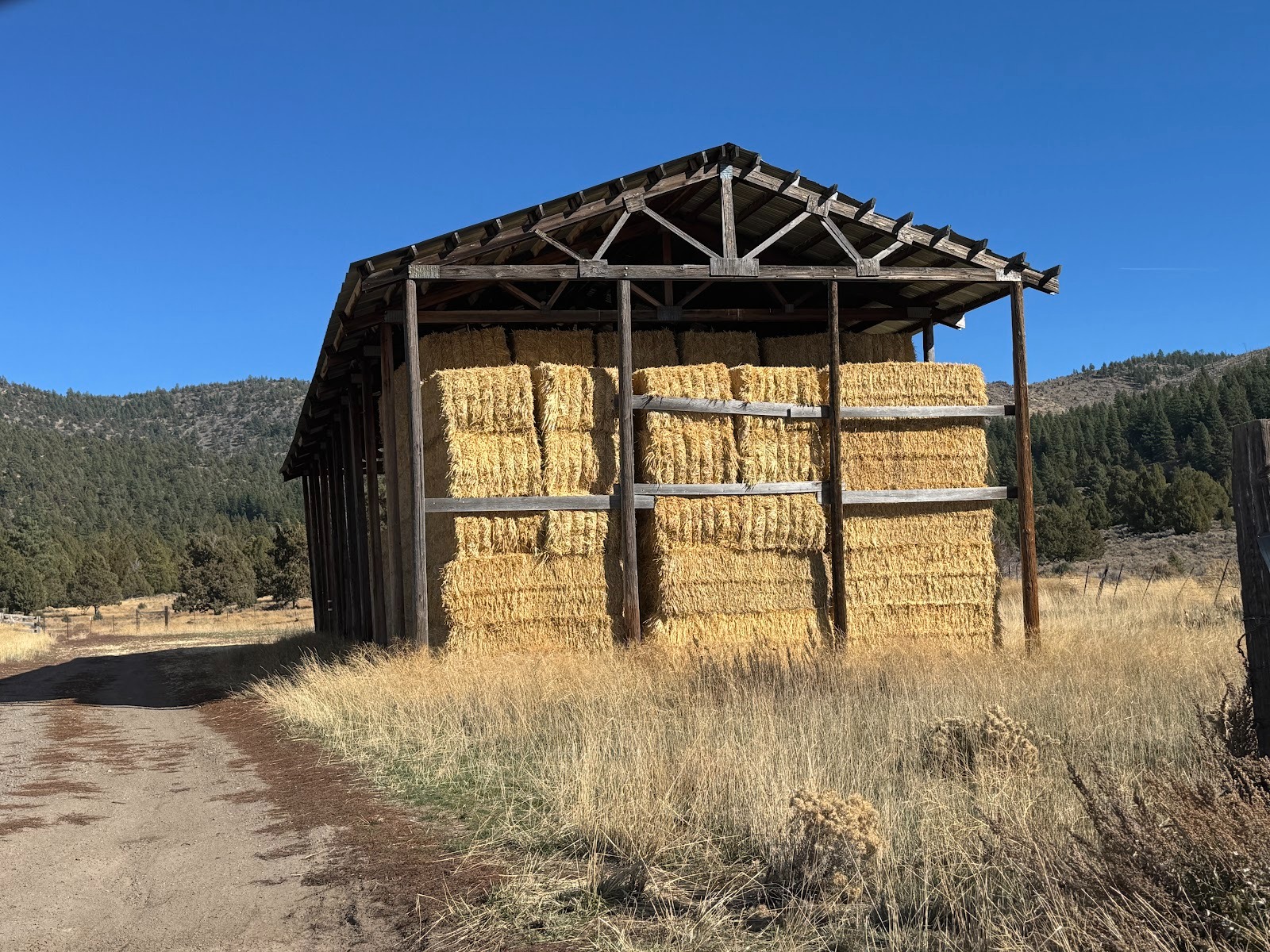
Storage for square bales.
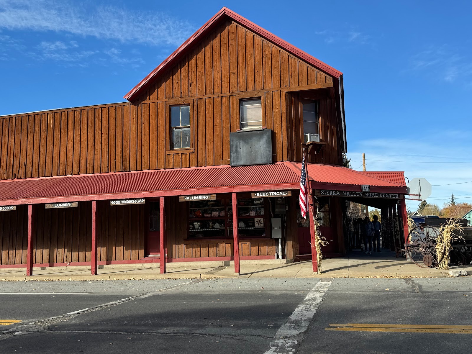
Loyalton has only store, but it's big, with lots of inventory.
My favorite. (No, I didn't.)
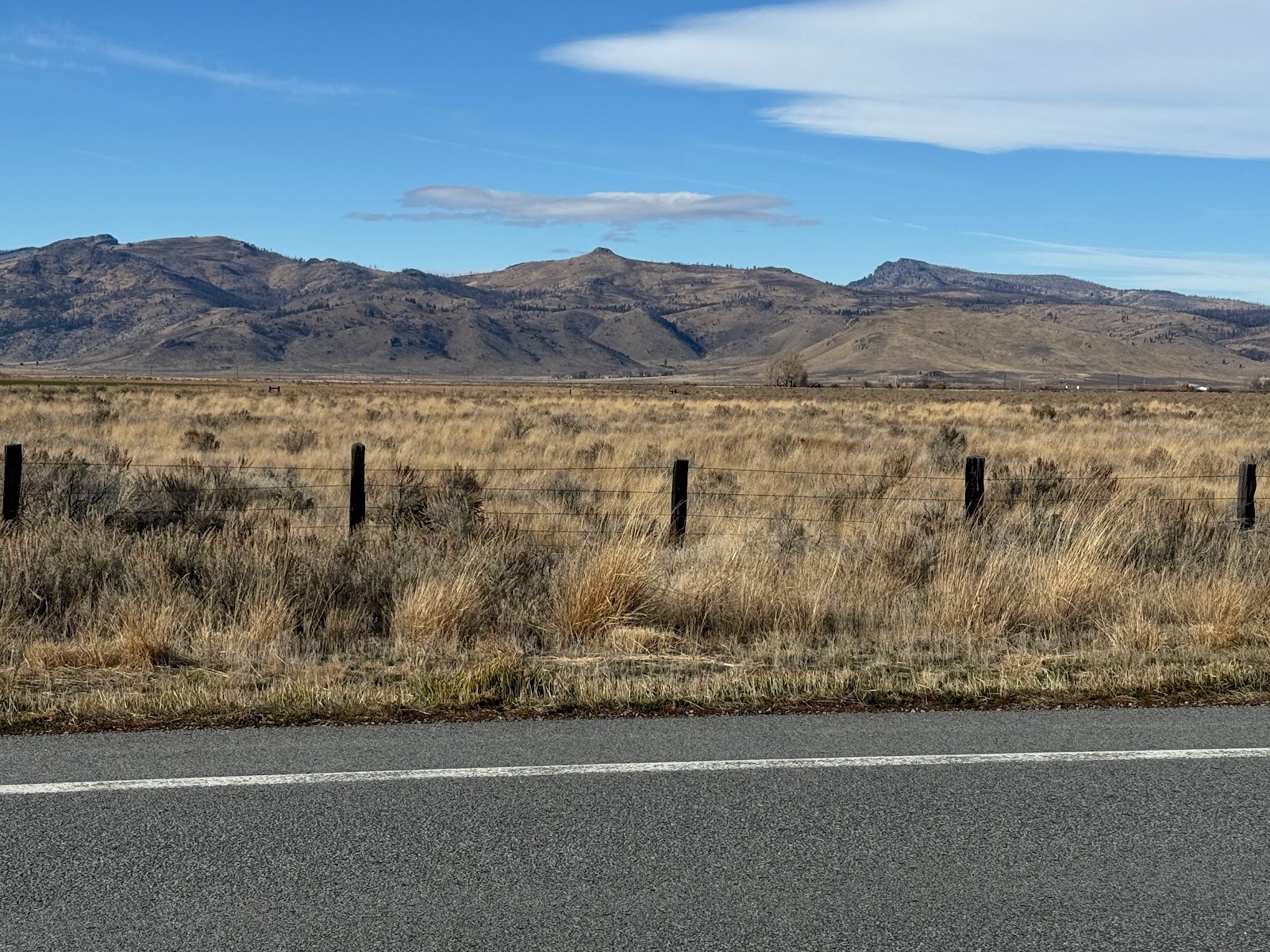
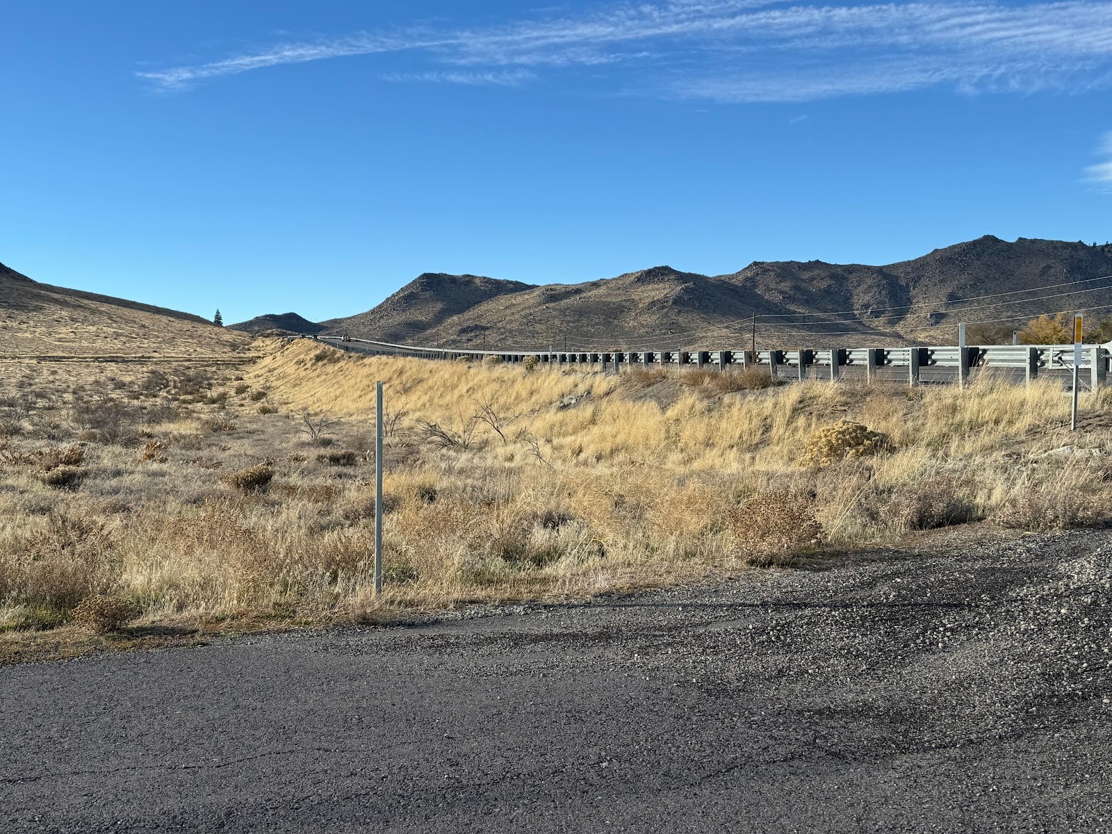
We're getting to the northeast side of the valley and to the end of 49. Welcome to sagebrush.
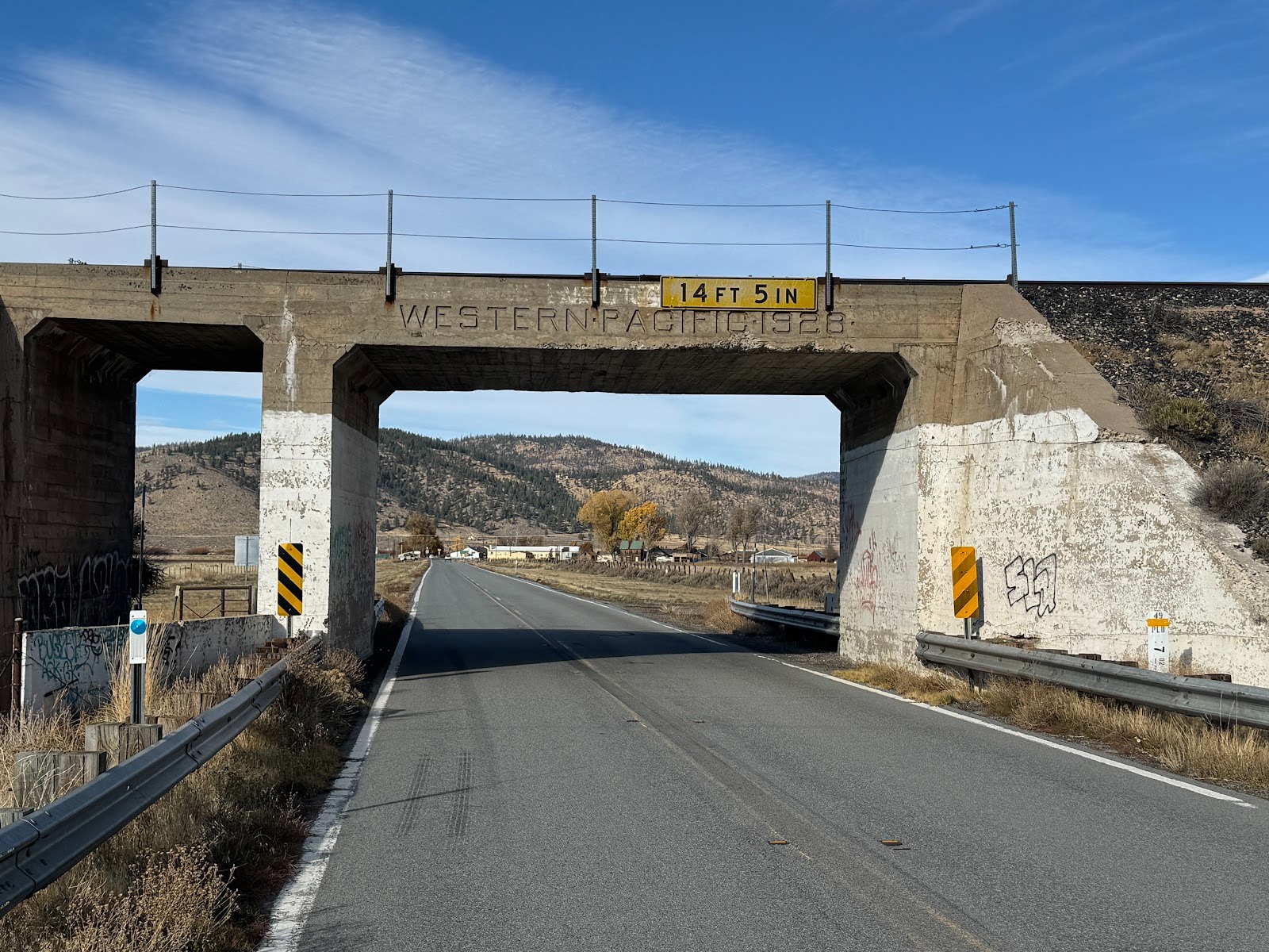
The overpass is dated 1928, but the Western Pacific was built in 1906 to offer some competition to what was then theSouthern Pacific. Alas, both lines now are part of the Union Pacific. How do you spell "competition?" Answer: nobody knows, unless you're talking sports.
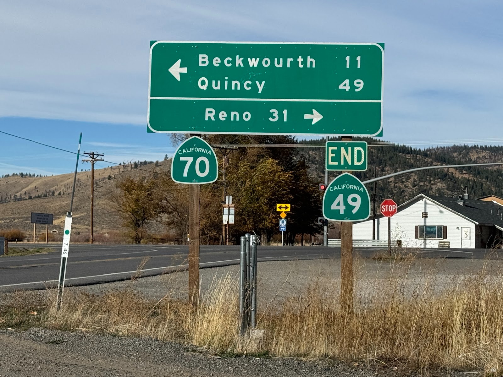
Anticlimactic? A bit. We're going to turn right.
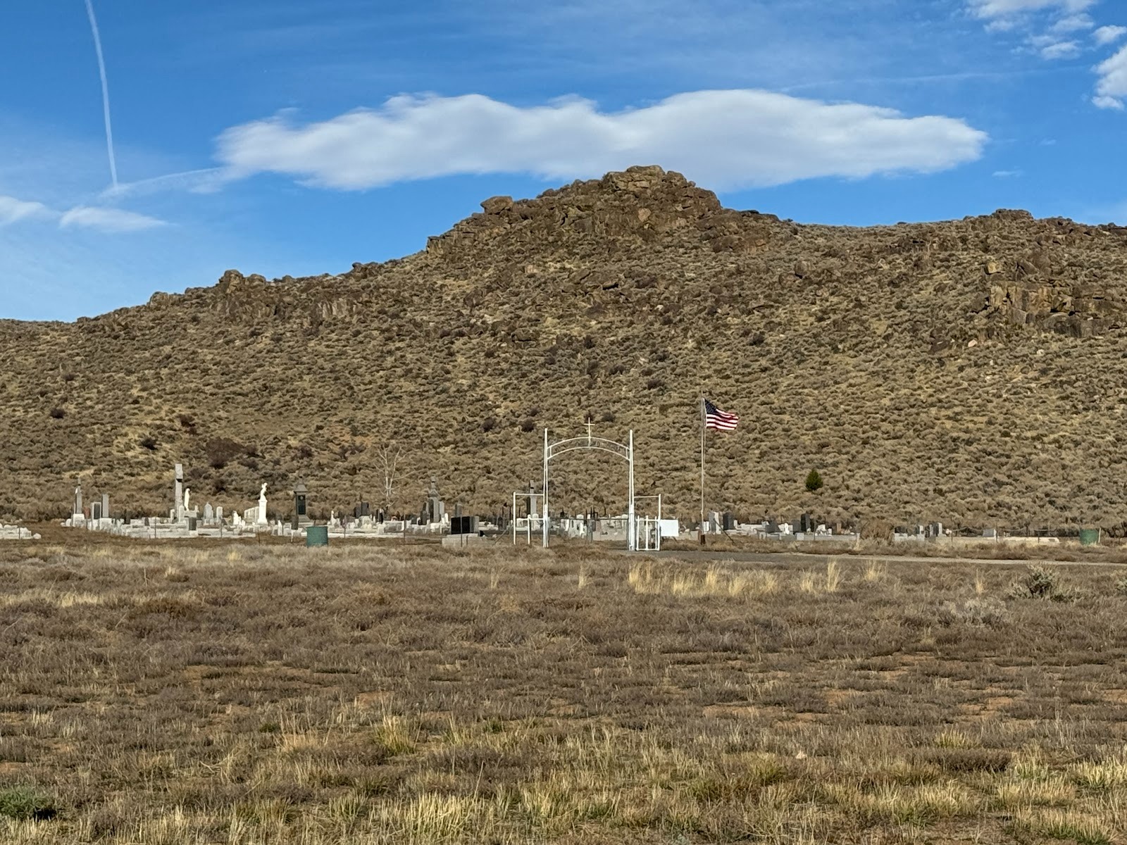
How's this for a lonely cemetery? It's the Vinton Cemetery, a mile down the road toward Reno.
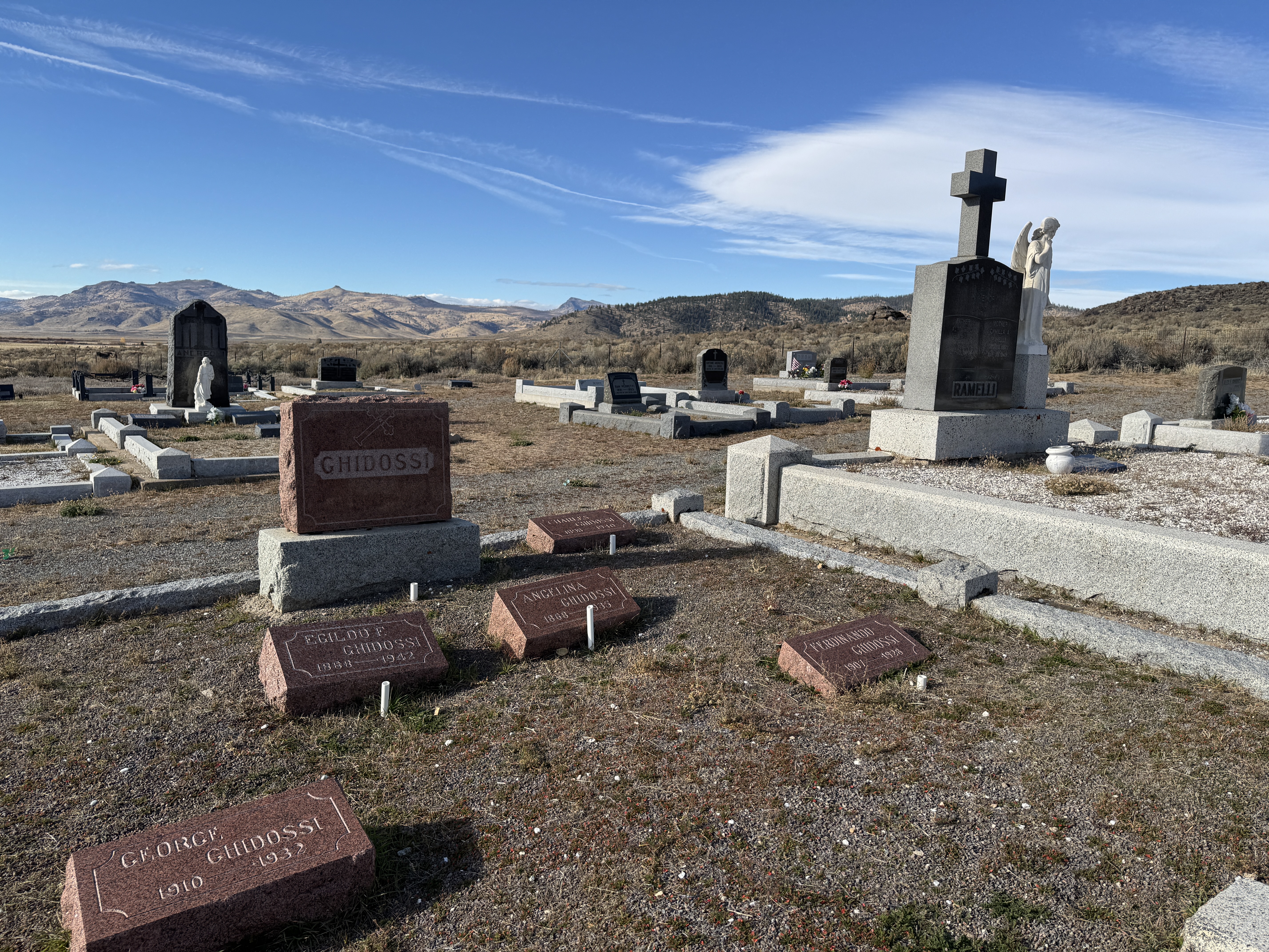
A tad bleak.
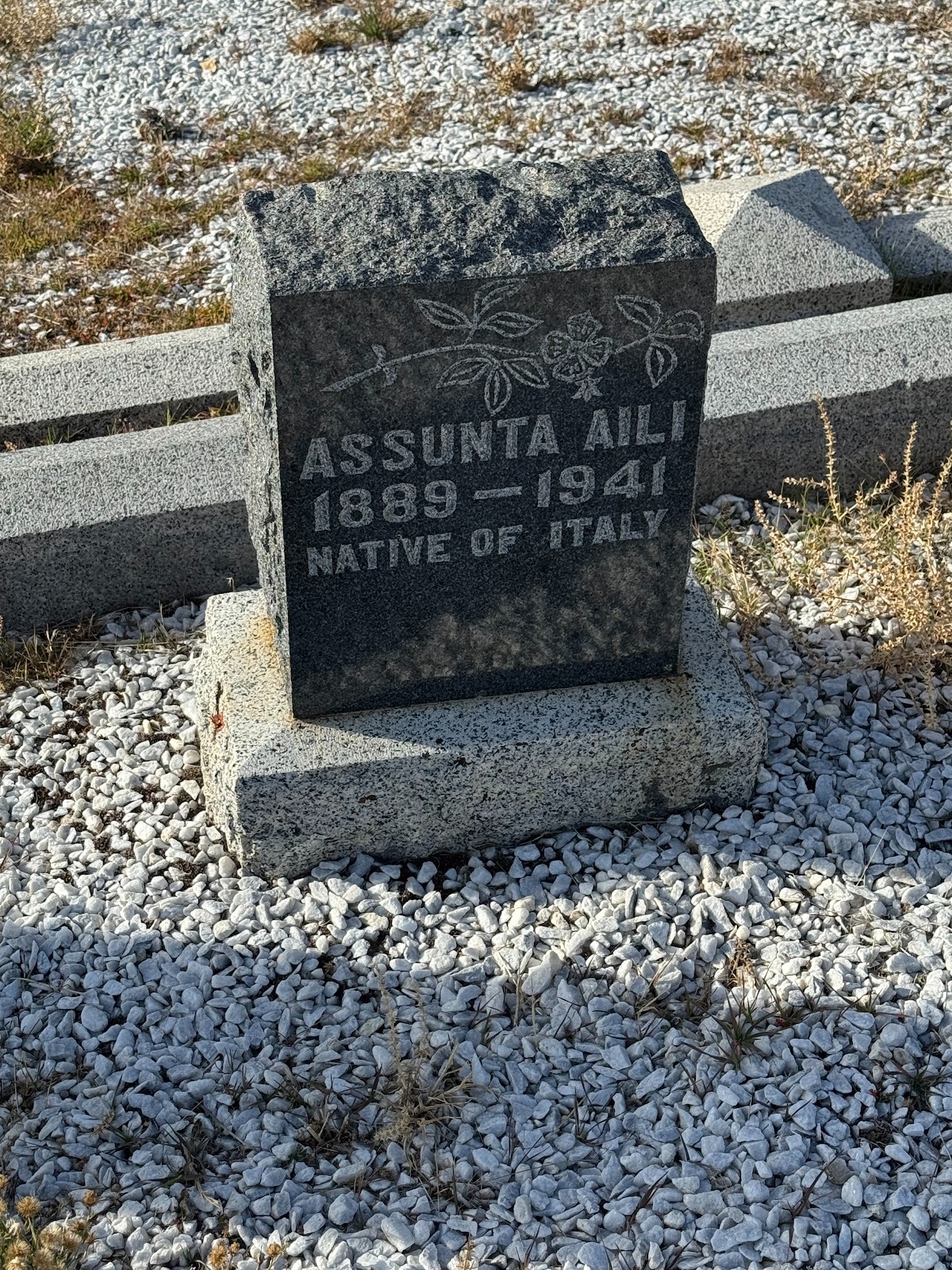
Everybody, or nearly everybody, is Italian.
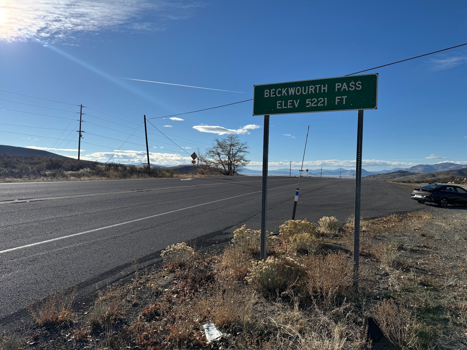
Another couple of miles and we cross the hills that frame the east side of Sierra Valley. It's a bit counter-intuitive, because Sierra Valley, despite being east of Yuba Pass, drains north and west into the Feather River, which means that Beckwourth Pass,1,500 feet lower than Yuba Pass, qualifies as the lowest pass across the Sierra Nevada. You can see why the Western Pacific came this way, because Donner Pass is over 7,000 feet high. Pulling trains uphill burns fuel.
Beckwourth Pass is not very impressive, but that was its appeal. Both railroads, by the way, use summit tunnels, so you won't find track over either Beckwourth or Donner.
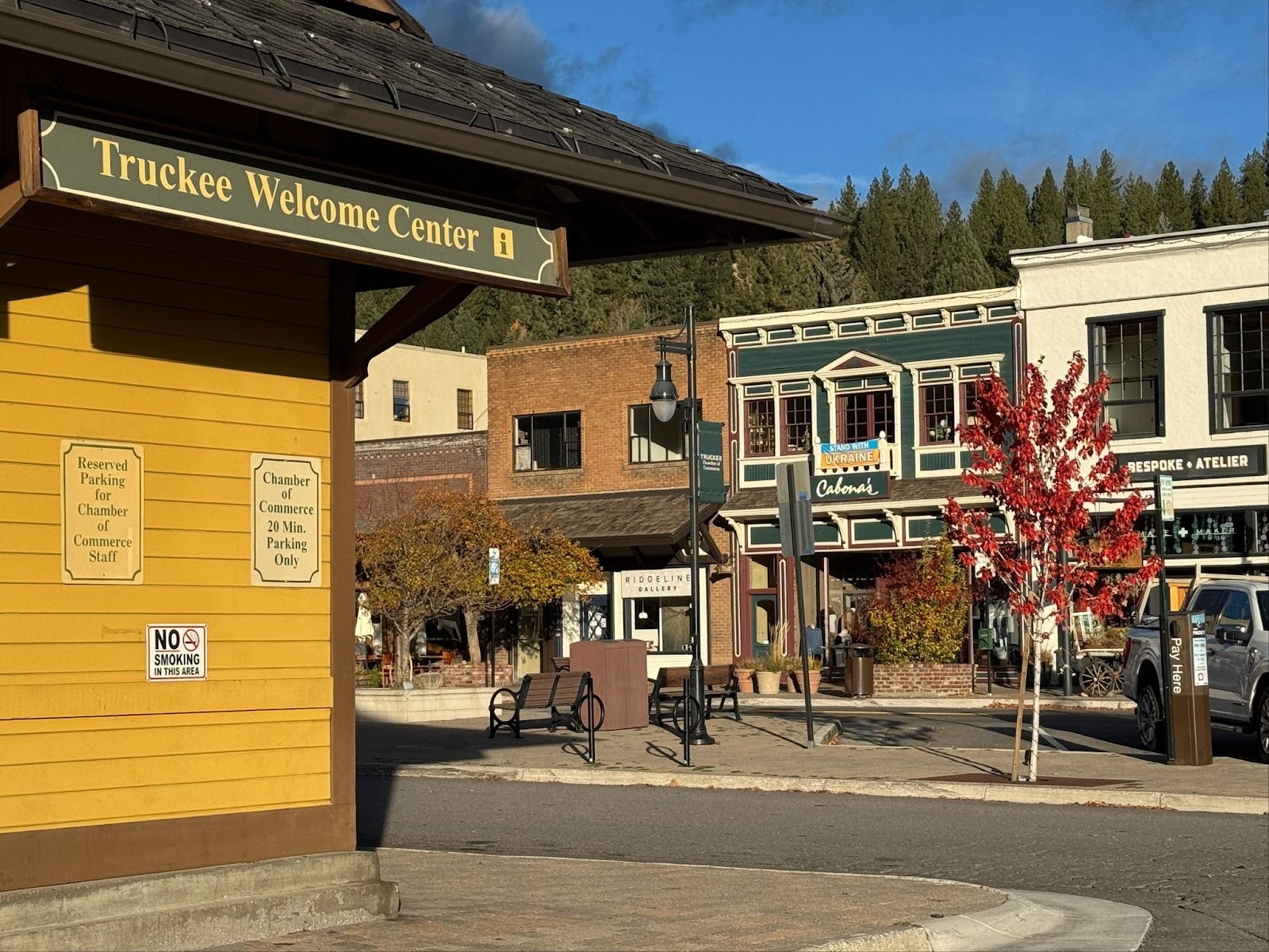
Let us pass over Reno and proceed west on Interstate 80 to Truckee. Notice the Bespoke Atalier? That's better even than a charcuterie.
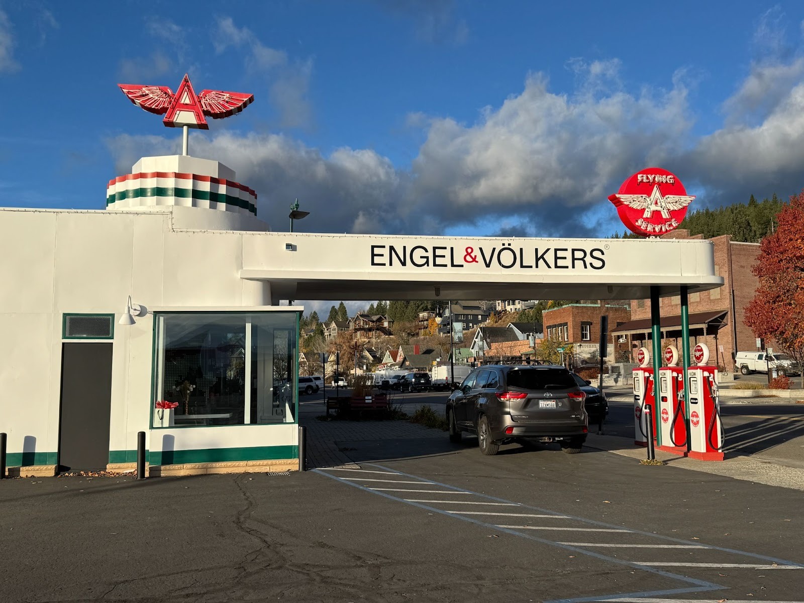
But it's hard to top this: a chi-chi realtor in a vintage gas station. (I've never, ever, used the word vintage before. Now excuse me: I have to lie down for a few minutes.)
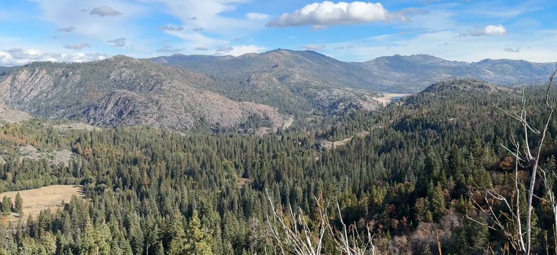
I'm about 30 miles west of Truckee and stopped at a vista point looking over Emigrant Gap, a route used by pioneers. But let me turn around.
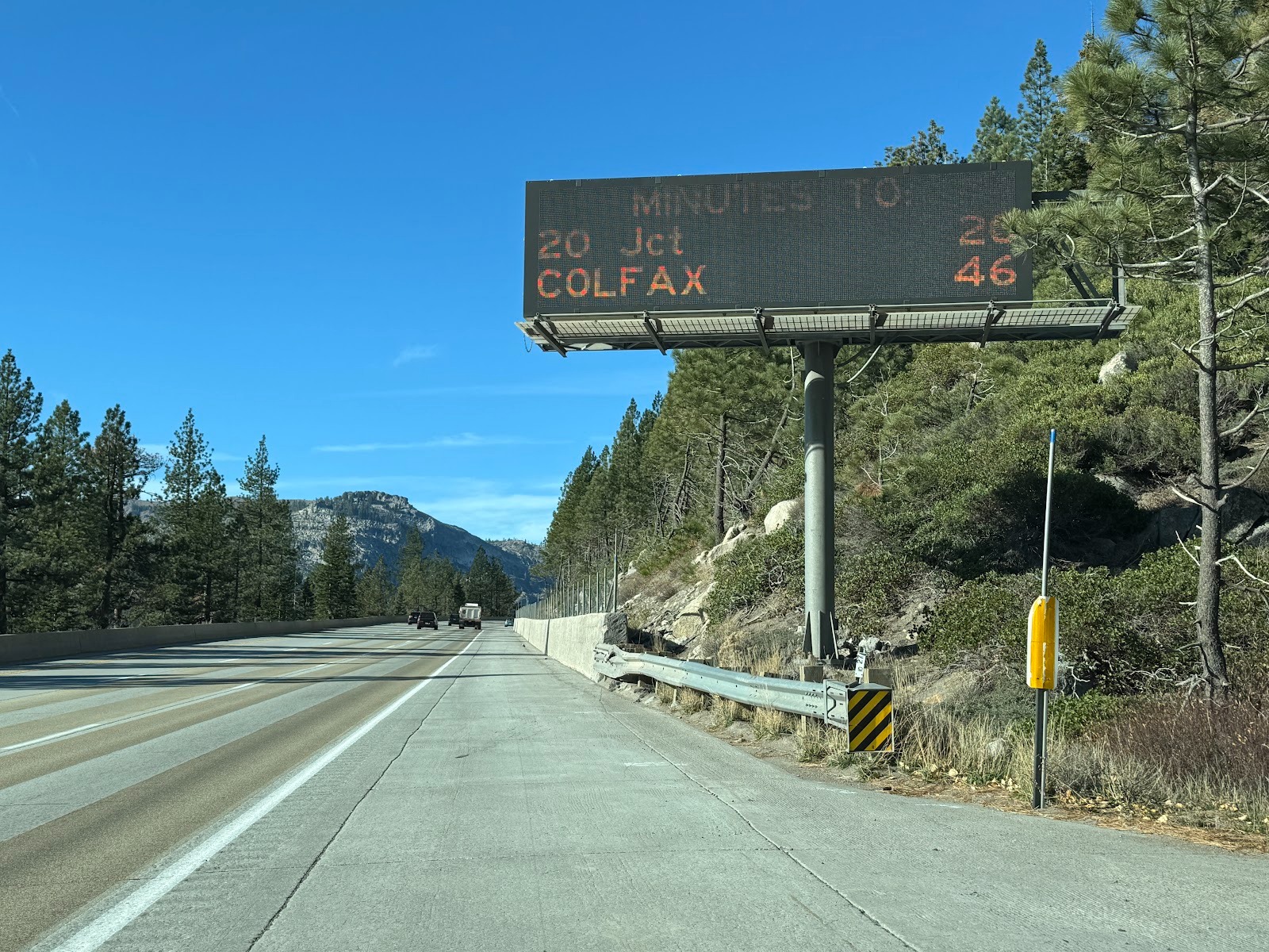
Ah! It's great that the highway engineers are helping us stay on schedule.
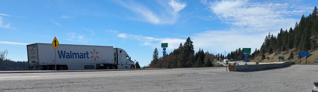
We've got freight to haul.
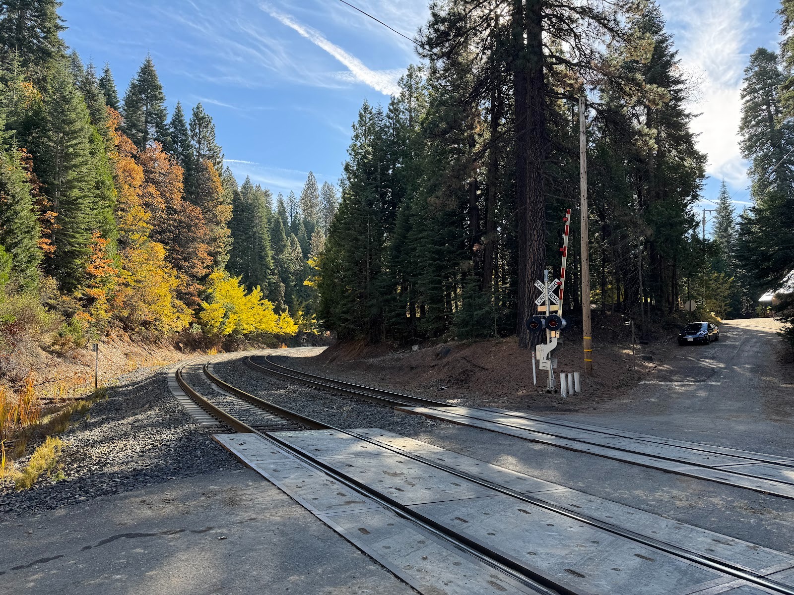
I got off the freeway and went a couple of miles down to Blue Canyon, where trains in the old days of the Central Pacific and Southern Pacific entered 30-odd miles of snowsheds. Nothing's changed since I was here in the 1960s, except we now have automatic crossing gates, which none of the very few people here need.
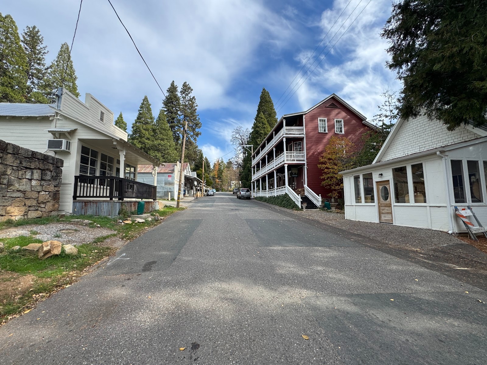
One more stop, a dozen miles farther down the interstate: Dutch Flat, where the hotel here on the right is reportedly being renovated. How do I know? Remember Colfax? The old hotel there was being renovated, and somebody said that the same guy was working here at Dutch Flat.
It was locked tight, alas, but I stand in awe of the stairs. I thought the ones in Mokelumne Hill and Amador City were wicked.
Through a window.
Across the street, an old post office keeps the community together. The lady behind the counter knows everything and everybody. A perfect place to catch up and for old folks to complain a bit about the dirt bikers who come to play in some abandoned nearby diggings.
**
**
T