Rural Texas 2, Big Bend Country, Texas
Here we go, from Del Rio up the Rio Grande as far as Presidio, then north to Marfa, Alpine, and Fort Davis.
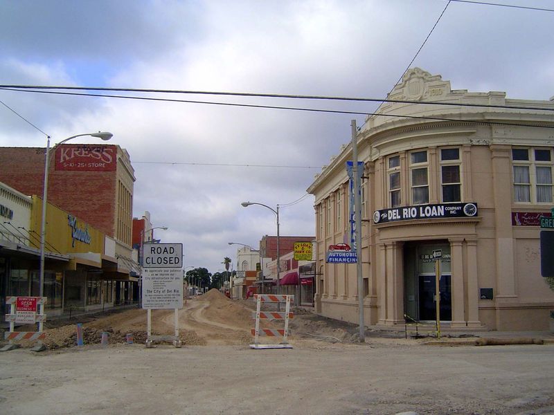
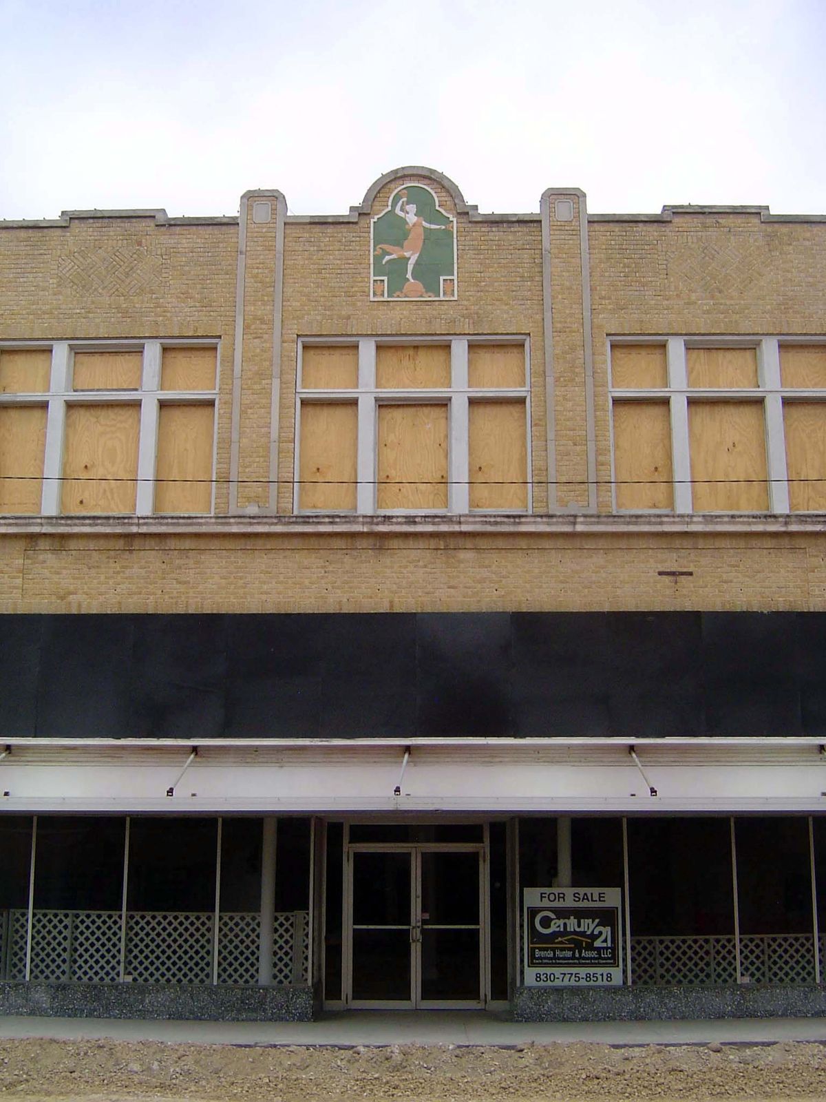
Summer, 2010: the corner of Main and Greenwood, the center of Del Rio.
Whatever the faults of Texas, hiding in the shadows isn't one of them.
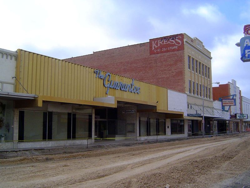
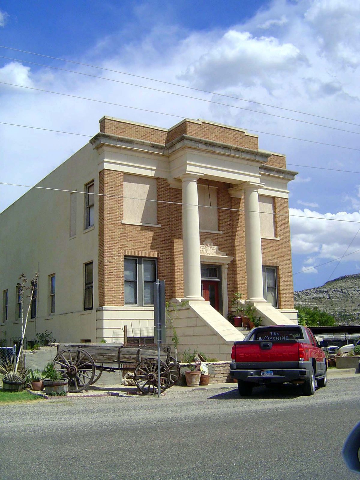
Ex-department store.
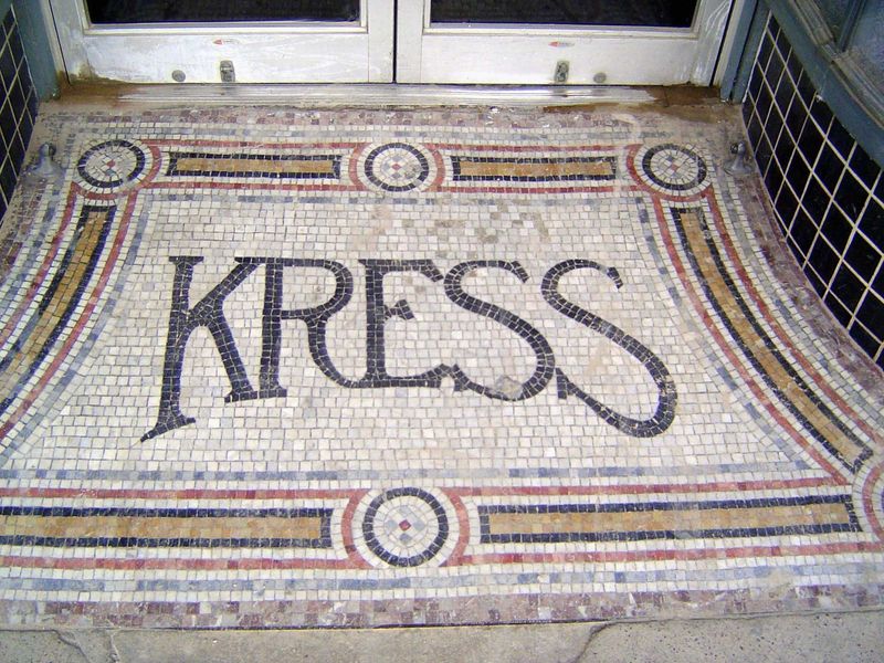
Can you imagine Wal-Mart paying for mosaics?
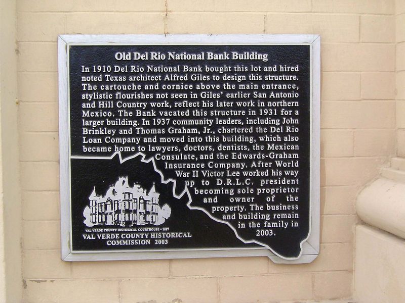
Across the street, there's another graceful touch.
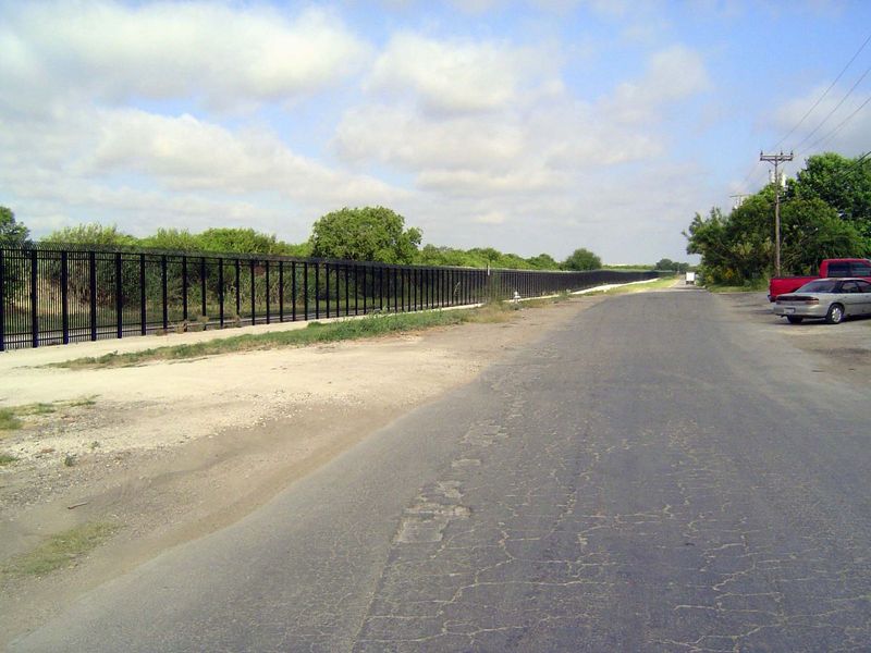
Not much grace here. This is as close as we can get to the Rio Grande, roughly half a mile to the south.
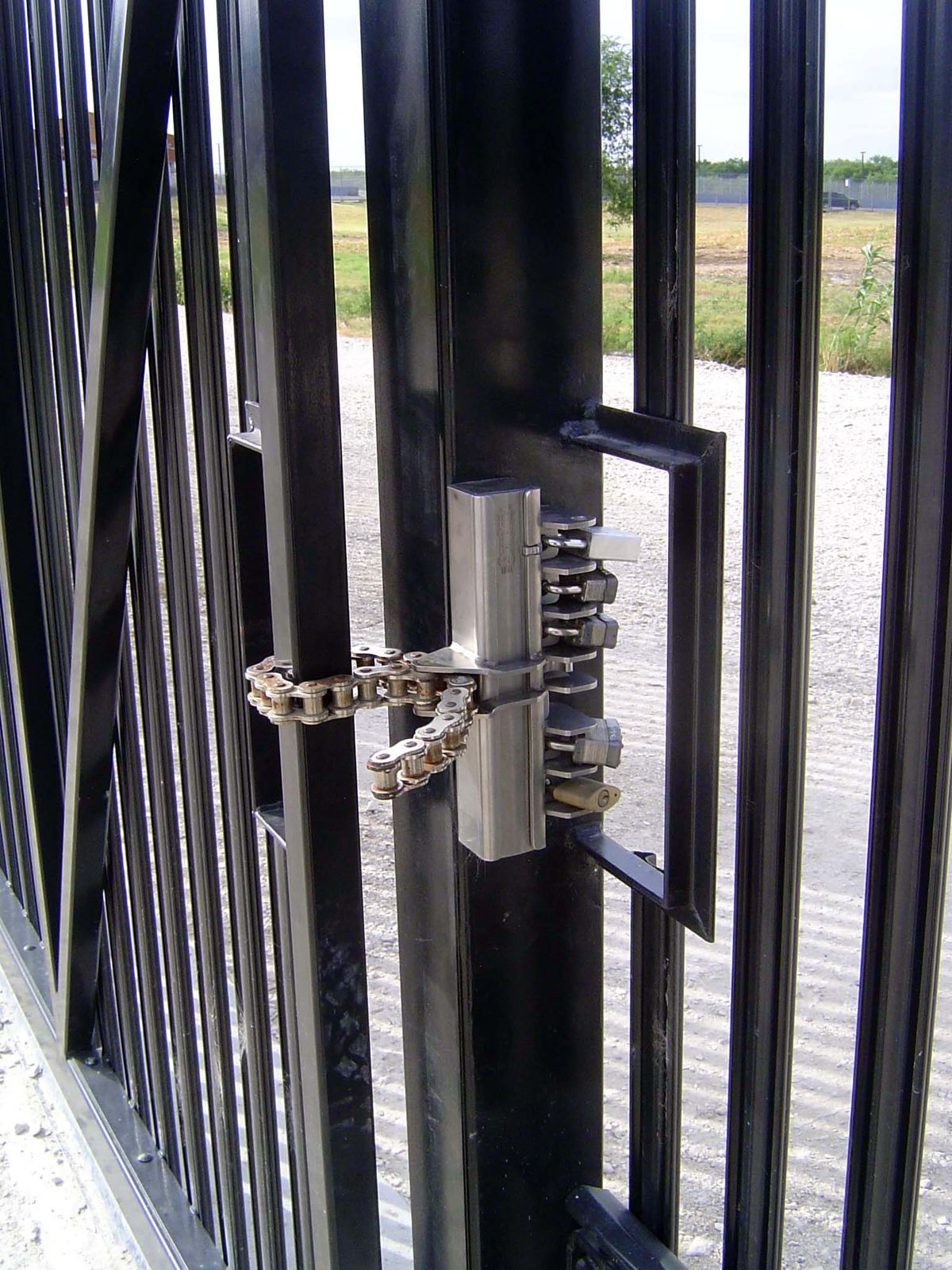
Padlock paradise.
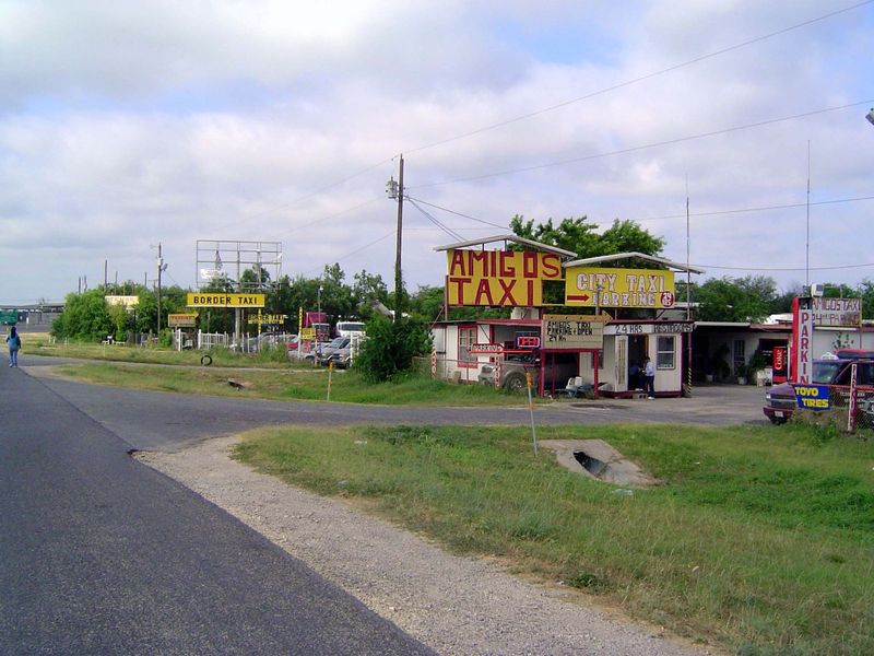
Here's the taxi station for folks heading south to Ciudad Acuña, which is across the river and has at least six times as many people as Del Rio.
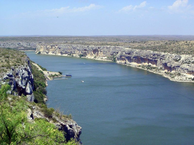
Thirty-five airline miles upstream, the Pecos joins the Rio Grande. The view here shows that point, with the Pecos flowing away from the camera and joining the Rio Grande flowing left in the distance. And, no, the Pecos isn't another Mississippi; it's deep and wide here only because this stretch is part of Amistad Reservoir, formed by a dam about 25 miles downstream. On the other hand, the river (or lake) is rarely this high. In the summer of 2010, when the photo was taken, the lake elevation was about 1,129, not far short of its maximum design elevation of 1,144, and well above the 1,070 feet of a few years earlier. The landing is a relic of a former ferry landing and bridge.
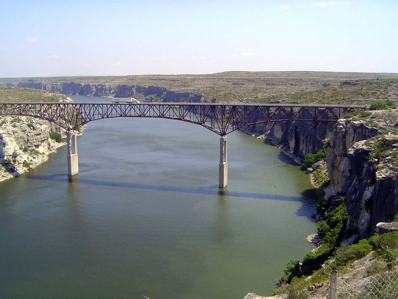
Now, U.S. 90 crosses the Pecos on this high bridge, just upstream. Another bridge, about four miles farther upstream, brings railroad traffic across the river.
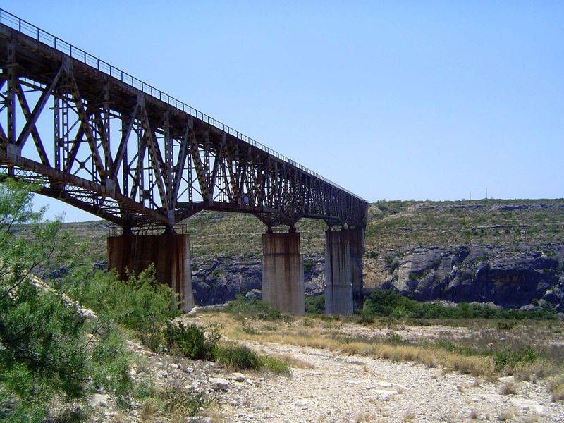
Here's that railroad bridge, and quite a disappointment it is. The bridge was built during World war II. Steel was short but the bridge was a strategic necessity. Why disappointing? Because it replaced the fabulously spidery steelwork of the original Pecos High Bridge, built in the 1880s. There's nothing left of the old bridge, which stood about a hundred feet to the north or left here. New bridge or old, this was the mainline of the Southern Pacific, now swallowed up by the Union Pacific but still very active.
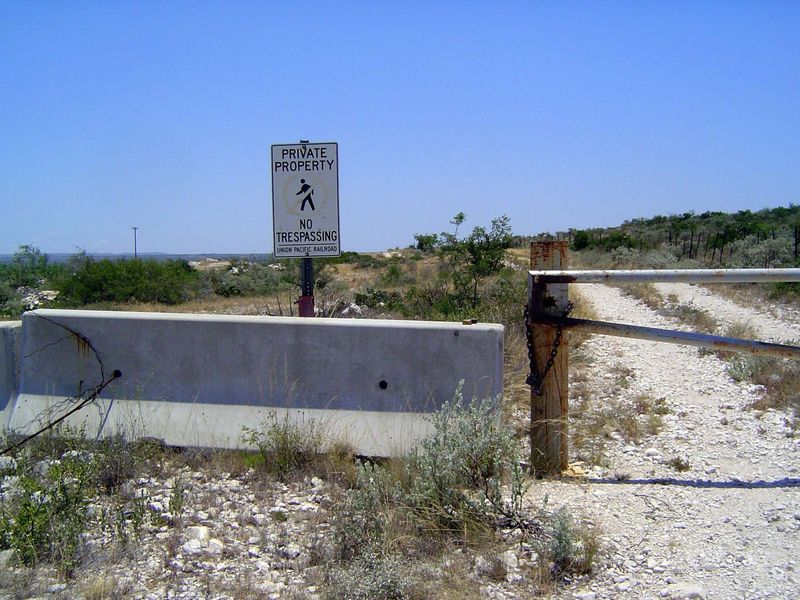
You have to walk a forbidden mile to approach the bridge.
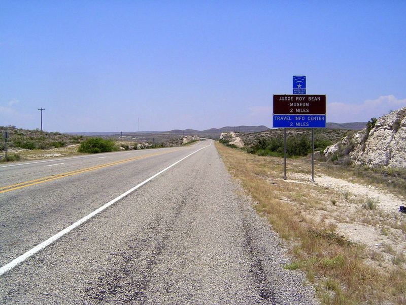
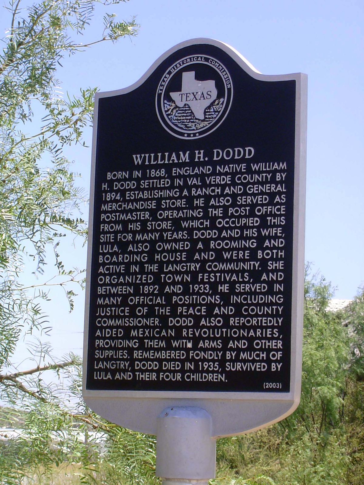
Continuing west, U.S 90 here approaches Langtry, the home of Law West of the Pecos. Roy Bean, a storekeeper, was appointed justice of the peace for Val Verde County (then called Pecos County) in 1882. His main job at the start was to help the Texas Rangers keep order among the railroad's construction gangs.
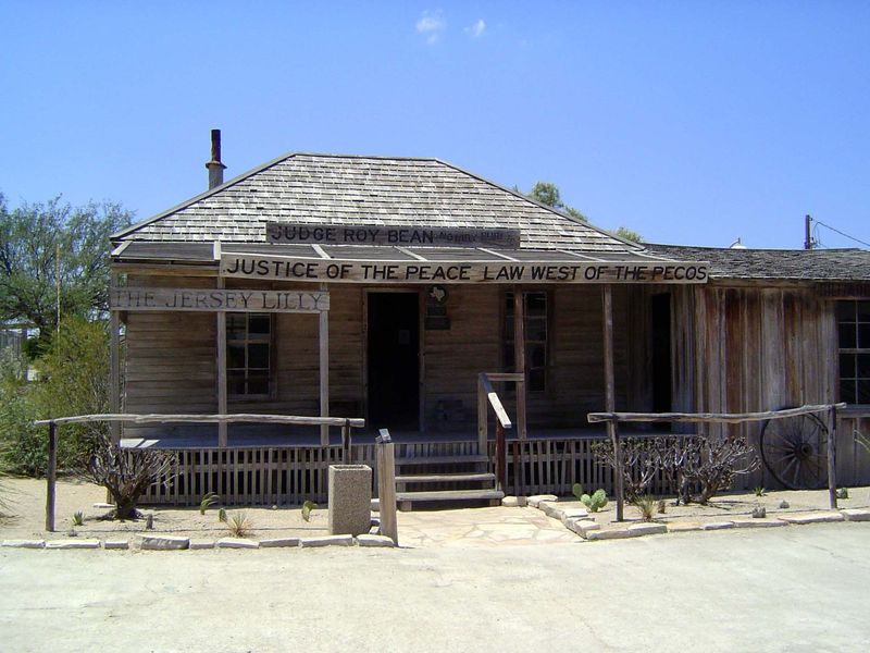
Roy Bean's place is now a museum, prominent only because there's so little else nearby. Well, that's unfair. Legends grew up around him, with plenty of help from the man himself. Among his endearing qualities was an infatuation with Lillie Langtry. Her name was mispelled on his store and courtroom, but his heart stayed true. After ignoring many letters, she did visit, but not until after Bean's death in 1904.
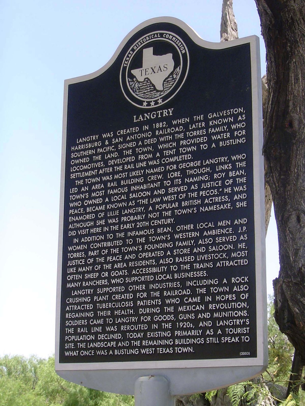
Once again, the Historical Commission is happy to recite the facts.
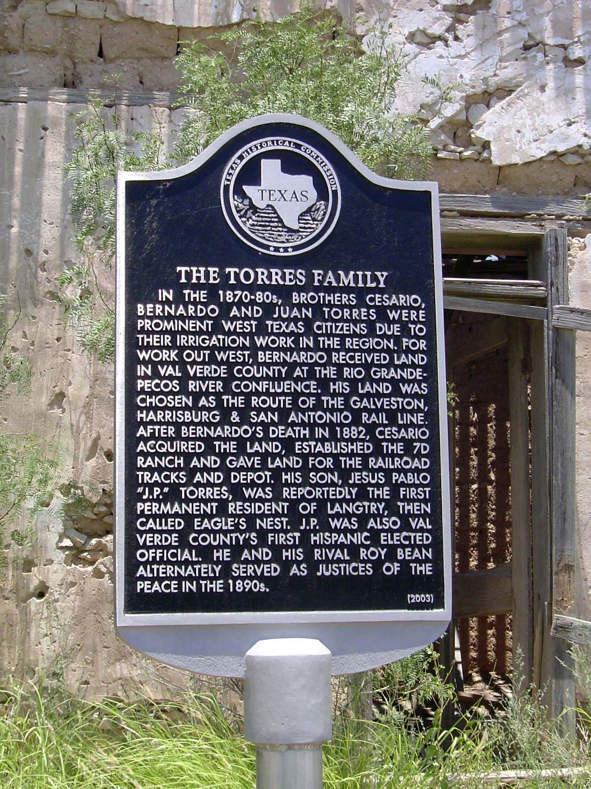
Here it reviews the history of a local family obscured by the blinding light of Bean's quasi-comical celebrity.
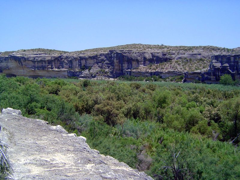
Langtry is just a quick walk north of the river at a spot known as Eagle's Nest. There's a reason for that name, of course, and perhaps the best explanation of it comes from Robert T. Hill of the U.S. Geological Survey. One of the first people to ride the river through the Big Bend country, he ended his journey here and on the last page of his narrative includes this sardonic note. "Opposite the village of Langtry, near the top of a vertical cliff some three hundred feet high, is a small bluff cavern. Poised on the edge of this inaccessible cavern in a huge pile of sticks skilfully entwined into what is perhaps the largest birds' nest in America. Since the trans-Pecos country was first known this nest has been a landmark, and until lately was inhabited by a pair of eagles which here annually brought forth their young. A few years since, however, a company of colored soldiers were stationed near this place, and, with the instinct which prompts men to shoot at every living thing, they killed the birds, which even the hardened frontiersmen had long protected." (Robert T. Hill, "Running the Cañons of the Rio Grande," in Century Illustrated Magazine, VXI:3, 1901, p. 371)
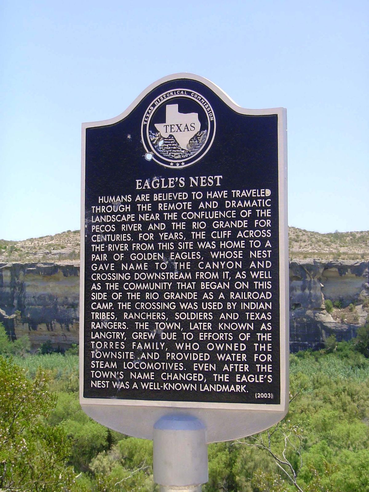
The historical marker leaves out the sorry detail.
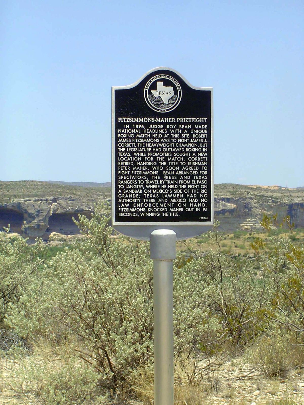
The site was also the location of one of Bean's best-known stunts.
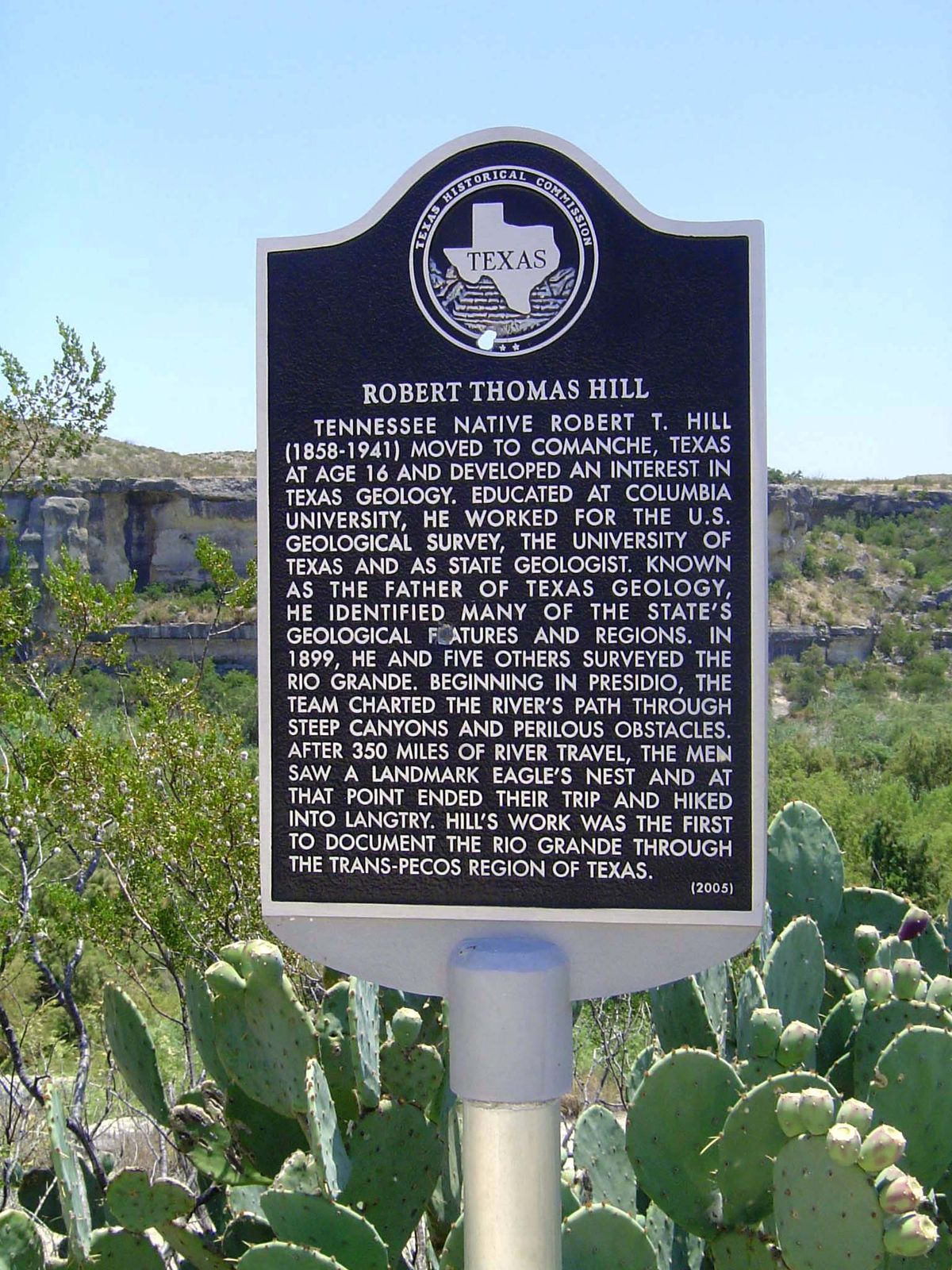
Even the geologist is remembered.
Live out here long enough, it seems, and you, too, can have your own historical marker.
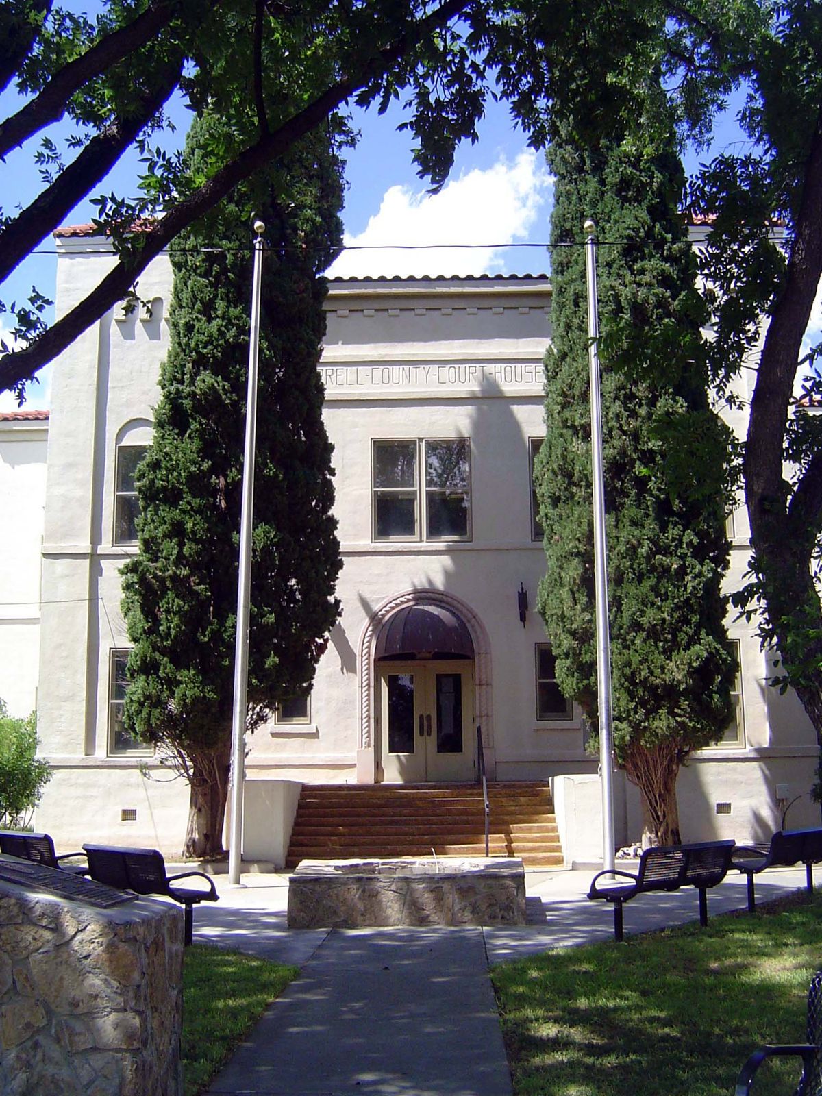
We've pushed on another 50 miles to Sanderson, the seat of Terrell County. There's a creek here—a long one called simply Sanderson Creek—and it makes the place greener than you might expect.
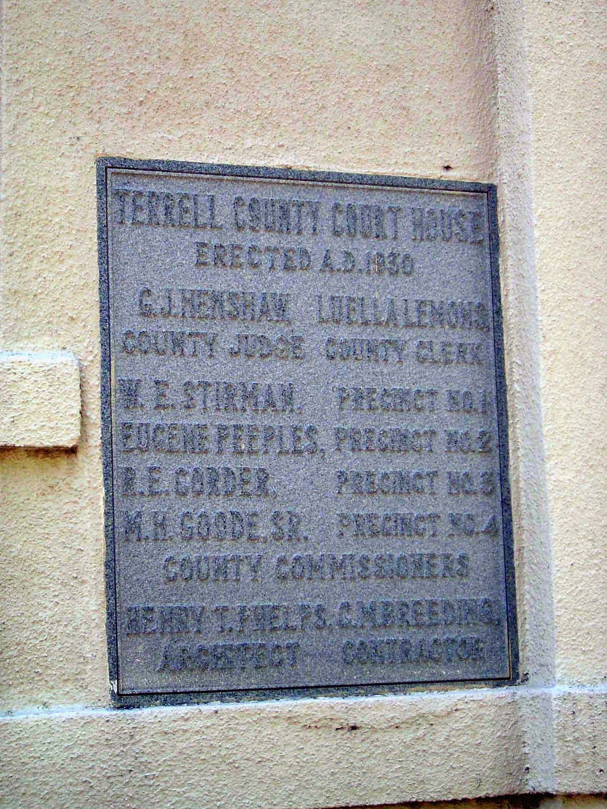
Plaque.
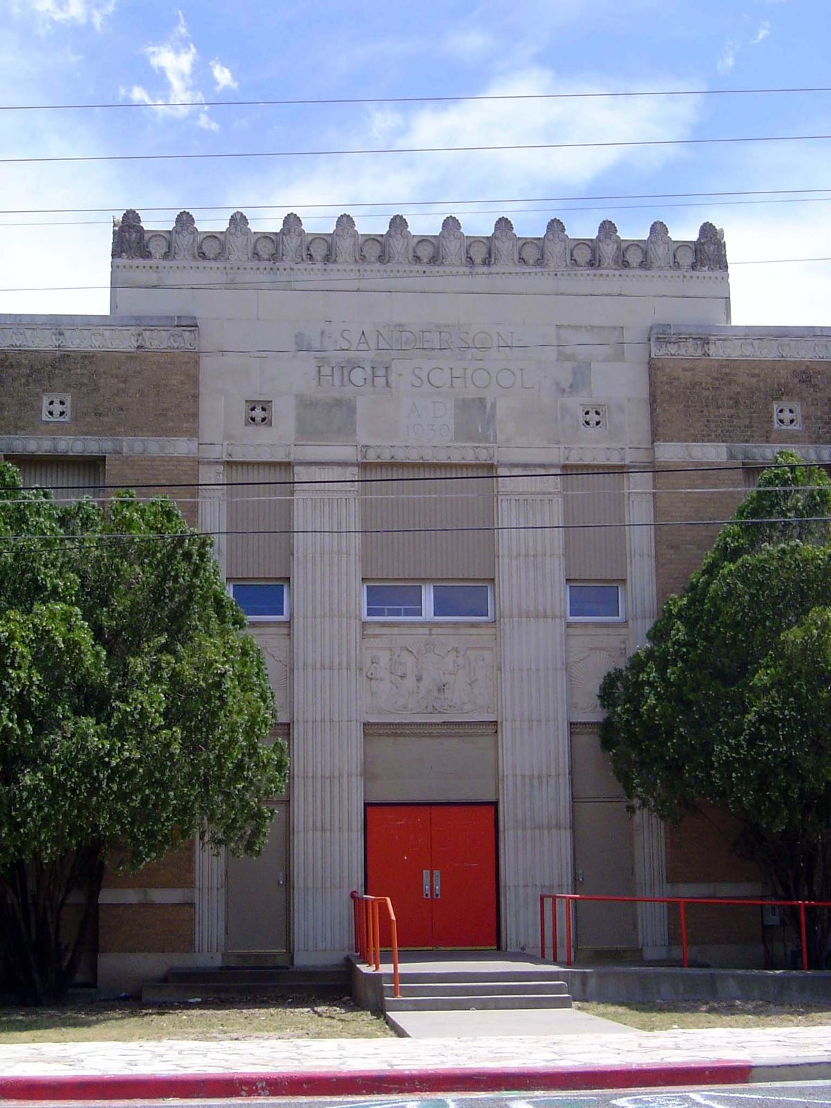
The local high school.
An older courthouse.
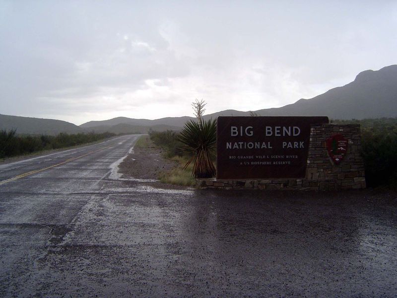
A hundred miles farther on, and 50 south of Marathon, there's a brief thunderstorm at the entrance to Big Bend.
Where there was water in the Big Bend country, there was likely to be settlement. In this case, one Sam Nail. His ranch, like others within the boundaries of the national park, was acquired in the 1930s.
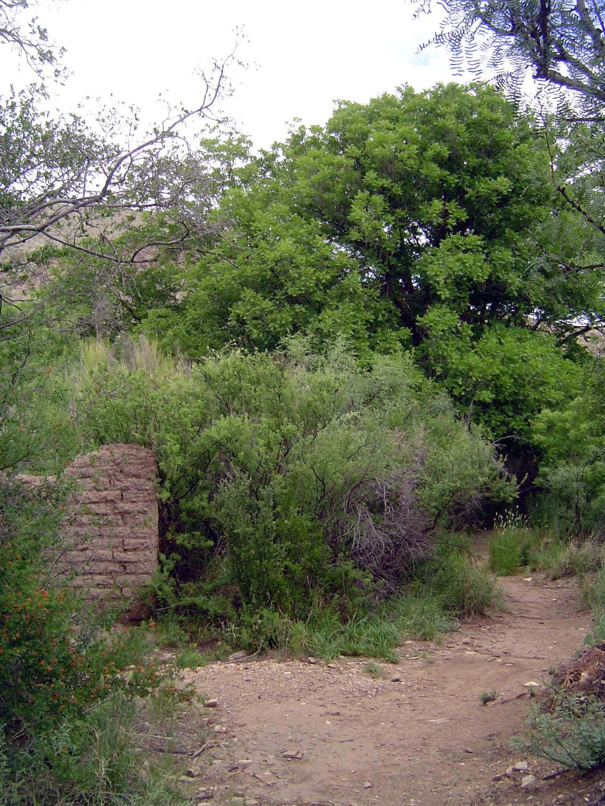
Foundations of his house.
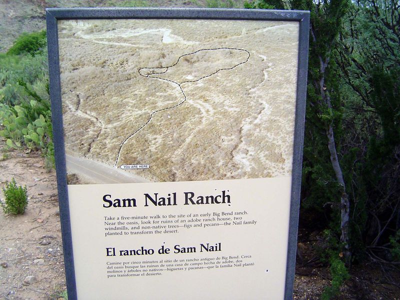
At your service: the NPS sign on the spot.
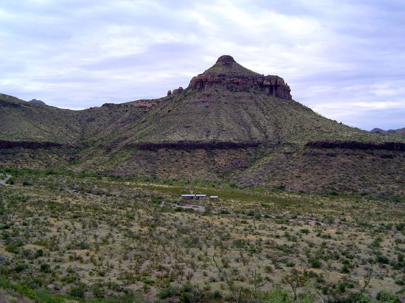
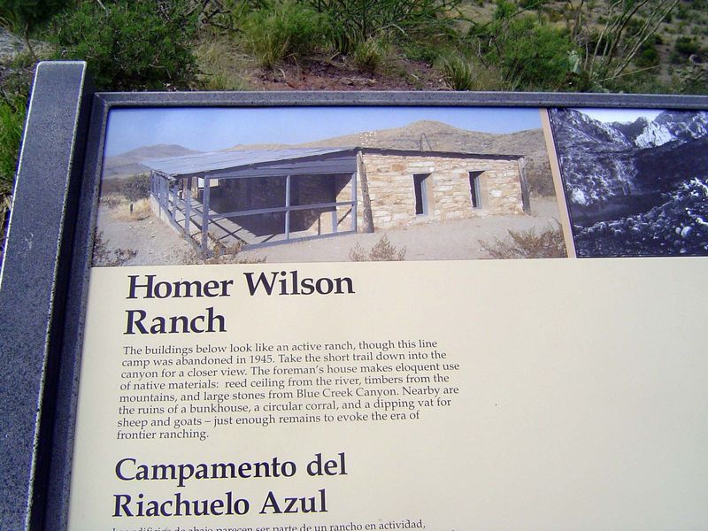
Another old ranch, identified on old maps as the Homer Wilson Ranch.
On the spot.
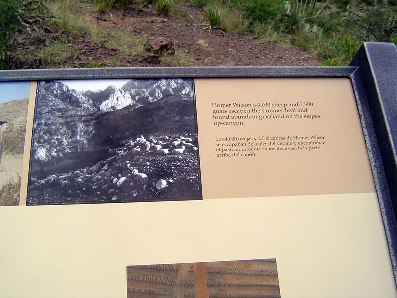
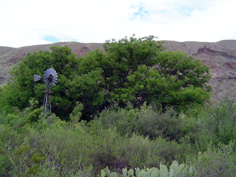
Sheep and goats! Not many of them left in this country.
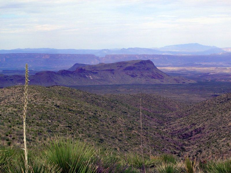
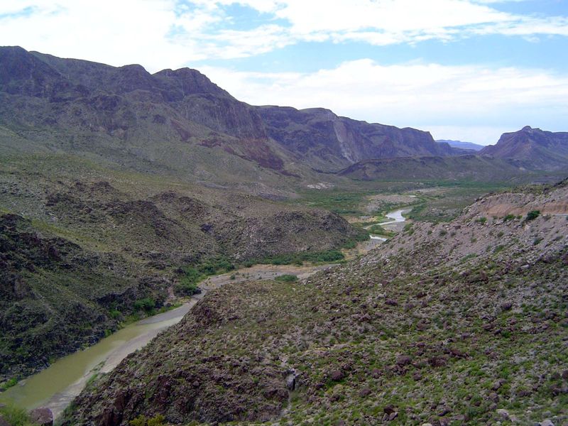
Looking south to the ridge of the Mesa de Anguila. The Rio Grande cuts through it with that slit in the middle of the image. It's the Santa Elena Canyon.
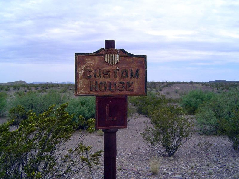
On the way to that canyon there's this sign of an abandoned border crossing.
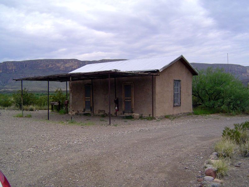
There are a few buildings here, too.
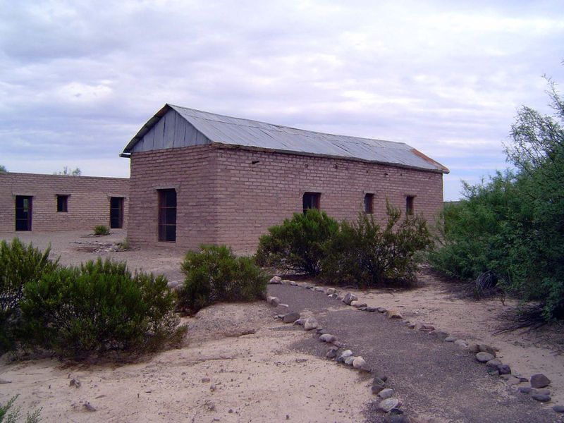
A couple of others.
The story of the place.
Closer to the mesa and canyon.
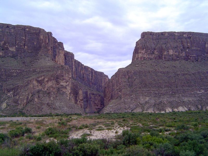
Closer still. That's Mexico on the left, the USA on the right. No need for a fancy fence here, unless you worry about immigrants skilled in rappelling.
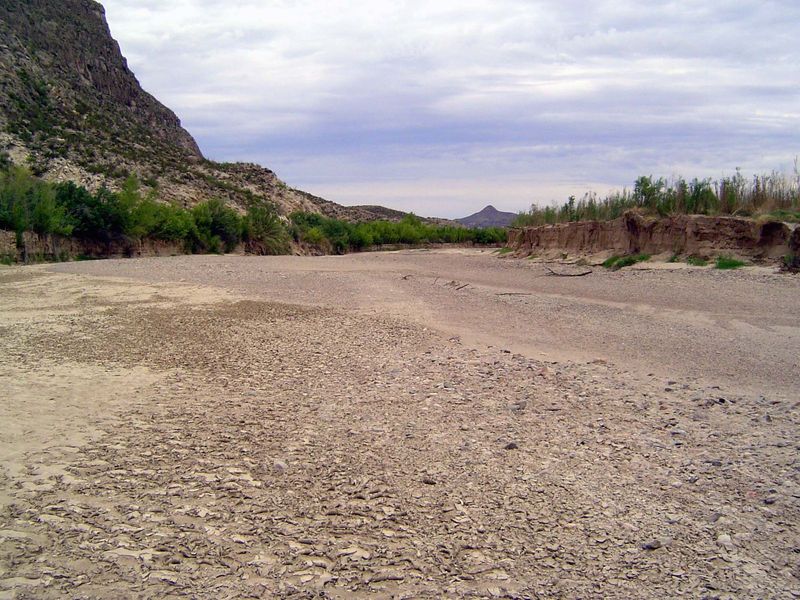
At the mouth of the canyon, Terlingua Creek comes in from the northwest. Or does from time to time.
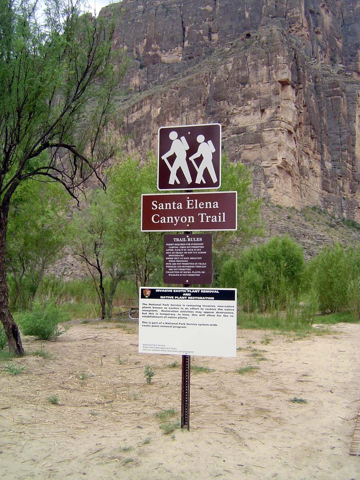
We cross it and head up the very tame canyon trail. But notice how he's in front of her. Tut, tut!
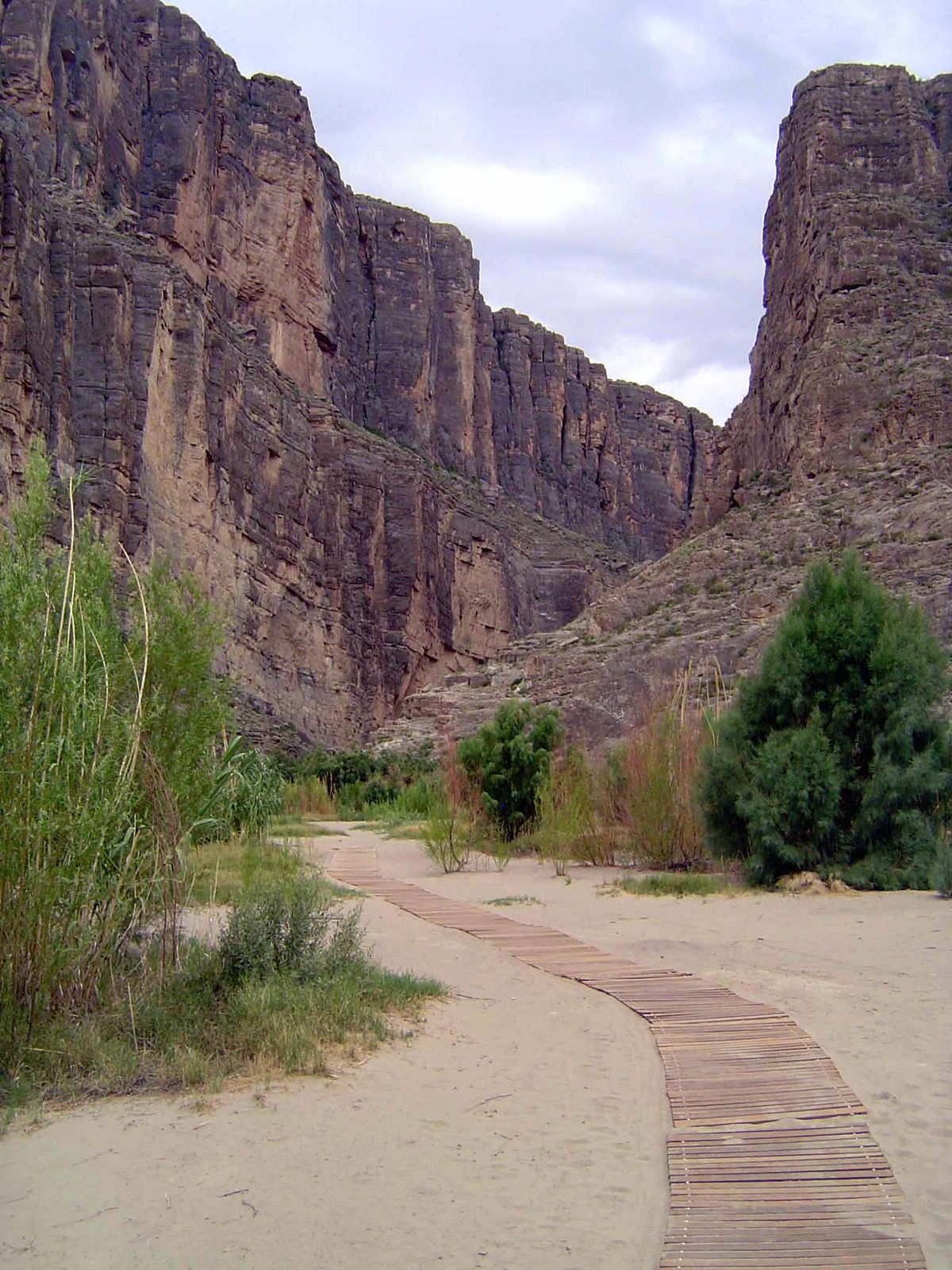
Tame indeed.
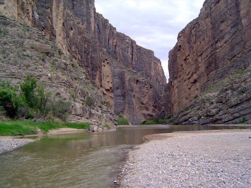
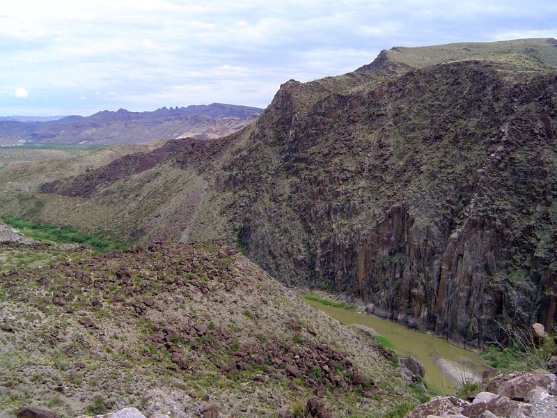
Eventually the slats disappear but after a thousand feet or so the trail does, too. Don't worry, there's plenty of company from people in rafts who just can't refrain from testing the echo. The pioneering Texas geologist Robert T. Hill, coming through the canyon on a freshet that raised the stream level, wrote, "We lingered long in contemplation of this most remarkable feature. It is an abrupt escarpment of massive limestone which rises in a vertical wall to a height of seventeen hundred and fifty feet and extends northwest and southeast for sixty miles, fifty miles in Mexico and ten miles in Texas. Its sky-line is as square-cut and horizontal as the top of a table. The face of the cliff appears absolutely vertical, although it is marked by one slight bench. Nicking the summit here and there at wide intervals are deep V-shaped rifts of minor waterless canons whose mouths are suspended in the air. As bold and extensive as is this mountain, it has hitherto found no place or name on published maps." Hill pointed out a parallel fault scarp some 40 miles to the east in the Sierra del Carmen. He writes: "The intervening region, or lower country, represents a downfallen wedge... in this case it was the arch of the Rocky Mountains which had dropped down."
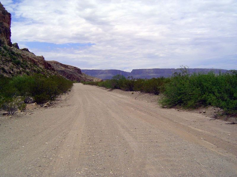
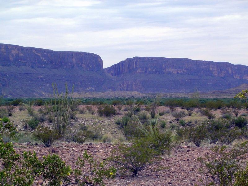
Heading north through what Hill called the Terlingo Desert.
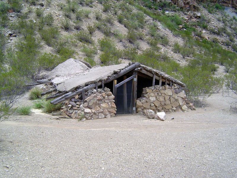
An abandoned house, half-buried for insulation.
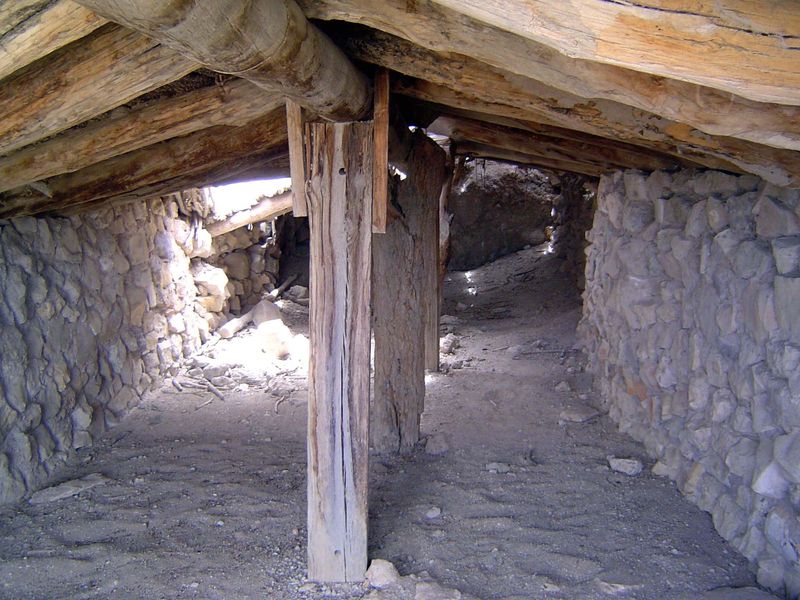
The interior.
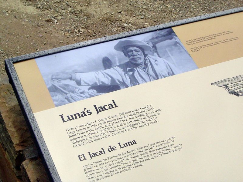
Explanatory sign.
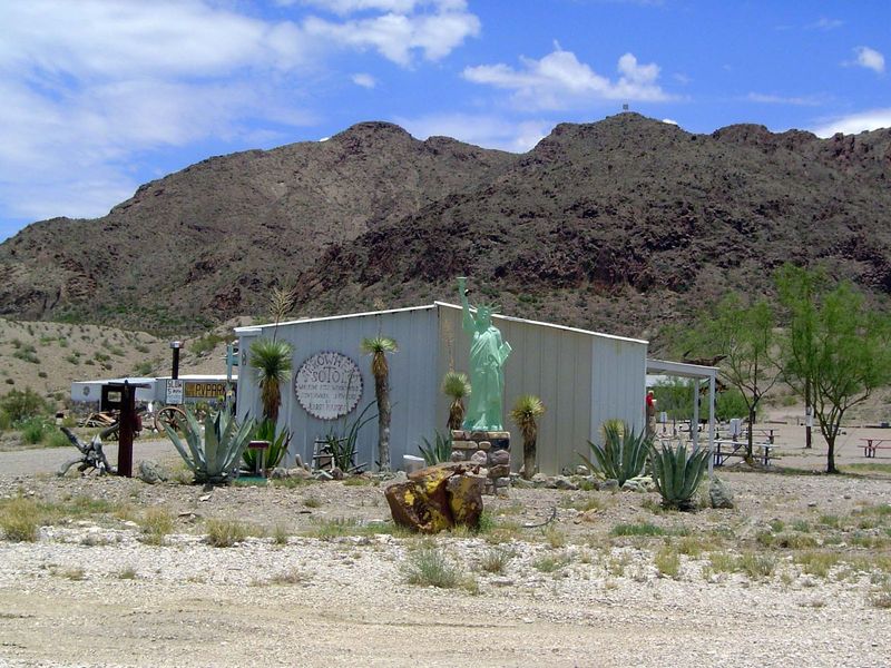
Outside the park, the first town is Terlingua, noteworthy for eccentricities.
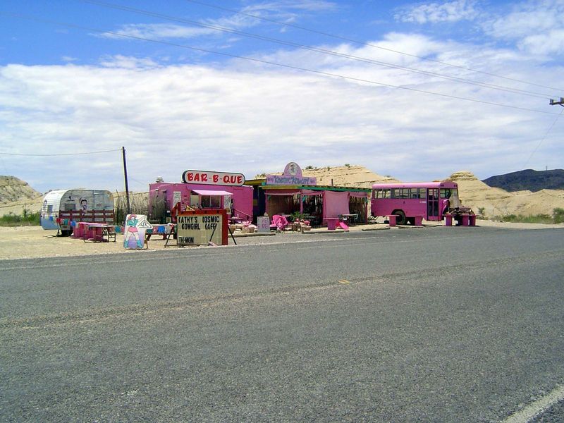
The pink place.
Terlingua peaked with a thousand people in 1900 as miners sought the local cinnabar or mercury ore, but operations stopped during World War II, and the place became a ghost town, rescued, to a degree, by tourism.
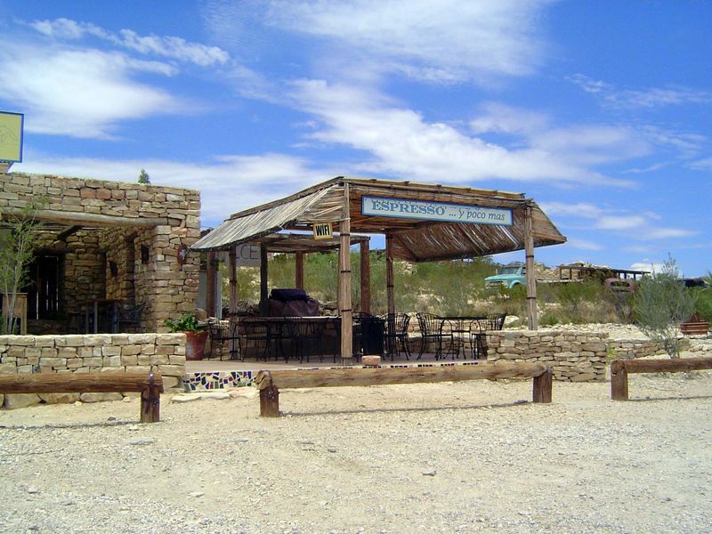
Some have dreamed of bigtime tourism. The best example is probably the Lajitas Golf Resort, begun in the late 1970s by a Houston developer. The place was auctioned in 2000 to a man from Austin who spent $100 million to make the place exclusive enough to join Leading Hotels of the World. No go: in 2007 the place sold for $13.5 million to a Dallas businessman who replaced $50 steaks with the chicken-fried kind.
Still, three years later, in the summer of 2010 there wasn't a visitor in sight.
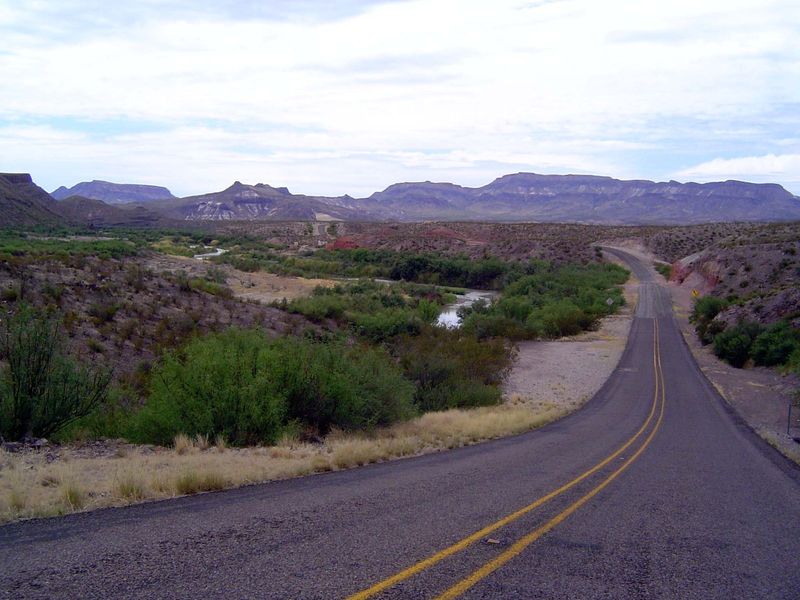
Continuing on toward Presidio. Yes, that's the Rio Grande. No fence, no cliff, just a degree of isolation and border-patrol stations on the highways farther inland.
Again the river cuts through mountains.
Not a trace of the 400 million people who straddle this border.
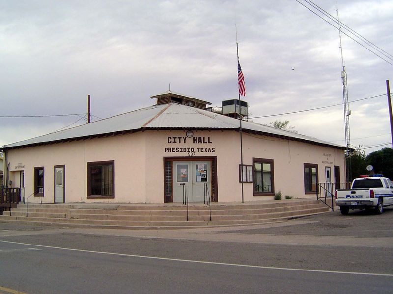
We've arrived.
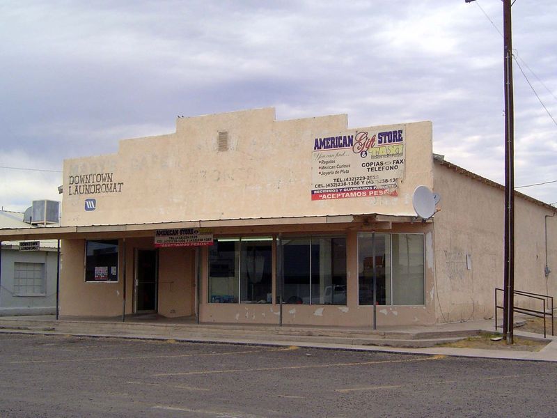
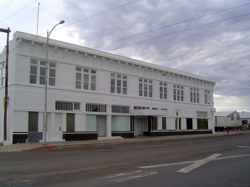
Not much to see, even on Main Street.
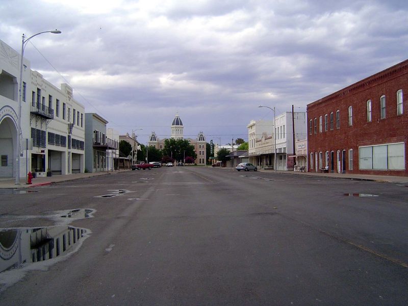
Sixty miles to the north, Marfa is in much better shape.
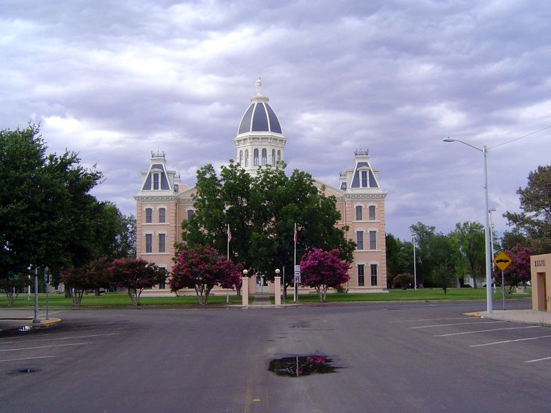
A courthouse with a touch of the Second Empire.
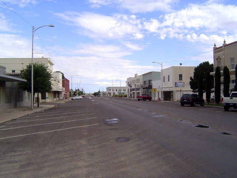
Looking in the other direction.
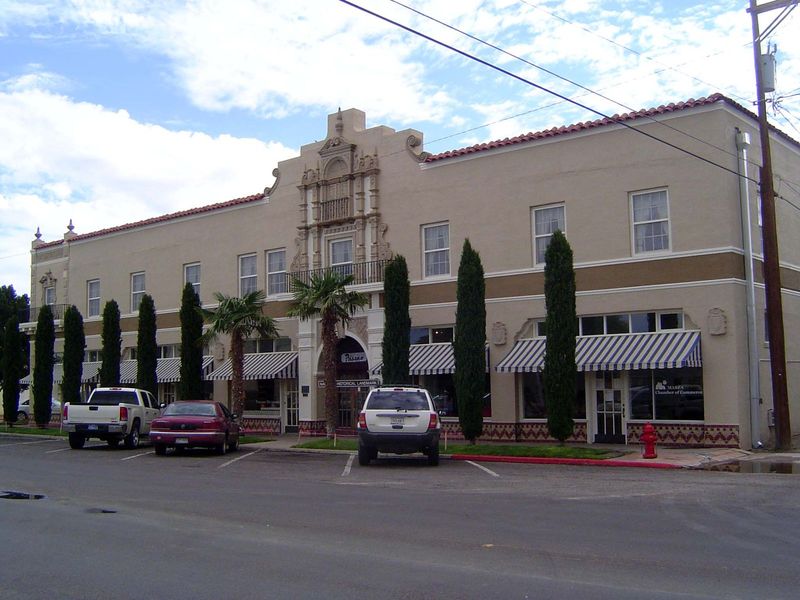
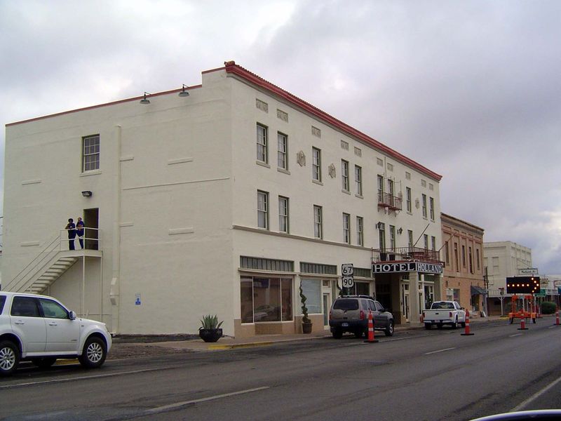
The town's proud hotel.
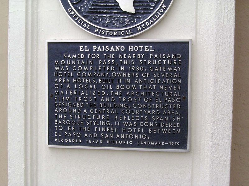
Plaque on the wall.
Across the street.
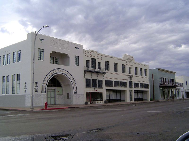
Stylish but so deserted it's spooky.
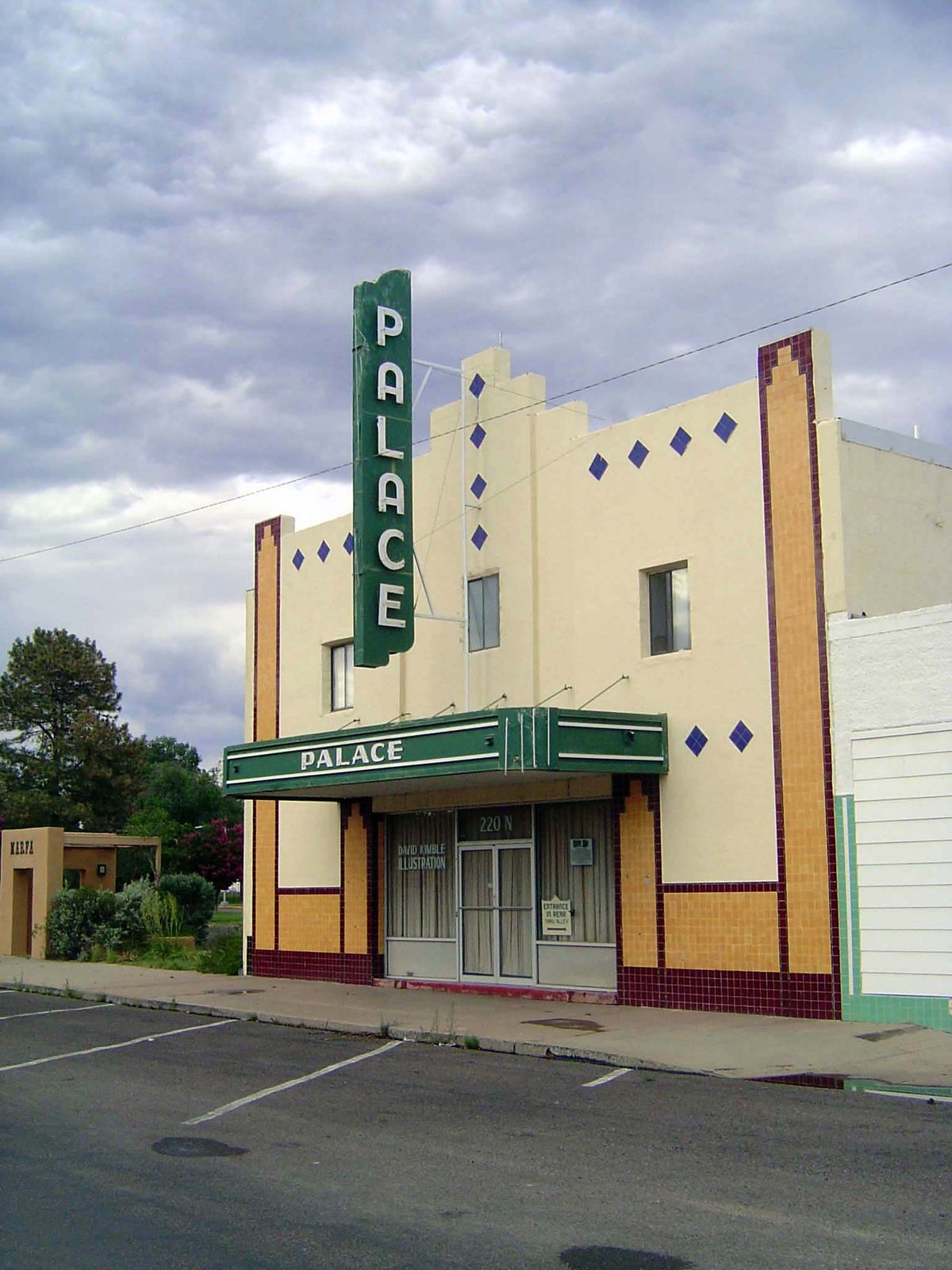
The Palace palace.
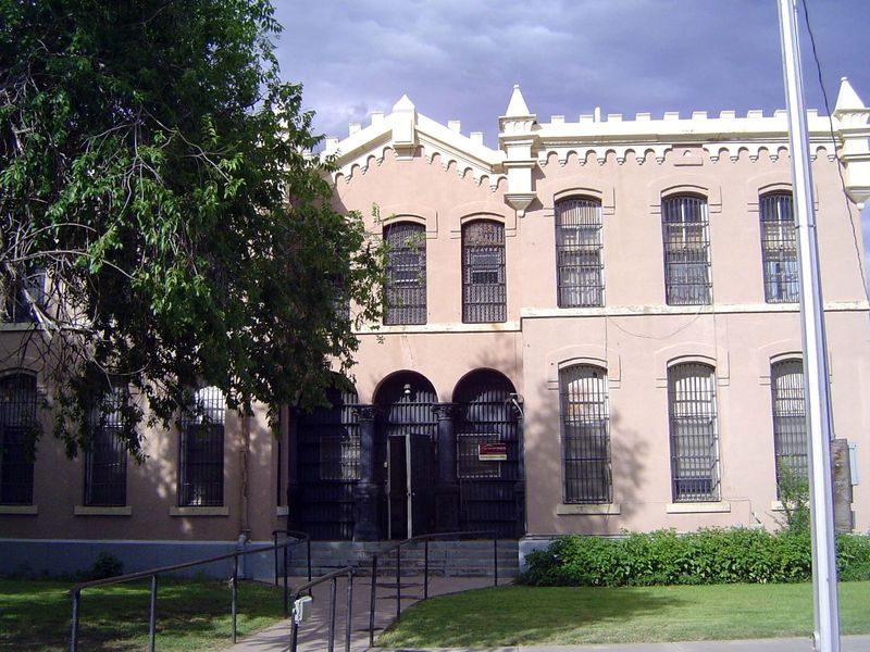
The county jail, in powder-puff pink.
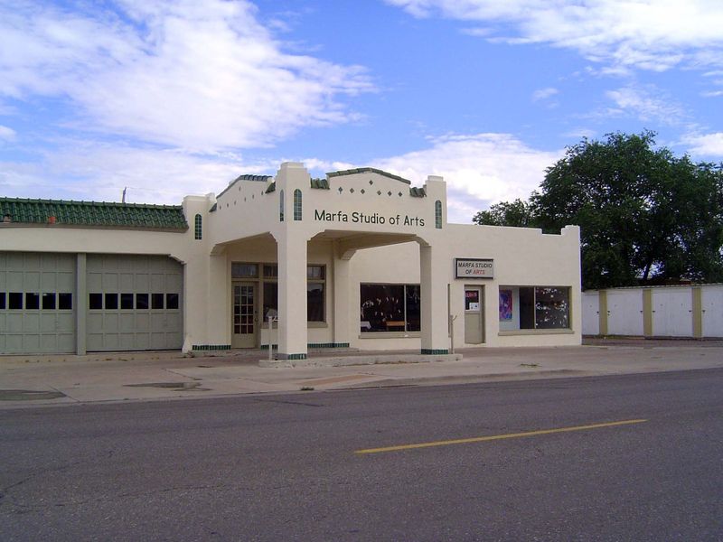
Best-kept-up gas station you've ever seen.
We've come 25 miles east to Alpine. Compared to Marfa, with 2,000 people, Alpine is a bustling place with 6,000, plus a couple of thousand more when school's in session at Sul Ross State University.
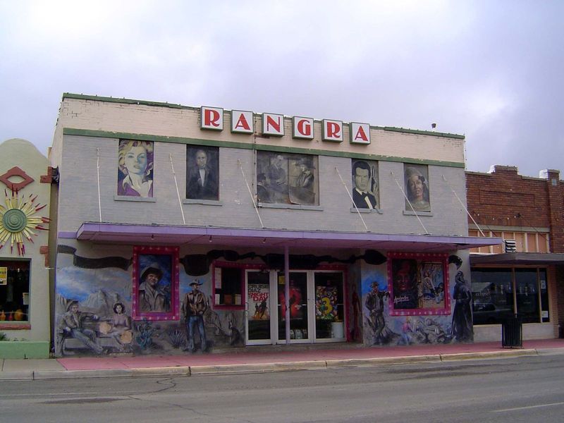
In 1980 a professor of chemistry at the college converted an old vaudeville theater to a movie theater; it's still in business, operating under his name.
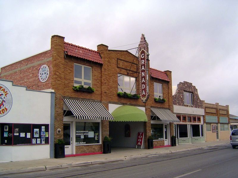
There's a more conventional theater, too.
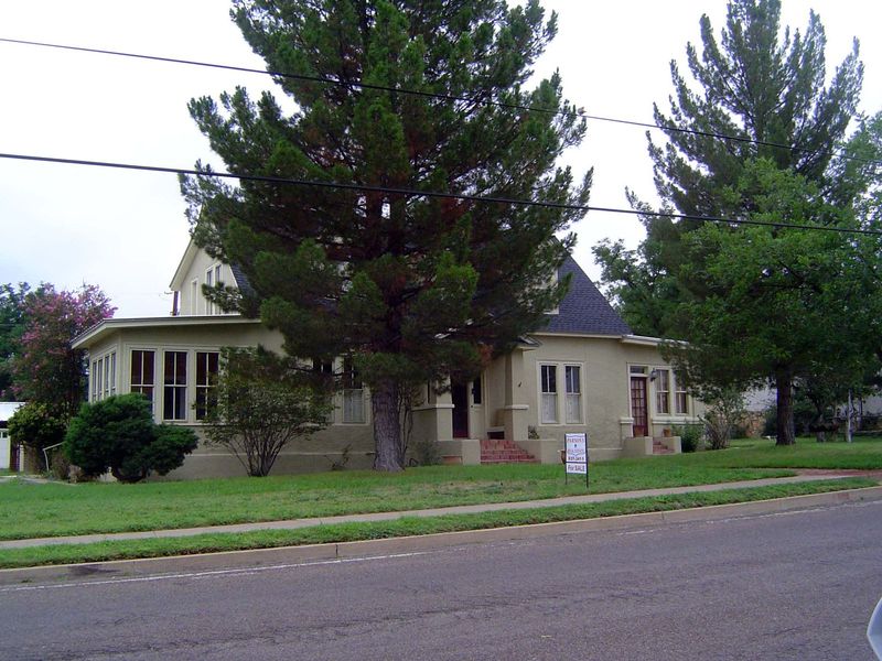
Off the main drag and close to the college.
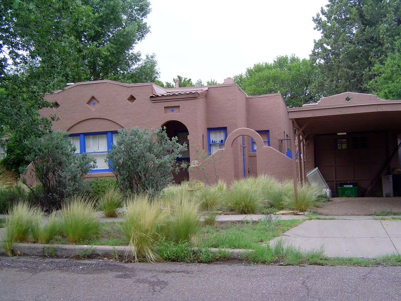
Neighbors.
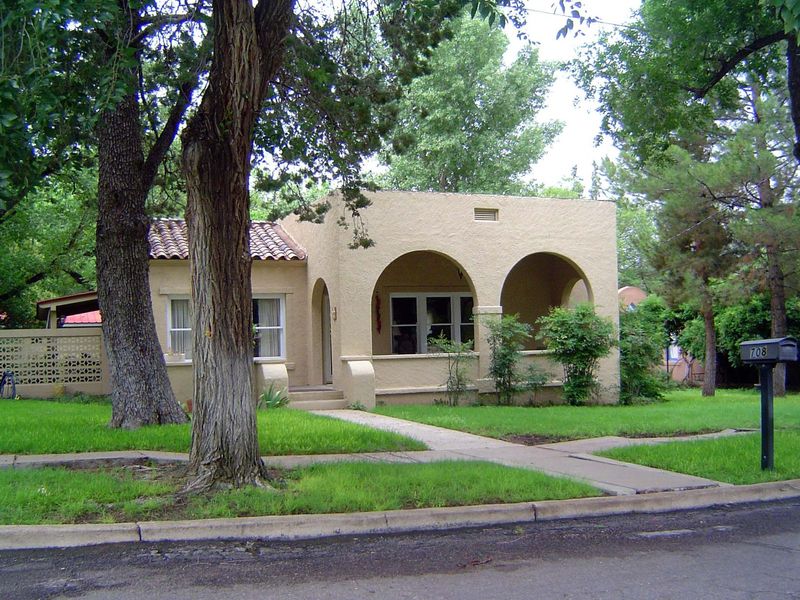
Did someone say Spanish?
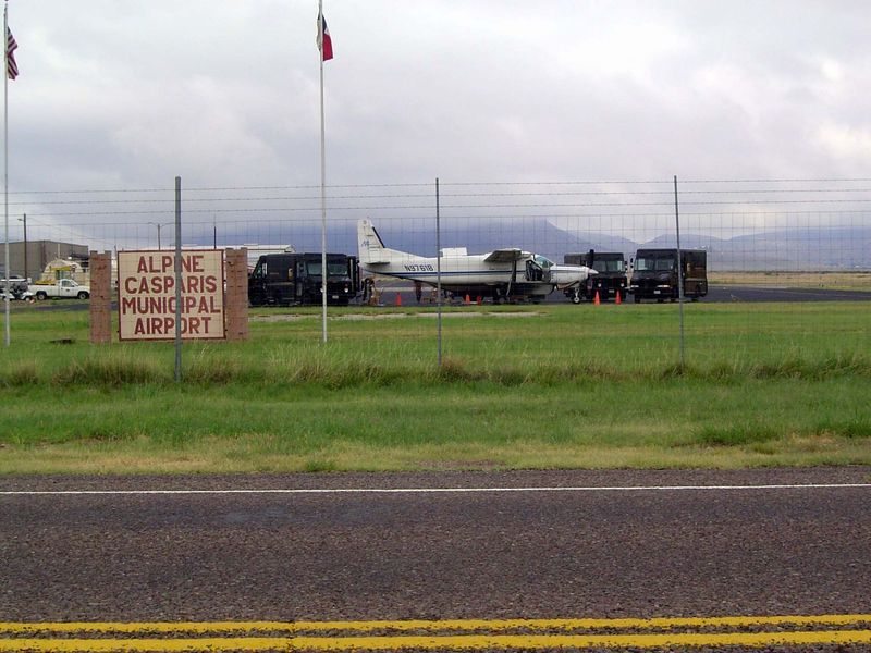
But Alpine isn't another country. Here's the morning plane for UPS.
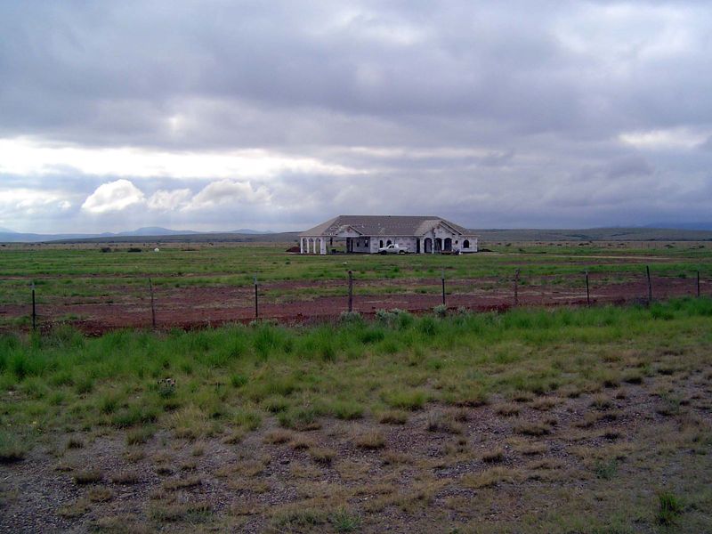
On the road north of Alpine, a house under construction.
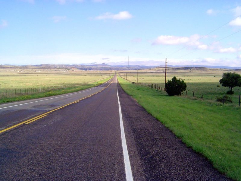
Fort Davis is straight ahead.
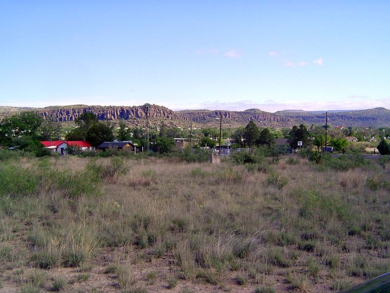
Here it is.
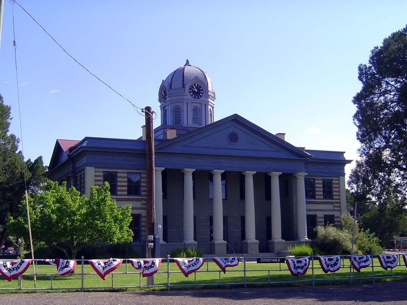
The courthouse.
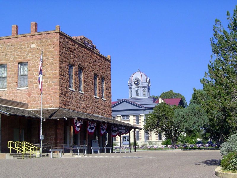
The Fort Davis State Bank.
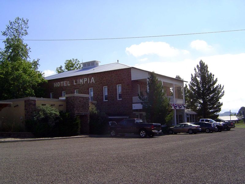
An old hotel named for the local creek.
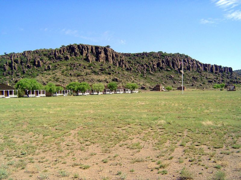
Officer's Row at Fort Davis proper. The fort was created in 1854 and was active until 1891. Since 1961, it has been maintained as the Fort Davis National Historic Site by the National Park Service. That would be the commander's house at the end of the line.
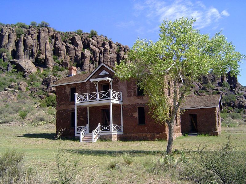
Nice, too.
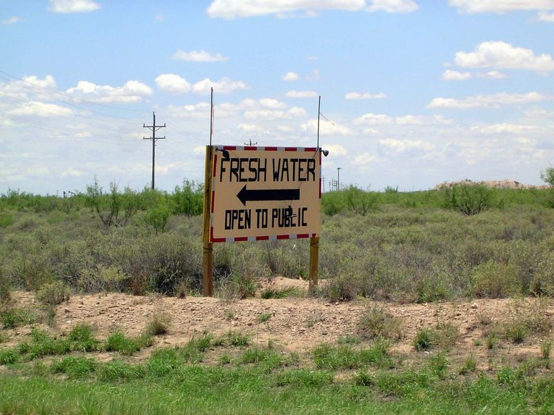
How many places in this country offer water to anyone with a tank to pick it up? Welcome to West Texas.
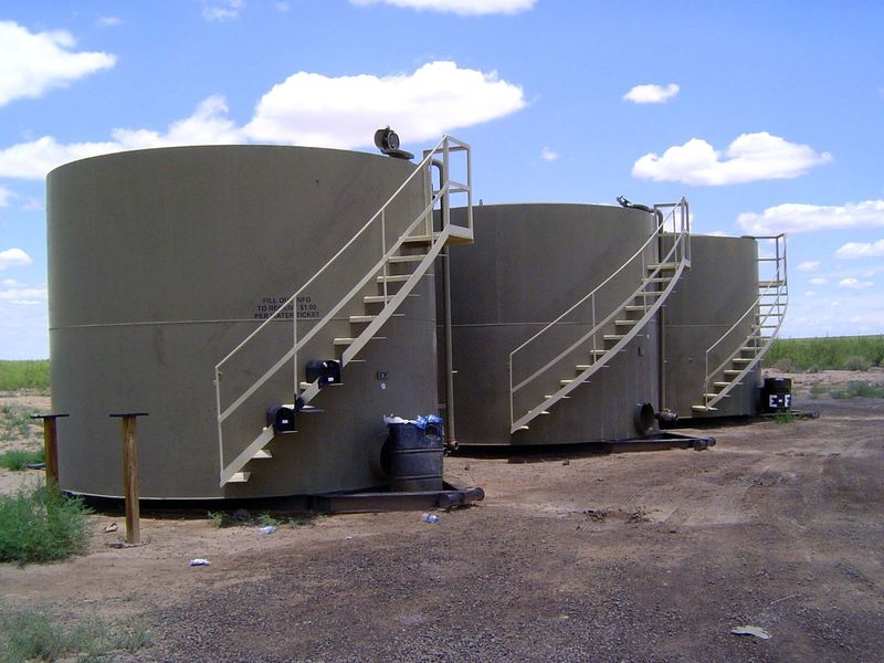
Here it is.