1 Panama City
Companion podcast? Try "An Itinerant Geographer"

The Atlantic end of the Panama Canal, at Col n, is west of the Pacific end, at Panama City. What? That's impossible! Fortunately, Vasco Nunez de Balboa in 1513 crossed the isthmus closer to South America, where the Pacific stays where it belongs. No telling what would have happened otherwise.
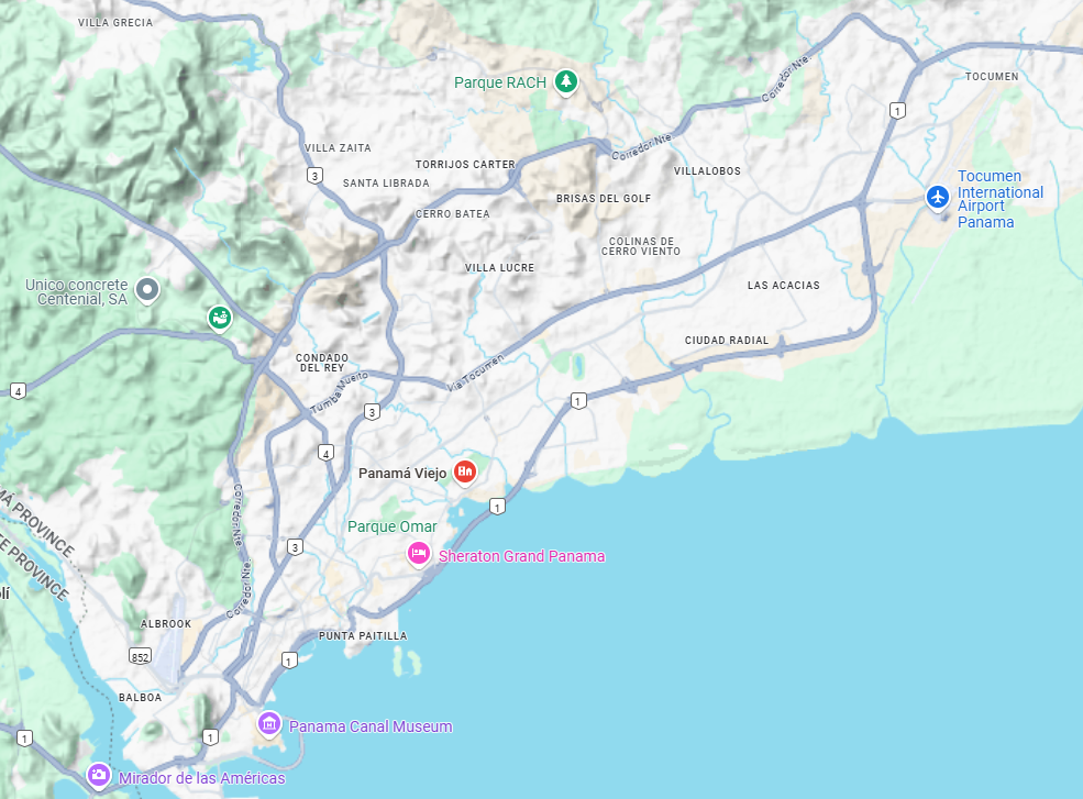
Panama City was established six years after Balboa saw the Pacific. (Cry your eyes out, St. Augustine, you weren't first.) And so Panama City was there when Pizarro went to Peru, and Panama City was still there, ready and willing, when the Spanish needed a port to unload their Peruvian treasure and pack it up for shipment across the isthmus and on to Spain. This early Panama City, labelled here as Panama Viejo, was destroyed by British pirates in 1671. (Well, the Spanish thought they were pirates.) Spain still needed a place to land its loot, so a new Panama City was built at the small but easily fortified peninsula marked here with a pin reading Panama Canal Museum. This second Panama City faded when ships in the 19th century began regular sailings around Cape Horn, instead of landing everything here and schlepping it across the isthmus. New life came with the California Gold Rush. That, too, faded once Americans could take trains across their own country, but construction of the Panama Canal brought yet another boom, boosting the city's population from about 20,000 people in 1900 to about 80,000 in 1920. The city in 1950 was still centered on the peninsula, plus new towns like Balboa, built to serve Canal workers. The city's huge eastward expansion began after World War II, with the city's population rising like a Roman candle from 128,000 in 1950 to a metropolitan population today of two million.
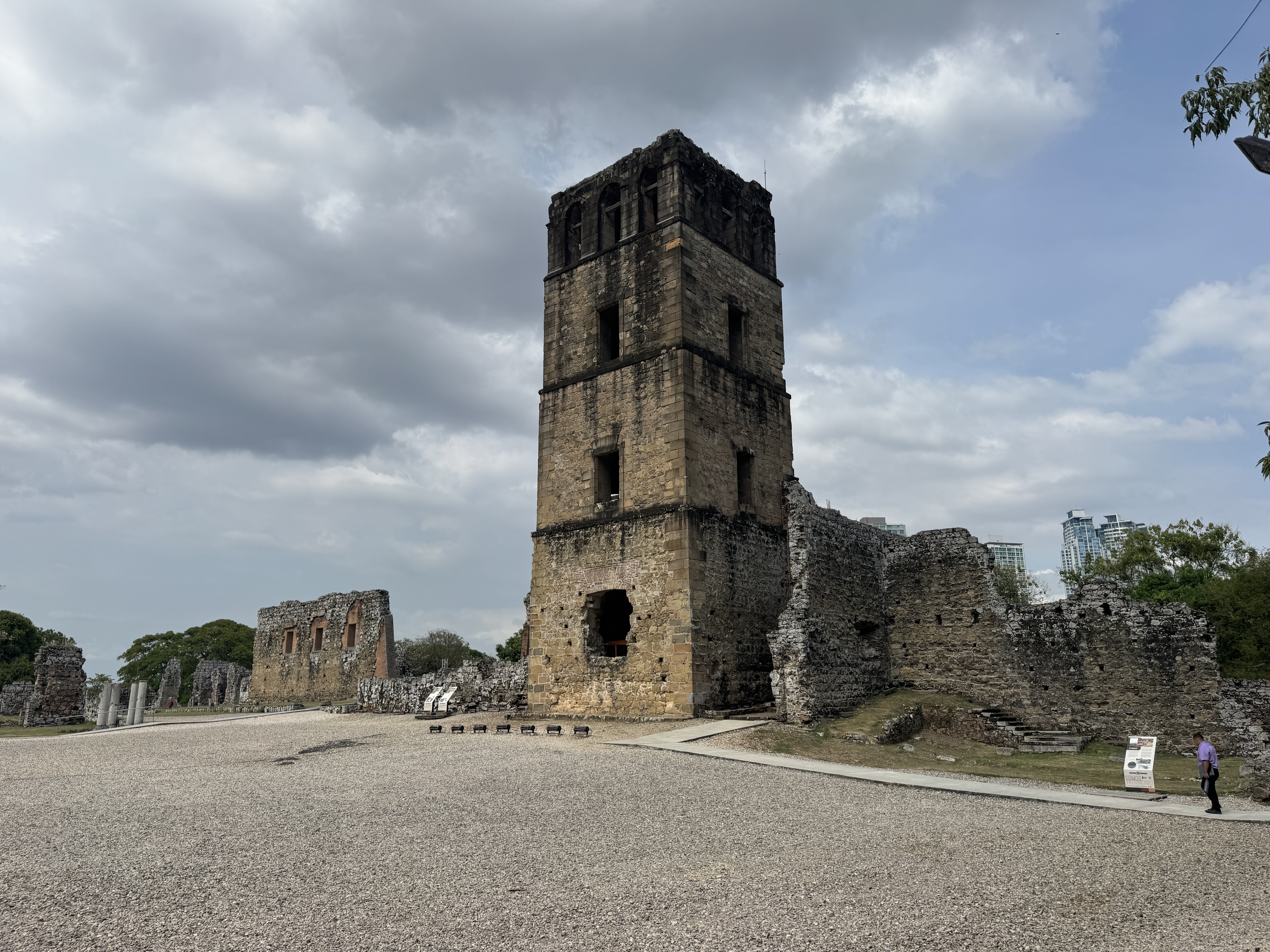
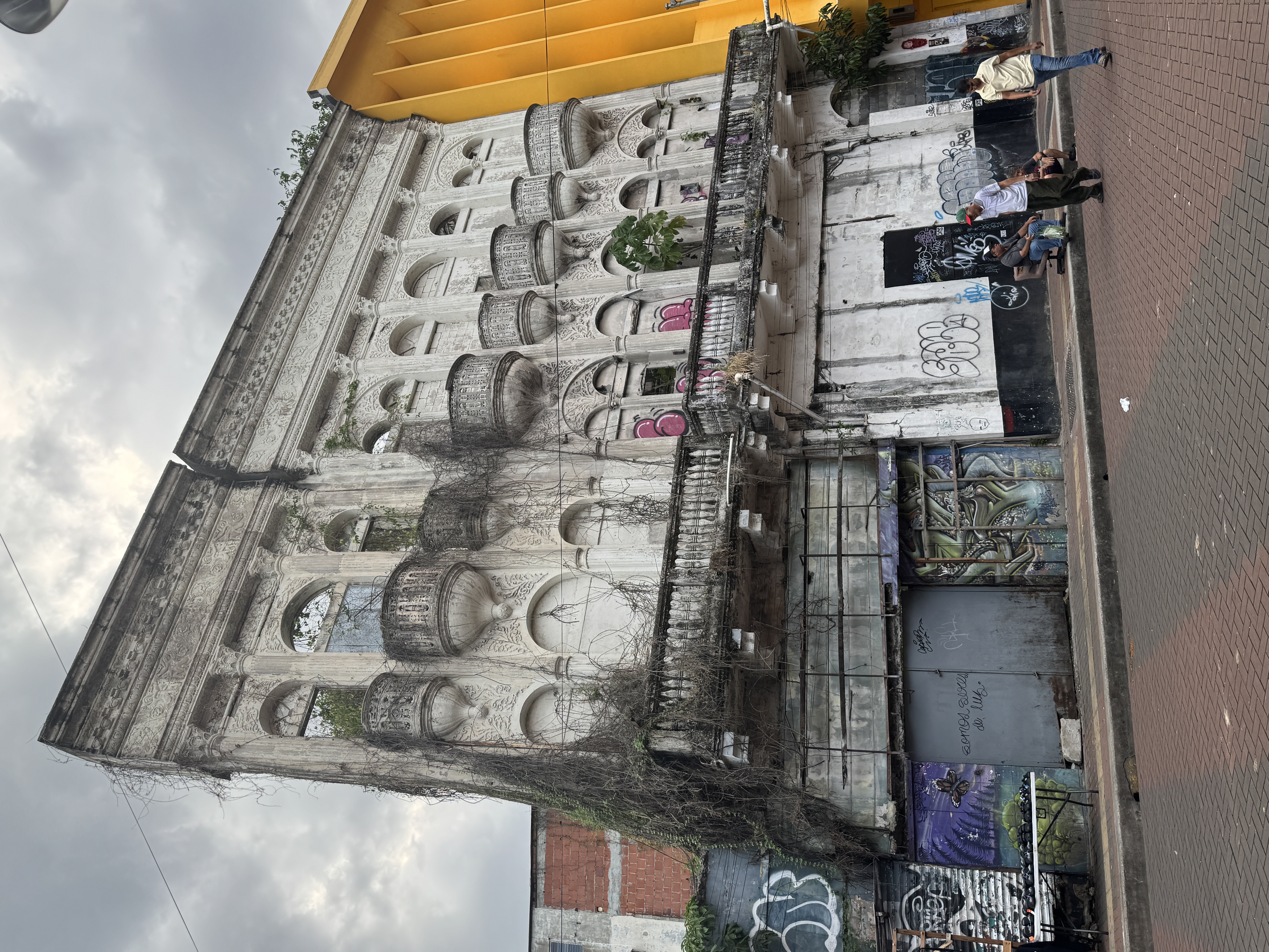
Panama Viejo, a ruin since Henry Morgan's most undiplomatic visit in 1671, is now an archaeological site whose most striking feature is this cathedral tower. It was built about 1620 after an earlier church of wood and thatch burned. It might look better if it was still covered with ivy, as it was when Americans saw it in 1849.
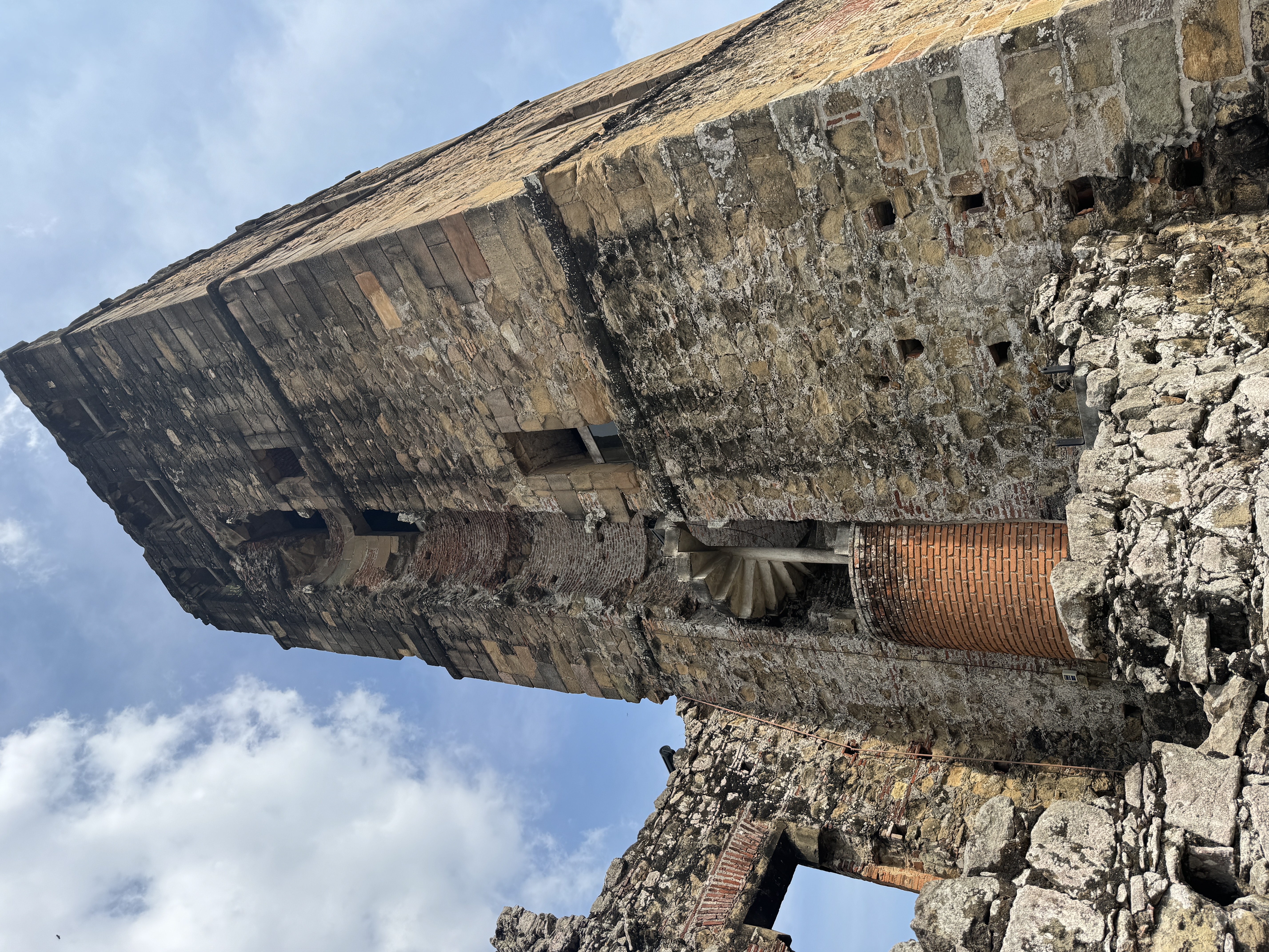
When was the spiral stairway added? Don't know.
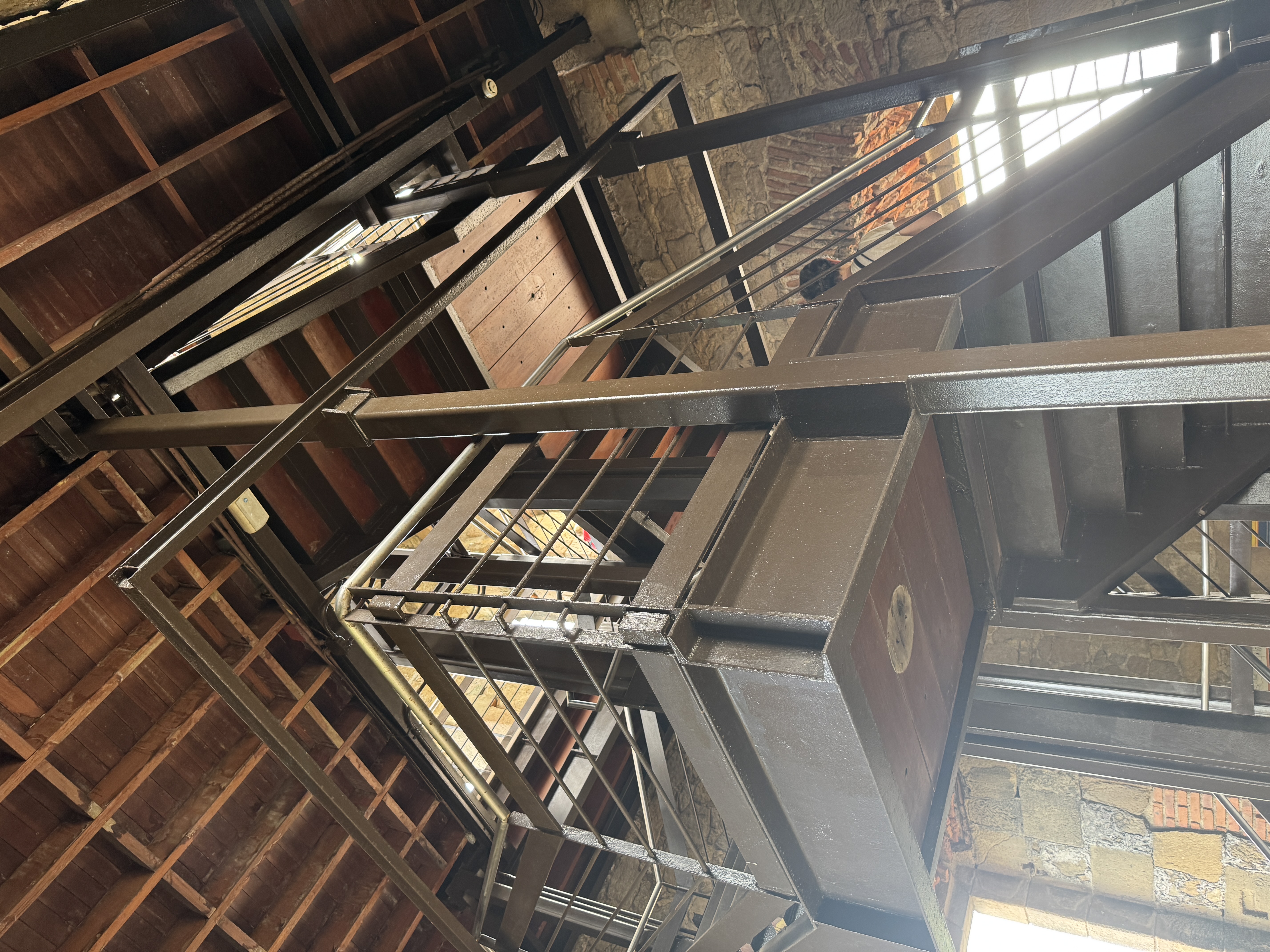
I do know that an interior stairway was added in 2006. It stabilized the tower and simultaneously provided a viewing platform for visitors.
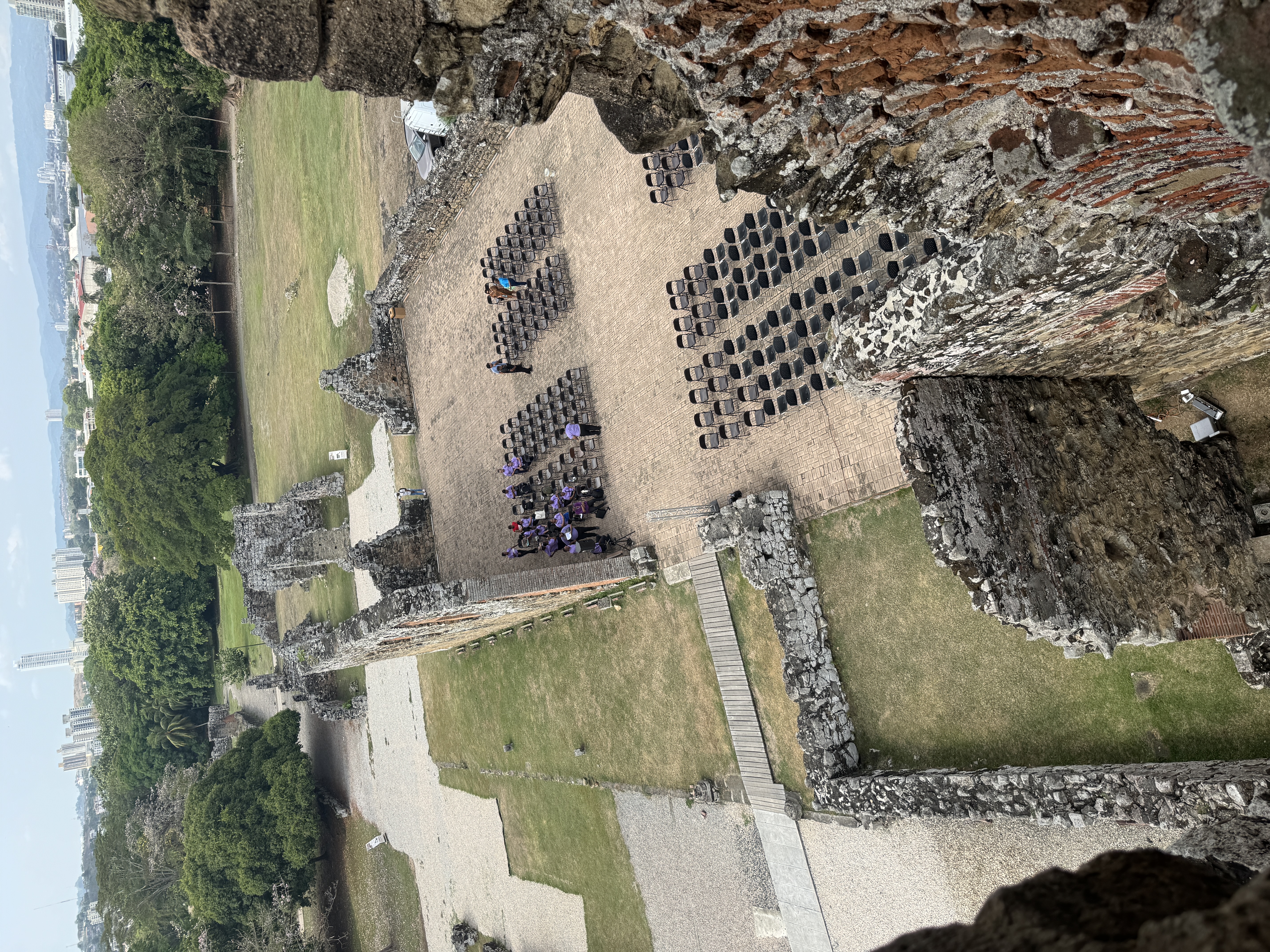
The cathedral ruins are now a venue.
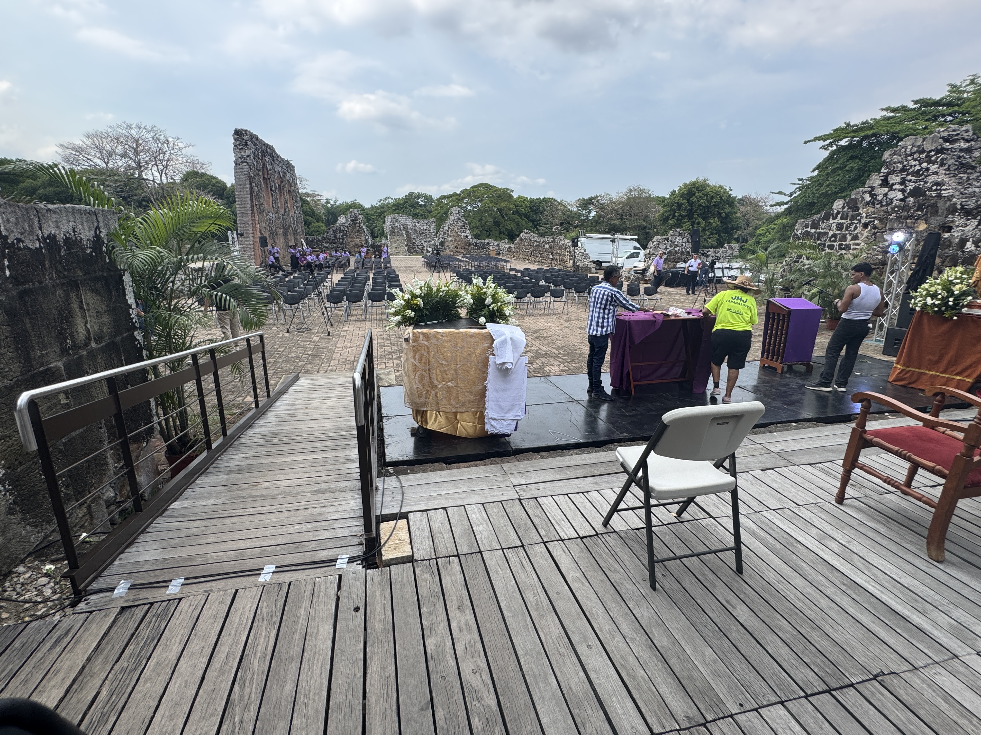
Don't be alarmed. It's for a religious ceremony, not a rock concert.
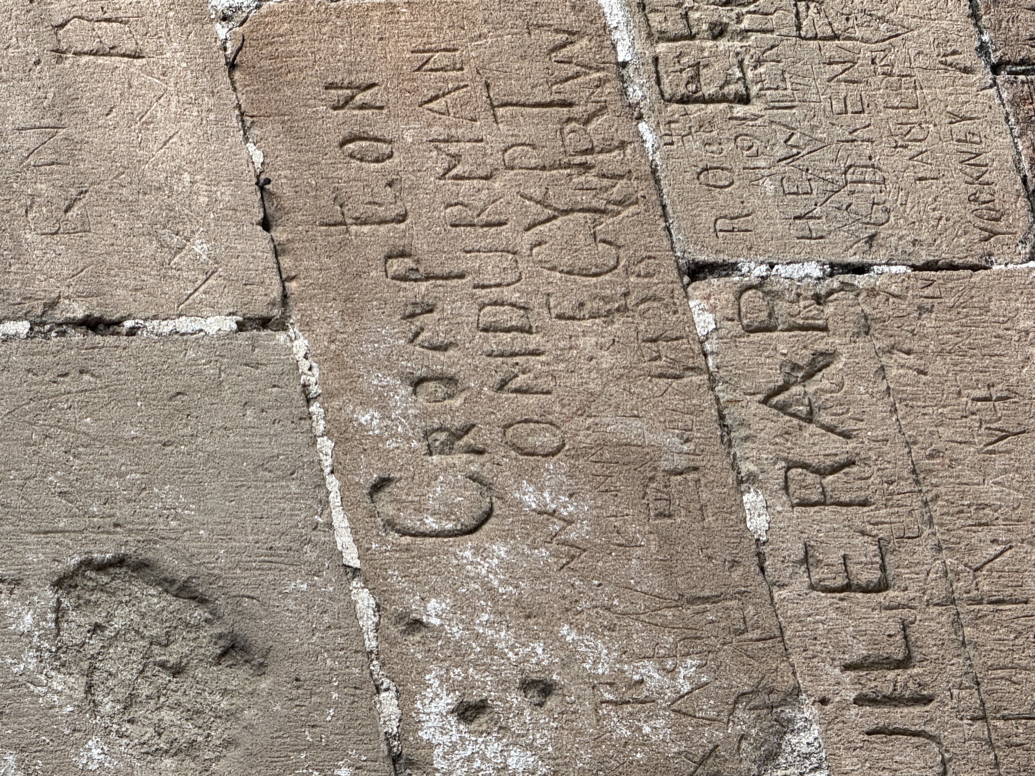
Is this the W. L. Crompton who supervised the survey of Sudan's Gezira Scheme near Omdurman? I'd like to think so, but it's hard to imagine him linking Omdurman to Egypt. Ah, the mysteries of graffiti!
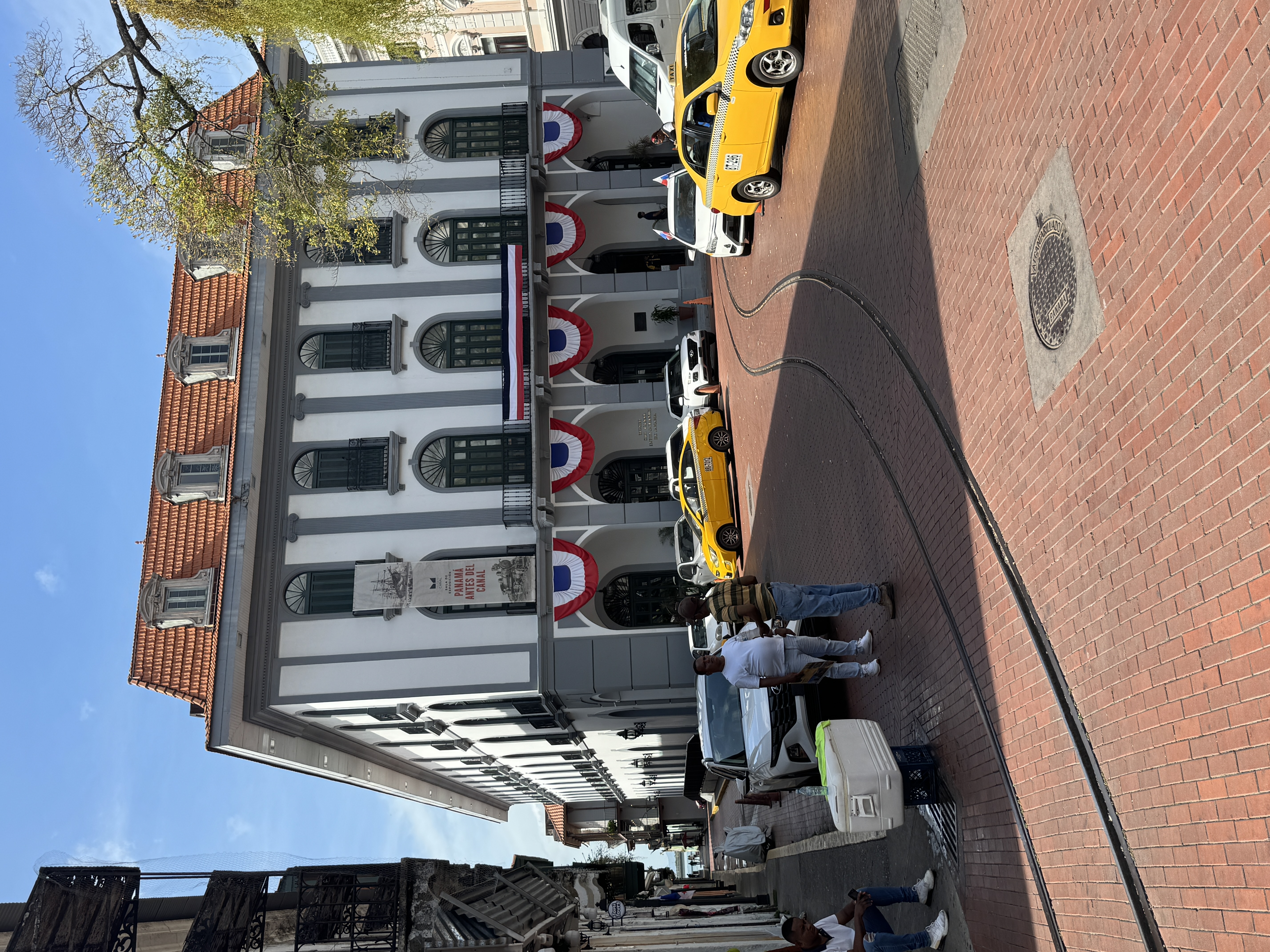
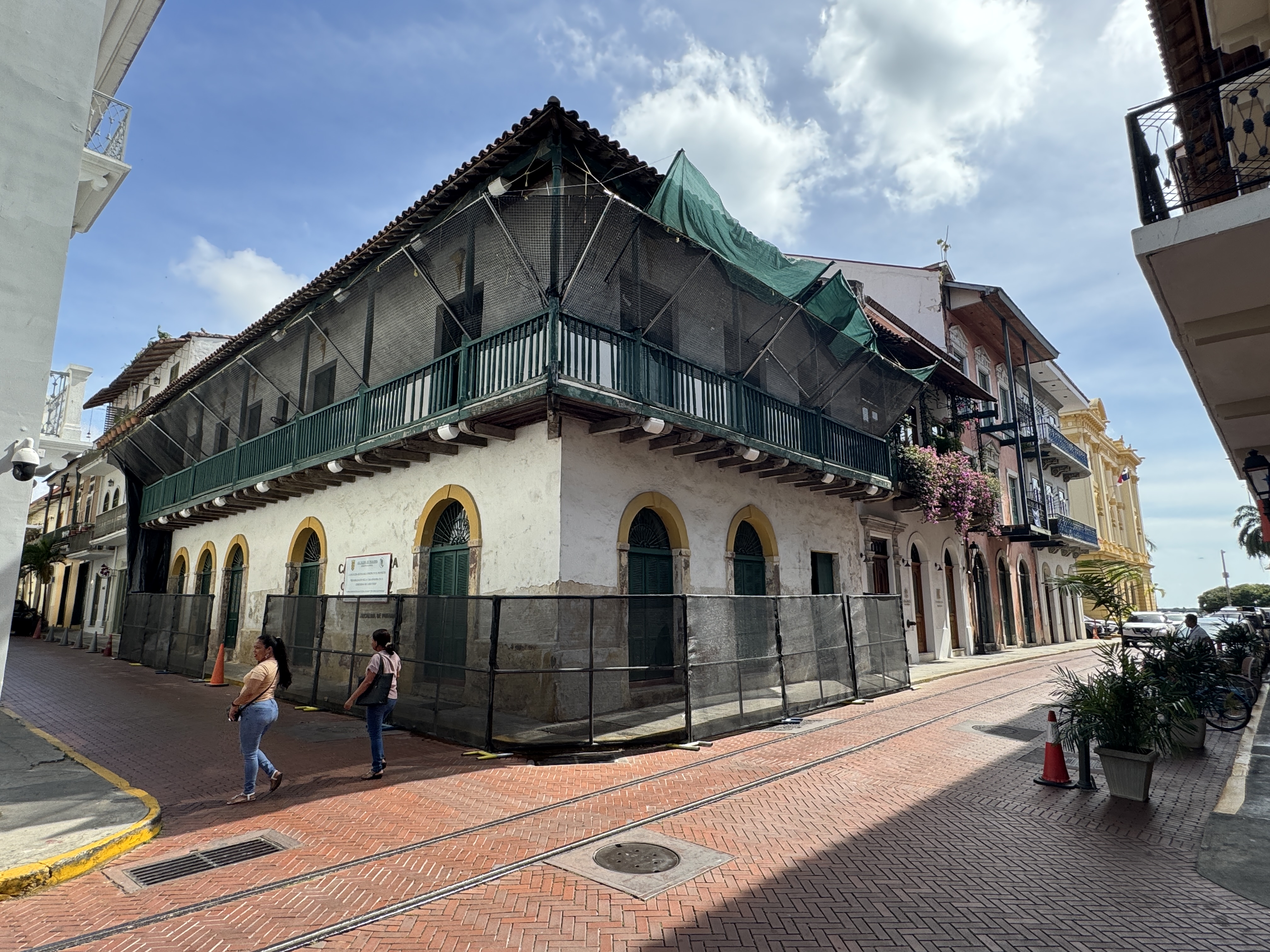
Archaeologists may deplore the short shrift I pay to Panama Viejo, but I'm moving to the city's second location, now called the Casco Viejo or Casco Antiguo. It covers all of 50 acres.
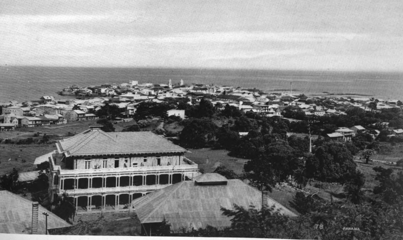
Here it is seen from Ancon Hill, with a building that briefly served as the American's Canal administration building. (F.J. Jackson, Makers of the Panama Canal, 1911, p. 361)
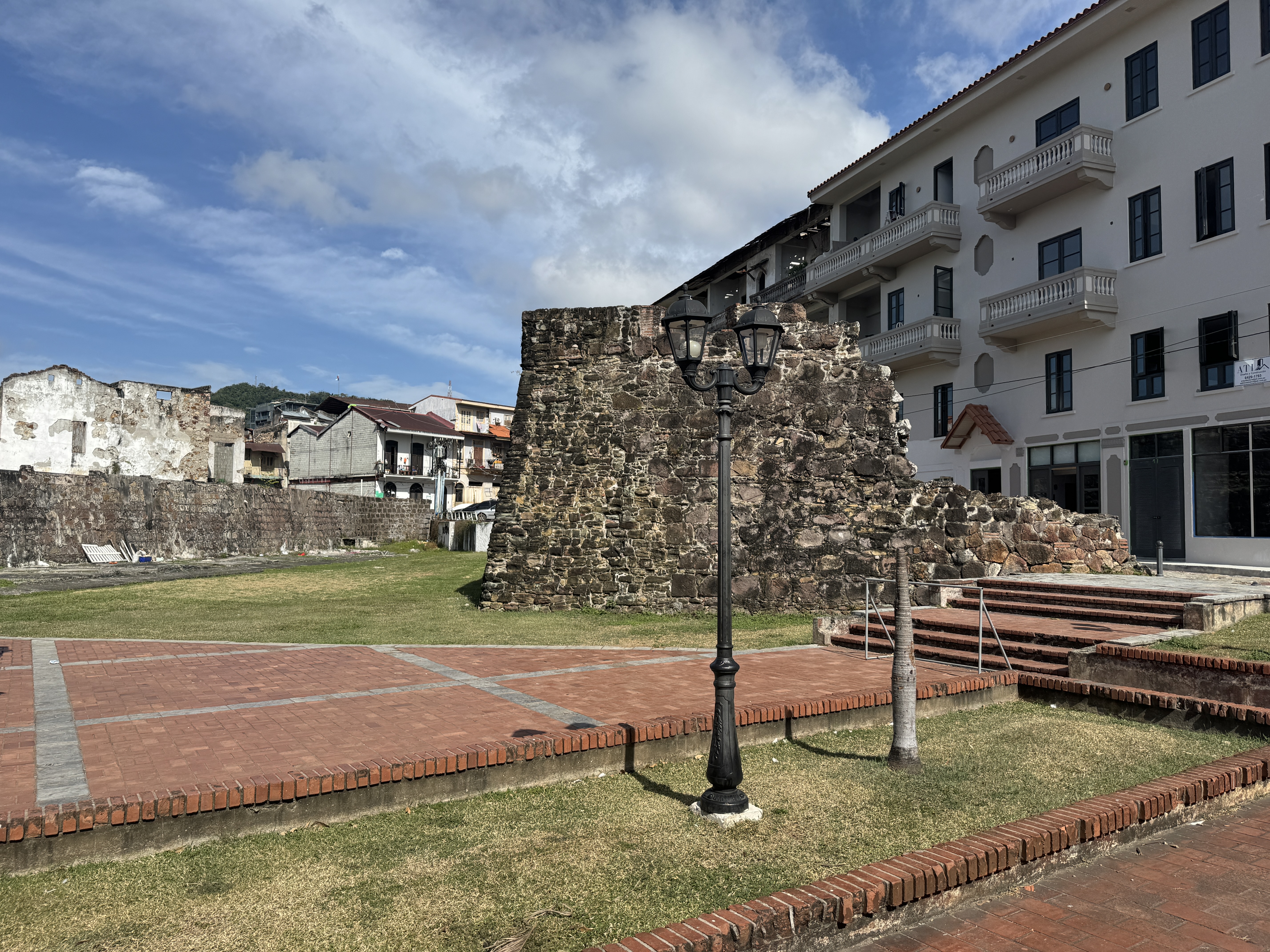
Not wanting to see this second Panama City pillaged, the Spaniards put a serious wall around it. Here's a surviving fragment on the land side near Plaza Herrara.
Another bit, this one showing the wall's buttresses. On the other side, there once was a moat, complete with drawbridge.
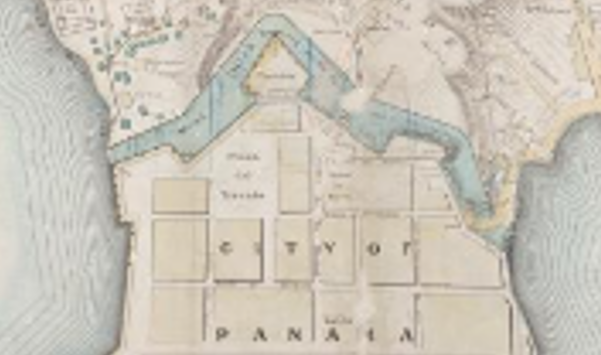
It's shown on this detail from an 1857 map of lands belonging to the Panama Railroad. Most of the wall was gone by the 1880s. (https: (//www.loc.gov/resource/g4874p.pcc00013/)
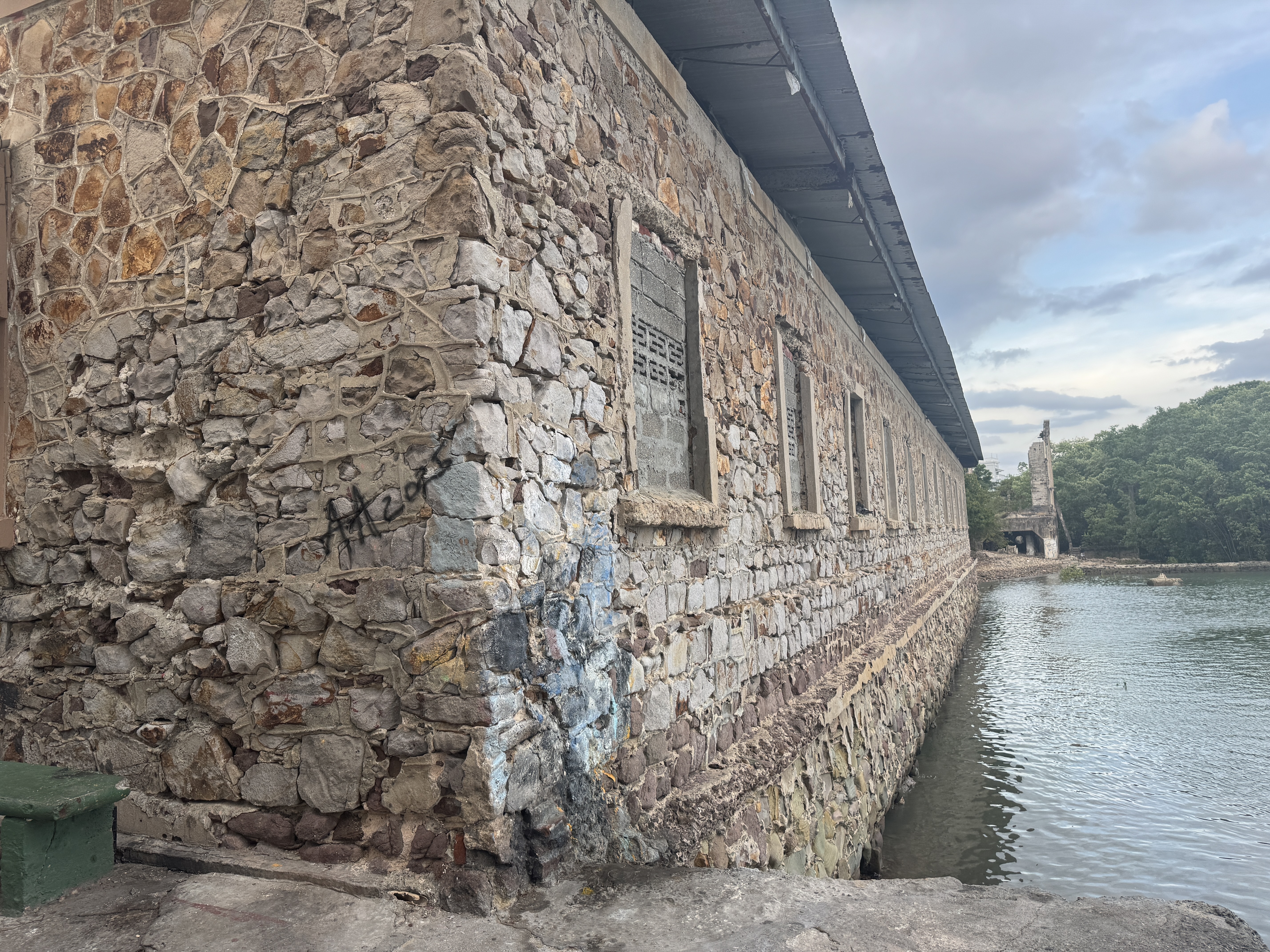
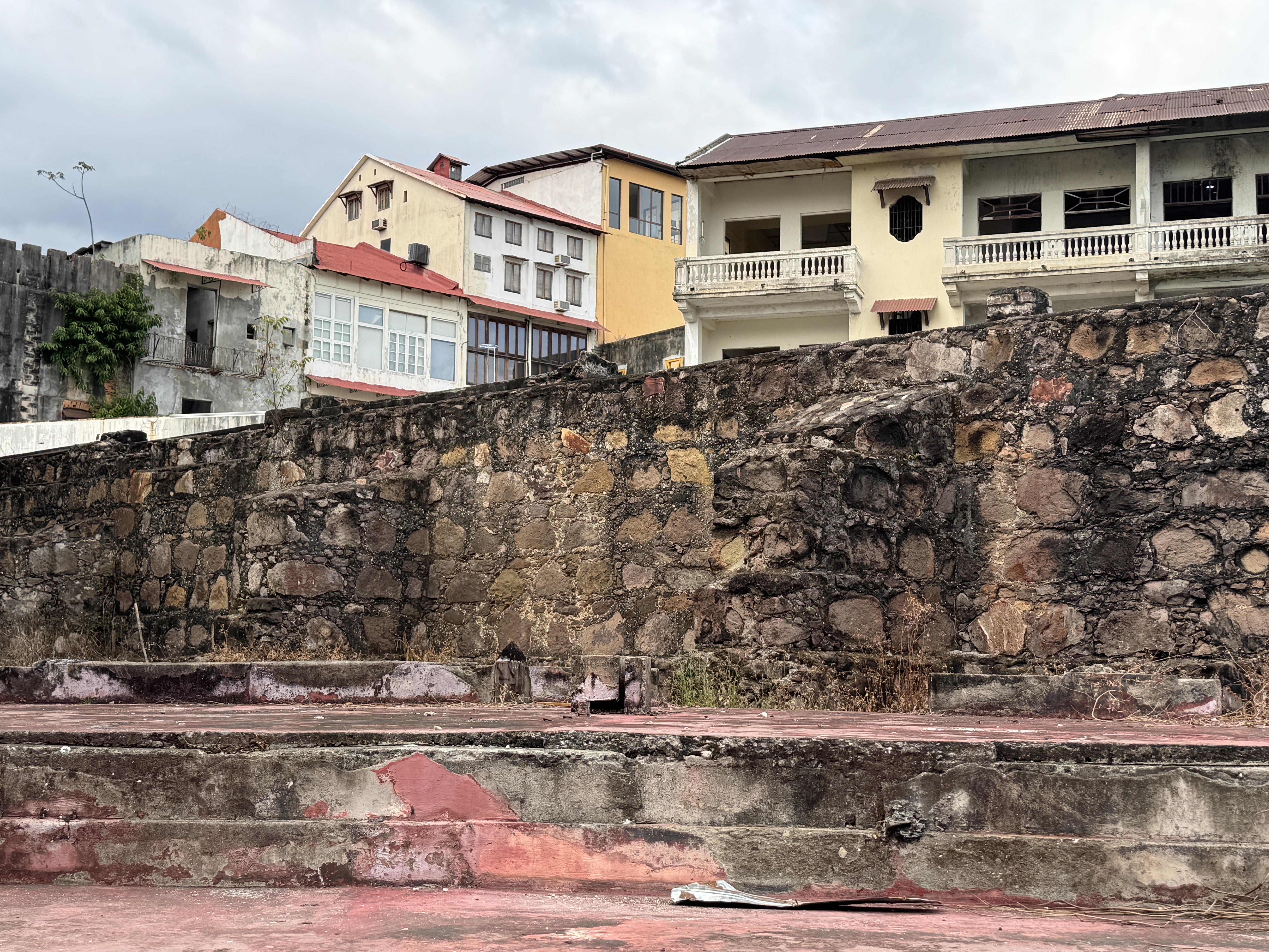
A bit of waterfront wall two blocks south of the previous pictures. Presumably it was built in stages or renovated from time to time. The stones used in the wall were, at least at first, taken from the ruins of Panama Viejo.
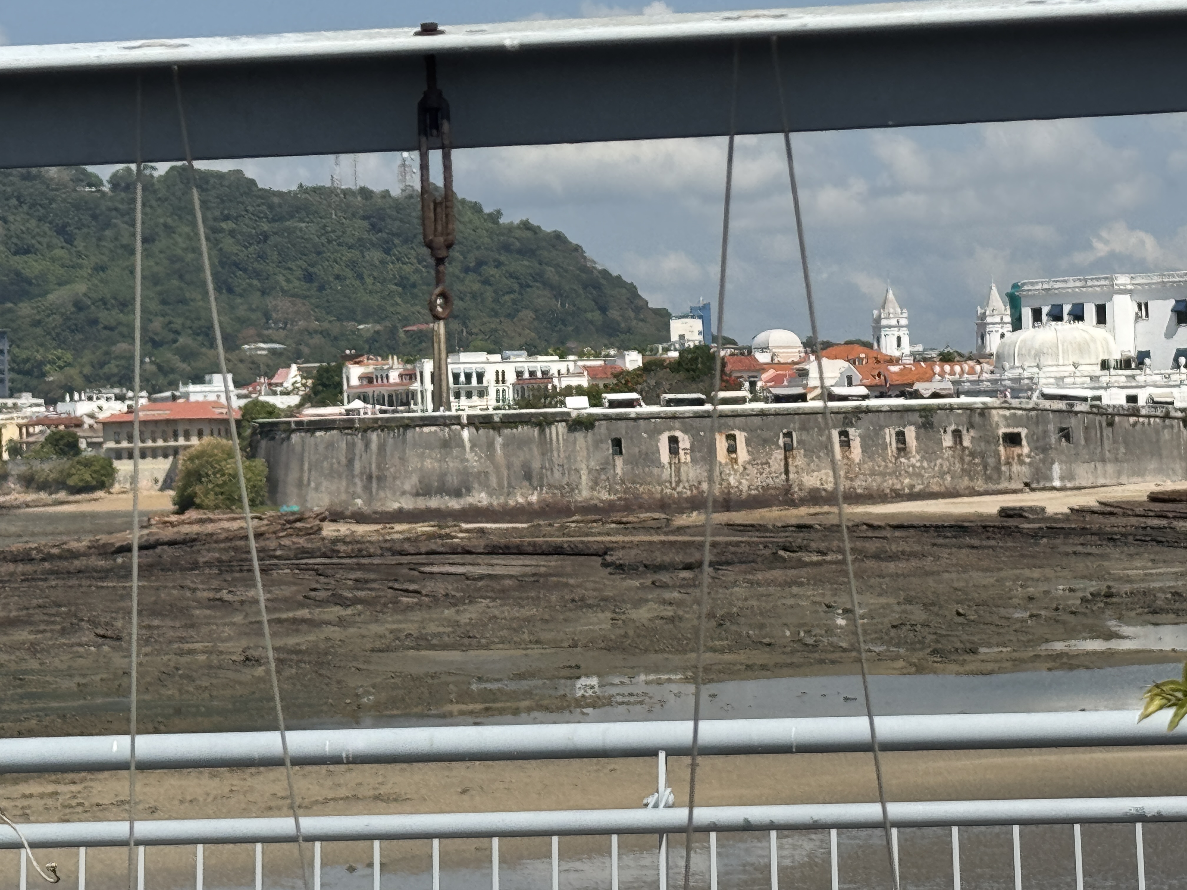
The Cinta Costera, an offshore highway, was opened in 2014 to alleviate congestion. (You know the drill: traffic is still intense.) The view here, from that offshore road, shows the city's wall at the tip of the peninsula. Yes, the tide's out. The tidal range here, by the way, averages 12 feet. Col n, 40 miles away on the Atlantic side of the isthmus, has a tidal range averaging one foot. Things you never knew.
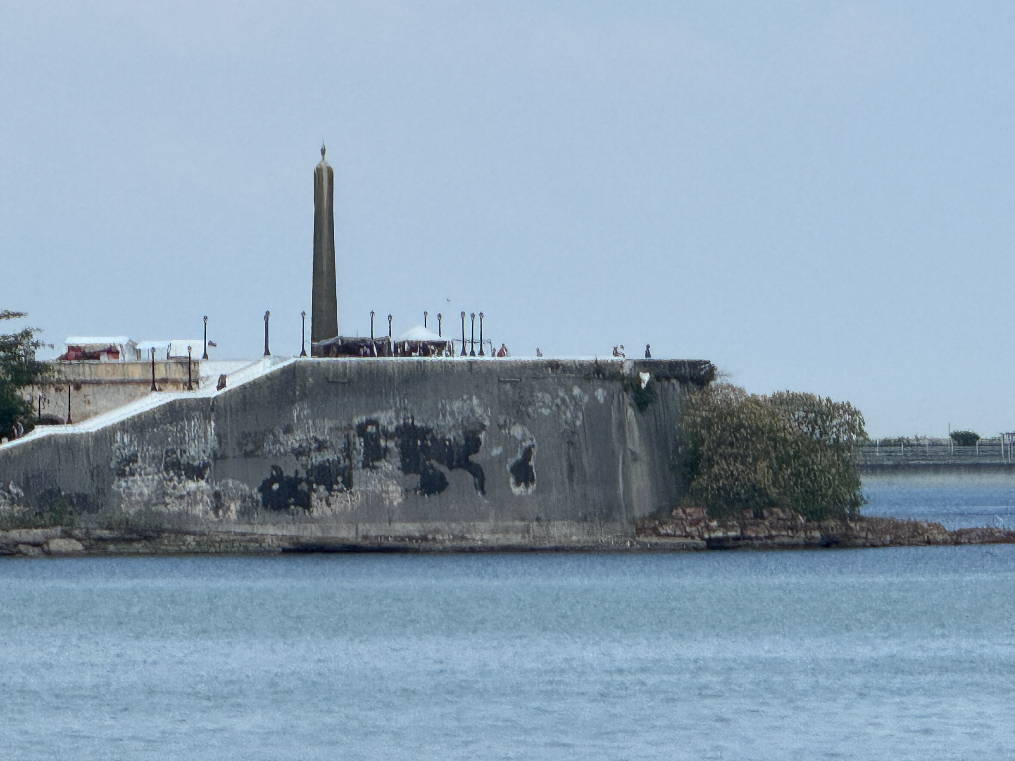
Here, from another spot on the same road and with the tide in, is the city's wall and an obelisk that is part of a monument built about 1920 to honor the French for their efforts at building a Panama Canal.

The Gallic Rooster sits atop the obelisk. It's all very civilized, but there used to be a prison within the wall. "In these vaults, damp and filthy, thousands of criminals, political offenders, and mere suspects, spent days of slow death, poisoned by filth, and weakened by want of good food." (John O. Collins, The Panama Guide, 1912, p. 161)
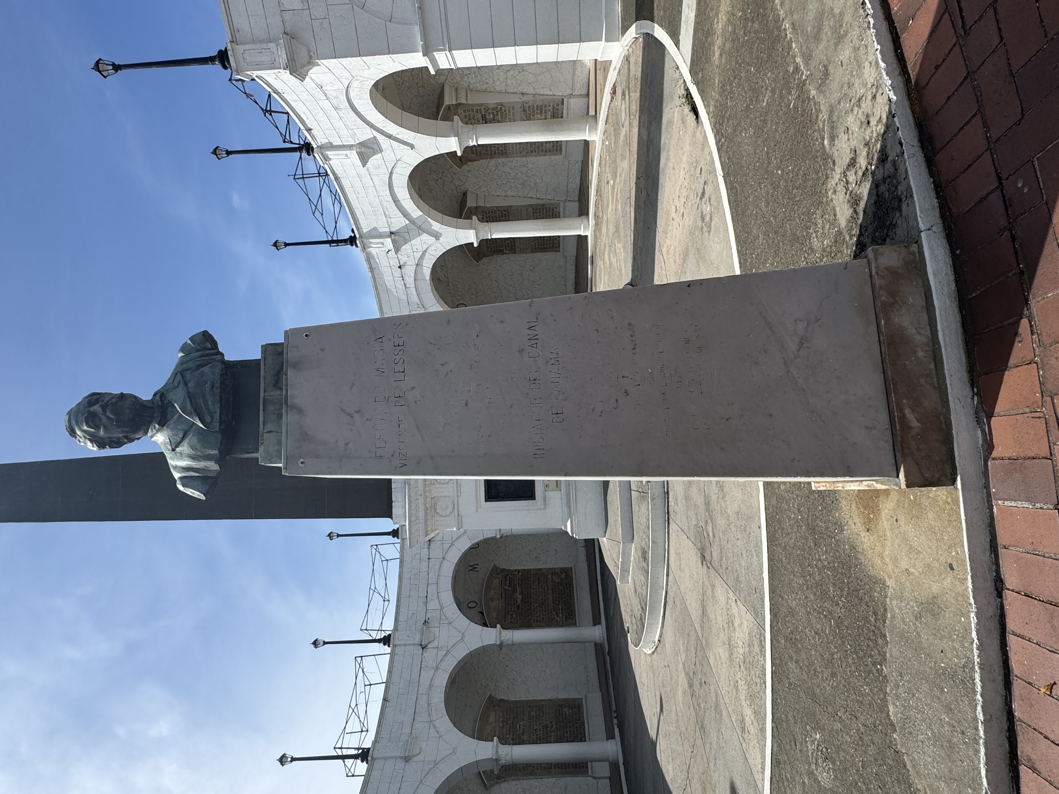
Ferdinand de Lesseps, the driving force behind the Suez Canal, was the leader of the failed French effort here. Contrary to what you might expect ("Losers!"), the Americans who finished the canal treated the French with respect. For one thing, the Americans would have had to excavate an additional 30 million cubic yards of dirt if the French hadn't already moved it for them.
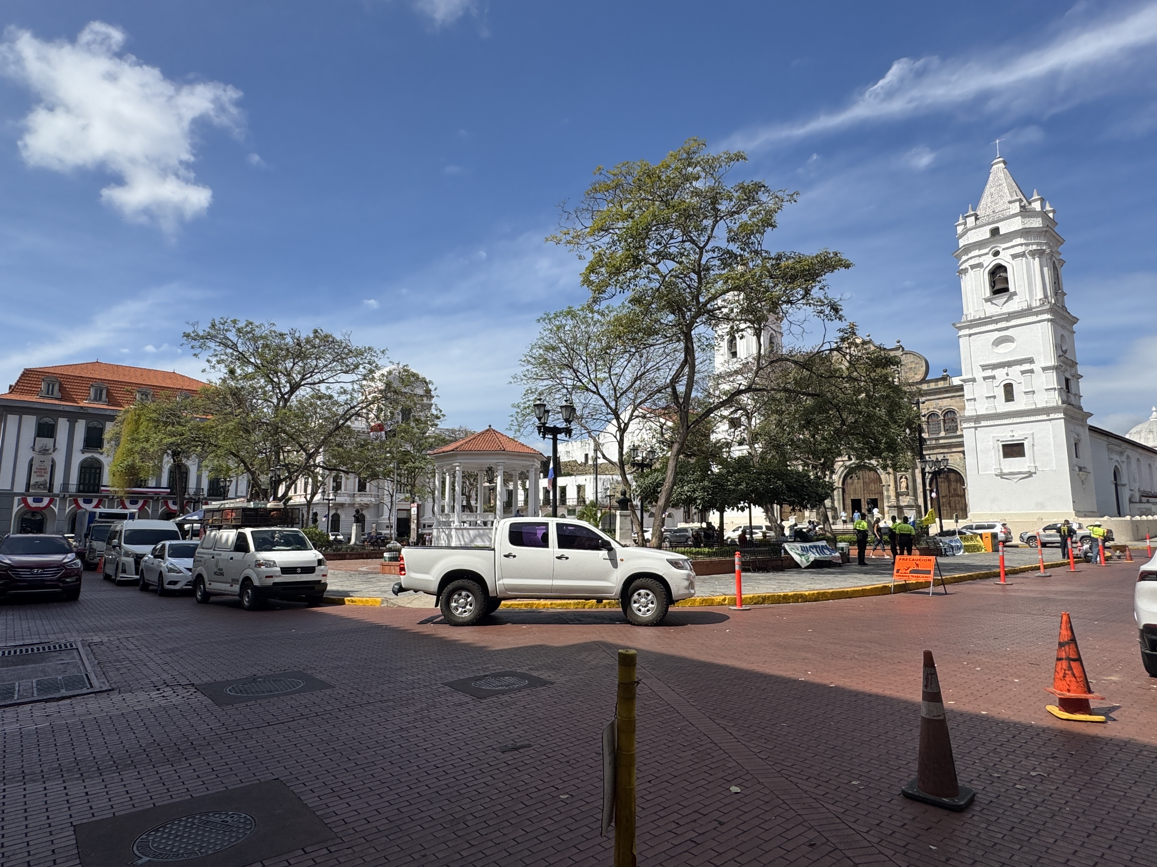
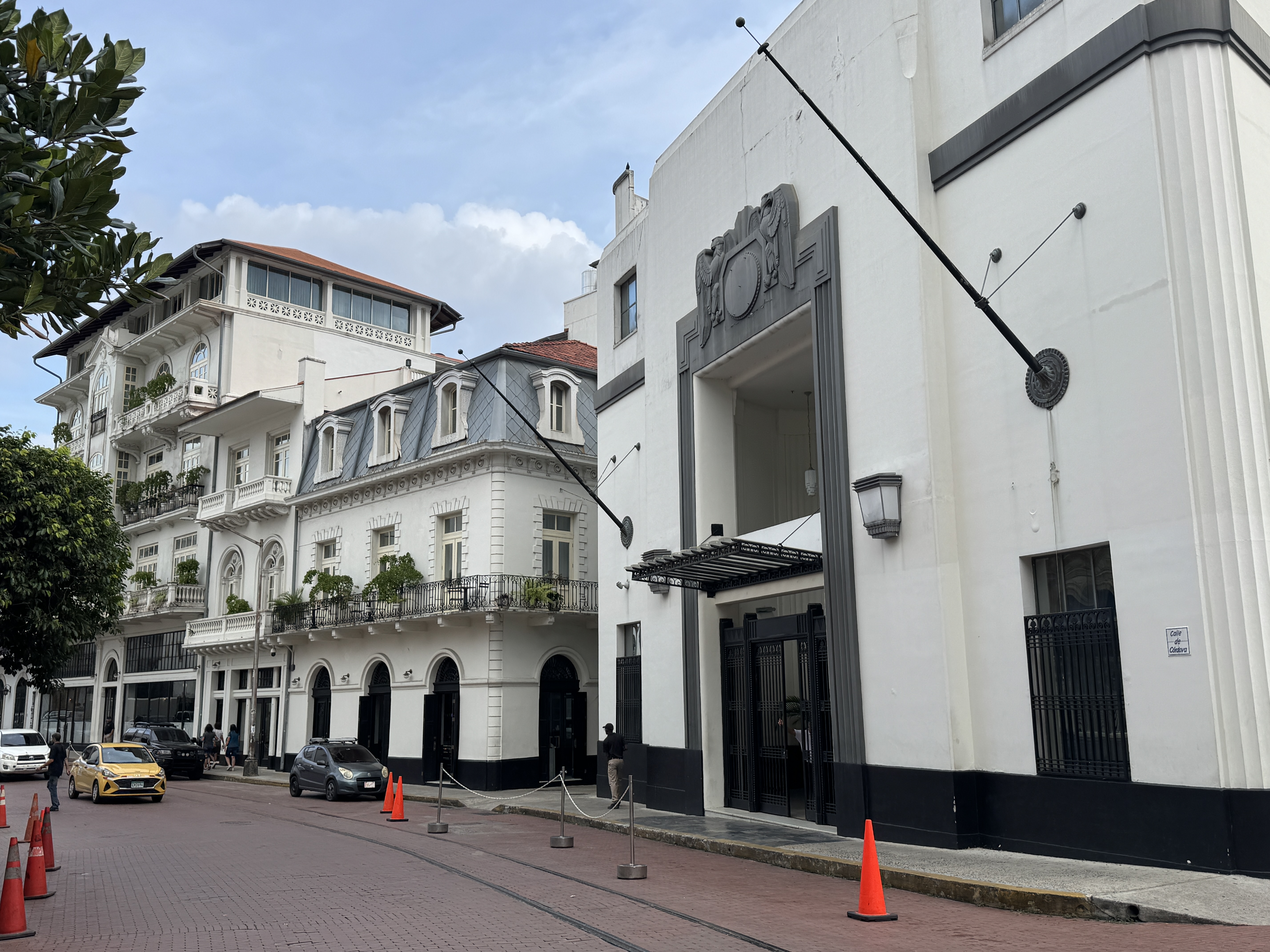
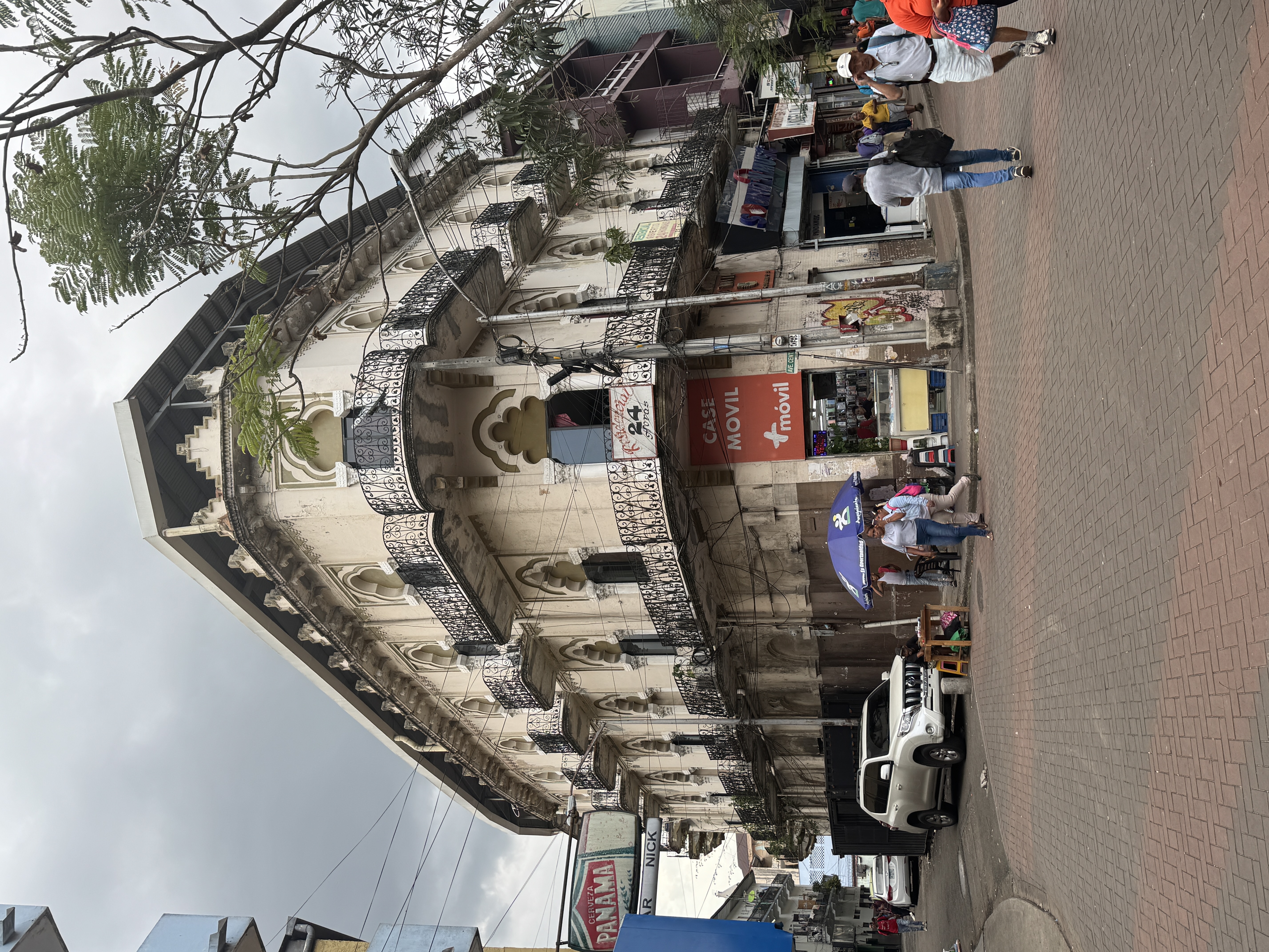
Ten minutes walk, if you're slow, and you're in Cathedral Square.
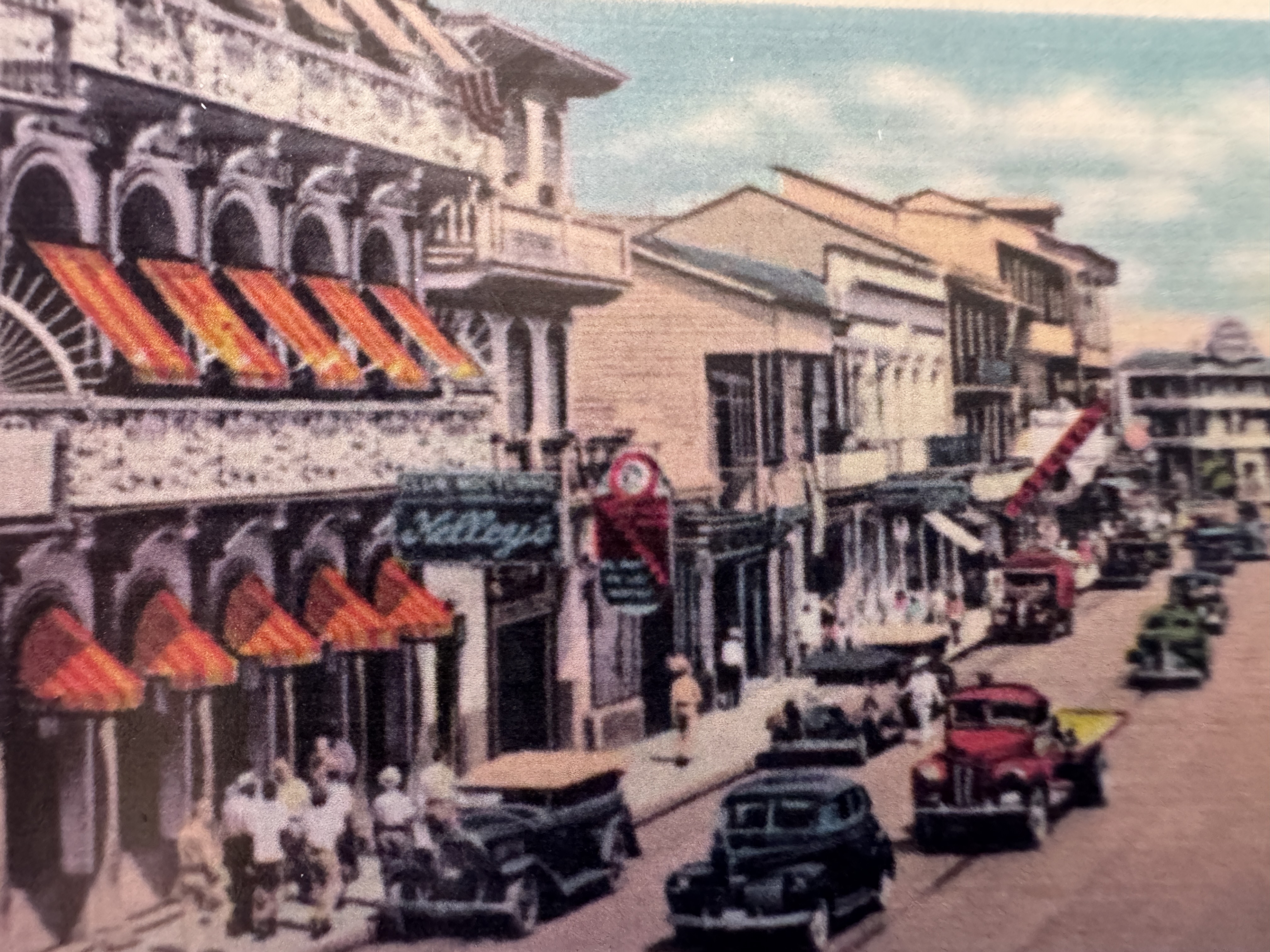
UNESCO in 1997 placed the Casco Viejo on its World Heritage List, despite this plaza eyesore. Also, some of the buildings around the plaza are recent, such as the Casa Alianza on the left, from the 1940s. An edge of the Grand Central Hotel, from 1874, appears on the right. Now it's the Central Hotel. It isn't cheap.
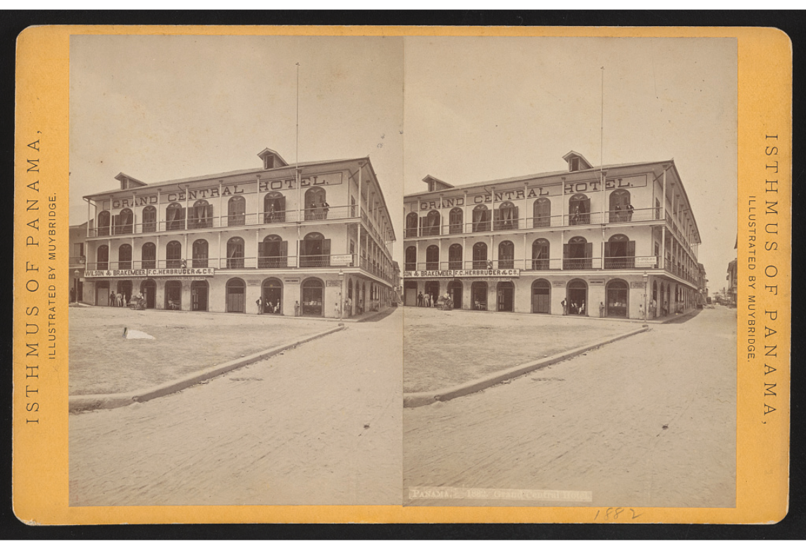
Here's a picture of it taken in 1875 by the pioneering photographer Edward Muybridge. He spent several months in Central America in the aftermath of murdering his wife's lover and lucking out with a "justifiable homicide" verdict. Did Muybridge stay at this hotel? I don't know, but let's hope conditions in the then-new hotel were better than they were 30 years later, when a guest wrote: "Hotel Central had a sort of monopoly of the business, since the others were either tenth class or unclassible.... The furniture consisted of two single iron bedsteads with dirt-stained mattresses of certain age....The second bed might have served as a prostrated clothes-press if the mattress had looked less infected.... I have given all of this detail out of kindness to the landlord, that the guests may know beforehand what to expect and not give him the trouble I saw a lady guest give him before she accepted the inevitable." Eager to celebrate its history, the hotel today omits this zero-star review. (John T. Byford, To Panama and Back: an Experience, 1908, p. 104)
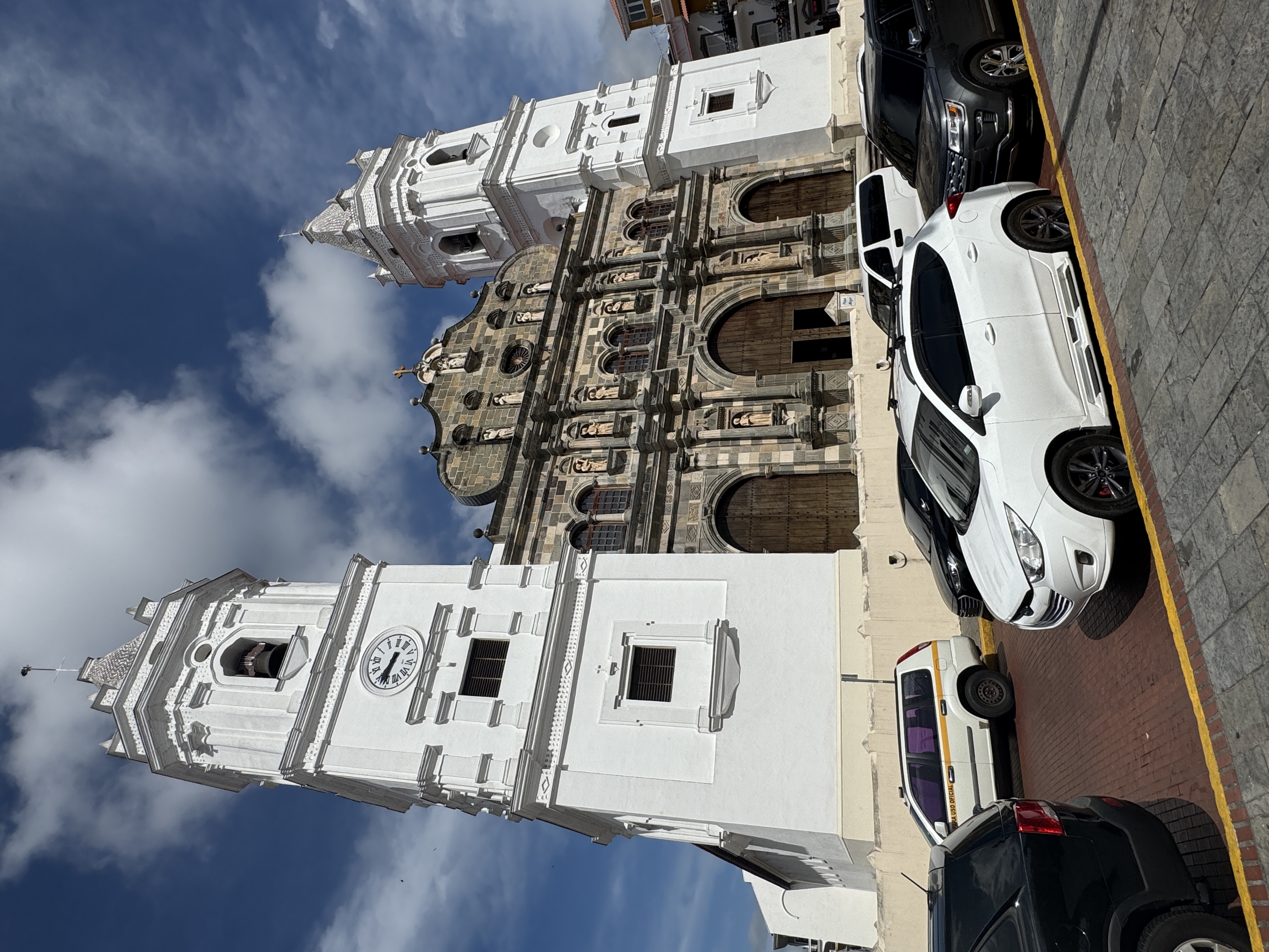
The cathedral dates from 1760, a century after the city's move to its new site. Well, cathedrals take time.
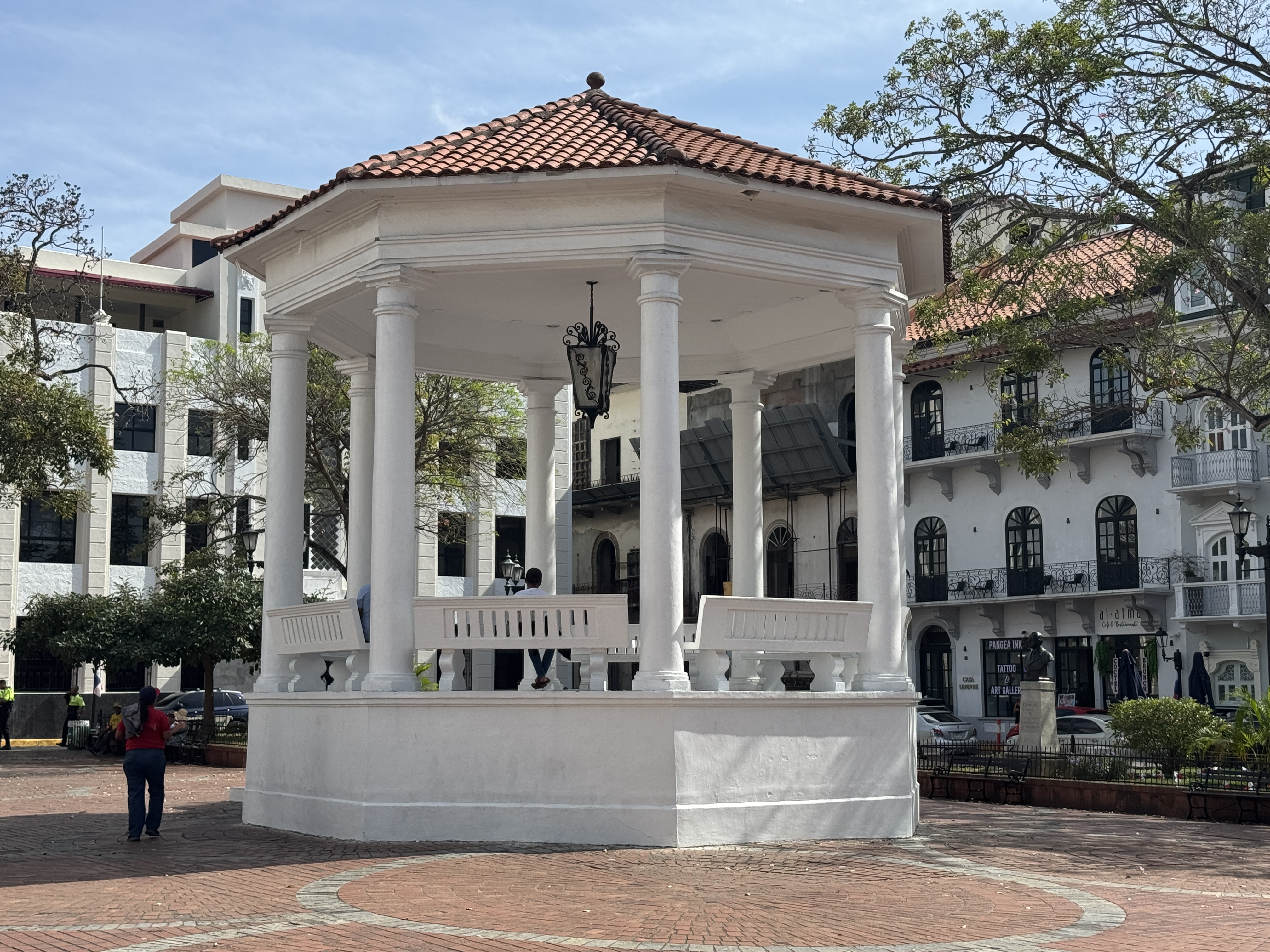
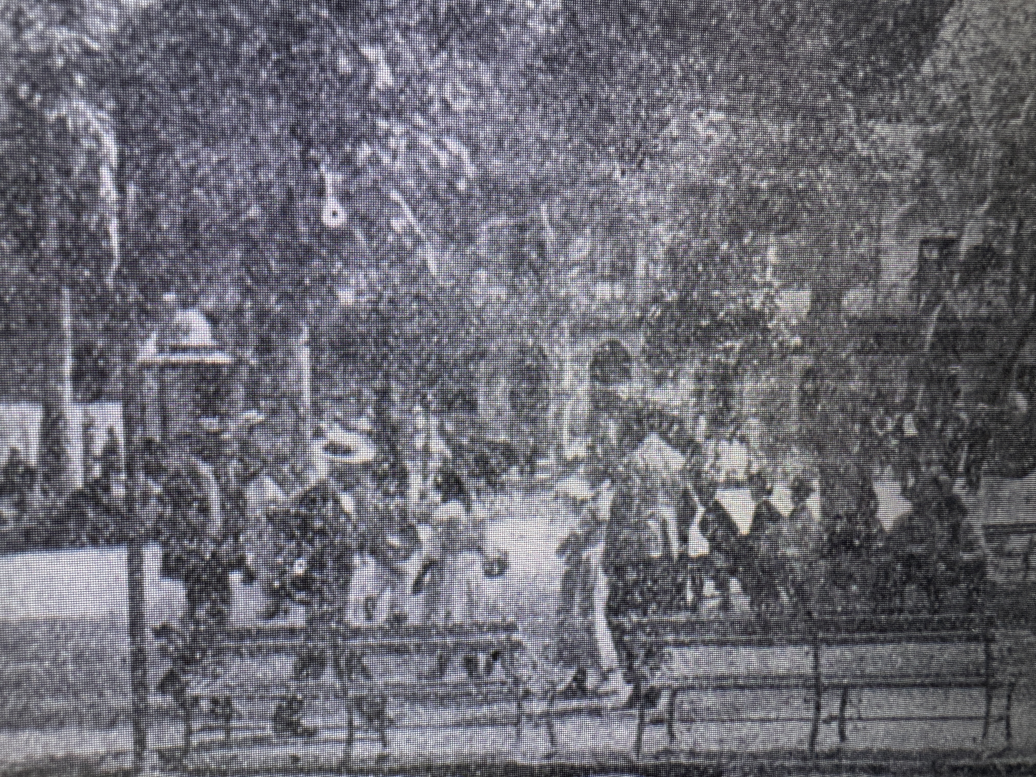
Here's another Muybridge photo from 1875 and showing a barren plaza and a monument instead of the later kiosk. There are at least two elegant street lamps and a corner of the Grand Central Hotel. (https://americanart.si.edu/artwork/cathedral-panama-38455)
Sorry for the resolution, but here's the plaza in 1908, as seen from the cathedral and looking towards the hotel. Lots of trees, lots of people sitting and standing, and a simpler kiosk than the one today. (William C. Haskins, Canal Zone Pilot, 1908, p. 67)
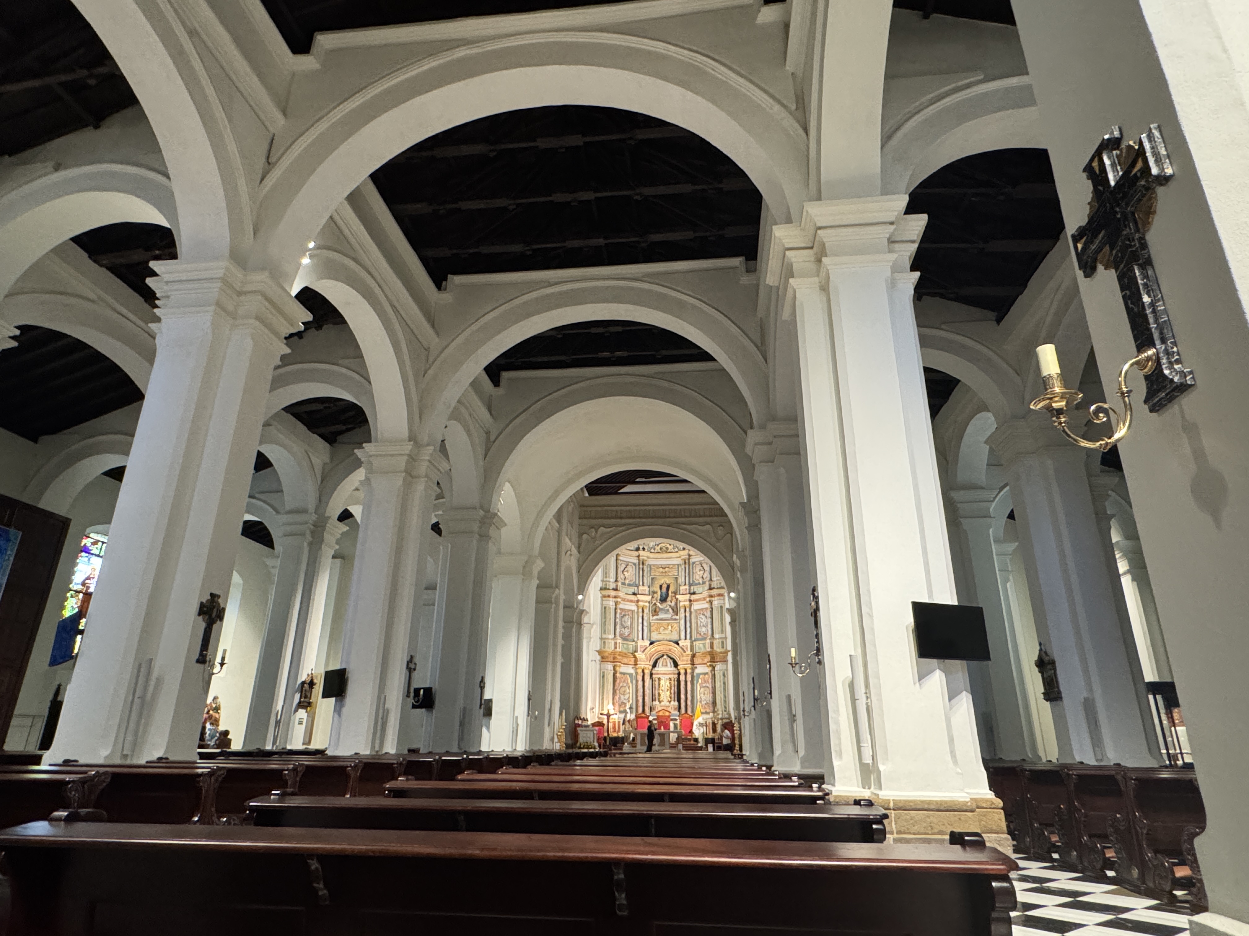
The interior of the cathedral has been described as "a veritable forest of cruciform columns," which perhaps is to be expected from an architect who in his day job was a military engineer.
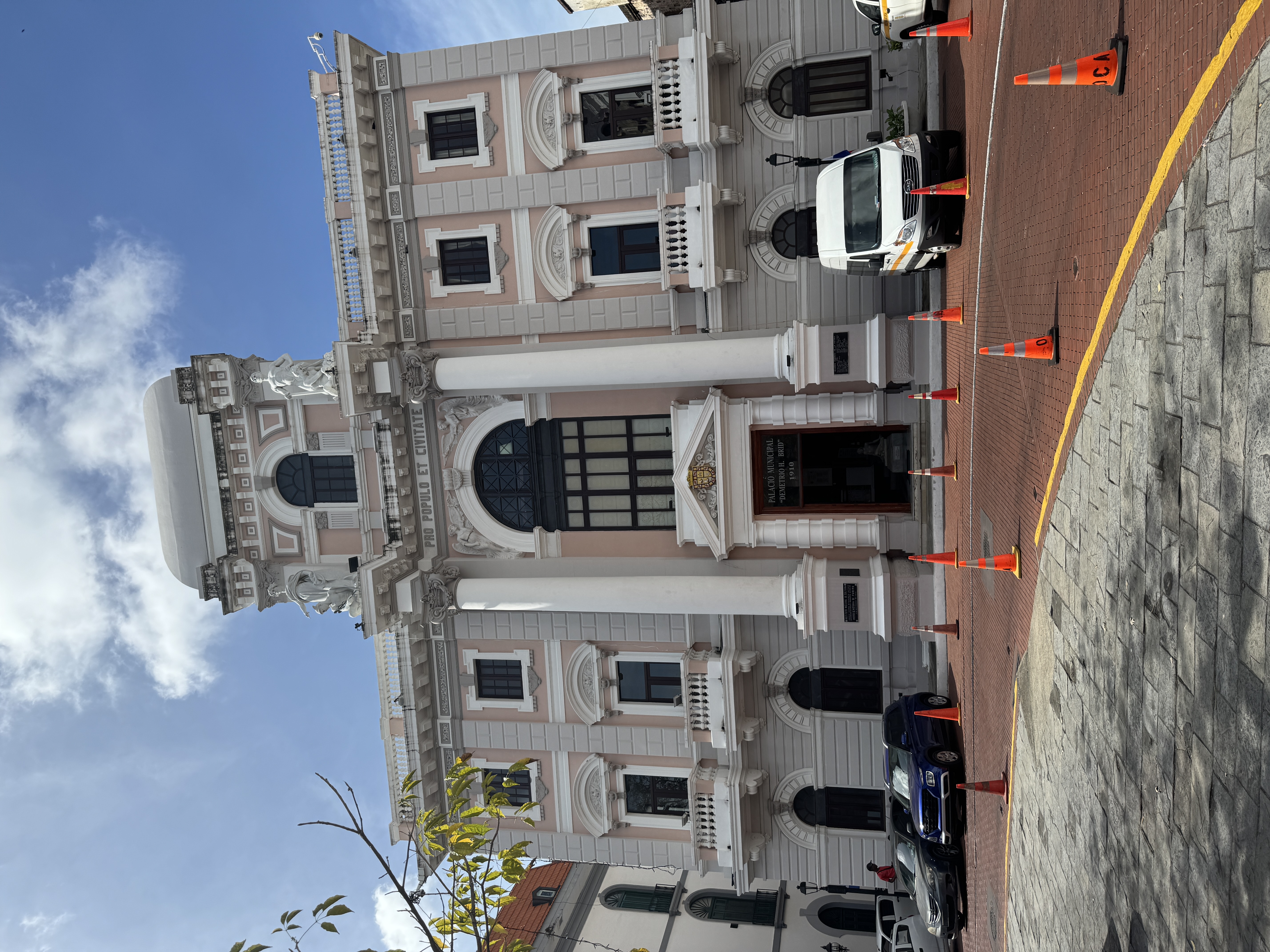
On the square also is this city hall, the Palacio Municipal from 1915. The Panama Canal had opened one year earlier, but the Panamanians apparently were still dreaming in French. I guess the same thing was true across Latin America. That's a hard truth for anyone raised on the Monroe Doctrine.
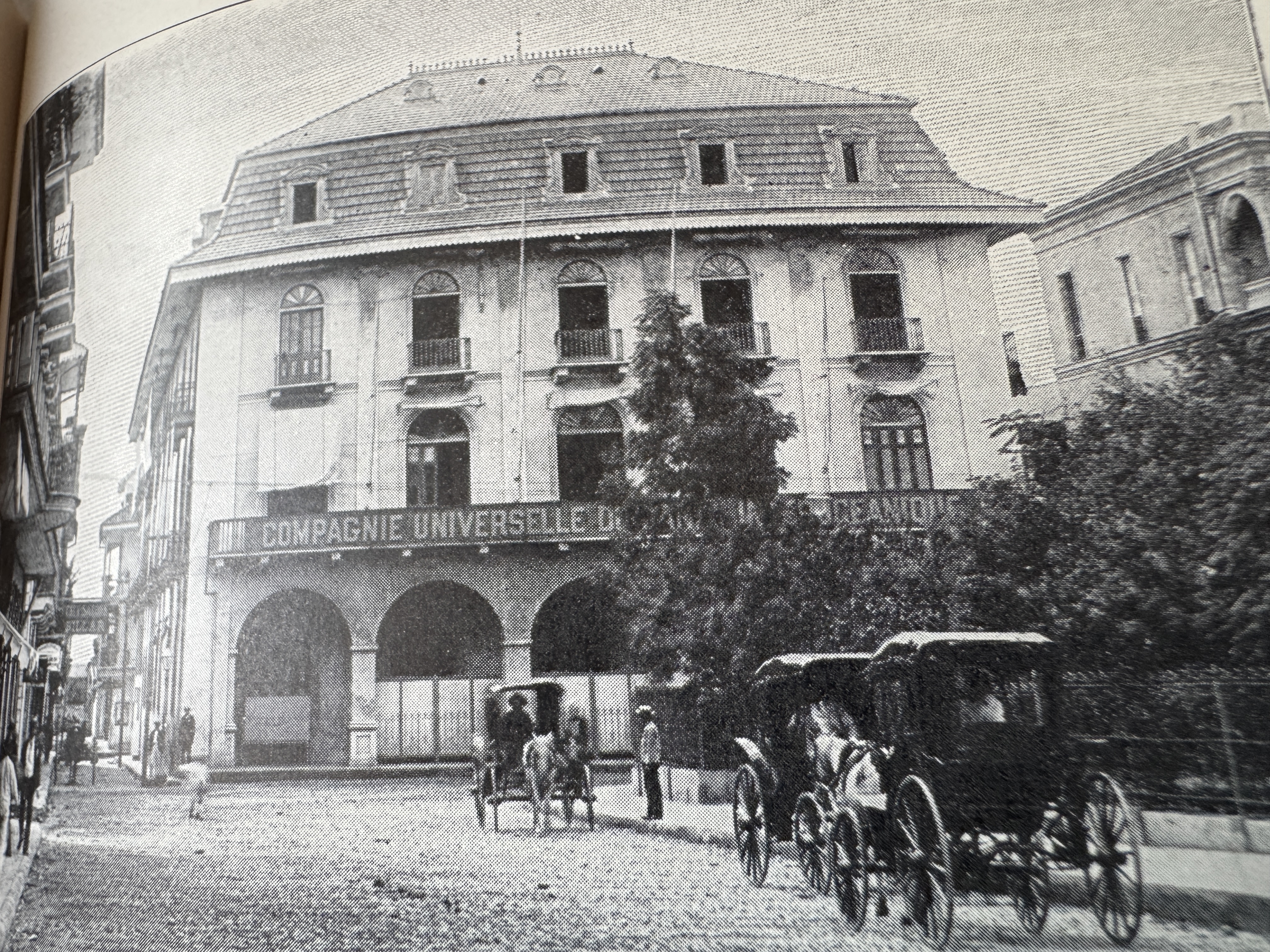
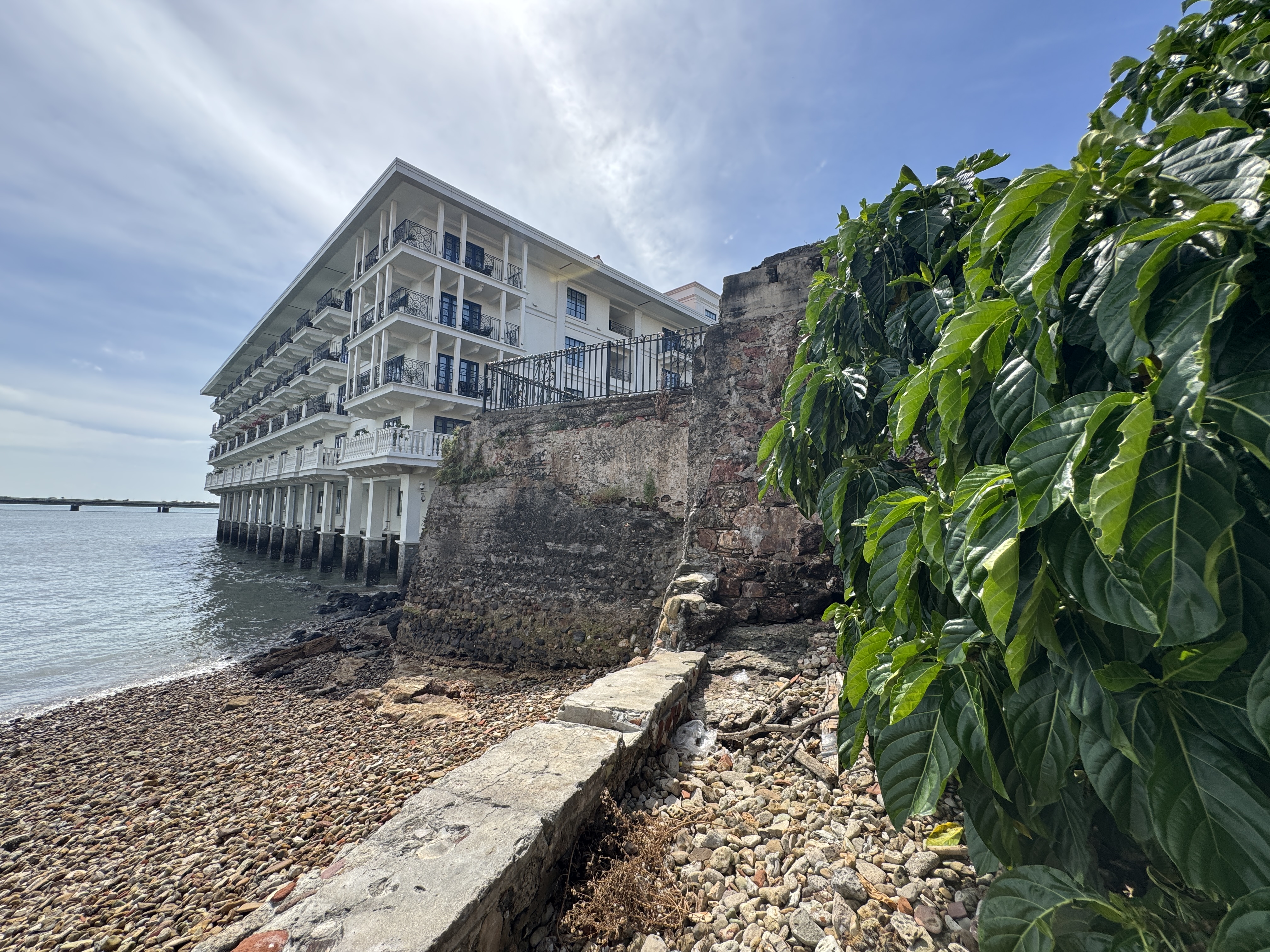
Next to it is this building, originally the Grand Hotel but used from 1881 until 1915 by the French and then by the American canal builders. The building was then sold to the Panamanian government, which allowed it to deteriorate until 1996, when the building reopened as the Panama Canal Museum (Joseph Bucklin Bishop, The Panama Gateway, 1913, p. 86.)
Here it is early in 2025. Want a ticket? It'll cost you $17, and you can't take photos. Is it worthwhile? I'll never know.
See the tracks? Svelte, n'est-ce pas? The Panama Tramway Company operated between 1913 and 1941.
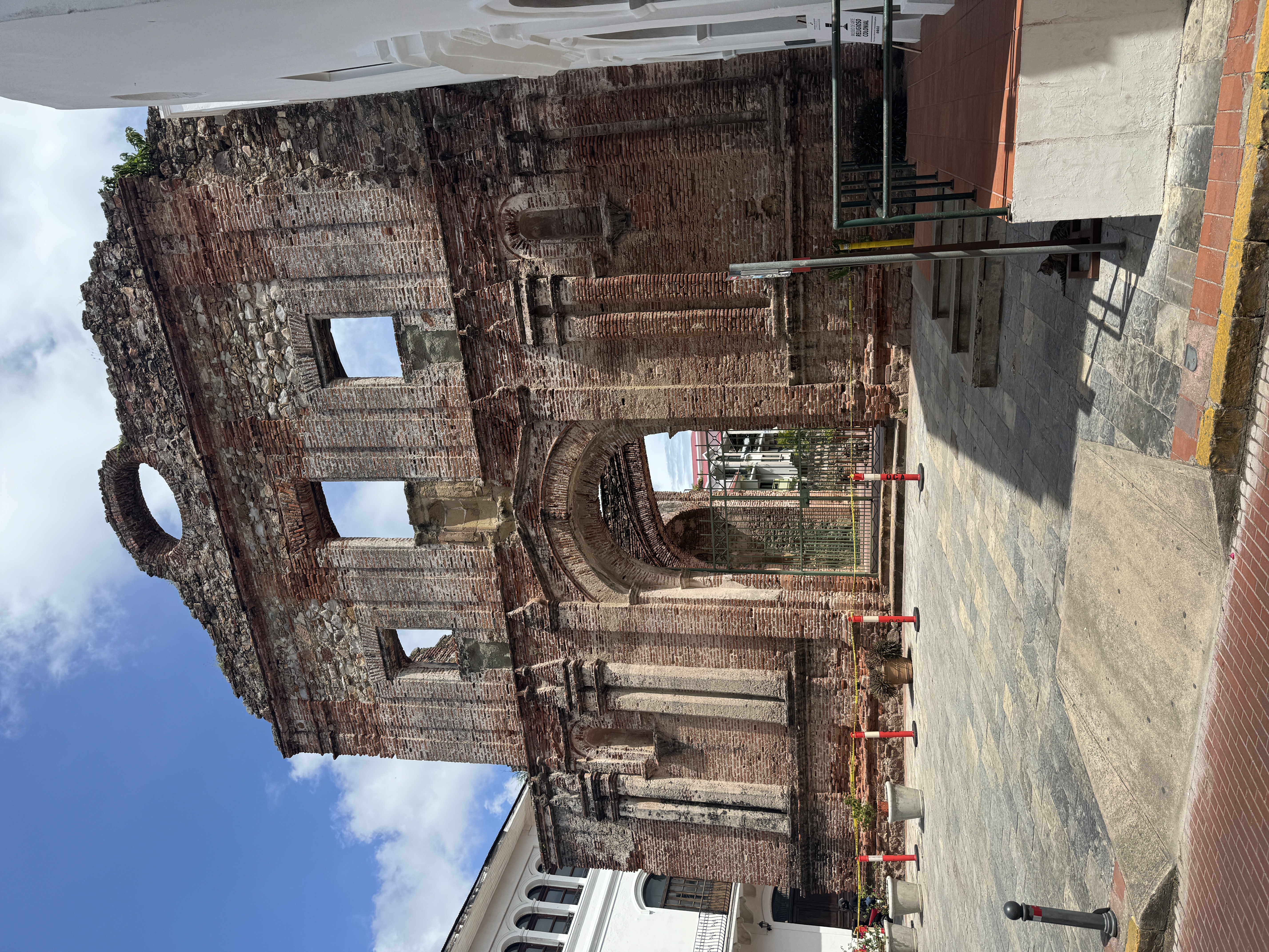
Midway between the Cathedral Square and the monument to the French canal builders is this carefully tended ruin of the Santo Domingo church. For a long time it's been celebrated for the flat arch you can barely see through the entrance.
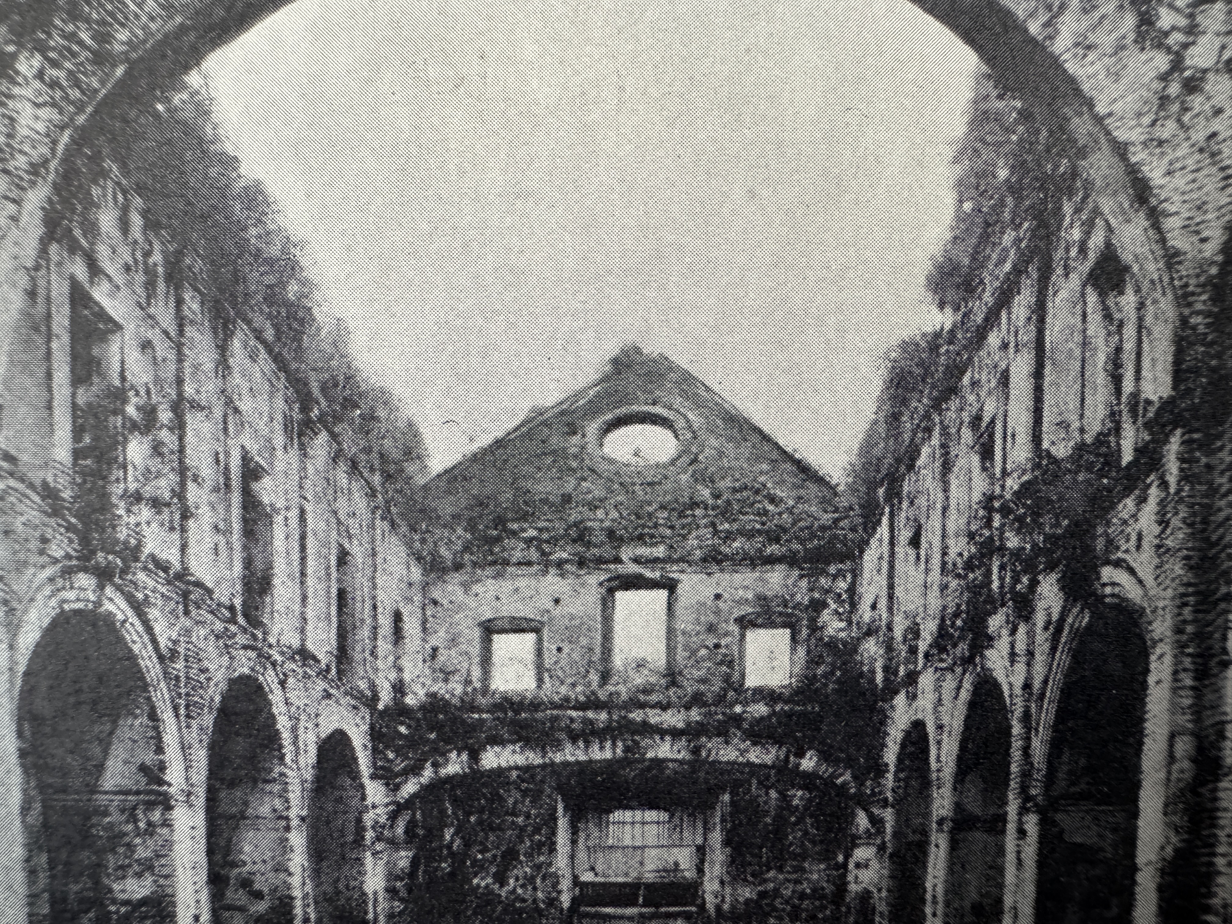
You can see it more clearly in a book written by the same author who complained about the Grand Central Hotel. He had come to Panama to attend a conference and, failing to find a guidebook, wrote one himself. The arch lives dangerously and has been cited from time to time as proof that Panama doesn't suffer from earthquakes. (Henry T. Byford, Panama and Back, 1907, p. 172)
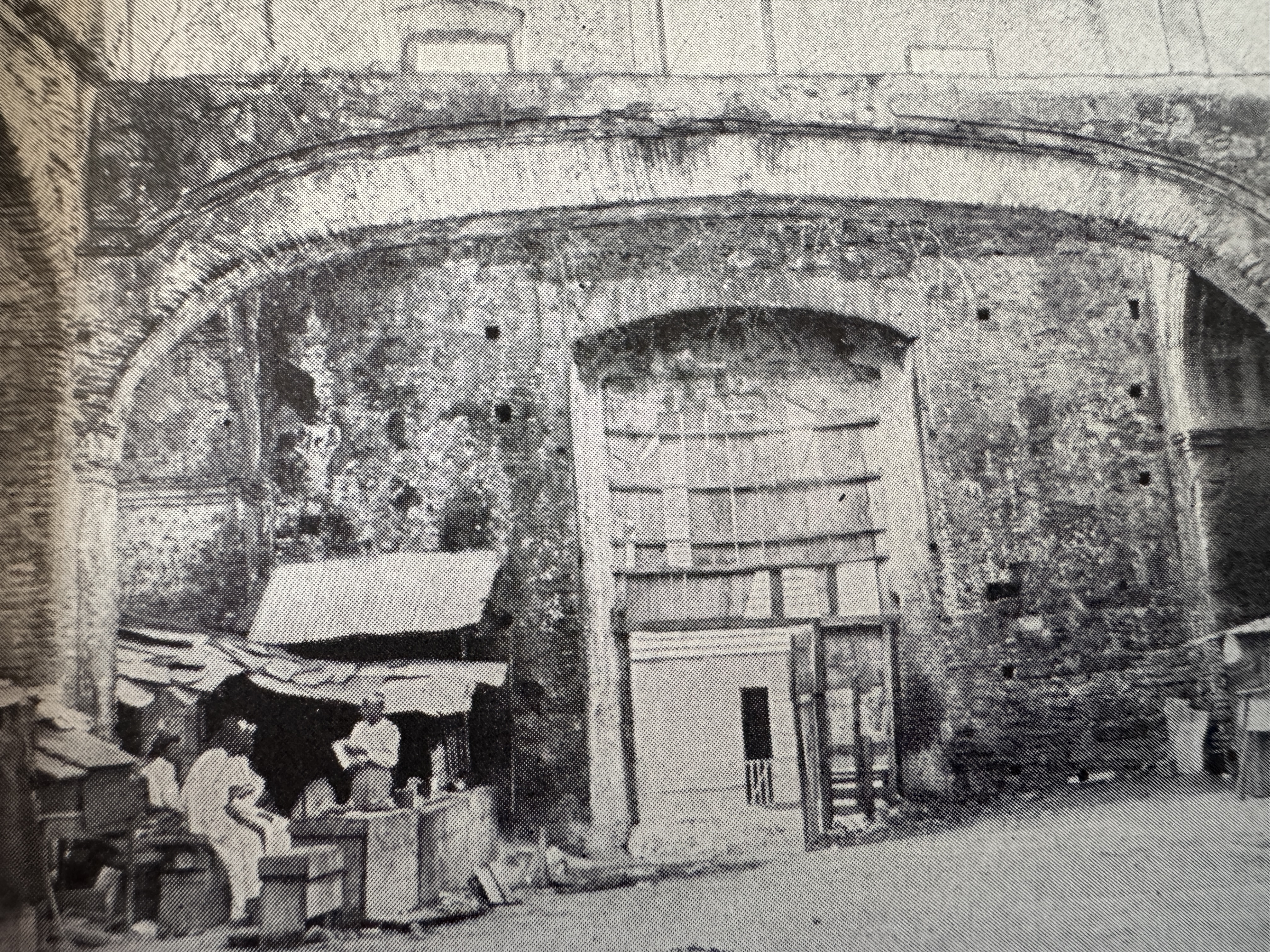
Here's the same arch as it appeared about 1913, when it was part of someone's home. (Joseph Bucklin Bishop, The Panama Gateway, 1913, p. 20).
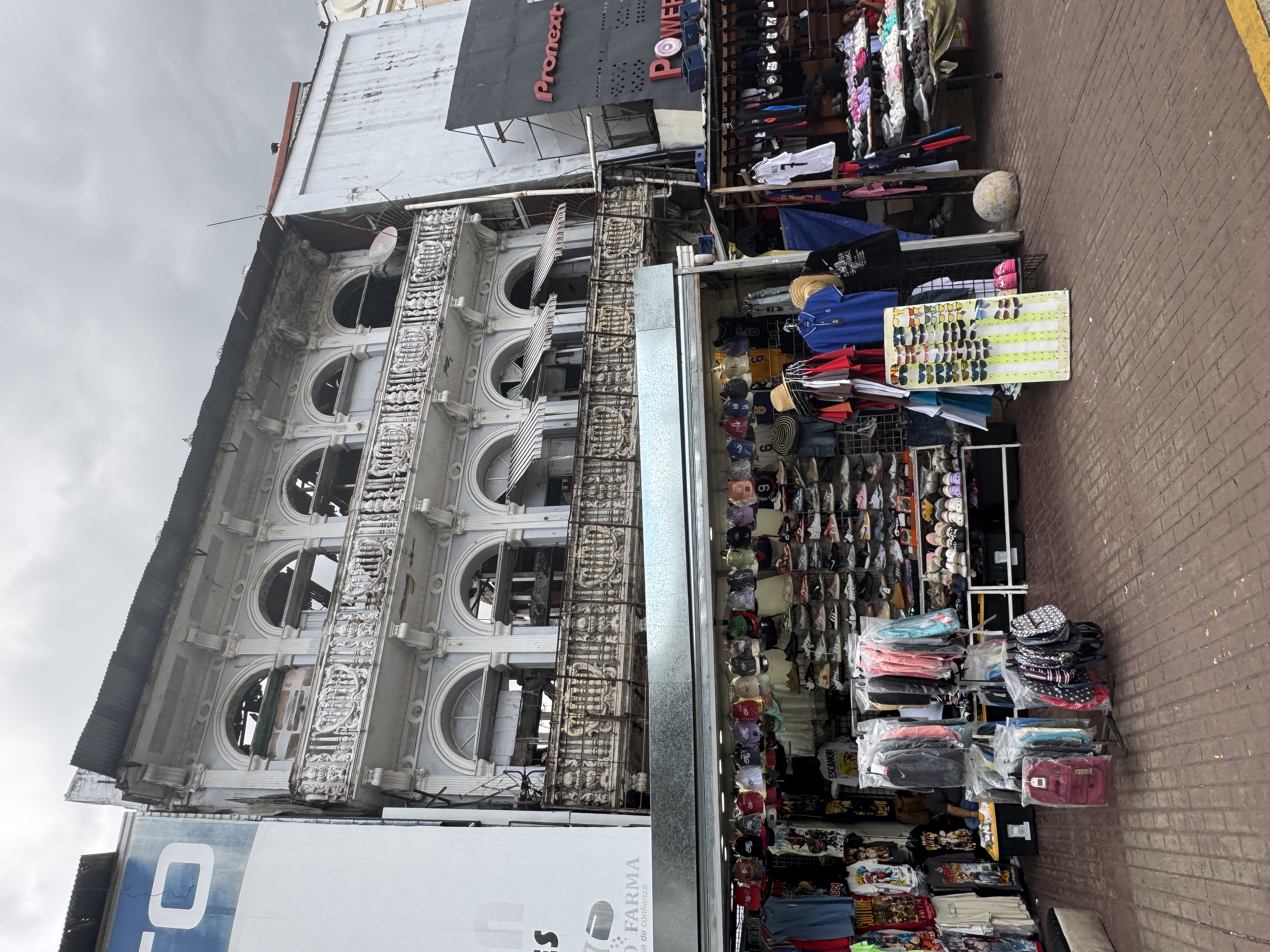
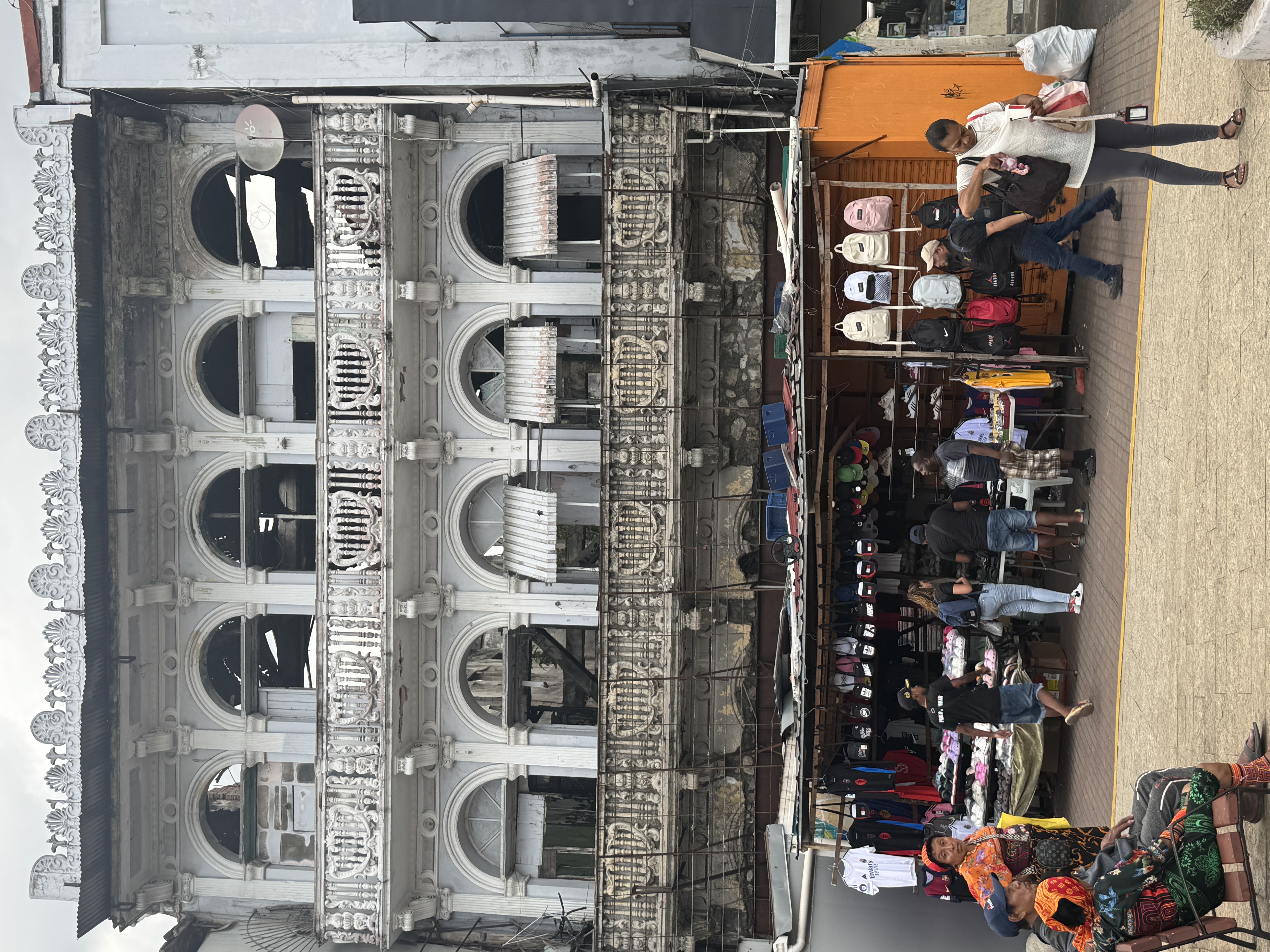
Some two and a half million tourists arrive in Panama annually, most on flights landing at Panama City's Tocumen Airport. Half probably are taken to see the Casco Viejo. Bet on it: the squatters are gone. Heritage is big business.
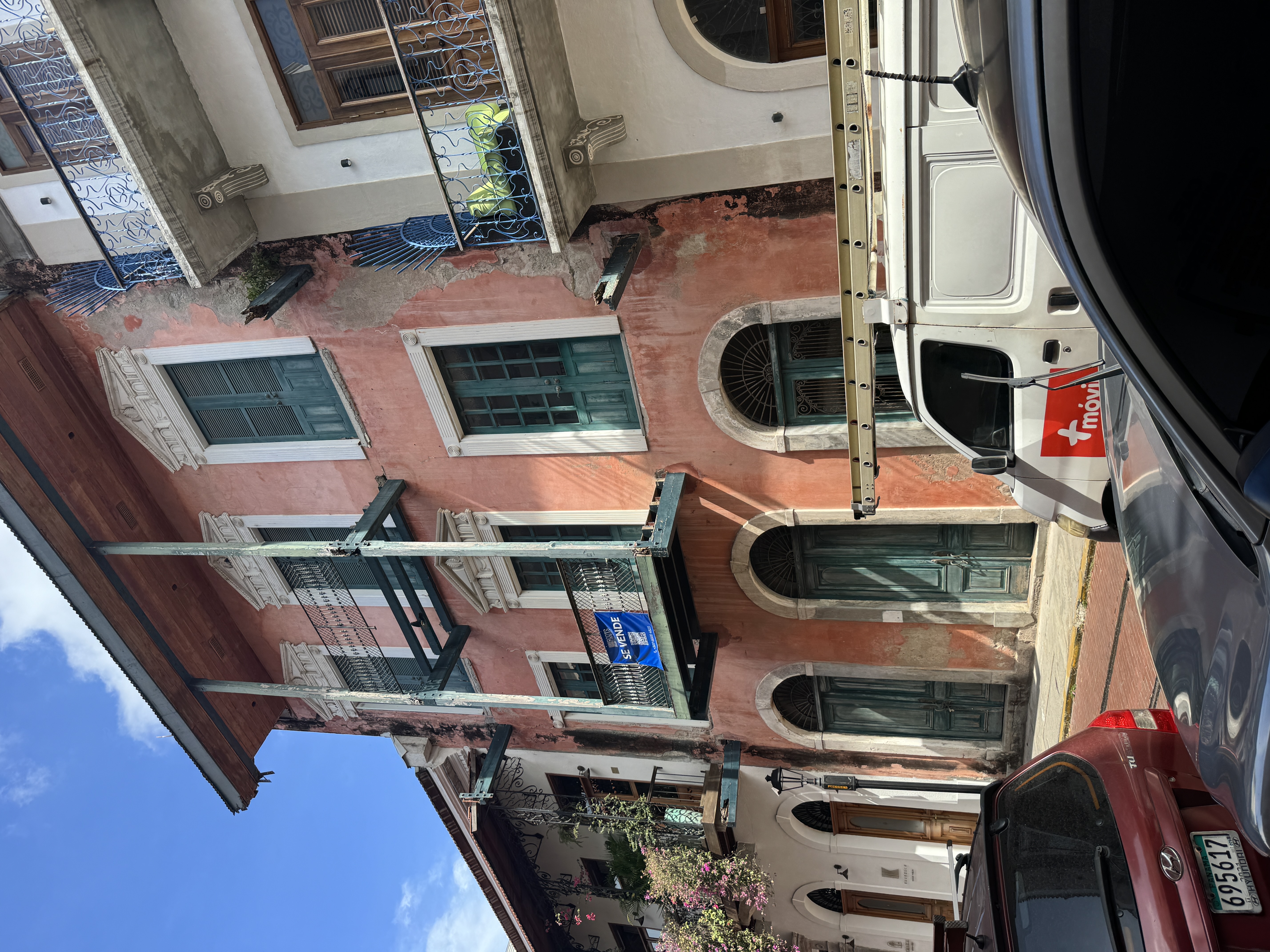
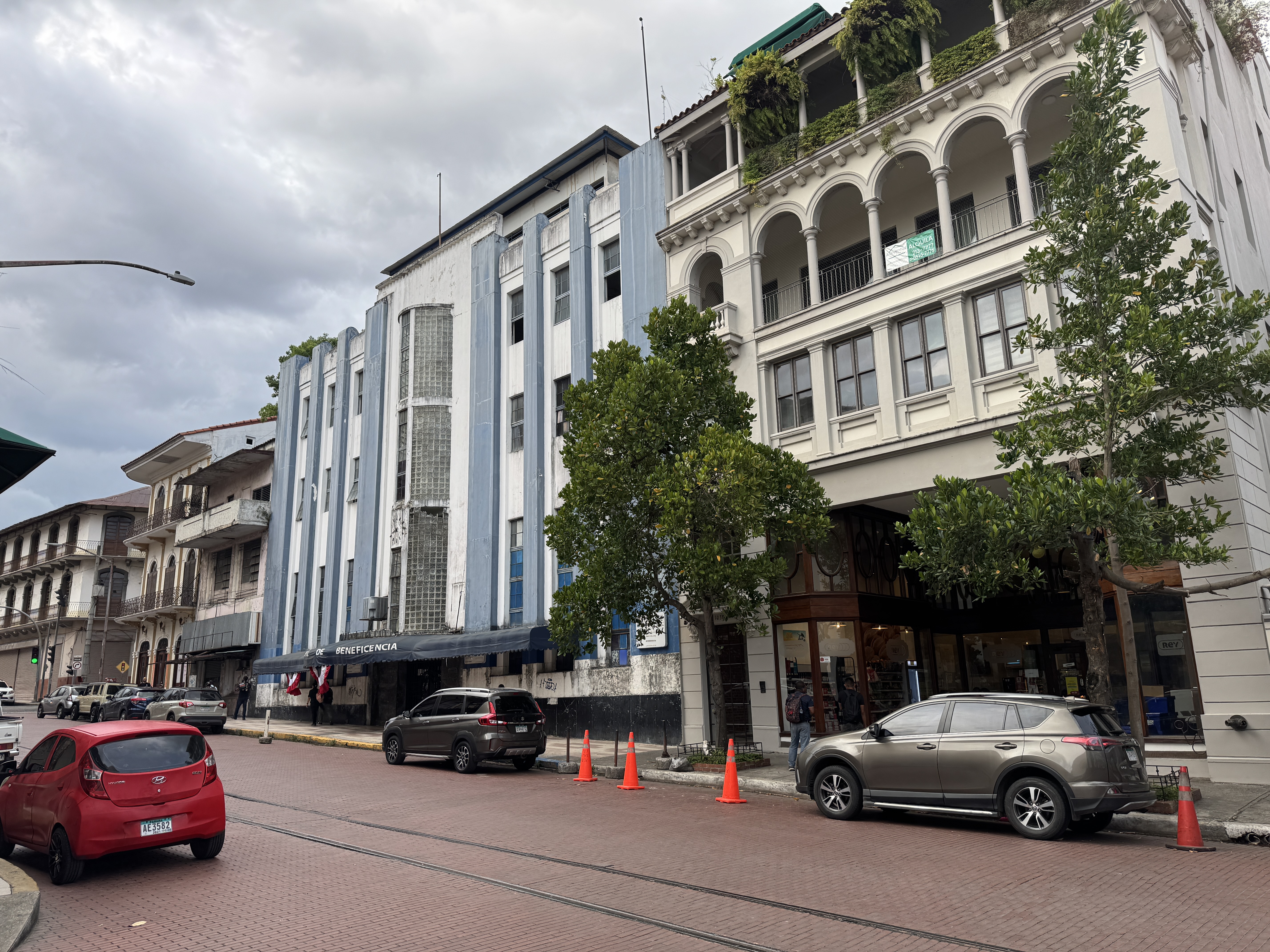
Lots of buildings have been handsomely renovated.
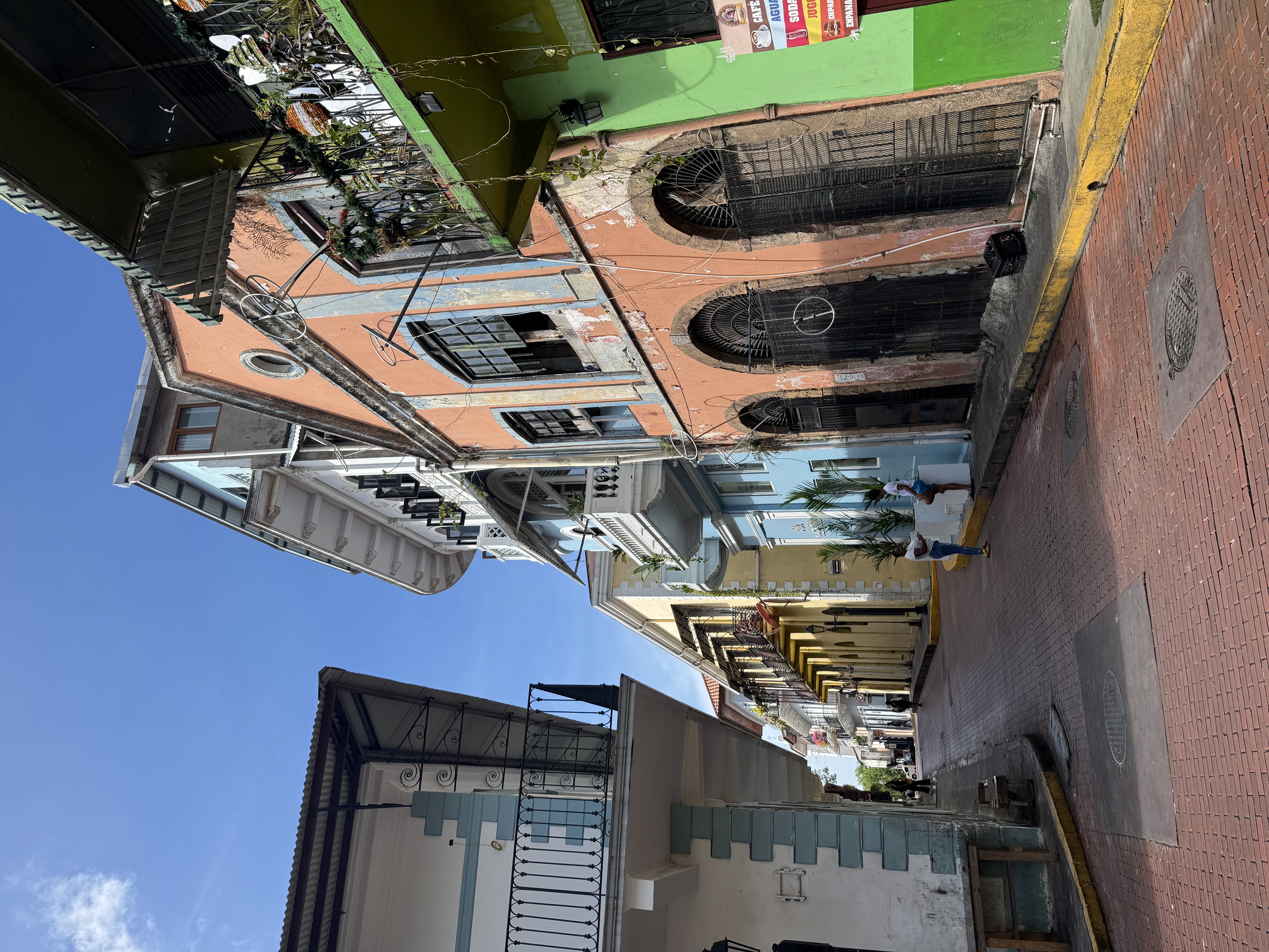
There are charming streets, so long as you're not driving. A doctor passing through from Chicago in 1900 noticed that "the external tints of the buildings run through varying shades of red, yellow, pink, gray and brown. Terra-cotta and pink are the prevailing shades. We of the north would consider such vivid coloring rather outr I fear, but, somehow, it seems here not only natural, but very pleasing...." That's still the case. (G. Frank Lydston, Panama and the Sierras, 1900, p. 64)
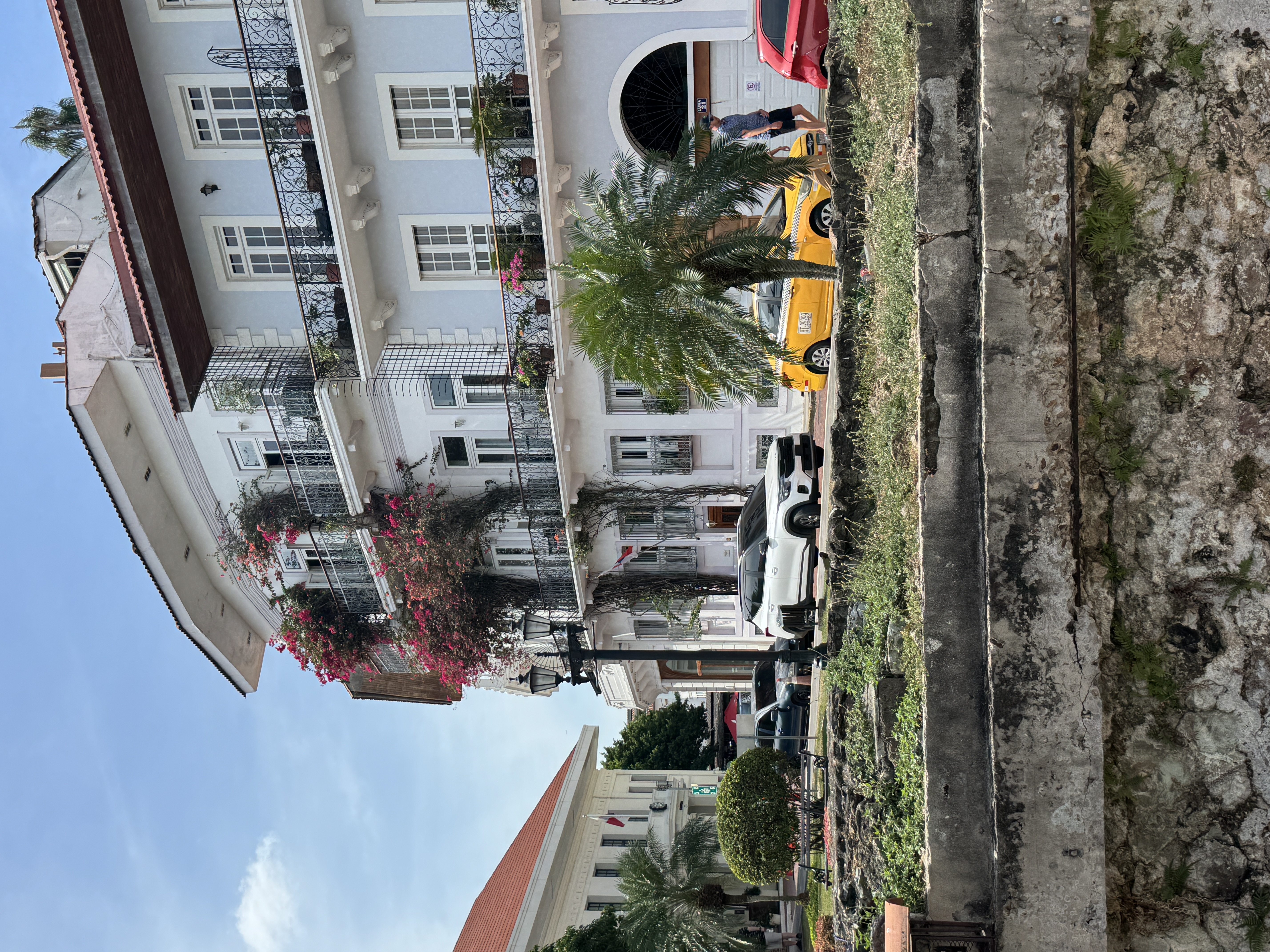
Plants help.
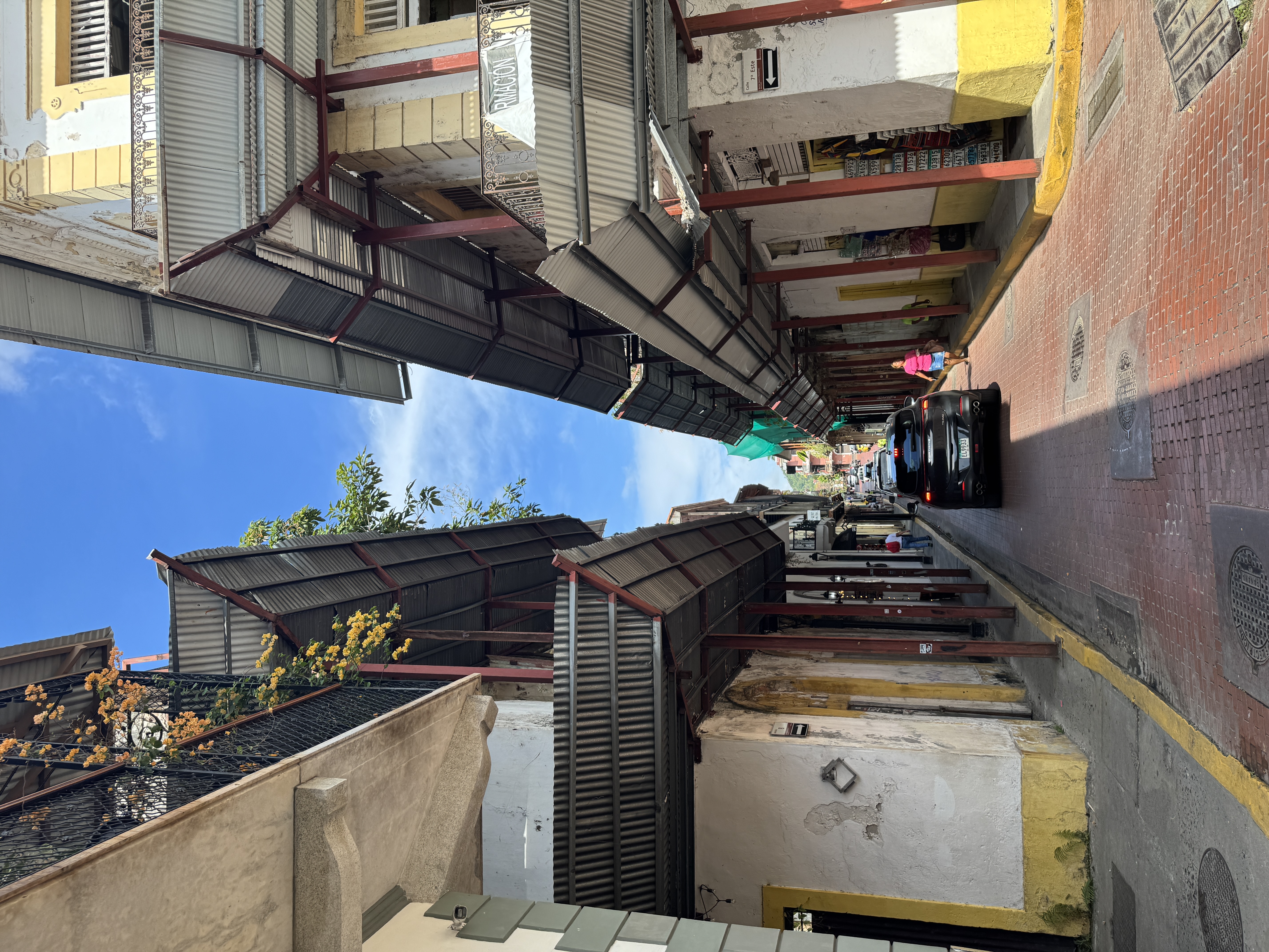
At the same time, many buildings need work, which is why screens protect pedestrian skulls.
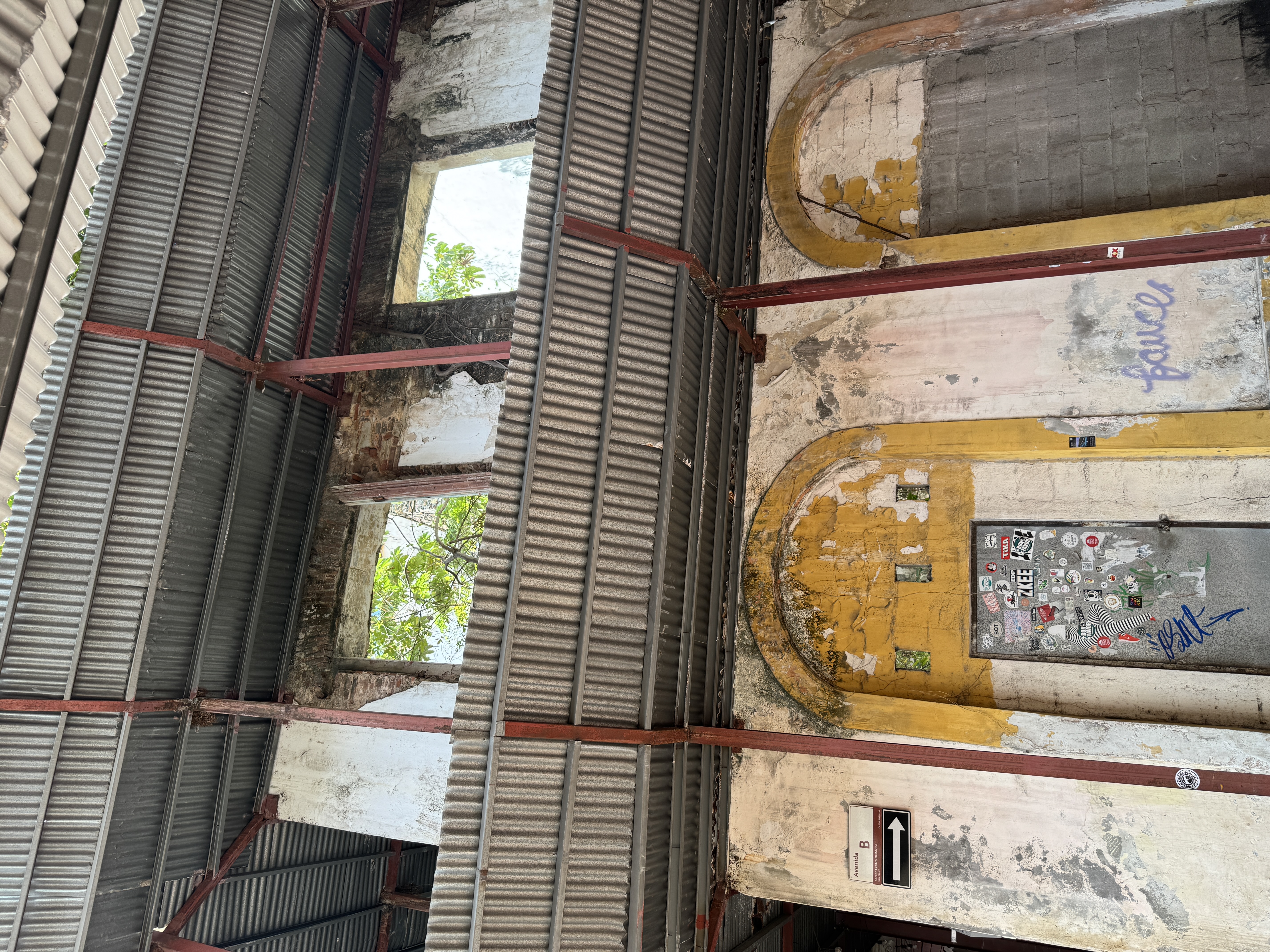
Peek through.
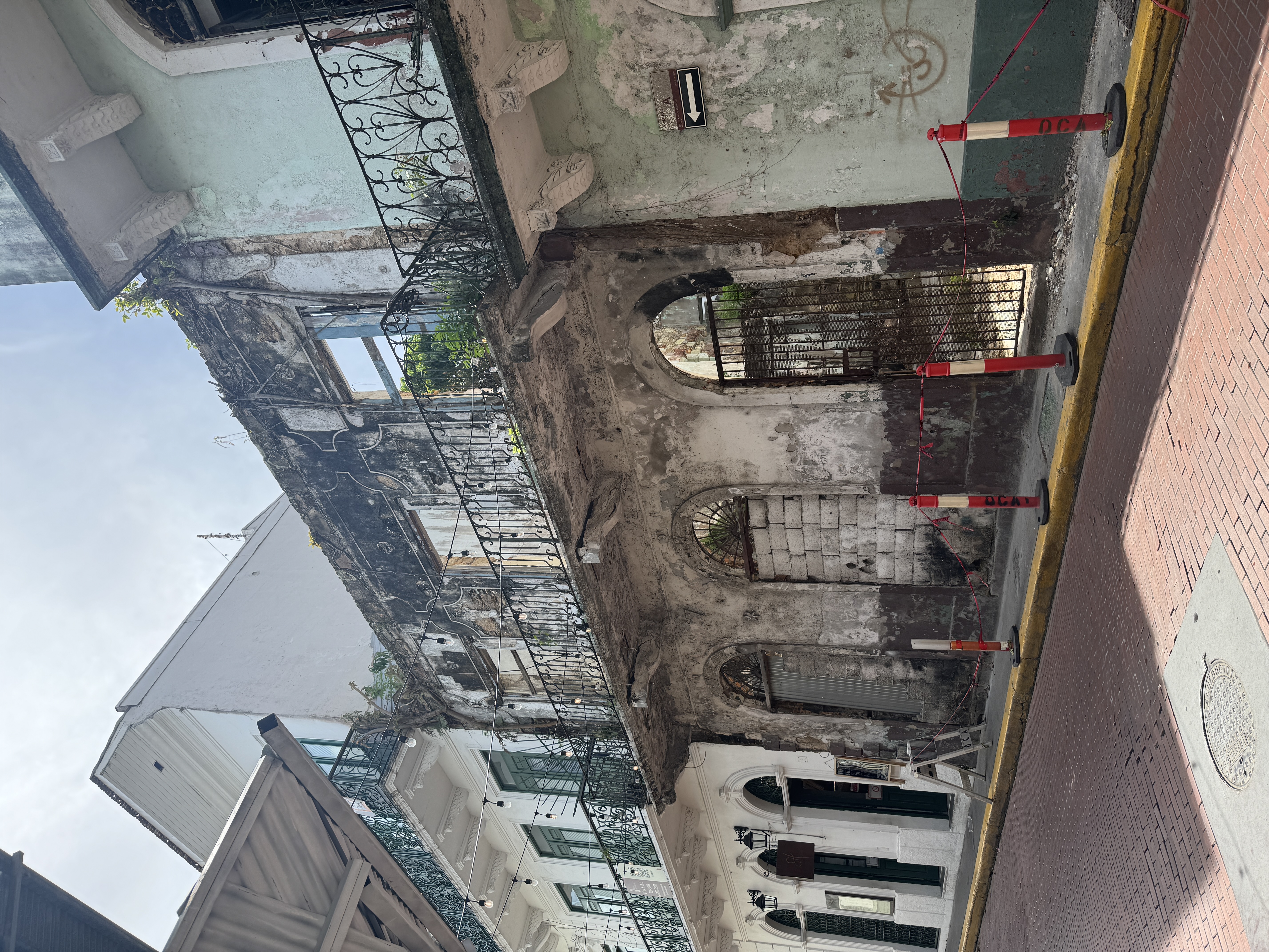
Nothing much left except the facade.
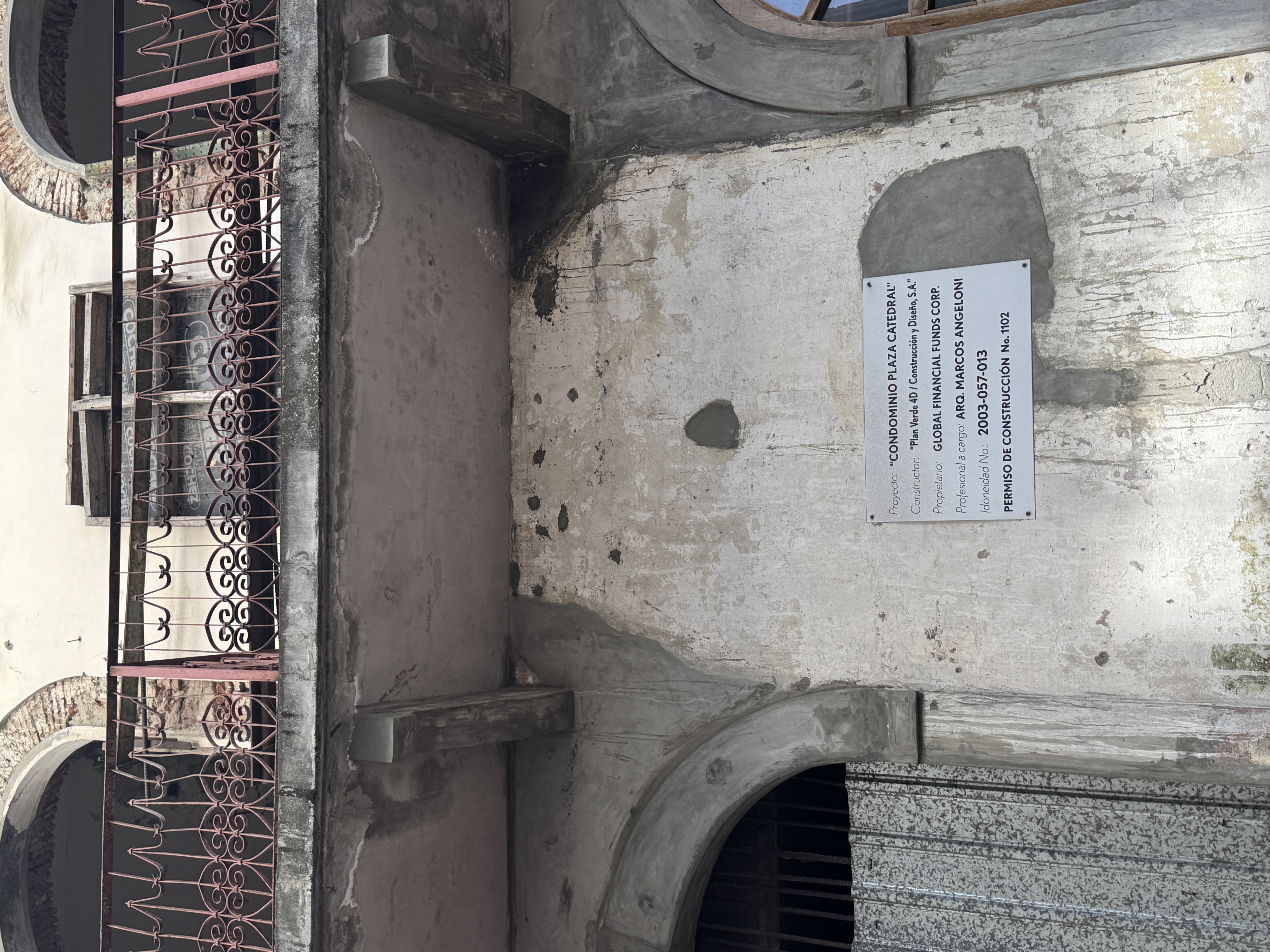
A developer at work in 2025.
And so a hotel sprouts. It's a Sofitel, opened in 2022 in the remodeled Club Uni n, which had opened in 1917 and closed in 1967.
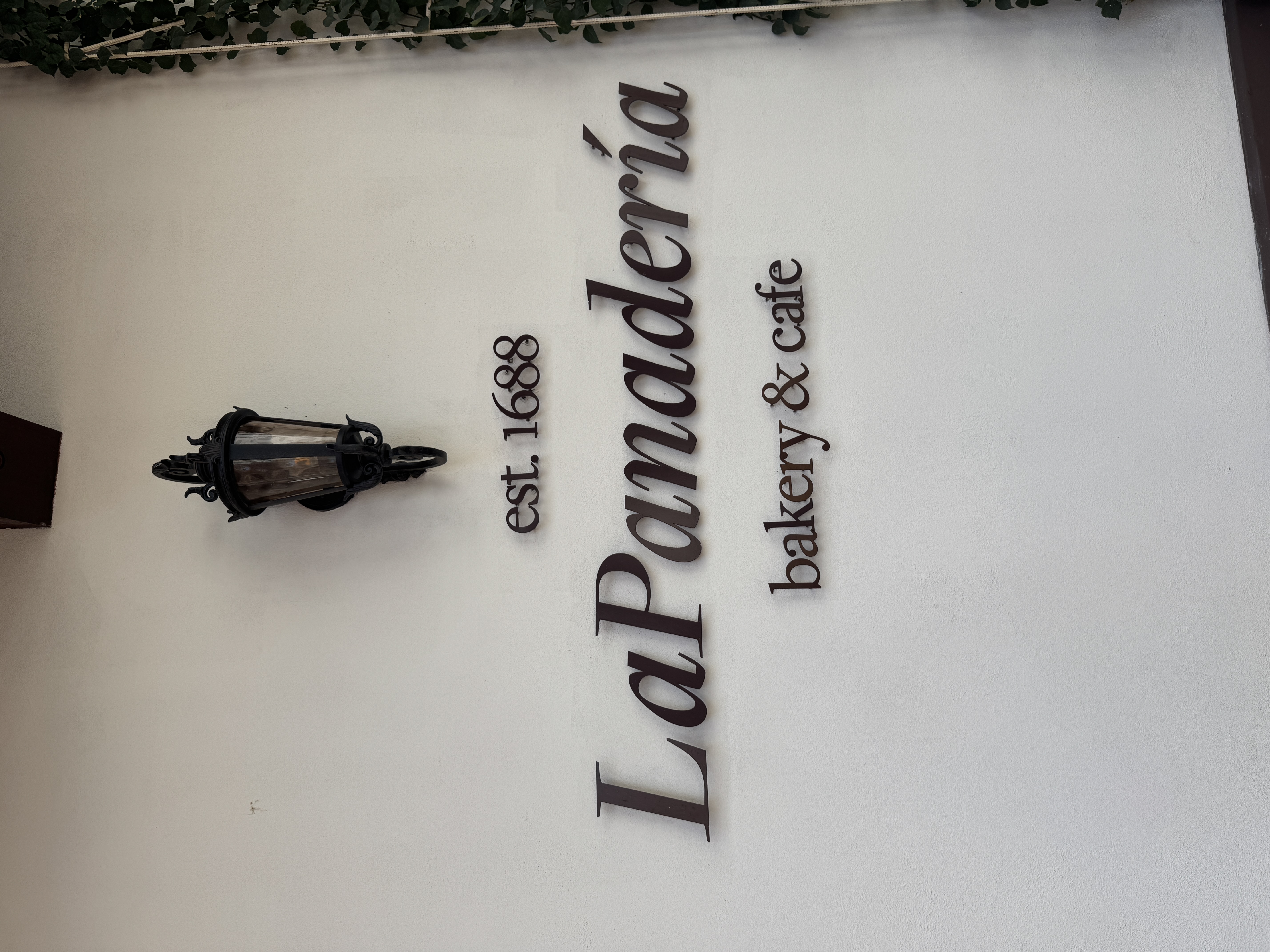
A Hyatt hotel boasts a bakery with an inflated history. (The building itself, the Casa Gongora, does date from the 1600s.)
You can see where this leads. (You don't need me to tell you.)
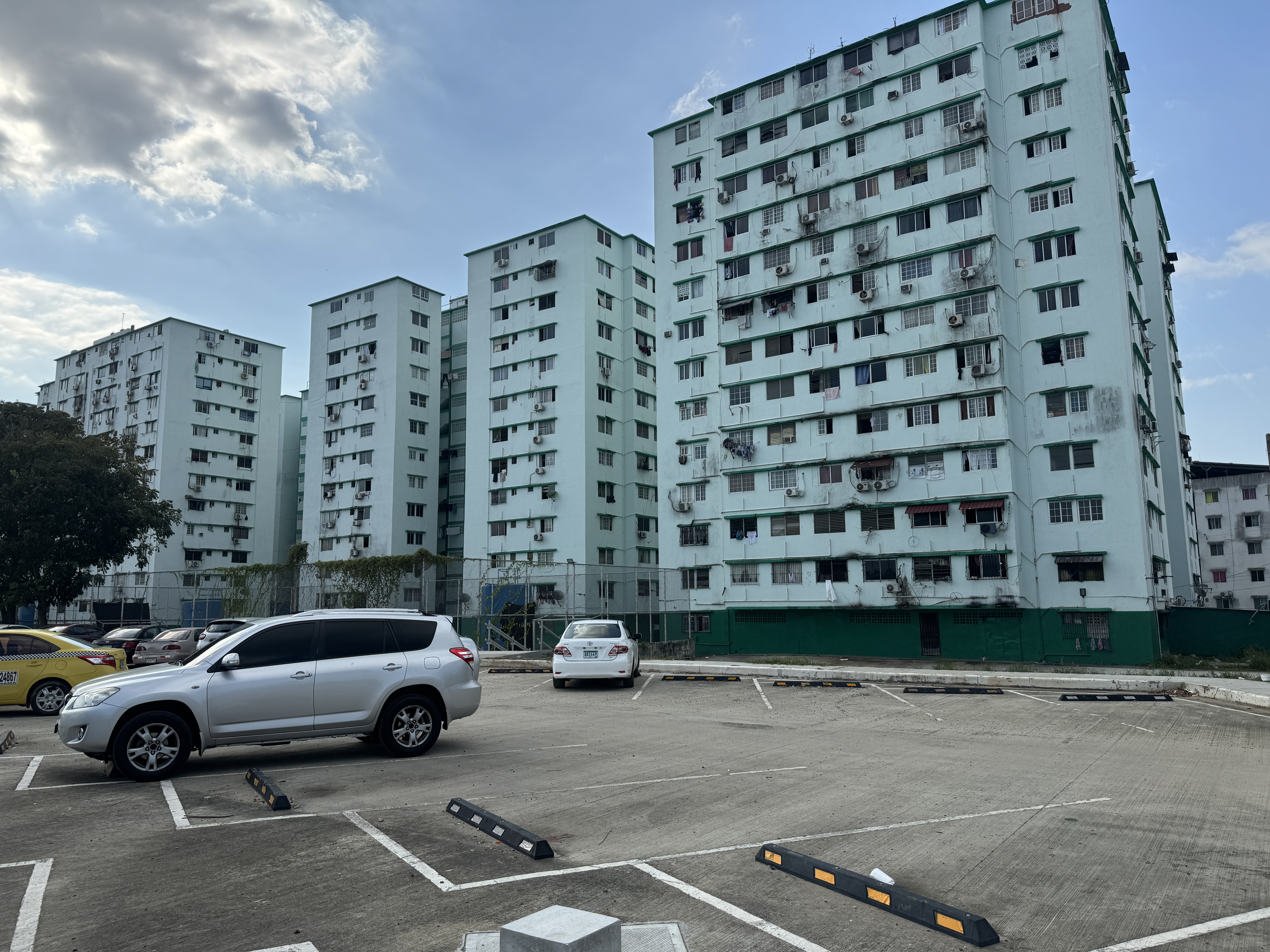
Meanwhile, at the gates of the Casco Viejo and only a half mile from the cathedral, public housing is a reminder that not everyone does Starbucks.
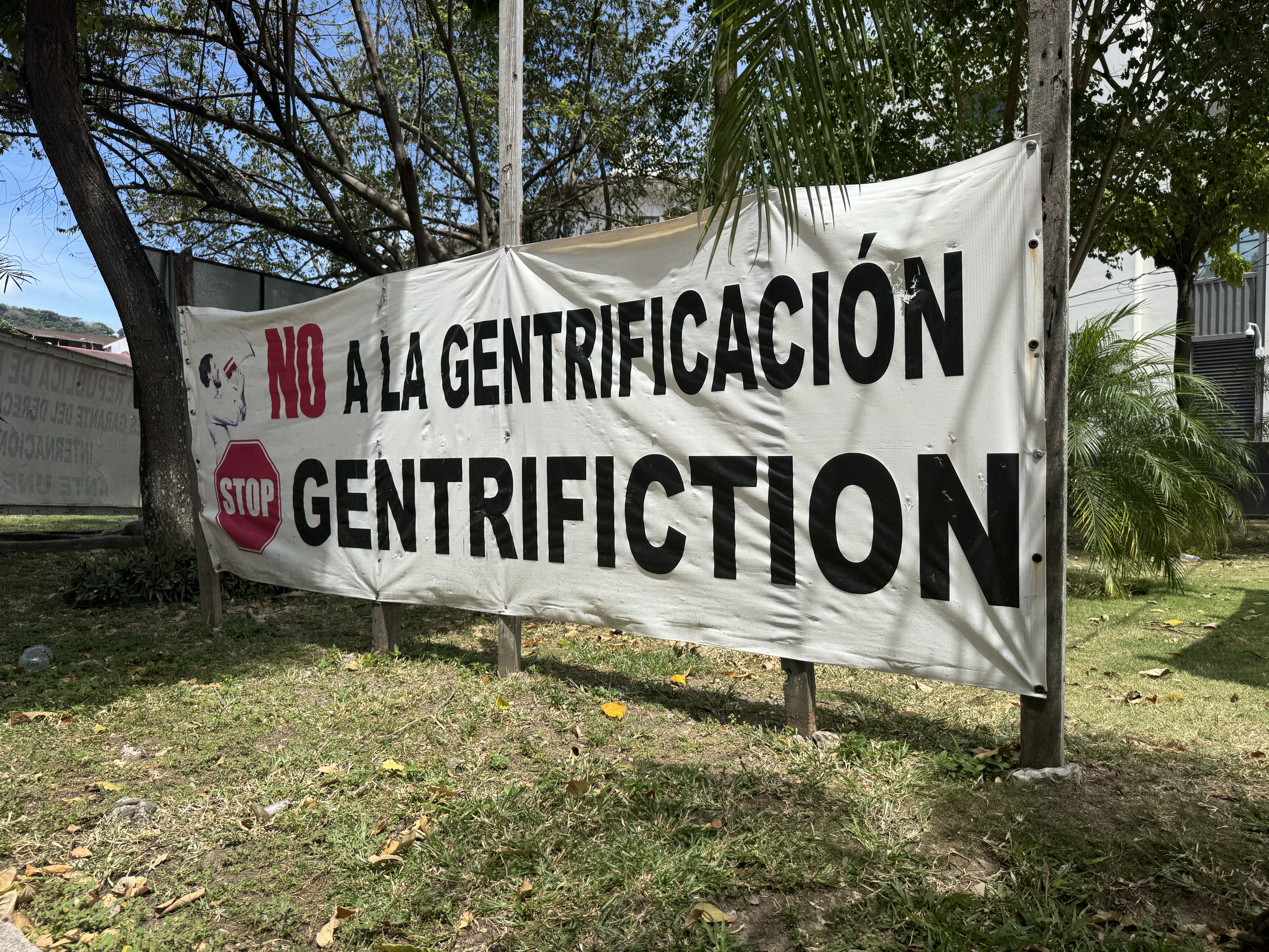
Somebody isn't happy.
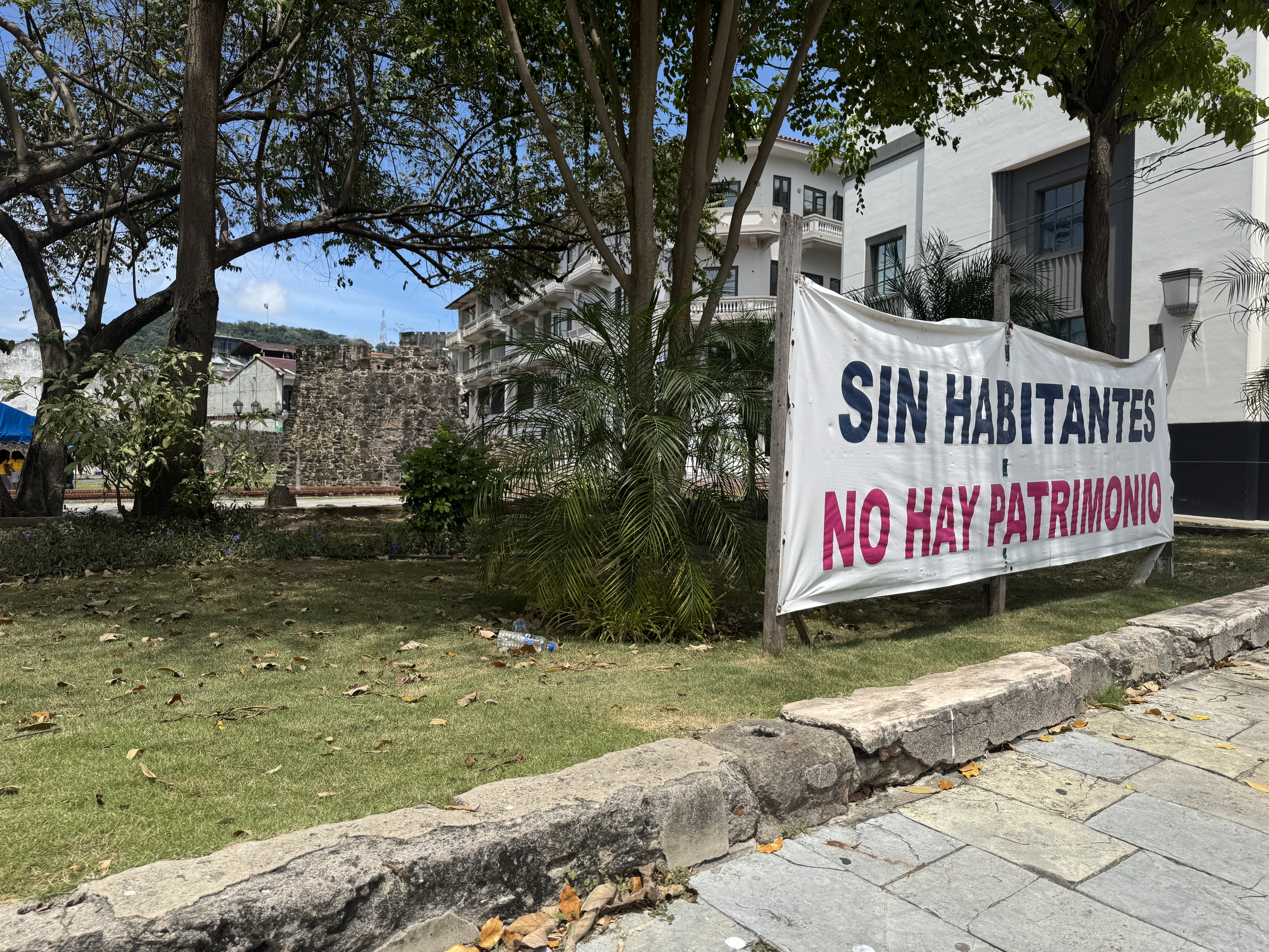
You say that gentrification provides jobs? True, but try telling that to the protesters.
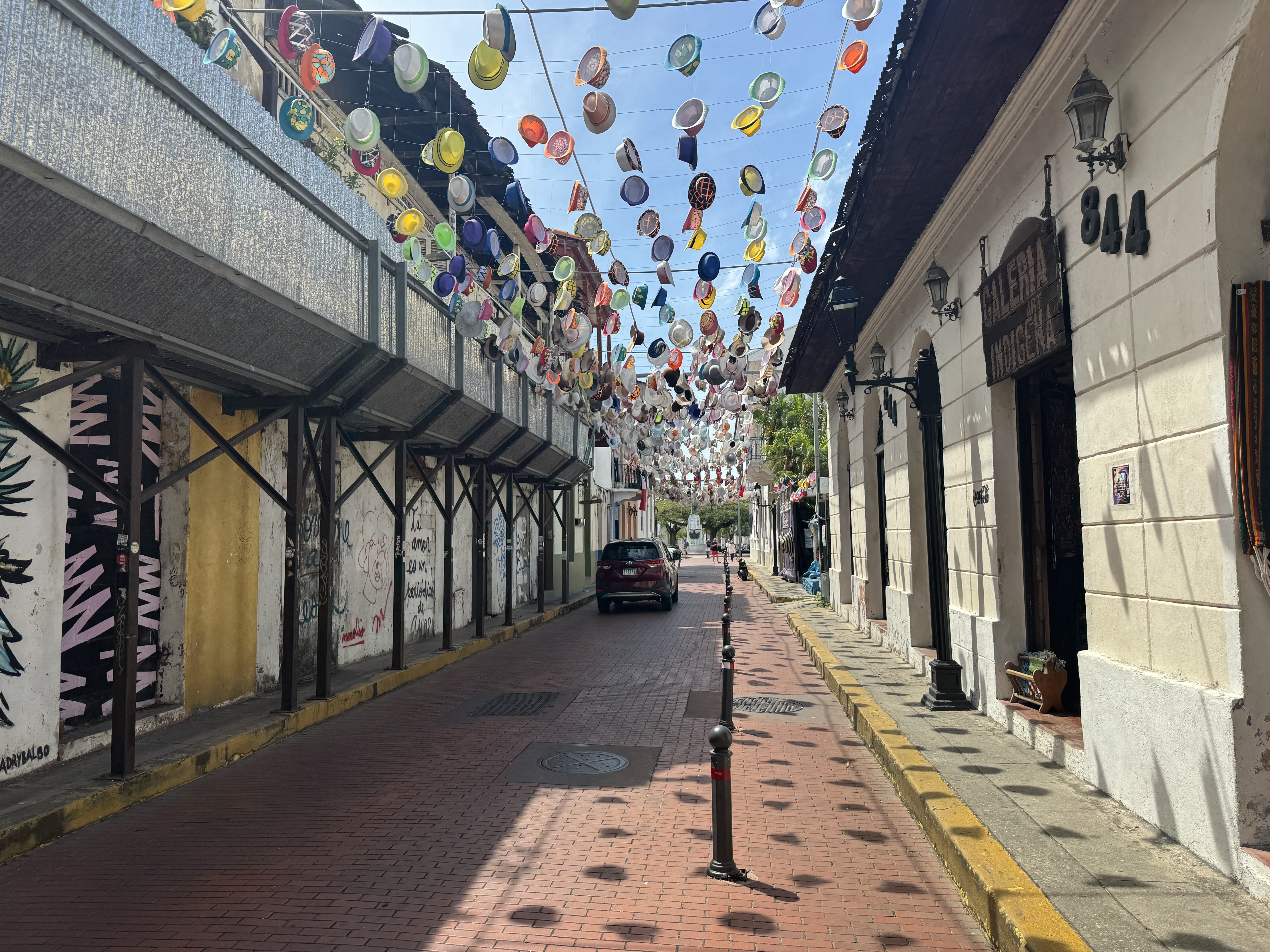
Anyway, for those with money to spend, it's party time in the Casco Viejo. That's why, close to the monument to the French pioneers, a line of shops sells Panama hats. You're not supposed to ask where they're made, but if you must, the answer is Ecuador. (Yes, in the 19th century some were made in the local prison. Perhaps some still are.)
We're going to follow the streetcar tracks for about half a mile to the former railroad station.
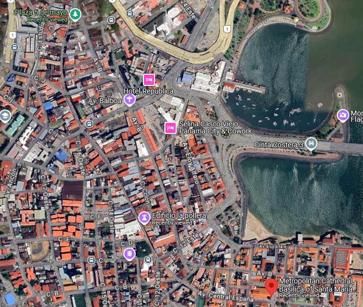
We start at the lower right and end at the upper left (Plaza 5 de Mayo).
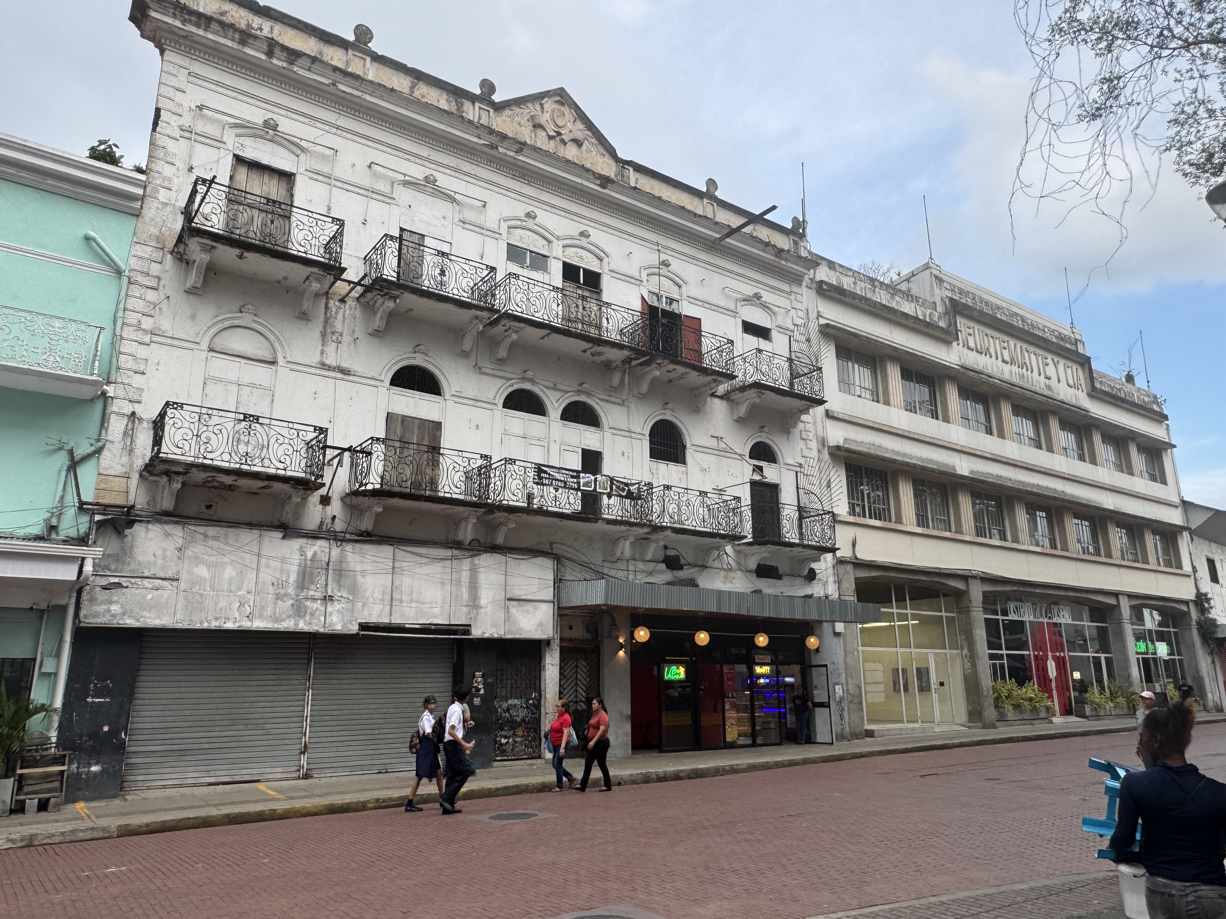
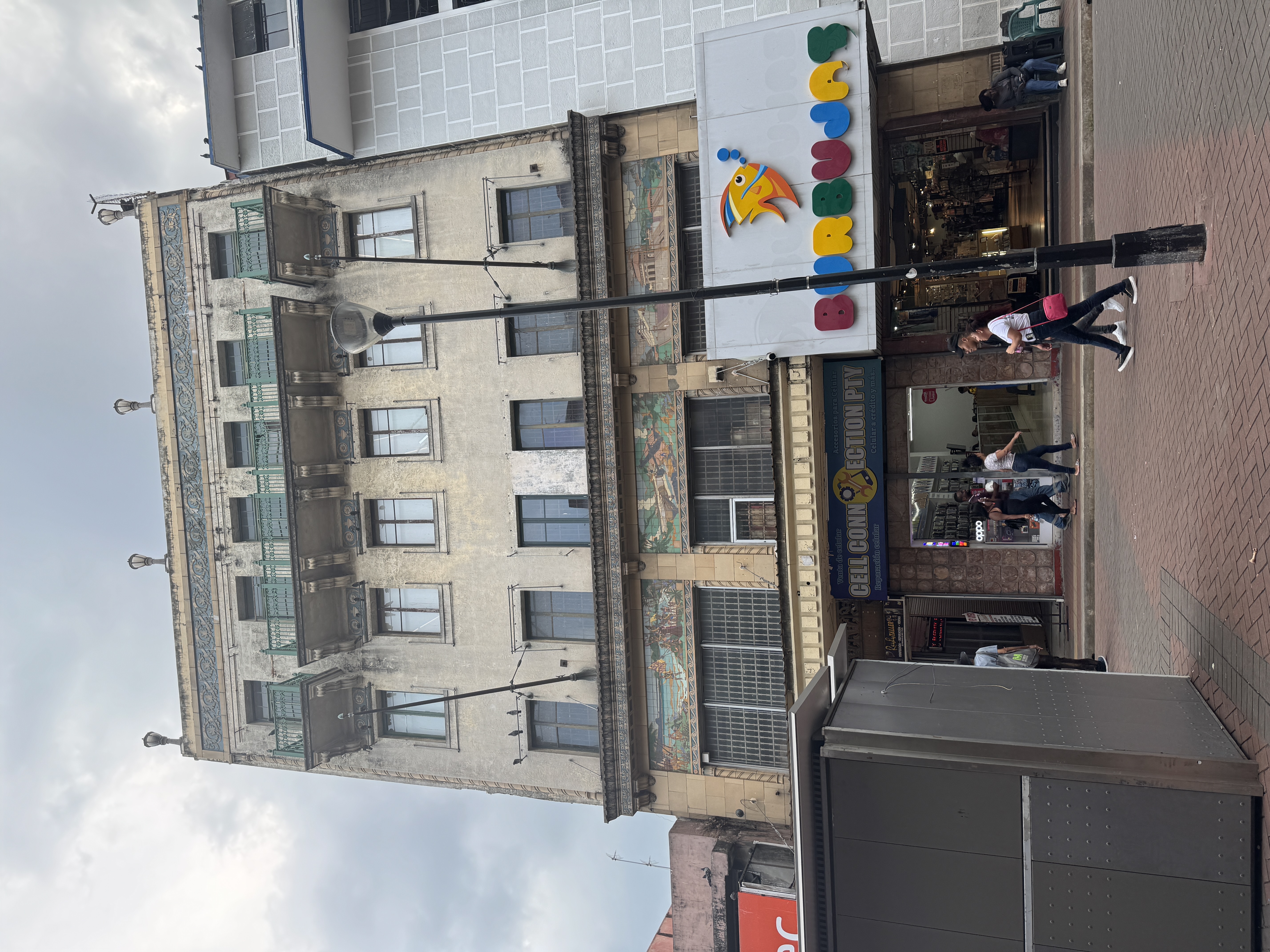
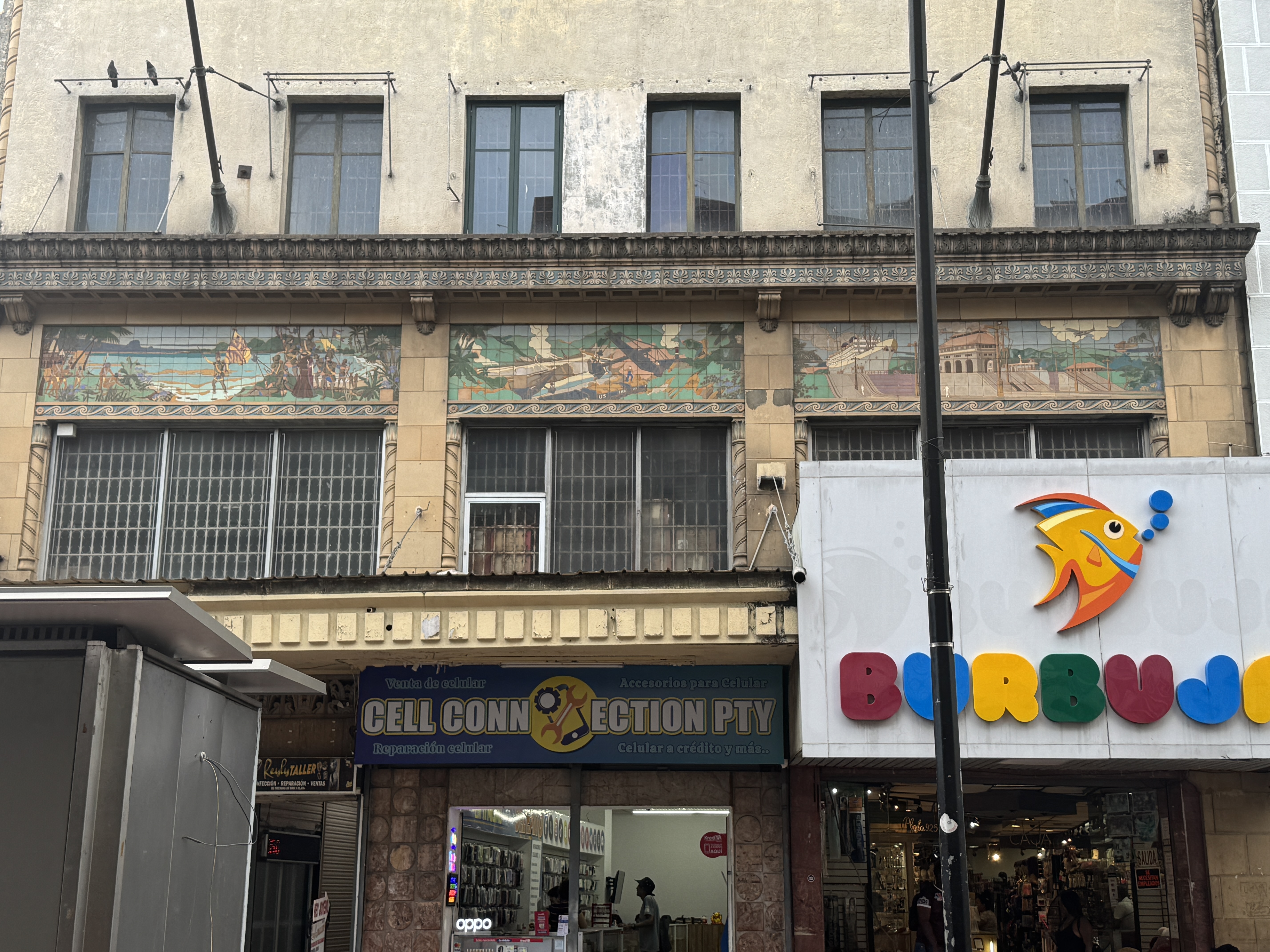
Here, facing the Santa Ana Plaza, is the former Hotel Metropole. It's next to an old department store. You can dig into details and find that the hotel was run in 1908 by F.P Petersen. The rooms had baths and electric lights, and German draught beer was on hand. The store next door took its name from Maxime Heurtematte, who arrived about 1850. Julio Huertematte, perhaps a grandson, would run the store in the 1930s but left for the U.S. to become a senior official at the Organization of American States and then the World Bank.
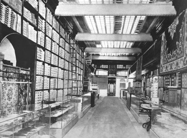
Interior of the Bazar Frances. (F. E. Jackson, Makers of the Panama Canal, 1911, p. 417)
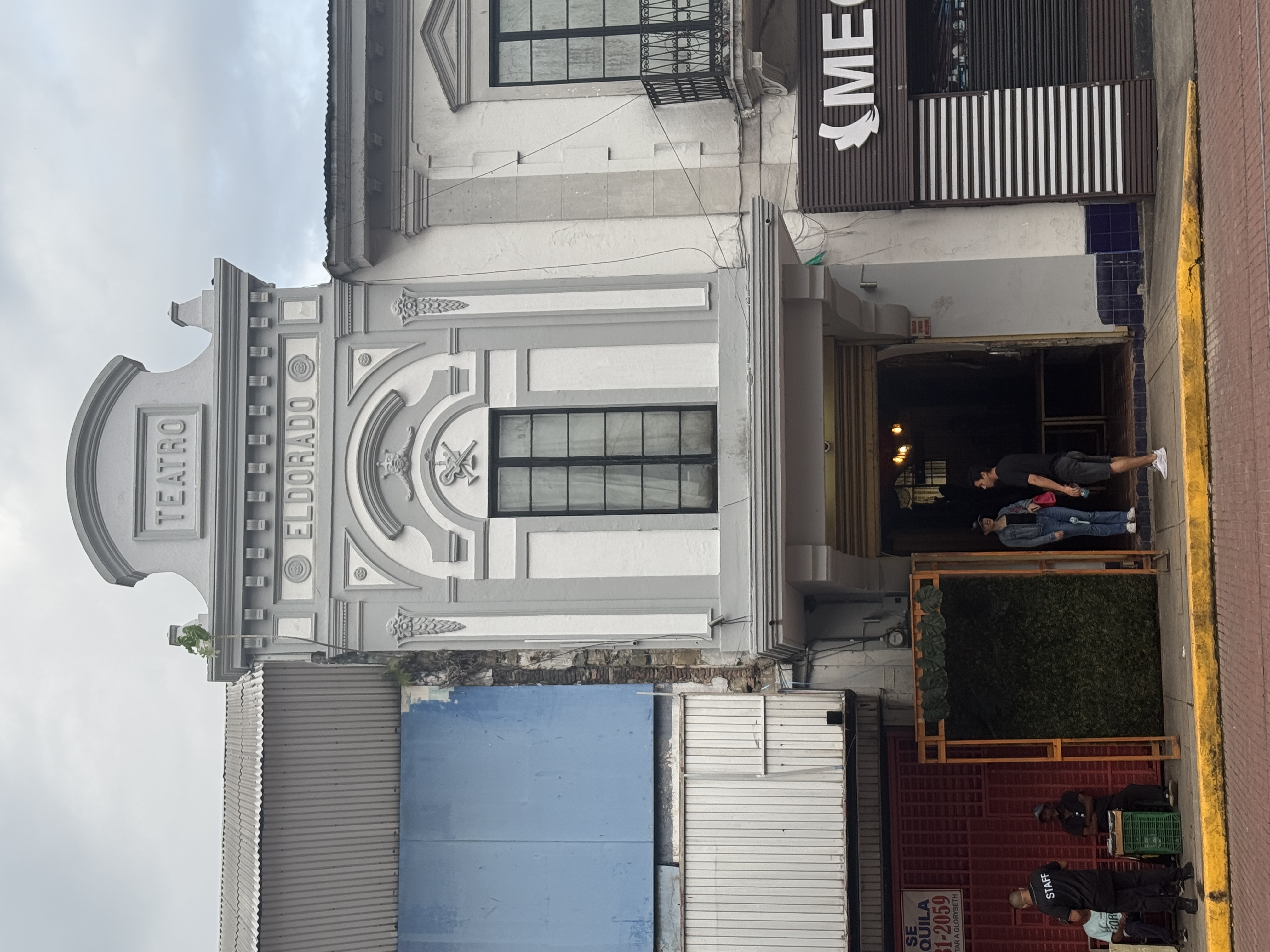
In the same block, a theater.
Around the corner, the Teatro Variedades, erected 1911-12.
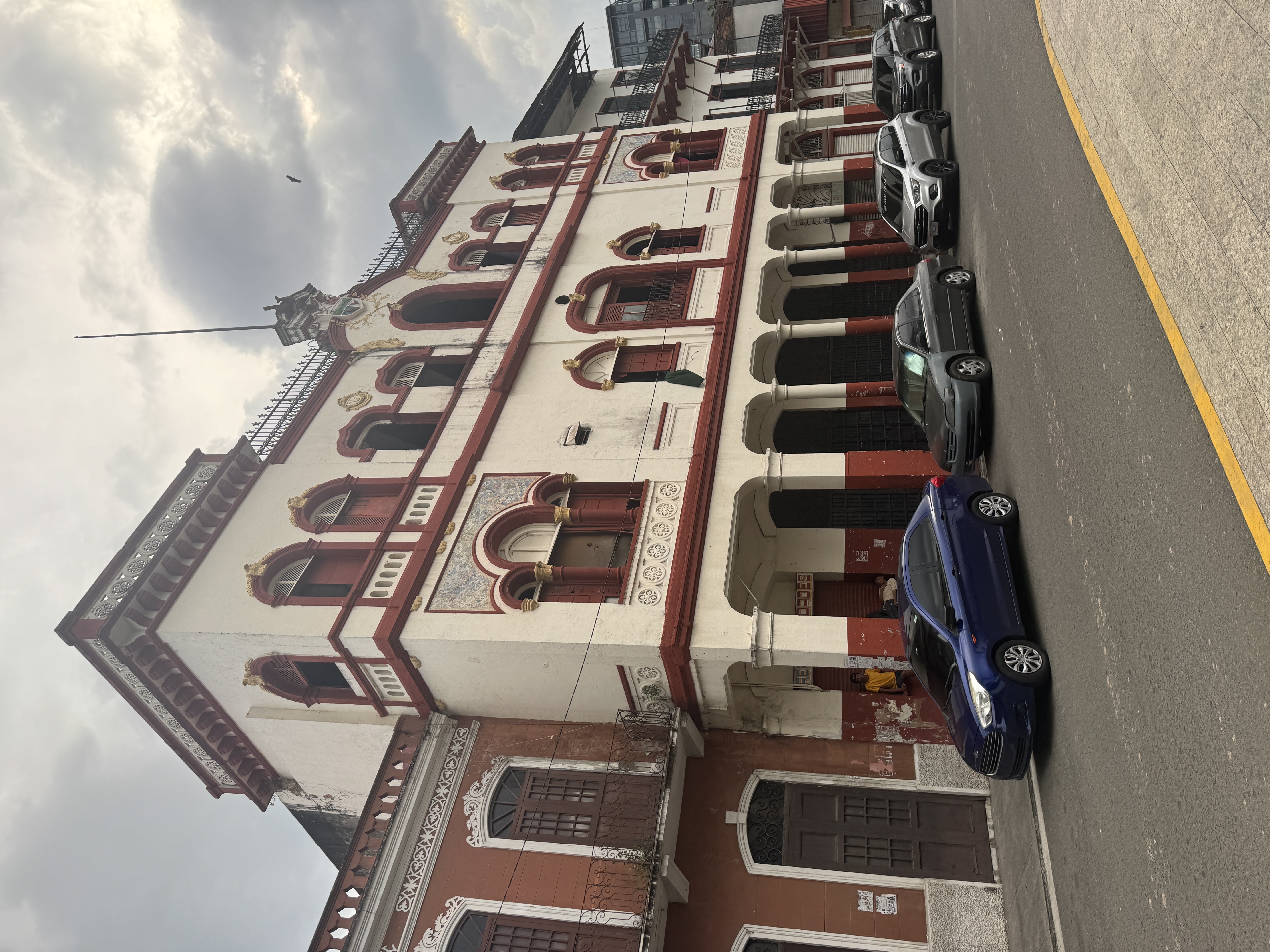
The Antonio apartment building, from 1928. Known popularly as La Pollera, it was designed by a Peruvian architect, Leonardo Meyer, who seems to have been the first architect to make Panama his home.
There's lots of mansards and a good deal of Art Deco.
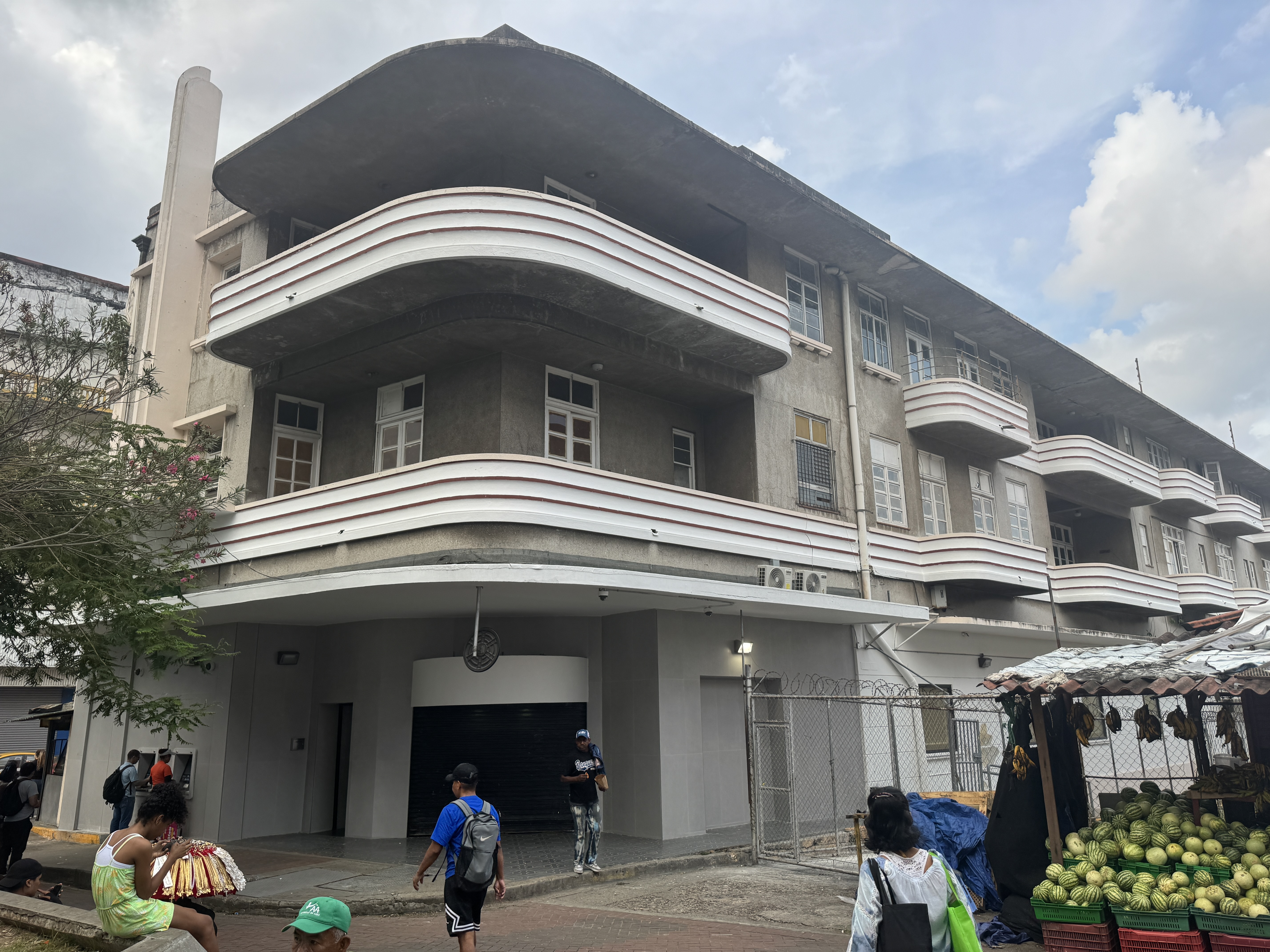
Moderne, too.
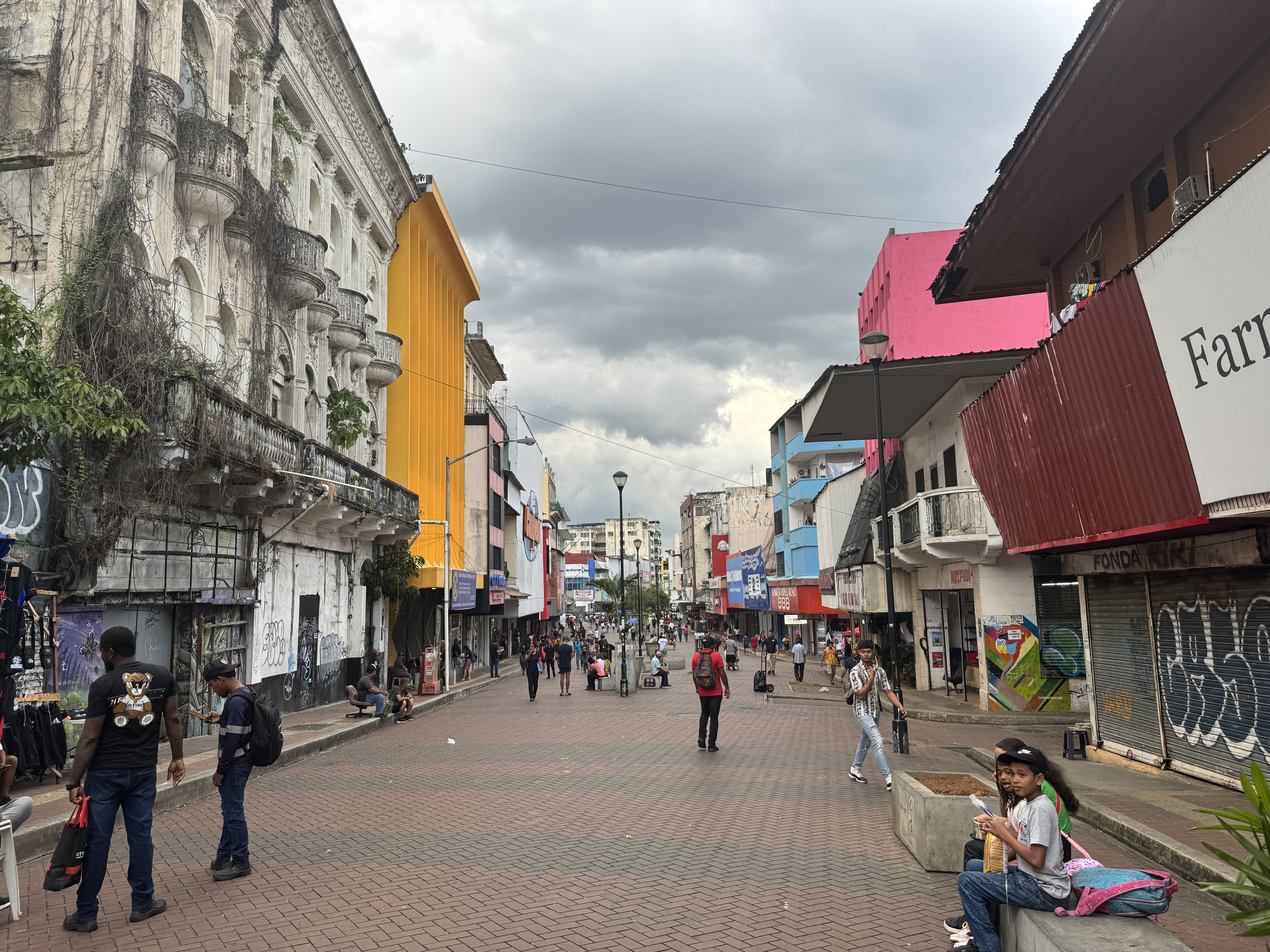
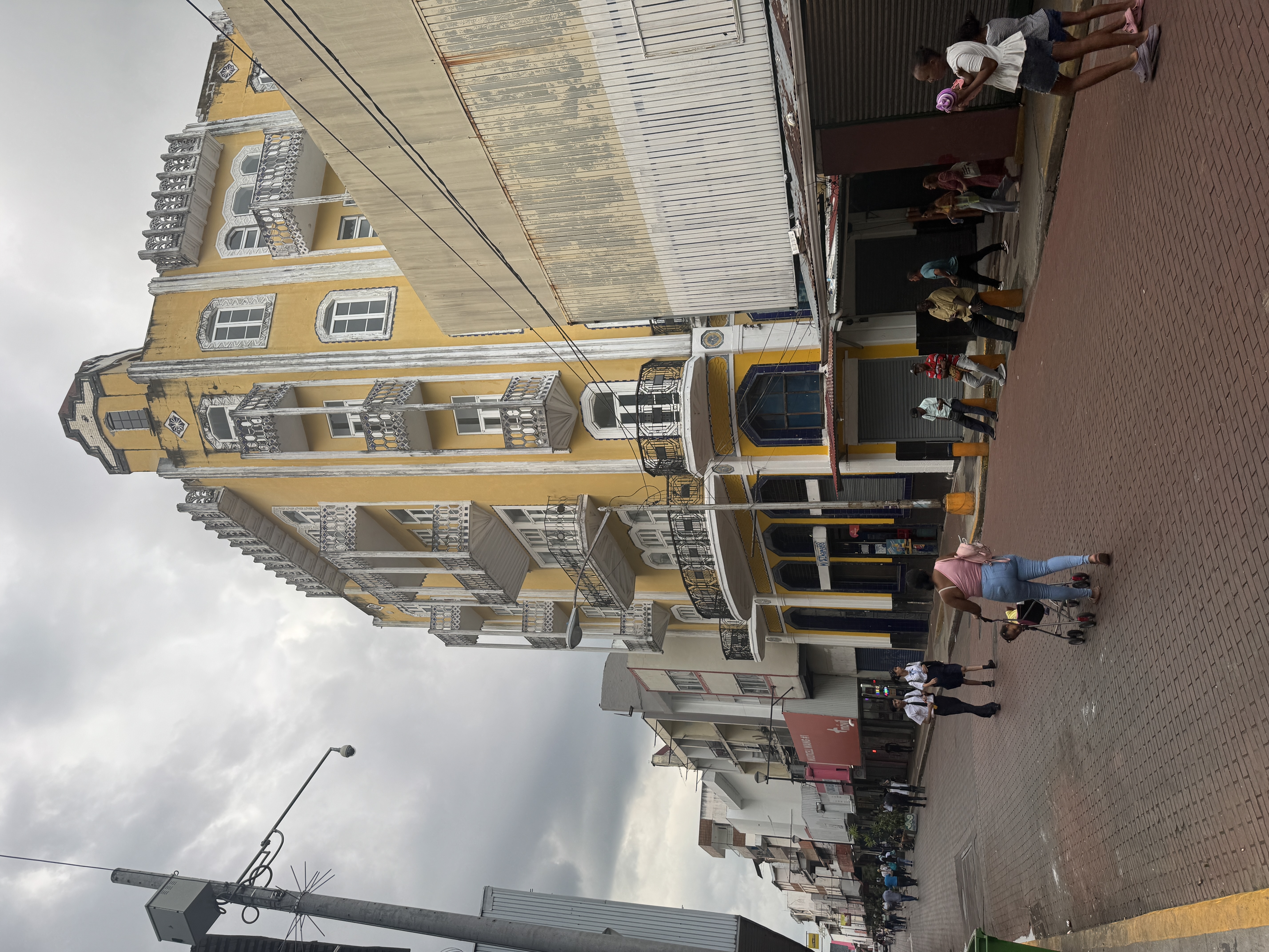
Part of the street (it's Central Espa a) has been pedestrianized, but all the new brick pavers in the world haven't spurred much renovation.
There are lots of old buildings that need work.
Here's one in good shape and celebrating the Canal.
The central mural is definitely the Culebra (for a long time it was called the Gaillard) Cut. The one of the right is a melange, and the one of the left seems to celebrate the Spanish arrival.
Another building in trouble. It must have been stylish in the 1920s.
And yet another, this one open to the sky. It's probably the International Hotel, opened in 1912.
"...fitted up with all modern conveniences." (John O. Collins, The Panama Guide, 1912, p. 153)
Here it is in a 1940's postcard. (Edith Crouch, Architecture of the Panama Canal Zone, 2014, p. 411)
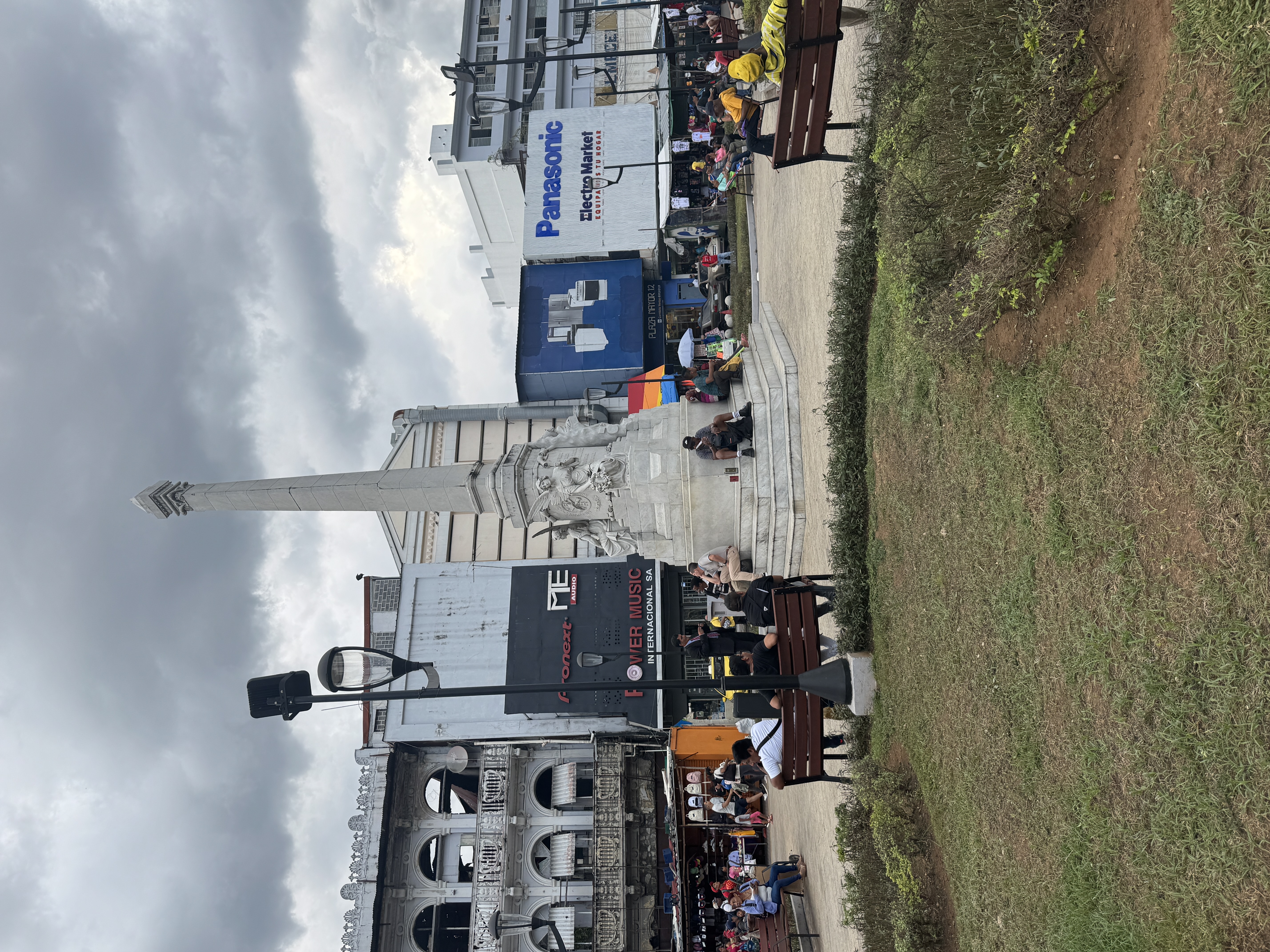
Here it is in the distance and facing the 5th of May Plaza, with its monument not to Mexico's Cinco de Mayo but to six firemen who died fighting a blaze that erupted on May 5, 1914.
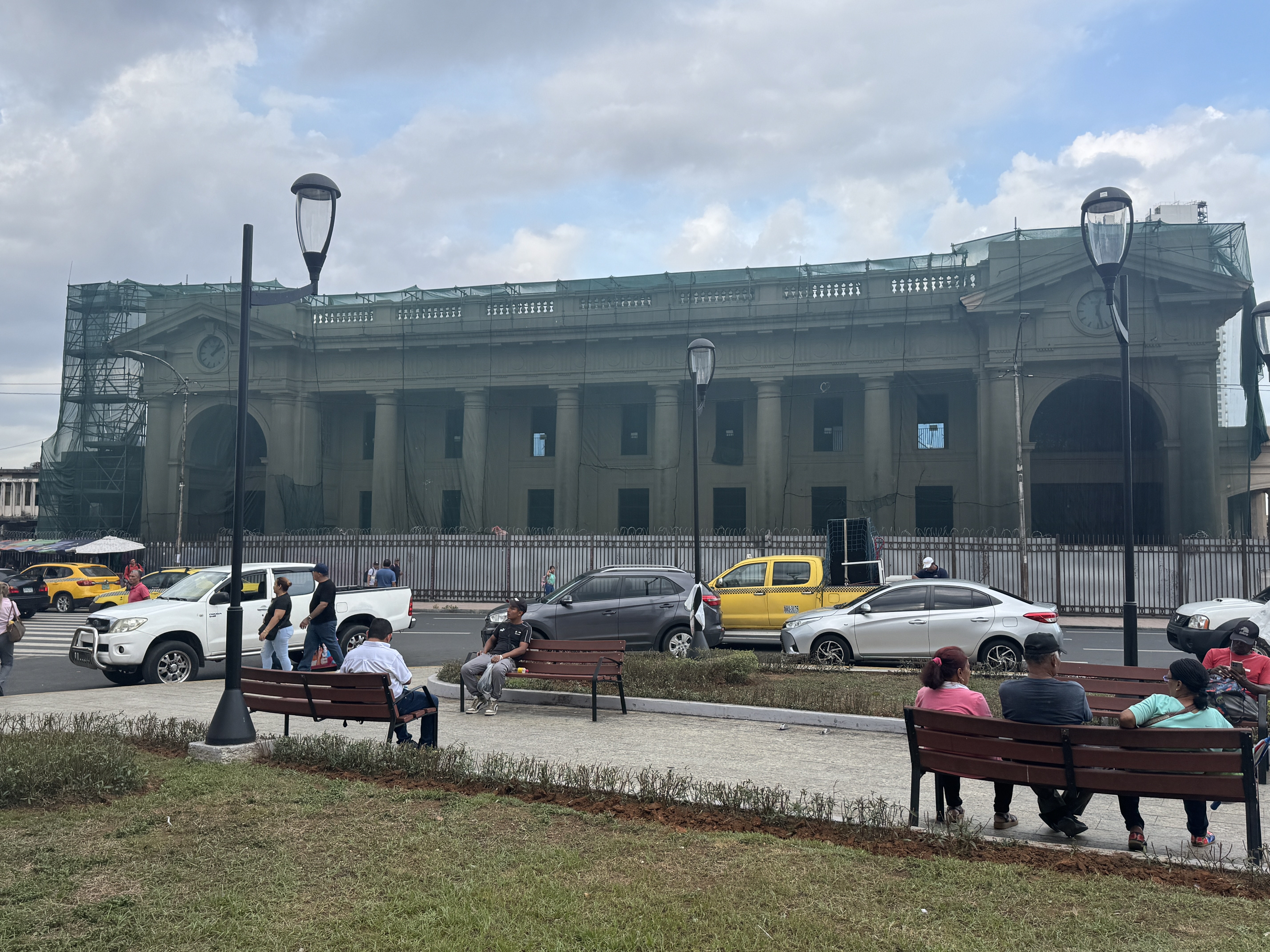
The monument also faces the main railroad station, which opened in 1913. It sure looks American but was described when new as a "free adaptation of the stucco architecture of Palladio as found in Vicenza." Under renovation in 2025, it had for some years been the Higher Institute of Fine Arts. When did the railroad pull out? No idea. Shameful! (Edith Crouch, Architecture of the Panama Canal Zone, 2014, p. 312)
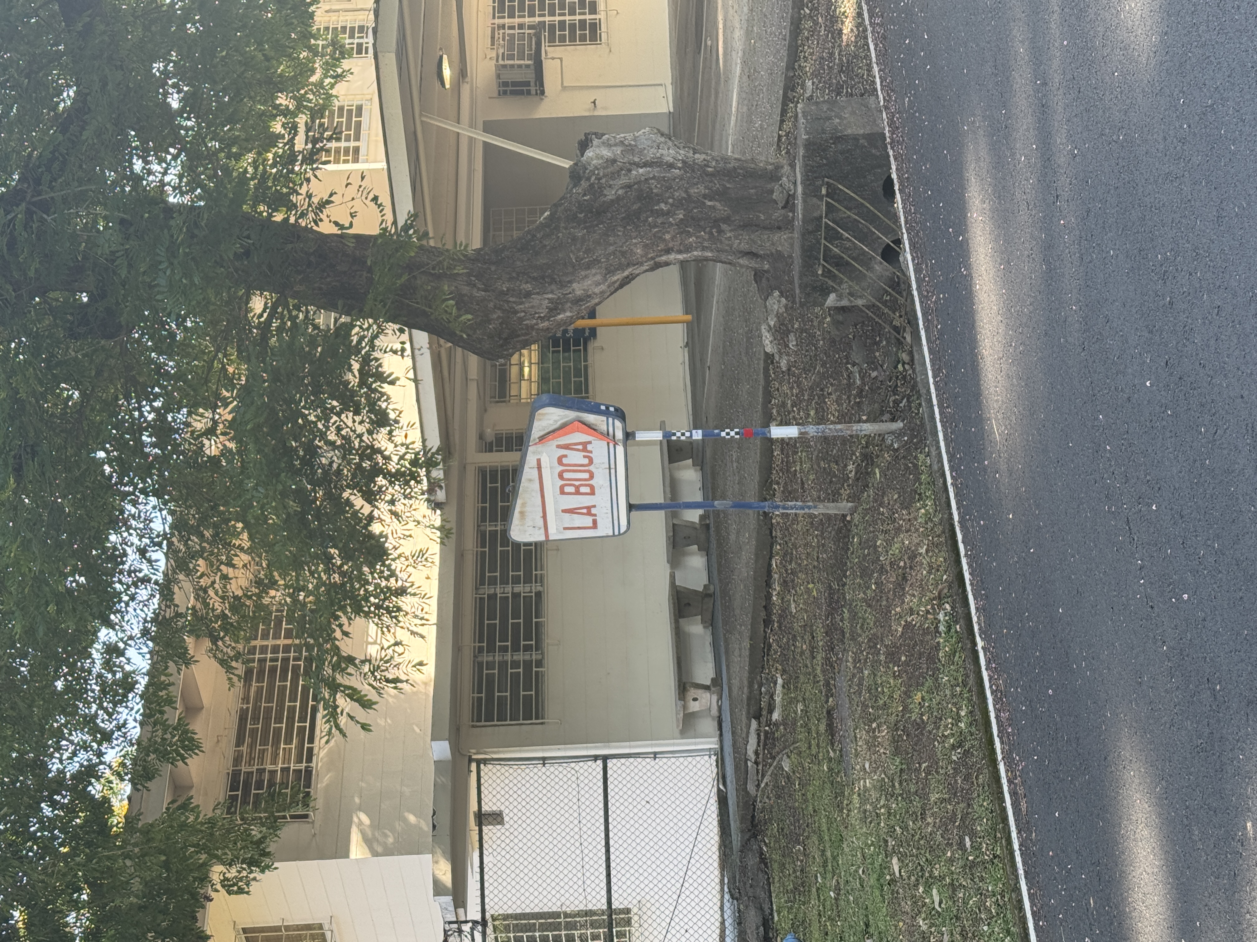
The station is at the upper right, now marked by the city's metro system, which opened in 2014. The Panama Canal had opened exactly 100 years earlier. By then, new towns like Balboa and La Boca were being built for Canal workers.
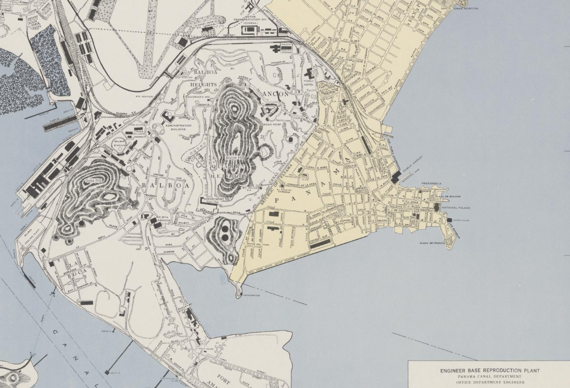
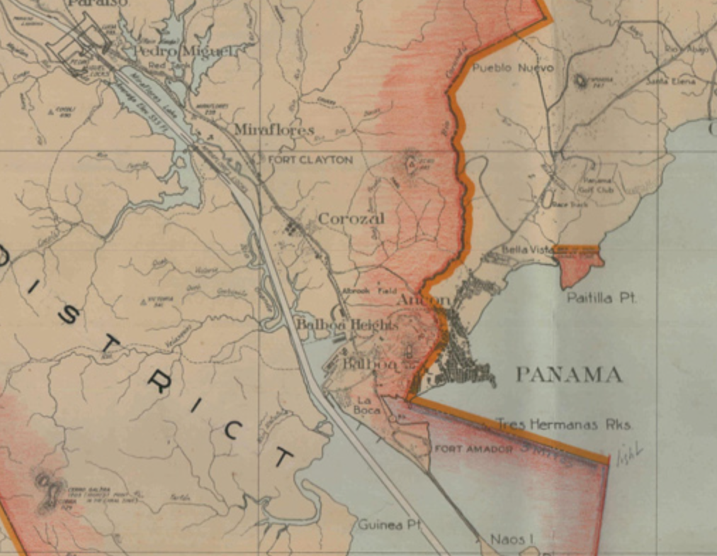
As the map shows with color, the Casco Viejo was not in the Canal Zone, but Ancon Hill and the towns of Balboa and La Boca were. (Demarcated in 1903, the Zone disappeared in 1979. Blame Jimmy Carter or thank him. Your politics, your choice.) https://wtbl.nyc3.cdn.digitaloceanspaces.com/3c5864b69782d3a6dc7c2e3ac81382bf#orig=/u/bwallach/_sha256/3c5864b69782d3a6dc7c2e3ac81382bff18be8d04df5bf74b18a4dbac5015b8b
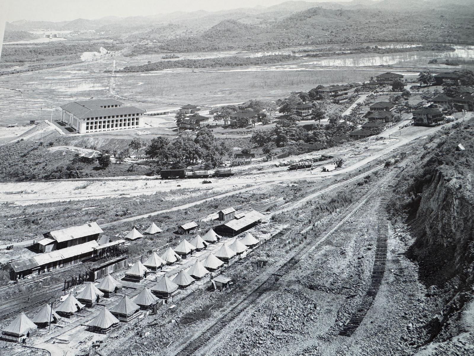
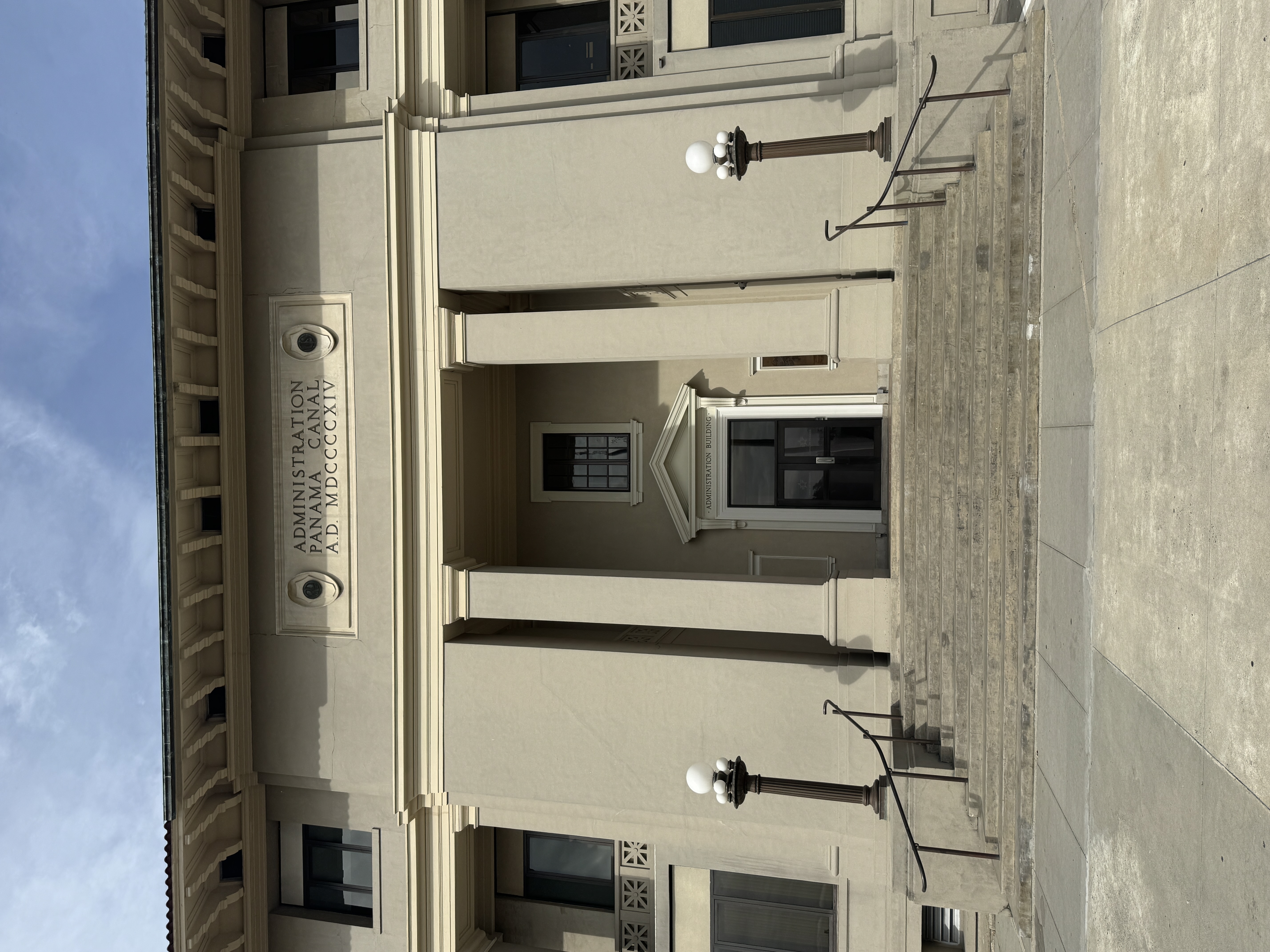
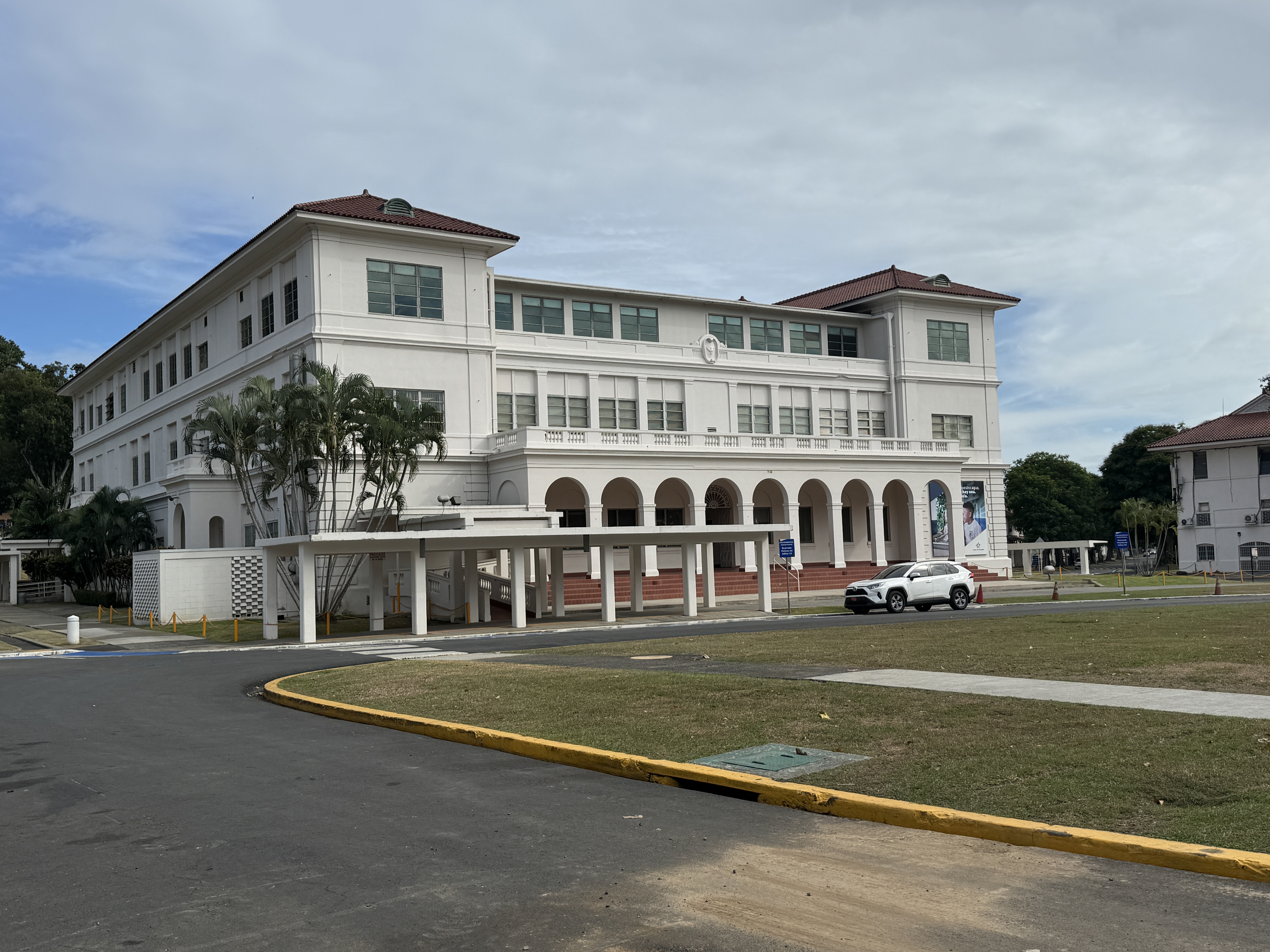
Here is the then-new headquarters buildings of the Panama Canal. It's in Balboa and (of course) is on a hill, from which officials could gaze over the level plain created with fill from canal excavations. (Edith Crouch, Architecture of the Panama Canal Zone, 2014, p. 80)
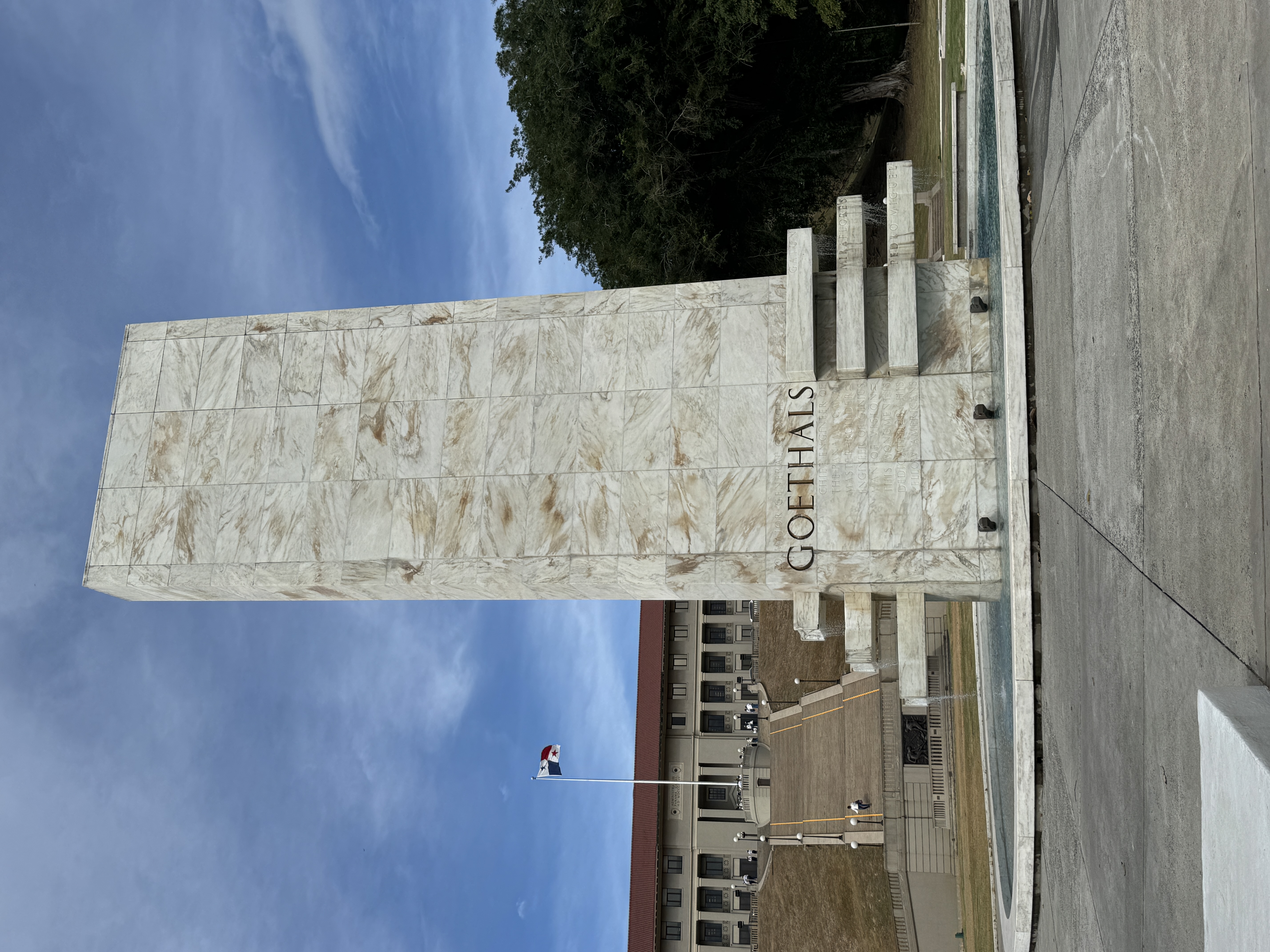
The building's architect was Austin W. Lord, director of the school of architecture at Columbia University. He wanted something grander than this but was opposed by the Canal boss, Col. George Goethals. Don't bother asking: Goethals won.
Lord was so distressed that he quit within a year, retired to Connecticut, and spent most of the rest of his life painting. Goethals went on to be quartermaster general of the U.S. Army in World War One. His right-hand man was Robert E. Wood, who later ruled Sears, Roebuck for many years. Looking back in retirement, Wood said of Goethals, "I was his assistant for seven years, and I might say that everything in my life since has seemed comparatively easy." (Robert E. Wood, Monument for the World, 1963, p. 34)
There had been a long, long debate about whether the canal should be built at sea level or built with locks. Goethel's predecessor, the charismatic John Frank Stevens, argued for locks, chiefly because, given the tidal difference between the two ends of the canal, a sea-level canal would have to be at least half a mile wide. Stevens won the debate with the man who mattered, Teddy Roosevelt. A year later with construction work going into high gear, Stevens resigned. People wondered why. Stevens much later called them "irresponsible scribblers.... stupid and mendacious... I knew better than anyone else that the work was so well organized... that competent engineers ... could be found to carry it on to a successful completion." I'd call that a not-so-veiled criticism of his successor, Goethals, but I'm also glad that Stevens isn't around to defend himself with what one acquaintance called "the sulphurous rhetoric in which he had such wonderful virtuosity." The locks are symbolized here by the lateral arms, from which you can see water flowing. (Stevens was a protege of the titanic James J. Hill, and the name Stevens will be familiar to many people in the State of Washington, where Stevens surveyed the route followed by the Great Northern Railway over what is now Stevens Pass. He located the route over Marias Pass, too, in the Rockies just south of Glacier Park.) (John F. Stevens, An Engineer's Recollection, 1946, pp. 40 and 53; William Franklin Sands, Our Jungle Diplomacy, 1944, p. 38)
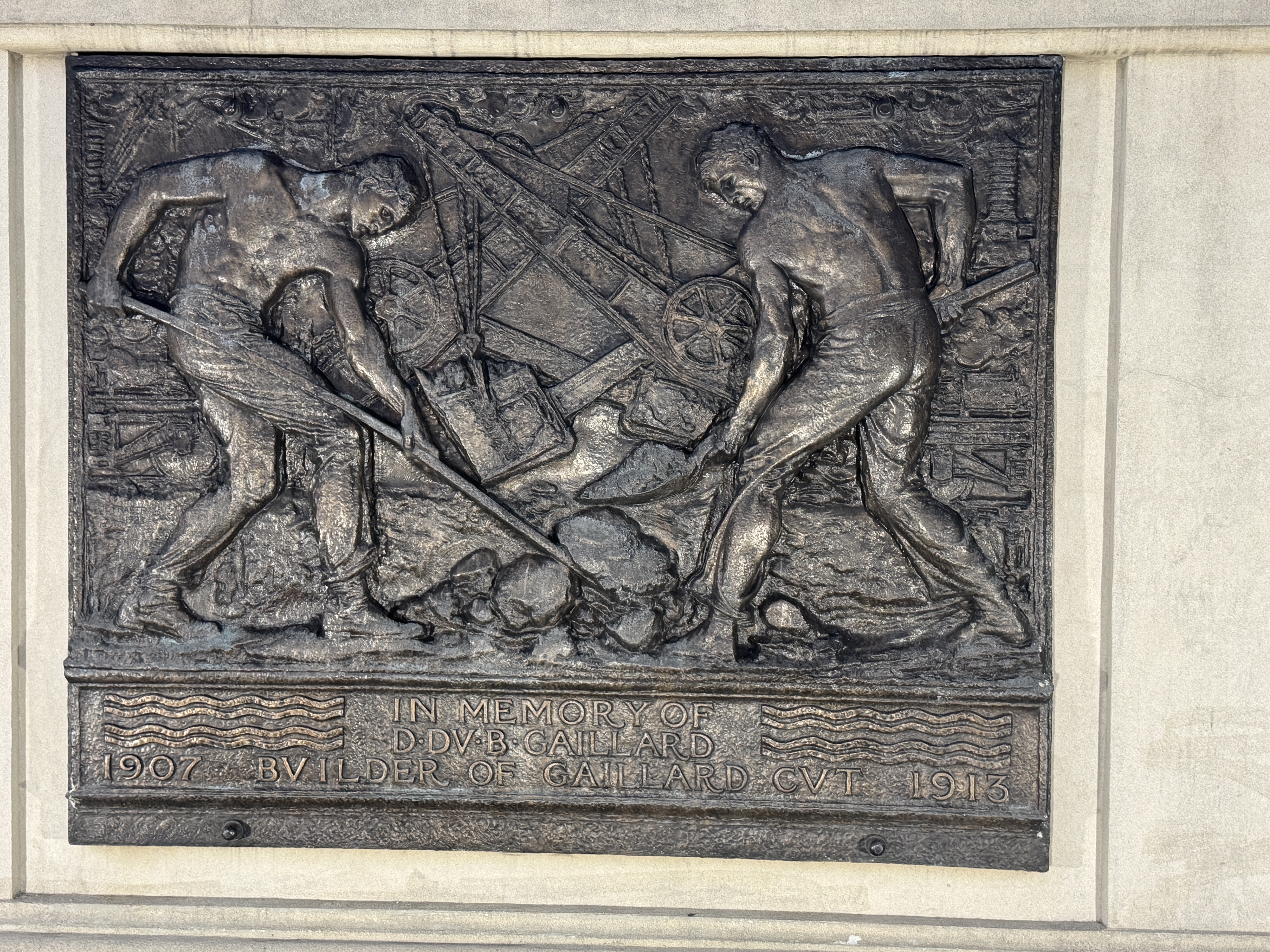
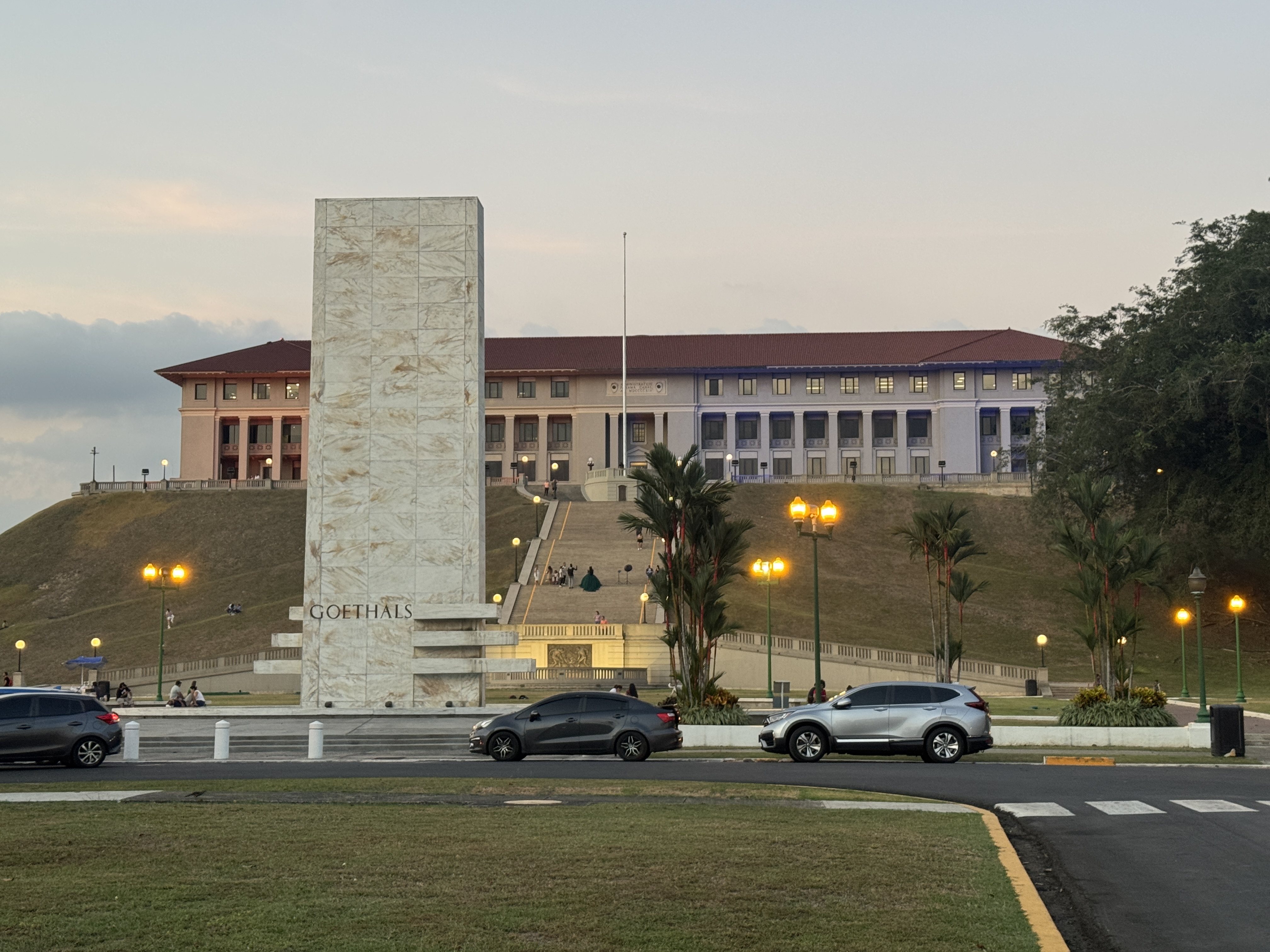
Behind the Goethals Memorial there's a plaque remembering David Gaillard, the engineer who supervised the excavation of the Culebra Cut through the highest point on the isthmus, which is to say through the Continental Divide. In his honor, the cut was named the Gaillard Cut in 1915, but the old name was restored in 2000.
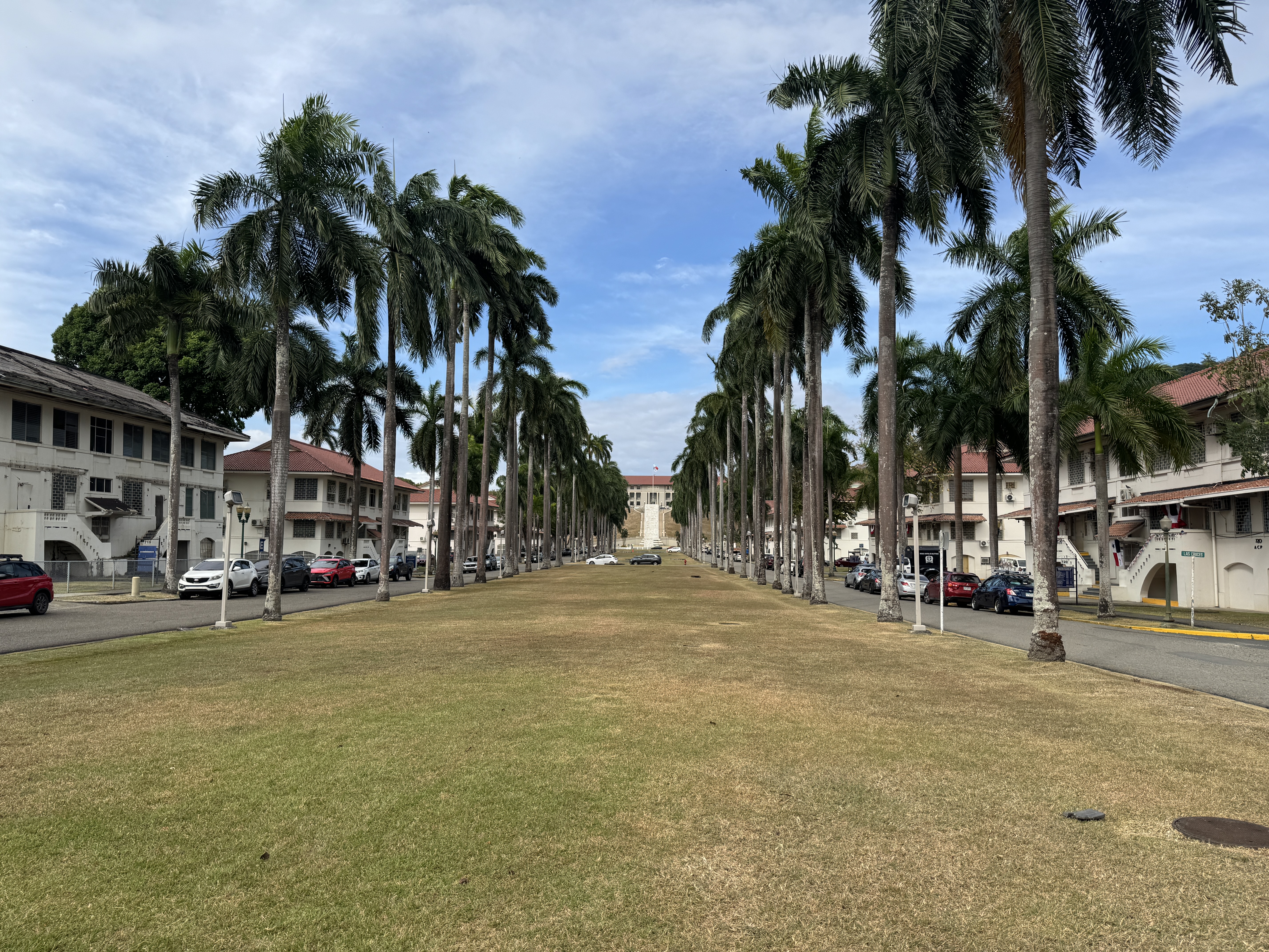
A view up the overlong Prado, with the Goethals Memorial and Administration Building in the distance. If you ever want to understand the engineering mentality, remember that the landscape architect who laid out this lawn, William L. Phillips, was told by Goethals to make it exactly 1000 feet long and 110 feet wide. Why? Do you have to ask? It's obvious: those are the exact dimensions of the Panama Canal's locks. (Phillips escaped and went on to design, among other things, much of the Fairchild Tropical Botanic Garden in Miami.)
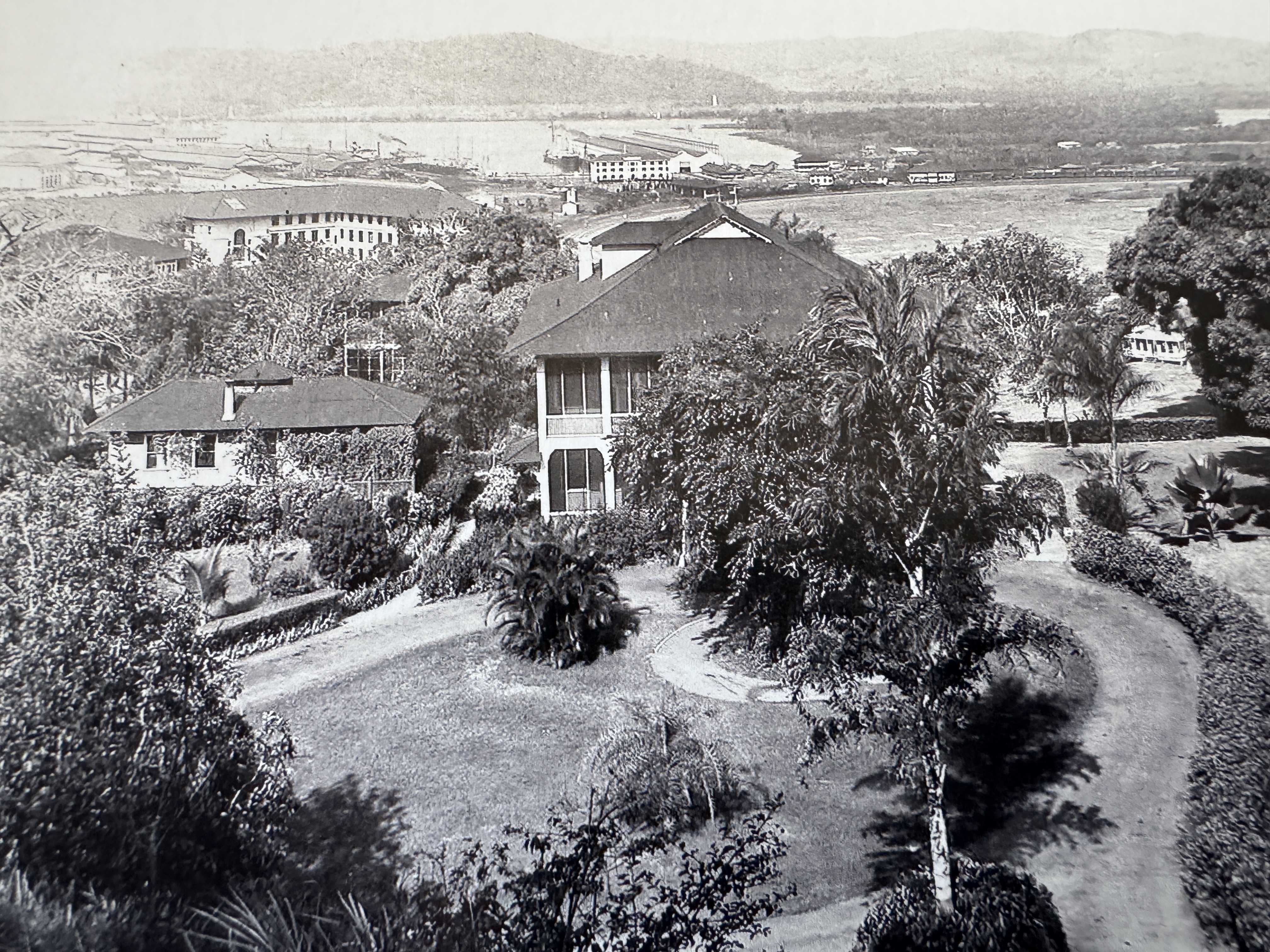
Here, seen in 1920 and farther up the hill from the Administration Building, is the house built for Goethals (Edith Crouch, Architecture of the Panama Canal Zone, 2014, p. 357)
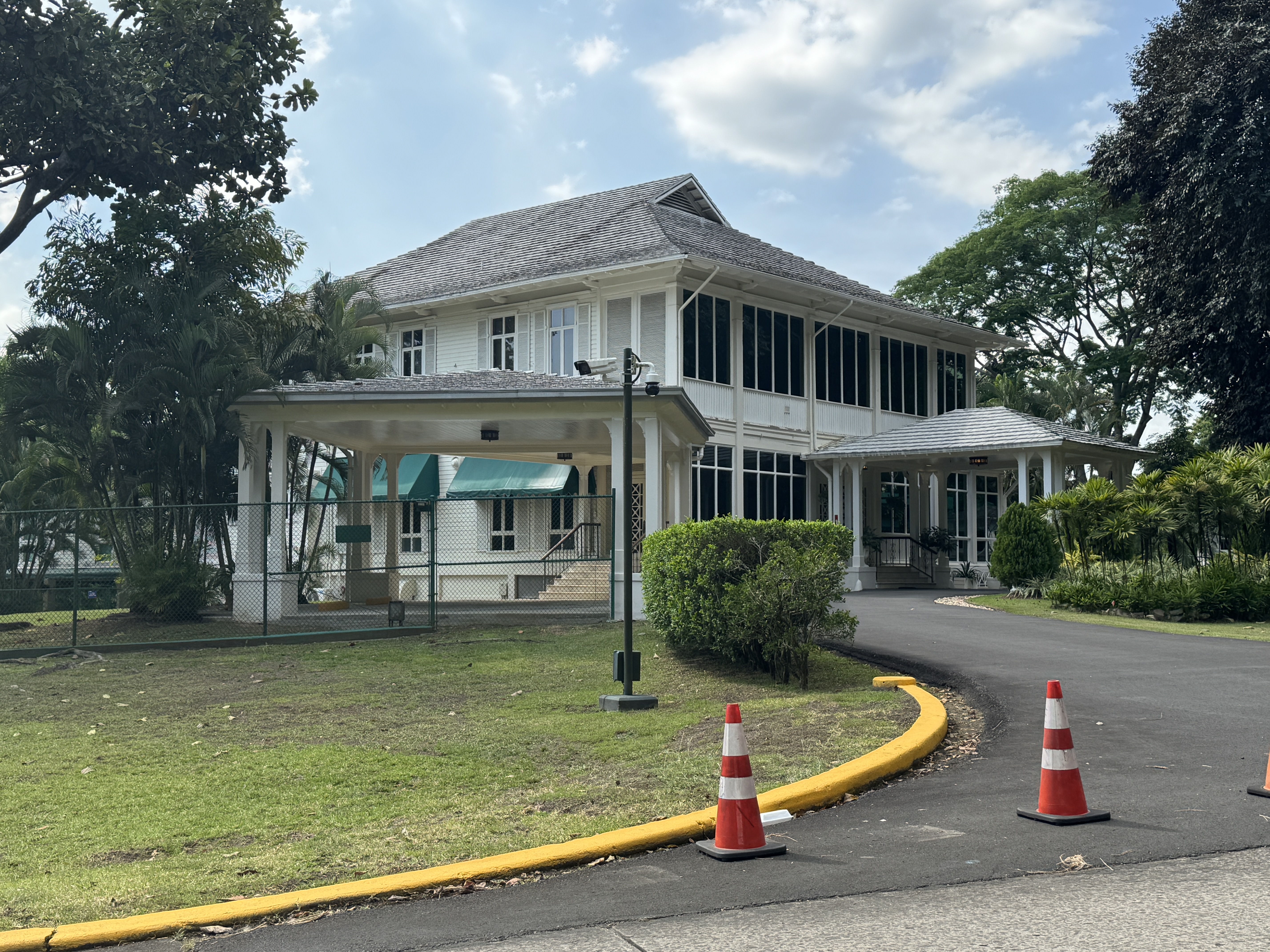
It's still there for a senior canal official.
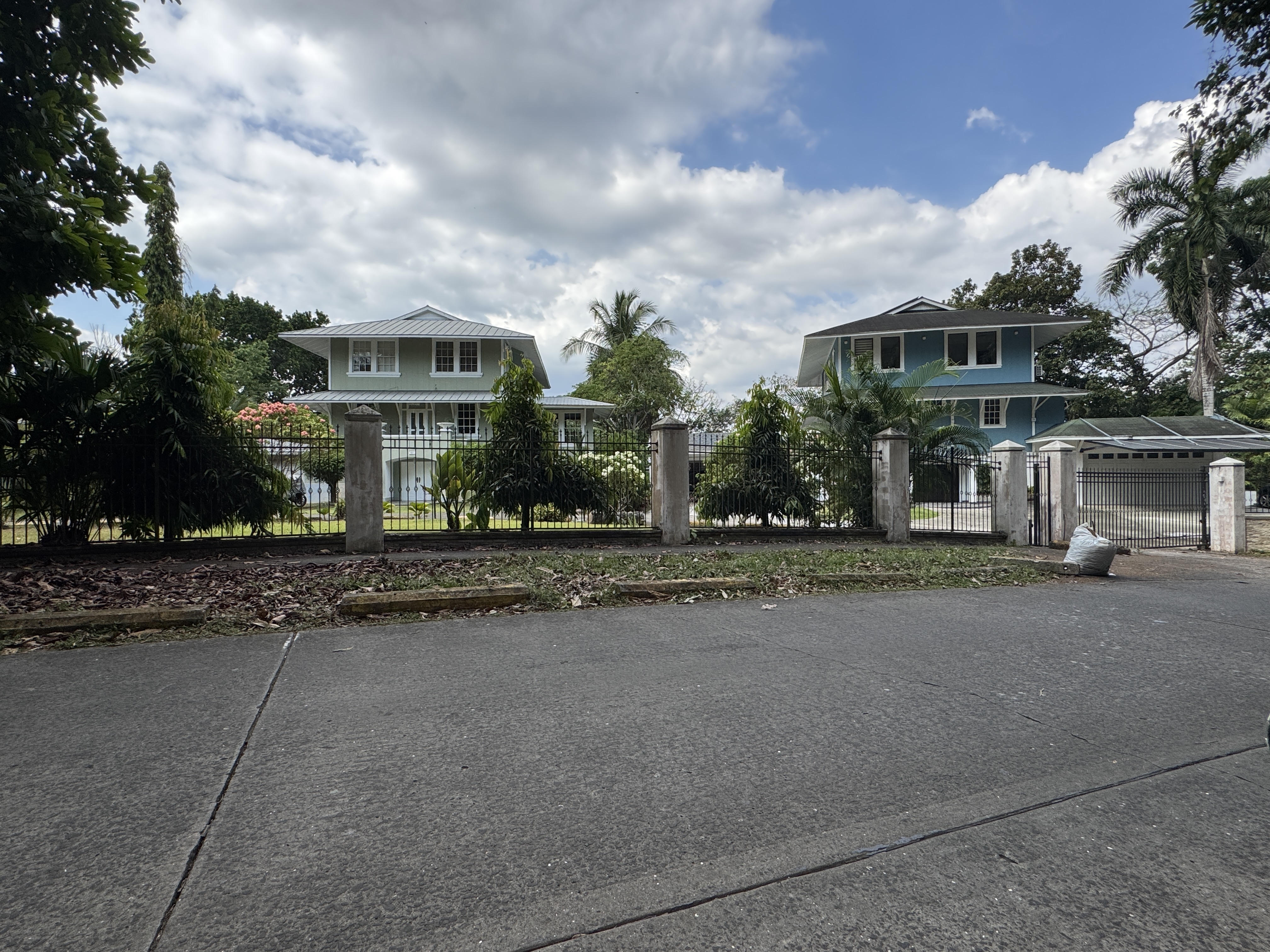
Housing across the Canal Zone was as hierarchical as military ranks. Here are two other houses for senior officials.
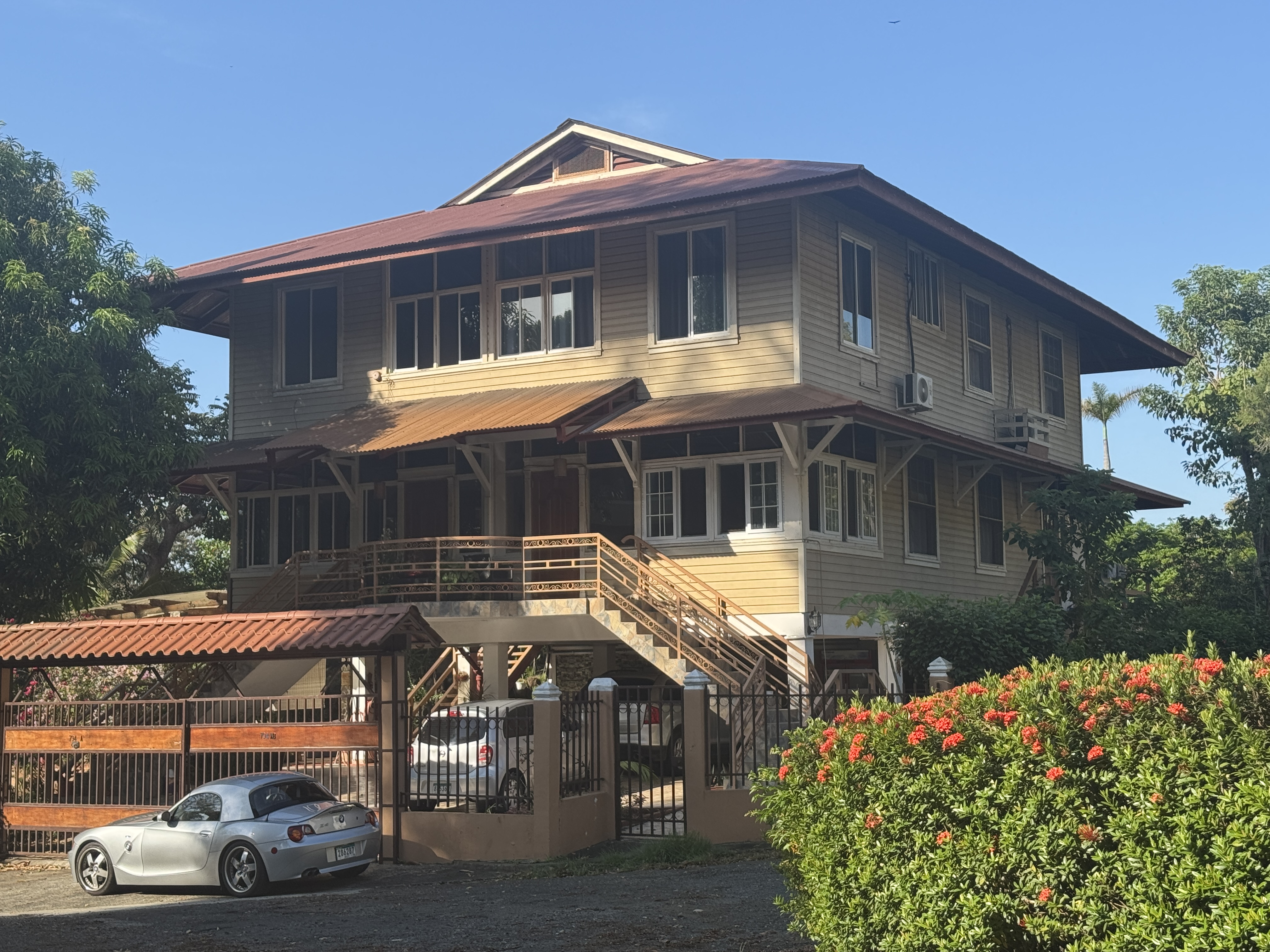
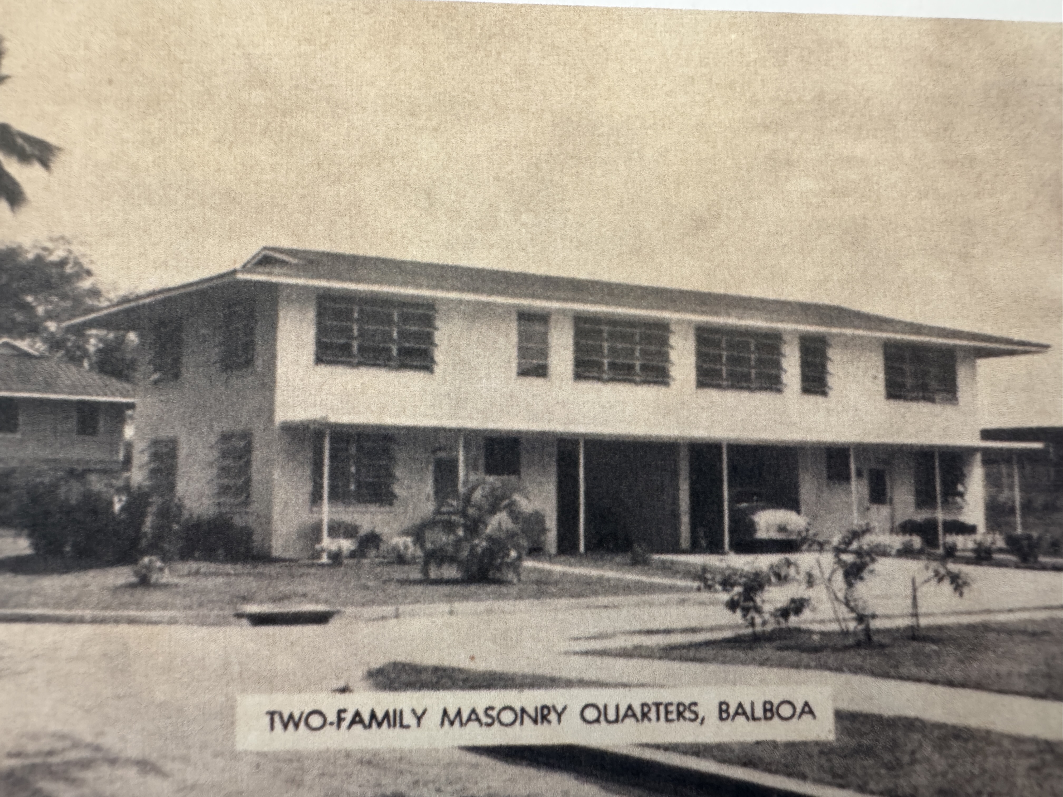
Here's a handsome duplex for men of lower rank.
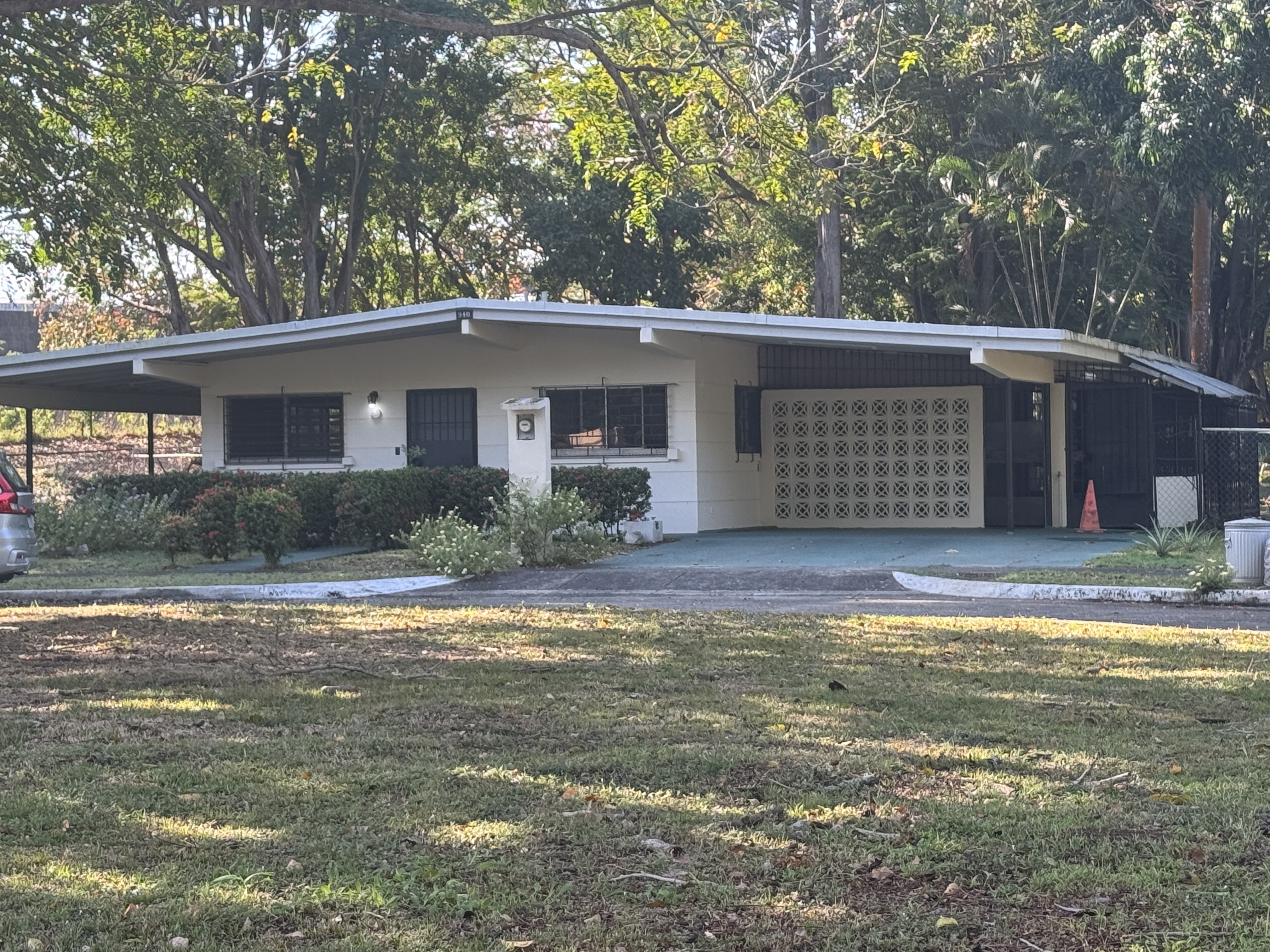
In the 1950s, many wooden houses were replaced by ones of concrete. (Edith Crouch, Architecture of the Panama Canal Zone, p. 307)
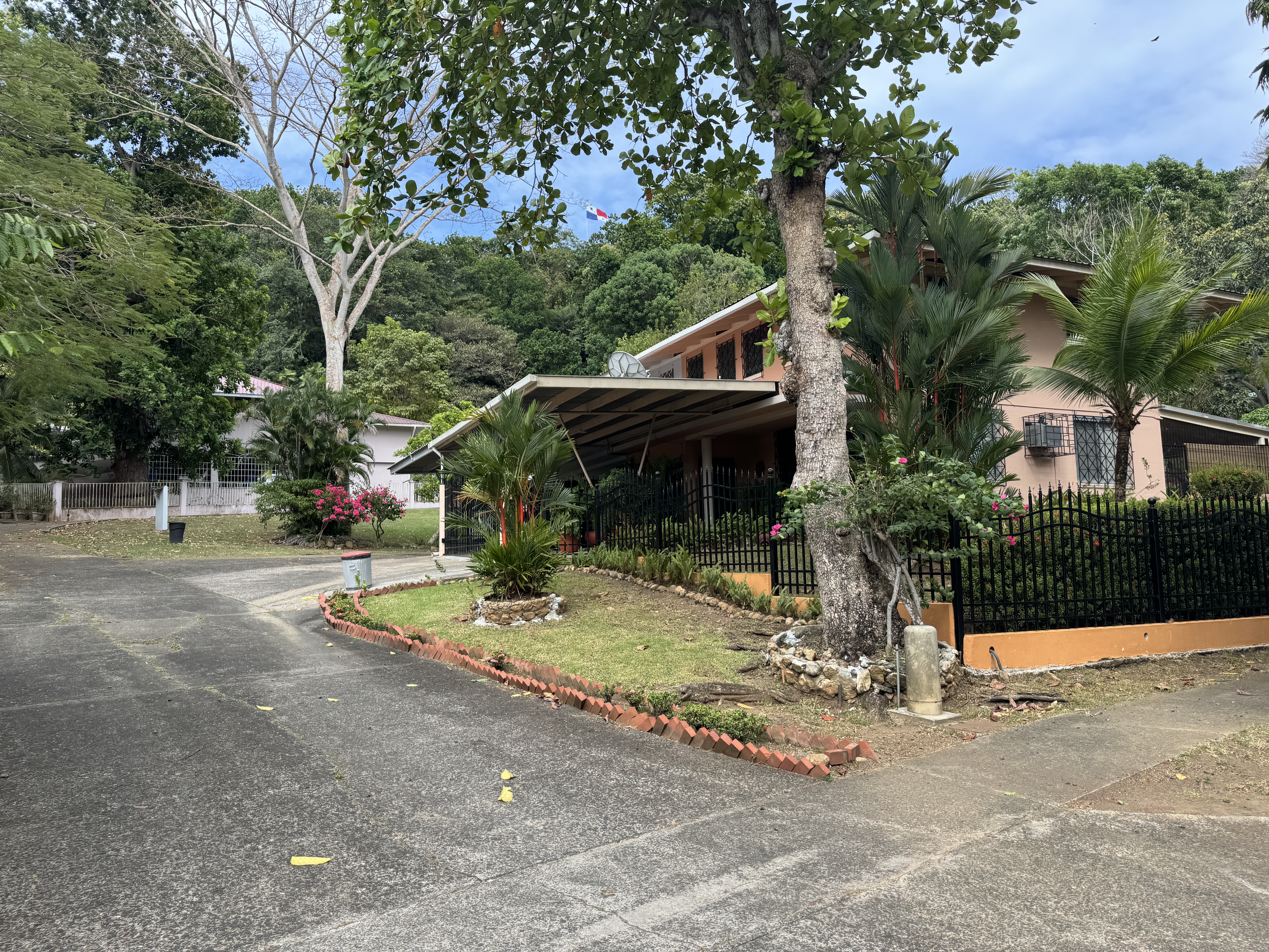
Those houses have now been privatized, and many have been modified.
The Zone was racially segregated, and as Balboa was reserved for Whites, so nearby La Boca was reserved for Blacks. (For a sense of the serene racism endemic in the Canal Zone, try this, from an article written by the engineer in charge of the Canal's Atlantic division in 1913: "The greater part of the laborers on the canal were Jamaican negroes. They were British subjects, but were ordinarily called 'British objects.' They make good servants if thoroughly trained and the routine is not varied.") (William L. Sibert in The National Geographic Magazine, Feb. 1914, p. 182)
Housing in La Boca was and remains simpler.
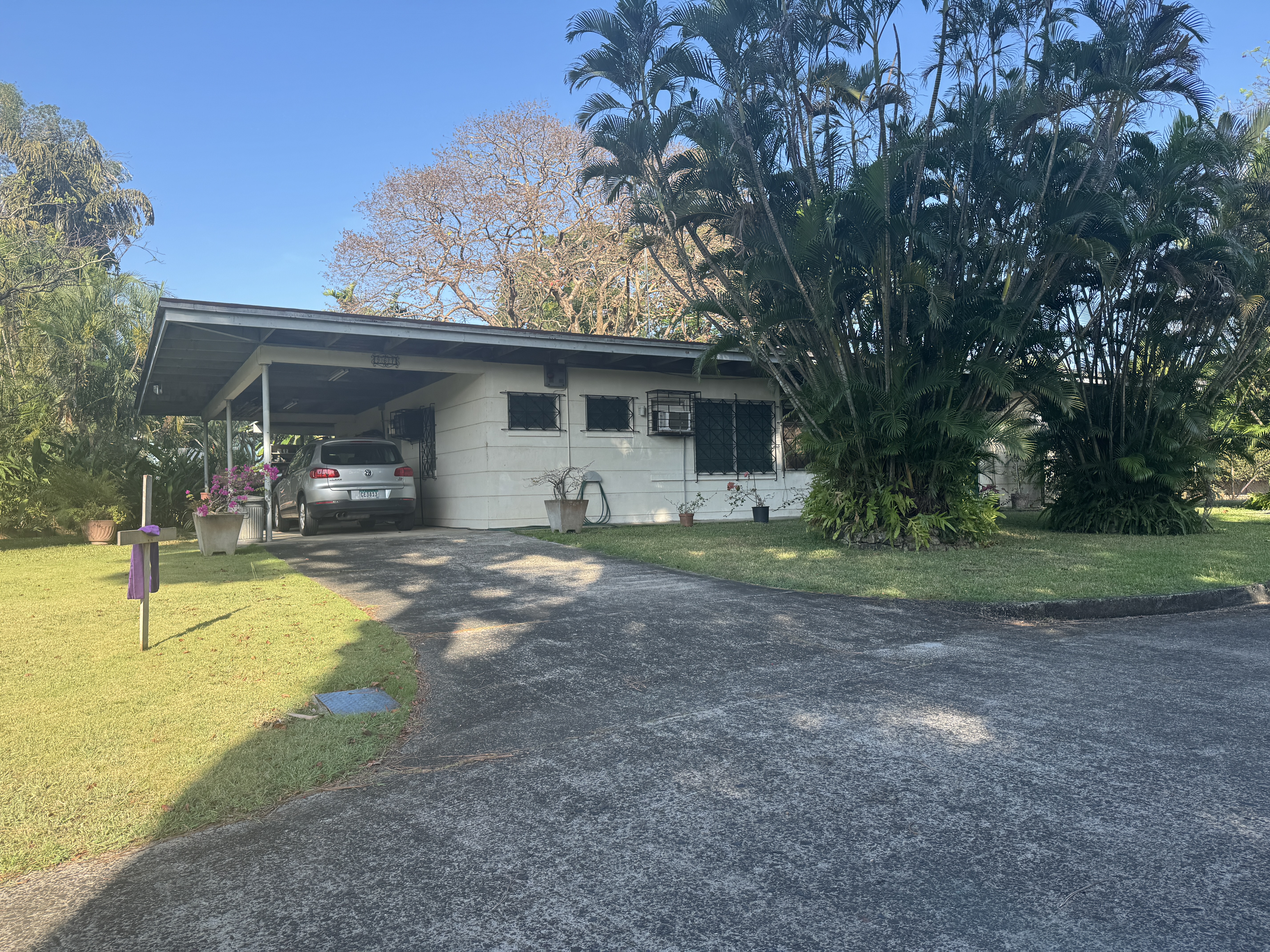
Carports were provided in later versions.
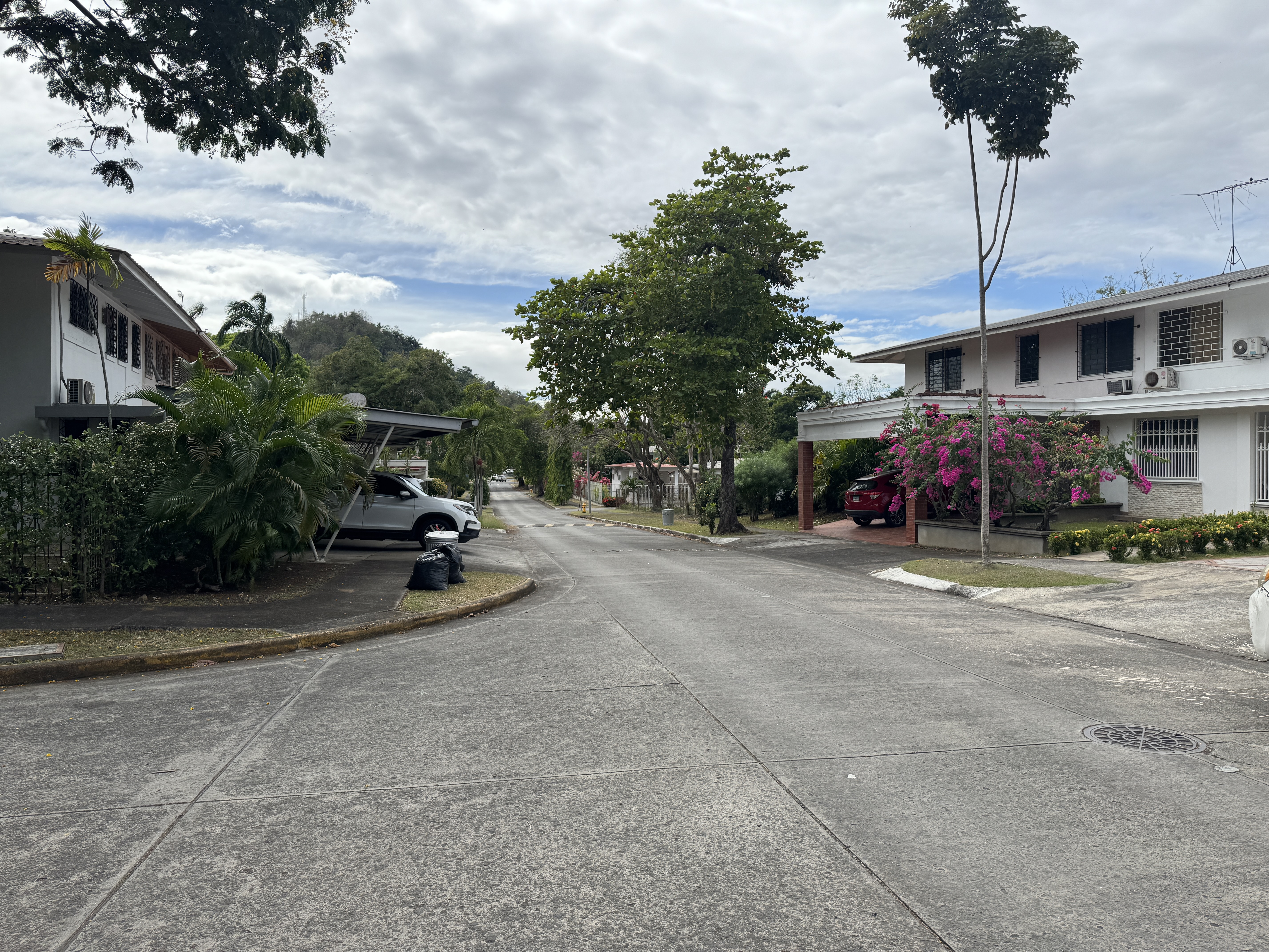
White or Black, residential neighborhoods were green and spacious. They still are. It's pretty nice, but balance it against the harsh judgment of the diplomat William Franklin Sands, here in 1906. The Zone was "a narrow ribbon of standardized buildings and standarized men working at standardized jobs. Its people had been hammered into a highly disciplined civilian army, into a mechanical state with rigid hierarchies of labor, by processes which at that time seemed utterly un-American... There is much, it seems to me, that our Panama Canal engineers could have taught Lenin or Stalin about the "rationalization" or mechanization of a human society...." Shockingly undiplomatic, but Sands was writing decades after Taft had sent him to Panama as a troubleshooter. (William Franklin Sands, Our Jungle Diplomacy, 1944, pp. 25-6)
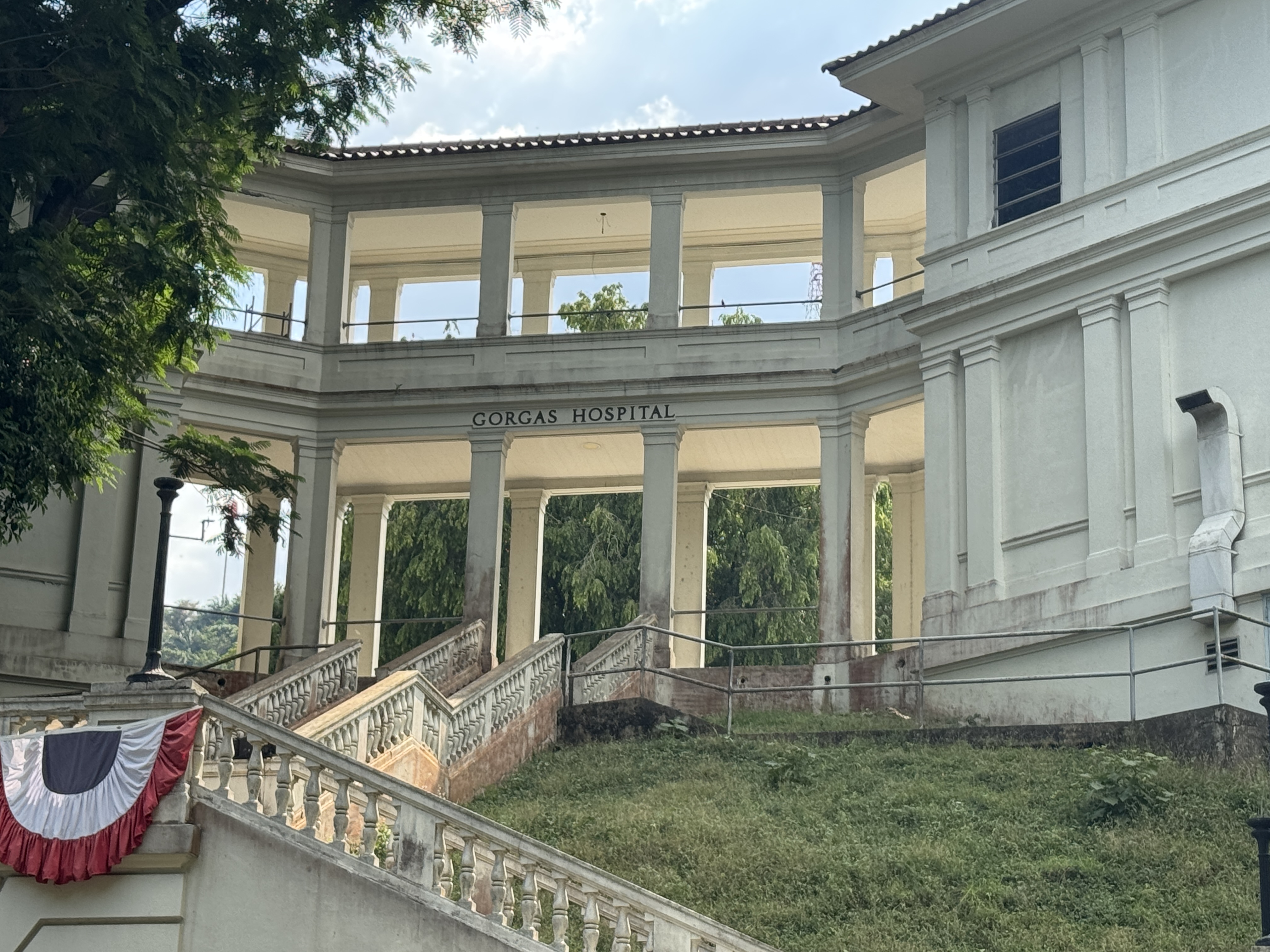
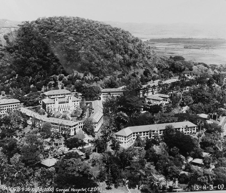
Workers who got sick were sent to the other side of the hill, where the Ancon Hospital opened in 1919. It was renamed for William Gorgas in 1928. His work clearing out mosquitoes from the Canal Zone was probably as important as anything John Stevens or George Goethals did. That may sound odd, but after Charles Francis Adams visited in 1911 he wrote that what impressed him most was not the Canal but the healthiness of the Americans he met--man, woman, child--in a country notorious for disease. "Not an insect was flitting; while the hum of the mosquito was noticeable from its absence" Gorgas didn't discover the connection between mosquitoes and malaria and yellow fever, but he knew about it, and he had the full support of Stevens and Goethals in draining and spraying and smoking the Canal Zone. Charles Francis Adams himself knew something about heavy construction: he was a former president of the Union Pacific Railroad. (Charles Francis Adams, "The Panama Canal Zone; an Epochal Event in Sanitation," 1911, p. 6)
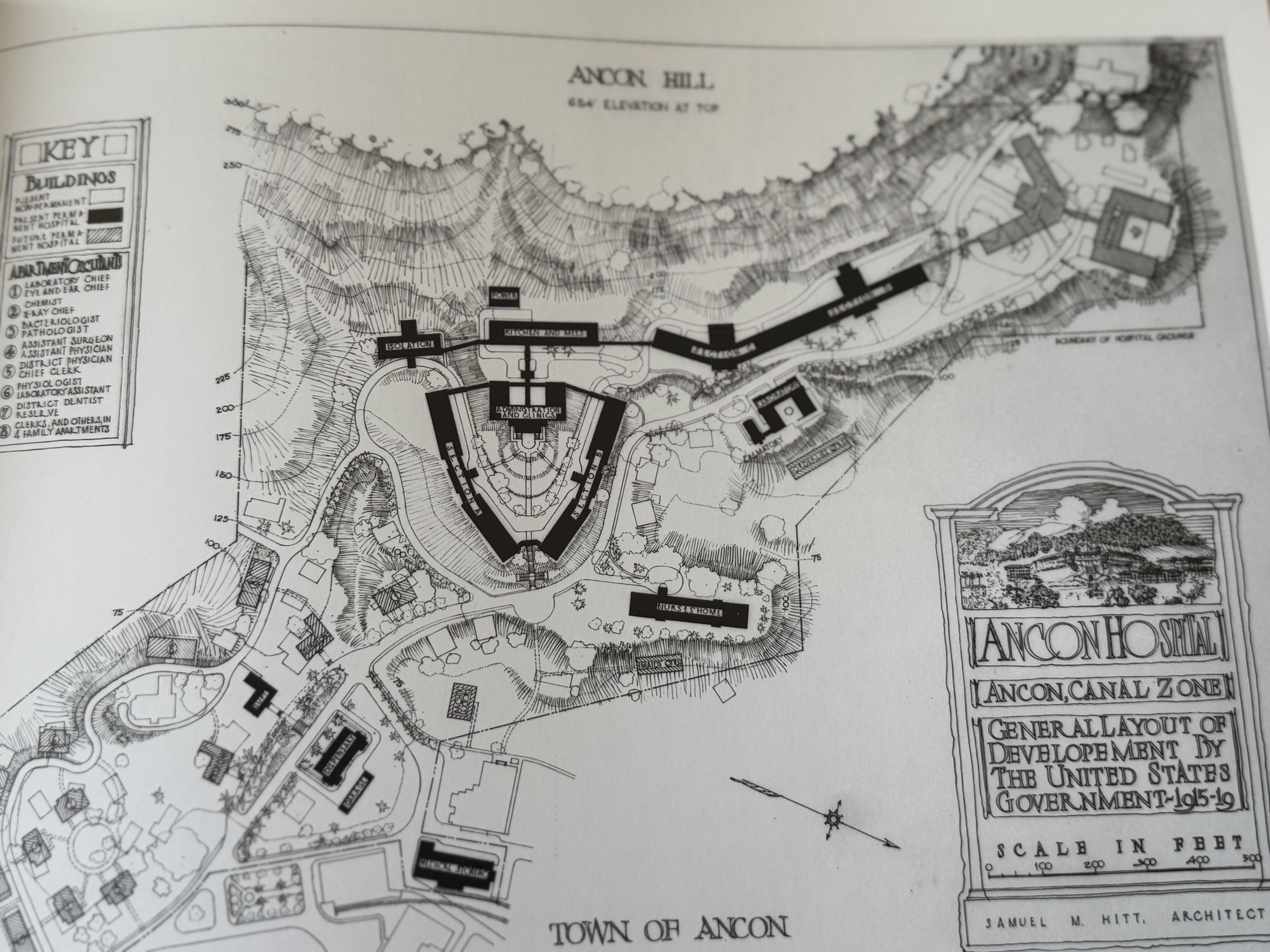
The Gorgas Hospital is hard to photograph, but the previous picture comes from the bottom of the V seen here. (Edith Crouch, Architecture of the Panama Canal Zone, 2014, p. 237)
You get the picture. https://catalog.archives.gov/id/100994750
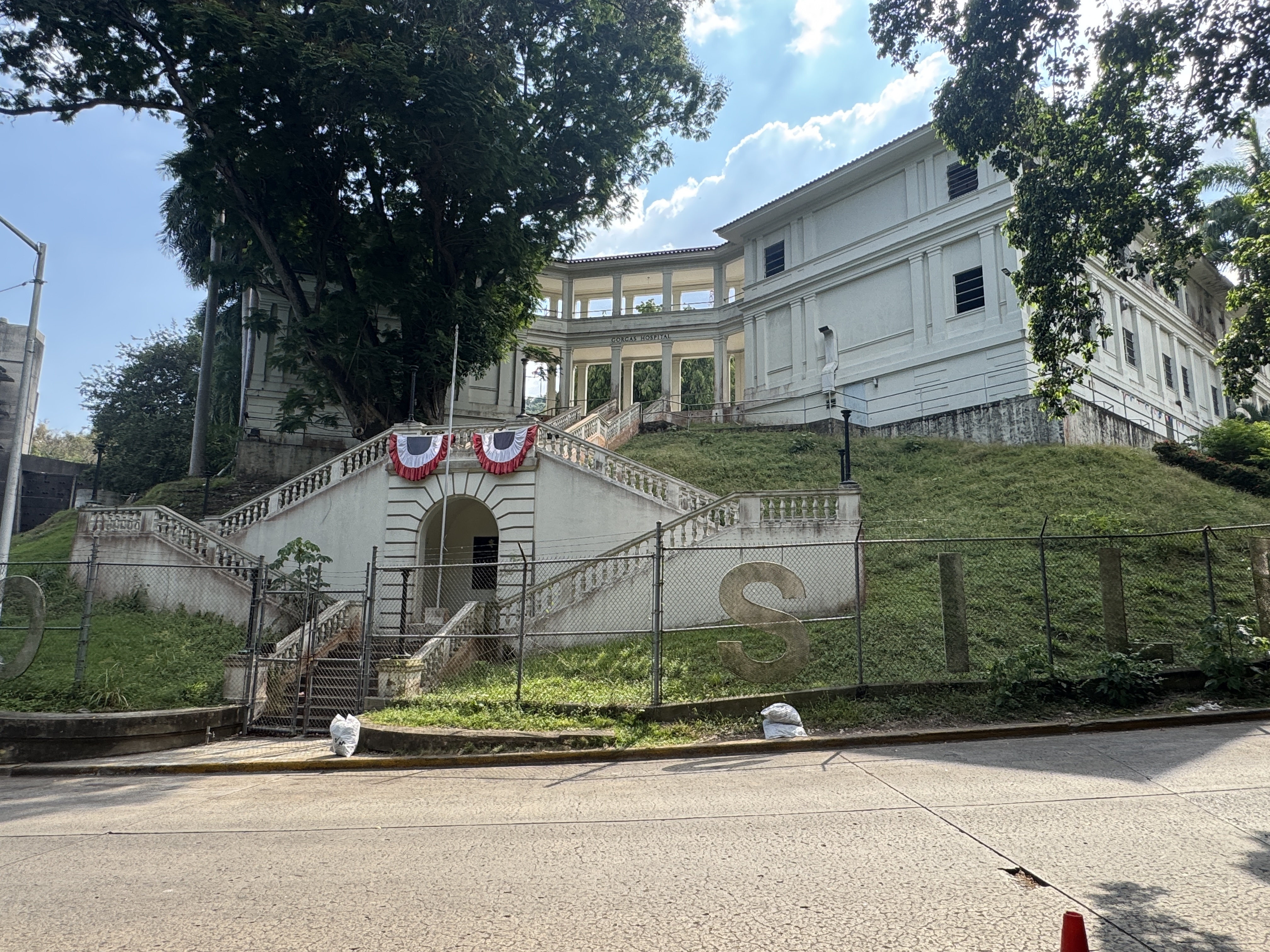
Just one more view of that angle. Sorry for the fence.
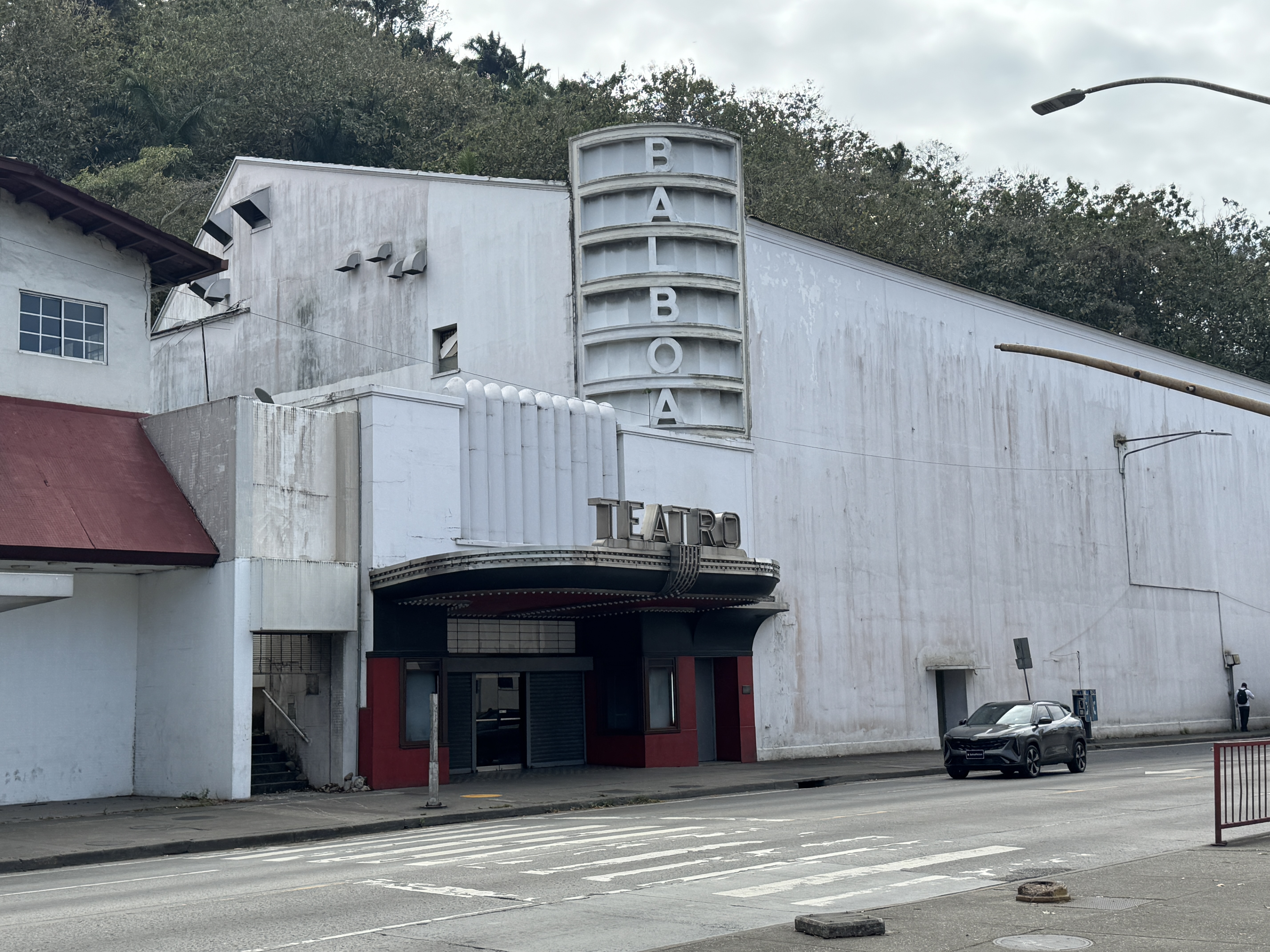
Most if not all Canal communities had social facilities. This Balboa theater, for example, opened in 1949 and replaced a wooden building from about 1920.

I haven't seen a picture of that earlier building, but maybe this will do. It's the long-gone YMCA Club built for Canal workers at Culebra, a dozen miles east of Balboa. (https://www.researchgate.net/publication/269204107TheAmericanEngineersthatBuiltthePanama_Canal/figures?lo=1)
There were schools, too: here's the one in Balboa. It fronts the Prado and is at the foot of the hill rising to the Administration Building.
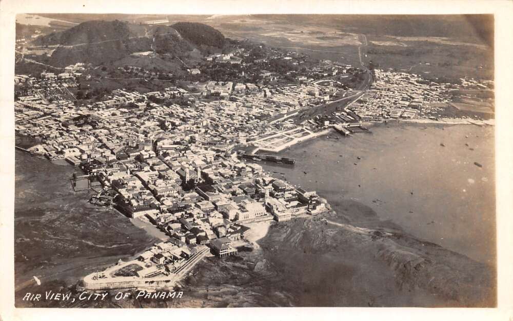
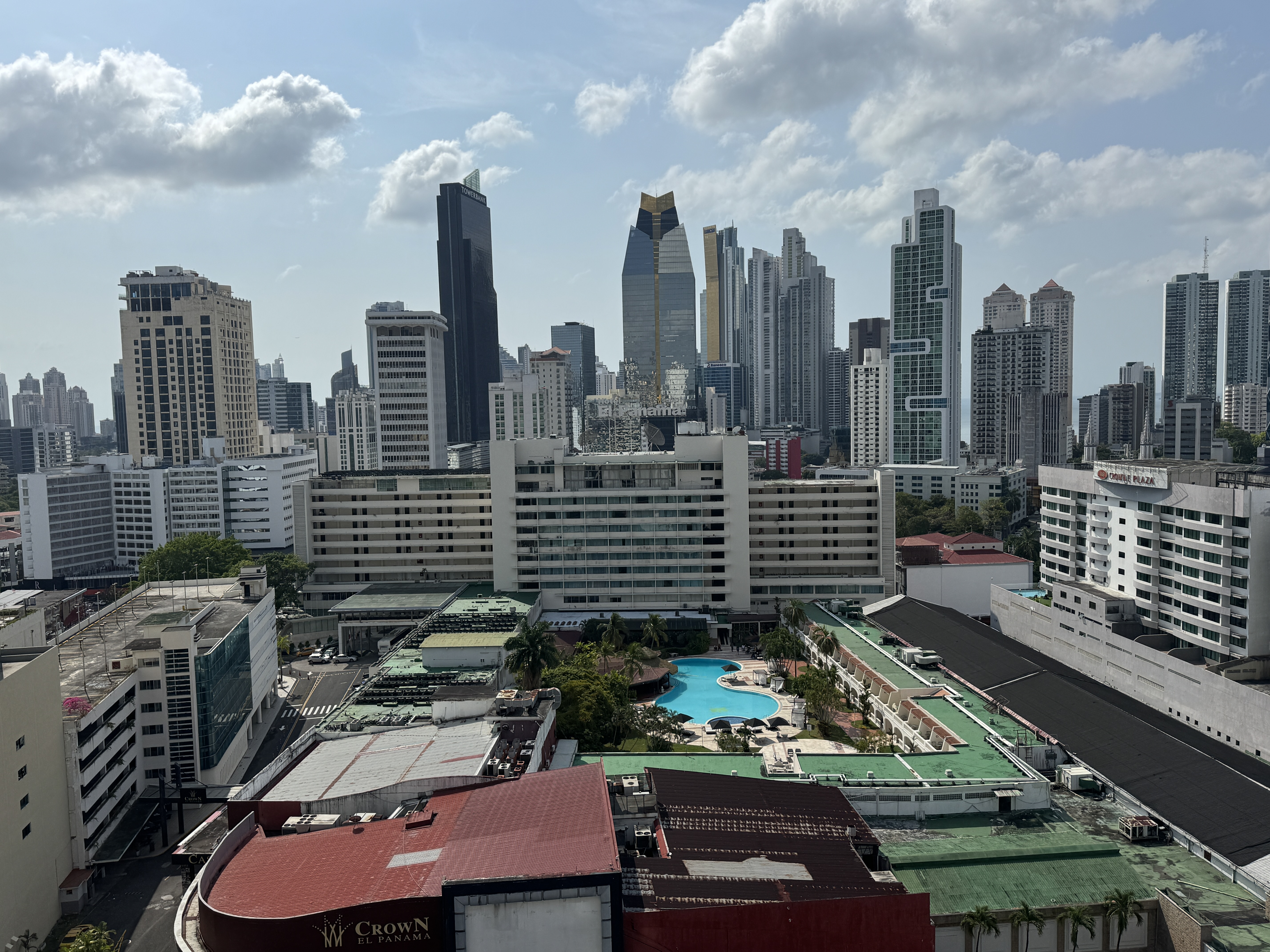
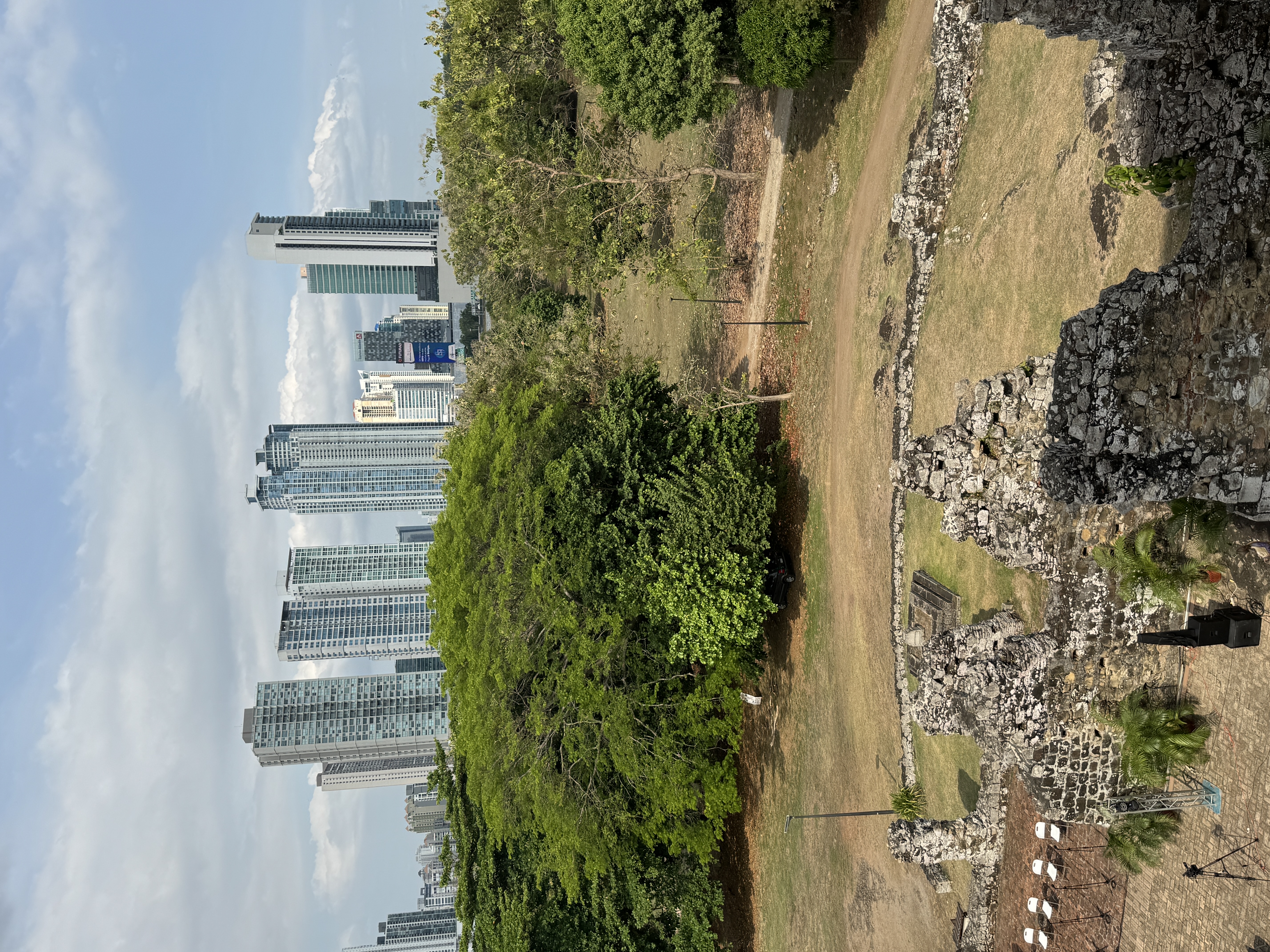
Here's an undated image, probably from about 1950, of Panama City beginning its eastward march.
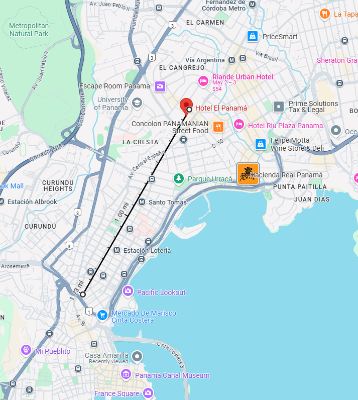
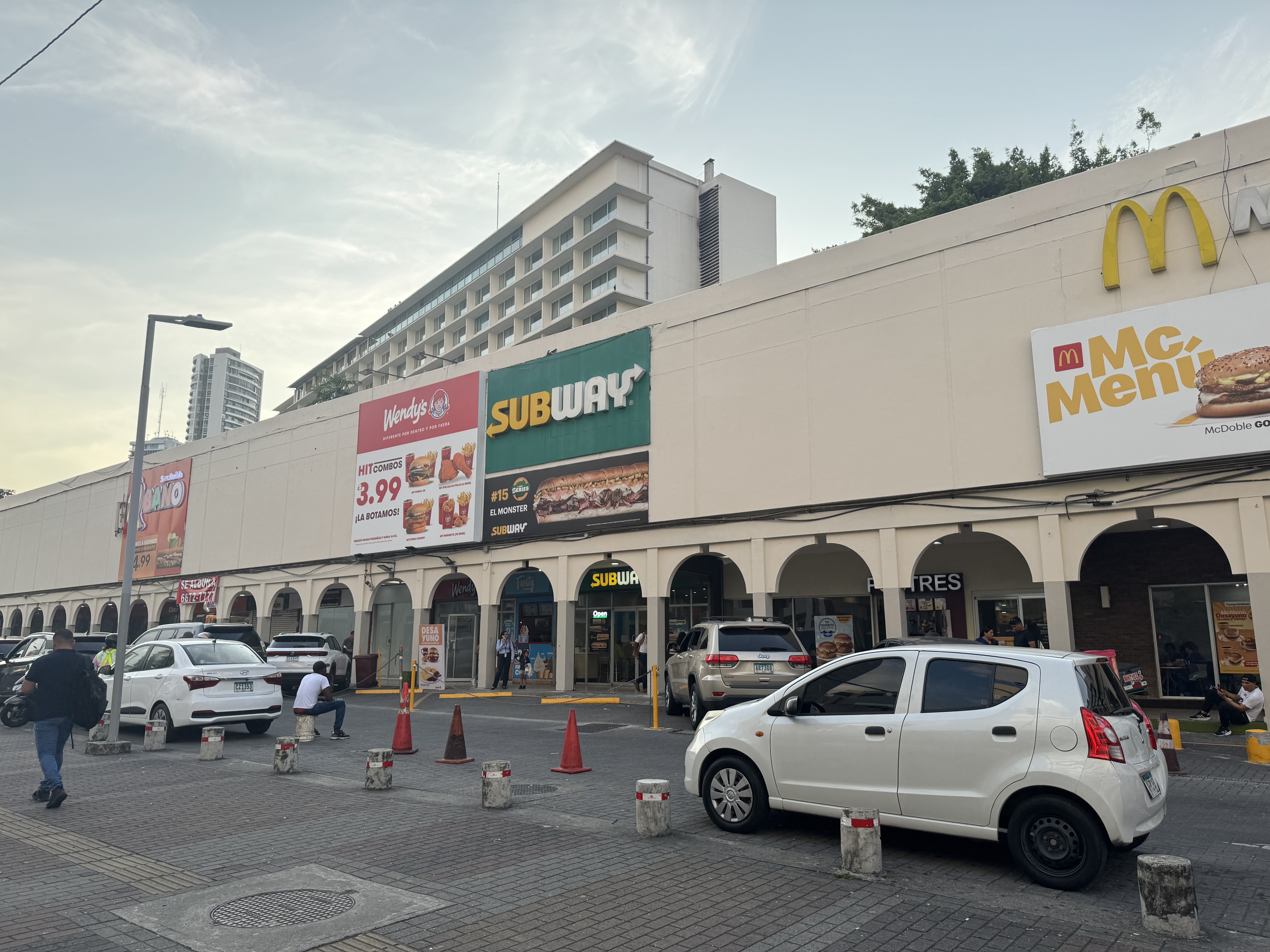
I've drawn a line a bit less than two miles long, from the railroad station northeasterly to the Hotel El Panama, a structure heralding the city's expansion.
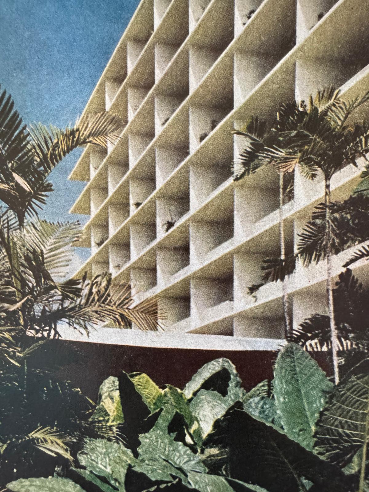
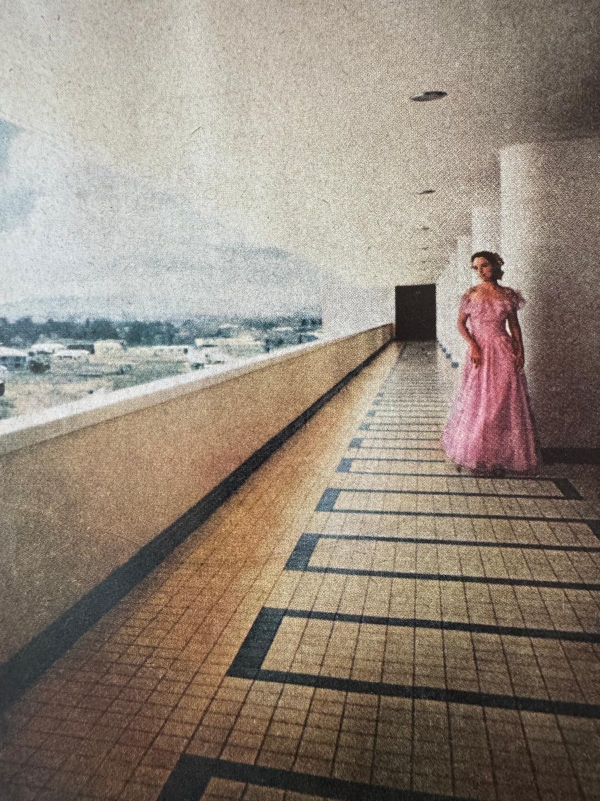
LIFE Magazine, which published this photo in January, 1952, called the El Panama the "most original tropical hotel in the Western Hemisphere [with] no doors, no windows and no lobby." There was no air conditioning in the guest rooms either, because the building's orientation and its isolated location allowed ocean breezes to flow through the guest rooms, which had louvered screens instead of doors and which opened "wide to a flower-laden balcony and to a deck." A decade later, Pan American's New Horizons World Guide for 1961, speaking of hotels in Panama City, said that "the lavish El Panama Hilton, situated in the residential section of Panama, is the best. It is one of the most spectacular buildings of its kind." The architect, Edward Durell Stone, would later design Washington's Kennedy Center. (And lots of other stuff; think of the U.S. Embassy in Delhi and--gasp!--the headquarters of the National Geographic Society.)
Another photo from the same issue. What astonishes me is the emptiness beyond the wall. Stone himself referred to the hotel's "magnificent suburban site.". Think it's that way now? Hang onto your hat. (Edward Durell Stone, The Evolution of an Architect, 1962, p. 39)
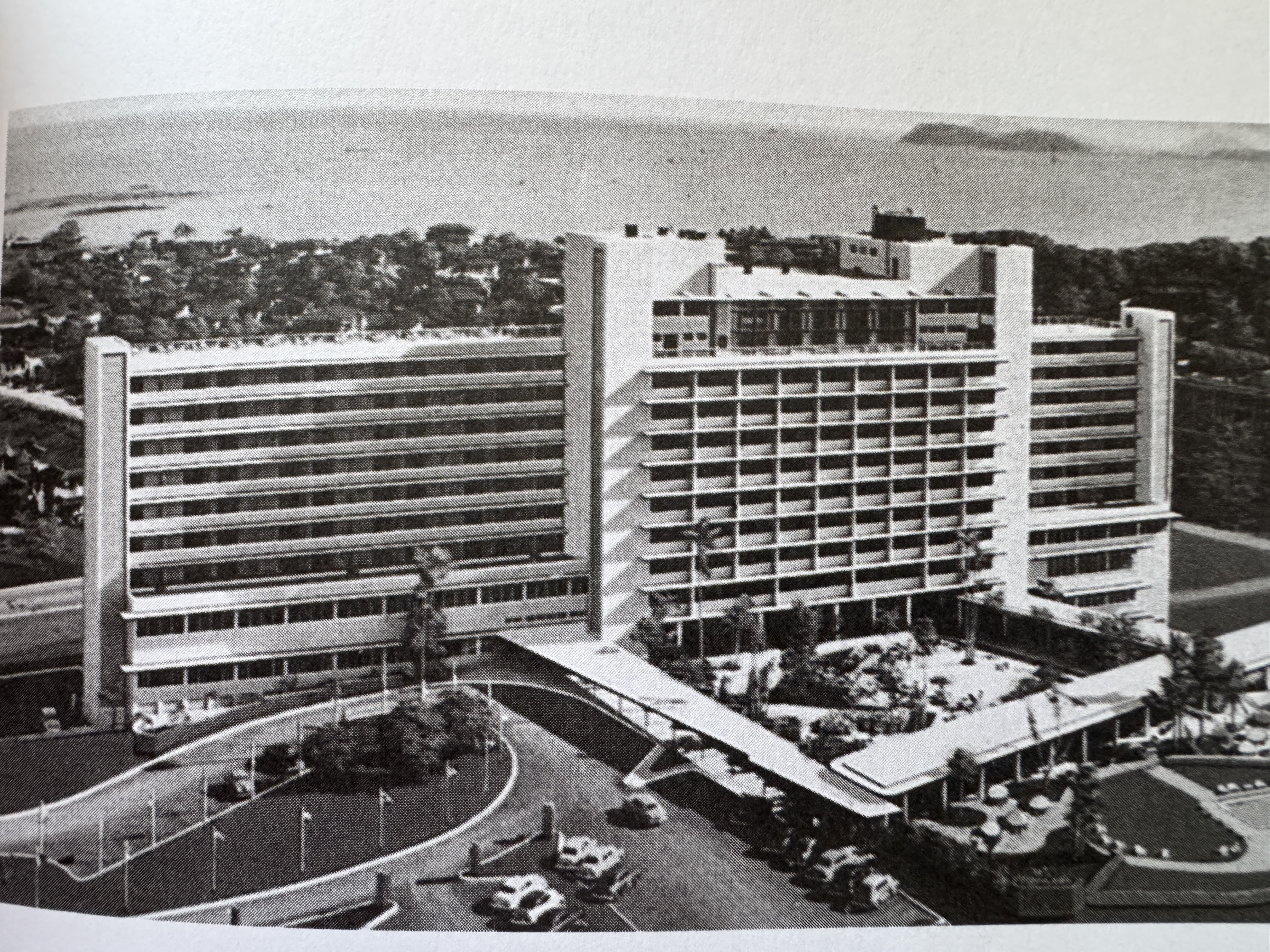
Here's the hotel a few years later, as the land between the hotel and the sea turned residential. (Mary Anne Hunting, Edward Durell Stone, America's Populist Architect, 2013, p. 51)
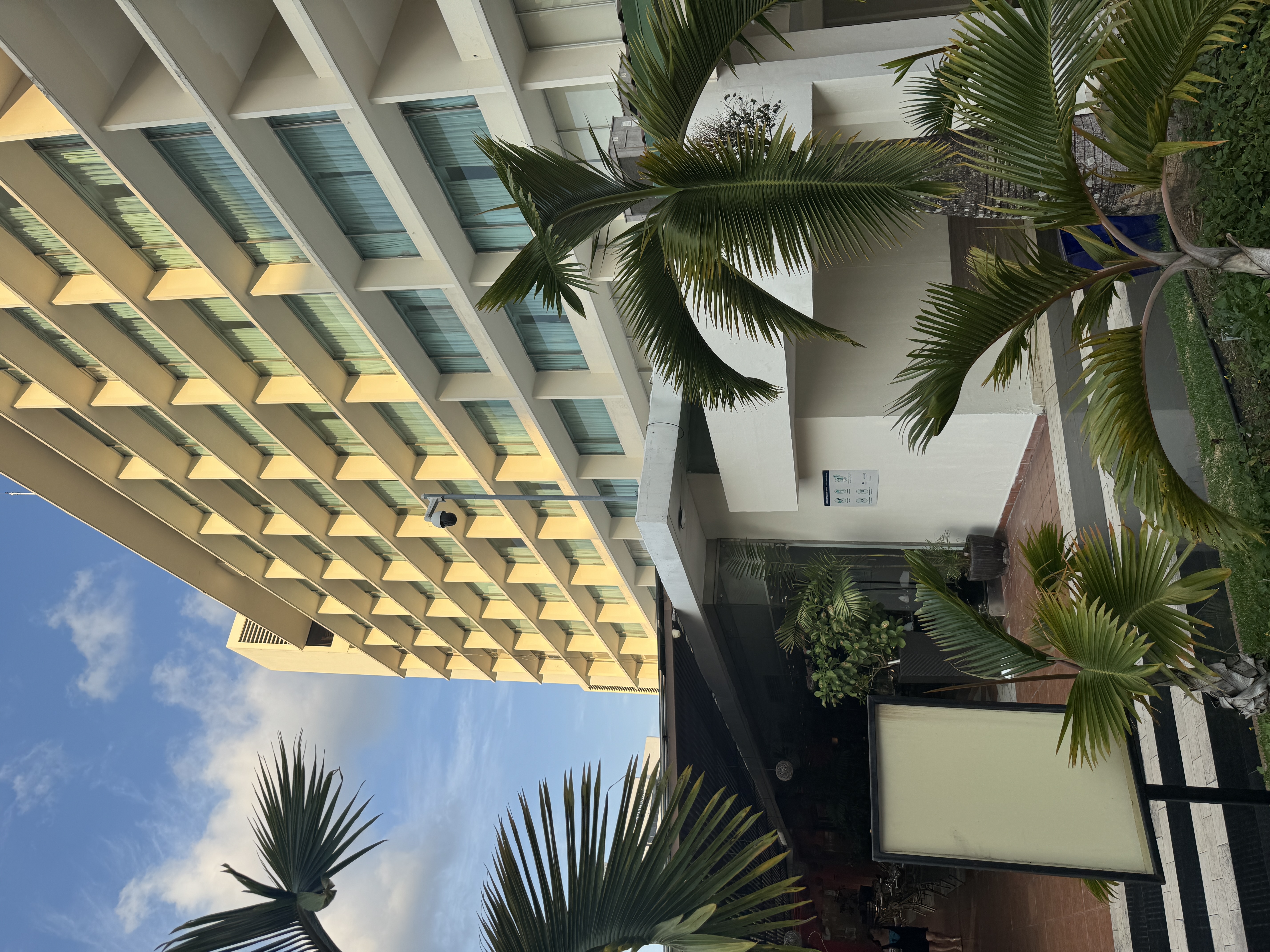
The hotel still stands, but the Hilton name came down in 2017, and the balconies and louvers are gone.
One reason: the breezes are gone.
There's lots of competition now. Worse, the best hotels have given up on the neighborhood and moved closer to the ocean.
Here's the view leaving the hotel.
It's a good thing that the hotel's original owners are dead. This would have killed them.
The Canal Zone included a detached bit at Patilla Pt. Notice the bump within that bit. (wikimedia.org/wikipedia/commons/4/44/MapofthePanamaCanalZoneandVicinityShowingJudicialDistricts-NARA-6861831.jpg)
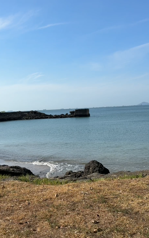
We're in the angle next to that bump.
Here's the view toward Patilla Point.
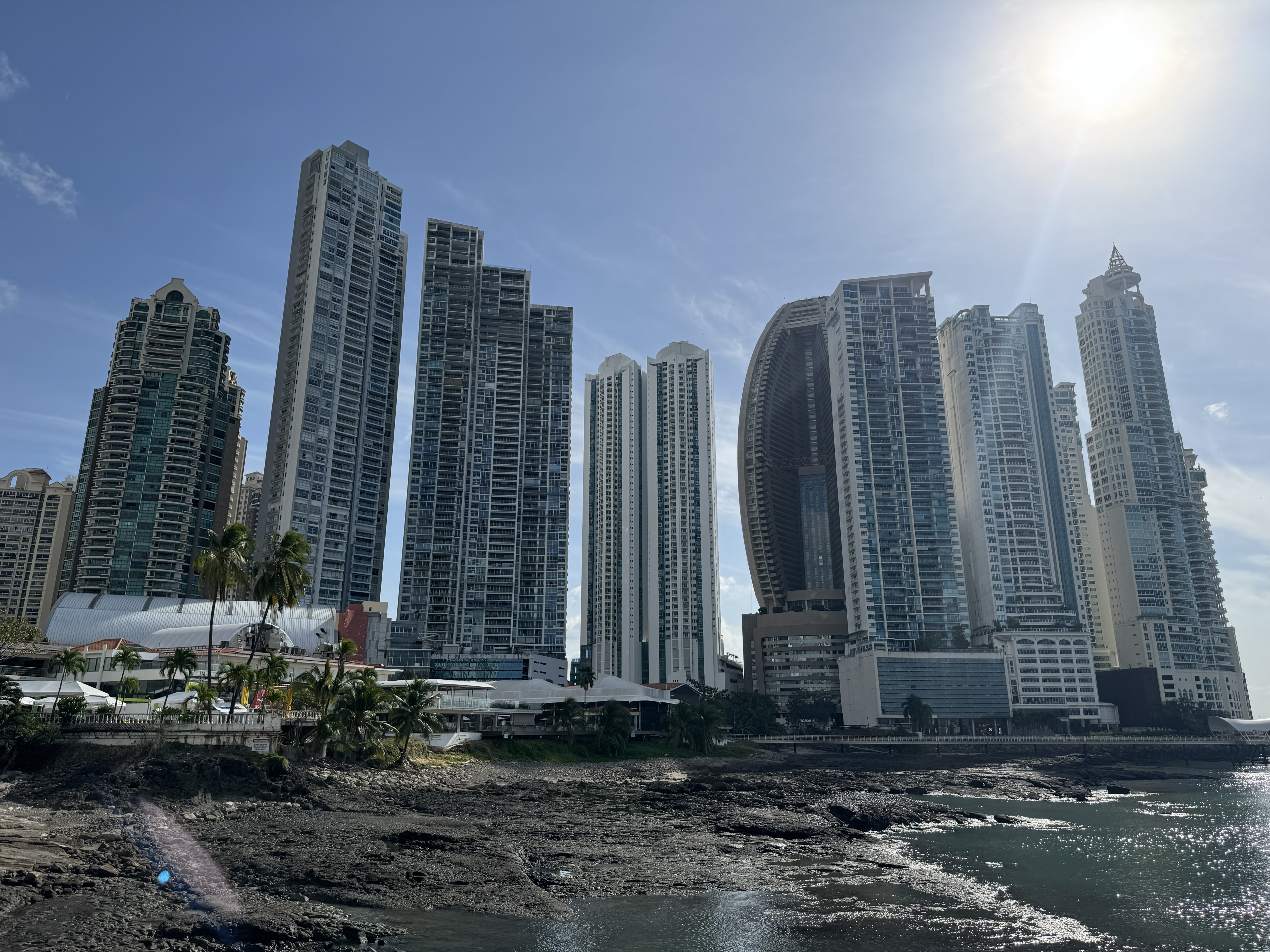
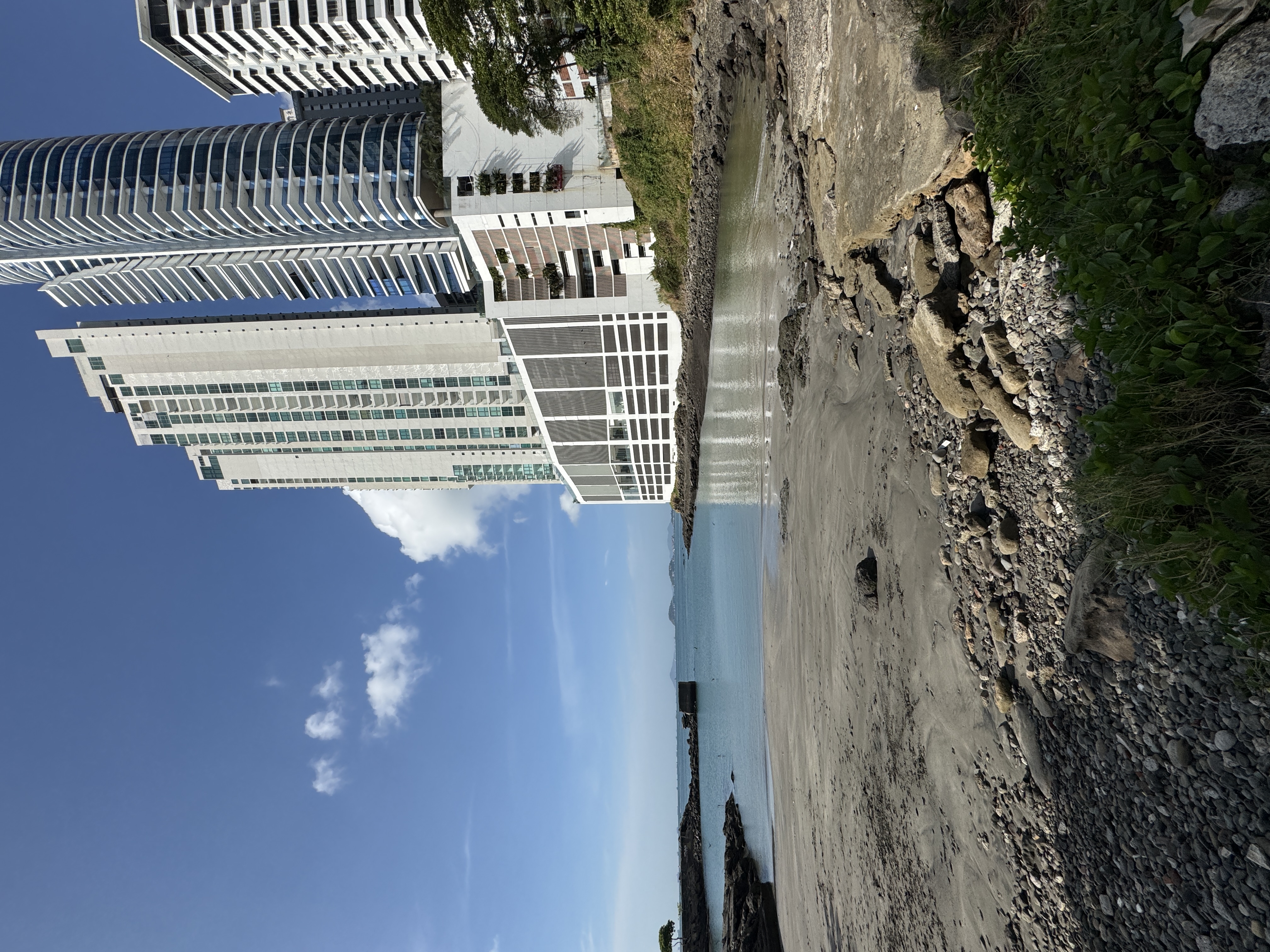
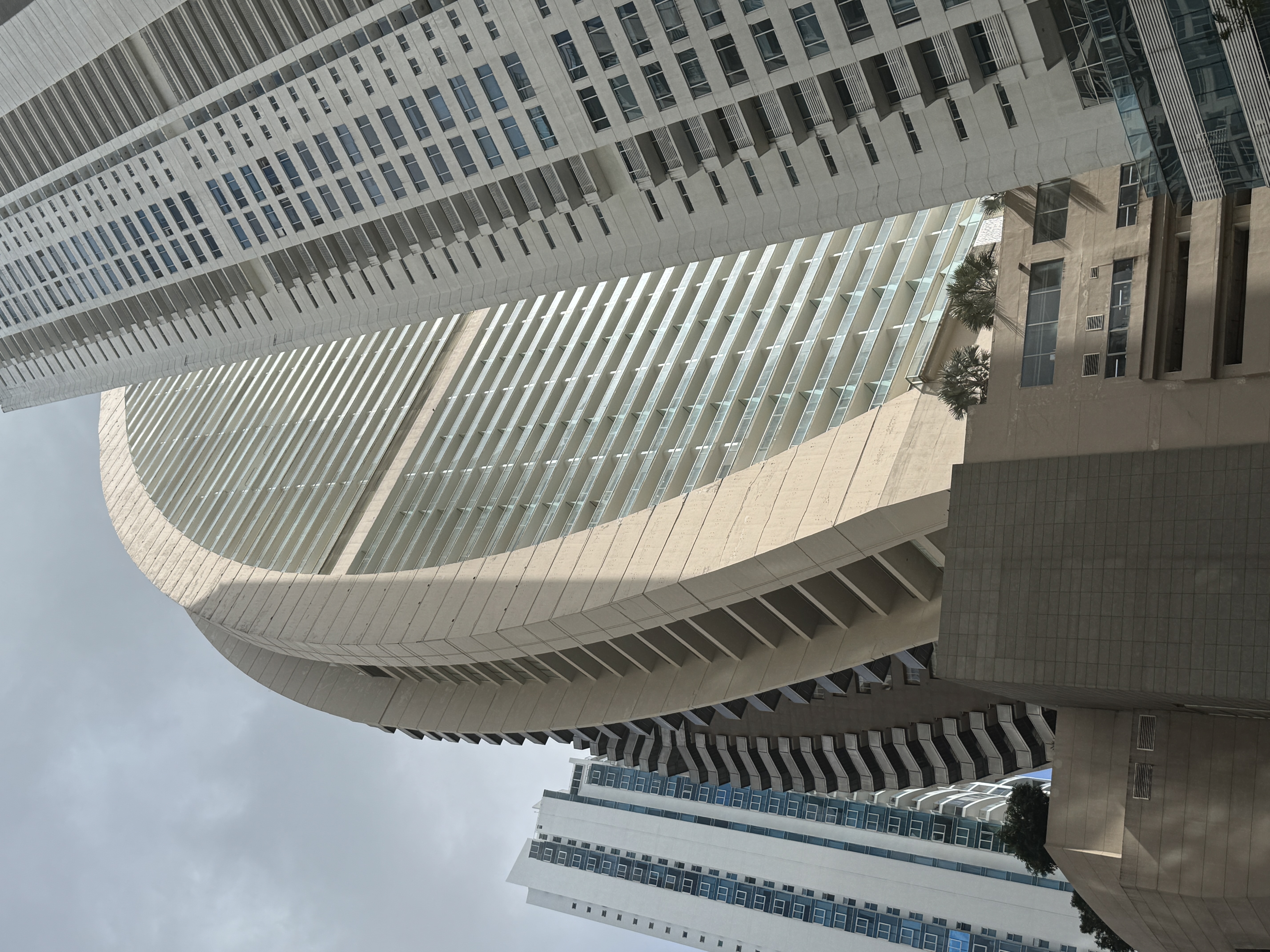
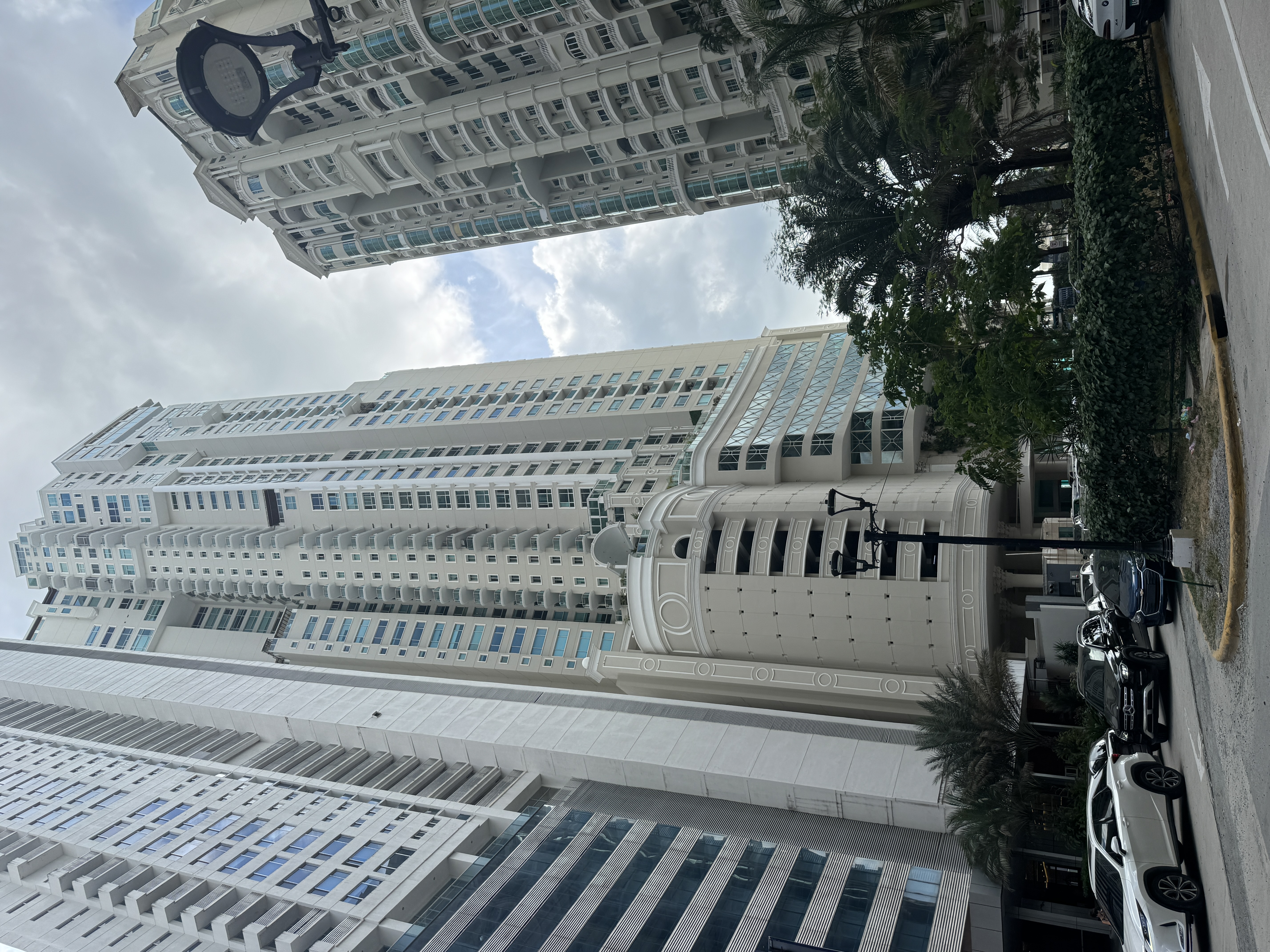
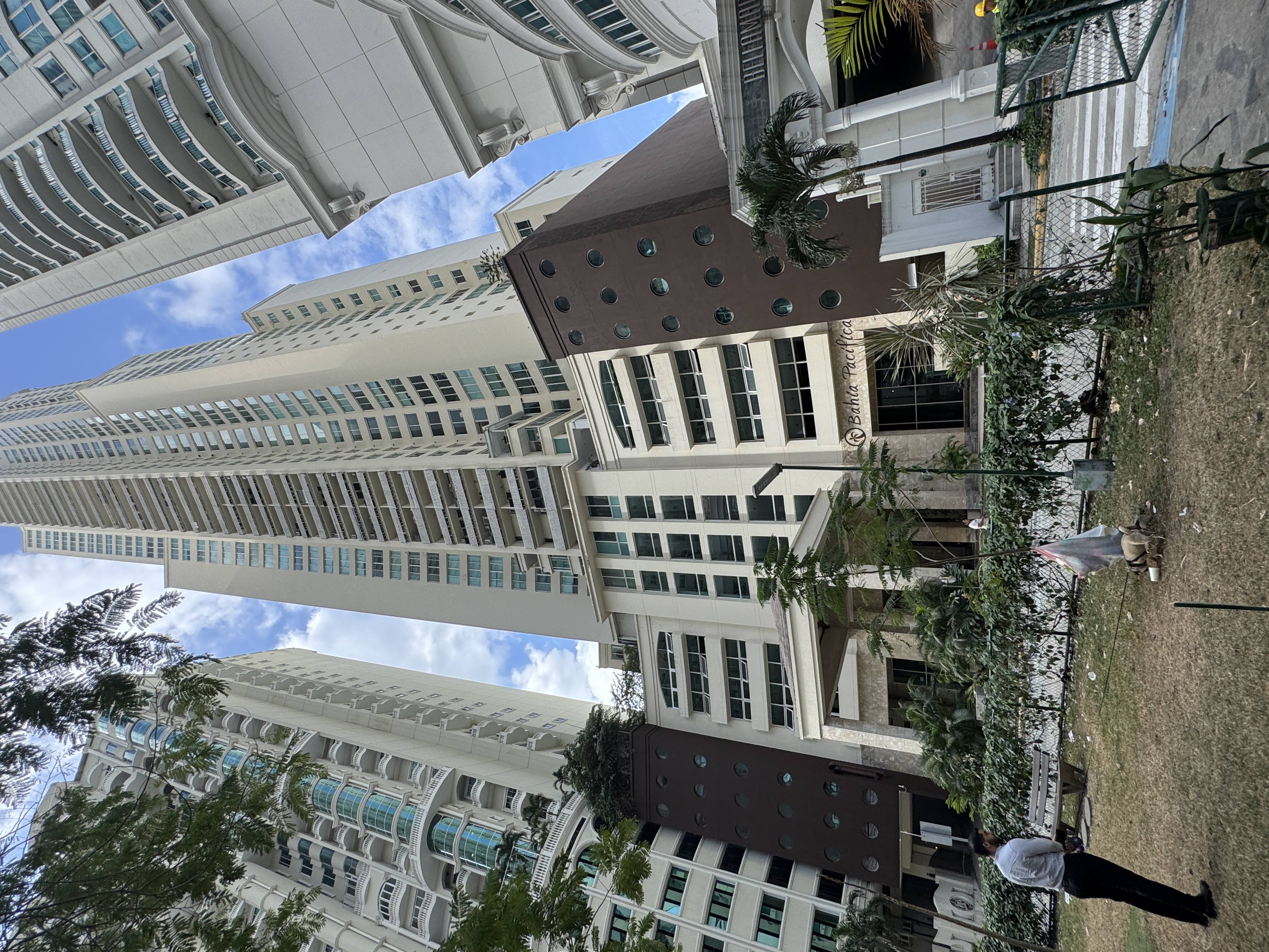
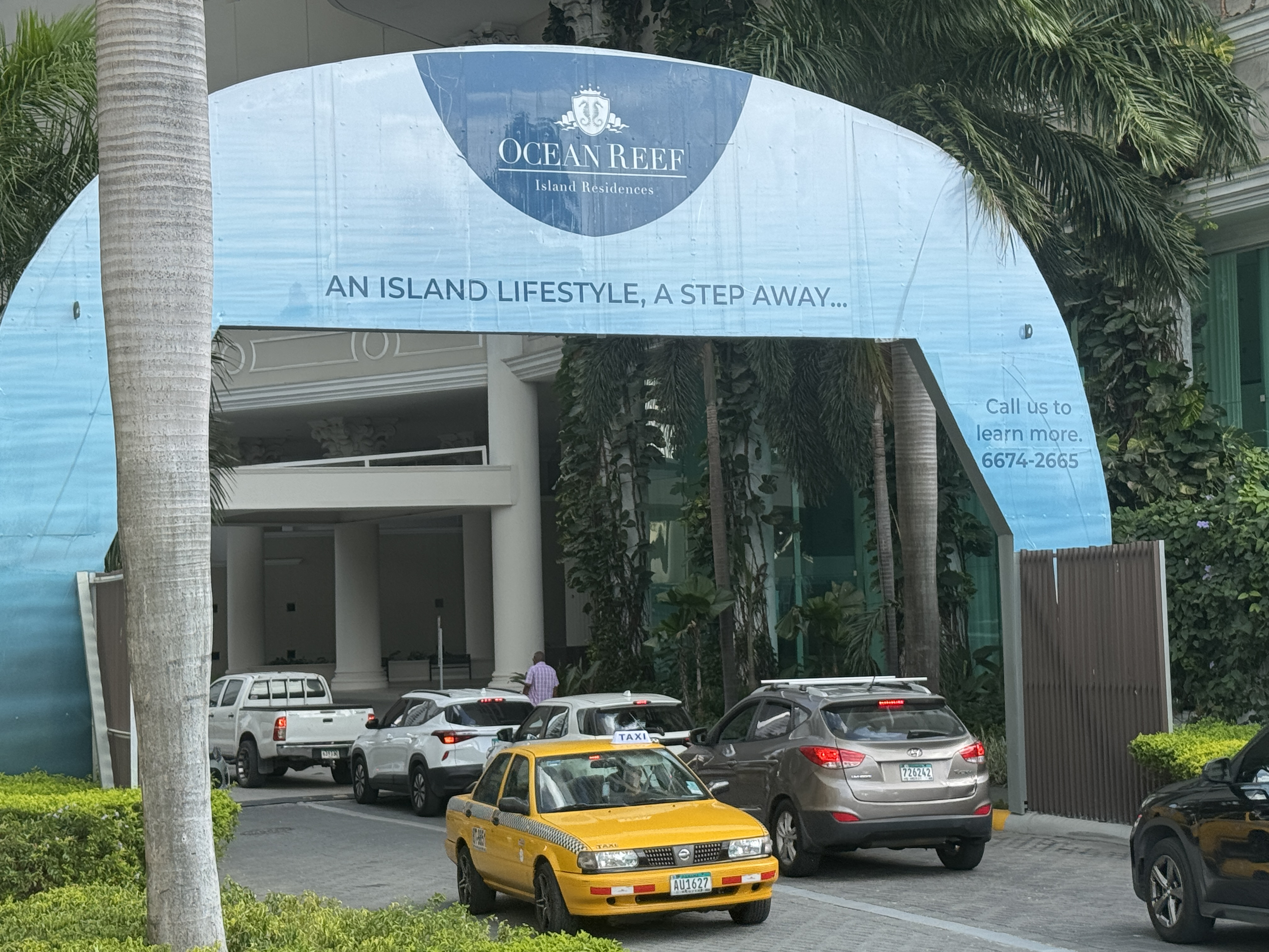
And here's the OMIGOD view toward the "bump," now called Punta Pacifica. Panama City got its first highrise (definition: over 100 meters) in 1979. The tower stood alone for 14 years, but had ten buddies by 1999. Forty arrived in the next decade, and in the peak year, 2011, 15 more joined the crowd. Then the fever broke. Since then, fewer than one tower has been added annually.
Orphaned property at Punta Pacifica. You can imagine the owner weeping at having held out too long for the price he wanted. (I'm betting that the name Punta Pacifica was some developer's brainchild.)
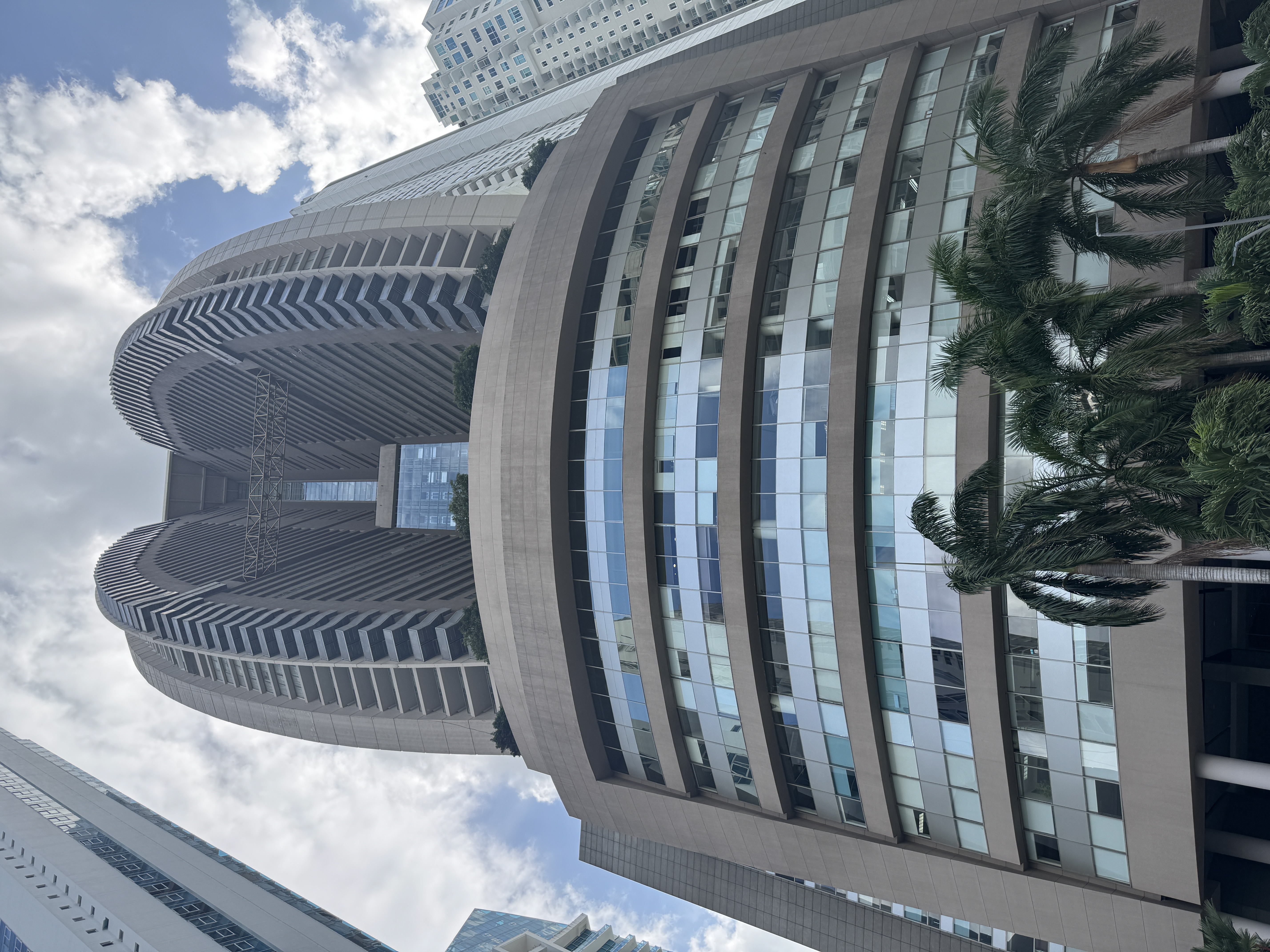
Behold the city's tallest building, now a J.W. Marriott but originally flagged Trump.
Beautiful, no? (Your sarcasm detector works, I hope.)
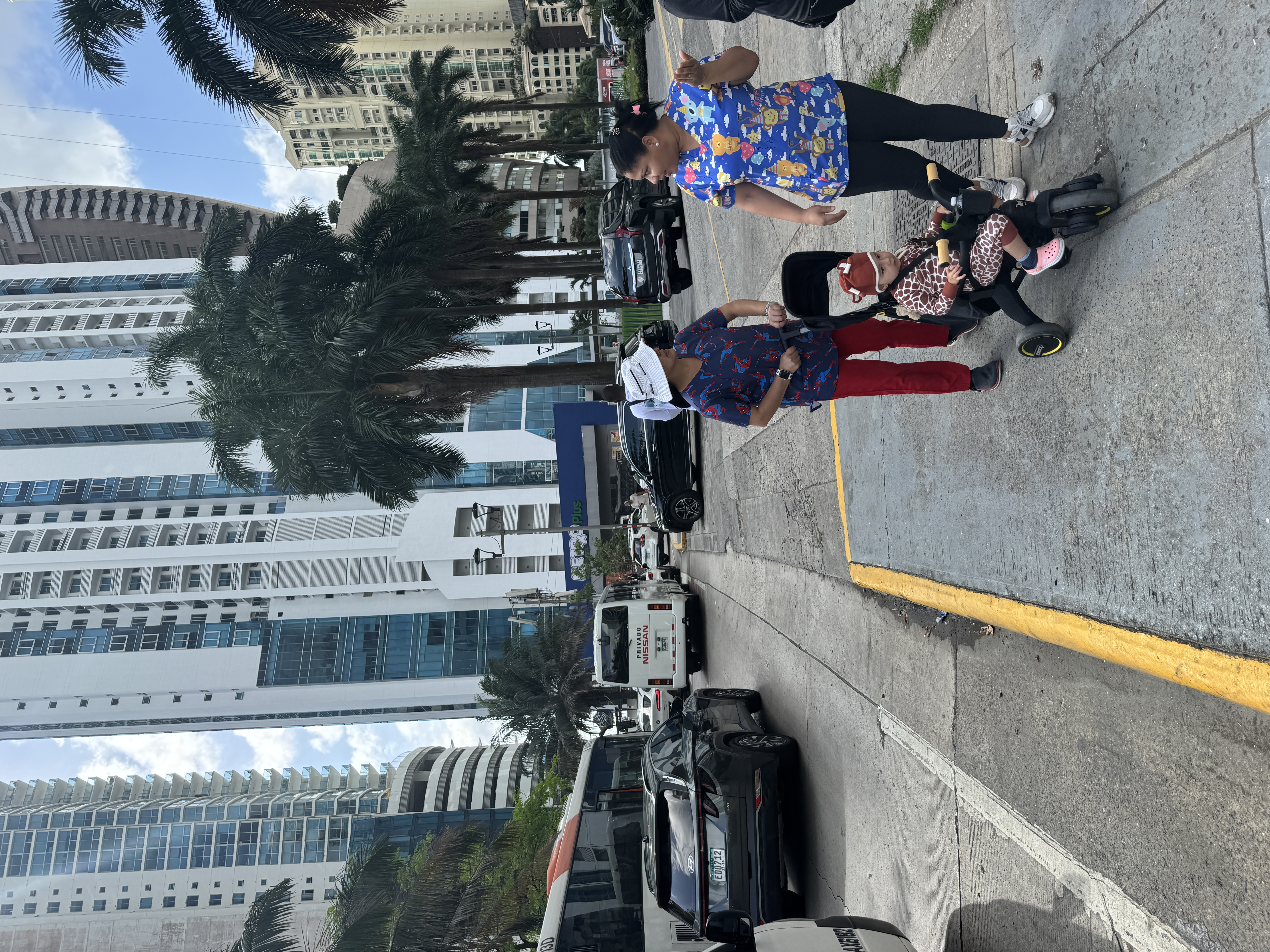
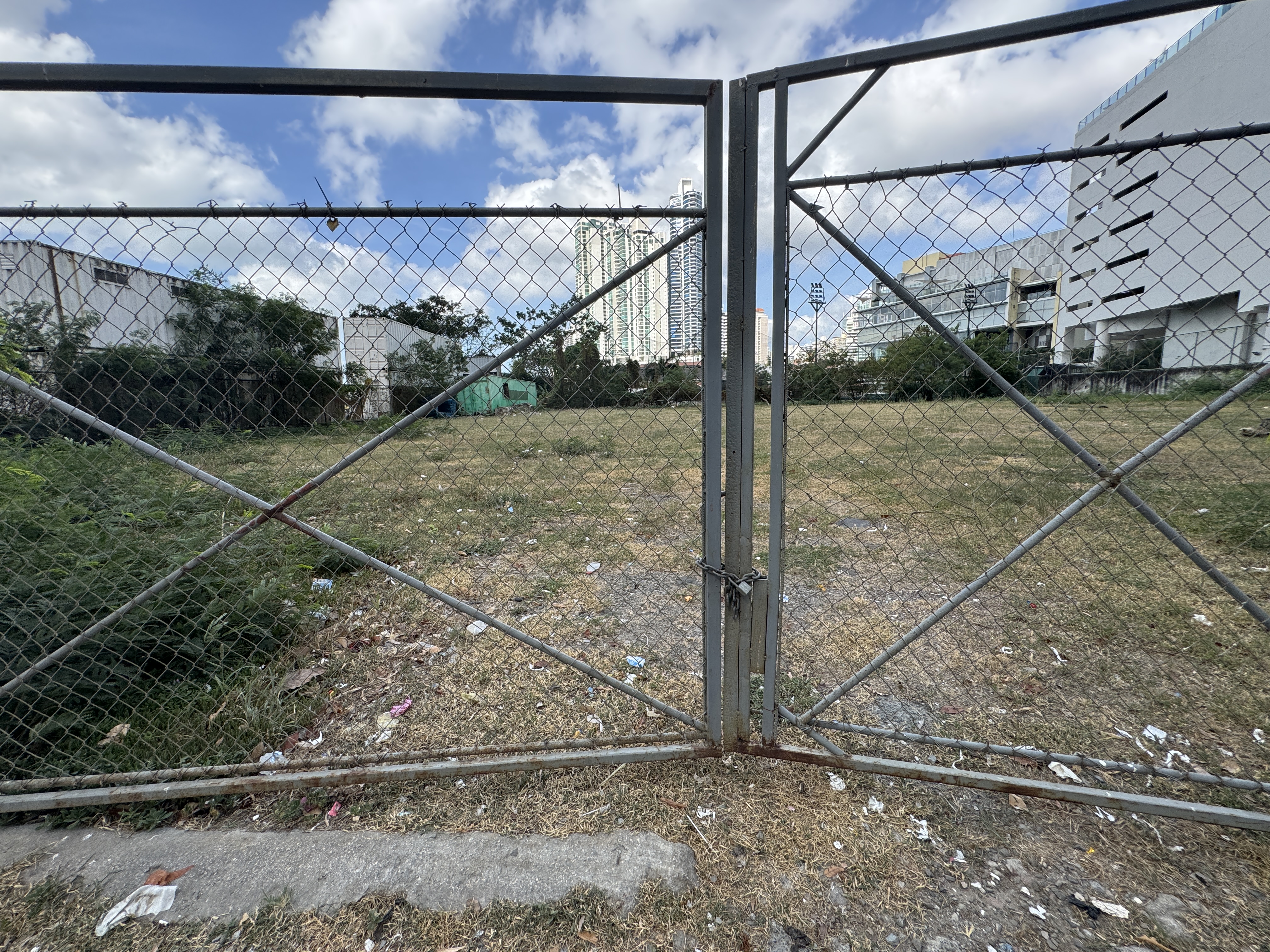
There's very little space for pedestrians at Punta Pacifica, and few people walk except child-care providers.
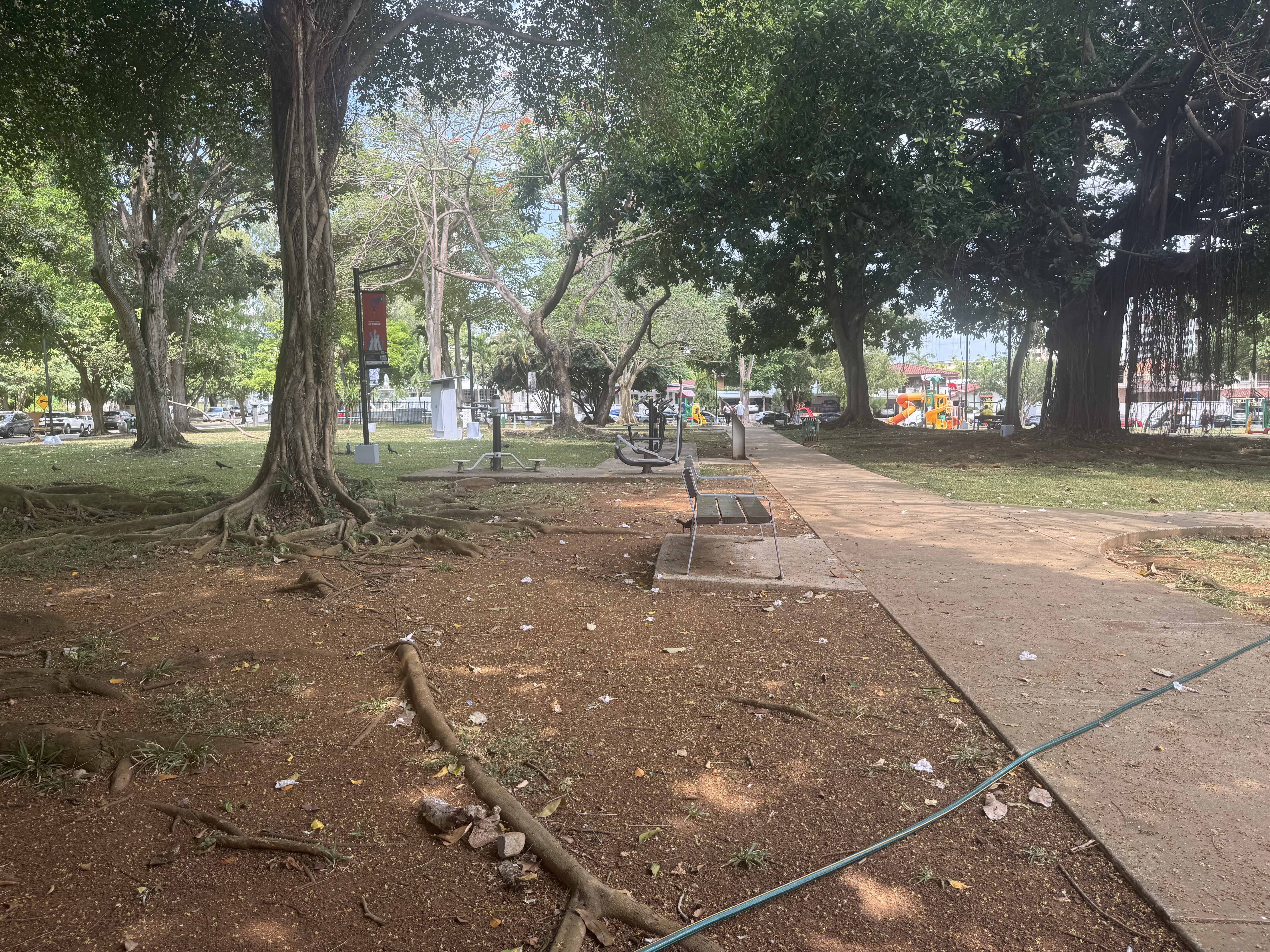
Ah, I overlooked the central park.
It even has a bench from which I could watch the dog-walkers.
Peaceful, no?
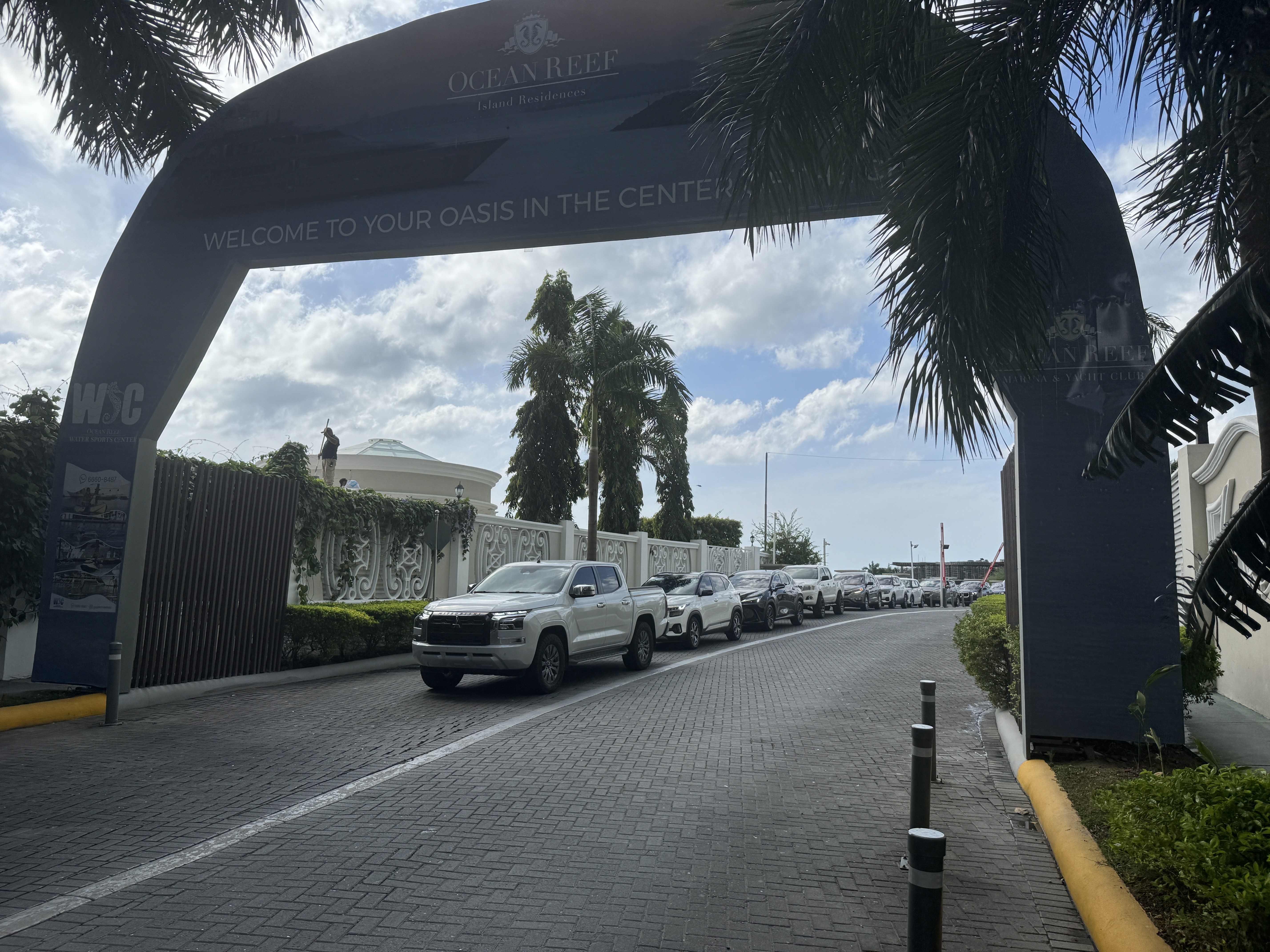
Some traffic heads to and from an artificial island that promises relaxation.
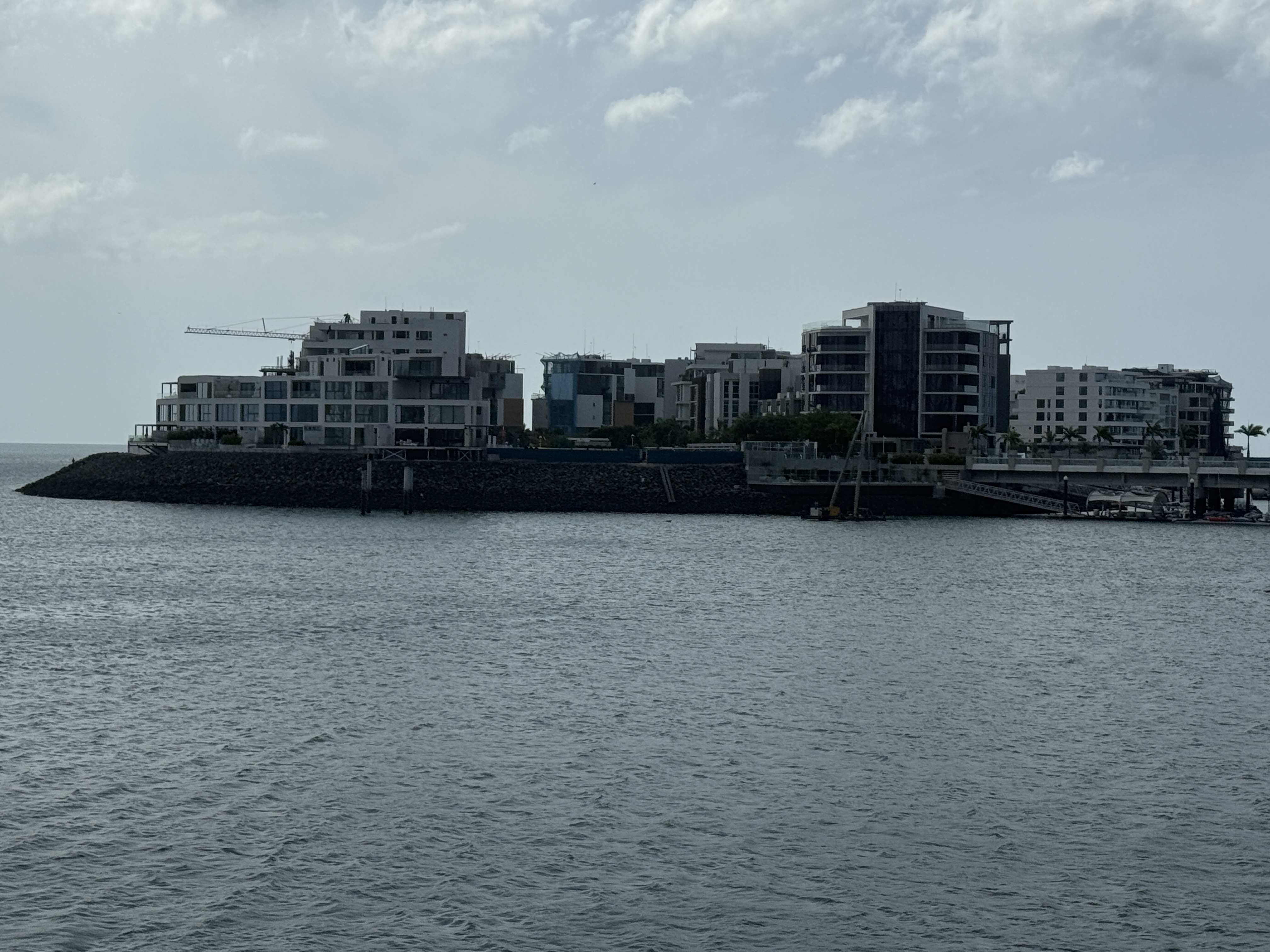
There it is. Guards keep out the riffraff, so I don't know what's out there.
I do know that if you want to get off the island you have to be patient. I recommend YouTube Shorts.
And there's more fun east of Panama Viejo with another high-rise cluster at Costa del Este. Can we leave it for another life?
Is there anywhere you can breathe in this city, apart from the Canal towns like Balboa and La Boca? I went hunting and found the Benito Juarez Park in the district called El Carmen.
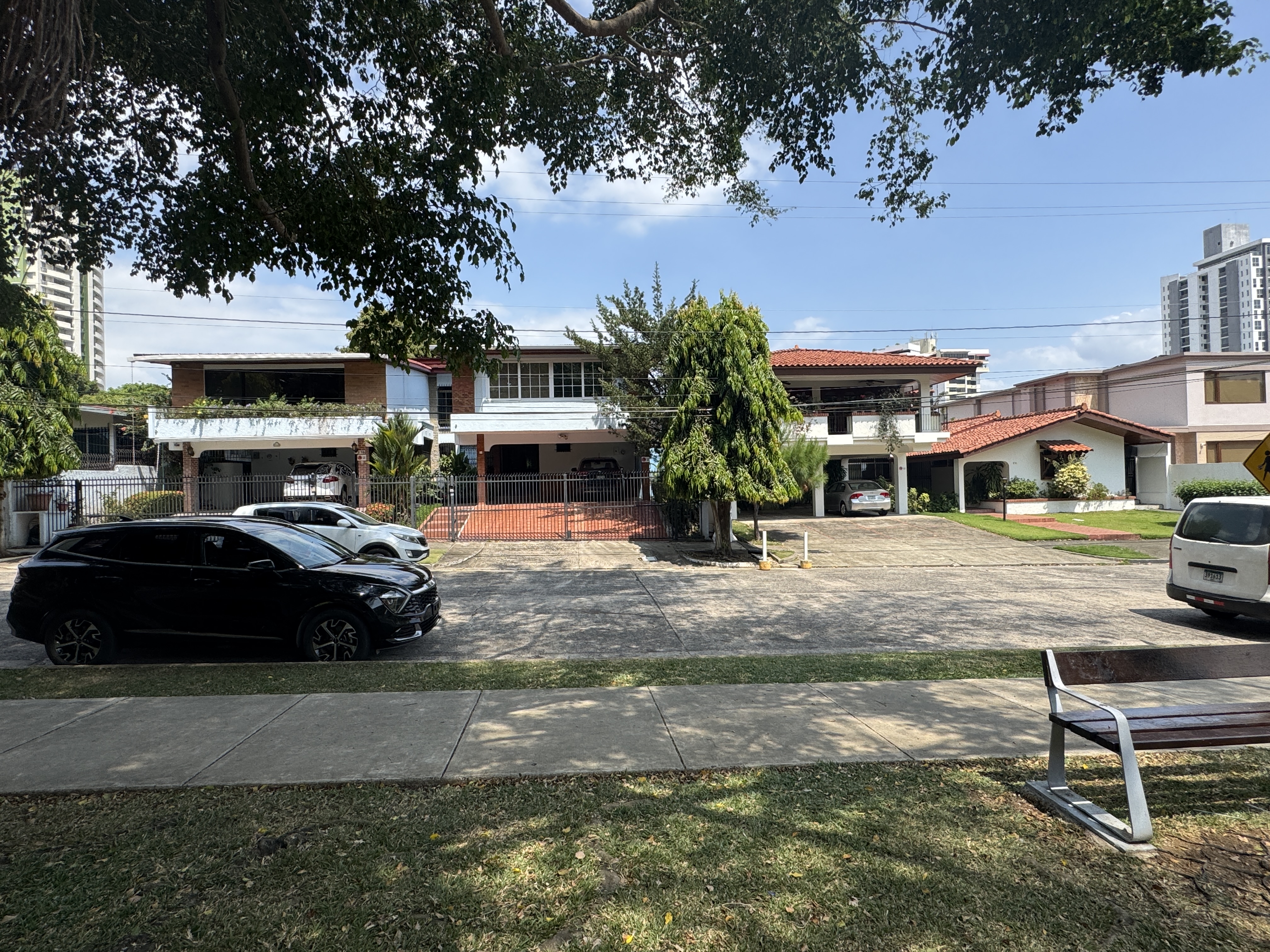
It's a neighborhood with lots of single-family homes.
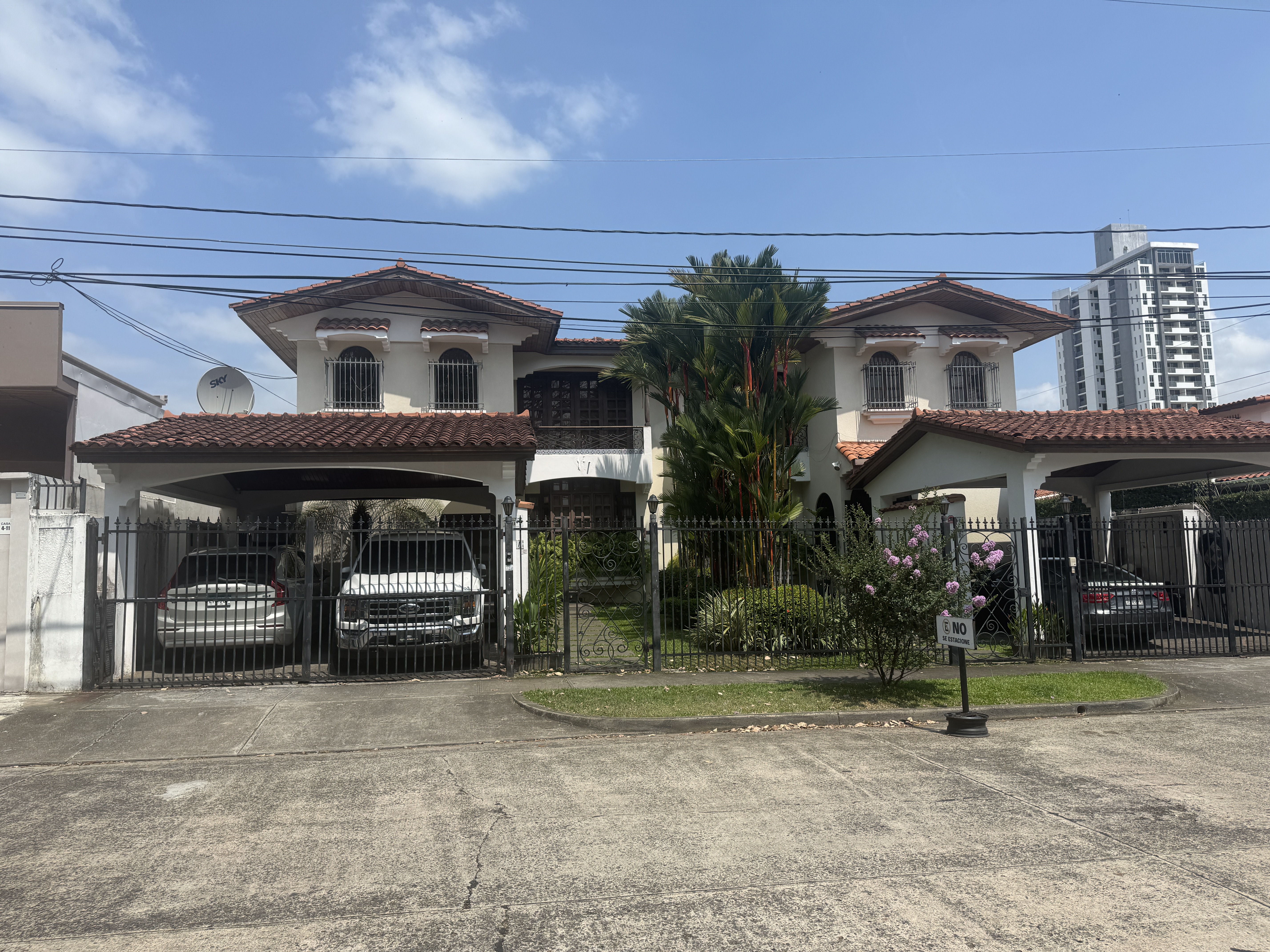
That's good, and some hint at tradition, though they're almost certainly from after 1950. The fences are worrisome.
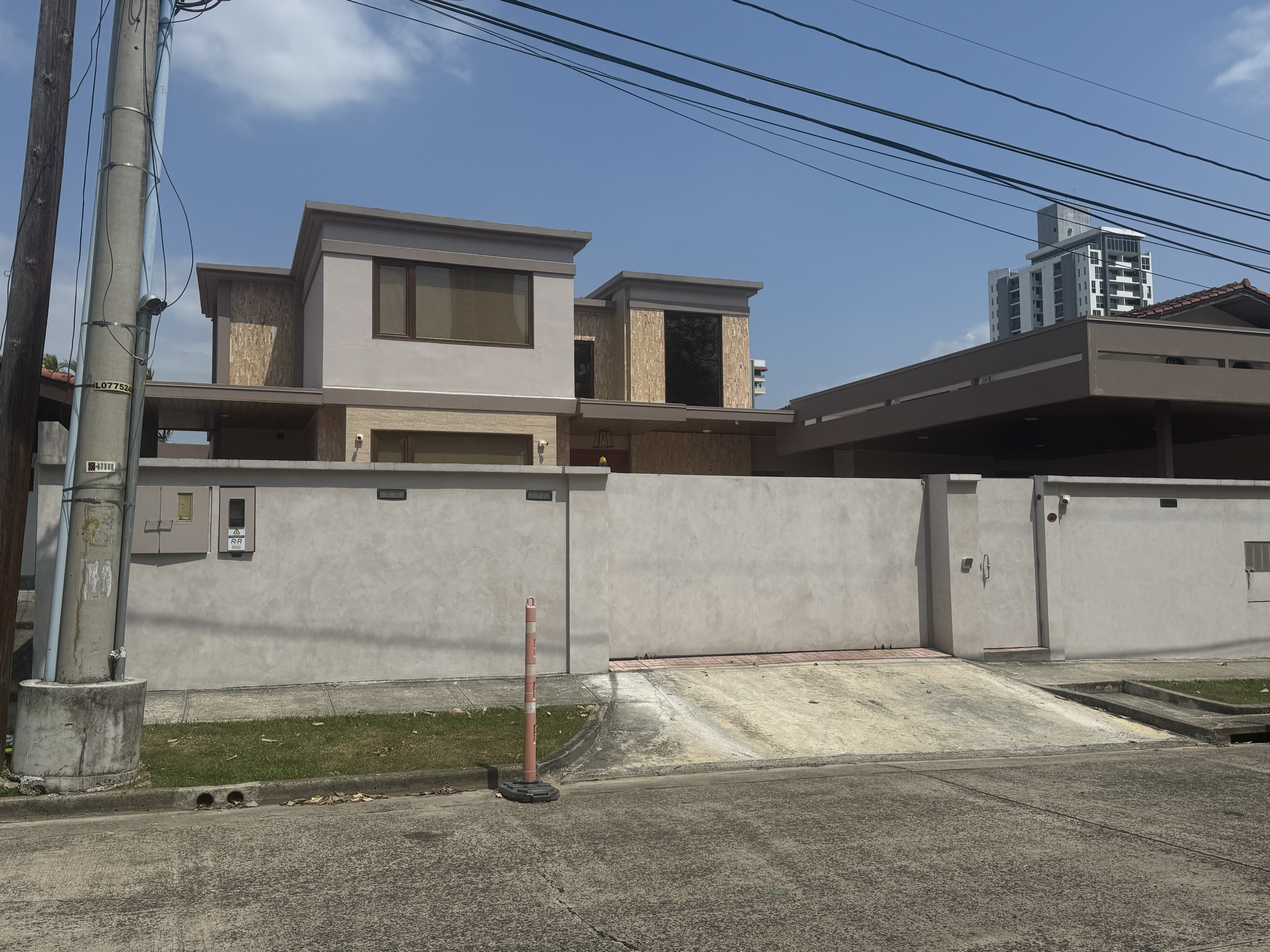
If you don't like fences, you can get a wall.
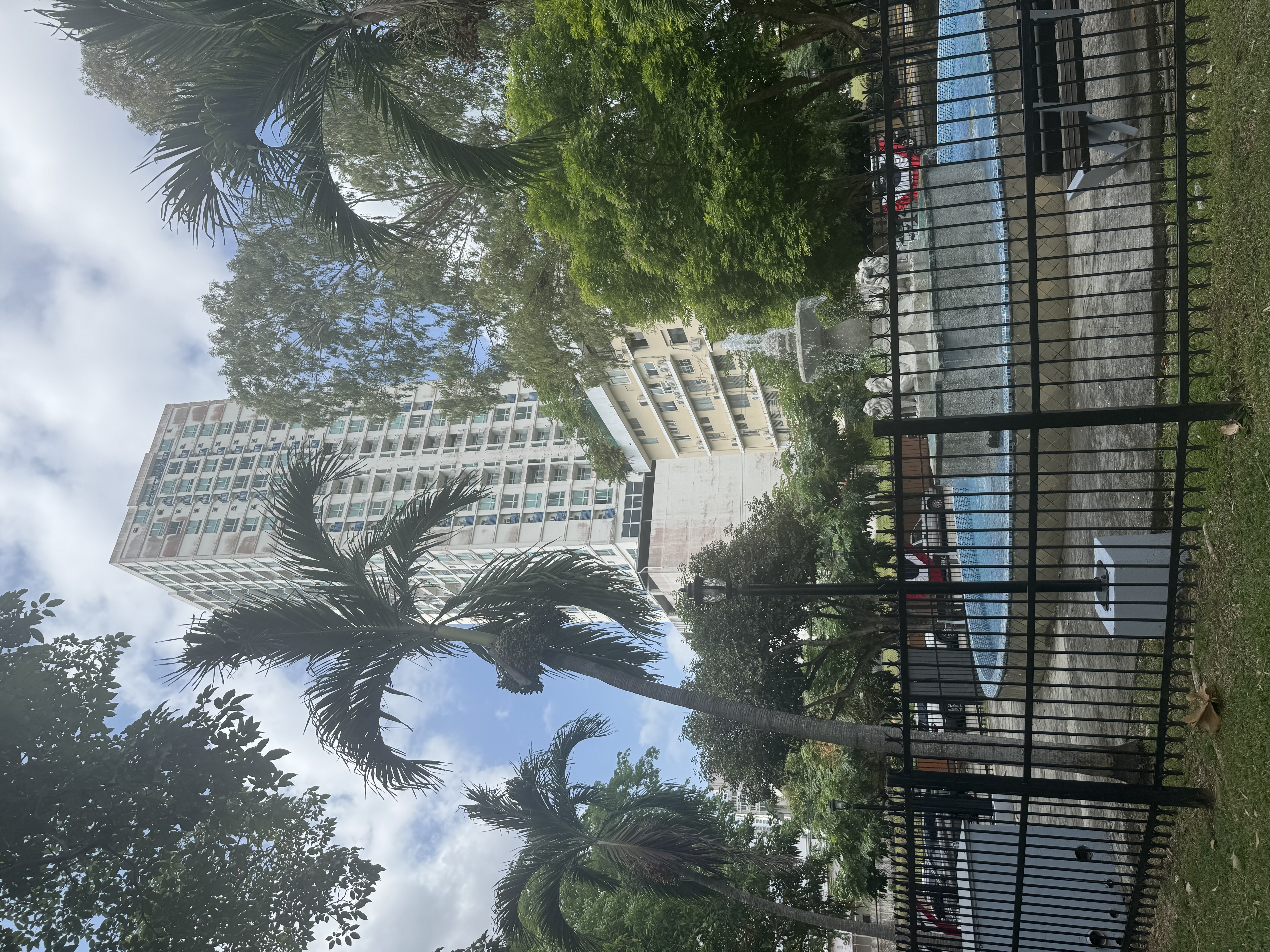
Over at one corner of the park, I found a fountain.
Observing its locked gate, I concluded that it was just as well, both for him and us, that Benito Juarez is dead.